
10 Feb 2025
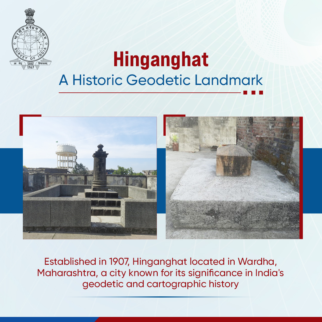
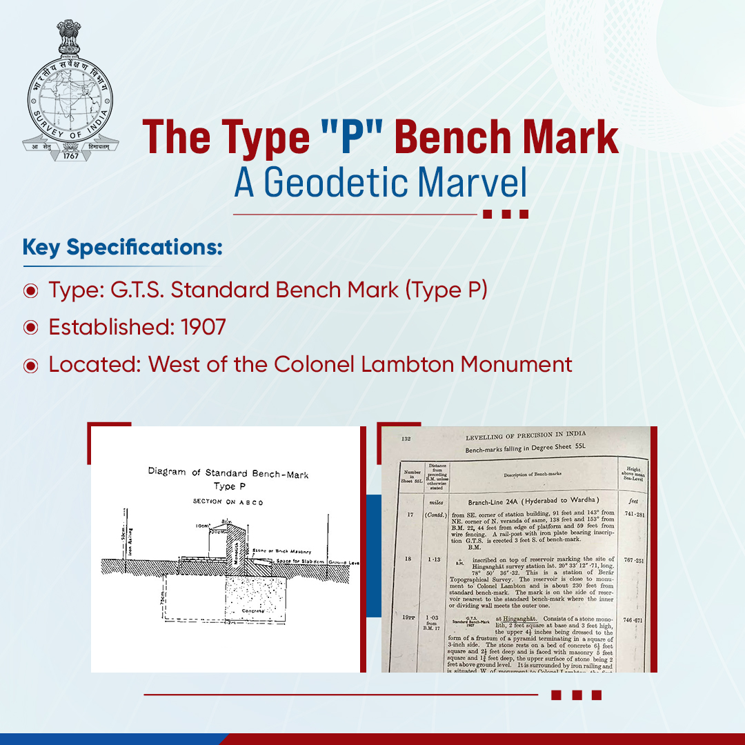
Hinganghat’s Type "P" Bench Mark is a significant geodetic reference point, reinforcing India’s surveying and mapping precision for over a century. Established in 1907, this G.T.S. Standard Bench Mark (Type P).
Enclosed by an iron railing, it remains an essential marker for geodetic control, cadastral mapping, and infrastructure development. This benchmark plays a vital role in high-precision land surveys, supporting accurate boundary demarcations, land resource management, and geospatial applications. It provides critical elevation data used in urban planning, disaster management, and geographic studies, ensuring reliable reference points for national development initiatives.
By linking historical surveying methods with modern geospatial technologies, Hinganghat’s benchmark continues to uphold India’s mapping legacy and geodetic excellence.
@DrJitendraSingh @karandi65 @IndiaDST
#SurveyOfIndia #GeodeticControl #NationalSurveying #MappingIndia #ColonelLambton #GeospatialMapping
1
5
5
392

6 Feb 2019
Honored to have contributed to the 2018 evaluation of the US National Spatial Data Infrastructure #NSDI on behalf of National Society of Professional Surveyors (NSPS) @nspsinc. #GeodeticControl WSP USA @wspusa
Report can be downloaded here: lnkd.in/encr3Mh
1