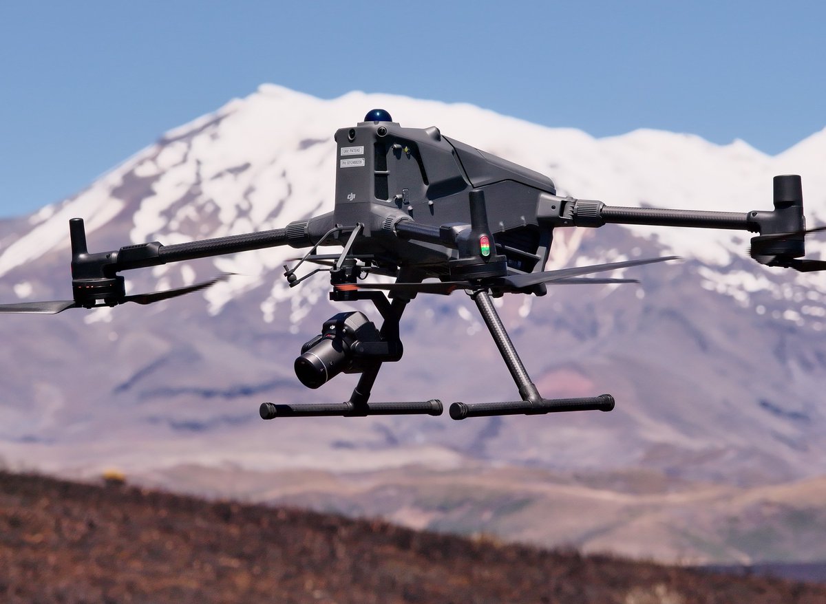
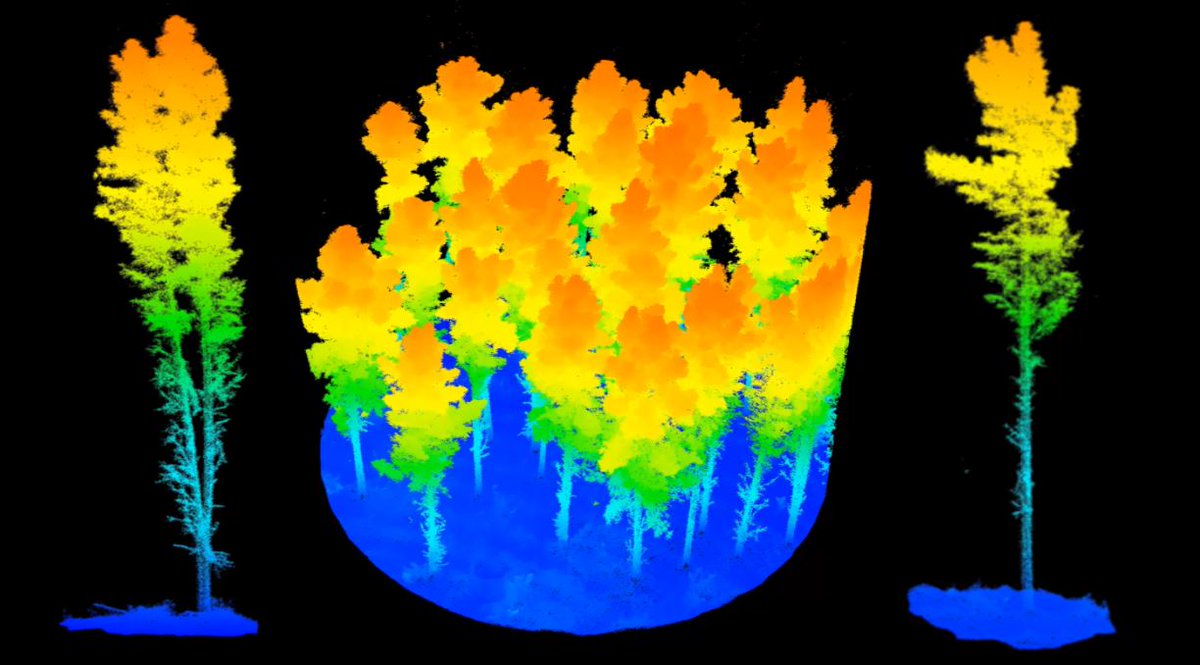
Drone-based LiDAR is transforming how we measure and understand our forests. It’s one of the fastest and most effective ways to collect detailed forest inventory and planning data.
From small woodlots to full forest estates, Interpine’s combination of modern LiDAR sensors, beyond‑line‑of‑sight drone operations, and advanced communication systems sets our team apart as sector leaders.
Paired with our SilvaCloud and TreeTools.ai analysis suite, we deliver fast, accurate, and scalable insights—making our end‑to‑end capability second to none.
TreeTools SilvaCloud treetools.ai/silva-cloud-pro…
Interpine Drone LiDAR Services interpine.nz/elevating-our-d…
1
4
60

18 Dec 2025
Extending Drone Capabilities: Interpine’s BVLOS Advantage
Beyond Line-of-Sight Operations Certification
At Interpine Innovation, we’re proud to operate under CAA Part 102 Certification, enabling us to fly drones Beyond Visual Line of Sight (BVLOS). This capability is a game-changer for our clients and the wider forestry and environmental sectors.
Why BVLOS Matters?
BVLOS operations allow drones to cover greater distances and access remote or hazardous areas without the limitations of maintaining direct visual contact. For our clients, this means:
Expanded Coverage: Survey large-scale forests, river systems, and infrastructure in a single flight.
Improved Efficiency: Reduce time and cost by minimising manual intervention and multiple take-off points.
Enhanced Safety: Keep crews out of dangerous terrain while still capturing critical data.
Leading with Innovation and Safety
Interpine continues to set the benchmark for safe, innovative drone solutions. Our BVLOS capability is backed by rigorous risk assessments, advanced navigation systems, and compliance with Civil Aviation Authority standards. This ensures every mission is not only efficient but also meets the highest safety requirements.
Driving the Future of Drone Technology
By extending the operational range of drones, we continue to unlock new possibilities for AI-driven analytics, environmental monitoring, and precision forestry. BVLOS is more than a certification—it’s a commitment to helping our clients achieve smarter, safer, and more sustainable outcomes.
2
30
26 Aug 2025
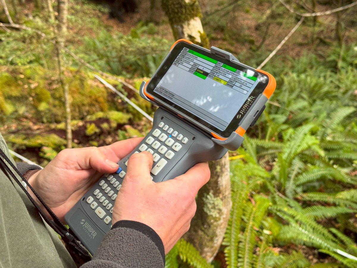
DataPlus Mobile Now on Android: Modernizing Field Data Collection
We’re excited to announce a major update to DataPlus Mobile, the trusted data collection application originally developed by Electronic Data Solutions. This powerful tool has now been upgraded to run on Android, bringing modern performance and compatibility to a platform long relied on by field professionals.
In partnership with Electronic Data Solutions, Interpine has led the transition of DataPlus Mobile to Android, focusing on seamless deployment with the Juniper Systems Archer 4—a rugged handheld device built for demanding field environments. Paired with the Allegro Bluetooth Keyboard, this setup offers a robust and efficient user experience, tailored for forestry, environmental monitoring, and other field-based workflows.
This upgrade means that users can now run their DataPlus applications on modern, reliable hardware without sacrificing the functionality they depend on. Whether you're collecting forest inventory data, conducting environmental surveys, or managing field assets, the new Android version of DataPlus Mobile ensures your workflow remains smooth, scalable, and future-ready.
Want to learn more or see how your existing DataPlus applications can be upgraded for Android? Chat with the team at Interpine—we’re here to help you make the transition and unlock the full potential of your field data collection.
2
56
10 Jun 2025
Heading to the National Fieldays at Mystery Creek this year?
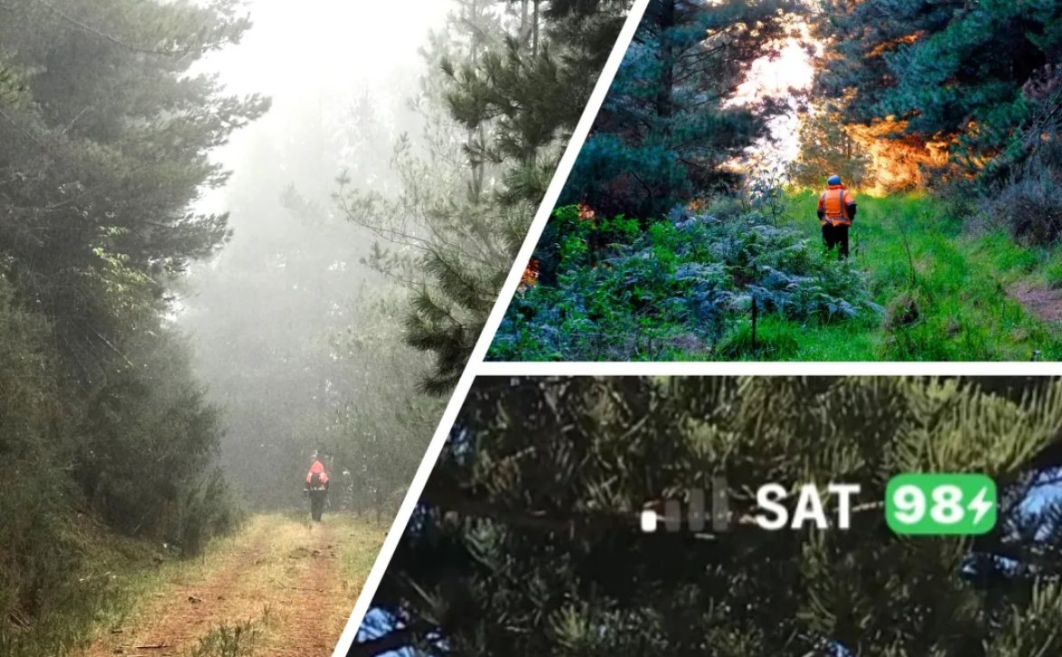
Join the Interpine team as we discuss the advantages of the One NZ Satellite TXT service, which we've been utilizing in our forestry operations since early 2025. Our CTO, David Herries, will be part of a cross-industry panel, sharing insights on how this revolutionary communication tool benefits those working in remote locations.
More Info: Fielddays Tent Talks
fieldays.co.nz/.../explore/f…
A little about Interpine experiences with the Starlink supported One NZ Satellite TXT service.
interpine.nz/nz-wide-mobile-…
Shaping Today's Forests / Natural Resources with the Technology of Tomorrow, He rangahau tēnei rā he hangarau āpōpō
2
103
11 Mar 2025
🌲 Join Our Team at Interpine! 🌲
We're hiring a Mobile Data Capture Solutions Architect / Forester and another role of a Full-Stack Developer to join our innovative forestry team in Rotorua. If you're passionate about shaping natural resources with cutting-edge technology, one of these roles is for you!
More info: interpine.nz/mobile-data-cap…
More info: interpine.nz/full-stack-deve…

4
171
28 Feb 2025
🌲 Game Changer for the Forestry Sector! Nationwide Mobile Coverage! 🌲
We’ve been using OneNZ’s SpaceX Starlink mobile phone text service, and the results are game-changing! 📡 Even in the most remote areas, and often under tree canopy our field crews and foresters can now communicate seamlessly using their standard mobile phones. Connecting to satellites passing overhead just like a cell tower. Moving forward, this will open up new methods of communication and cost efficiency for the sector. It will lead to increased productivity and enable environmental or security monitoring systems, and IoT device connectivity.
Read more about how this technology is transforming our operations: interpine.nz/nz-wide-mobile-…
#ForestryInnovation #SpaceX #OneNZ #MobileCoverage #Interpine @SpaceX @onenzofficial

1
3
128
12 Feb 2025
🚀 Announcing Our 2025 Drone Course Dates! 🚀
Join us for a comprehensive 5-day drone course in partnership with FenixUAS. Perfect for forestry and natural resources professionals. 🌲
📅 Course Dates:
10-14 March 2025
30 June-4 July 2025
6-10 October 2025
💡 Highlights:
Comprehensive training
Advanced UAS Remote Pilot Certificate
Flexible options
📍 Location: Rotorua
Ready to elevate your skills? Register now! ✈️
interpine.nz/announcing-our-…
#DroneTraining #UAV #Forestry #Interpine

3
69
22 Jan 2025
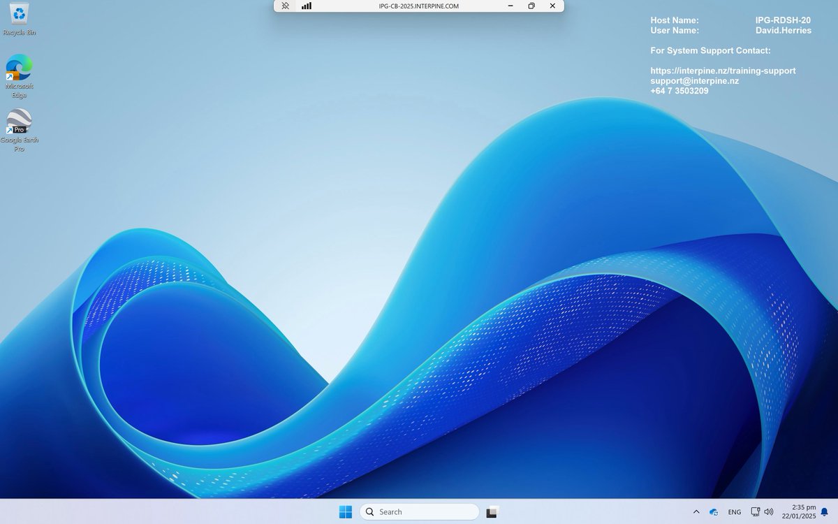
We’re thrilled to announce the rollout of our 2025 Cloud Remote Desktop Upgrade!
Our state-of-the-art platform is designed to enhance productivity, improve security, and modernize your remote work experience when managing your forest information within our cloud. This continues to provide ease of access to software like ArcGIS Pro, GeoMaster, PSLog, YTGen and much more in one easy place.
Here are some key upgrades:
📷 Improved ArcGIS Pro Performance 📷 Better Microsoft 365 Integration 📷 Windows 11 Look and Feel with Windows Server 2025 📷 Latest NVIDIA A10 GPUs with 24GB RAM 📷 2x RAM of Previous System, Now 55GB 📷 2.5x Increased Network Bandwidth, Now 5000Mbps
To get started, check your email for instructions from our team. If you have any issues, our support team is here to help!
#Interpine #CloudServices #RemoteWork #TechUpgrade #ProductivityBoost
3
51
7 Jan 2025
Important Update for Landowners Considering Planting New Forests!
Starting October 2025, new restrictions will be in place for registering new forest land in the Emissions Trading Scheme (ETS). This new policy, announced by the government on December 4th, will not affect land currently registered or in the process of being registered, but it may impact your future planting projects.
To help you navigate these changes, we’ve created a simple flowchart on our website. If you have any questions or need advice on your future planting projects, don’t hesitate to reach out to us!
Link to full article: interpine.nz/restrictions-on…
#Interpine #ETS #Forestry #Sustainability #Landowners
1
56
17 Dec 2024
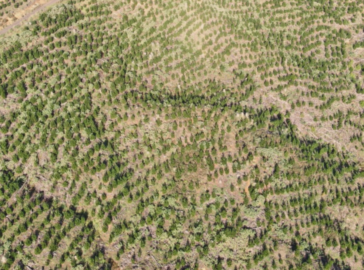
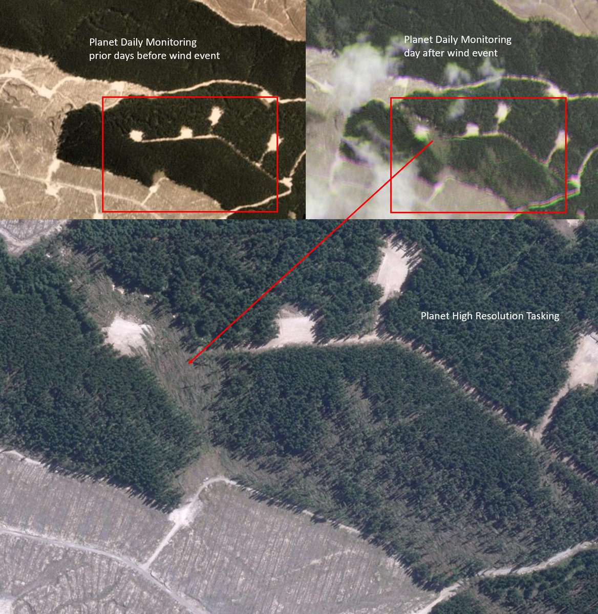
🌍 Unlock the Power of Planet SkySat! 🌲
High-Resolution Imagery: 0.5m GSD for detailed forest mapping.
Flexible Tasking: Always get the latest data.
Cost-Effective: Affordable, frequent updates.
Enhanced Decision-Making: Accurate, current data for better forest management.
Environmental Monitoring: Track land erosion, forest health and changes.
Partner with Interpine to revolutionize your forest info systems! 🌲✨
#Forestry #SatelliteImagery #PlanetSkySat #GIS #ForestManagement
1
6
88
25 Nov 2024
🌲 YTGEN and PLOTSAFE Course Dates Released! 🌲
We’re excited to announce our 2025 dates for the YTGEN and PLOTSAFE Forest Inventory and Yield Analysis courses! 📅 Plus, we still have spots available for next week’s course. Don’t miss out!
🔗 More info: Training and Support | Interpine Innovation
#ForestryTraining #YTGEN #PLOTSAFE

2
52
13 Nov 2024
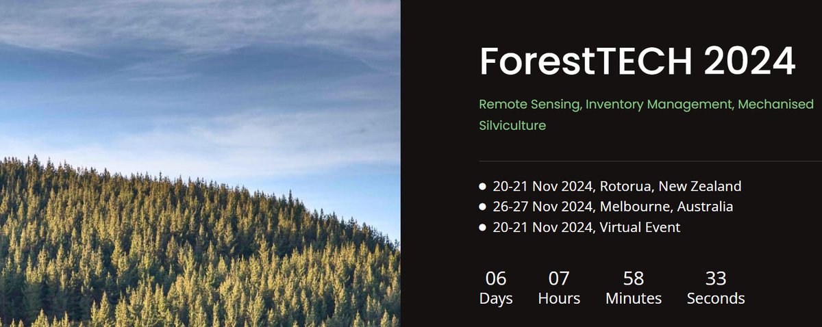
Excited for #ForestTech 2024! 🌲✨ Join the Interpine team as we unveil our #TreeTools software, leveraging #LiDAR and drone imagery for optimal tree thinning management. Plus, see our #drone-based forest woody debris assessment in action, ensuring #NES-CF compliance. Don't miss out!
1
5
68
27 Sep 2024
🎉 Congrats to the Interpine GIS team for winning 2nd prize with ESRI Story Maps at the ESRI NZ Conference in Wellington! 🌟👏 #ESRINZ #GIS #Innovation #Teamwork
2
84

15 Sep 2024
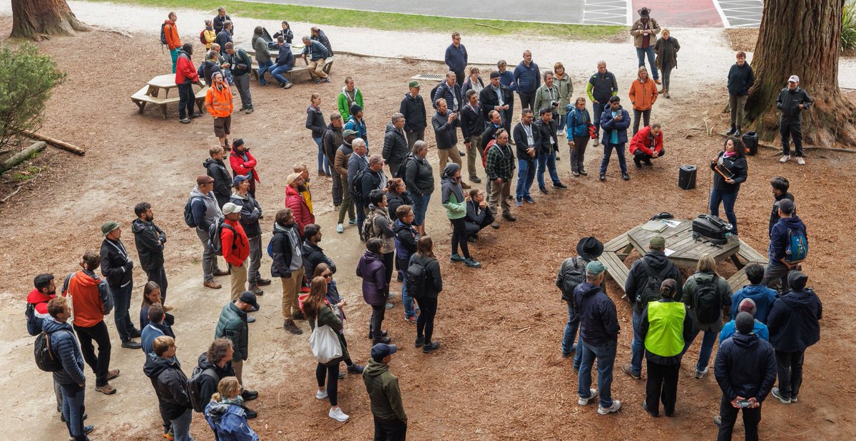
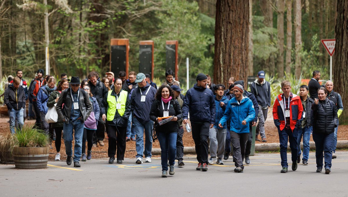
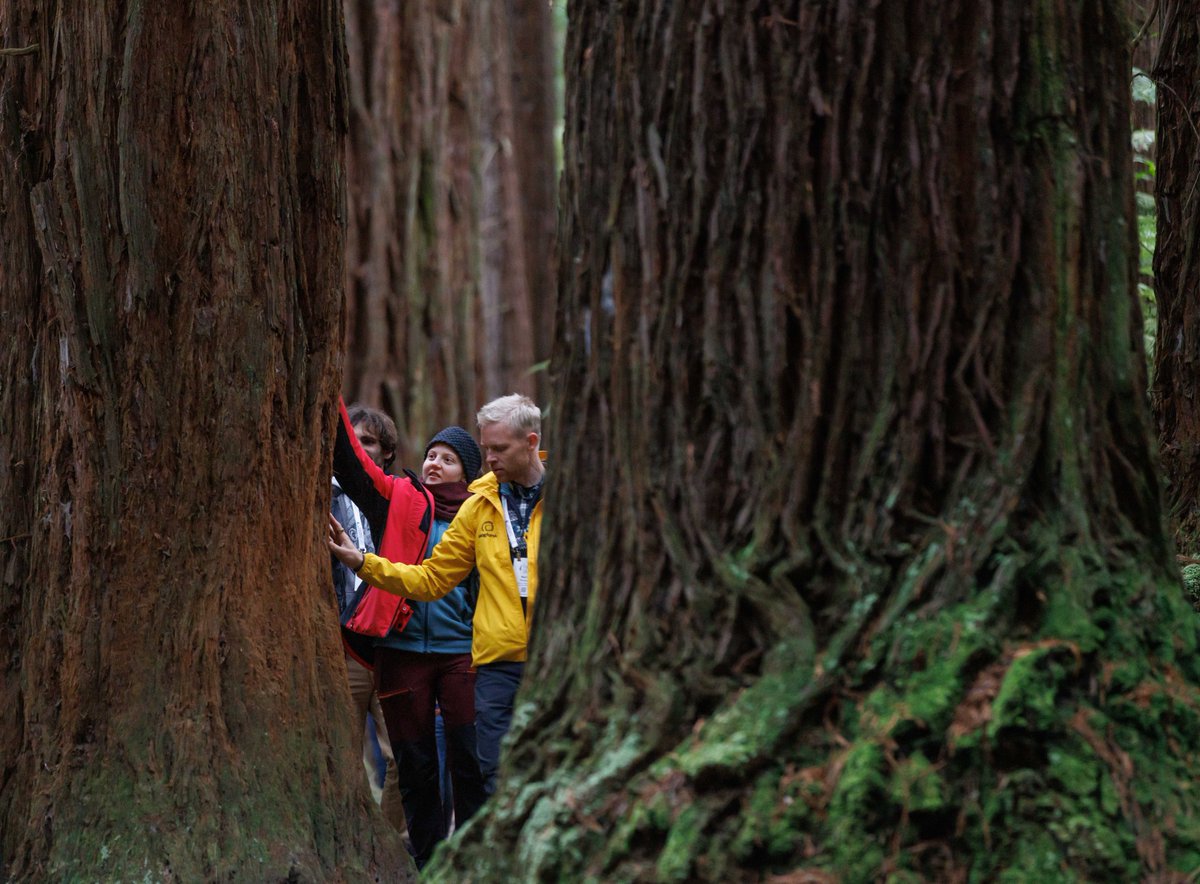
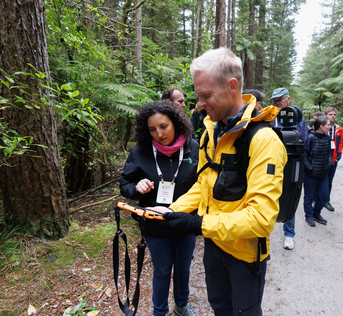
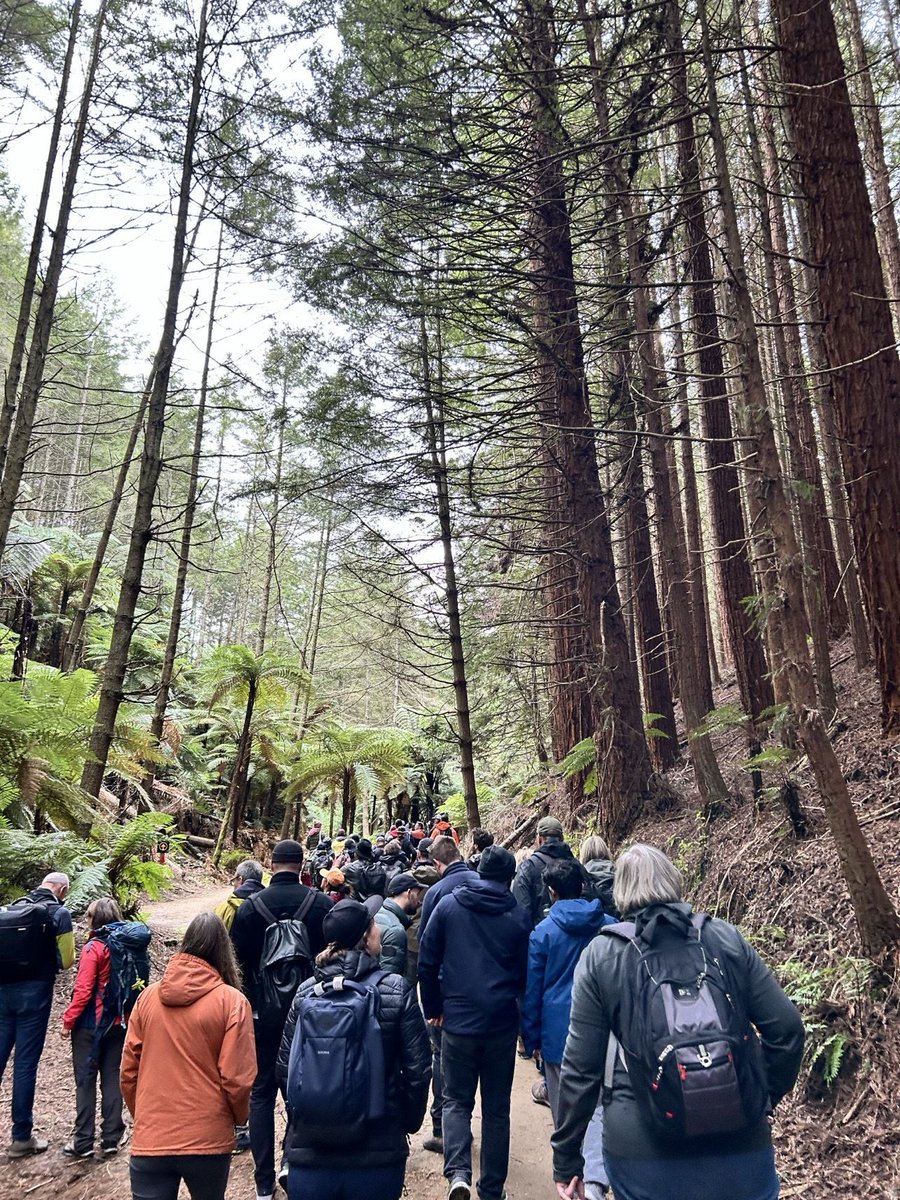
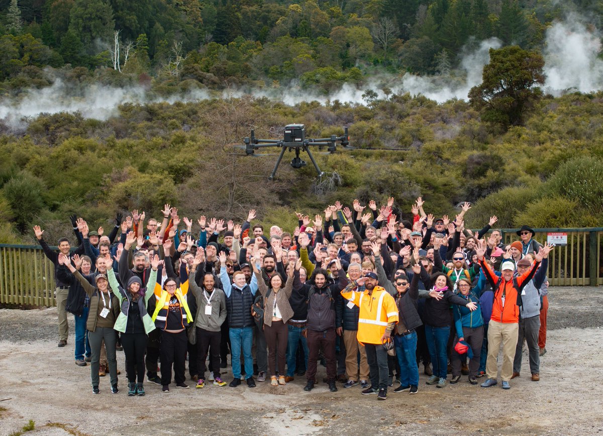
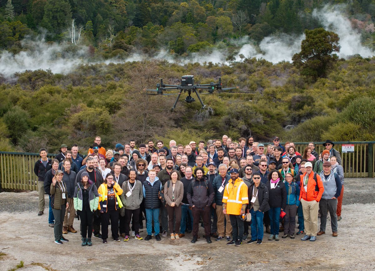
140 #ForestSAT2024 delegates joined us on a post-#conference field trip on Friday.
Here they are at Whakarewarewa Forest checking out the Interpine Innovation Hovermap. What an incredible way to round out the week.
#fieldtrip #LiDAR


3
15
1,188

15 Sep 2024
140 #ForestSAT2024 delegates joined us on a post-#conference field trip on Friday.
Here they are at Whakarewarewa Forest checking out the Interpine Innovation Hovermap. What an incredible way to round out the week.
#fieldtrip #LiDAR

1
2
201
13 Sep 2024
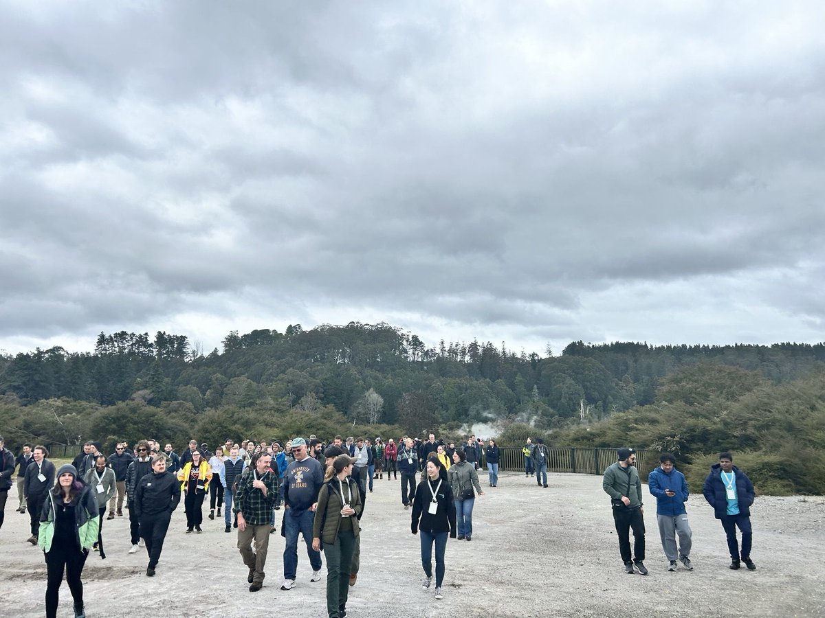
That's a wrap on #ForestSAT2024. Thanks to the 300 delegates who joined us in person.
Friday's fieldtrip around Rotorua included stops at Waipa with Timberlands, a UAV demo with Interpine, a stop at Whakarewarewa Forest, and more.
Stay tuned for more #conference #highlights
4
34
1,544
9 Aug 2024
Interpine is out collecting data for NZ’s forest inventory as part of the LUCAS project by MfE, tracking greenhouse gas changes. We’ve been involved since 2004, 20 years later we are proud to be a key supplier. Find out more tinyurl.com/2dn7sd3r
2
58
5 Jul 2024
🌲 Join Interpine! 🌲
We’re hiring a Resource Forester / Remote Sensing Analyst in Rotorua, NZ! If you have a passion for forestry and remote sensing, we want you on our team. Find out more: tinyurl.com/3753j4t8
5
12
558
24 Nov 2023
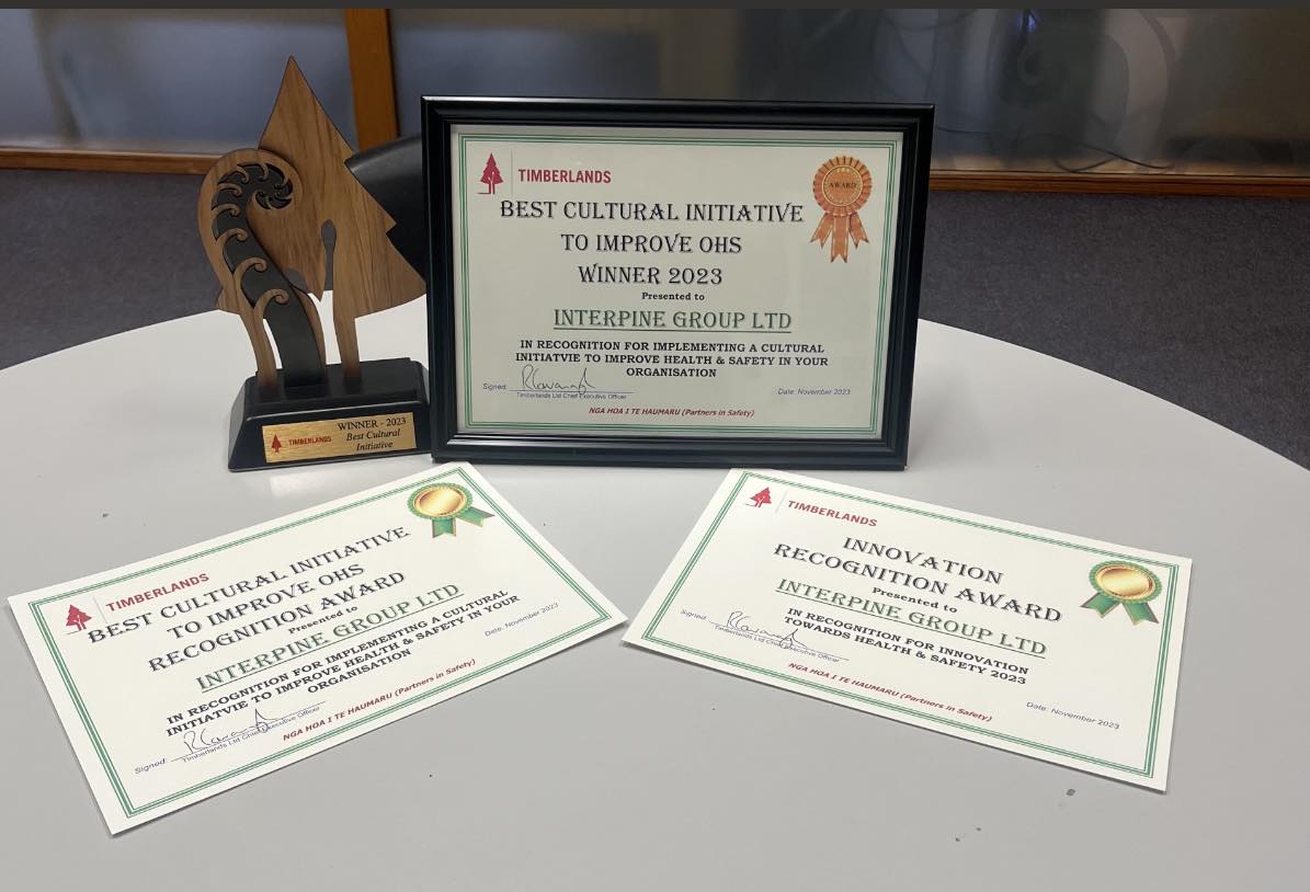
🎉 Interpine won two awards from Timberlands for our HSW innovation and cultural initiative. Thanks to Timberlands for recognizing our team’s efforts. Mihi tīma, whakahirahira ki te haumaru, mahi whakamataku 🎉
1
3
143
30 Sep 2023
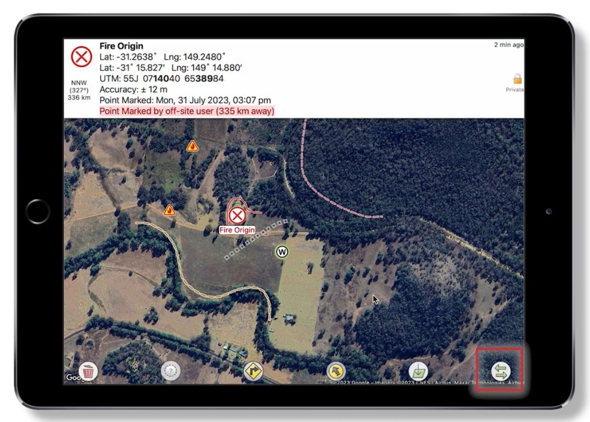
Preparing for the upcoming #forest #fire season, get familiar with @firemapper_app with their latest video tutorials. youtu.be/9jEA6CrLOMY?si=X9va… Interpine has long supported the deployment of FireMapper to our clients.
2
99