
23h
A flood-planning task that normally takes six minutes in GIS took 46 seconds when a local AI system was allowed to run the workflow.
The system is called TransResAI. Researchers at Old Dominion University built it for Hampton Roads, Virginia, one of the most flood-exposed transport regions in the United States.
That setting matters. Hampton Roads has coastal roads, bridges, tunnels, storm surge, sea-level rise, commuter flows, emergency routes, and vulnerable households layered on top of each other. Every useful planning question cuts across several datasets.
A planner might need to know which road links flood first. Which neighbourhoods lose the most mobility. Which census tracts combine high poverty with high exposure. Which adaptation guidance applies. Which routes need priority treatment.
In a normal workflow, that means opening GIS, loading flood layers, joining road-network data, checking traffic model outputs, adding census indicators, reading policy documents, producing a map, then explaining the answer to people who don’t use GIS.
TransResAI turns that into a text box.
A user can ask it to calculate speed reductions under a flood scenario, or show the areas with the highest mobility loss, etc.
The system then breaks the request into parts:
• location
• metric
• scenario
• operation
• visual output.
It writes code, runs the analysis, retrieves the right data, builds the map, and produces the answer.
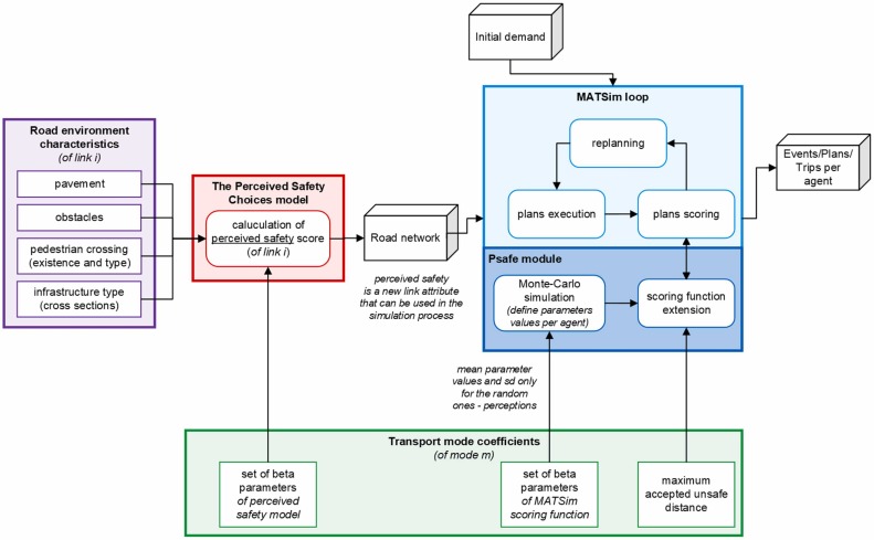
The architecture is the interesting part.
The model is connected to MATSim traffic simulation outputs, OpenStreetMap flood-risk networks, census-tract demographic indicators, regional policy documents, and a map-rendering pipeline.
It’s also local. The base model is GPT-OSS:20B, running inside a controlled environment with read-only data, no internet access, whitelisted libraries, bounded memory, process isolation, and full logging.
The results were pretty strong.
Analytical tasks took 29.7 seconds on average. Conventional GIS workflows were estimated at 197.1 seconds.
Visualisation tasks took 46.1 seconds. The manual GIS estimate was 364.0 seconds.
Across all tasks, completion rates were above 94%. Mean accuracy was 4.60 out of 5. The system cut task time by 80 to 88% compared with conventional GIS workflows.
But, that said, the caveat is important. It was just five users is a small study. The manual GIS comparison came from expert estimates rather than a fully timed head-to-head trial.
That said, it's an interesting data point. I find that a big bottleneck is having people who know how to connect different datasets fast enough to support a real planning decision.
Anyway, TransResAI is trying to compress that expertise into an interface ordinary planners can use.
Link to paper: arxiv.org/pdf/2606.00042

2
1
33
2,322

Jun 13
🎓 Fully Funded PhD in 𝗘𝘅𝘁𝗲𝗻𝗱𝗶𝗻𝗴 𝗮𝗻 𝗜𝗻𝘁𝗲𝗴𝗿𝗮𝘁𝗲𝗱 𝗨𝗿𝗯𝗮𝗻 𝗦𝗶𝗺𝘂𝗹𝗮𝘁𝗶𝗼𝗻 𝗠𝗼𝗱𝗲𝗹 𝗳𝗼𝗿 𝗛𝗲𝗮𝗹𝘁𝗵𝘆, 𝗦𝘂𝘀𝘁𝗮𝗶𝗻𝗮𝗯𝗹𝗲 𝗖𝗶𝘁𝗶𝗲𝘀 (United Kingdom 🇬🇧)
💶 Fully funded 3-year PhD studentship with a tax-free stipend of £20,780/year UK tuition fees covered
✅ Passionate about #SustainableCities #UrbanPlanning #ClimateAdaptation 🏙️🌍🚲
✅ Highly recommend this interdisciplinary #fullyfunded #PhDPosition across the Schools of Sport, Exercise and Health Sciences and Architecture, Building and Civil Engineering @lborouniversity 🇬🇧
📌 This #phdproject focuses on advancing one of the world's most sophisticated integrated urban simulation platforms to better understand how transport systems, urban environments, housing, and climate change influence health, sustainability, and social equity.
You’ll work on:
🔷 Extending the SILO–MITO-MATSim urban simulation framework to generate policy-relevant insights
🔷 Modelling climate adaptation challenges including extreme weather events, climate disruptions, and behavioural responses
🔷 Investigating decarbonisation pathways, electric vehicle adoption, and their impacts on households and public health
🔷 Analysing housing affordability, neighbourhood conditions, and health inequalities
🔷 Improving air quality, exposure modelling, and assessment of environmental health risks
🔷 Developing advanced activity-based and agent-based models to understand travel behaviour and urban dynamics
🌍 Contribute to healthier, more sustainable, and equitable cities by developing cutting-edge simulation tools that support evidence-based policymaking for transport, housing, climate adaptation, and public health.
✅ Work with Professor James Woodcock and collaborate with leading international partners including TU Munich, TU Graz, Utrecht University, ISGlobal Barcelona, and TU Berlin
⏰ 𝗗𝗲𝗮𝗱𝗹𝗶𝗻𝗲: 𝟮𝟵𝘁𝗵 𝗝𝘂𝗹𝘆, 𝟮𝟬𝟮𝟲
👉 Full details & apply here:
🔗phdscanner.com/opportunities…
📩 Want more like this?
➕ Follow @PhdScanner and join WhatsApp for updates:
whatsapp.com/channel/0029Vb5…
🌐 Visit: phdscanner.com
#fullyfundedPhD #PhDposition #PhDScanner #LoughboroughUniversity #UnitedKingdom #SustainableCities #UrbanPlanning #ClimateAdaptation #TransportModelling #HealthyCities #UrbanSimulation #PublicHealth #ResearchOpportunity
♻️ Share with someone applying this cycle

6
288

MATSim実践編――ドラッグ&ドロップで1万人超のエージェントを動かしてみる:リタイア直前エンジニアの社会人大学漂流記(5-2)(1/4 ページ) - EE Times Japan eetimes.itmedia.co.jp/ee/art…
11

 Gino Hard


19 Mar 2025
Cool! Have you looked into real traffic simulators like SUMO or MATSim? Of course they are not web-apps …
1
5
875

22 Nov 2024
We joined Matsim user meeting held at UTokyo. Thank you very much for organizing it @kotsukenUT2 !
1
5
557

5 Sep 2024
It was a pleasure to present @David_AlvCas's PhD work from the @GeospatialCDT in a very hot room at #CRBAM today and be part of a thoughtful discussion about the role of modelling in planning for cities with higher active travel uptake. Great to see others using MATSim too! 1/n
5 Sep 2024

@AlistairCFord presenting @David_AlvCas's agent-based model for Tyne and Wear, showing how changes in policy impact cycling levels 🚲📈
Fascinating session on cycle modelling and simulation this morning at #CRBAM 🚴♀️👨💻

2
7
1,035

18 Aug 2024
This Journal of Cycling and Micromobility Research paper introduces a new, parametric agent-based modeling approach for simulating micro-mobility, using MATSim as a platform. spkl.io/60104hoTO
3
10
1,724
19 Jun 2024
Including our own work by @David_AlvCas where PAM helped us to build the inputs for a MATSim implementation for Tyne and Wear!
1
2
105
7 Jun 2024
Very happy to see our article published in the Journal of Urban Mobility, charting work by @David_AlvCas to build an open-source UK implementation of the MATSim agent-based transport model to test active travel interventions. @GeospatialCDT @the_DARe_Hub sciencedirect.com/science/ar…
3
6
461


16 Apr 2024
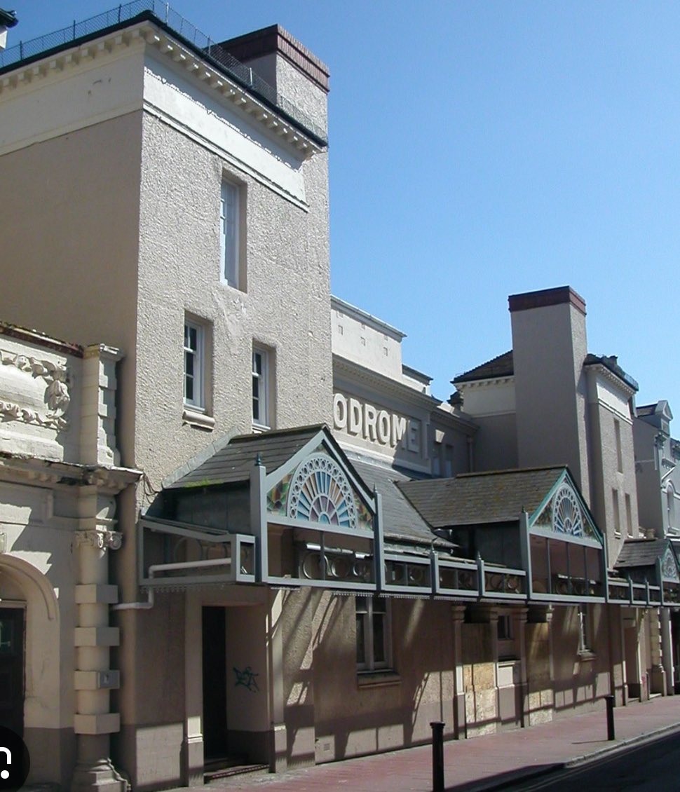
Thrilled to see local company Matsim are wasting no time getting straight to work to save and restore #Brighton's Hippodrome following recent planning approval brightonandhovenews.org/2024…
4
9
67
14,257

ICYMI: A £20 million restoration of Victorian venue the Brighton Hippodrome has won the approval of its local council, following years of wrangling between developer Matsim and campaigners.
Find out more 👇 thestage.co.uk/news/controve…
4
3,060
A £20 million restoration of Victorian venue the Brighton Hippodrome has won the approval of its local council, following years of wrangling between developer Matsim and campaigners.
Find out more 👇 thestage.co.uk/news/controve…
5
2,166

3 Apr 2024
Agree Tom. 🔜
It is superb news - lots of people have done lots & lots to make this happen. #Vision
Well done @BrightonHoveCC planning folks, councillors & developer. #Matsim
3 Apr 2024

Absolutely thrilled to hear that the plans to move forward with the redevelopment of the Brighton Hippodrome have today been APPROVED!!
Well done @bhlabour & @BrightonHoveCC.
Such an amazing building. Can’t wait for people to enjoy comedy and music there once again!
1
2
8
733

Just did a quick live two-way with @adamdowling on @BBCSussex about the #Brighton Hippodrome result. Much excitement in the chamber and I was very glad to have had a long conversation with Simon Lambor from Matsim for more background #LDreporter
1
8
552
"I don't think anyone could think of turning this down" says Maureen Winder, although the council must look to the residents. @LizBHPlanning says it is important to care for the heritage asset & to lose the GradeII* listed building would be a great loss Matsim is doing a good job
1
2
262
19 Mar 2024
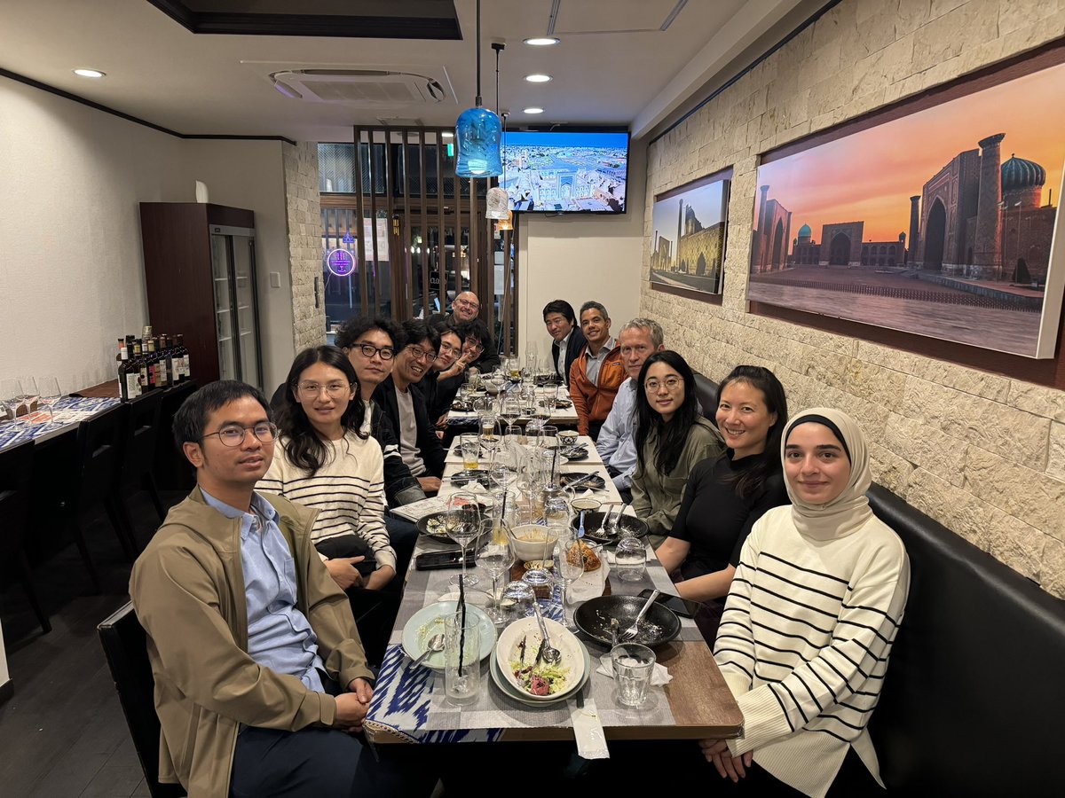
Dinner at Tsukuba after MATSim meeting


1
4
219