
Jun 12
🏚️#EMSR882 #Philippines 🇵🇭
On 8 June, a magnitude 7.8 #earthquake struck offshore #Sarangani, southern #Mindanao, affecting thousands of people & causing widespread damage
Our #MappingTeam has been activated & will soon provide damage assessment maps
🔗mapping.emergency.copernicus…

3
4
701
Jun 11
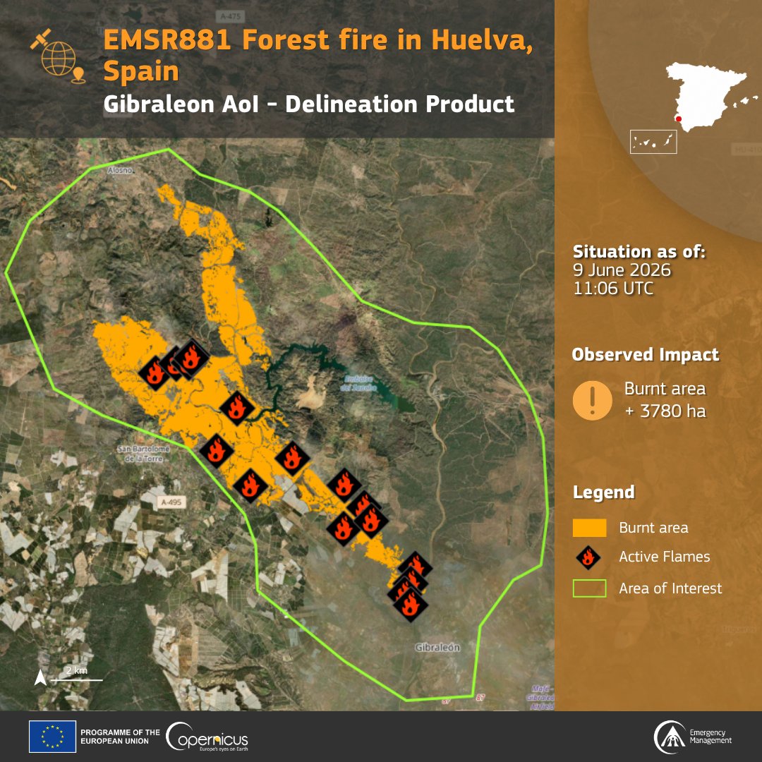
🔥#EMSR881 #IFVillanuevaDeLosCastillejos
On 8 June, a #wildfire broke out in #Huelva province, #Andalucia, #Spain 🇪🇸
Our #MappingTeam has been activated
A first Delineation Product has already been delivered, with a second one planned for later today
mapping.emergency.copernicus…
13
21
2,616
Jun 10
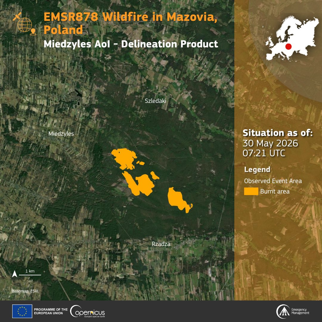
🔥#EMSR878 #Poland 🇵🇱
On 27 May a #wildfire broke out in Wołomin County in the Masovian region, just a few kilometres Northeast of #Warsaw
Our #MappingTeam supported local authorities by delivering a delineation of the fire extent
More at: mapping.emergency.copernicus…
1
5
12
1,517
Jan 28
#EMSR861 – Floods in Andalusia 🇪🇸
More rainfall is expected to ⬆️river water levels, reaching buildings and infrastructure in floodplains and urban areas.
Our #MappingTeam is helping understand the basin's response.
🗺️Maps soon: mapping.emergency.copernicus…
7
14
1,922
Jan 28
#EMSR860 – Storm in Ireland
Strong winds and floods are impacting lives, livelihoods, buildings and infrastructure in 🇮🇪
Our #MappingTeam will soon be providing emergency maps to help increase situational awareness.
🔗mapping.emergency.copernicus…
1
11
1,151
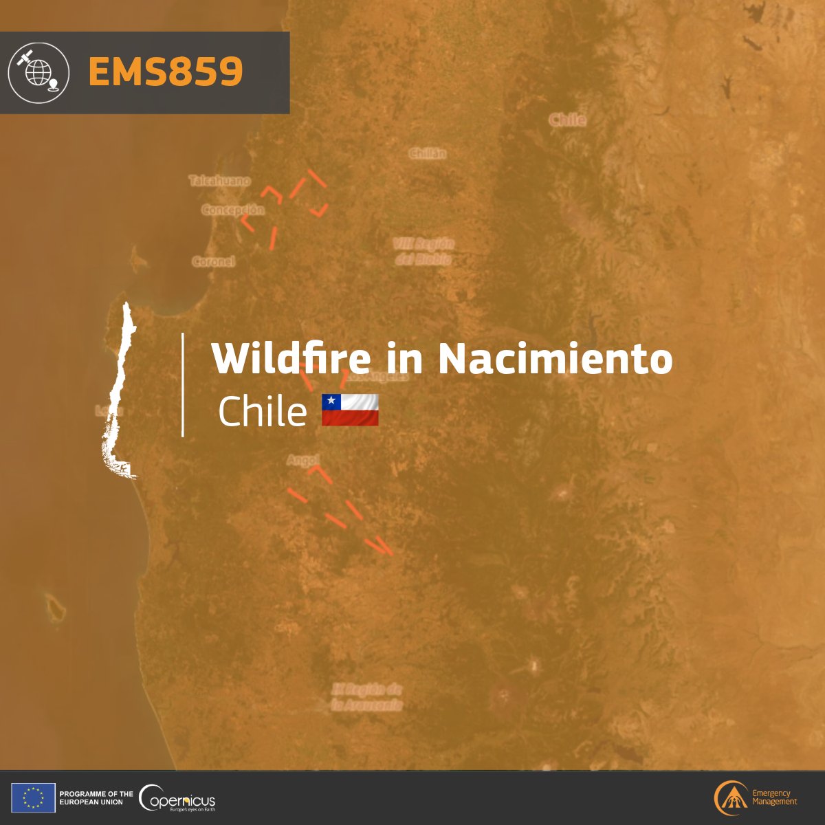
Jan 21
🔥#EMSR859 – Wildfires in Nacimiento 🇨🇱
A major outbreak has been affecting central Chile w/ multiple fires burning across the Ñuble and Biobío regions amid extreme heat, strong winds, and drought.
Our #MappingTeam is providing emergency maps.
🔗mapping.emergency.copernicus…
6
11
1,573
Jan 19
🌊Floods hit South Africa, Mozambique & Zimbabwe, killing over 100.
In 6 areas🇲🇿 our #MappingTeam estimated:
166,770 ha of max flooded area,
24,000 people and 550 km of roads potentially affected.
Check the link in the comments to monitor the evolution.
#EMSR857🛰️
ALT Heavy rain that started in December, has caused several floods in Mozambique. Based on the analysis of 12 remotely-sensed images, Copernicus Emergency estimated that approximately 24k individuals, 598.2 ha of buildings, and 550 km of roads had been potentially affected in 6 areas of interest.
1
12
21
1,691
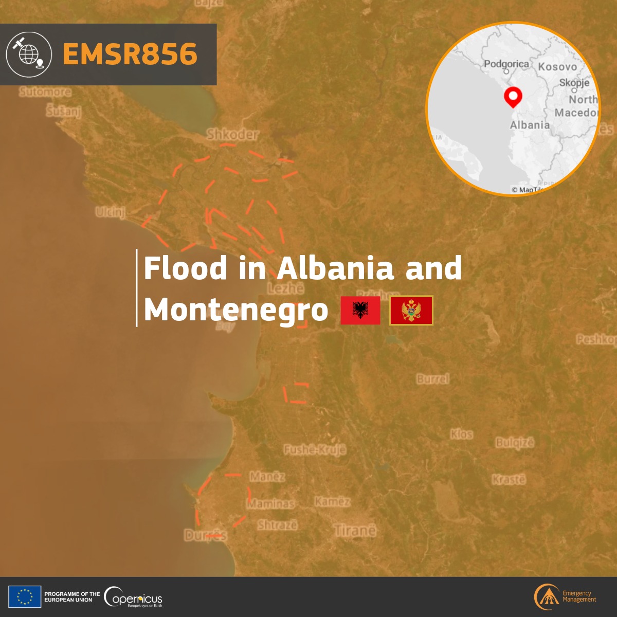
🌊#EMSR856 – Floods in Albania and Montenegro 🇦🇱🇲🇪
Severe weather has caused flooding & disruption.
Our #Mappingteam activated via @eu_echo to assess flood extent & damage in 6 areas of interest.
First emergency maps expected in the next hours.
🔗rapidmapping.emergency.coper…
1
4
11
1,388
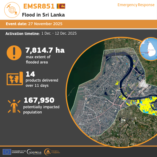
16 Dec 2025
🌊#EMSR851 update – Sri Lanka🇱🇰
On 27 Nov, cyclone #Ditwah brought heavy rains to Sri Lanka, causing floods and landslides.
🛰️ Our #MappingTeam identified 10,344 built-up structures and 523.3 km of roads affected across 9 areas of interest.
🔗rapidmapping.emergency.coper…
5
11
955
15 Dec 2025
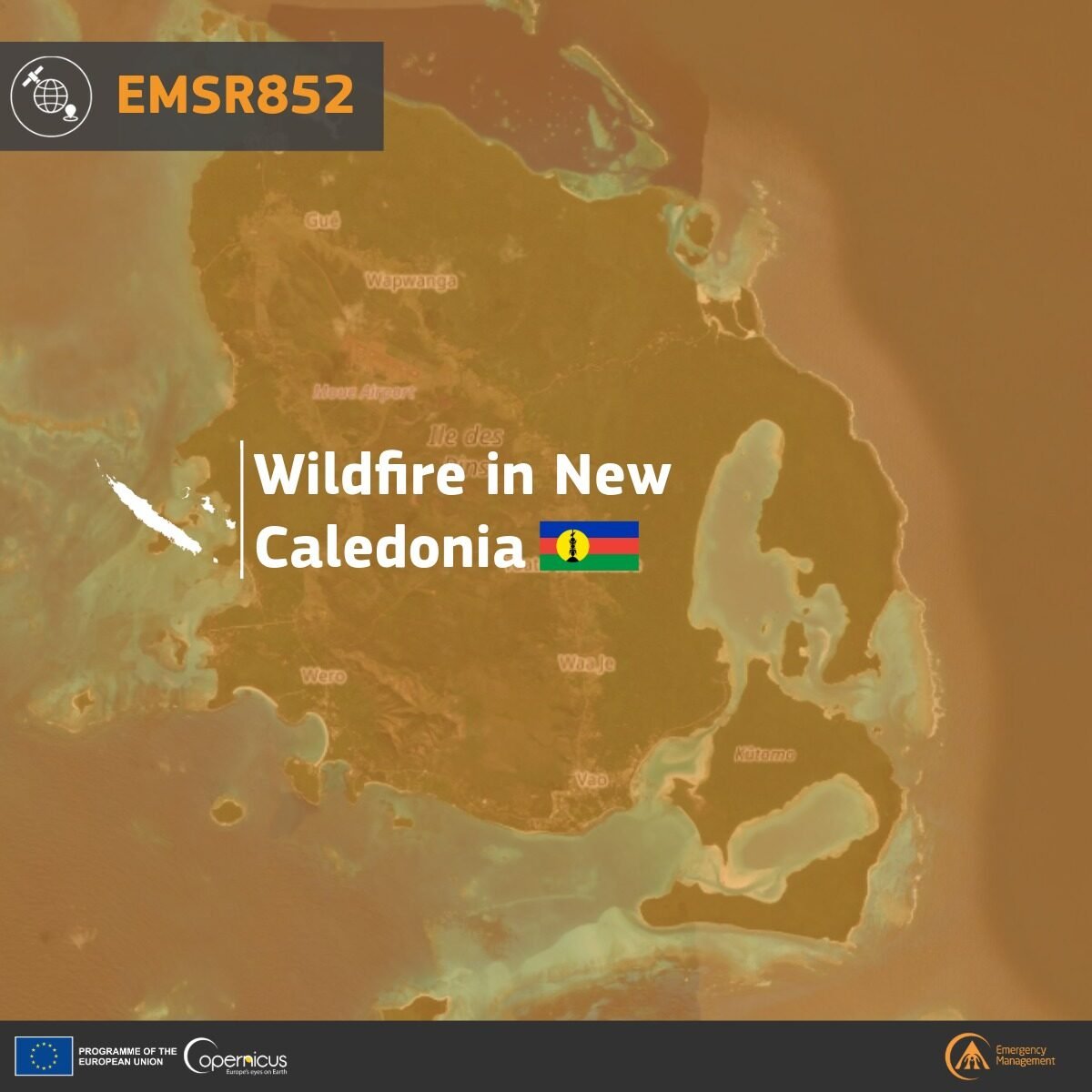
🔥 #EMSR852 – Wildfire in New Caledonia 🇳🇨🇫🇷
A wildfire broke out on the Isle of Pines, New Caledonia, on 30 Nov.
Our #MappingTeam team identified 40.8 km of roads and 49 built-up structures impacted in the area of interest.
More information 🔗 rapidmapping.emergency.coper…

4
11
833
11 Dec 2025
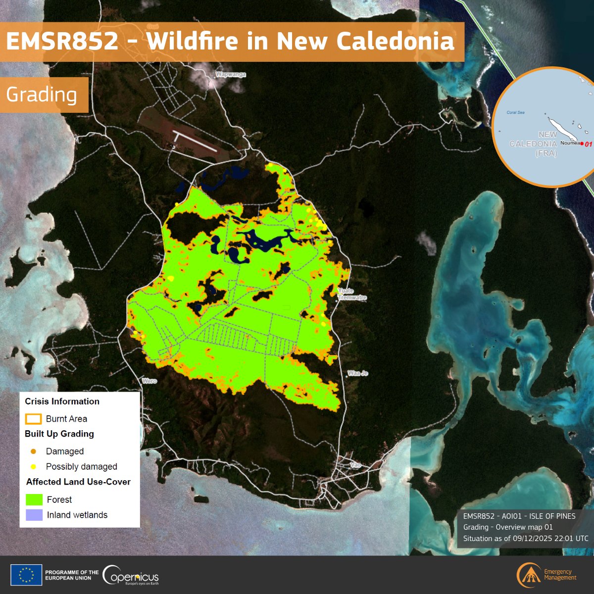
🔥 #EMSR852 – Wildfire in New Caledonia 🇳🇨 🇫🇷
Grading from our #MappingTeam shows the fire affected 1.908.1 ha of forest and 8.3 ha of wetland.
The burnt zone also impacted 49 built-up structures on the island, and 1.5 km of road.
More information 🔗 rapidmapping.emergency.coper…
4
10
924
10 Dec 2025
🌀 #EMSR849 – Storm Claudia in Ireland 🇮🇪
Last month, #StormClaudia brought intense rainfall and flooding to Ireland, especially across Leinster and Munster.
Our #MappingTeam analysed 4 areas of interest.
More information about the activation: rapidmapping.emergency.coper…

1
4
17
967
9 Dec 2025
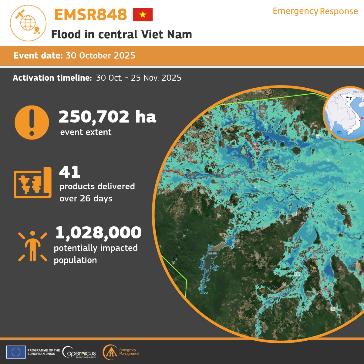
🌊 #EMSR848 – Floods in central Viet Nam 🇻🇳
Record rains caused severe flooding and landslides across central Viet Nam.
Our #MappingTeam analysed 19 areas, estimating major impacts on people, built-up areas and transport networks.
All delivered maps: rapidmapping.emergency.coper…
5
9
918
8 Dec 2025
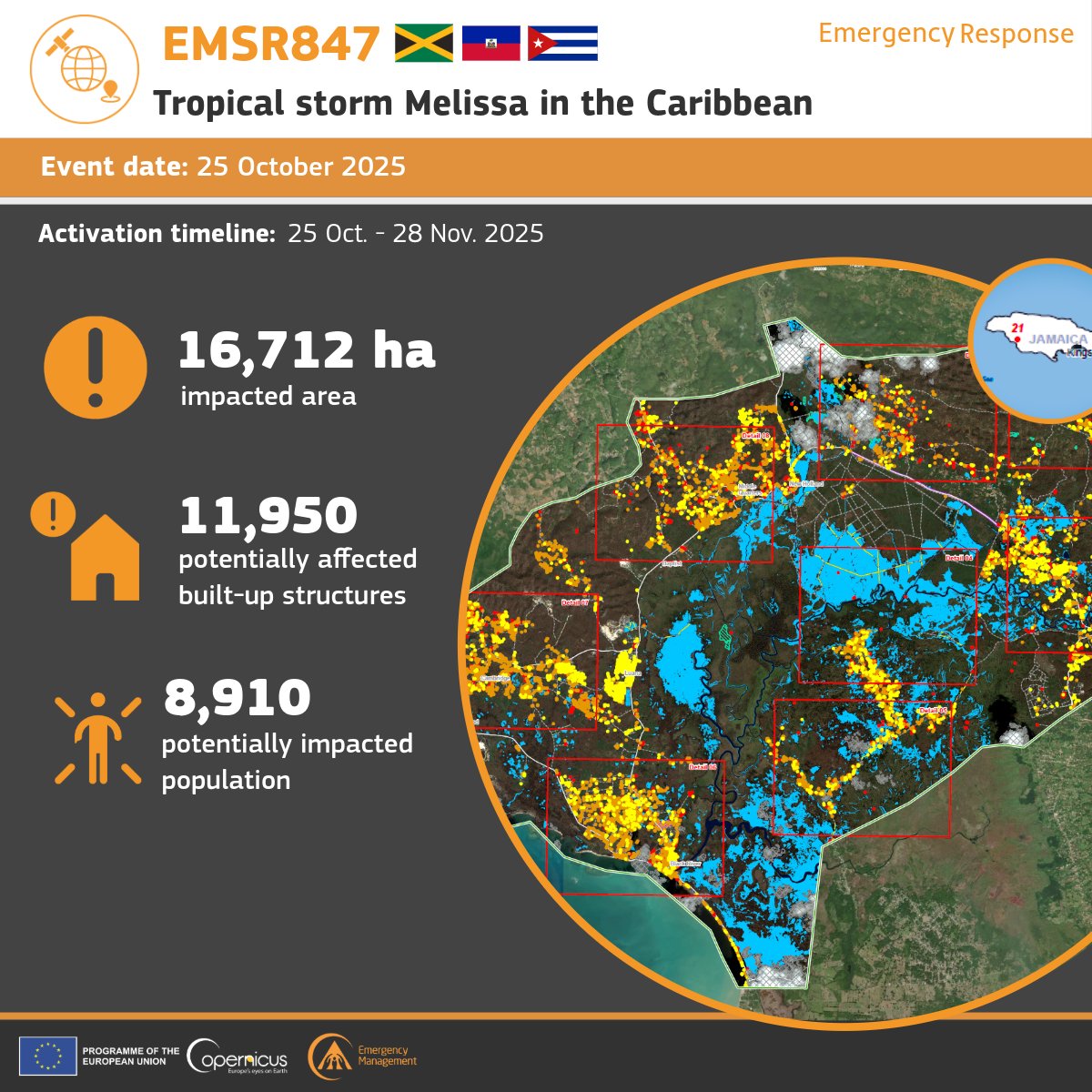
🌀 #EMSR847 – Tropical Cyclone Melissa
Our #MappingTeam has completed the activation in 🇯🇲Jamaica, 🇭🇹Haiti & 🇨🇺Cuba, publishing 49 emergency mapping products across 39 areas of interest.
More details & maps: rapidmapping.emergency.coper…
2
7
902
8 Dec 2025
🔥 #EMSR852 - Wildfire in New Caledonia 🇳🇨
A wildfire that started on the Isle of Pines on 30 November continues to spread towards Vao.
Our #MappingTeam has been activated to provide initial rough estimation and wildfire extent emergency mapping.
🔗 mapping.emergency.copernicus…
1
4
8
1,132
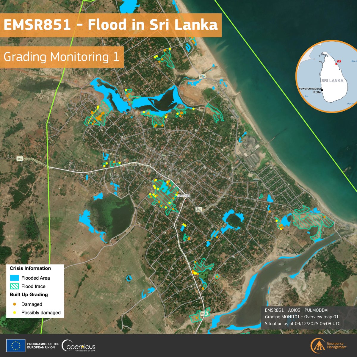
5 Dec 2025
🌊 #EMSR851 – Floods in Sri Lanka 🇱🇰
Our #MappingTeam has released a new grading update for Pulmoddai.
Satellite analysis shows:
🔸 94 ha flooded
🔸 116 built-up structures possibly affected
🔸 ~300 people potentially impacted
More information here: rapidmapping.emergency.coper…
1
9
937
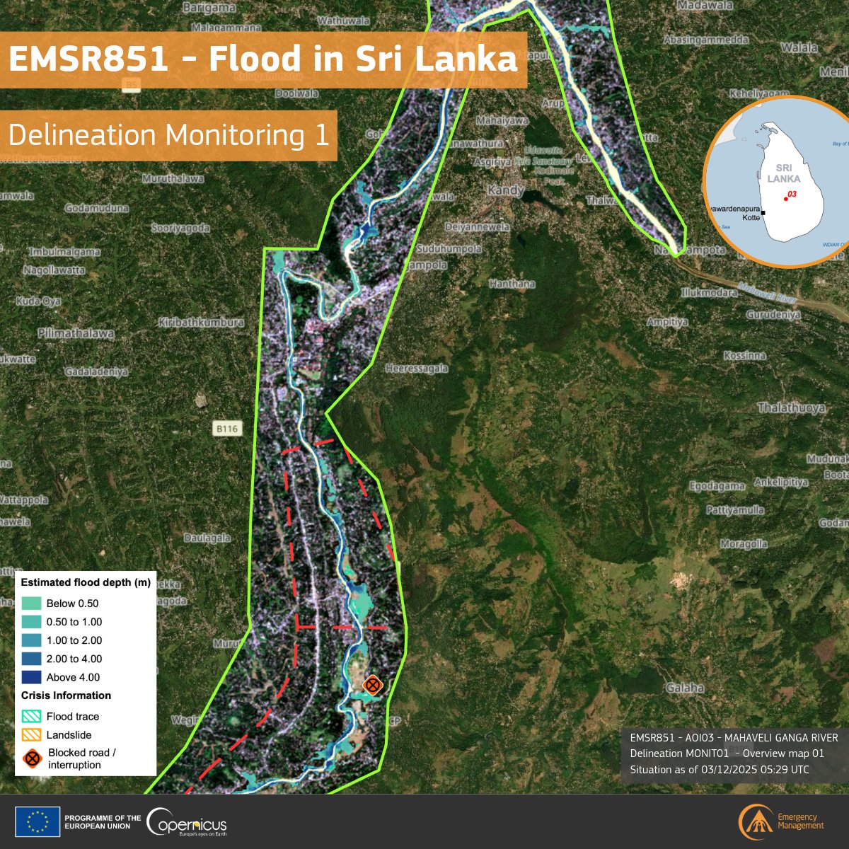
4 Dec 2025
🌊 #EMSR851 – Floods in Sri Lanka 🇱🇰
Our #MappingTeam has released a new map for the Mahaveli Ganga River area. Latest findings show:
🔸 85.6 ha of flooded areas
🔸 43.7 ha of built-up potentially affected
🔸 ~7,800 people in the impacted zone
More:
mapping.emergency.copernicus…
3
8
1,065
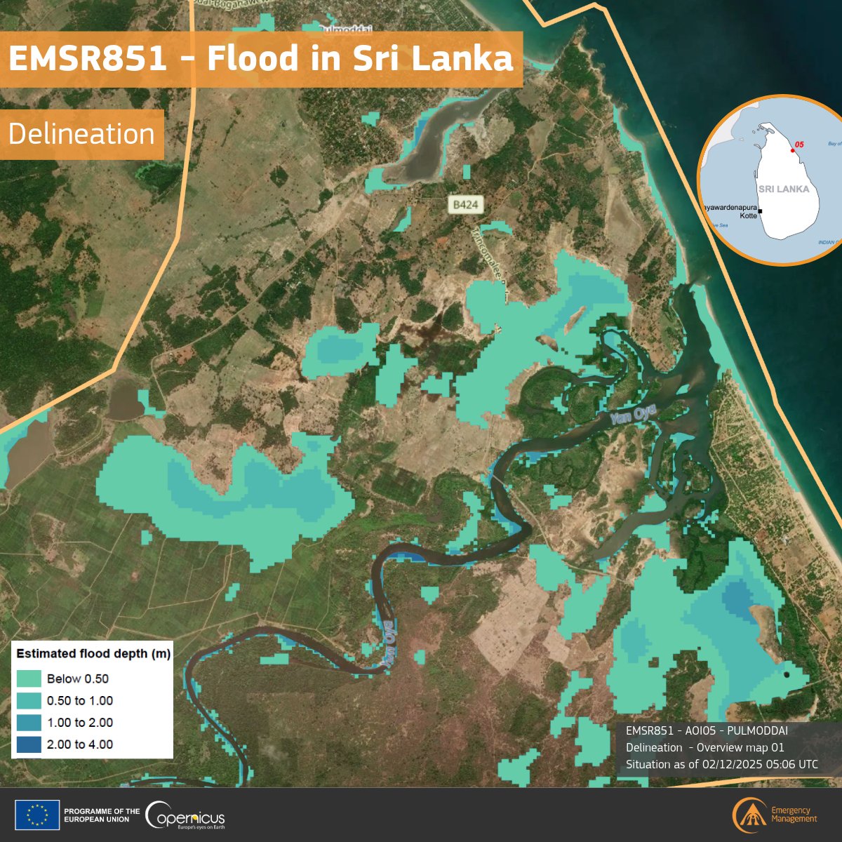
3 Dec 2025
🌊 #EMSR851 – Floods in Sri Lanka 🇱🇰
#MappingTeam released a new delineation for Pulmoddai following severe flooding linked to #CycloneDitwah
🔸 666.3 ha of observed flooded area
🔸 ~200 people potentially affected
🔸 11.4 ha of built-up area impacted
🔗rapidmapping.emergency.coper…
8
12
1,075
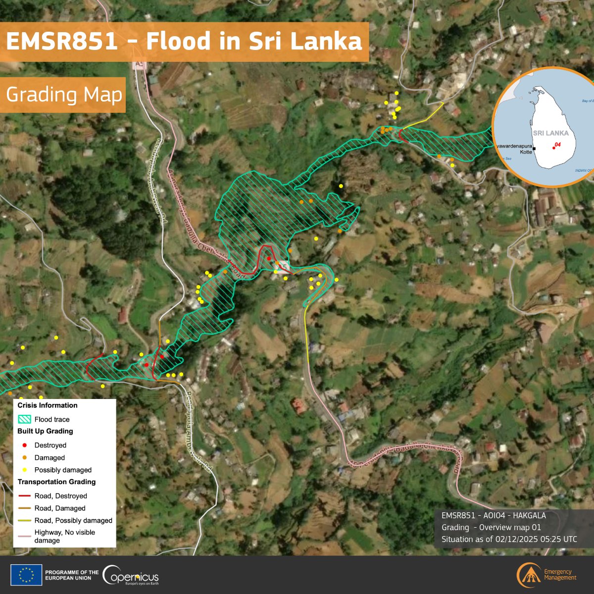
3 Dec 2025
🌊#EMSR851 – Floods in Sri Lanka🇱🇰
Our #MappingTeam released a new grading product for Hakgala, where flood traces and damage to buildings and transport have been detected.
🔸 59 affected buildings
🔸 6.5 ha flooded
🔸 ~100 people potentially impacted
🔗rapidmapping.emergency.coper…
2
10
962
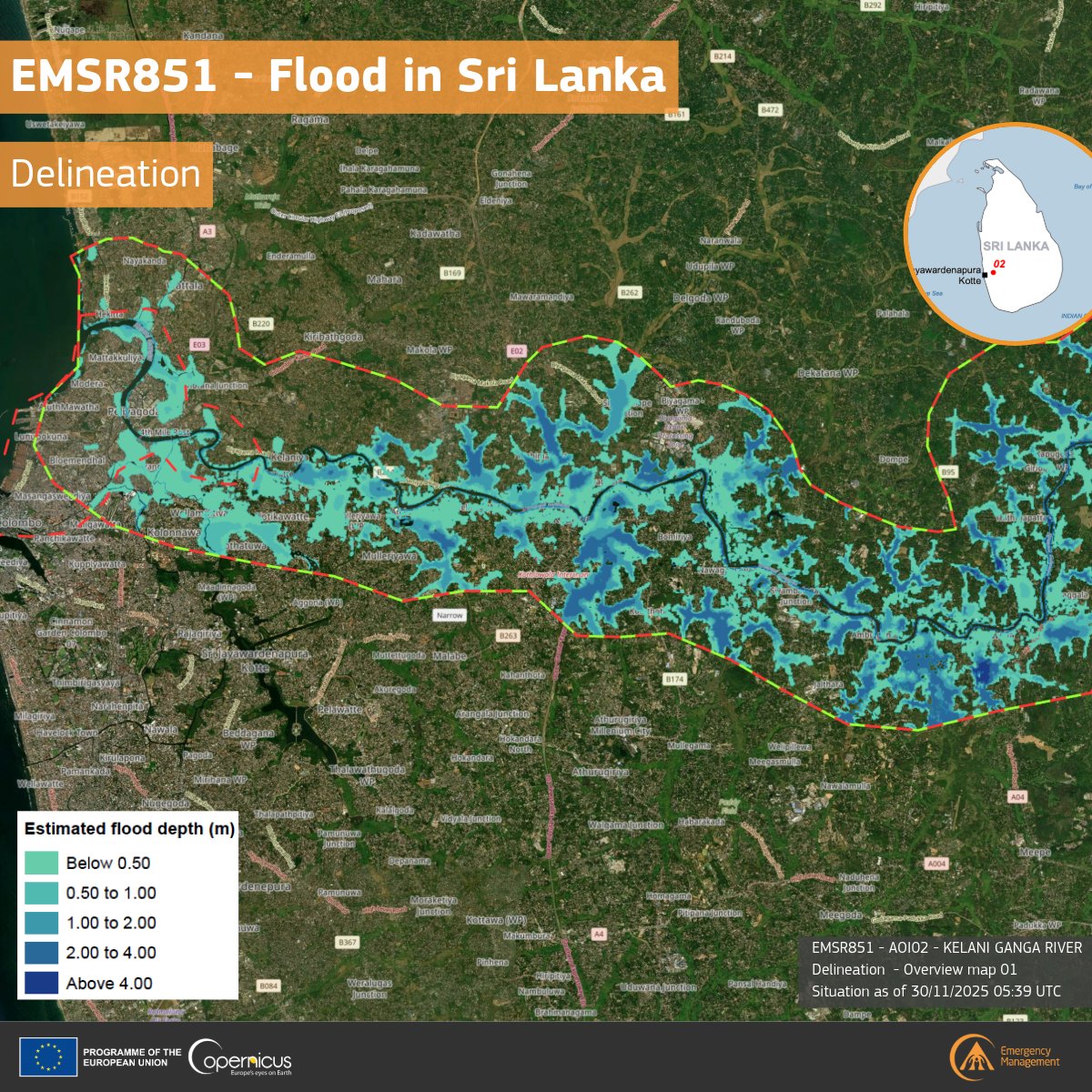
2 Dec 2025
🌊 #EMSR851 – Flood in Sri Lanka 🇱🇰
Our #MappingTeam released the first delineation map for the Kelani Ganga River area.
The analysis shows ~6,760 ha flooded and significant impacts on nearby settlements, with ~149,000 people potentially affected.
🔗rapidmapping.emergency.coper…
1
6
926