
Apr 5
The IRGC’s statement exposes the truth: Trump’s “rescue mission” was a cover for a humiliating defeat. Iran’s forces destroyed two Blackhawks and two C-130s, holding more U.S. POWs. Delaying Planet Labs images only deepens suspicion, what is the U.S. really hiding?
#IranVsUS #MilitaryFail #POWAlert
5
7
1,145

6 Mar 2025
🎉 WIN A FREE SEASON PASS! 🎉
Winter is calling, and we’re making sure you never miss a powder day again! ❄️🏂⛷️
We’re giving away a FREE Epic or Ikon Season Pass so you can ride all season long—on us. Plus, one lucky runner-up will score a $100 Backcountry.com gift card!
🔔 PowAlert keeps you ahead of the storm with real-time snow alerts, resort updates, and pro tips. You focus on shredding—we’ll handle the forecasting.
✅ How to Enter:
1️⃣ Click the link below 👇
gleam.io/D4WPW/powalert-laun…
2️⃣ Complete as many steps as you’d like (more steps = more chances to win!)
👉 [Insert Giveaway Link]
⏳ Hurry! Giveaway closes March 31. Winners will be announced shortly after.
Tag your ski squad & board crew—because pow days are better with friends! 🏔️❄️
#PowAlert #SeasonPassGiveaway #SkiSeason #SnowboardLife #EpicPass #IkonPass #NeverMissAPowDay

7
6
339
5 Feb 2025
PowAlert is OFFICIALLY LIVE! Celebrate our launch with an epic giveaway to elevate your ski and snowboard season. Get real-time snow updates, insider tips, and all the slope info you need.
Win:
- 1 x Epic or Ikon Season Pass (your choice)
- 1 x Runner-up - $100 Backcountry.com gift card
Enter at [gleam.io/D4WPW/powalert-laun…]. More steps, more chances!
**Key Dates:**
- Giveaway Closes: February 28
- Winners Announced: Shortly after
Don't miss out! Enter now and spread the word!
#PowAlert #Giveaway #SkiSeason #SnowboardLife #EpicPass #IkonPass #Backcountry
107
11
2,324

28 Mar 2024
Buenos dìas my friends,
Cup'O'Joe in hand, So buckle up, ya'buttercups!
Today's warm temps are just the calm before the storm 😎 Snow starts tonight and intensifies on Friday = #Ripping #MaNatural Sierra Spring conditions (expect a >12" above 5,500ft!) AND winter driving challenges ❄️🚗.
Resorts reporting in with a mixed bag of 24-hour totals ranging from up on I80 with 9" down to SR4 with 9".
24hr Base totals:
• Sugar Bowl - 9"
• Bear Valley - 9"
• Palisades - 8"
• KirkwoodMtn - 8"
#CaliPass #StokeLevelRising #PowAlert #AkovaLife
Stay'nThirsty for POW
Coop
2
782
24 Mar 2024
Buenos dias, my friends
Cup'O'Joe in hand with the #StokeLevelRising on a mid-March Sunday #PowderDay. It's not a #ColdSmokeSunday; nevertheless, it's a #PowderDay!
Overall Outlook
Lingering Snow Showers: Snow showers continue through today, especially in the Sierra but are gradually tapering off. Drier conditions prevail from this afternoon onward.
Cooling Temperatures: The weekend's cooler temperatures will persist through today. Expect a slight warming trend starting tomorrow.
Mid-Week System: Another weather system arrives around Wednesday, bringing more rain, mountain snow, and potentially thunderstorms.
China Peak (NWS Hanford)
Snowfall: The Winter Storm Warning continues until 5p today. Up to one additional foot of snow is possible in the Sierra Nevada. A Winter Weather Advisory is also in effect for the Kern County mountains above 5,000 ft.
Winds: Strong west wind gusts near 55 mph will persist in the Kern County desert until 11p this evening (Wind Advisory remains in place).
Thunderstorms: A few strong thunderstorms are possible across Central California this afternoon. Be aware of the potential for lightning, small hail, gusty winds (up to 45 mph), and funnel clouds.
Changes from Yesterday: Snowfall totals may be slightly lower than initially expected, but significant accumulation has occurred.
Bear Valley & Dodge Ridge (NWS Sacramento)
Snowfall: Lingering snow showers will continue through today, then taper off this afternoon with only 2-4” inches of additional snow likely.
Winds: Winds will gradually decrease today.
Thunderstorms: This afternoon, there is a small chance (10-15%) of thunderstorms, mainly in areas south of the resorts. Conditions are less favorable than on previous days.
Changes from Yesterday: Snowfall totals are expected to be lower than initially projected, and the chance of thunderstorms has decreased.
Extended Forecast
NWS Hanford: Dry conditions are expected Sunday afternoon through Tuesday. There is potential for another significant storm system next weekend.
NWS Sacramento: Mostly dry conditions Monday and Tuesday. The next weather system arrives around Wednesday, bringing a chance of widespread rain, snow showers, breezy winds, and isolated thunderstorms. This is not currently projected as a high-impact event, but precipitation amounts and snowfall totals will become clearer over the next few days.
Stay'nThirsty for POW
Coop
#CaliPass #PowAlert #FreshTracks #SkiCalifornia #AkovaLife
4
1,227

10 Feb 2023
2
22

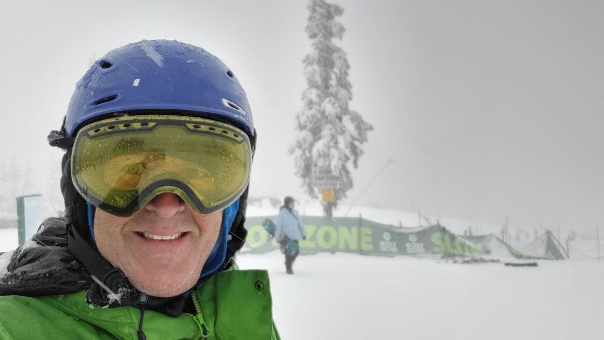
| ALERT : SUPERBE JOURNÉE |
.
Alors les gars du Sud-Ouest, vous faites quoi demain ?
.
Parce que nous.... on sait où on sera ! ⛷🏂❄☀️
#PowAlert #snowalert #pyrenees
@Altiservice
2
7

25 Dec 2021
Merry Christmas & Happy Holidays! Santa was sleighing it last night as we received a wonderful gift! Open your presents, grab some breakfast & make first chair! #powalert #holidayparty #thatswy #snowydays instagram.com/p/CX5-EavLOm9/…
2

31 Jan 2019
Whatever you do... It has to be fun! Period.
#ski #skicanada #powalert #powday #snow #winter #sutton #purementsutton #winterstyle #quebecoriginal #cantonsdelest #easterntownships #quebec… instagram.com/p/BtSIvWDFH3y/…
1
1

5 Mar 2018
It's a powder day in Colorado! But it's also windy. If you're skiing or riding today (spring break?!?), be prepared for wind gusts up to 50 mph at the top of the lifts. Additional snowfall will be limited to 1-2" today. #PowAlert #CBS4Mornings #cowx #4wx

1
2

8 Feb 2018
1
2
5 Feb 2018
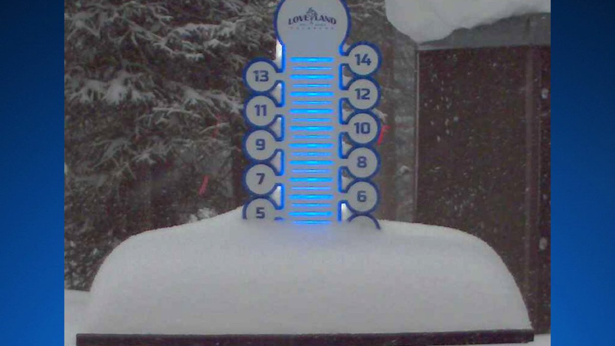
Loveland ski area is approaching 5" of snow already. We could see up to a foot over the higher mountains by early Tuesday. #powalert @LovelandSkiArea
3
2
1 Feb 2018
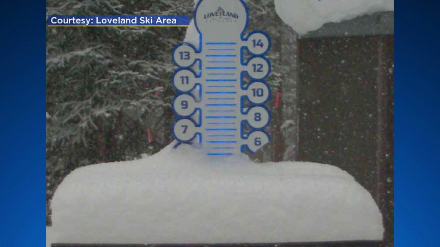
After reporting 0" on their morning snow report, @LovelandSkiArea now has 5" on their snow stake. And this is just the start...it will snow off and on in the Colorado high country through the weekend! #powalert @CBSDenver @ChrisCBS4 @LaurenCBS4
1
6


25 Oct 2017
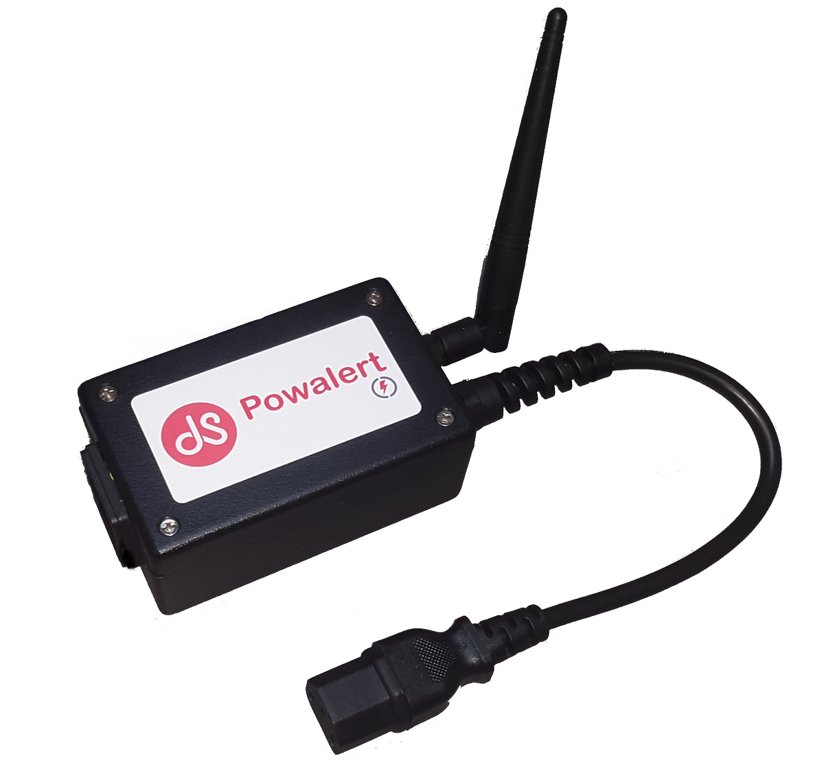
Tomorrow we will be launching Powalert. Our new #IoT solution for telecommunications causation.

1
2
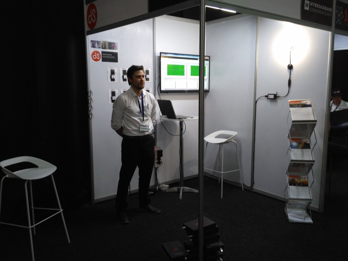
25 Oct 2017
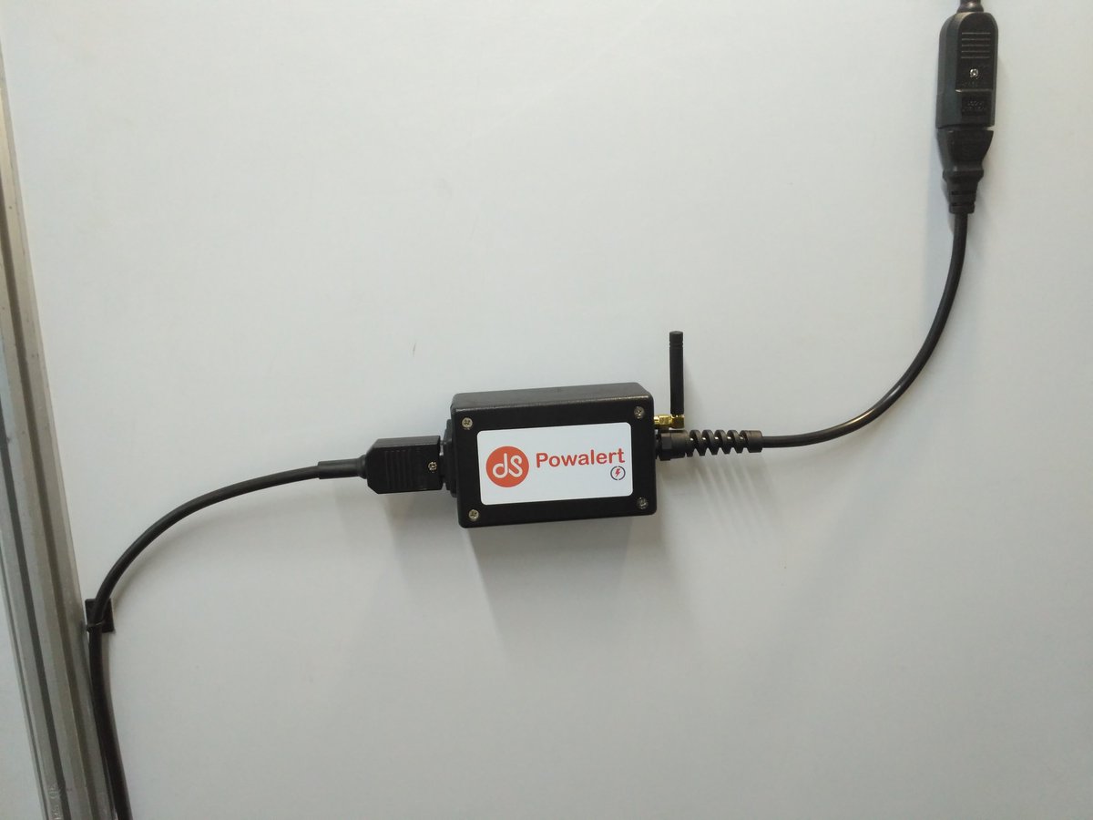
Come and see a demo of the Powalert. A new patented IoT sensor designed and manufactured in South Africa at the @mybroadband conference.
1
1

1 Feb 2017
80 cm in 3 days?! // get your snorkels out! #powalert #hookey #skibc #coastmountains #exploreBC @WhistlerBlckcmb
1

31 Jan 2017
Look out for our new PowAlert range of remote mains supply monitoring systems - with GSM, IP and Bluetooth options!
1

4 Jan 2017
Thanks to the southerly flow, @SundanceResort has racked up 13" in the past 24 hr. Cottonwoods favored when shifts to NW flow! #powalert
1
11