
「Pix4D Certified Trainer Program 2025」に挑戦させて頂きました。全て英語のオンライン試験ですが、全製品合格しました!
認定トレーナーとして、引き続き精進していきます。
#Pix4D
#CertifiedTrainer
#PIX4Dmapper
#PIX4Dmatic
#PIX4Dsurvey
#PIX4Dcloud
#PIX4Dfields
#PIX4Dreact
#PIX4Dcatch
4
138


This article features a hands-on project where university students used drones and #PIX4Dreact to map their campus grounds, identifying new building locations and planning recreational areas: pix4d.com/blog/drones-for-go…
#dronesforgood #PIX4Dreact #Pix4D

3
418

🛰️Our Swiss partner, PIX4D, has released the PIX4Dreact 1.6 software update, a solution actively used by rapid response teams in countries around the world.
🔗 Learn more about PIX4Dreact on our website: drone.ua/blogs/novosti-o-pro…
3
31
🚨PIX4Dreact 1.6 is here: React faster, respond smarter!
We know every second counts. That's why this update is packed with features designed to make life easier for first responders & SAR teams on the ground. See the release in full:
pix4d.com/blog/pix4dreact-1-…

1
292

25 Sep 2024
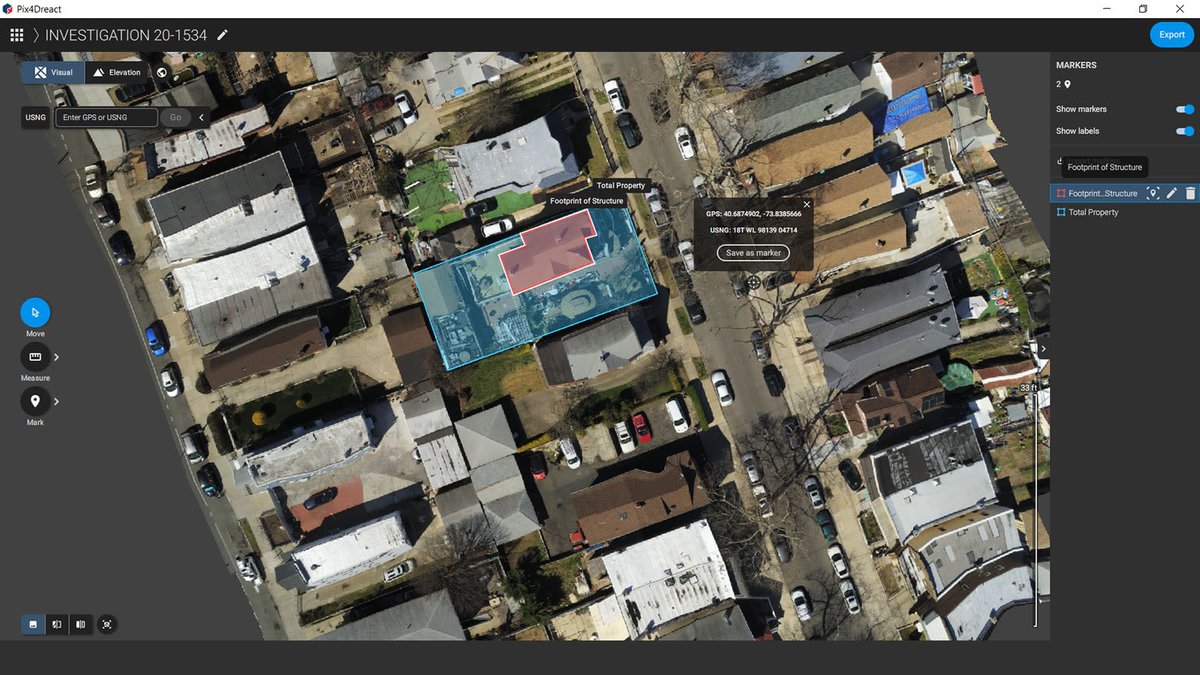
We conducted an extensive search for Sebastian Rogers today, covering a significant area on foot and by using drone mapping. Attached is a link to a section of the drone map we created. You can use the tools within the viewer to explore the map (collapse the left and right panels to enlarge the viewing area). From there, you can zoom in and out and pan around the orthomosaic map using your mouse. The map was generated from images I programmed the drone to capture, and I stitched them together using PIX4DReact to create a detailed, searchable aerial map of the area. We will be back at the search early tomorrow. I feel I cleared this map before posting but if anyone spots anything please let me know. #SebastianRogers cloud.pix4d.com/dataset/1984…
26
34
288
13,143
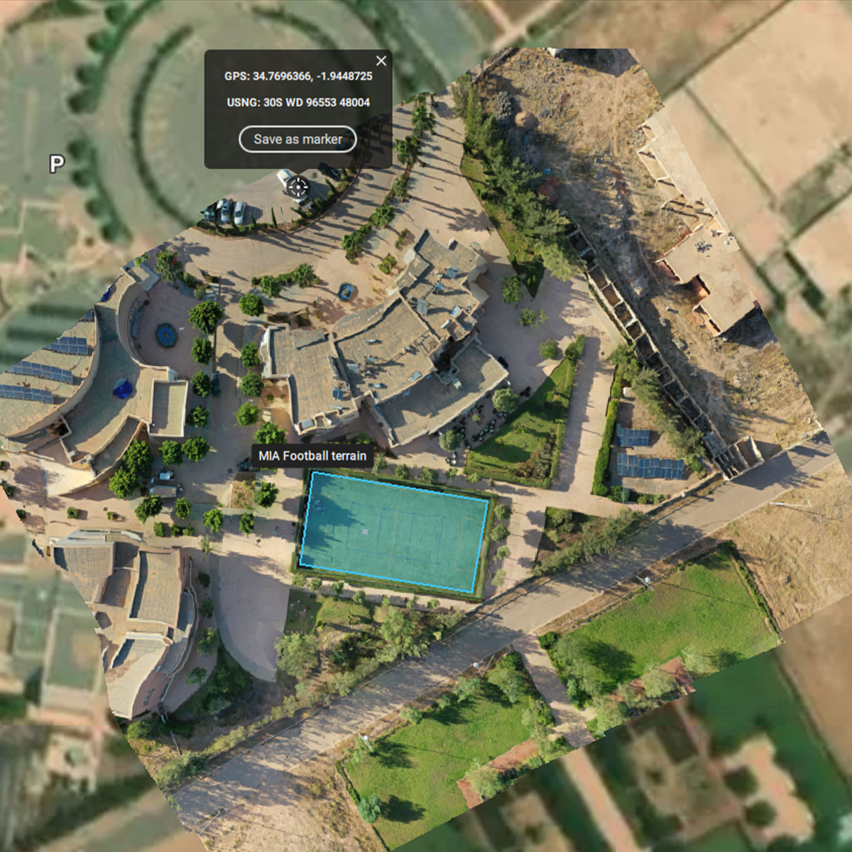
Students use #PIX4Dreact to learn #photogrammetry, processing drone images to create maps, identifying spaces & buildings for situational awareness. Advantages:
➡️ Immediate area assessment
➡️ Enhanced coordination
➡️ Offline processing
Read more here: hubs.li/Q02DpvKv0

6
389
24 Apr 2024
Keep in mind through 90% of people using LOC8 are not mapping also. That is something I commonly do but it's not required for LOC8. For mapping I use Pix4Dreact But LOC8 does not require mapping. It's just a personal preference
1
2
52

22 Apr 2024
Orthoimageは自前でやります。これだとPix4Dreact。
ODMあたりでやってみるのもありかもしれませんね。
というかRealityCaptureがあるか。
1
2
54
1 Apr 2024
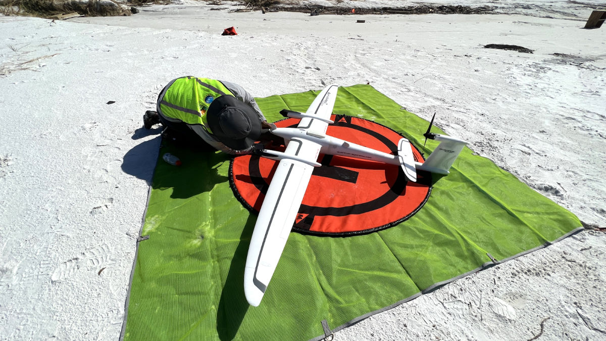
this was done with an Autel thermal drone and Pix4DReact emergency response public safety mapping software.
1
3
254

21 Feb 2024
国産ドローンSOTENの機能紹介。
【オルソ画像撮影の調査(測量)飛行】
標準セットで可能。すでに港湾土木など公共土木の現場で使われています。PIX4DmapperとPIX4Dreactが正式サポート。
youtu.be/AHTUyPwawmU?si=-8rZ…
#SOTEN #蒼天 #国産ドローン #ドローン #ACSL #PIX4Dmapper #PIX4Dreact #Metashape
1
2
6
1,144

9 Feb 2024
株式会社イメージワンは能登半島地震復興支援の取り組みとして、災害や安全保障の分野に特化したドローンマッピングソフトウエアPIX4Dreactの恒久ライセンスを無償で提供しています。お申込み期限は2024年3月末までです。
対象者・お申し込み方法などの詳細はこちらから:hubs.li/Q02k94pr0
4
12
856

5 Feb 2024
1
9
2,476
🌏 Empowering the youth for positive change with #PIX4Dreact.
Morocco Flying Labs and Pix4D educate students to tackle local challenges through mapping skills and #photogrammetry. Teaching future generations to use drones for good: hubs.li/Q02hHfNh0
#DronesForGood
1
6
493
Drones played a vital role in damage assessment after Hurricane Ian. #PIX4Dreact was used to create high-resolution 2D maps, enabling a detailed analysis of the damage. The aerial maps created were used to advise for better preparedness in the future: hubs.li/Q025fY-y0
1
5
692
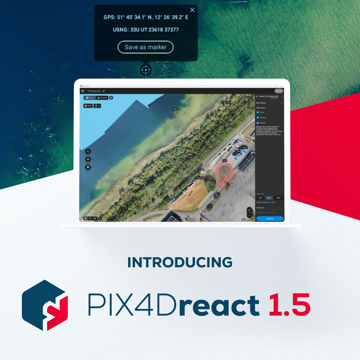
#PIX4Dreact 1.5 is here!🚨
Get high-resolution snapshots for large-format printing, support for uploading markers to PIX4Dcloud, and new location display in degrees, minutes, and seconds to further facilitate the valuable work of search and rescue teams! hubs.li/Q021613F0
3
752
Fighting fire with #drones! Learn how a career #firefighter is using #PIX4Dreact for pre-planning situational awareness and #emergency response. Check out the interview here: hubs.li/Q01-3ptL0 #PublicSafety
5
908

Constat : peu d'interactions entre les activités #SIG et celles des groupes #Drone en #SDIS -> prises de vues pas aussi exploitées que possible.
Essais du @SDIS40 de logiciels de restitution -> #Pix4dReact comme le plus aisément utilisé (adapté à la topo landaise). #GeoSDIS2023
2
10
537
This week on #PIX4DLabs - how can we generate an #orthomosaic faster? 2D maps are critical outputs for our products #PIX4Dfields and #PIX4Dreact - and we need those results quickly! This is how we are making our software faster: hubs.li/Q01CcLkg0

3
601