
2,711 Photos and videos


⏳ Last call! #PIX4Dmatic Essentials Online Workshop starts next week.
We are a week away from kicking off our online workshop on June 16-17. If you've been planning to join us to learn tips, tricks, & best practices, now is the time.
Lock in your spot: training.pix4d.com/courses/p…
1
135
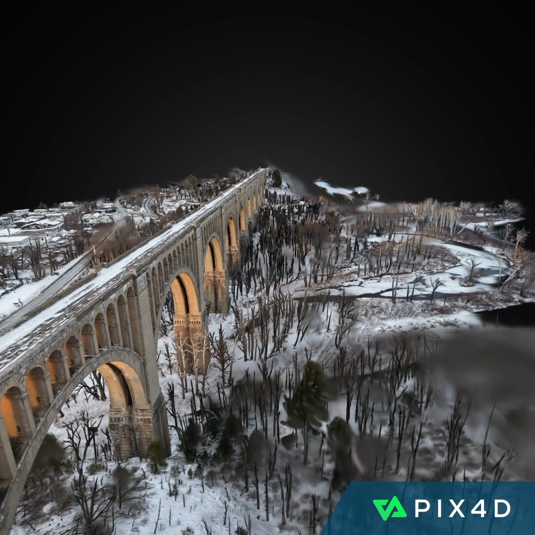
With this incredible capture of the Lackawanna Bridge, we bring a historic landmark into the digital age. 🚂
We love the details on the arches, the contrast against the winter snow, and the way the bridge spans across the valley. 🌉 ❄️
Processed in #PIX4Dcloud.
#3DMonday
1
3
1,015
PIX4D is 15 years old!! 🎂 🎉
15 years of turning images into professional-grade maps and models, helping industries and communities address real-world challenges. 💫🌍
Check out our anniversary retrospective video.
Read the full PIX4D story: pix4d.com/blog/15-years-pix4…
2
216
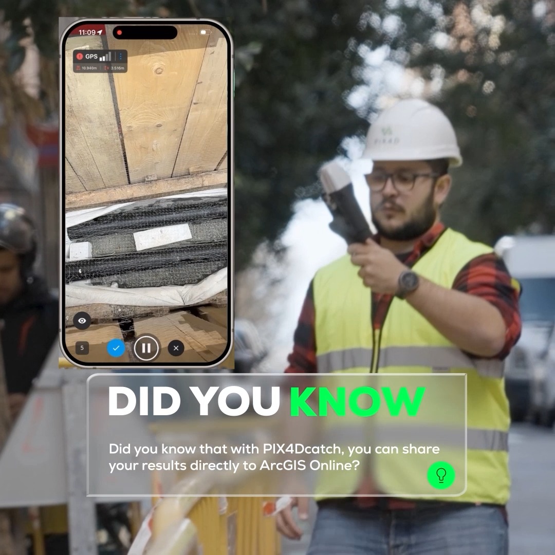
Did you know, with the PIX4D and @Esri terrestrial mapping workflow, you can connect cm-accurate field data directly from PIX4Dcatch to ArcGIS Online. 📱 🌐
Watch the video to see how! 👇
#GIS #DYKTuesday #PIX4Dcatch #Construction
4
743
Our FREE webinar is tomorrow, sign up and discover how to make the most of PIX4Dmatic's new Gaussian splatting output!
🗓️ Tomorrow, Wednesday, 3rd June, choose from 2 sessions:
11:00 AM CEST
2:00 PM EST
Sign up: discovery.pix4d.com/gaussian…
#GaussianSplatting #PIX4Dmatic #PIX4D
3
232
The PIX4Dmatic Essentials online workshop is just a few weeks away!
Learn how to generate accurate 2D and 3D georeferenced representations of reality. Export and share deliverables!
Secure your seat early!
👉 Register here: training.pix4d.com/courses/p…
174
How do you map a dense forest? 🌳
When thick canopy blocked GPS and traditional #surveying tools, aereal pro solutions used #drones and #PIX4Dmatic to build a digital inventory and map every tree for a nature-first architectural design.
👉 Case study: pix4d.com/blog/drone-mapping…
1
2
9
757
Register for next week's FREE webinar and discover how to make the most of PIX4Dmatic's new Gaussian splatting output!
🗓️ Wednesday, 3rd June.
11:00 AM CEST
2:00 PM EST
Register here: discovery.pix4d.com/gaussian…
#GaussianSplatting #PIX4Dmatic #PIX4D
3
217
Heading to Digital Construction Week next week? 🏗️
Come say hi to the team! We’d love to chat about digitizing your construction workflows. 💻 🚧
📍 Excel London, UK
📌 Booth D505
🗓️ 3 & 4 June 2026
#DCW2026 #Construction #PIX4D
170
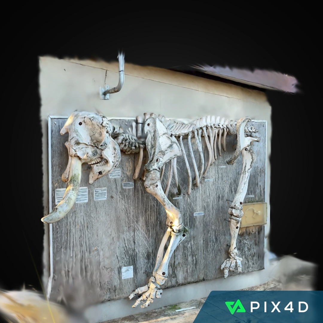
For this week’s #3DMonday, we're highlighting an elephant skeleton display at Addo Elephant National Park, South Africa! 🐘
This quick #PIX4Dcatch scan was processed with #PIX4Dcloud 📱 ☁️ , using #GaussianSplatting to bring the intricate details of the skeleton into focus. 🦴
1
305
📢 Upcoming #PIX4Dmatic Essentials Online Workshop! 💻
This intensive session will cover the fundamentals you need to succeed, from flight planning to quality reports. 🚀
Seats are limited, so secure yours early!
👉 Register here: training.pix4d.com/courses/p…
182
Your data security is our priority. 🔒 PIX4D upholds the highest international standards for digitizing your critical infrastructure:
#ISO27001 Certified ✅ #SOC2Type2 Compliant ✅
Your projects are safe with us.
More information: pix4d.com/blog/pix4d-data-se…
178
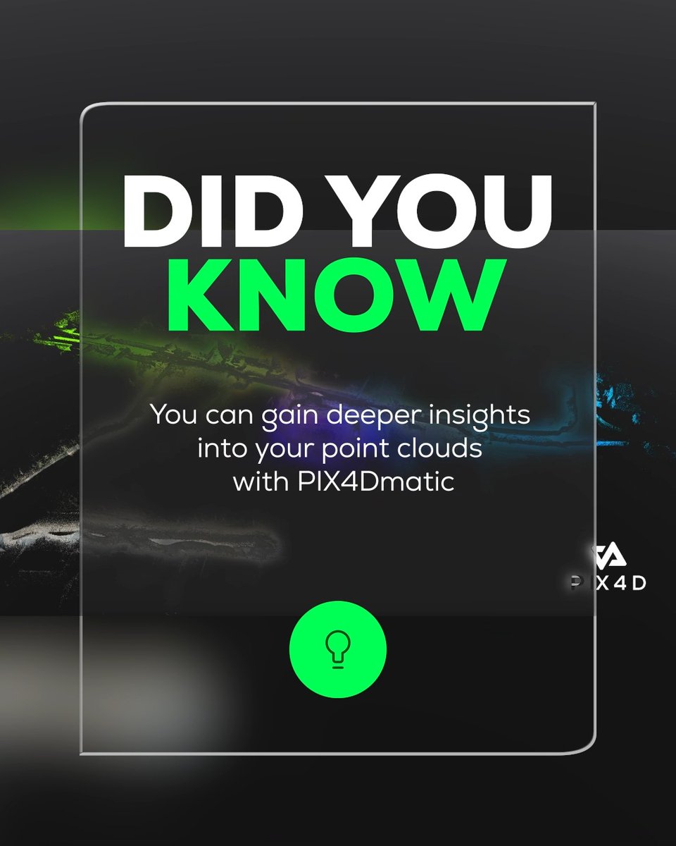
Today's #DYKTuesday spotlight shows how you can gain deeper insights into your point clouds with #PIX4Dmatic.
Changing the symbology reveals hidden patterns and details, helping you understand your dataset.
Watch the video to find out more. 📽️
252
#GaussianSplatting is now in #PIX4Dmatic! Join our webinar to see how this tech delivers:
✅ Hyper-realistic 3D models
✅ Denser, more complete point clouds
✅ Seamless mobile-to-desktop workflows
Don’t miss out! 🚀
Choose your live session here: discovery.pix4d.com/gaussian…
2
294
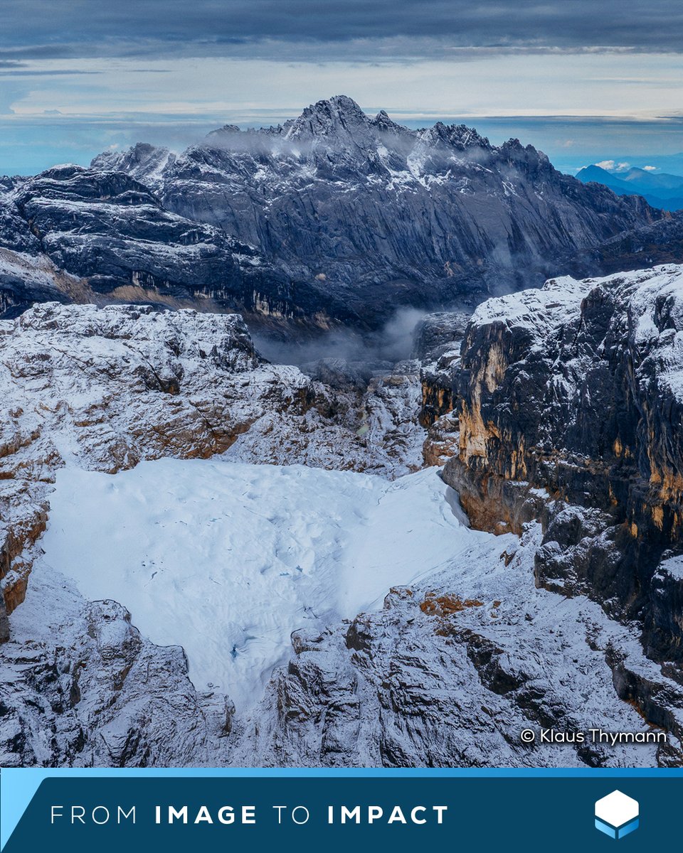
Mapping one of the last remaining equatorial glaciers. ❄️ Led by Klaus Thymann and Project Pressure, the team successfully captured the first-ever 3D photogrammetry model of the vanishing glacier, capturing history before it melts. 🏔
Read more here: pix4d.com/blog/Mapping-last-…❄️
1
216
📢 Gaussian splatting in #PIX4Dmatic! ✨
We now offer #GaussianSplatting in mobile, cloud, & desktop environments. 📱🔄☁🔄💻
A high-fidelity & georeferenced workflow that stays connected from start to finish. 🌐
Read more: pix4d.com/blog/gaussian-spla…
9
1,046
Captured with #PIX4Dcatch, this #3DMonday, we bring a historic fountain in Olite, Navarre, to life.
From the rugged stone basin to the iconic fish-shaped spout, mobile scanning preserves cultural heritage (& Olite’s medieval charm) ✨
Try for yourself: pix4d.com/product/pix4dcatch…
1
333
The countdown is on! ⏳
We are less than two weeks away from our PIX4Dcatch & PIX4Dcloud Online Workshop. If you’re looking to master terrestrial scanning and cloud-based photogrammetry, this is the session for you.
Join from anywhere!
Sign up here: training.pix4d.com/courses/p…

157
Did you know you can align external point clouds in PIX4Dmatic? 🌩️
Find out how in the video below 📽️
#DYKTuesday
794
How does an iPhone compare to a professional total station? Surveyor @RamiTamimiPhD, put the 17 Pro and #PIX4Dcatch with the @bad_elf Flex Mini to the test. Check out the full breakdown in our video and blog: lnkd.in/d2yBpFru
#Digitalconstruction #Geospatial #Surveying
1
429