


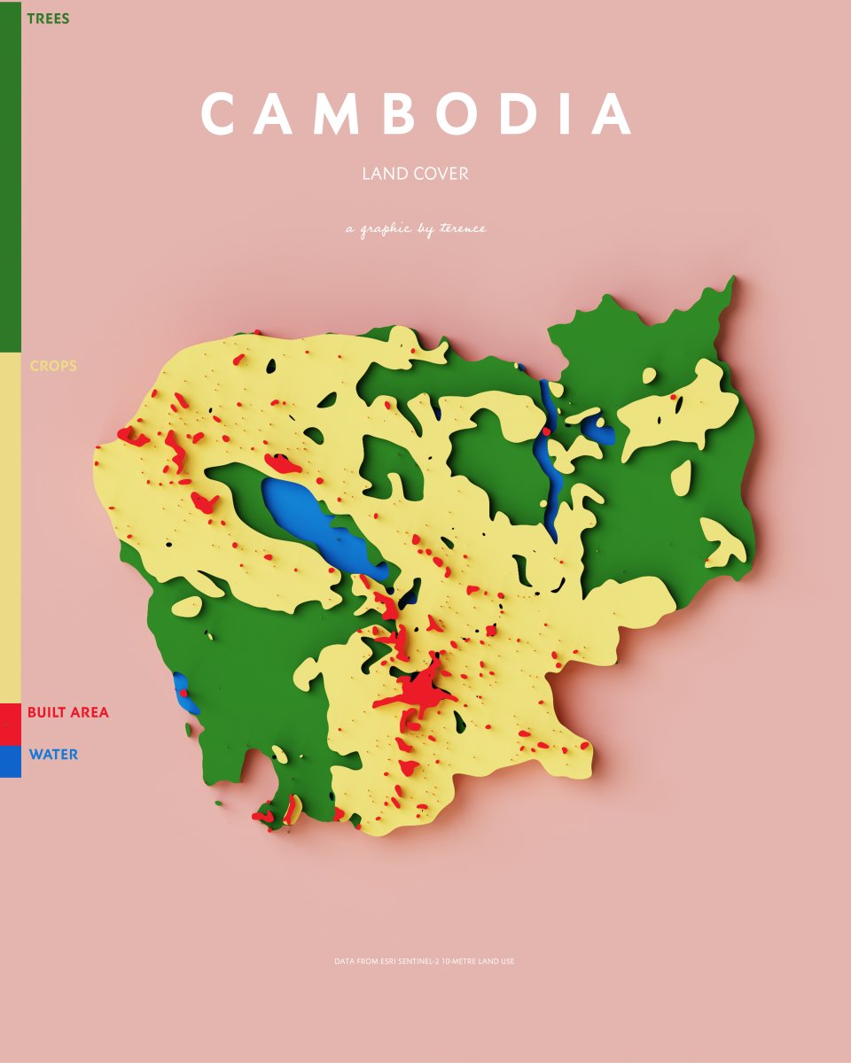
ALT A visualisation of Cambodia's land cover

ALT A visualisation of Minnesota's rivers and lakes

ALT A visualisation of Illinois' rivers and lakes
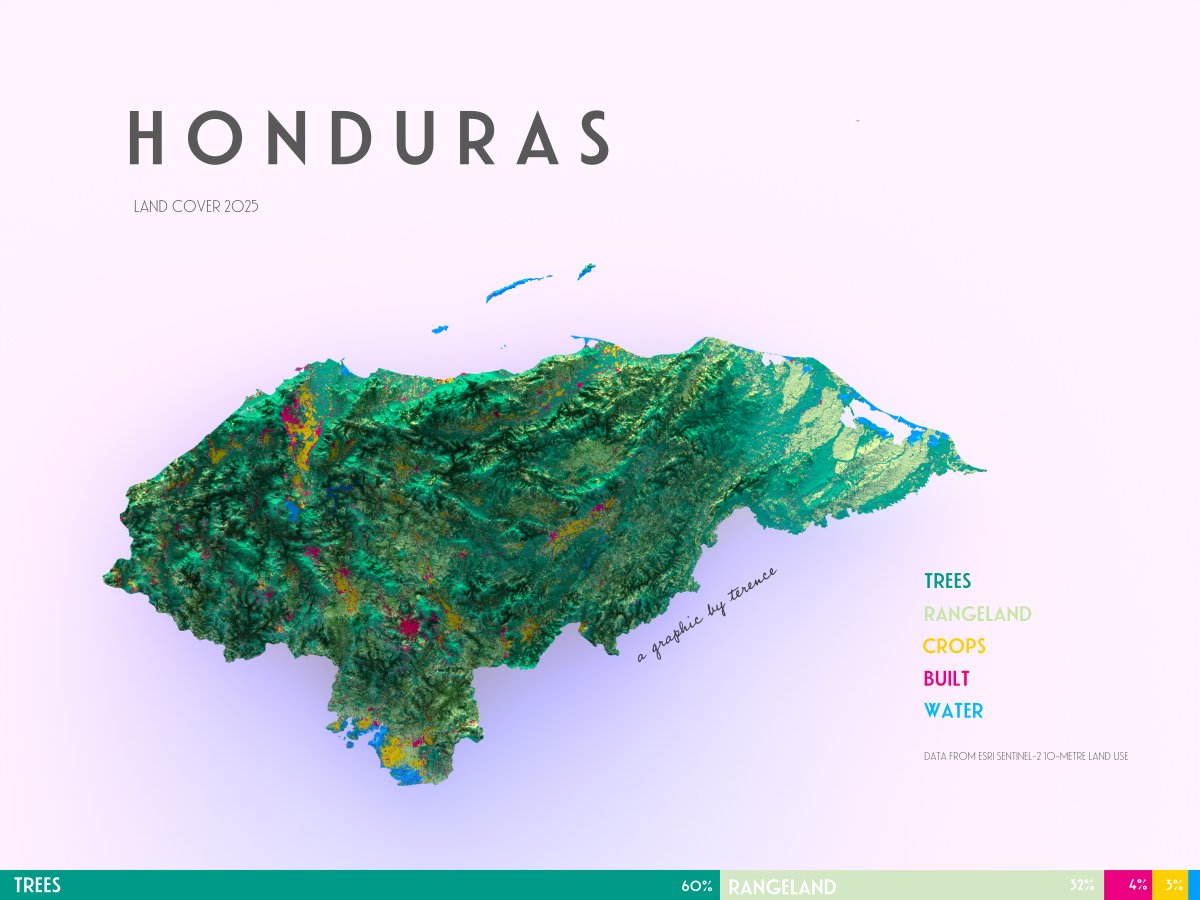
ALT A visualisation of Honduras' land cover
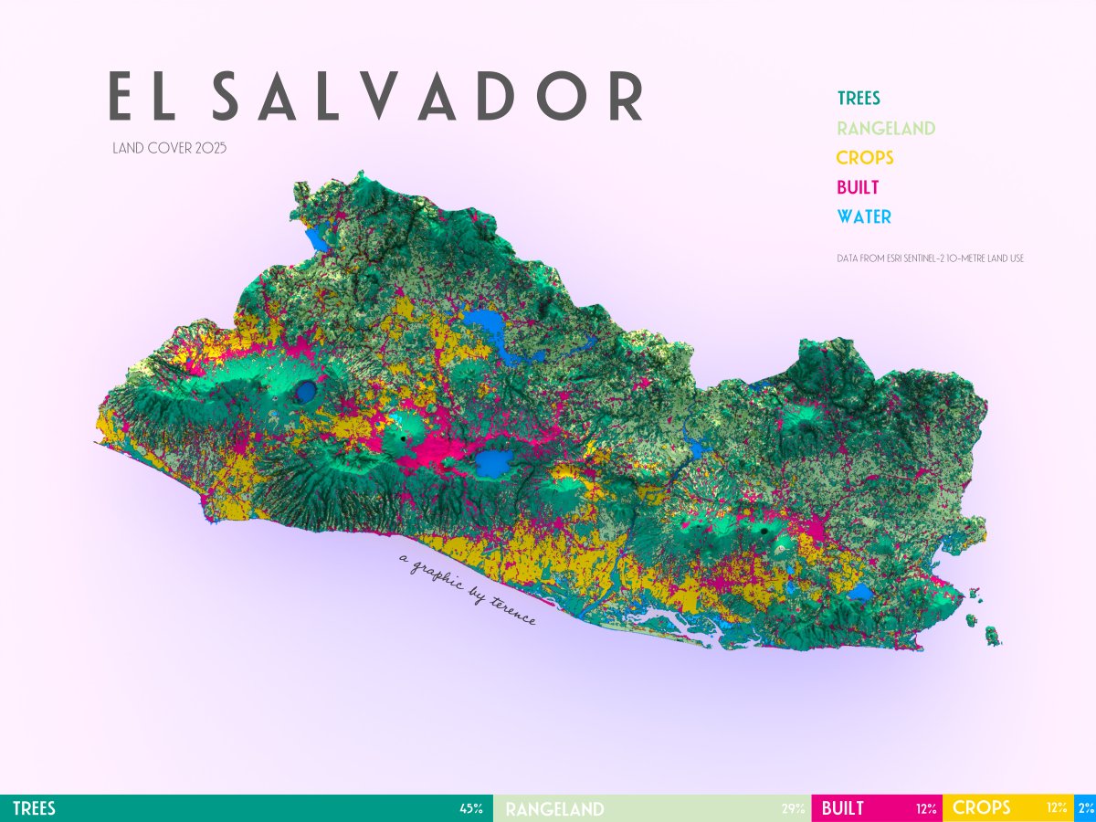
ALT A visualisation of El Salvador's land cover

ALT A visualisation of Serbia's land cover
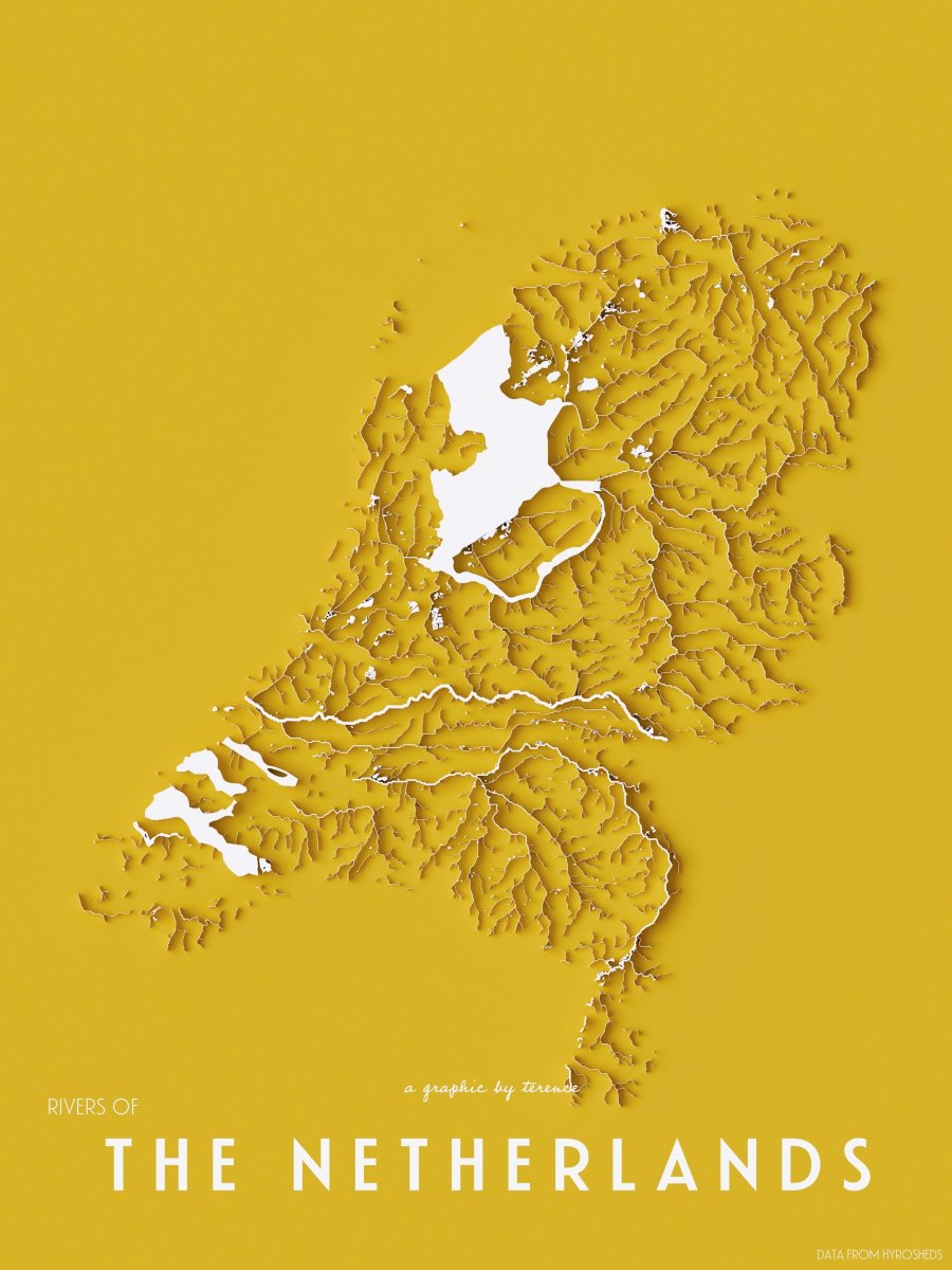
ALT A visualisation of the Netherlands' rivers and lakes


ALT A visualisation of Thailand's land cover
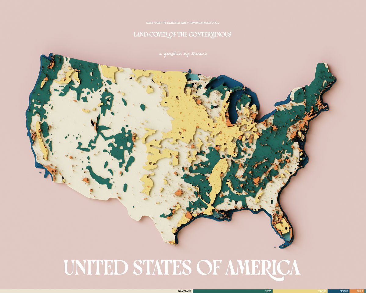
ALT A visualisation of the land cover of the United States of America
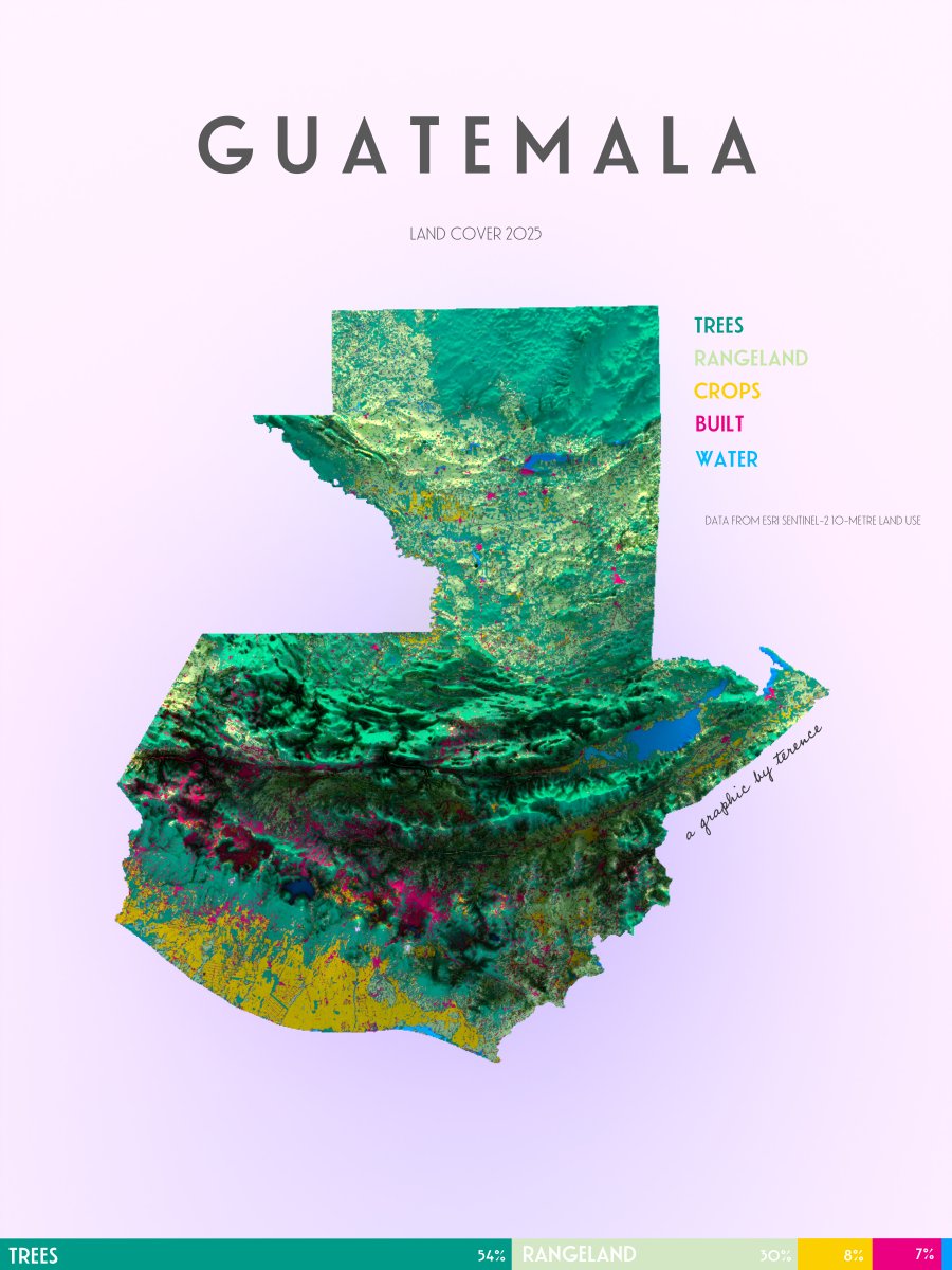
ALT A visualisation of Guatemala's land cover

ALT A visualisation of Australia's rivers

ALT A visualisation of Romania's land cover
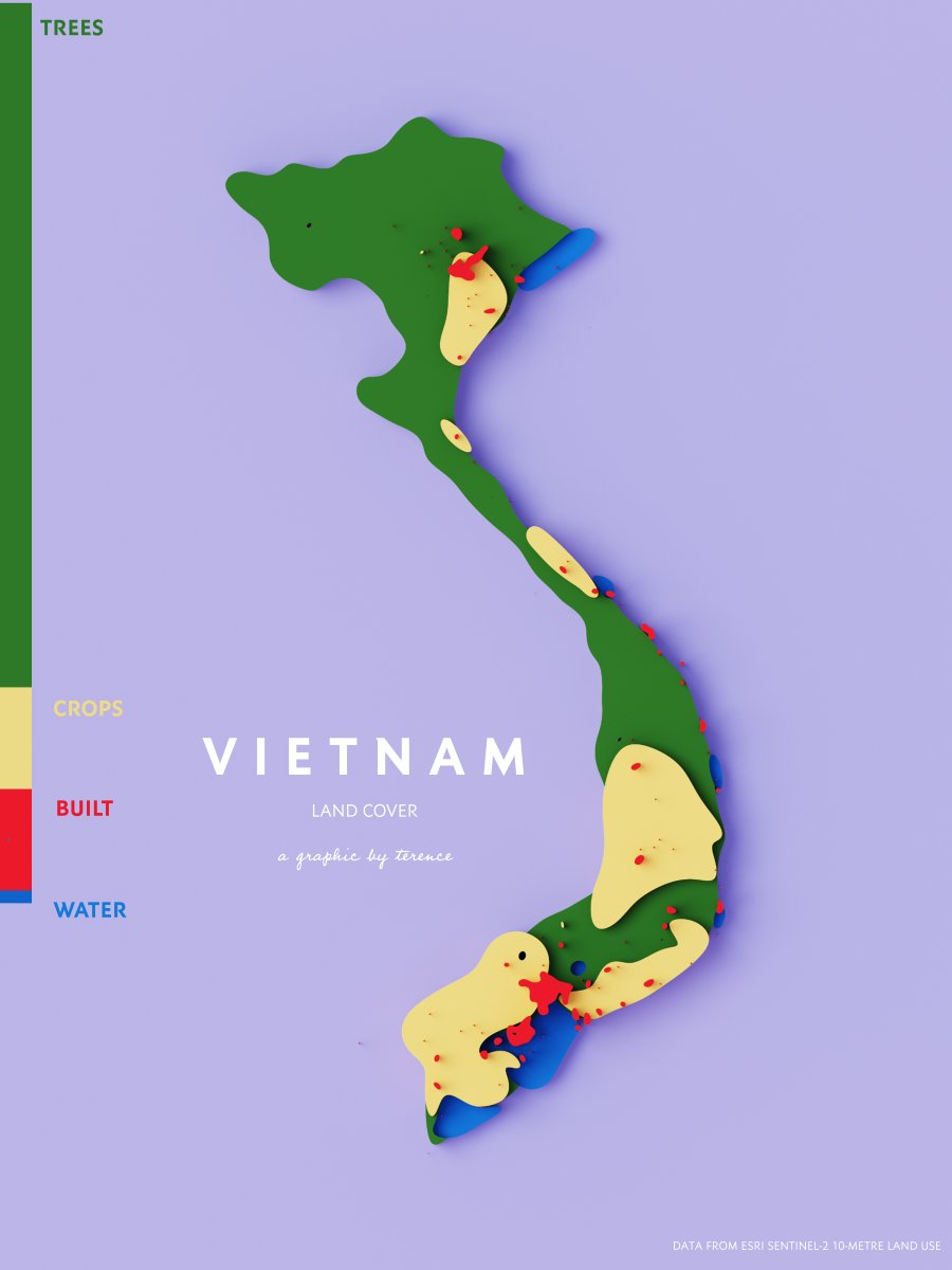
ALT A visualisation of Vietnam's land cover
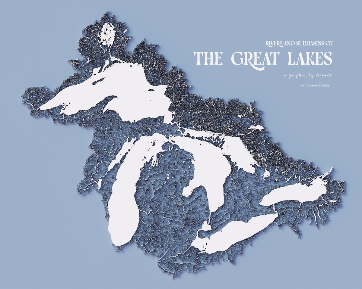
ALT A visualisation of the rivers and subbasins of the Great Lakes


ALT A visualisation of the rivers and subbasins of the Great Lakes