
I need everybody to simply chill out and just let the morning play out before jumping to any conclusions, especially ones only based on SIMULATED REFLECTIVITY of literally all things 😂 #wxtwitter
1

You could be right. This is the reflectivity shown at 3p EST and cloud cover pretty much 100% at 5p EST. Cloud cover in your Cig3 zone is 90% from 12pm - 8pm
29
Jill Toussaint retweeted

Strong tornado may be on the ground. Visible debris ball on reflectivity lined up with a CC drop and lower DR, despite the radar indicated warning. (This has been showing up for a few scans now). SEEK SHELTER NOW! Morgan, Hedricks, Putnum counties in western Indiana!
#wxtwitter
1
3
291


People need to stop over-analyzing the hrrr reflectivity every time a new run comes in. The environment is clearly primed for several strong tornadoes tomorrow. Don’t even look that shitty cam until it gets to the day of.
11


Can't wait for everyone to say "tomorrow is slop" or, "it's gonna bust" after seeing one HRRR reflectivity run that isn't even that bad.
1
72


Now this is better representation of reflectivity.

3
64

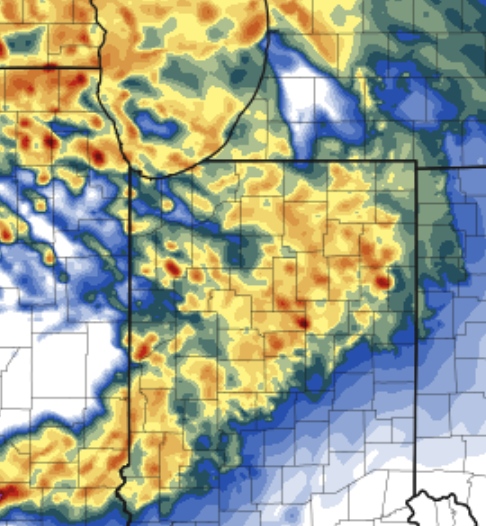
Also the far more accurate NAM3km reflectivity looks even worse. It is just simres but if it busts tomorrow don’t say the models didn’t tell you.


Don’t think tomorrow will be as rainwrapped as people are saying. In one scenario. Both storm mode and PWAT favor rainwrapped wedges, although ventilation is insanely good, although ventilation is a characteristic of ALL violent tornado outbreaks. I expect a 15% sig 3. Stay safe!


5
311

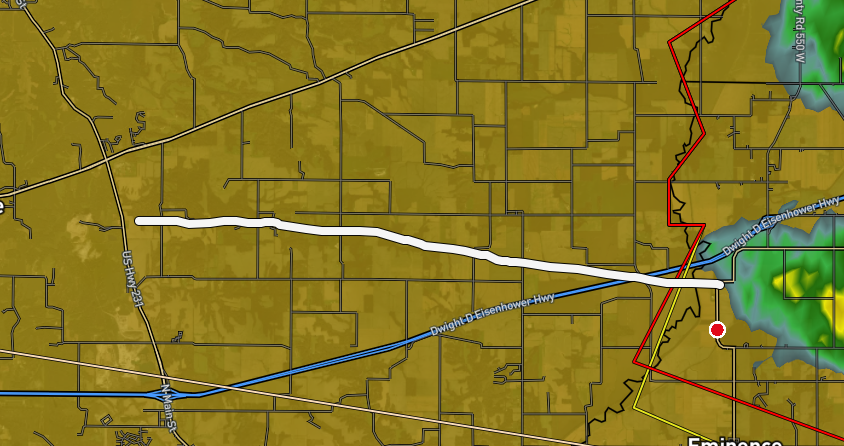
estimated ~8.9 mile path of a tornado in Indiana today (Based on Reflectivity & CC)
8:45-9:06 PM CDT
126


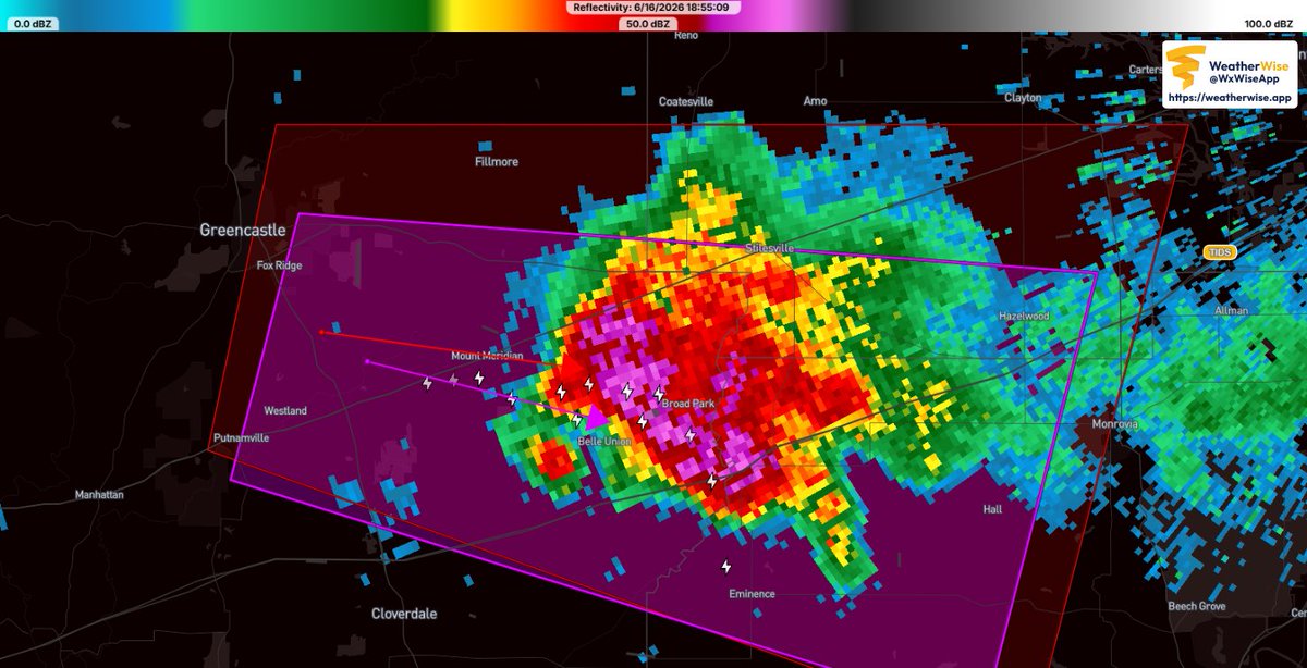
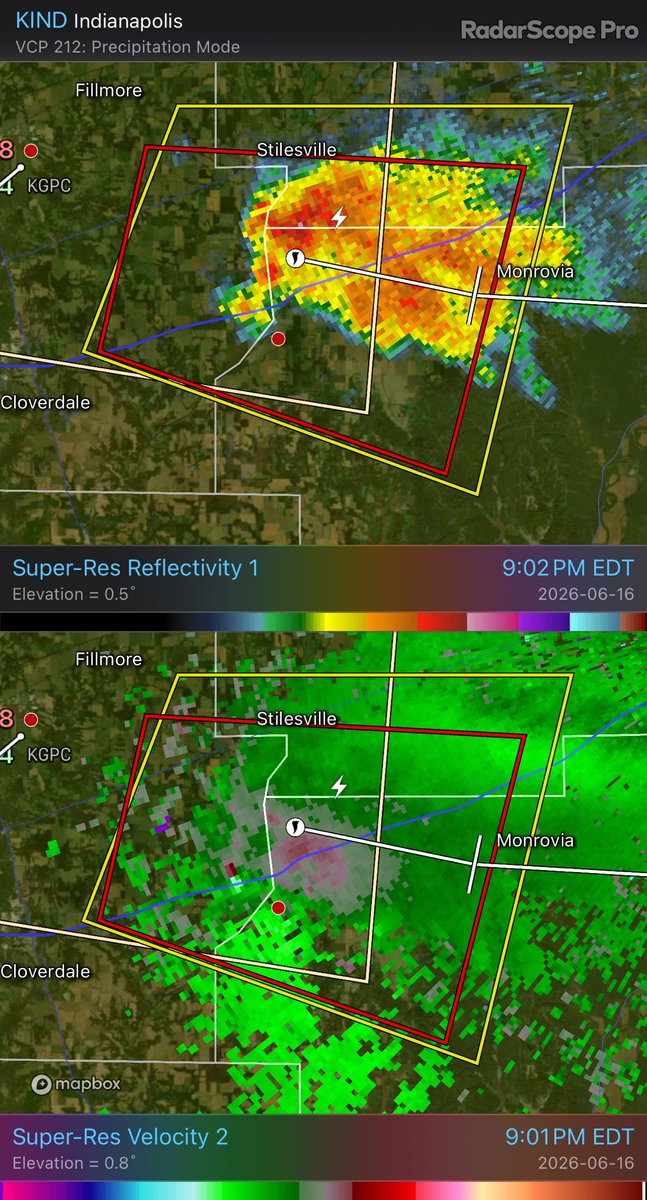
Tornado Warning for Stilesville Indiana observed tornado with this storm
KIND - Super-Res Reflectivity 1 7:02 PM Super-Res Velocity 2 7:01 PM #inwx
1
367
Melissa retweeted

Likely a tornado on the ground near Cloverdale, IN given a debris ball on reflectivity/CC. Hard to tell within the traffic camera near there but looks like there’s a funnel atleast. #inwx


1
6
870
♱ 🐈⬛Keanu Siamese🐈⬛ ♱ 🇨🇦🇺🇦 retweeted
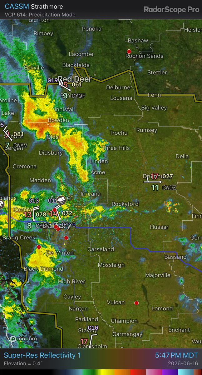
Showers blasting off the foothills CASSM - Super-Res Reflectivity 1 5:47 PM #ABStorm
1
1
2
685