
Joined July 2021
- Tweets 11,374
- Following 616
- Followers 1,049
- Likes 8,438
2,576 Photos and videos


Pinned Tweet

13 Mar 2025
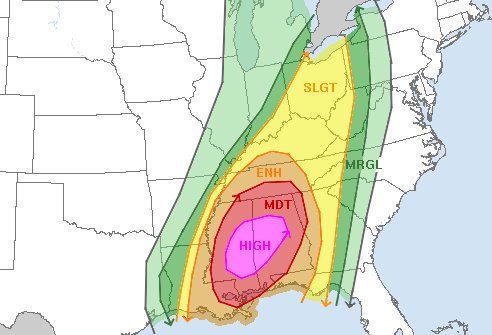
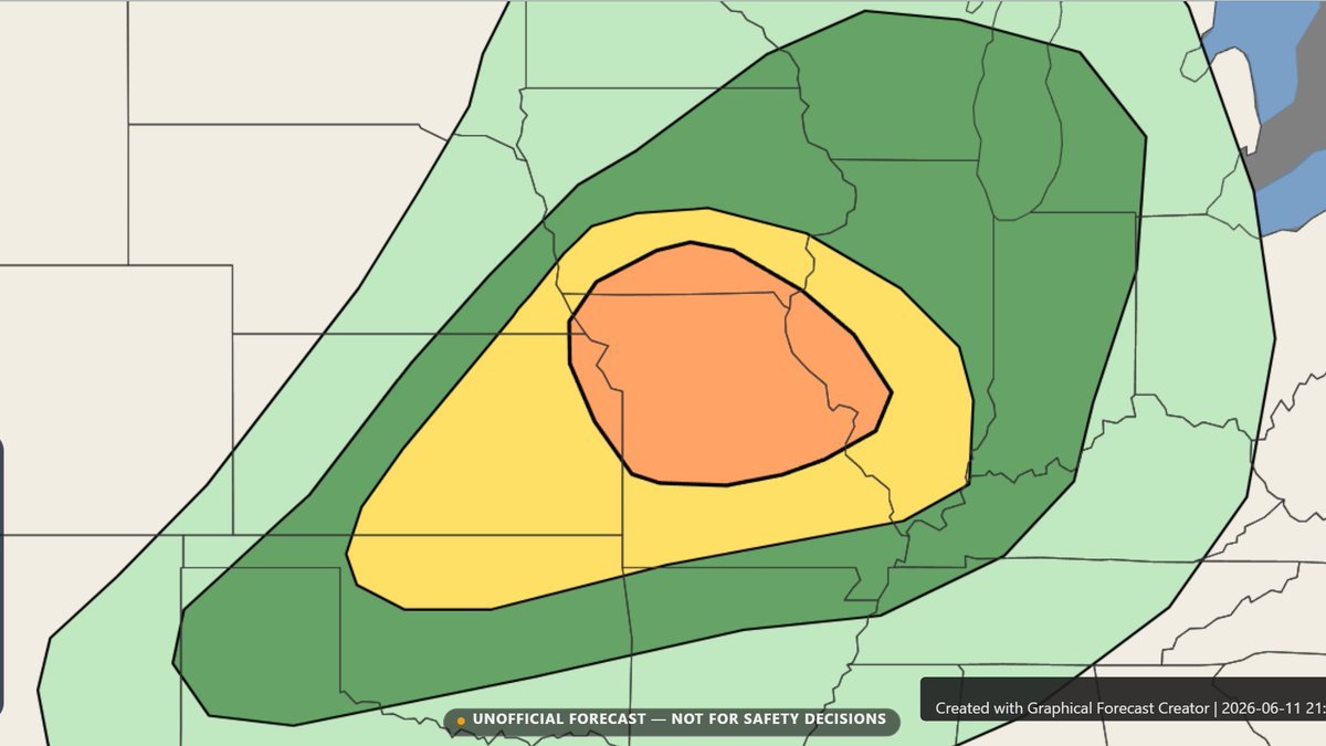
***UNOFFICIAL NON-SPC*** Day 2 Prediction on the likely Tornado Outbreak Saturday...
HIGH RISK!
30# Tornado, several strong-intense, long-tracked tornadoes likely
45# Wind, some gusts greater than 80mph
30# Hail, some hail stones greater than 2"
#wxtwitter #tornado #wx
16
12
118
15,307
Twisted Knight🔫 retweeted
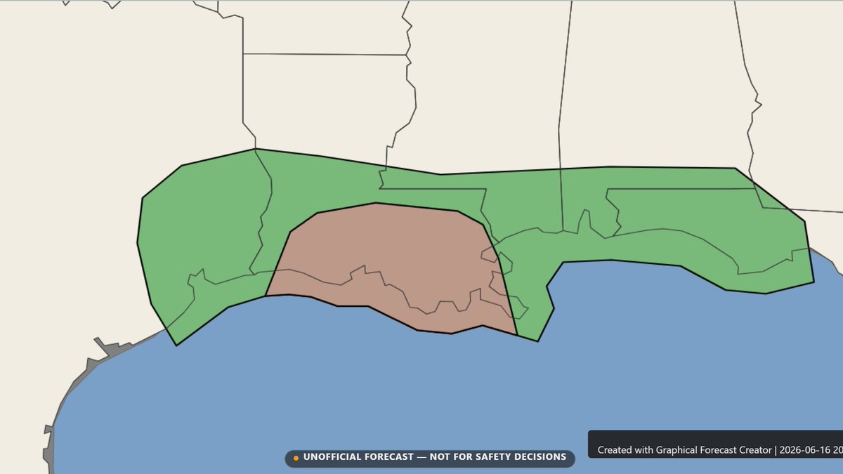
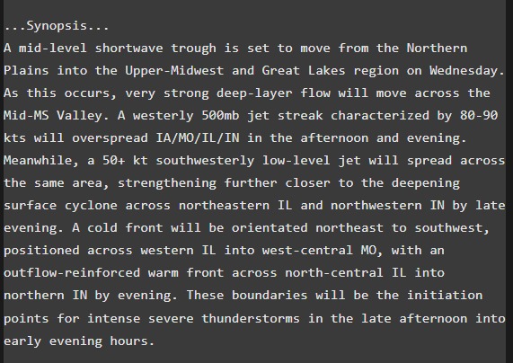
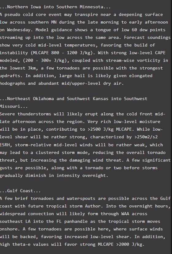
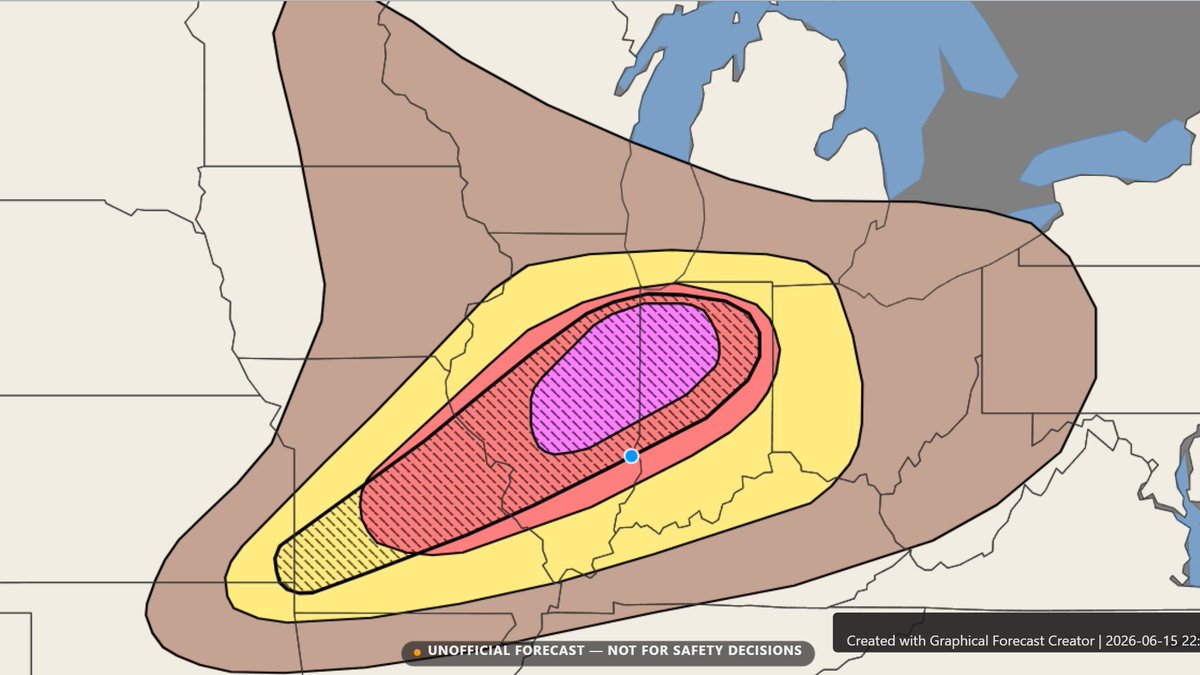
1/4 Thoughts on Wednesday's severe weather - An outbreak of severe thunderstorms is likely tomorrow with long-track, strong to intense tornadoes on the table. A few failure modes do exist, but a volatile environment is still forecasted. #wxtwitter
5
3
19
1,153
1/4 Thoughts on Wednesday's severe weather - An outbreak of severe thunderstorms is likely tomorrow with long-track, strong to intense tornadoes on the table. A few failure modes do exist, but a volatile environment is still forecasted. #wxtwitter
5
3
19
1,153
Two other areas across the U.S. to watch for increased tornado potential would be a pseudo cold core setup across the Upper-Midwest and a tropical setup across the gulf coast, specifically across southern Louisiana.
1
170

Twisted Knight🔫 retweeted

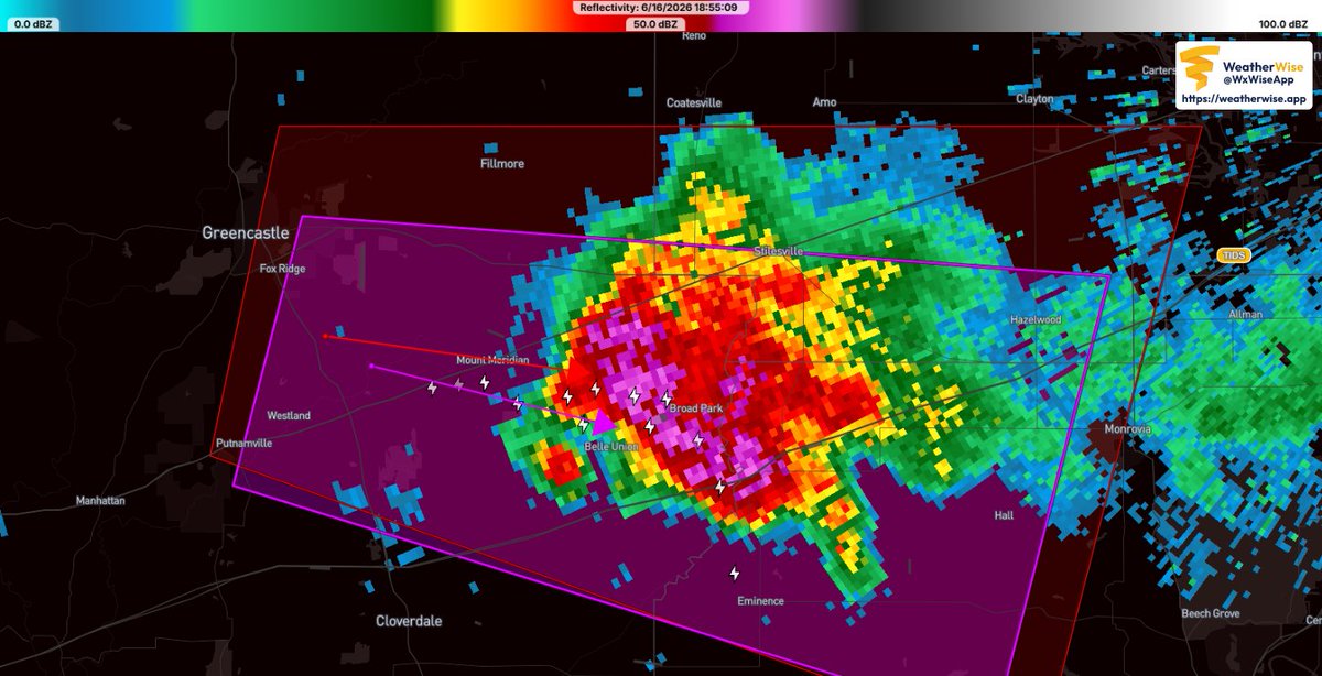
Probably 20 thousand feet with the debris


3
5
46
3,252
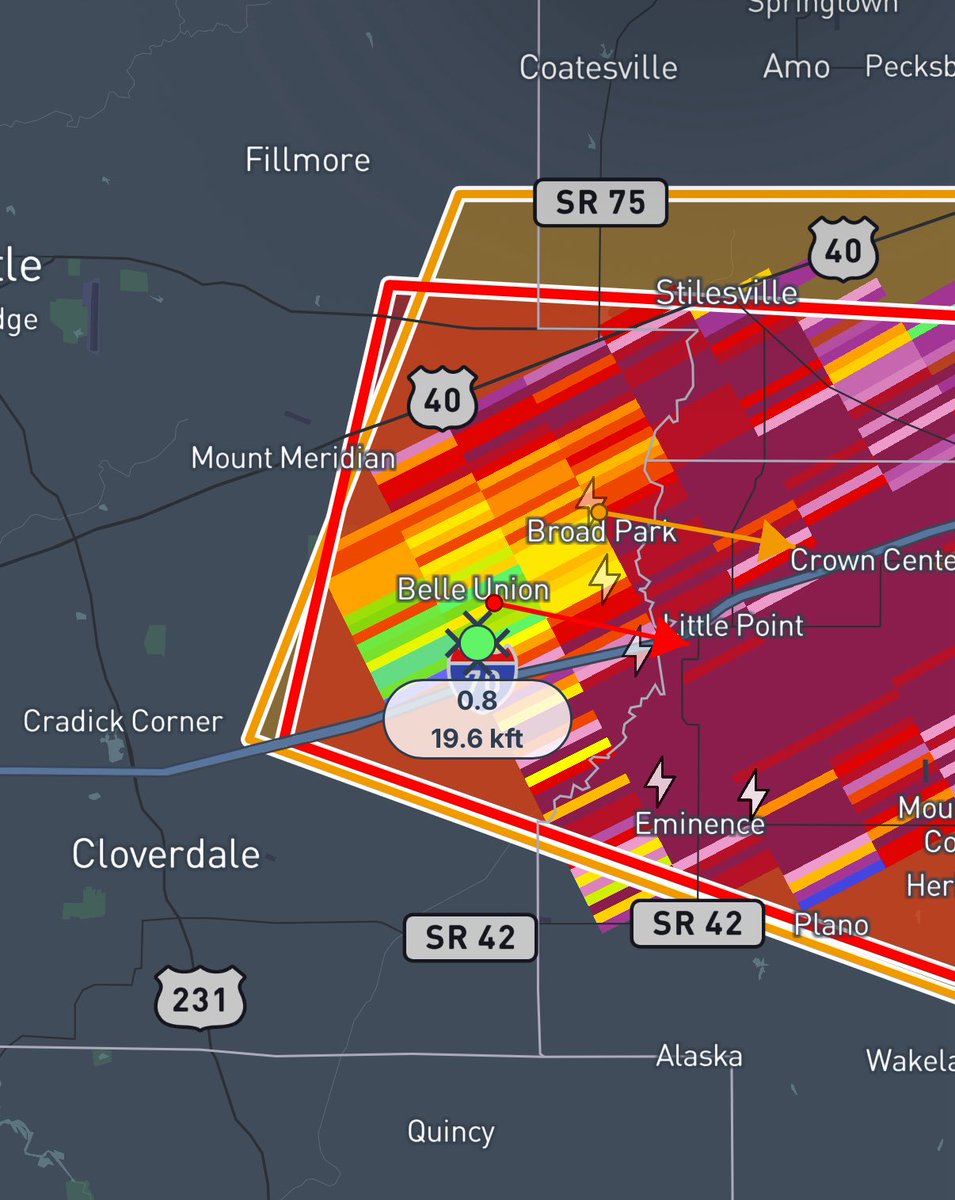
Strong tornado may be on the ground. Visible debris ball on reflectivity lined up with a CC drop and lower DR, despite the radar indicated warning. (This has been showing up for a few scans now). SEEK SHELTER NOW! Morgan, Hedricks, Putnum counties in western Indiana!
#wxtwitter
1
3
359
50kt 500mb jet translation speed for tomorrow. Does exceeding OMEGA High Risk criteria, should Broyles be in the office to use it.
1
1
36
2,580
FYI the criteria is 40kts. Also, just because it exceeds that doesn't mean we're getting a High Risk, and I don't think we should right now, at least until we get surface observations tomorrow morning and we see how morning convection evolves.
4
147
This is a perfect setup for a 15% CIG3, maybe even consider a 30%.
1
24
1,243
Twisted Knight🔫 retweeted
Jun 16
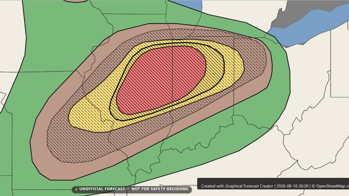
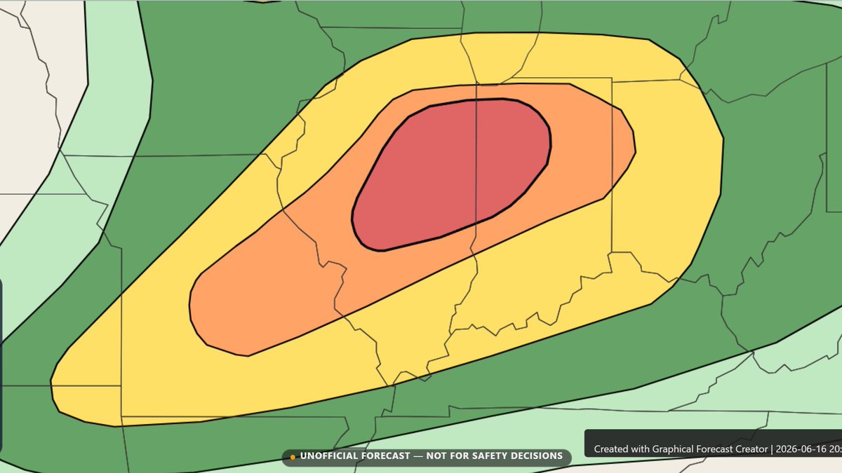
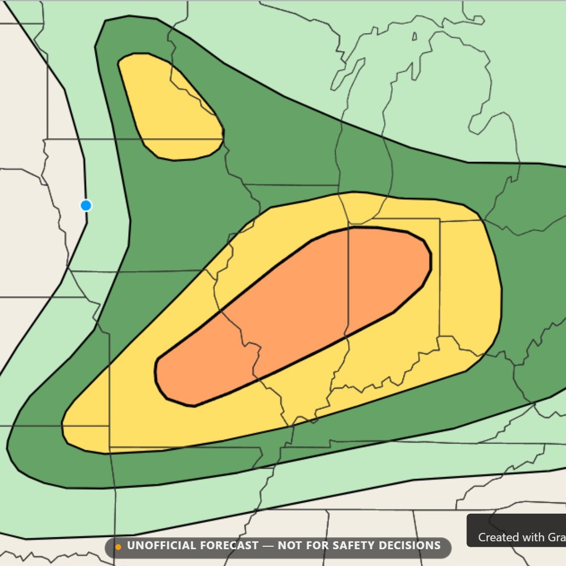
1/3 Thoughts on Wednesday's severe weather - A potent setup is in the forecast. I've outlined an ENH driven by 45% CIG1 Wind and 10% CIG2 Tor. I've opted to wait until I have an area of higher confidence to outline a 15% CIG2 (prob. NE IL/NW IN vicinity). #wxtwitter
2
2
3
255
Jun 16
1/3 Thoughts on Wednesday's severe weather - A potent setup is in the forecast. I've outlined an ENH driven by 45% CIG1 Wind and 10% CIG2 Tor. I've opted to wait until I have an area of higher confidence to outline a 15% CIG2 (prob. NE IL/NW IN vicinity). #wxtwitter
2
2
3
255
Jun 16
I was going to wait to add a CIG2 for the tornado risk, but considering the exceptionally potent kinematics, I don't think it's a bad decision to just cover a broad area with the CIG2 hatching. A sneaky pseudo cold core setup in IA/MN also to watch.


2
1
129


Twisted Knight🔫 retweeted

Jun 15
GAETHJE NATION STAND TF UP BABY🇺🇸🇺🇸🇺🇸🇺🇸🙌🏽🙌🏽🙌🏽🙌🏽🙌🏽 #UFCFreedom250 #UFC250
1
2
7
1,150
Jun 14
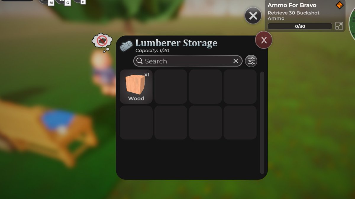
.@DaRealMiniToon There is a bug with the NPC's saying there is no storage even when it's not full, IDK if this is just for the logging.
51
Jun 13
SummerSlam Predictions:
Gunther (c) vs Oba Femi (KOTR winner)
Roman Reigns (c) vs Seth Rollins
Cody Rhodes vs Sami Zayn
Seth Rollins vs Bron Breakker
Jey Uso vs LA Knight
#Smackdown
1
505
Twisted Knight🔫 retweeted

Jun 12
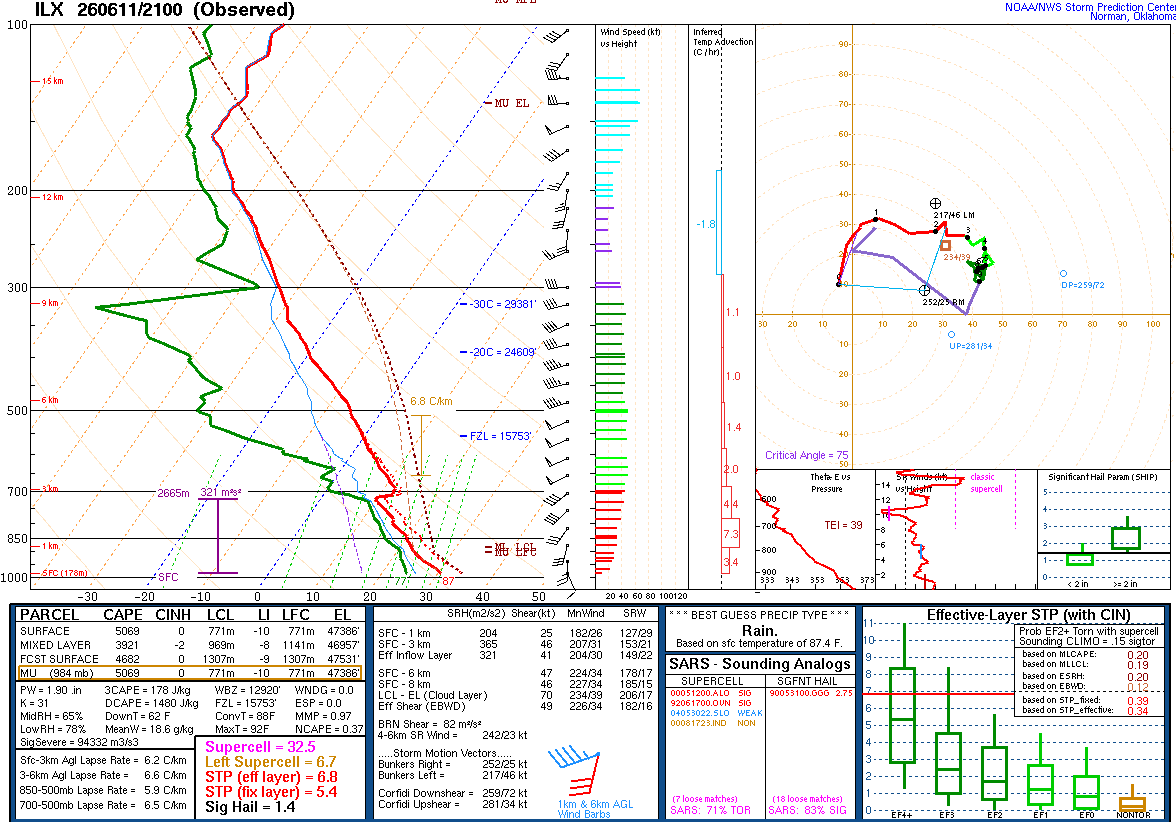
I forecast HP storms yesterday in IL and was very wrong. The ILX 21z sounding might tell half the story, with dry air above 700mb (along with a small capping inversion, potentially due to subsidence from the earlier MCS). Low LCLs may also have forced narrow, inefficient updrafts
Jun 12

So - genuine question - why was every single open warm sector tornado yesterday completely rain free?
I certainly expected to see HP/rainwrapped messes. Instead everything was dry and photogenic. Not to mention cyclical and productive. ????
10
15
195
19,638
Jun 12
One of my better outlooks relative to the SPC almost spot on
Jun 12

1/2 Thoughts on Saturday's severe weather - While still early models have been hinting at one or two MCS's across the central U.S., particularly one that may form from supercells along a surface boundary along the MO/IA border. Another one may form in central KS.
#wxtwitter
1
102