

Easier said than done. Before you tout this, read up on SPLUMA & IDPs and then refer back to National Treasury derailing economic growth.
Then, we'll have a conversation about the land queation and finally corruption in municipalities.
Jun 14

Unpopular opinion - we need to ban informal settlements in South Africa. The government needs to build adequate housing for people but people should not just build anywhere man. It defeats the purpose of planning and monitoring of budgets.
1
5
173

The signing ceremony marked a significant milestone in the longstanding relationship between DLRRD and SAPI, and formally established a strategic partnership to advance South Africa’s spatial planning and land use management agenda.
The partnership is founded on a shared commitment to promoting effective implementation of the Spatial Planning and Land Use Management Act, 2013 (SPLUMA), strengthening planning capacity, advancing spatial transformation, and fostering professional excellence within the planning sector.
As the national custodian of spatial planning and land use management, DLRRD is responsible for providing leadership, coordination, policy direction, and oversight in the implementation of SPLUMA across all spheres of government.
@dlrrd has partnered with SAPI, a leading professional body representing planners across the public, private, and academic sectors, to fast track success of South Africa’s spatial planning system.
#govzaupdates #dlrrdatwork #governmentza#GovernmentAtWork


2
183
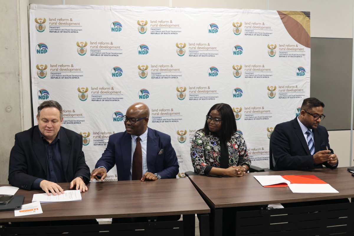
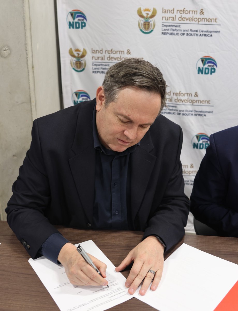
*DLRRD AND SAPI FORMALISE STRATEGIC PARTNERSHIP TO ADVANCE SPATIAL PLANNING AND LAND USE MANAGEMENT*
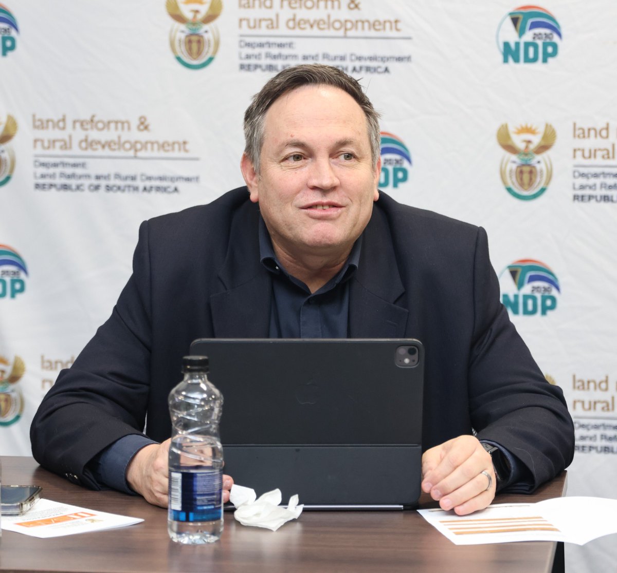
Today, the Acting Director-General of the Department of Land Reform and Rural Development (DLRRD), Mr Clinton Heimann, hosted a delegation from the South African Planning Institute (SAPI), led by its President, Dr Johannes Mulaudzi, for the signing of a Memorandum of Understanding (MoU) aimed at strengthening collaboration between the two partners.
The MoU provides a framework for cooperation in several strategic areas, including support in the implementation of the Spatial Planning and Land Use Management Act (SPLUMA), capacity development, research and knowledge sharing, professional development, policy and legislative reform, and stakeholder engagement.
Through this partnership, both organisations aim to strengthen the professional and technical foundations of the planning system while supporting national efforts to achieve spatial justice, sustainable development, and inclusive growth.
#govzaupdates #dlrrdatwork #governmentza #GovernmentAtWork @governmentza @gcismedia @vukuzenzelegcis


2
178

Jun 12
Surely the custodians of SPLUMA - National DLRRD are monitoring these on purpose misalignments must start custodian-ing @DLRRD_za
49

It sounds to me like the city may be correct in that it isn’t beholden to SPLUMA uwcscholar.uwc.ac.za:8443/se…
22
It sounds to me like the city may be correct in that it isn’t beholden to SPLUMA uwcscholar.uwc.ac.za:8443/se…
13
It sounds to me like the city may be correct in that it isn’t beholden to SPLUMA uwcscholar.uwc.ac.za:8443/se…
19
It sounds to me like the city may be correct in that it isn’t beholden to SPLUMA uwcscholar.uwc.ac.za:8443/se…
42

Jun 8
When the @CityofCT Planning By-Law Amendments were published we picked up a number of issues: the redensification of the most over populated areas, the free development bonus to developers in the CBD, the absence of a definition of “affordable” etc.
We did not pick up this small, but deeply cynical and unethical (probably illegal) amendment about terms-of-office limitations for Planning Tribunal members.
I regret that. Though objecting to it would’ve made no difference - @Our_DA used their majority to ignore all objections.
We must remember that the DA in Cape Town never wanted to implement SPLUMA. The “old guard” wanted Mayor @PatriciaDeLille to challenge SPLUMA all the way to the Constitutional Court. So the comment that SPLUMA is national legislation “overreach” means nothing has changed in over a decade.
2
5
15
1,180
Jun 8
When the @CityofCT Planning By-Law Amendments were published we picked up a number of issues: the redensification of the most over populated areas, the free development bonus to developers in the CBD, the absence of a definition of “affordable” etc.
We did not pick up this small, but deeply cynical and unethical (probably illegal) amendment about terms-of-office limitations for Planning Tribunal members.
I regret that. Though objecting to it would’ve made no difference - @Our_DA used their majority to ignore all objections.
We must remember that the DA in Cape Town never wanted to implement SPLUMA. The “old guard” wanted Mayor @PatriciaDeLille to challenge SPLUMA all the way to the Constitutional Court. So the comment that SPLUMA is national legislation “overreach” means nothing has changed in over a decade.
Members for life — The capture of Cape Town’s planning tribunal dailymaverick.co.za/article/…
2
15
32
1,623

May 22
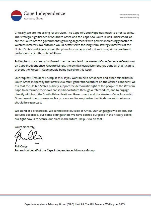
I don’t care for the Cape independence diatribe, but what exactly is an ‘unregulated property market’? Cape Town property is already buried under zoning, SPLUMA, rates, approvals, banking and transfer regulations. I genuinely don’t understand the line.

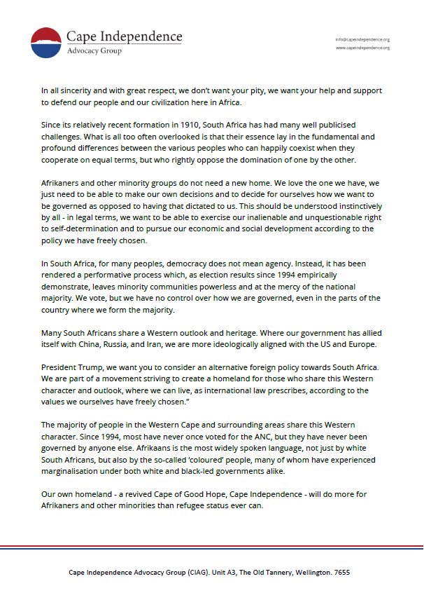
One day, the Government of the Republic of South Africa will wake up shocked to the takeover that’s coming!
They have allowed unpatriotic & racist organizations to run their mouths & ultimately paint this country as non-functioning!
With the property market prices in Cape Town unregulated, the clear regime change narrative from organizations such as Cape Independence, including Afriforum, we will one day be required to carry passports to visit Cape Town!
The DA will NEVER CALL OUT CAPE INDEPENDENCE as it suits them!
Destabilisation of this country is loading in many fronts!
Our leaders are nowhere!
In what country and what government can a statement like this go unchallenged nor the founders of such organizations go unchecked?
WTF:
‘Our request, President Trump, is this: If you want to help Afrikaners and other minorities in South Africa in the way that offers us a multi-generational future on the African continent, we ask that the United States publicly support the democratic right of the people of the Western Cape to determine their own constitutional future through a referendum, and to engage directly with both the South African National Government and the Western Cape Provincial Government to encourage such a process and to emphasise that its democratic outcome should be respected.’
#CountryDuty

1
3
7
1,105

May 20
I had to go ask Ai what can be done in this situation and this is what it had to say:
CLAIM 1: “The City allegedly intends to demolish, remove, or damage structures at Marble Towers without lawful authority”
Owner’s Argument
* The City allegedly has no lawful basis to demolish or remove the structures.
* The City is allegedly acting arbitrarily, unlawfully, and beyond its powers.
⸻
City’s Counterargument — The Law Grants Full Authority
The City’s position is that it does not require permission to act because legislation already grants it direct enforcement powers.
1. National Building Regulations and Building Standards Act 103 of 1977 (NBRA)
Section 4(1)
* A local authority is empowered to order the demolition or removal of structures erected without approved building plans.
* Mayor Morero stated:
“They are illegal structures. There are no building plans, and even if there were, there’s no way these structures can be approved as they are hazardous in nature.”
Legal Effect
* Once a structure lacks approved plans, the City’s enforcement powers are triggered automatically by statute.
* The City argues this is not a discretionary action requiring separate judicial authorization.
⸻
Section 21 of the NBRA
* It is a criminal offence to erect or maintain a structure without approved plans.
* The City argues that the owner is therefore:
* not a victim of unlawful municipal action,
* but rather in ongoing violation of statutory requirements.
⸻
2. SPLUMA and Municipal Planning By-laws
Spatial Planning and Land Use Management Act 16 of 2013 (SPLUMA)
* Together with the City of Johannesburg Municipal Planning By-law, SPLUMA empowers the City to:
* investigate unauthorized developments,
* enforce compliance,
* and take action against unlawful structures.
Key Point
* The City argues these laws permit enforcement action without needing a separate court order in every instance.
1
2
310

Mar 31
Does South Africa maintain an adequate, full, and complete system of economic geography locally and map local economic development? Does it cover all the minimum elements, including mapping the township economy and all rural towns
South Africa possesses a sophisticated, policy-driven framework for economic geography and Local Economic Development (LED), but it is not currently a fully "complete" or consistently adequate system on the ground. While national spatial planning is robust, the implementation and detailed mapping of township and rural economies vary significantly by municipality, facing major data, capacity, and resource gaps.
Cooperative Governance and Traditional Affairs
Cooperative Governance and Traditional Affairs
Key Components of SA's Economic Geography System
National Spatial Development Framework (NSDF): Adopted in 2022, this is a legally mandated 2050 framework under the Spatial Planning and Land Use Management Act (SPLUMA). It provides the high-level spatial vision, aiming to correct Apartheid-era spatial injustices.
CSIR Geographic Analysis Platform (GAP): This system uses GIS mapping to estimate the spatial distribution of economic activity, allowing for detailed analysis of nodes and corridors, notes the Council for Scientific and Industrial Research (CSIR).
LED Frameworks: The National LED Framework (2018–2028) aims to align municipal LED strategies with national growth, but many municipalities still struggle with the "how-to" of implementation, reports the Department of Cooperative Governance (CoGTA).
Township Economy Mapping and Coverage
Partial Mapping: Mapping is often strongest in large metropolitan areas (e.g., Gauteng, Cape Town) where "Township Potential Atlases" and FMCG (Fast-Moving Consumer Goods) surveys have identified thousands of informal businesses, say Africascope.
Significant Gaps: Outside metros, the mapping of the informal township economy is uneven. Research shows a need for better understanding of entrepreneurial ecosystems, particularly in rural townships which lack basic infrastructure.
Economic Drivers: While 40% of the working-age population lives in townships, they are generally not well-integrated into the mainstream economy, with many, like Diepsloot, operating as dormitory settlements, notes the World Bank.
Rural Town Coverage and Mapping
Uneven Development: Mapping of rural towns is often sparse, with many small towns facing significant economic decline and lacking the capacity to produce detailed spatial plans, according to the Twenty Year Review.
Focus Areas: Efforts are often concentrated on secondary cities, while remote rural areas and small service centres struggle to attract investment, notes the SARChI Chair in Development and Local Economies.
Challenges: The "30-year Review" indicates that while spatial planning policies exist, implementation is inconsistent due to a lack of institutional capacity at the local government level, as explained in the 20 Year Review.
Limitations of the System
Data Scarcity: Robust data for city-level and local-level analysis is often lacking, especially regarding informal employment, according to CoGTA.
Implementation Gap: There is often a disconnect between national policy (like the National Development Plan) and the ability of municipalities to execute local economic development on the ground.
Sector Focus: The focus remains heavily on the formal economy, despite the massive size and importance of the informal sector.
1
3
382

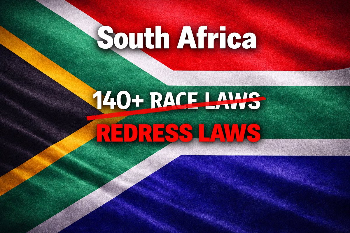
Spatial Planning and Land Use Management Act (SPLUMA)
This one flies under the radar, but it matters.
What it does: standardises how land is planned and used across municipalities, undoing the apartheid-era spatial mess where cities were designed to separate people by race and push black communities to the outskirts.
No race quotas. No exclusion clauses.
What it does do is give municipalities tools to integrate cities, approve mixed-use developments, and break down the old spatial segregation.
So when people scream “race laws,” this is what they ignore, laws aimed at fixing the physical layout of apartheid.
1
2
45

Mar 27
Day 1 Highlights: #LocalGovernmentPropertySummit
Exploring challenges, opportunities & partnerships in LG Property Development. SPLUMA, lease-to-title models & more driving dignified housing & sustainable growth. #InspiringServiceDelivery #HousingTheNation #GPF #SALGA
2
2
163
Mar 26
A panel discussion at the Property Summit facilitated by Mr Futhwa explored ways to improve policy & practice in development planning, with speakers sharing insights on leveraging SPLUMA to create certainty and streamline development applications.
#InspiringServiceDelivery #SALGA
1
3
2
159

Mar 26
What does data-informed spatial planning look like in practice?
Join our Insight Exchange
🗓️ 7 April 2026 | ⏰ 14:00–16:00
Hear from leading experts shaping SA’s planning future.
Register now: bit.ly/4bMMvh7
#SpatialPlanning #SPLUMA #UrbanDevelopment

4
2
288

Mar 1
Well said, they stand out like sore thumbs in every village near a main arterial road. Built without any adherence to the “Spatial planning land use management Act” (SPLUMA) nor are there any approved plans or EIA’s this alone should be regarded as red flags 🚩. Try altering an existing house in any town and the officials are all over you, yet they close a blind eye to these mansions. Makes you think
1
1
3
113