
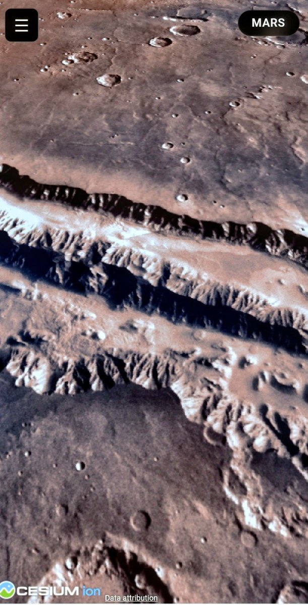
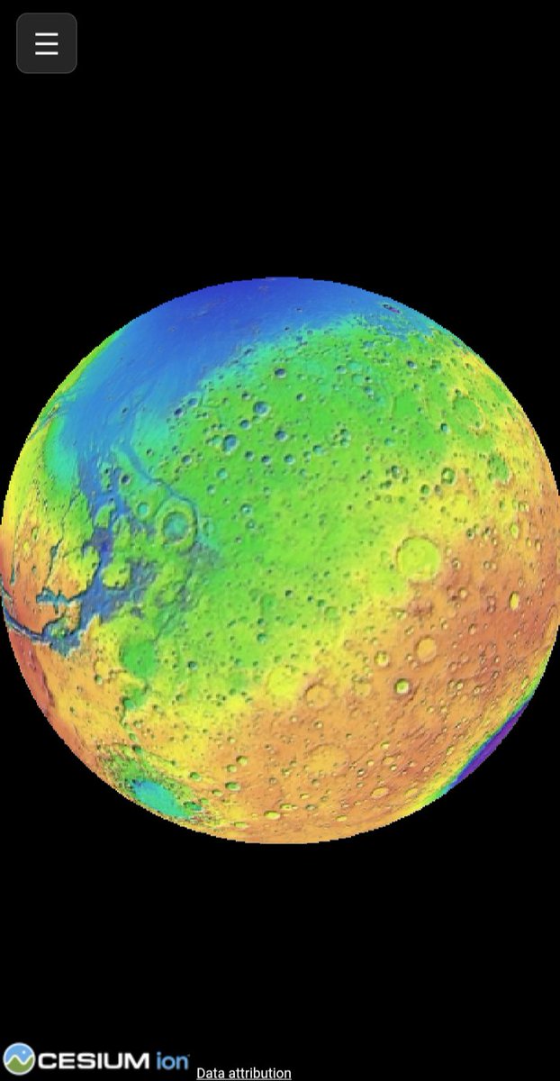
Hermes is amazingly good at exploring public data resources. Here is what Hermes generated for NASA planetary WMTS data, a web viewer and then a writeup of the process!
Upped to kimi-k2.7 to save tokens.
Viewer: hermes-nasa.pages.dev/treks/
Writeup: a2ee9af5.hermes-nasa.pages.d…
Hermes is incredibly fun to explore with!
22

Jammer dat in de levering van #omgevingsplan niet de Standaarden WMS WFS WMTS worden gebruikt.
(We kunnen hier wel spreken van een dicht-timmer cultuur. Duidelijk geen OpenStreetMap cultuur.)
google.com/search?q=omgeving…
61

Jun 14
Won't do you any good. You can try switching your store location tho maybe one of your nearby wmts have it selling for $0.50.
4

WMTS Streaming is now live on SkyFi 🌎
SkyFi users can now stream high-resolution satellite imagery directly into ArcGIS and QGIS as live map layers.
Available now for Pro and Enterprise customers: app.skyfi.com/pro
8
6
15
1,544
Eldrige de Melo, PhD (c) retweeted

Jun 9
WMTS is the unsexy feature that wins. Your analysts live in ArcGIS and QGIS all day. Now SkyFi imagery streams straight into those maps as a live layer, full res, zero download.

WMTS Streaming is now live on SkyFi 🌎
SkyFi users can now stream high-resolution satellite imagery directly into ArcGIS and QGIS as live map layers.
Available now for Pro and Enterprise customers: app.skyfi.com/pro
1
1
9
976

Jun 9
WMT will open only 20 new stores in 2026, remodel 650 superstores & Neighborhood Markets. In 1996, WMT planned 60 to 70 new WMT stores, plus 100 to 110 Supercenters—-90 of which would be relocations/expansions of existing WMTs and Neighborhood Markets.
catalog.sndigitalmagazine.co…

11


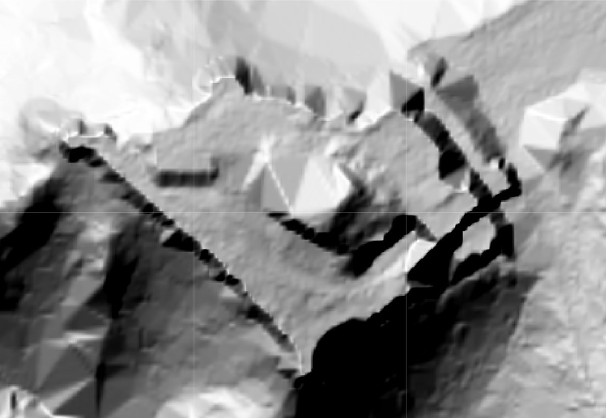
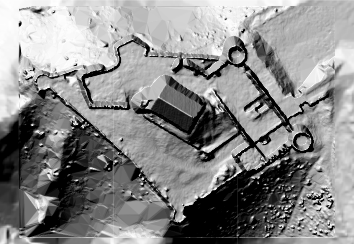
Two images from THE SAME DATASET.
Left: public WMS/WMTS terrain model.
Right: the same LiDAR data processed with my algorithm.
A very problematic summer dataset with uneven ground, ruins, slopes, depressions and high/low vegetation growing everywhere.
Time for a beer. Cheers!
4
11
633

May 25
🛰️ Hoy en el #BlogIDEE hablamos del proyecto #PNOA
🛩️Disponibles las ortofotos 2025 de máxima actualidad de Extremadura y Murcia y las provisionales de Andalucía, Ceuta y Melilla
📡 Acceso mediante servicios WMS, WMTS y TMS, y descarga en formato COG.
blog.idee.es/archivo/-/blogs…

1
7
11
1,050

May 20
Wireless Medical Telemetry Service #WMTS
#HBC Human Body Communication
#MICS Medical Implant Communication
#MBAN Medical Body Area Network
IEEE 802.15.6
researchgate.net/figure/Radi…

1
2
33

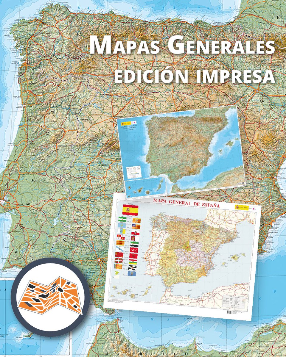
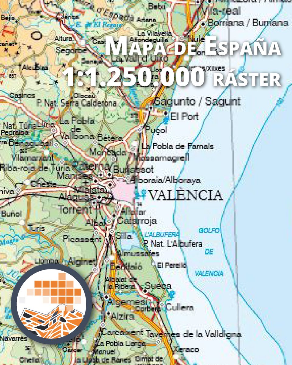
🗺️ Nueva edición del mapa de España a escala 1:1.250.000
El IGN presenta una nueva edición del mapa de la península ibérica, Baleares y Canarias, ahora basada en la nueva base de datos cartográfica BCN1250.
🔹 Permite trabajar directamente en entornos SIG
🔹 Facilita la actualización y la interoperabilidad con otras bases geográficas
🔹 Generado mediante un proceso automatizado de producción cartográfica
Disponible en múltiples formatos:
📍 Papel y relieve en puntos de venta físicos ("Casas del Mapa") y en nuestra Tienda Virtual:
👉 f.mtr.cool/wvjghxlwun
📍 Formato digital en el Centro de Descargas del CNIG:
- Ráster 👉 f.mtr.cool/nrcqcmosjj
- Vectorial 👉 f.mtr.cool/ewqfynbkij
📍Servicios web de visualización de datos geográficos:
- #WMS:
👉ign.es/wms-inspire/mapa-rast…
- #WMTS:
👉ign.es/wmts/mapa-raster?requ…
- #TMS:
👉tms-mapa-raster.ign.es/1.0.0…
#IGNSpain #CNIG #Cartografía #Geografía #SIG #DatosGeográficos #Mapas #Geoinformación #CartografiaDigital #Interoperabilidad #DatosAbiertos #InfraestructuraDeDatos #BCN1250
#MapasDeEspaña @transportesgob

18
61
4,808


Zeměměřický úřad provedl začátkem května aktualizaci:
- mapových produktů Mapa České republiky 1:500 000, 1:1 000 000 a 1:2 000 000 poskytovaných jako otevřená data ve formátech TIFF a PDF
- přehledové mapy ČR poskytované jako Esri ArcGIS Server, WMTS a WMS
- sady Data50 (digitální geografický model území České republiky odvozený z kartografické databáze pro Základní topografickou mapu ČR 1:50 000)
- technické zprávy k Ortofotu ČR (byly rozšířeny zejména o údaje týkající se polohové přesnosti) geoportal.cuzk.gov.cz/Dokume…
Dále nově publikoval Fyzickogeografickou mapu České republiky 1:500 000 ve formátu PDF openzu.cuzk.gov.cz/opendata/… (351 MB)
1
22
158
50,781