
May 15
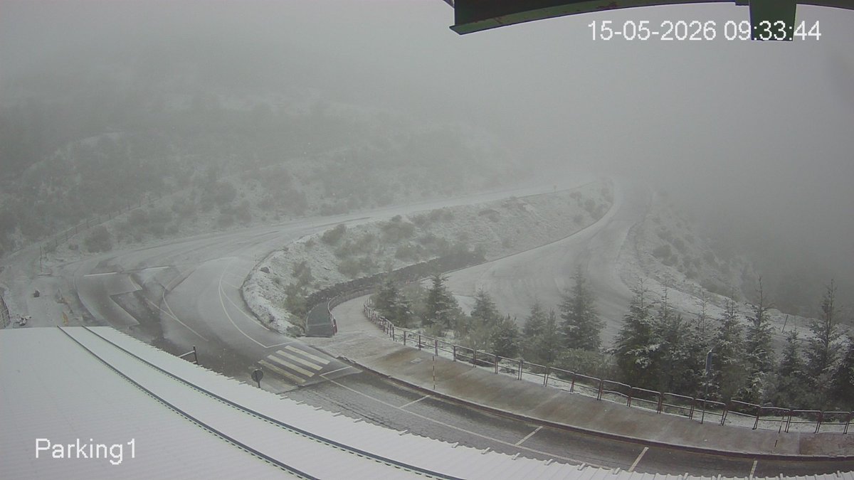
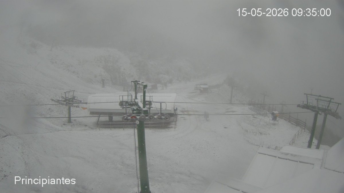
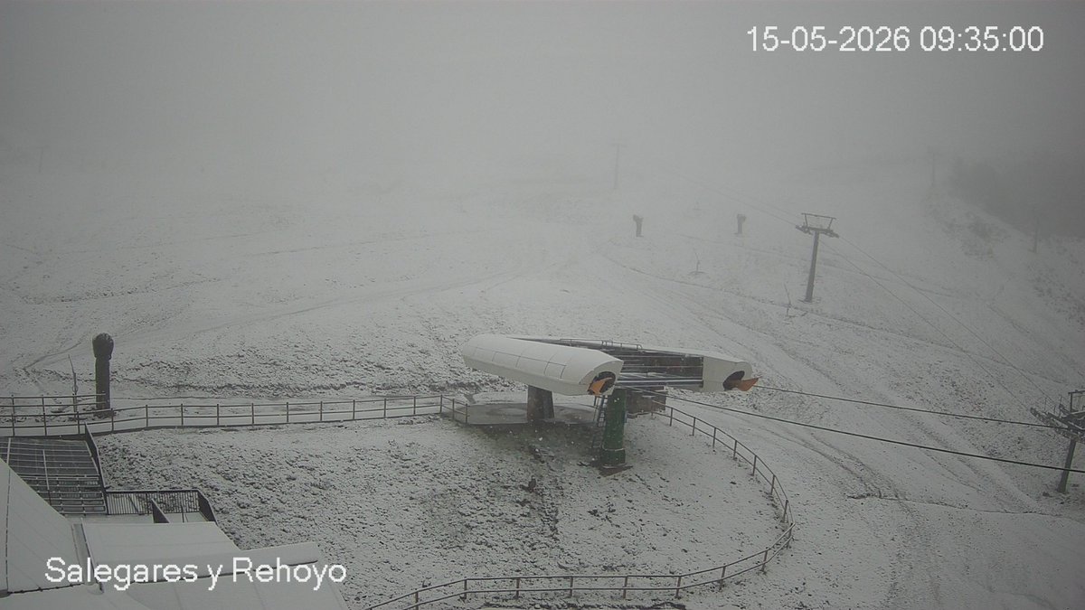
La #nieve❄️❄️ vuelve a las montañas de #LaRioja en cotas de unos 1400/1500 metros, aunque la cota podría bajar hasta los 1200 metros a lo largo del día.
Imagen del Moncalvillo del SOS Rioja y Valdezcaray.
#winterisback en #LaRiojaMeteo

1
2
11
799


May 3
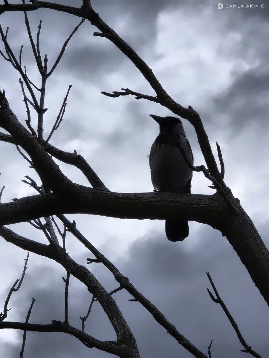
📷🎶
Kış geri geldi. Nevermore düşünceli.
#winterisback #Nevermore #crow #tree #Cloudscape
Uli Doenitz - For the Crow
youtu.be/SMlZwGr9Ats?si=iGMM…
9
58

Thank you ops team at @KirkwoodMTN @KWconditions
For always making lemonade out of lemons 🍋 🍋 🍋
Enjoy the moment 🏂⛷️❄️🏔️
Carpe diem #MiracleApril
‘Fresh powder 12 - 42 inches of Sierra Nevada 🏔️this upcoming week
#Winterisback’ 👉@jason61987 #CAwx
🤩🌨️❄️❄️🏔️⛷️🏂
Apr 19

A Winter Storm Watch has been issued for the Sierra Nevada & southern Cascades above 5000 feet from late Monday night-Wednesday afternoon as confidence is increasing in the threat for moderate to heavy snow. Plan ahead & check the forecast/road conditions before travelling! #CAwx
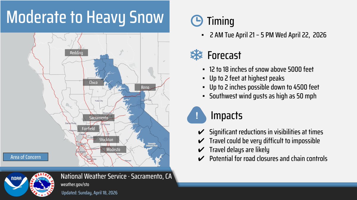
ALT Moderate to heavy snow 2 AM Tuesday - 5 PM Wednesday for the sierra and southern cascades above 5000 feet. 12 to 18 inches, with up to 2 feet at highest peaks. Up to 2 inches down to 4500 feet. Southwest wind gusts up to 50 mph. Potential for reduced visibilities at times, travel could be very difficult, delays likely and potential for road closures and chain controls
1
2
414

Apr 19
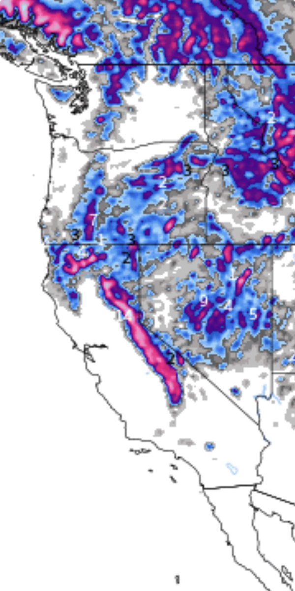
Saturday April 18, 2026, 7:50 PM: The latest satellite shows an incoming robust late-season Pacific storm into all of California starting Monday at 10PM to Tuesday at 7PM. The 545 DM low axis, approximately 240 miles northwest of San Francisco, continues to intensify greatly due to escalating warming of the Pacific, and a piece of embedded impulse from a typhoon near Guam will eject into this system.
The main low axis will form a secondary low near San Luis Obispo to western Los Angeles counties late on Monday afternoon. This actually may further escalate the stronger surface cold front that will maintain all way through Southern California especially Los Angeles County. Perhaps even grazing Riverside, San Bernardino, and San Diego counties.
In addition to this, there will also be severe thunderstorms that will be associated with the system, especially up into the Bay Area just south of Sacramento and Fresno. There could be isolated tornadoes as well on Tuesday afternoon. I'm watching this developing situation closely in the next 24 - 36 hours. The snow levels remain 5,500 feet for Lake Tahoe and Mammoth Mountain and that includes Yosemite Valley, where snowfall accumulation can reach 12 to 36 inches of snow by Wednesday afternoon. #CAwx #winterisback
8
25
228
15,371
Apr 19
Saturday April 18, 2026, 6:30 PM: A potent late-season storm turning back the clocks to February in April just wild! Fresh powder 12 - 42 inches of Sierra‘s this upcoming week. #Winterisback #CAwx April 21 - 25, 2026 @SnowPalsDotOrg ❄️❄️
6
16
159
4,985
Apr 17
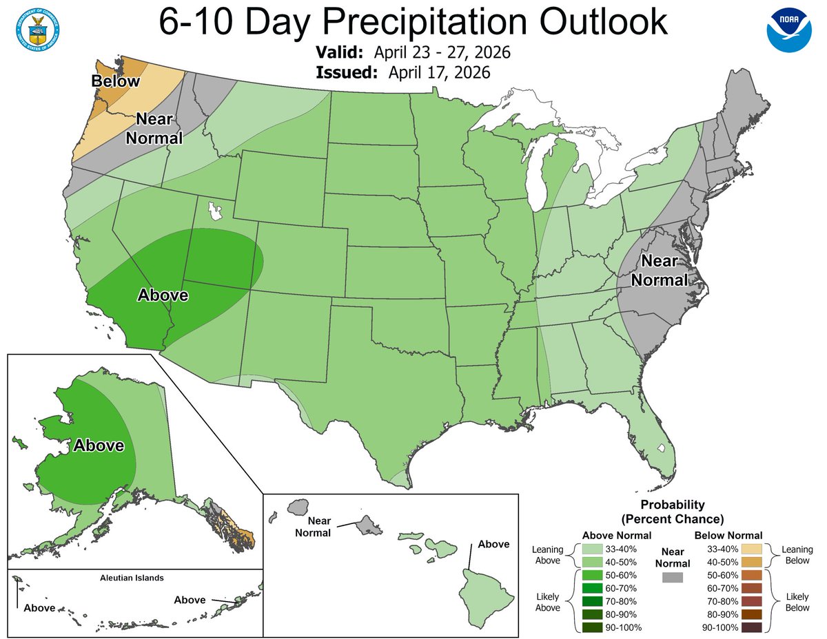
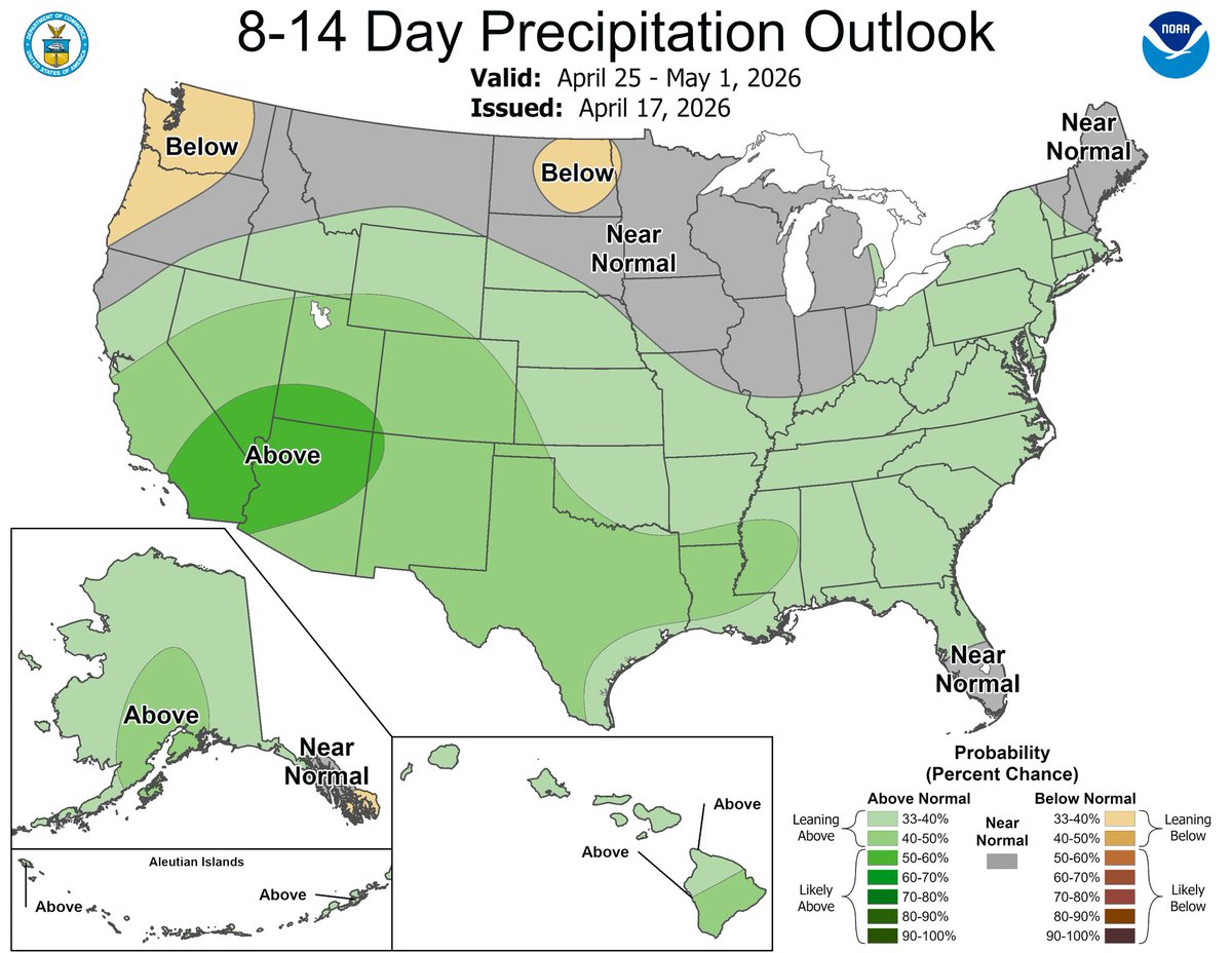
Friday April 17, 2026, 12:04 PM: There it is! What we just discussed in our discussion this morning and the last few days. The latest CPC is on board a wet pattern for all of California and southern California and the Southwest is on the way starting next week and the week after! ⛈️☔☔❄️#winterisback #CAwx
12
20
204
8,715


Mar 25
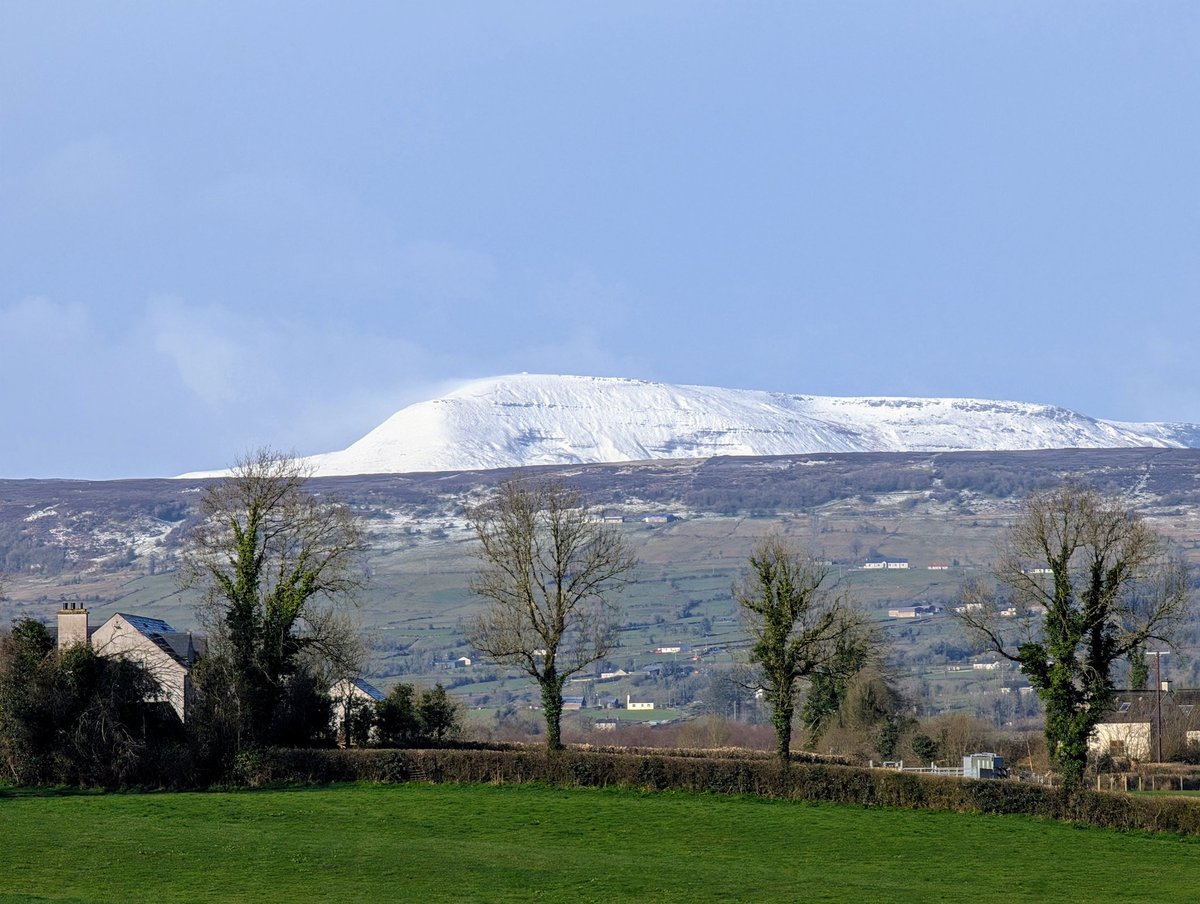
Nice covering of snow on this mountain in #fermanagh this morning @WeatherCee @StormHour #winterisback @bbcniweather
1
13
490

Hey Indra Dev. Tanky overflow hori hai. Motor band kar dijiye🙏🏻
#binmausambarsaat #winterisback
1
3
61

Mar 15
ਛਾਈਆਂ ਕਾਲੀਆਂ ਘਟਾਵਾਂ, ਮੌਸਮ ਹੋਇਆ ਖੁਸ਼ਨੁਮਾ, Ferozpur 'ਚ ਕੁਦਰਤ ਨੇ ਬਦਲਿਆ ਰੰਗ
#Ferozepur #WeatherUpdate #PunjabRain #WinterIsBack #FerozepurNews
98

Mar 13
1
1
16
110

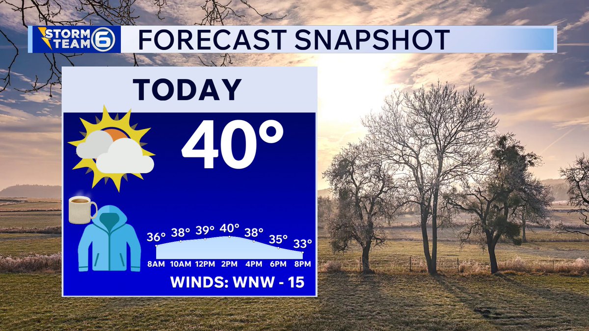
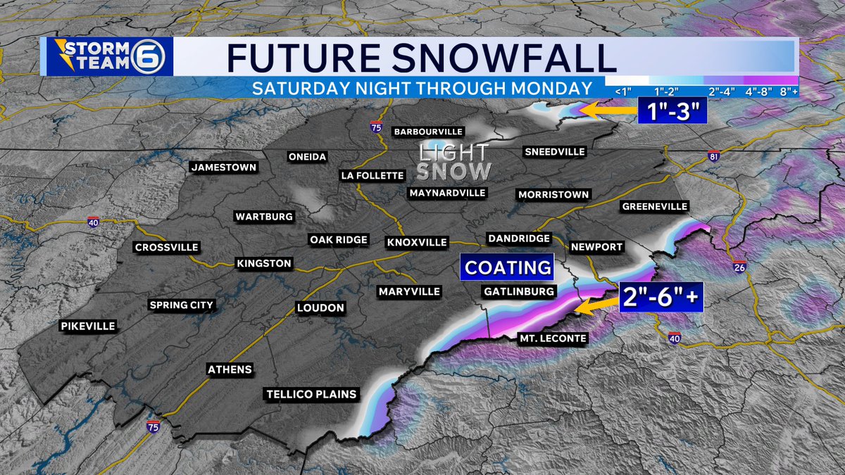
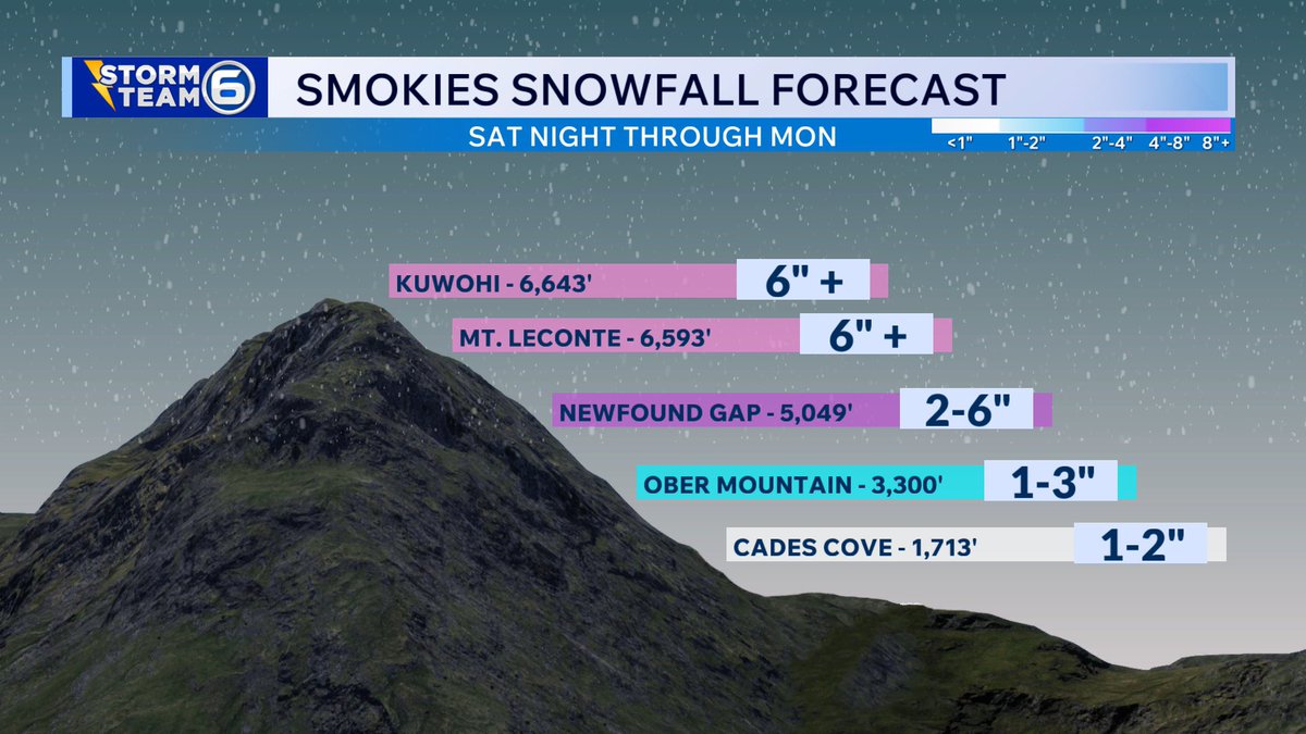
9am SUN 2/22/26
-Sun won’t be around for long today
-Breezy and chilly afternoon (most stay in the 30s)
-Cold tonight with Mountain #snow (most likely >2,500ft)
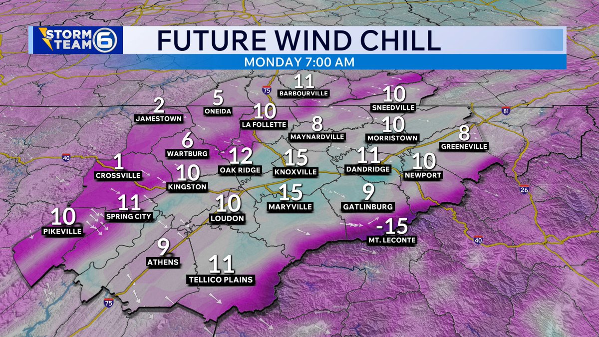
-Windy & cold MON with frigid Wind Chills
#tnwx #WinterIsBack #SnOMG
7
399

Feb 22
1
44
295

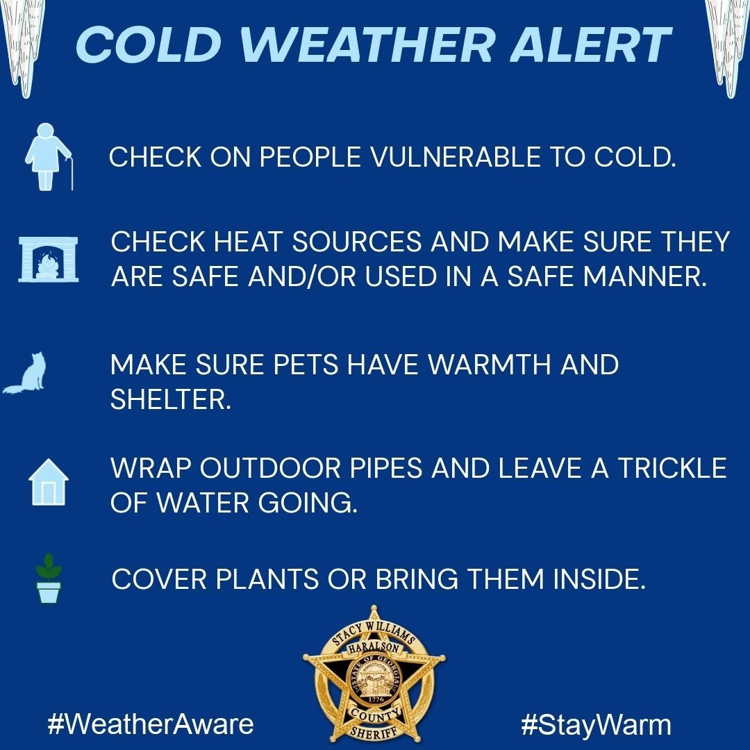
Everyone from round here knows that false Spring doesn’t last…and it looks like Winter is reclaiming its rightful place starting tomorrow afternoon/night. We all know the drill, check on and protect your people, pets, pipes and plants!
#WinterIsBack
#PeoplePetsPipesPlants
#HCSO
1
3
37

Feb 19
It looks like an arm with a winter claw is reaching out to remove the spring weather we had the past week. Prayers for everyone having to work through extreme weather. #winterisback

1
3
288

Feb 18
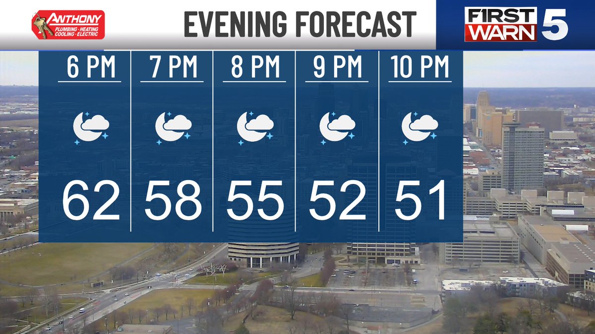
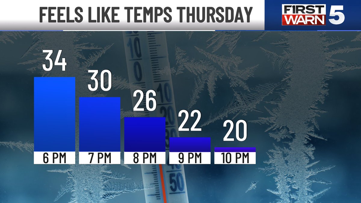
Enjoy our comfy conditions this evening. It's the last one of this spring fling.
Grab the winter coat, hat and gloves when out and about Thursday evening.
Look at the difference!
#mowx #winterisback
@KCTV5
3
229

Feb 5
3 good news today...
1. My bhai is in Dubai and will leave for Sydney tomorrow, InshaAllah so my Thursday is already blessed.
2. My bestie is coming all the way from Riyadh to spend the weekend with me.
3. My line manager, who treated me bad, took credit for my work and mentally traumatized me for almost an year got fired today.
Sometimes we feel like Allah(swt) is not listening to our prayers and is only putting us through difficult times… but we don’t see the wisdom behind His plans.
#thursdayvibe #Winterisback
5
24
922


29 Nov 2025
❄️7” of fresh snow overnight and more on the way. We simply LOVE to see it! AND SKI IT! 😉 #cowx #winterisback #lovelandskiarea #snow
3
13
195
10,083