I think its brilliant!
Rely sets you apart
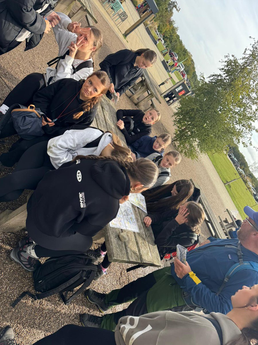
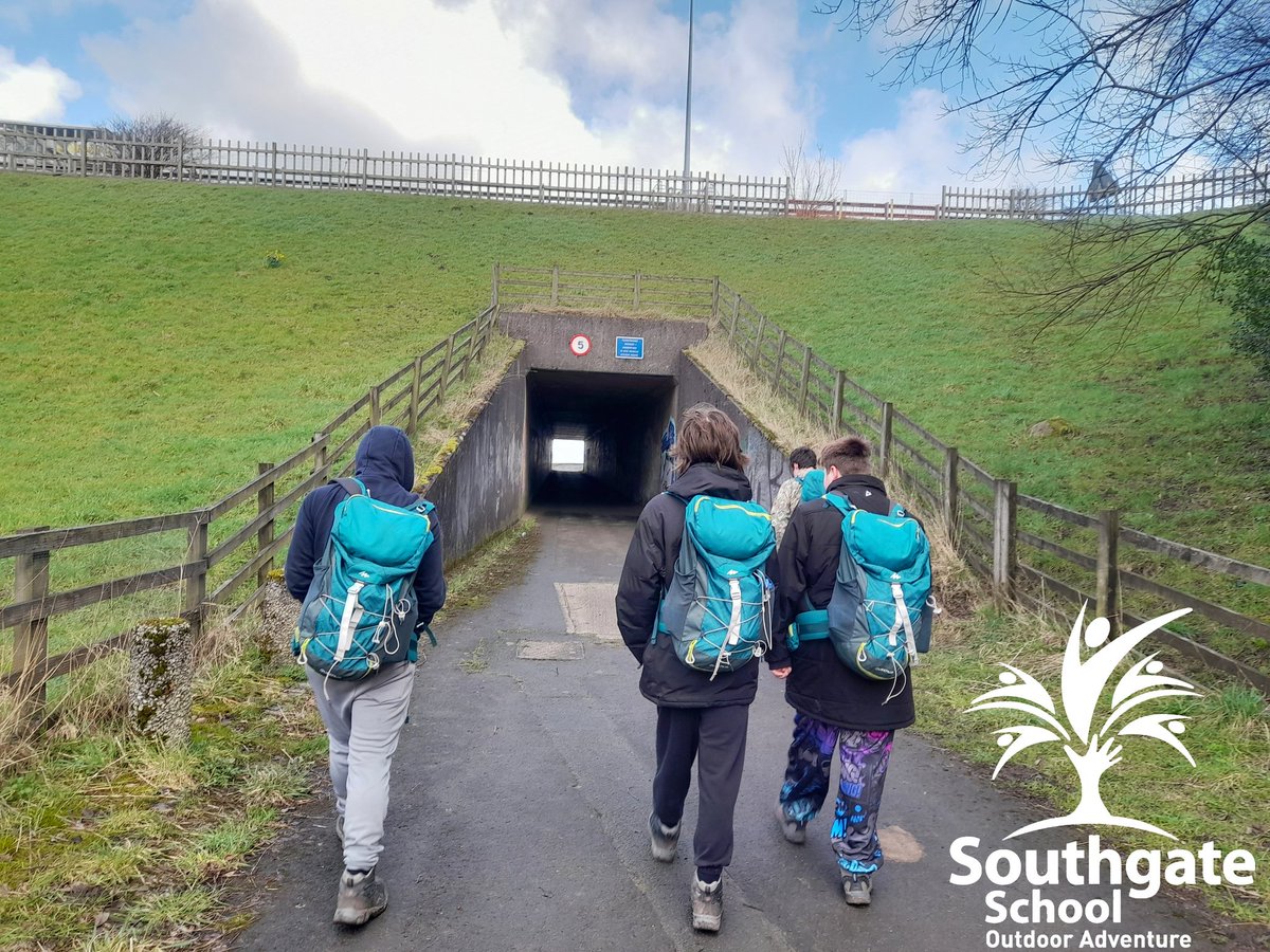
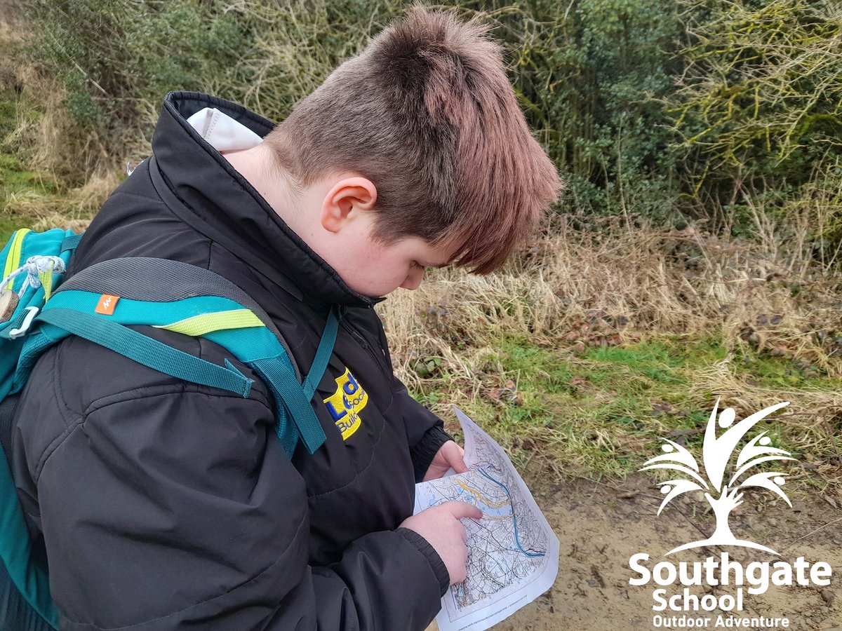
Add mapreading
1
19

May 13
Thank you for the message: First response of a few today: Yeah, no. The largest pit ever dug is the Rio Tinto copper mine in Utah. Right at a mile across. If this theory is going by the depth lines on the map and thinking the lakebed is stepped like that, then the theorist needs remedial mapreading classes. The earliest French maps of the Great Lakes date to the 17th century, driven by explorers like Samuel de Champlain, who documented inland water bodies based on Indigenous knowledge. Key early, influential maps include Nicolas Sanson’s 1650 map (first to show all five lakes) and the 1672 Jesuit Relations map, which dramatically improved knowledge of the upper lakes.Key Early French Maps & MapmakersSamuel de Champlain (1632): Provided the first European maps indicating multiple large bodies of water in the interior.Nicolas Sanson d'Abbeville (1650): Created a foundational map that, for the first time, correctly depicted the general layout of all five Great Lakes.Jesuit Relations Map (1672): Titled Lac Superieur et autres lieux ou sont les Missions..., this map, attributed to Fathers Jean Allouez and Claude Dablon, greatly improved the understanding of Lakes Superior and Michigan.Vincenzo Coronelli (c. 1688): Produced detailed maps for Louis XIV based on reports from French explorers and missionaries, offering detailed, albeit stylized, views of the region.18th Century AdvancementsJacques-Nicolas Bellin (1745/1755): His map, Partie Occidentale de la Nouvelle France ou du Canada (1755), is considered one of the most comprehensive and influential 18th-century maps, relying on earlier Jesuit reports and explorer journals like those of Vérendrye.Mythical Geography: Early maps, including those by Bellin, often included fictitious islands in Lake Superior, such as Isle Philippeaux, which persisted for over a century.These maps reflect the reliance of French cartographers on Indigenous, Iroquois, Algonquin, and Ojibwe knowledge to map areas not yet seen by Europeans.Mapping Michigan | Clarke Historical Library* For example, a British map published in 1626 gave no hint of the Great Lakes existence. British maps issued as late as 1701 showed only a single large lake at...Central Michigan UniversityCharting the Great Lakes - Mackinac State Historic ParksNov 2, 2015 — Vincenzo Coronelli derived his cartographic information about this region from the reports of French explorers from the court of King Louis XIV and Jesuit Missi...Mackinac State Historic ParksThe Great Lakes Like You've Never SeenJun 9, 2025 — The Great Lakes region had been mapped, described, and navigated by First Nations peoples for many years before European explorers and colonizers arrived. These...ArcGIS StoryMaps1755 Partie Occidentale de la Nouvelle France ou du Canada...Unit price / per. 17.5 x 22 inches - Original Size. 21 x 26 inches. 24 x 30 inches. 29 x 36 inches. 32 x 40 inches. 17.5 x 22 inches - Original Size. 21 x 26 in...the Vintage Map ShopFile:1755 Bellin Map of the Great Lakes - GeographicusOct 21, 2024 — He also relies on Verendrye's journals with regard to the placement of numerous Indian nations and villages. Charlevoix is generally regarded as Bellin's source...Wikimedia CommonsMapping the French Empire in North America - Newberry LibraryReference: Kaufman. "Lac Superieur et autres lieux ou sont les Missions. . .," map from the Jesuit Relations (1672). The Newberry Library. This map, attributed ...Newberry Library1755 Bellin Map of the Great Lakes - Geographicus Rare Antique Maps1755 Bellin Map of the Great Lakes. This item has been sold, but you can get on the Waitlist to be notified if another example becomes available, or purchase a ...Geographicus Rare Antique Maps
1
2
44

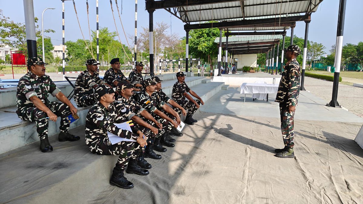
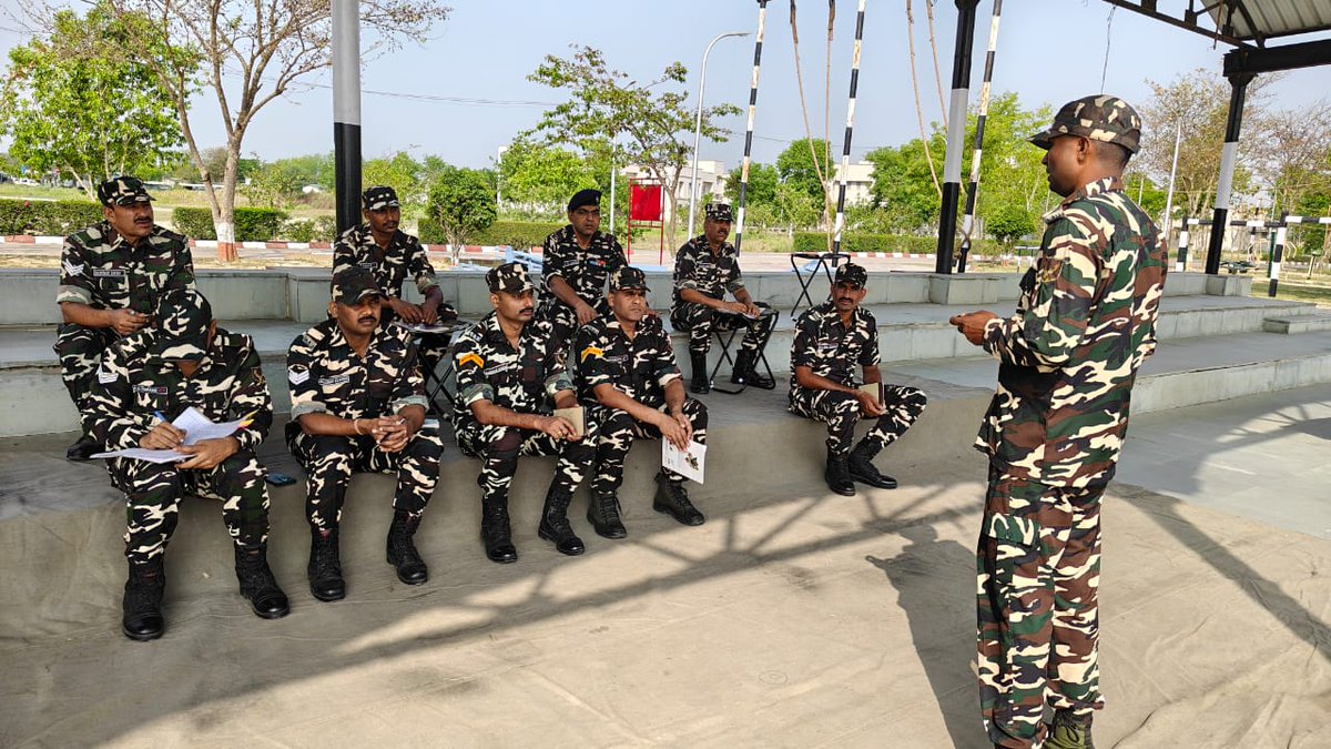
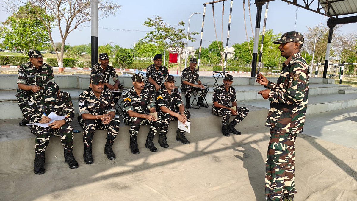
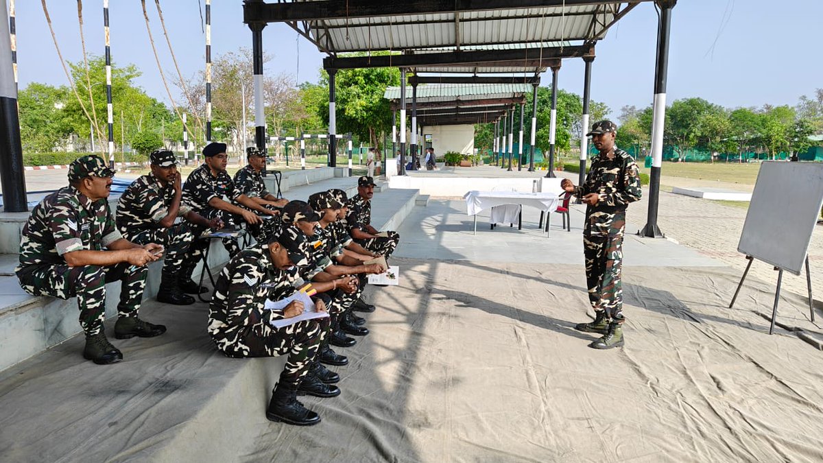
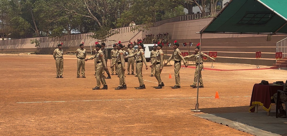
वाहिनी के कार्मिकों ने मैप रीडिंग का प्रशिक्षण प्राप्त कर दिशा-बोध और जमीनी समझ को और सुदृढ़ किया—हर परिस्थिति में सटीक निर्णय की तैयारी।
#SSB_INDIA
#SSBFTRLUCKNOW
#SSBSHQGKP
#MapReading
#प्रशिक्षण
#दक्षता
4
71
125
336

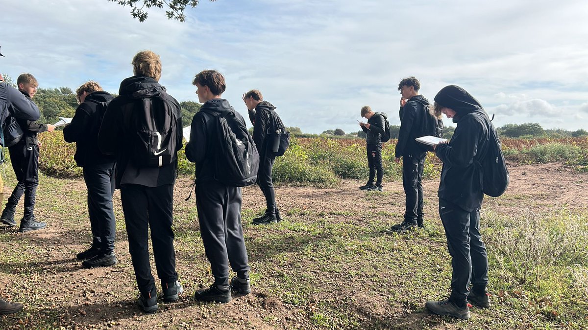
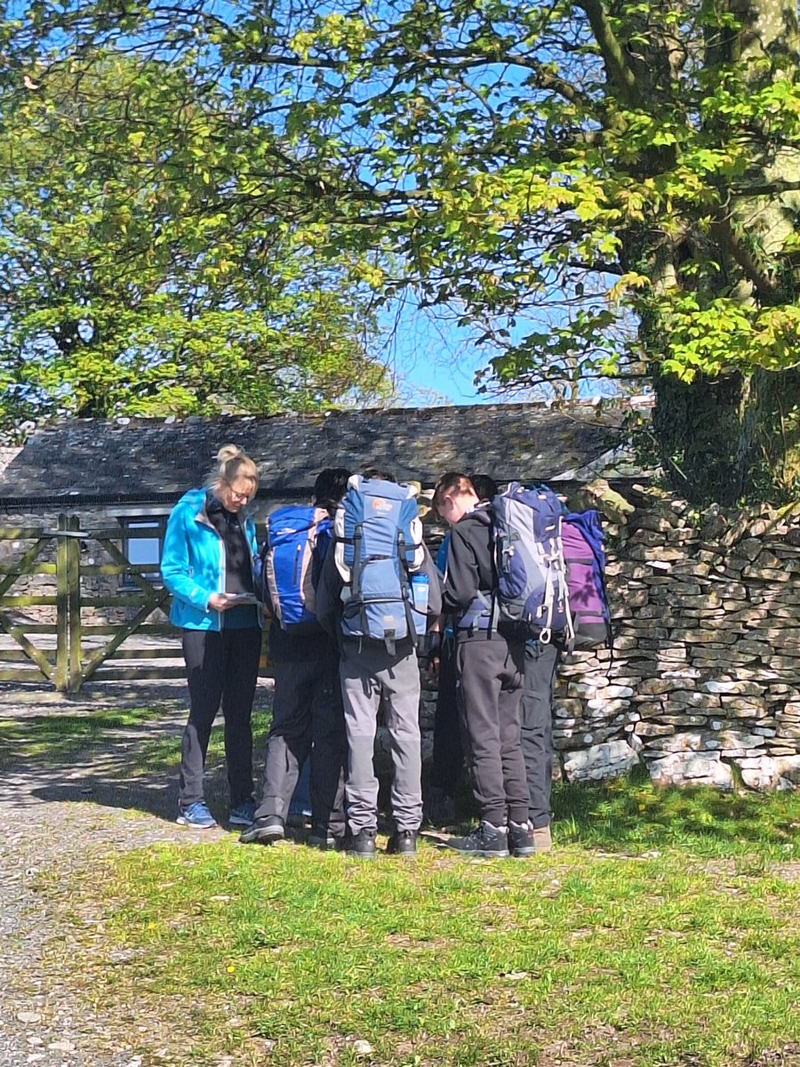
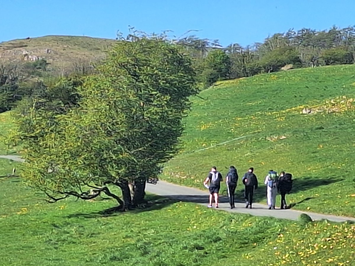
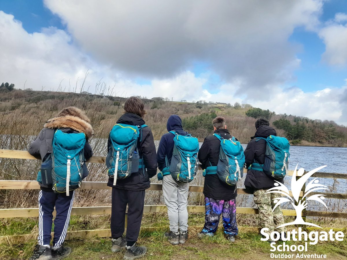
A great evening last night on Scout Scar with our Bronze DofE team 🌄 Now looking ahead to the practice expedition—bring it on! 💪🥾
#DofE #DofEBronze #Teambuilding #mapreading
4
102
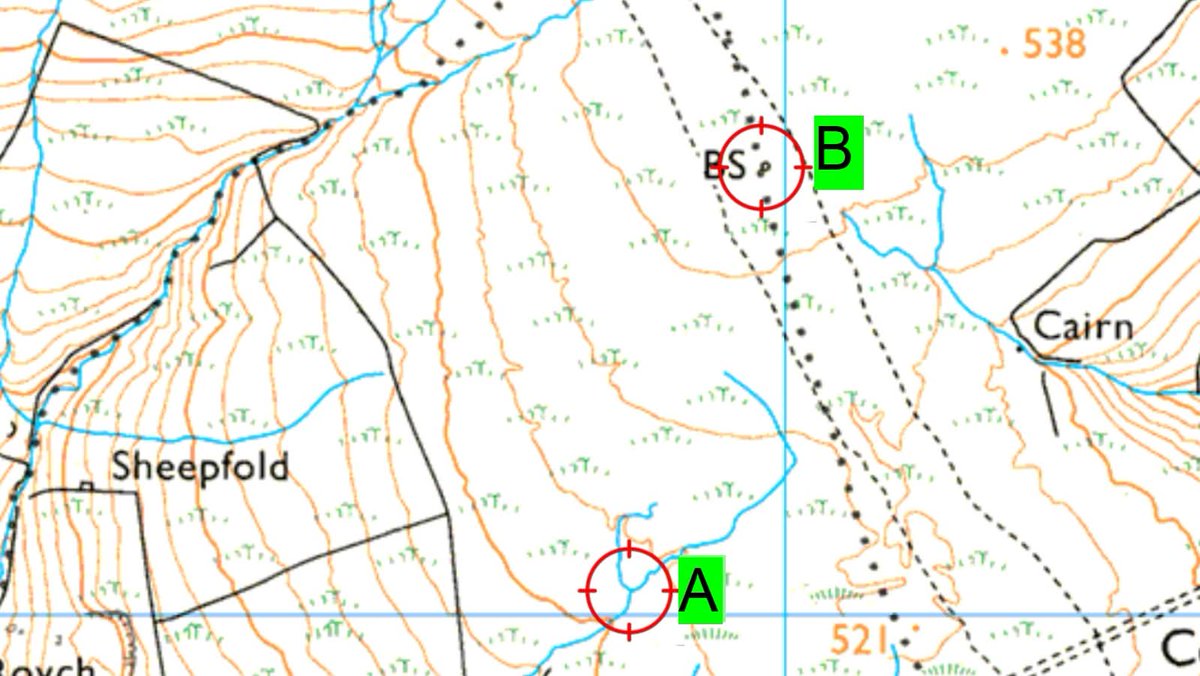
Video in comments discusses route choices from A to B in the dark.
The black dots ISN'T A PATH!
#mapreading
1
4
526

Apr 9
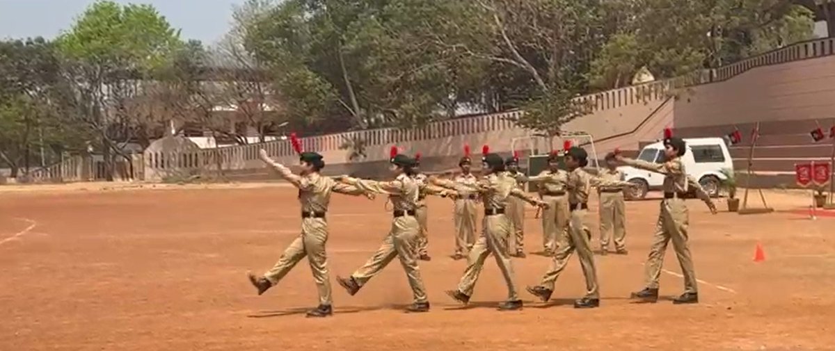
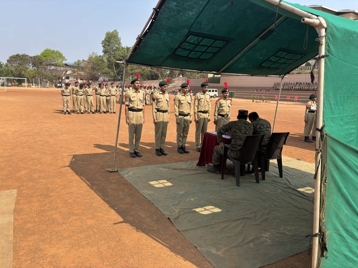
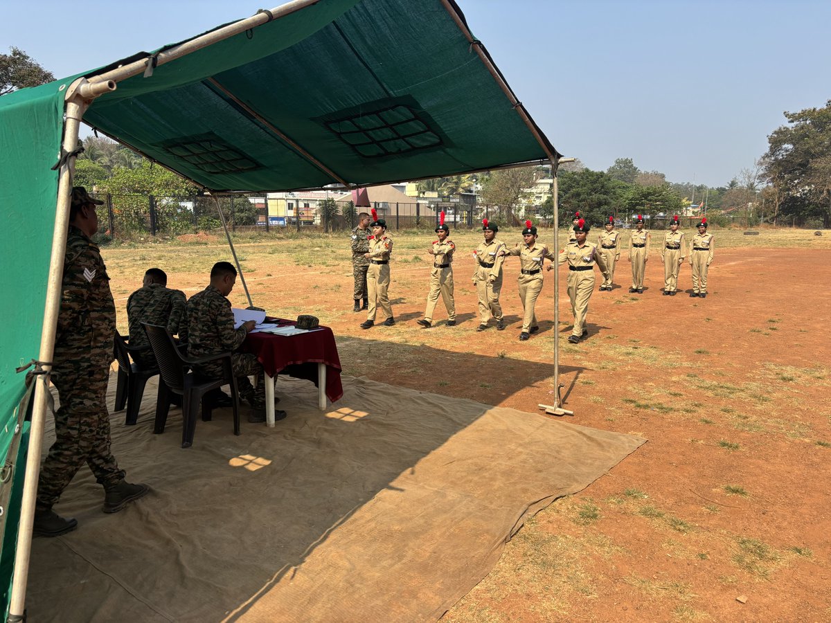
National Cadet Corps ‘B’ Certificate Examination Successfully Conducted for IIT DHARWAD Cadets
The NCC Battalion conducted the NCC ‘B’ Certificate Examination (Practical and Theory) on 14th and 15th March 2026 at JSS College Campus, Vidyagiri, Dharwad.
From IIT DHARWAD, a total of 31 students were eligible to appear for the examination. Of these, 27 students completed the registration process, and 26 cadets appeared for the examination, with one student being absent. Among the participants, 16 were SD (Senior Division) cadets and 10 were SW (Senior Wing) cadets.
The Practical Examination was held on 14th March 2026, where cadets were assessed across multiple components including Drill Square Test (DST), Field Craft and Battle Craft (FCBC), Map Reading, and Communication.
The Theory Examination was conducted on 15th March 2026. Across both days, the participating cadets from IIT DHARWAD actively engaged in the examination process and showcased commendable performance.
#IITDharwad #NCC #NCCCadets #NCCTrainees #Bcertificate #StudentAchievements #Discipline #Leadership #YouthDevelopment #Drill #FieldCraft #MapReading #CadetLife #TrainingAndDevelopment
1
5
265

Mar 26
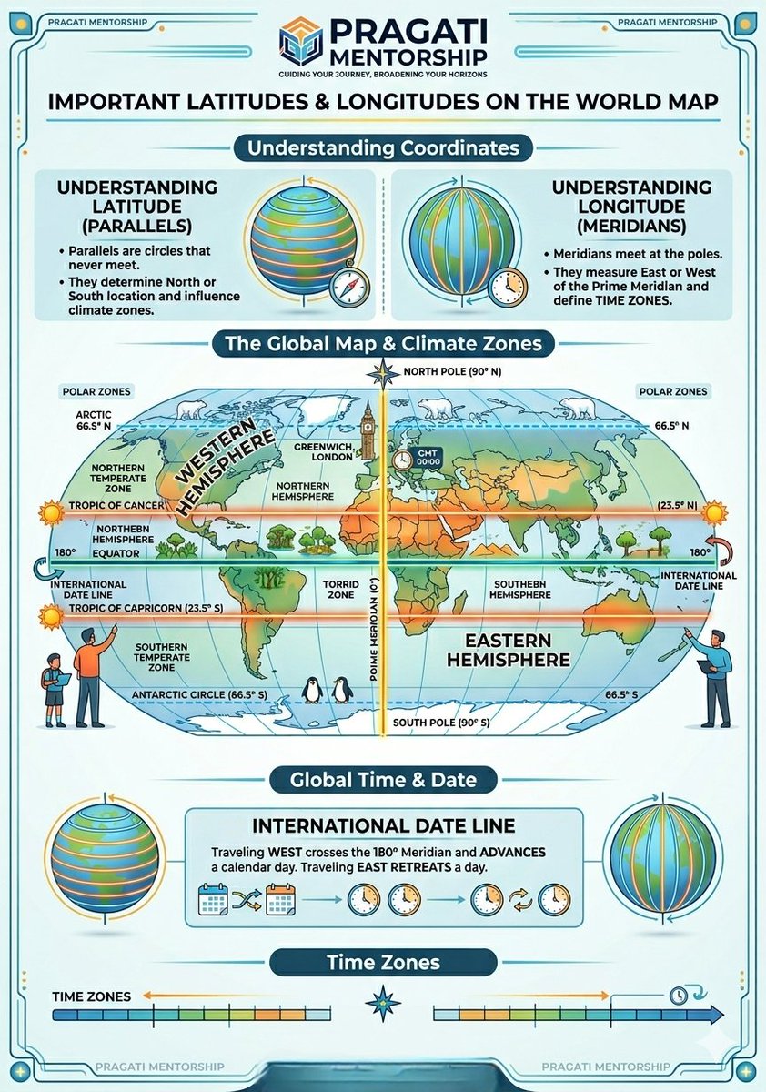
Master the Globe with Pragati Mentorship!
Mastering the world map doesn't have to be complicated! 🌏✨
We’ve mapped out the essential Latitudes & Longitudes in this @pragati_mentorship guide. From Climate Zones to Time Zones, get your basics right.
#Geography #MapReading #Education #PragatiMentorship #UpscPreparation #GeneralKnowledge
6
41
673
Woodland #DofE putting their map reading skills into practice today, as part of a @DofE Taster Day. 🗺🧭
#MapReading #NeverStopExploring #LearningAway #OutdoorClassroom
@KirkleesCouncil @EVOLVEadvice @OrdnanceSurvey @SchoolTravelOrg @TOG24Official @TrailMagazine
2
3
475

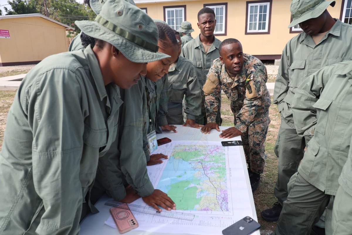
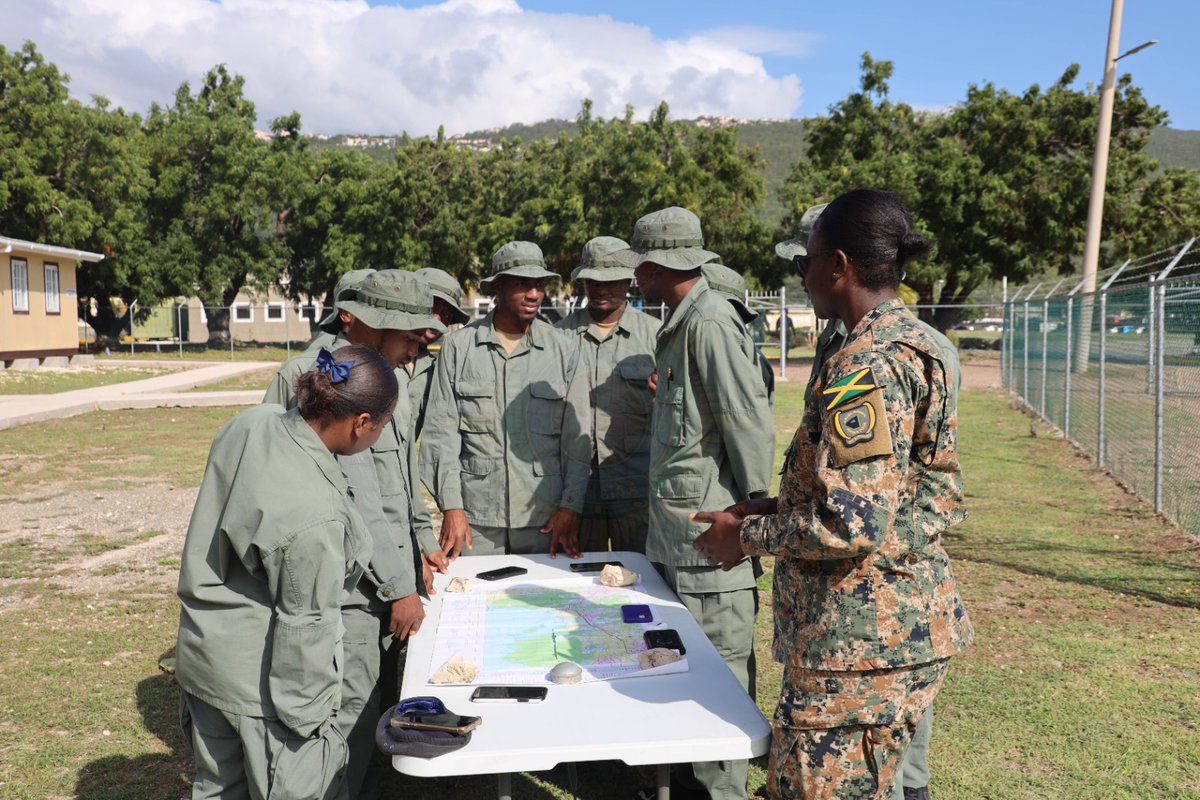
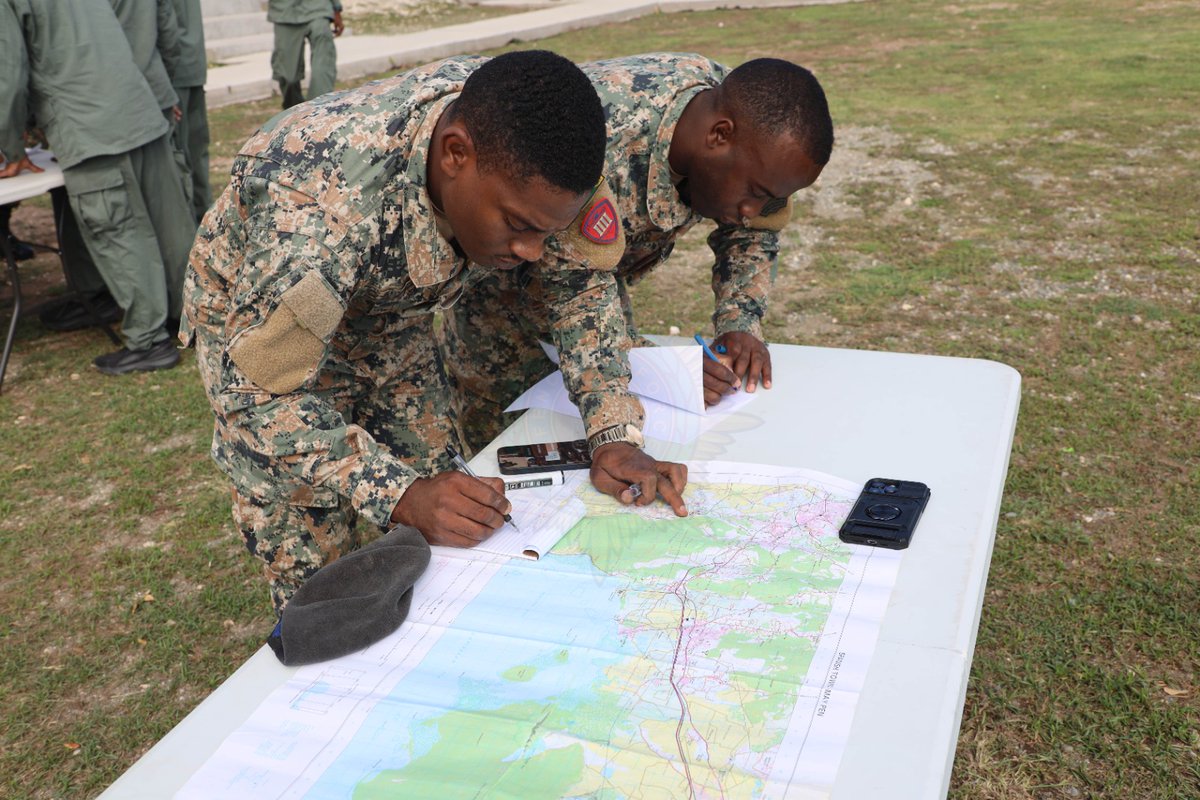
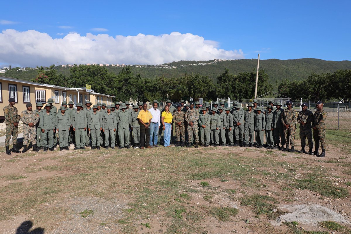
leadership and discipline.
Well done to our hard working trainees!!!!
#Skillstraining
#MapReading
#IndividualCompetence
#JamaicaDefenceForce
#HEARTNSTATrust
Photos by Private Joewell Black, Headquarters Jamaica Defence Force
1
2
291

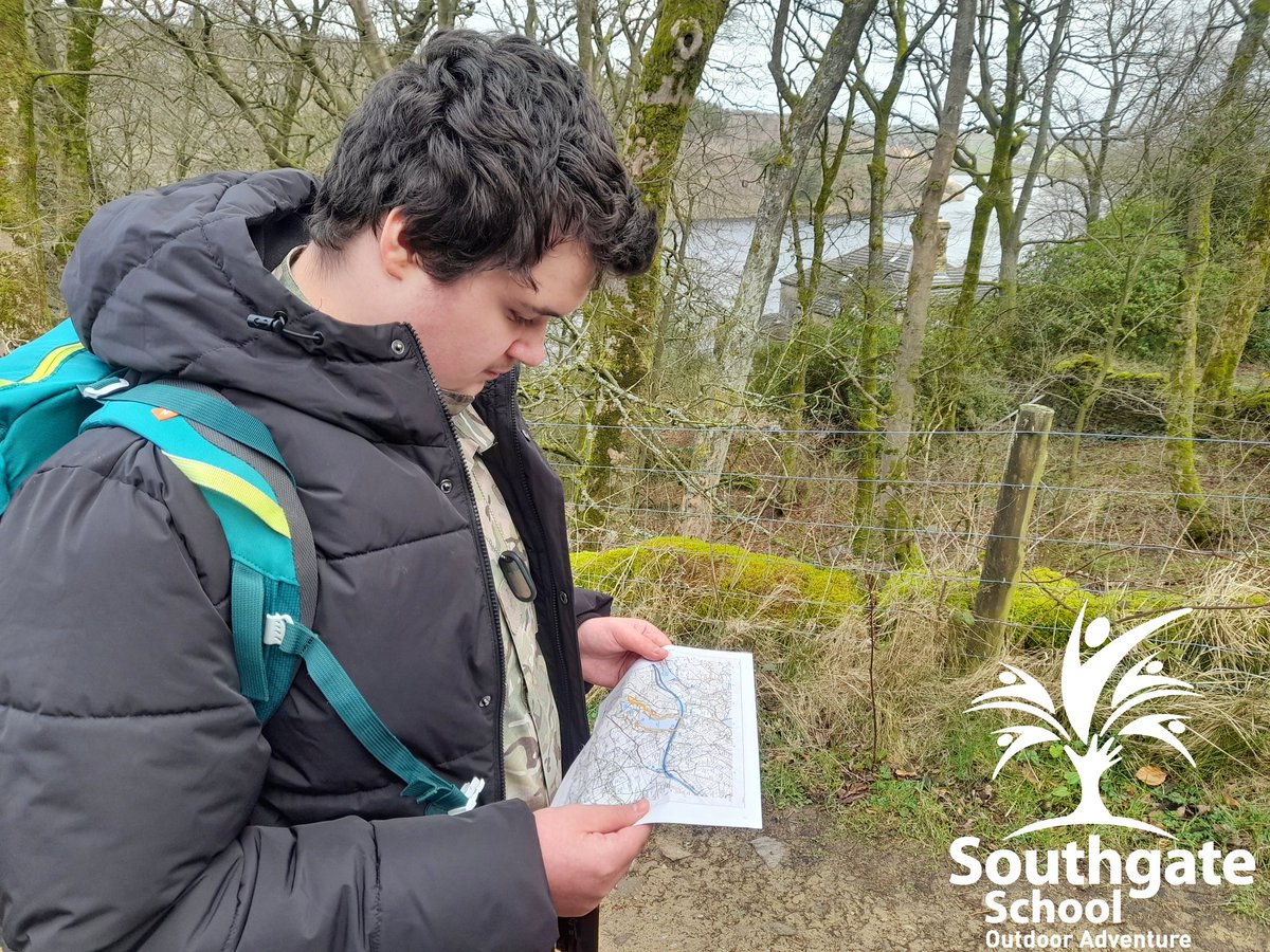
🌄🗺️ Nearly 50 of our Bronze DofE students spent yesterday morning learning new map‑reading skills!
Fantastic to see so much enthusiasm as they build the skills needed for their upcoming expeditions. Great job, everyone! 👏
#TeamQEGS #DofE #OutdoorLearning #MapReading

4
128

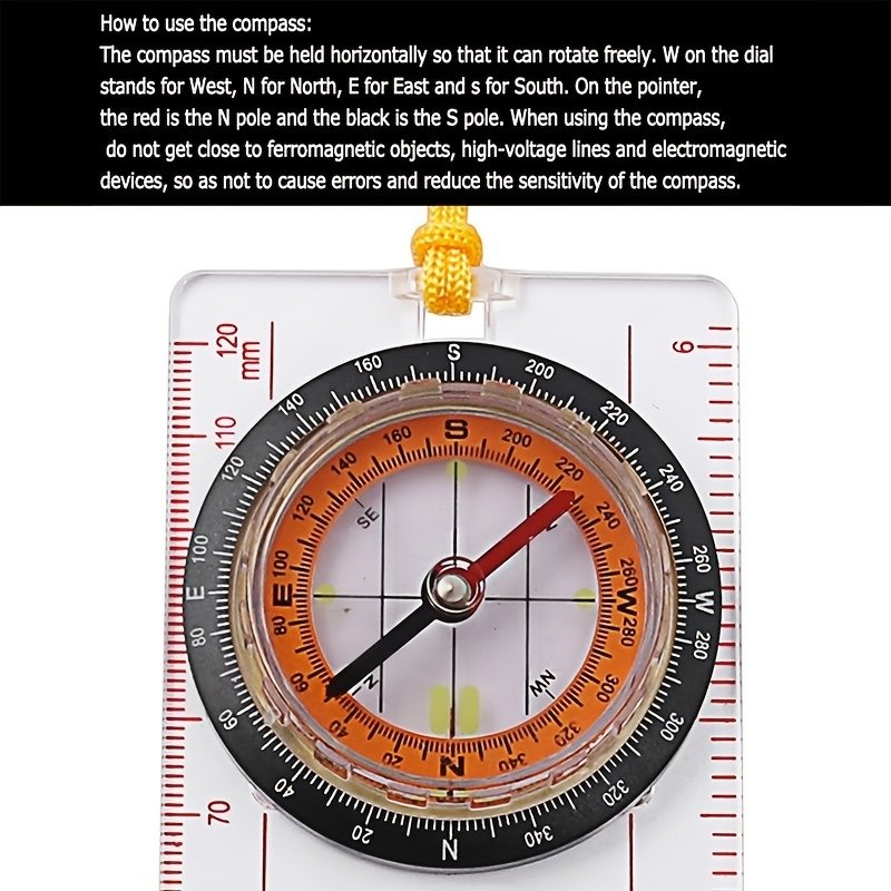
Compass With Ruler Scale For Scout Hiking Camping Boating Orienteering Map Professional Magnifying Compass
survival-needs.com/portable-…
survival-needs.com
#portablecompass #compass #ruler #scales #scout #hiking #camping #boating #orienteering #mapreading


1
2
19

19 Dec 2025
Rescued a 1960 US Army field manual on map reading from an Army-Navy store! It only cost $15-$20. Check out the table of contents. This manual supersedes FM 2126 from March 1956. #MapReading #ArmyHistory
2
21

26 Nov 2025
Time for reflection as pupils discover the wreck of a WW2 Barracuda MD963 1945 aircraft on @MarsdenmoorNT.
#WeWillRememberThem
#MapReading #GetOutSide #History
@nationaltrust @RamblersGB @OSleisure @Team_BMC @DofE @EVOLVEadvice @IOLOutdoorProfs @tes @KirkleesCouncil


4
75

25 Nov 2025
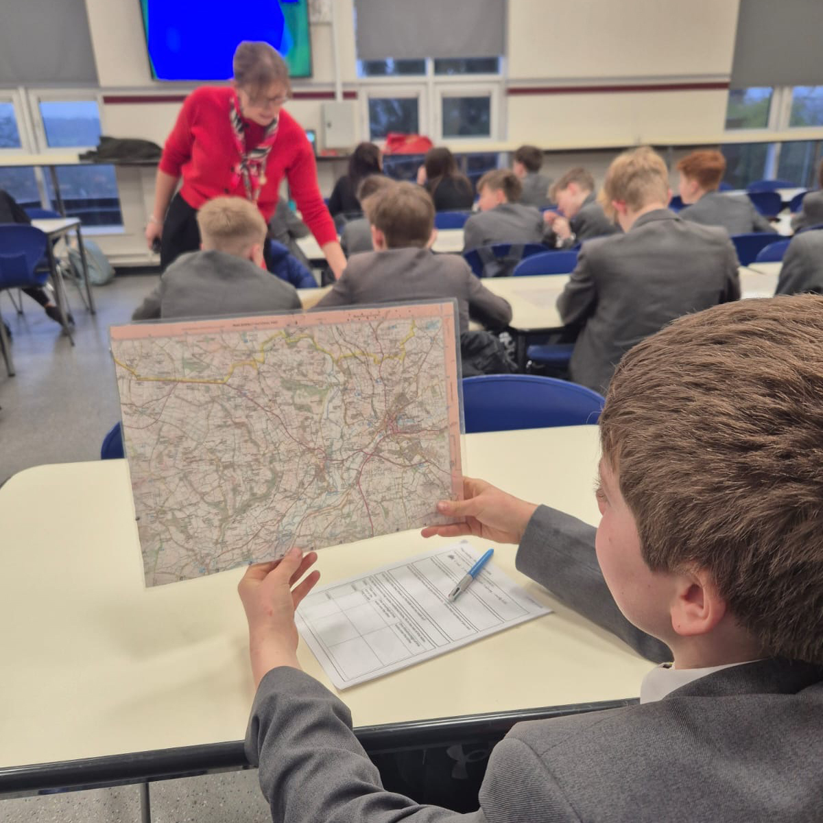
Year 7 have been putting their @OrdnanceSurvey map skills to the test, directing rescue teams after ‘flooding’ at a nearby reservoir. 💜🗺️🧭🌍💜 #OrielGeography #Skills #Application #MapReading #WeLoveGeography
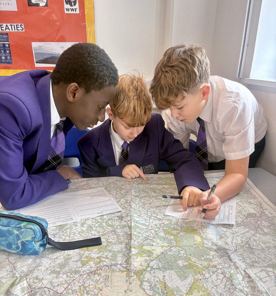


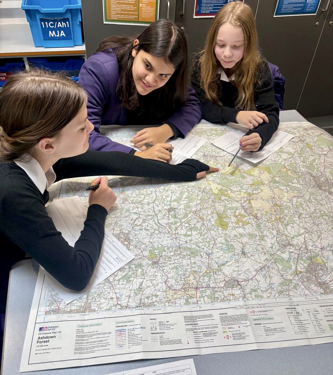
3
239

17 Oct 2025
In Geography, Year 3 used the 8 points on a compass to locate places on a map. #Geography #mapreading #compassskills
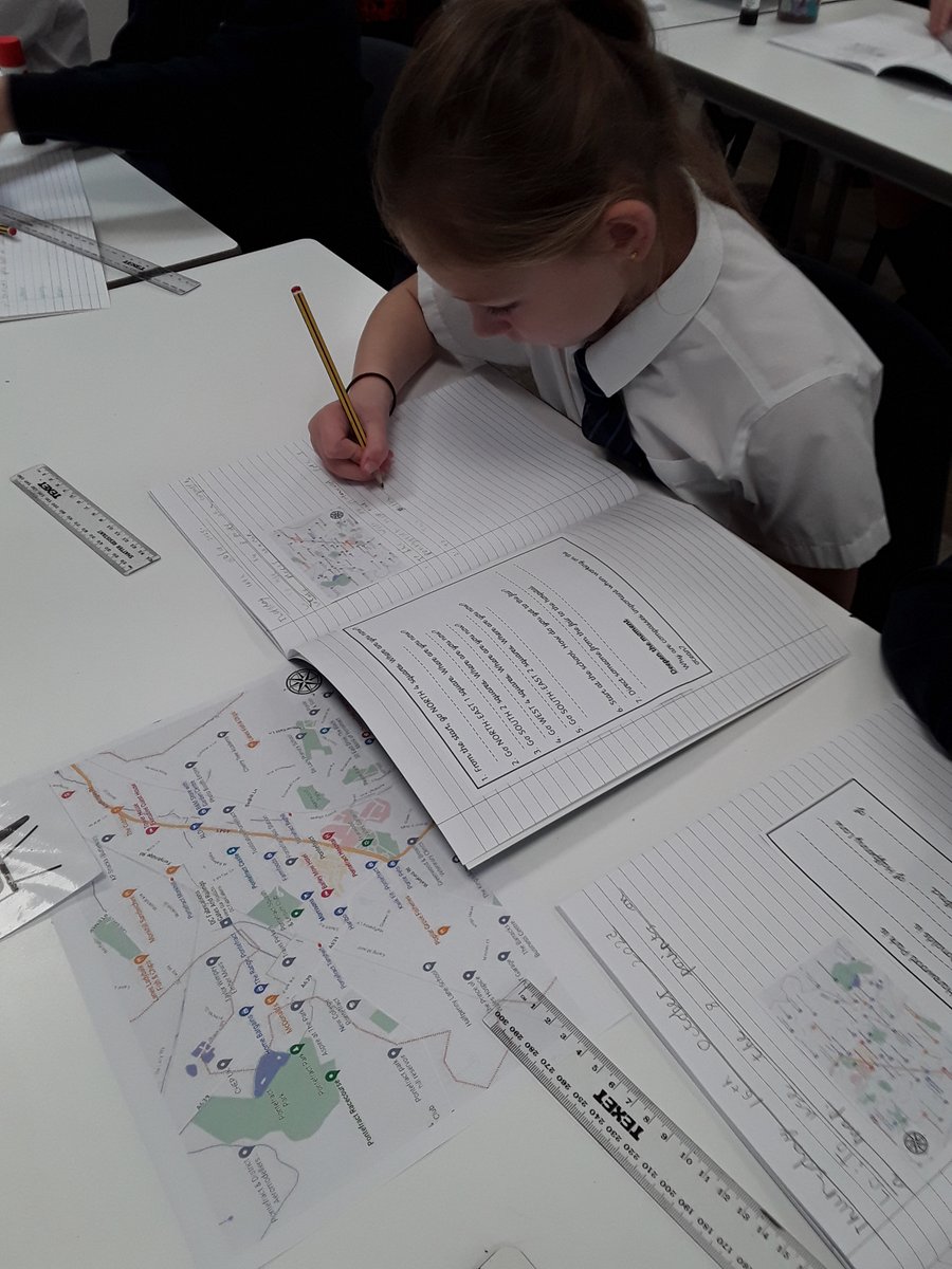
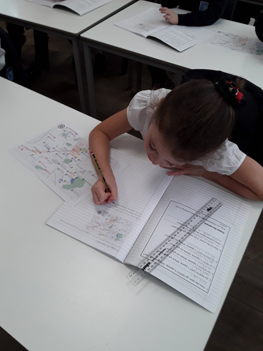
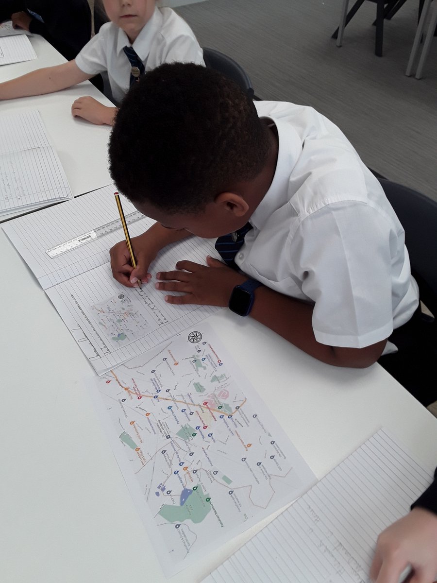
2
306

9 Oct 2025
Some Games🏐 😄 some Map Work🗺🧭 and some more games 🪑, another productive #ScoutMeeting ⚜️ #ScoutsDoStuff #SkillsForLife #Scouting #Craic #Orienteering #ScoutingIreland #MapReading 🥾🏔⚜️

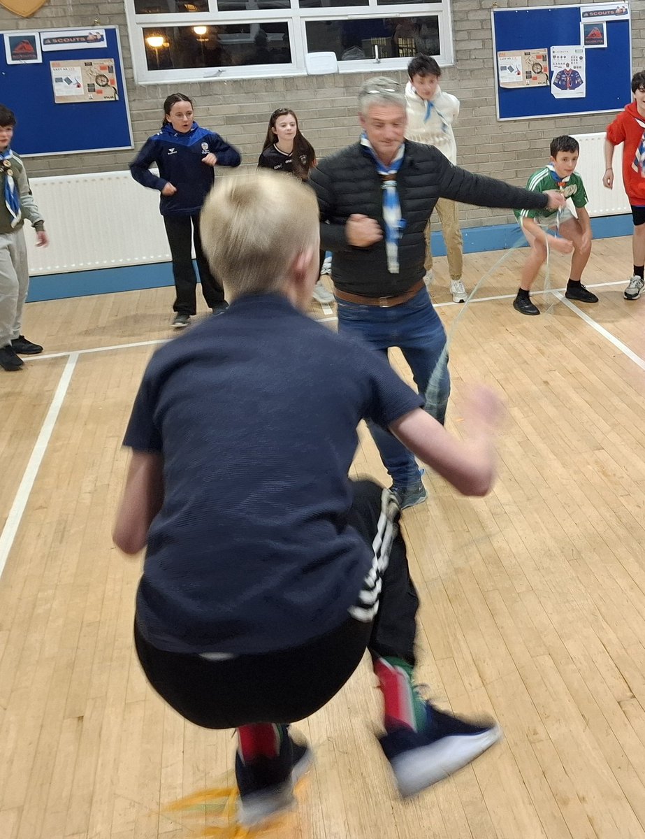
4
236

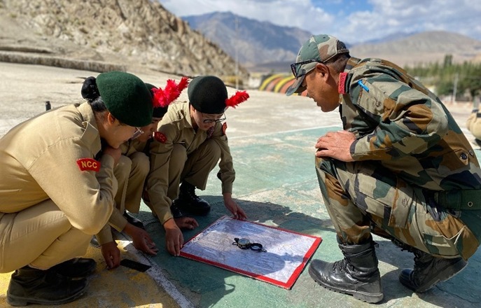
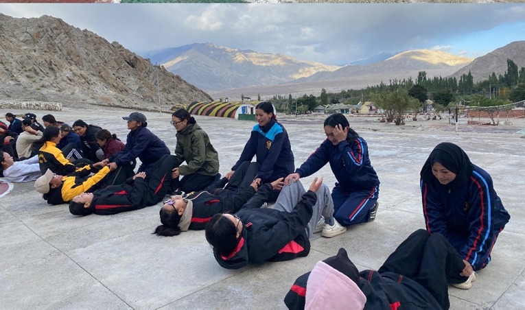
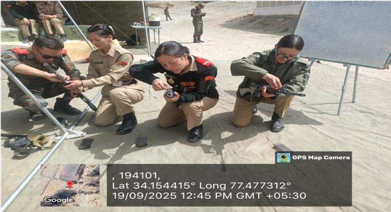
27 Sep 2025
Army Attachment Camp (Girls) is in progress at Phyang #Leh. 45 Girl Cdts from various schools & colleges from UT, Ladakh are attending the same. Cdts are being trained in #Drill, #WeaponTraining & #MapReading under expert Army Instructors—instilling core ethos of Unity & Discipline.
#IndianArmy #NCCIndia
#FitIndia #NariShakti
@adgpi @NorthernComd_IA @firefurycorps @HQ_DG_NCC @NCCDteJKL @Gphqjammuncc @prodefleh @lg_ladakh
1
3
289


14 Sep 2025
Trying to work out which stream junction we are at!
Typical scenery from today's navigation course on Kinder.
#mapreading

5
366