
31 Oct 2024
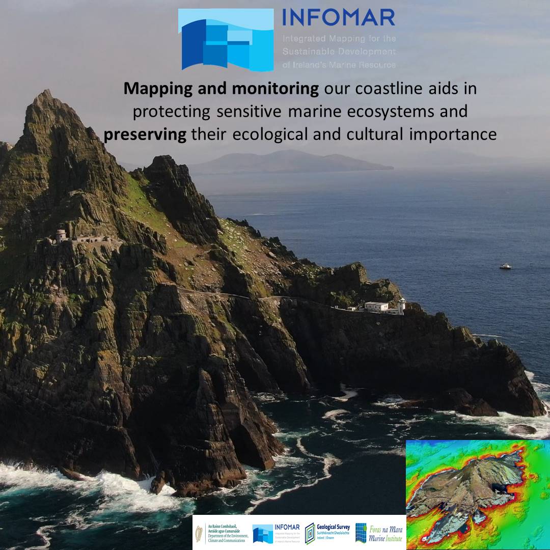
Mapping and monitoring our coastline helps protect sensitive marine ecosystems and preserve their ecological and cultural significance. @UCD_Geography #MScModule students are learning about these crucial efforts with #INFOMAR.
#SeabedData
@Dept_ECC @GeolSurvIE @MarineInst
1
5
227
29 Oct 2024
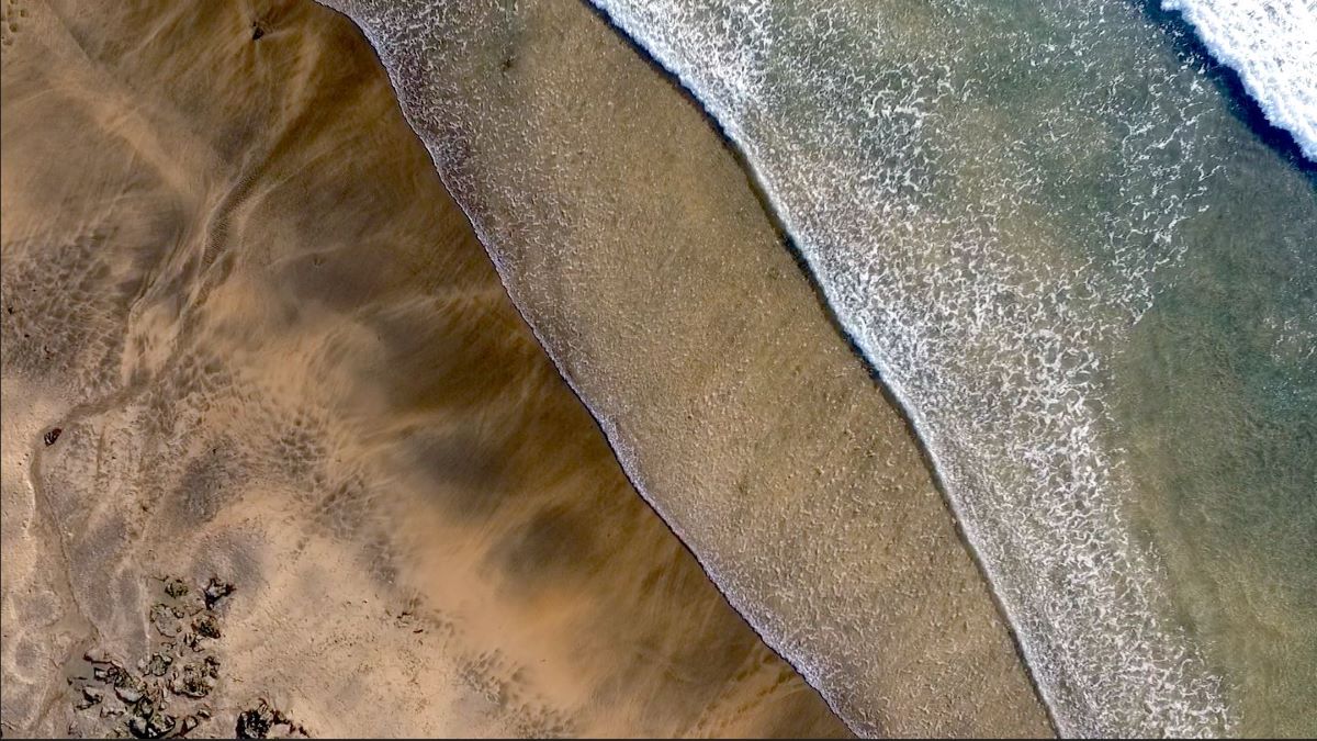
Trochoidal waves are complex wave patterns formed by tides and currents. @UCD_Geography #MScModule students are studying how #SeabedMapping data improves our understanding of sediment dynamics and seabed stability.
#MarineScience #SeabedData
@Dept_ECC @GeolSurvIE @MarineInst

1
5
301
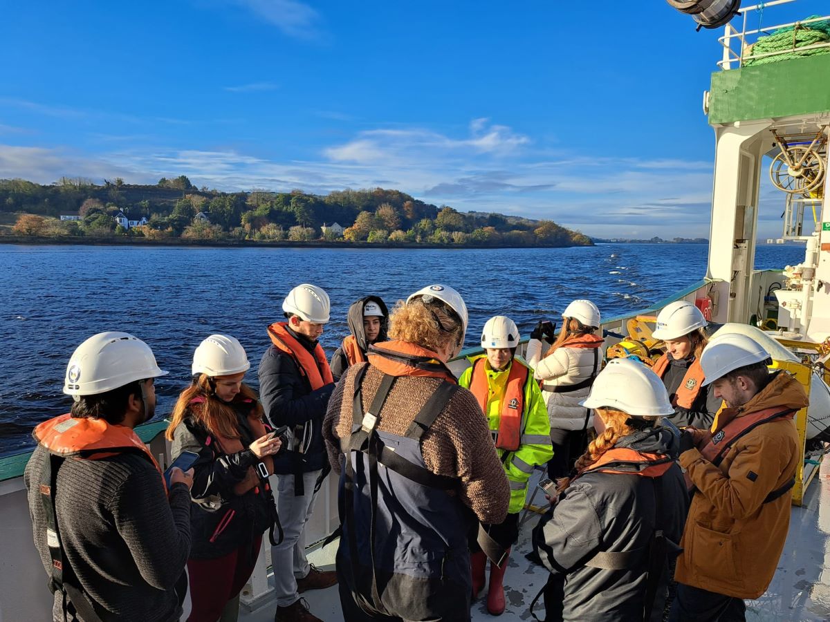
17 Oct 2024
The #INFOMAR #MScModule Module continues with @UCD_Geography GEOG40990 students learning about Satellite Derived Bathymetry. They processed data using @QPSofficial sponsored software and Sentinel-2 satellite data to study coastal seabed depth.
@Dept_ECC @GeolSurvIE @MarineInst
2
6
344
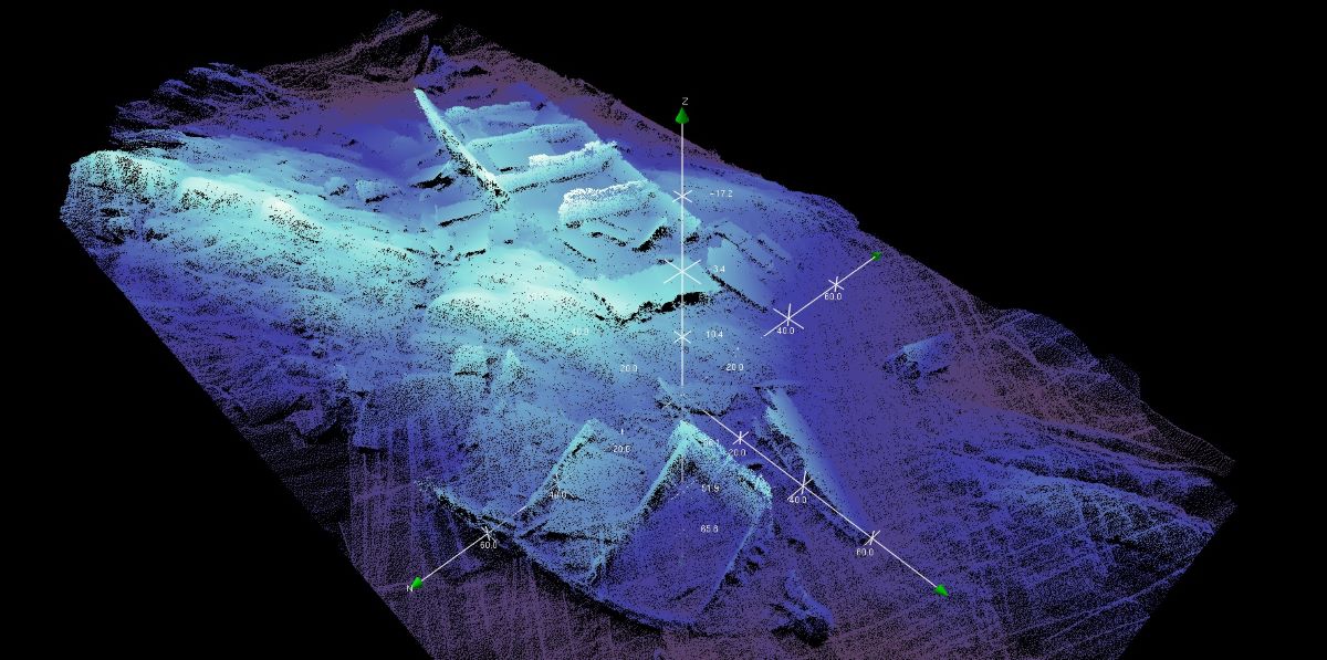
7 Oct 2024
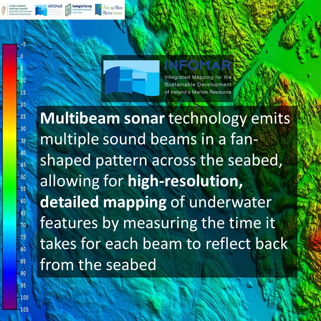
Multibeam sonar tech emits sound beams in a fan pattern, enabling high-res mapping of underwater features. @UCD_Geography GEOG40990 students are learning about these systems with the #INFOMAR #SeabedMapping #MScModule. #MarineScience
@Dept_ECC @GeolSurvIE @MarineInst
1
6
380
3 Oct 2024
In today's Coastal Change tutorial, @UCD_Geography GEOG40990 #MScModule students will analyze shoreline change using Earth Observation data, mapping shorelines and calculating change rates in the context of climate change. #CoastalChange
@Dept_ECC @GeolSurvIE @MarineInst
3
6
373
23 Sep 2024
Seabed mapping by #INFOMAR has uncovered large, dynamic sand wave fields off Ireland’s coast, shaped by powerful tidal currents.
The @UCD_Geography #MScModule students are learning about seabed geology and sediment movement. #MarineScience
@Dept_ECC @GeolSurvIE @MarineInst

4
10
441
19 Sep 2024
The @UCD_Geography students continue their #INFOMAR #SeabedMapping #MScModule with Marine Data Science. Discover, View, Access! Today’s focus: Data Management and how INFOMAR products & services are shared.
#MarineData
@Dept_ECC @GeolSurvIE @MarineInst
1
2
268
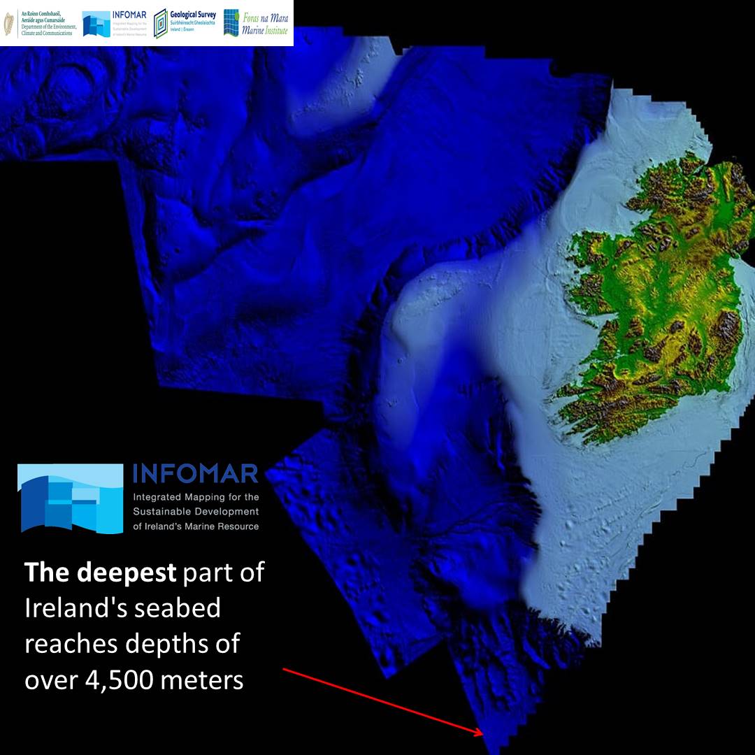
16 Sep 2024
Did you know? The deepest part of Ireland's seabed reaches over 4,500m!
@UCD_Geography students are gaining hands-on experience with the #INFOMAR #MScModule, exploring #SeabedMapping in depth!
#MarineScience #OceanKnowledge
@Dept_ECC @GeolSurvIE @MarineInst
2
11
383
12 Sep 2024
The #INFOMAR #SeabedMapping module with @UCD_Geography kicks off today! We’re diving into Seafloor Mapping, exploring its critical role in ocean safety, renewable energy, climate action, conservation, and more!
#OceanKnowledge #MScModule
@Dept_ECC @GeolSurvIE @MarineInst
5
13
472
11 Sep 2024
We are excited to team up with @UCD_Geography again to deliver the #INFOMAR Marine Seabed Data module! Our team is ready to share over 20 years of #SeabedMapping expertise this trimester.
Read about this #MScModule 👉 bit.ly/3MHhaQR
@Dept_ECC @GeolSurvIE @MarineInst
3
12
537


7 Dec 2021
Current revision tactic: sitting surrounded by my notes hoping it will enter my brain through some form of knowledge osmosis #mscmodule #masters #advancedcardiorespiratory #student
7

13 Jul 2021
Good luck Nursing colleagues 4 tomorrow presenting Professional Nurse Advocate Posters @worcester_uni
@ProudPMAs
A-EQUIP
#RestorativeSupervision
#MScModule @GaskinKerry @JackieE98151429 @amandamoore65 @LouPearsonNHS @margetts_naomi think we're ready 😱
3
7

12 Mar 2018
And so it begins...my journey into Masters level learning 😬 woohoo! #braniacs #mscmodule #OT #iloveneuro #neurorehab @TherapyUnitLWSW 💚💙
3
8

30 Sep 2016
I trained in insulin pump MScModule-but no experience in pump clinic- as a GPSI in diabetes, would I advice or Rx? Nope!
2
2

29 Jan 2016
Progress todate #MScmodule #ResourceHub #OTinterns #AHPplacements #OTvolunteeers #AHPPhd #whatnext? #dementiafriends qmu.ac.uk/marketing/press_re…
2