
On-demand non-Earth imaging and insights of spacecraft that matter.
Joined May 2016
- Tweets 481
- Following 197
- Followers 6,265
- Likes 839
229 Photos and videos


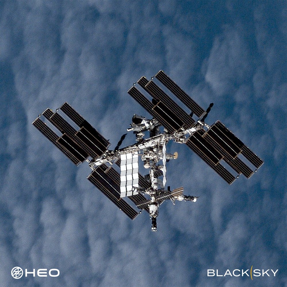
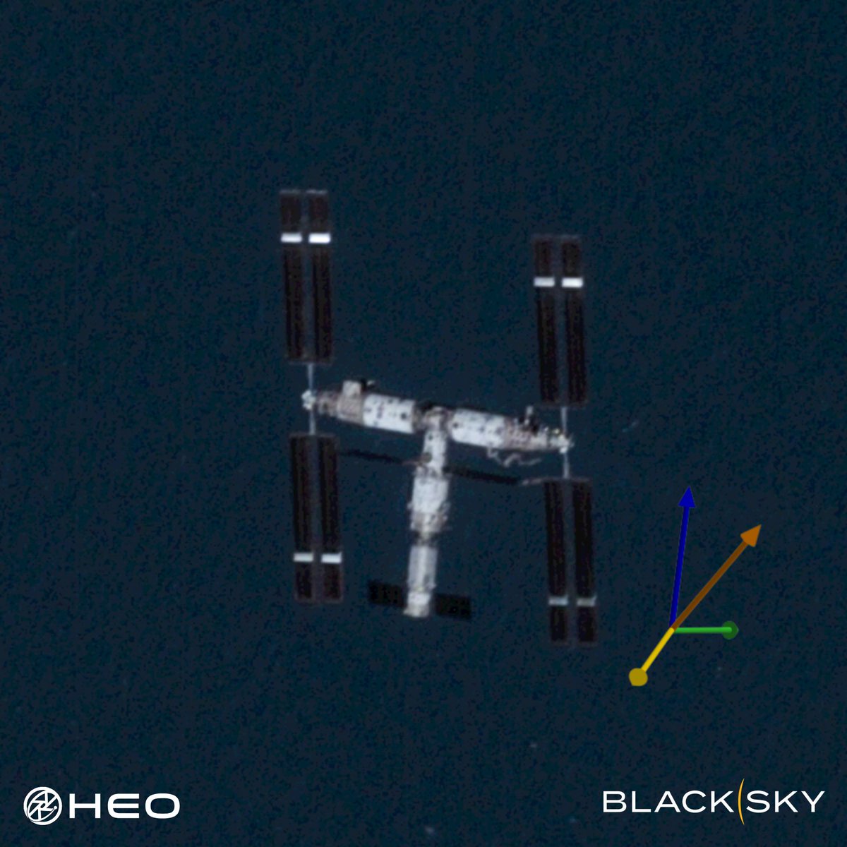
We’ve captured one of our best images of the @Space_Station yet.
The number of satellites in orbit is set to increase tenfold in the next decade. At the same time, space-to-space threats are rising and the need to inspect and maintain satellites is accelerating faster than anyone expected.
Resolution alone won't deliver what's needed. True understanding comes from observing satellites frequently, from multiple angles and orbits, so you can see how they behave, respond to their environment, and what they're capable of across time and geography.
That's why HEO focuses on high-frequency Non-Earth Imaging. Our technology is built for speed, scale, and adaptability, operating across multiple orbits with diverse satellite providers to deliver more coverage, more data, and faster insights into thousands of satellites. This approach will get us to a future where satellite inspection is truly on-demand. You tell us you want an image of your satellite and we deliver imagery and analysis when you need them.
Image of the ISS captured with our partner @BlackSky_Inc.
37
195
1,177
86,516
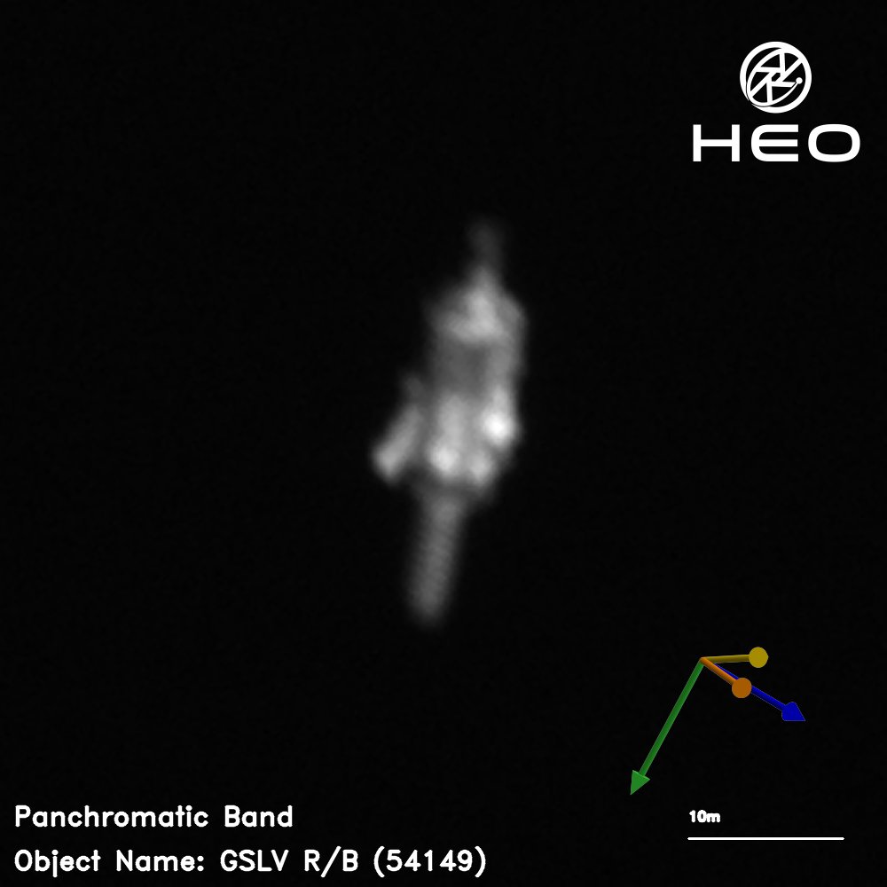
This is the spent upper stage of India's LVM3-M2, imaged here at 14 cm/pixel.
The rocket's first dedicated commercial mission, flown in October 2022, placed 36 OneWeb satellites into orbit, executing a nine-phase deployment sequence across 75 minutes to deliver the heaviest payload ISRO had ever flown at the time.
HEO characterised this object from a distance of 34.54 km. The collection shows the structure is largely intact and we’re able to resolve its attitude and condition after three years in orbit.
As proximity operations become a reality rather than a future prospect, the ability to approach, interact with, or deorbit an object depends on knowing its current physical state.
Historical imagery of this kind also establishes a baseline: what the object was, when, and in what condition. If its status changes, whether through fragmentation, collision, or degradation, that record becomes an attribution resource.
4
31
121
5,912
This satellite outlasted its design life by nearly 26 years.
Launched in March 1984 with a three-year design life, Landsat 5 went on to complete more than 150,000 orbits, transmit over 2.5 million images of Earth's surface, and hold a record as the longest-operating Earth-observing satellite in history.
When its successor failed to reach orbit in 1993, Landsat 5 was already a decade past retirement, but it kept collecting. It received its final command in 2013 and manoeuvred to a lower orbit and silenced its transmitter for good.
HEO characterised Landsat 5 through Non-Earth Imaging and the collection shows the solar panel is deployed, its high gain antenna extends from the central body, and the spacecraft is tumbling.
As the on-orbit servicing and debris removal economy develops, the ability to approach, interact with, or deorbit an object depends on knowing its current physical state, its attitude, its configuration, and how it is behaving in orbit. NEI will help you know before you go.
6
57
329
15,511
What happens when the satellites driving the global economy need attention?
At the Resilience Summit in Sydney yesterday, HEO's CEO Dr William Crowe joined the Above the Noise panel to discuss what the growth of the space economy demands of the industry.
He highlighted HEO's plans to use our non-Earth imaging technology to enable the emerging inspection and maintenance layer in space, operating in Low-Earth Orbit today, with Geosynchronous Orbit firmly in our sights.
1
7
854
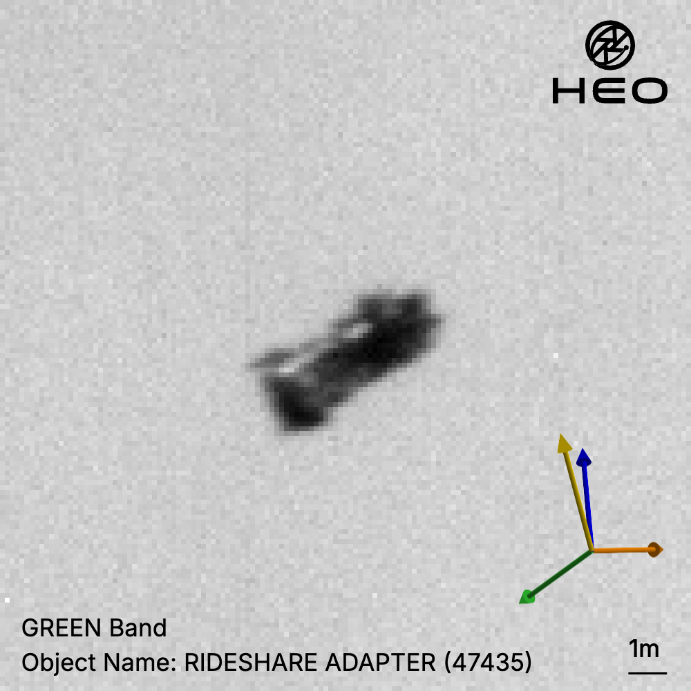
This is the rideshare adapter that carried 143 satellites on Transporter-1.
On January 24, 2021, SpaceX's Falcon 9 launched 143 spacecraft to orbit on a single vehicle, setting a record that still stands today.
HEO's Continuum-1 imaged the adapter from 60km away, at 13cm/pixel resolution, over the Arctic Ocean.
7
58
386
25,362
Two years ago, @esa and @JAXA_en launched EarthCARE to improve our understanding of how clouds and aerosols affect our climate.
HEO collected this image from ~100 km away at a resolution of 22 cm/pixel, close enough to resolve individual structural features of EarthCARE. The solar array is visible, fully deployed and sun-facing, alongside the deployed cloud profiling radar.
Congratulations to all of the teams involved on two years of climate science in orbit.

1
52
157
11,507
When HEO acquired Continuum-1, we committed to using it to catalogue objects in low-Earth orbit (LEO). Part of that work means turning attention to derelict hardware.
As noted in the recent issue of the @IntegrityISR Flash, CZ-6A upper stages are a growing concern to the sustainability of LEO as they have produced some of the largest fragmentation clouds in LEO in recent years. These rocket bodies are left in orbits that will take years to decay, with no means of manoeuvre and no plan for removal.
This is one of them.
Continuum-1 imaged this CZ-6A rocket body in orbit. It is the upper stage from the October 31, 2023 launch that carried the Tianhui 5A and 5B satellites. It appears largely intact and is gravity-gradient stabilised.
Images like these establish a baseline. If the object's state changes, that deviation is observable and comparable against something real. Attribution is rarely straightforward after a fragmentation event. A prior record can make the difference between knowing something happened and knowing why.
Reference: isruniversity.com/2026/05/19…
1
15
75
4,794
HEO has a #NoUFOPolicy.
Objects we image leave with an identity and characterisation, as it is critical to identify space objects to maintain space and Earth safety.
For example, this object is currently listed as Object A in public tracking databases, a designation assigned to newly launched objects pending formal cataloguing.
HEO has imaged and characterised it as the Lingxi 03 communications satellite, a designation corroborated by publicly available information on the mission.
When identities and capabilities in orbit remain obscure, whether by cataloguing lag, sparse public data, or the absence of independent characterisation, operators work with an incomplete understanding.
Unknown no longer has to be a permanent state.
*Measured in the 2D image plane. Any extension into the image plane is not captured, so this figure represents a minimum. The true length may be greater.
2
28
144
14,005
This is how we make space transparent.
Most space activity has never been visually observed. No image, no confirmation, no clear record of what happened or why.
Despite rapid advancements in satellite technology, the ability to see what’s up there remained largely absent.
To meet the moment, we need persistent, scalable, autonomous visual awareness of space. That's why we built HEO Inspect.
HEO Inspect is the web app and API interface to our core non-Earth imaging and insights that tasks our constellation, processes every collection automatically, and delivers finished insights.
Underpinning it is our proprietary software that runs NEI operations autonomously at scale, replacing what would otherwise require significant manual effort from specialised engineers.
Make space transparent.
7
42
3,156
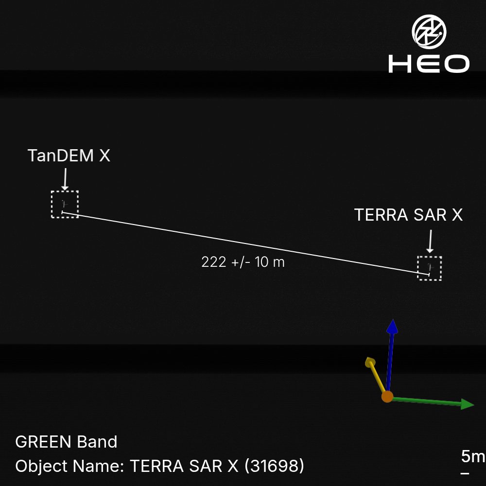
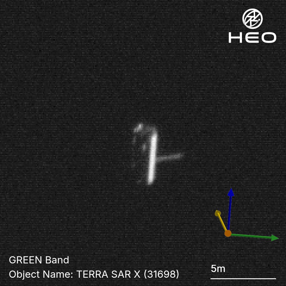
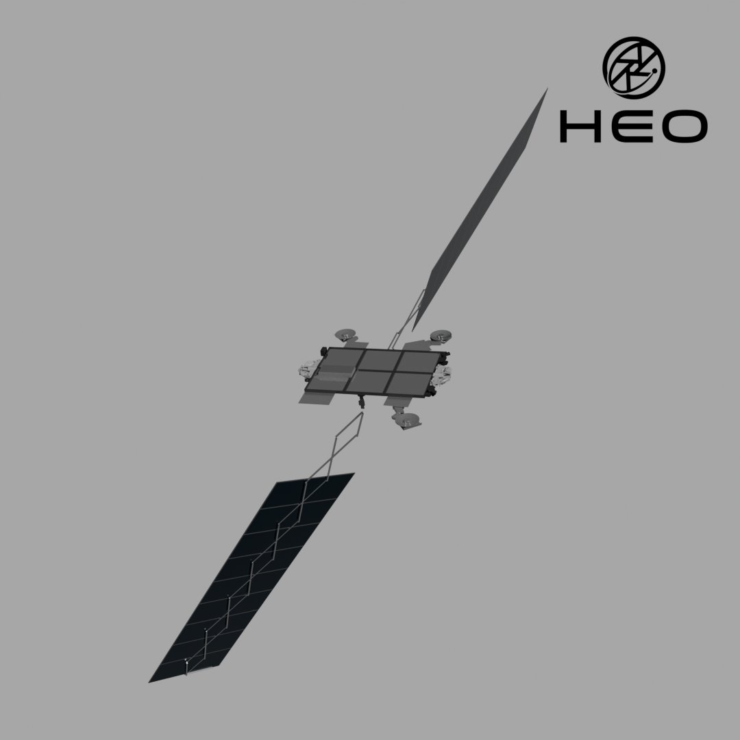
Most satellites operate alone. These two are a duet.
TerraSAR-X and TanDEM-X are among the most precisely coordinated formation-flying satellites ever operated. Launched three years apart, Germany's TerraSAR-X in 2007, TanDEM-X in 2010, they orbit in lockstep at ~508 km altitude, separated by just hundreds of metres while travelling at over 27,000 km/h.
Together, one transmits and both receive, forming a large single-pass SAR interferometer that has produced a high-precision global digital elevation model (DEM) of Earth's entire land surface.
Here, we captured both satellites in a single frame, at least 222 metres apart.
While a single image shows what a satellite looks like at a moment in time, by imaging it repeatedly, we build a deeper understanding of how it operates, how it's configured, and how it behaves in space.
*Measured in the 2D image plane. Any separation into the image plane is not captured, so this figure represents a minimum. The true distance may be greater.
3
42
198
11,290
We imaged this rocket body in orbit and you can make out the logo.
Can you identify it?
Below is what our sensors captured, plus the measurements our analytics pulled from the image.
Drop your answer below and we'll share it in the comments. Bonus points if you can name the payload it brought to space.

26
50
656
96,598
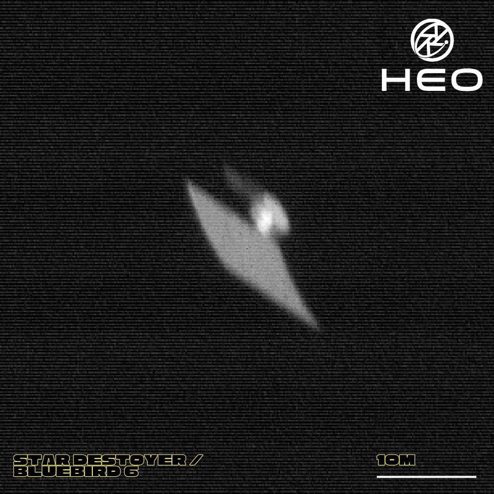
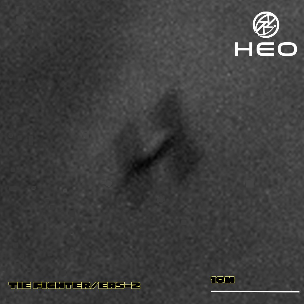
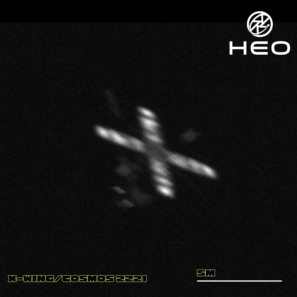
From a galaxy far, far away, they look.
A Star Destroyer. A TIE Fighter. An X-Wing.
But satellites, they are.
Transparent, the galaxy becomes when you know where to look.
#MayTheFourthBeWithYou
5
40
267
21,694
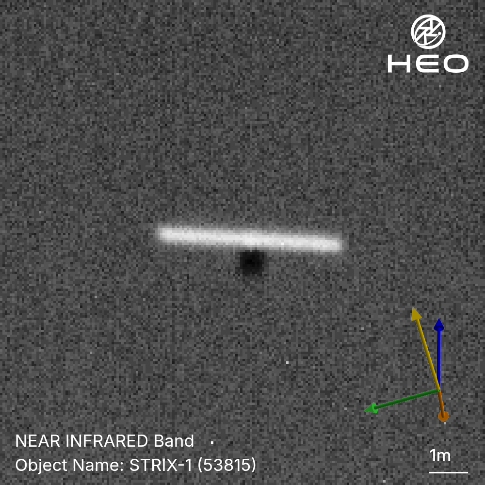
Just like its namesake, the Ural owl, this satellite 'hunts' in darkness.
This is Strix-1, Synspective's SAR satellite that sees through clouds, night, and weather to image Earth. Unlike conventional large SAR satellites, Strix-1 weighs just 100kg. To deliver imaging capability that compares to larger platforms, it uses a foldable SAR antenna that deploys to 5 metres, captured here at 6cm per pixel.
Strix-1 is the first of a planned 30-satellite constellation.
2
56
308
19,807
The satellite you're looking at was designed to do nothing in orbit.
This is SIMSAT 2, a dummy satellite. Launched in May 2000 aboard the very first Rokot-KM rocket, it was never meant to do anything in orbit. Just 657 kg of dead weight, simulating the mass and dynamics of an Iridium satellite to prove out a new upper stage before the real payloads flew.
Objects like SIMSAT 2 are a reminder that space is a museum filled with decisions made decades ago, and that truly understanding what is up there, and what it actually is, requires imaging it from space.
What we can see with our imagery is that SIMSAT 2 is still largely intact, still tumbling, and still an object that needs to be understood and catalogued.

13
113
1,728
135,989
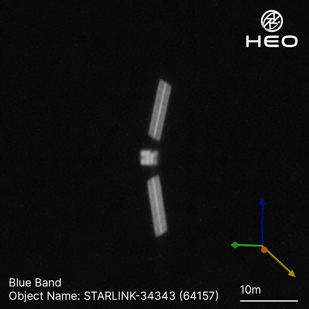
We’ve captured another post-fragmentation image of Starlink 34343.
With a higher resolution than our first, we can now confirm that the larger subsystems, like the antennas, are structurally where we would expect them to be. However, the solar panels are in an orientation we have not previously observed on this object.
With fragmentation events like this and more satellites launching into an increasingly active space domain, seeing the object is the first step to understanding what happened to it.
28
225
2,800
303,063
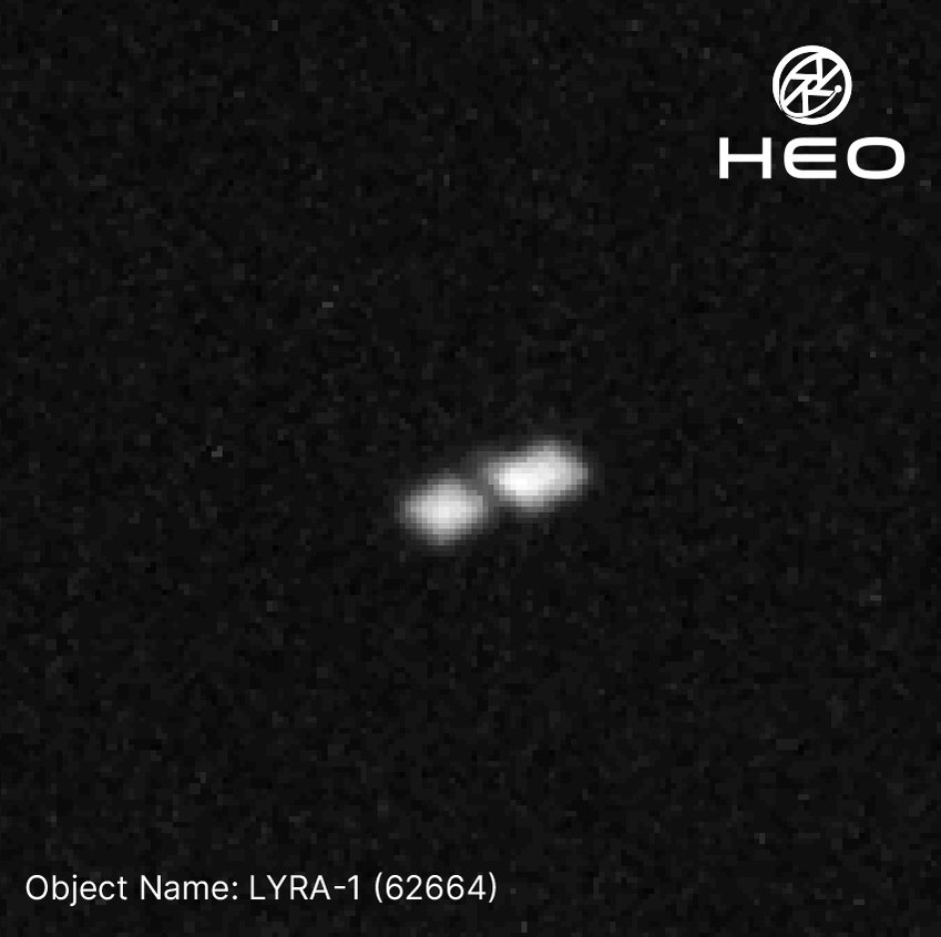
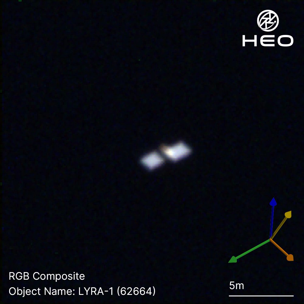
POV: HEO captures your satellite as it flies by.
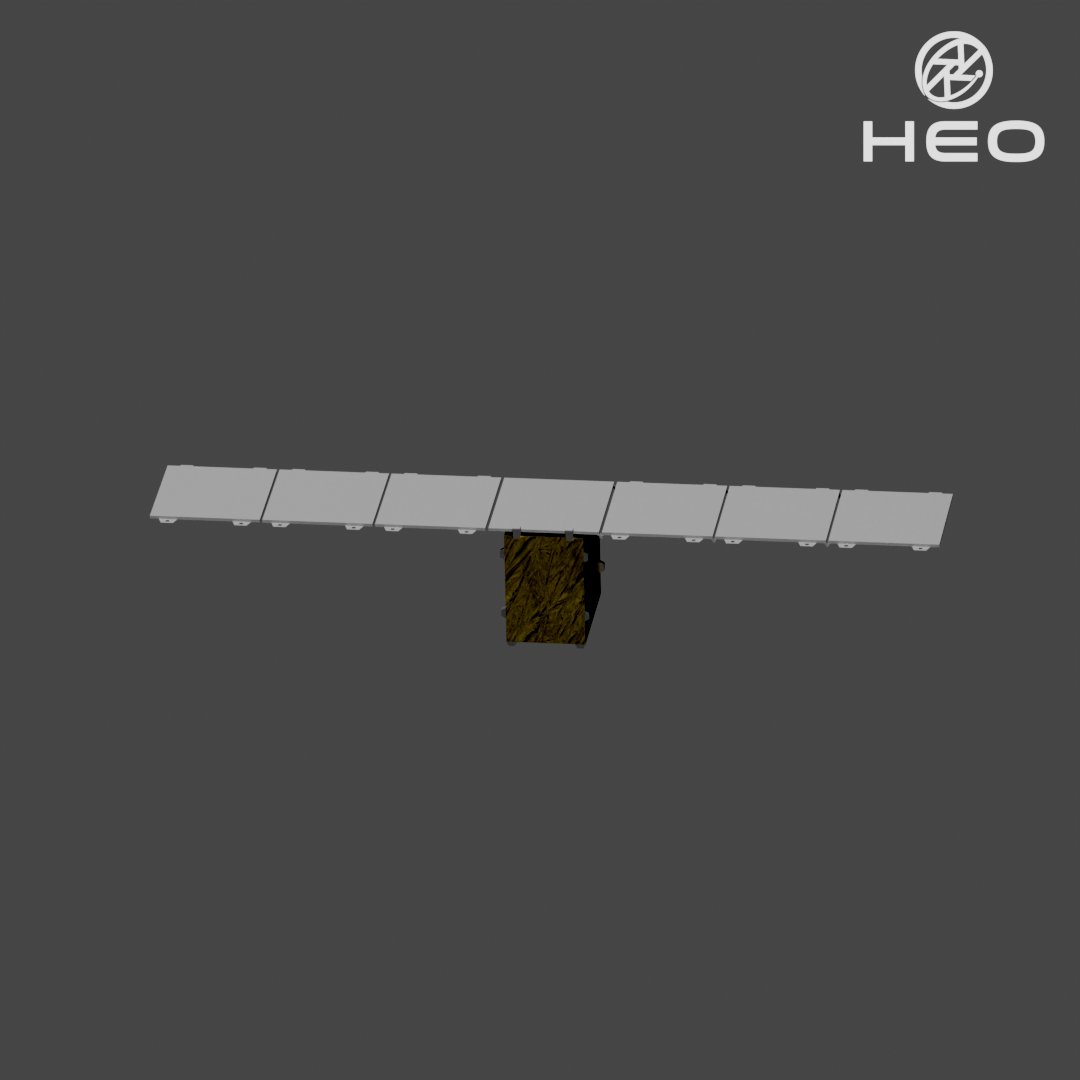
LYRA-1 is a 74 kg S-band IoT smallsat, launched January 2025 on a SpaceX Falcon 9 rideshare. Designed to deliver global IoT connectivity as part of a larger constellation, it's one of thousands of objects we're building a more complete picture of in orbit.
Captured at 12 cm/px, this imagery reveals its deployed solar panels and confirms attitude stability. We fuse in-orbit imagery with open-source information to construct accurate 3D models of objects in space, giving our customers a level of object characterisation that's never been possible from the ground.
1
21
127
6,207
Following reports of an in-orbit fragmentation event involving Starlink 34343, HEO tasked its sensor constellation to collect non-Earth imagery of the spacecraft.
The imagery below shows the main structure of the satellite is still intact but tumbling at a minimum of 16 degrees per second about its z-axis. At this resolution, we can only derive single-axis attitude estimation, so the true rotation rate is likely higher.
What makes this collection particularly significant is that we already held pre-fragmentation imagery of Starlink 34343 from two months ago in our catalogue, showing the satellite was stable and in an operating configuration. That historical baseline enables before-and-after comparison to support attribution while offering the context needed to begin assessing potential damage and root cause.
We will continue tasking our constellation against Starlink 34343, with higher-resolution collections planned for further analysis.
See below for body frame definition.
12
104
675
51,755

Starlink 34343 experienced a fragmentation event on March 29, 2026.
HEO collected imagery of this satellite on February 14, 2026, shown below. We are now tasking follow-up collections to image it from space, bringing visual awareness and understanding to the satellite's state as the situation develops.
LeoLabs initially detected and characterised this event.
14
92
772
65,459
Crossing 5,000 successful non-Earth imaging missions.
We define one mission as one successful observation of a spacecraft — whether it's captured in a single frame or hundreds.
From some of our earliest missions capturing the Chinese Space Station taking shape on orbit to today, we're proving commercial non-Earth imaging at scale.
Second photo of the Chinese Space Station taken with our partner @BlackSky_Inc.

2
20
145
7,424