
Online gallery offering authentic, rare and beautiful maps from the past. linktr.ee/IdeaRareMaps
Joined December 2009
- Tweets 1,006
- Following 622
- Followers 785
- Likes 635
684 Photos and videos


18 Jun 2025
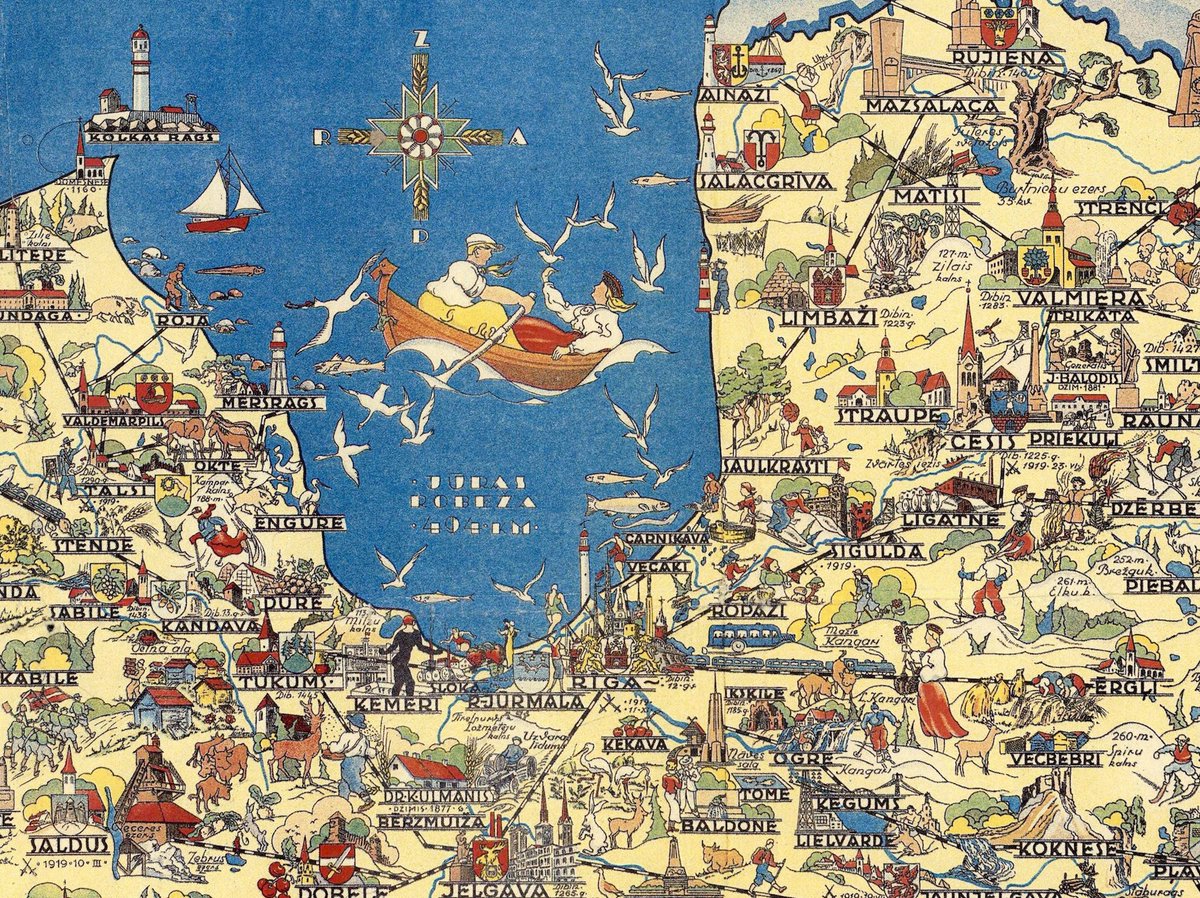
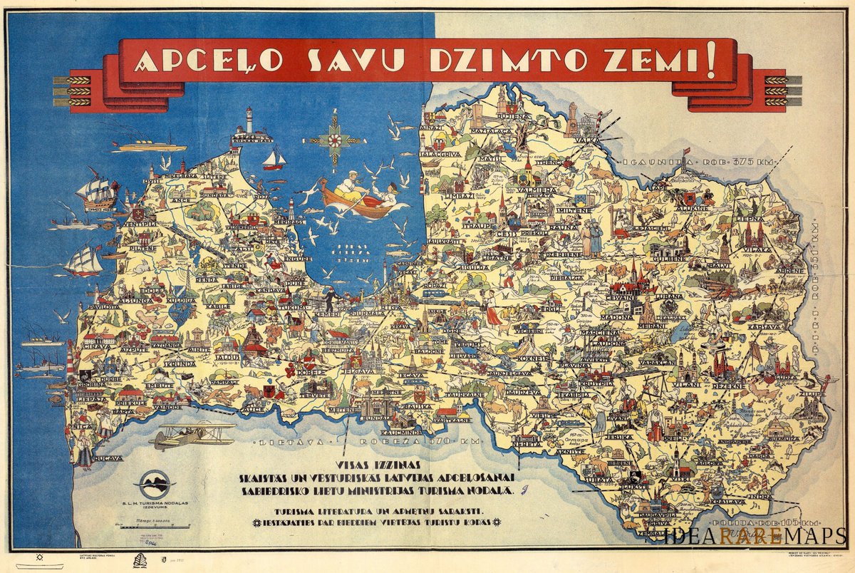
Lively pictorial map of Latvia, titled “Apcelo Savu Dzimto Zemi!” – or “Travel to Your Homeland!” printed in Riga in 1938 and commissioned by the Department of Tourism of the Ministry of Social Affairs to celebrate and encourage domestic tourism on the eve of World War II.
1
94
18 Jun 2025
Latvia's landscape is richly illustrated with folk, historical, and architectural elements. Place names, from major cities like Riga, Liepāja, and Daugavpils to smaller towns, are accompanied by images of castles, churches, peasants, artisans, monuments, nature, and costumes.
95
10 Apr 2025
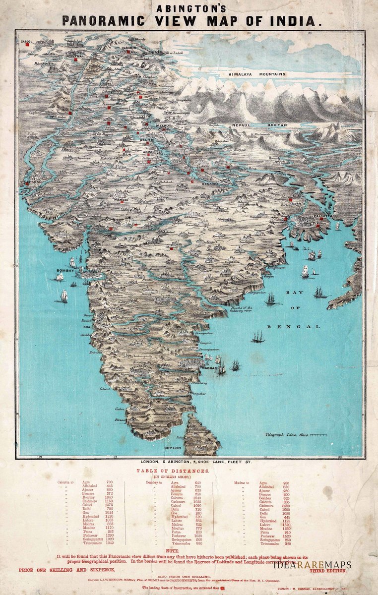
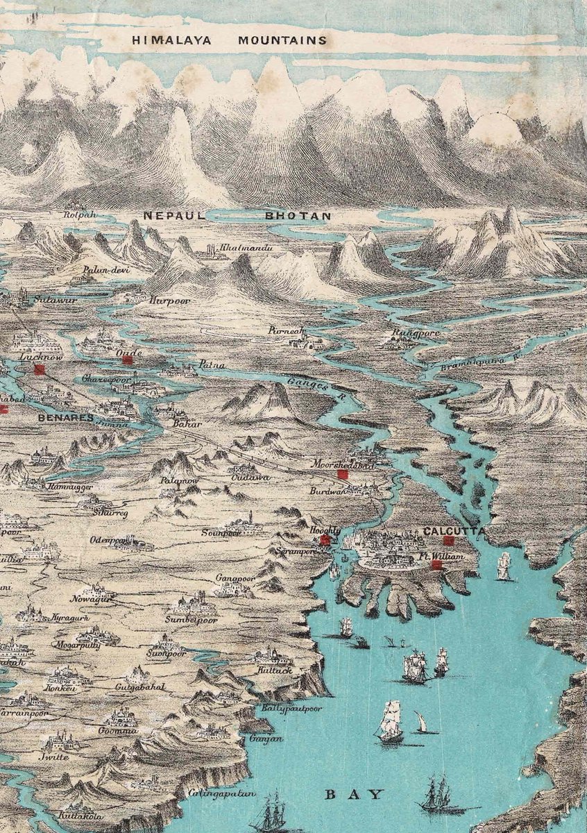
Abington's 1858 map of India presents a bird's-eye view, emphasizing regions and mountain ranges, especially the Himalayas with striking relief, creating a near three-dimensional effect. A table at the bottom lists distances between Calcutta, Bombay, Madras, and other key cities
84
3 Oct 2024
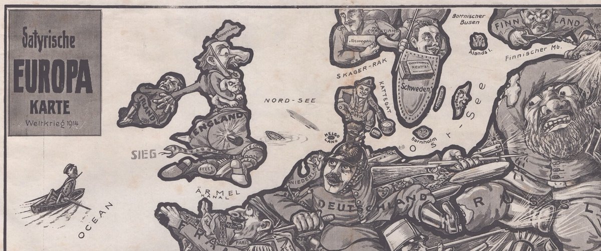
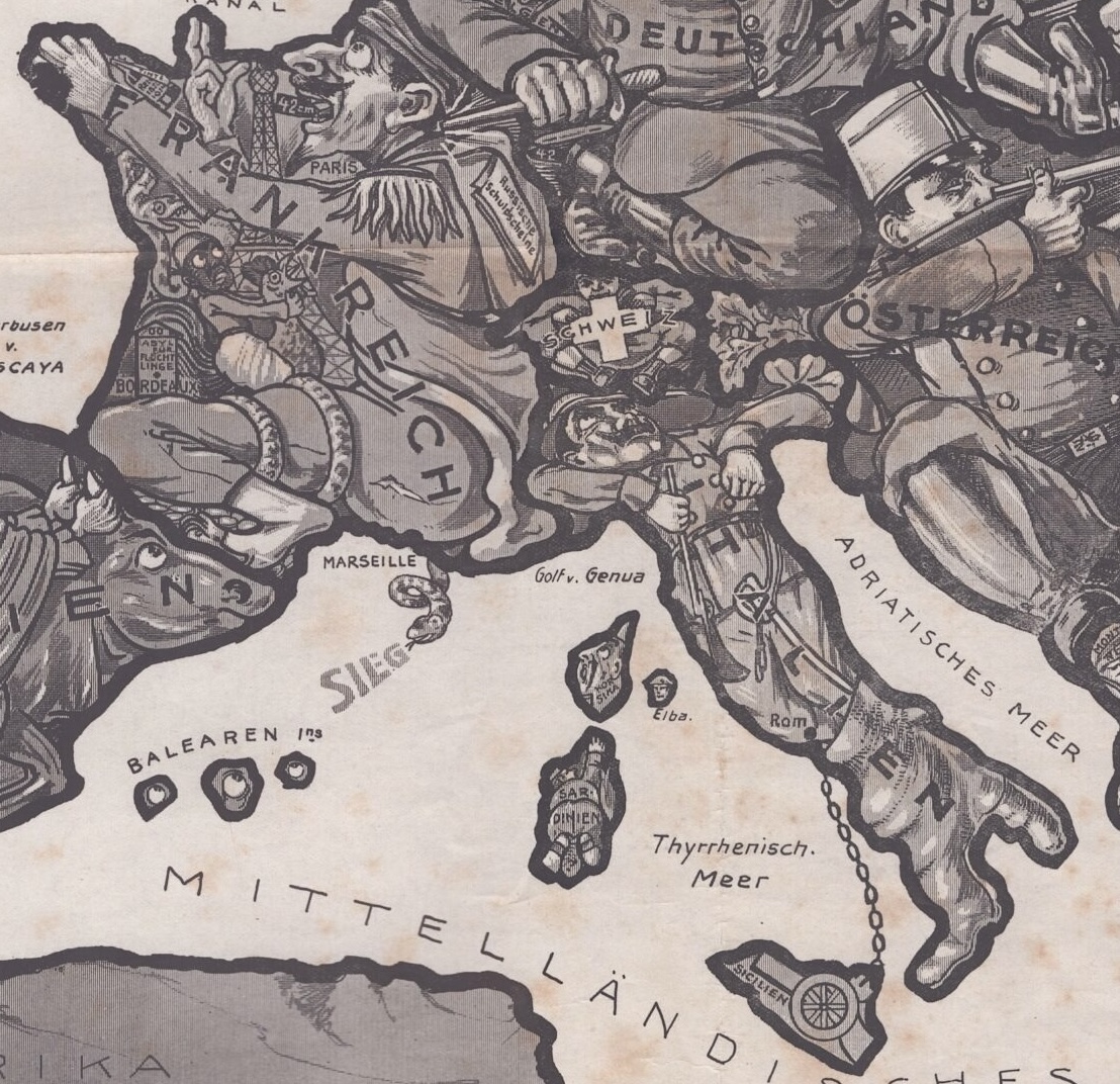
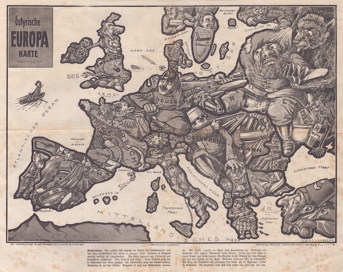
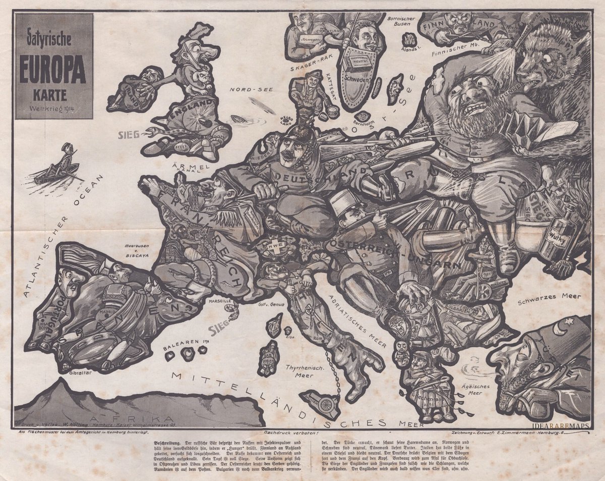
Rare German satirical map published just after the outbreak of the First World War. The nations of Europe are humorously caricatured through crude stereotypes and allegories.
1
1
3
233
3 Oct 2024
La Gran Bretagna sembra voltare le spalle all’Europa ma colpita nel posteriore da un grande proiettile tedesco viene intrappolata da un serpente che urla ‘vittoria’. Norvegia e Svezia sono mostrate come potenze neutrali protette da uno scudo con la celebre scatola di fiammiferi.
1
1
81
3 Oct 2024
La #Danimarca, anch’essa neutrale vende burro alla Germania. La #Finlandia, incatenata alla Russia, cerca di liberarsi tagliando la catena. I Paesi Bassi, nonostante tutto, riescono a dormire.
1
71
10 Sep 2024
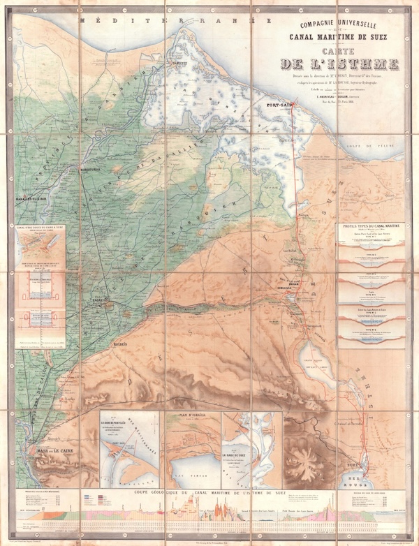
The rare 1866 first edition of the official map of the Suez Canal issued by its builder, the Compagnie Universelle du Canal Maritime de Suez.
A beautiful colourful work, it served as a powerful promotional piece celebrating one of history's greatest technical achievements.
1
160
7 Sep 2024
“Carta delle stazioni militari, navigazione e poste del Regno d’Italia … eseguita per ordine del ministro della guerra nel 1808”.

2
114
3 Sep 2024
"Novo at Accurato disegno della Lombardia"
la rarissima mappa disegnata dai cartografi Marco Antonio e Giovanni Battista Barateri, incisa su rame da Bernardino Bassano e pubblicata a Milano da Giovanni Battista Bonacina nel 1637.

ALT antica mappa lombardia
1
200
29 Aug 2024
A fantastic mechanized postcard displaying the breakup of Hungarian territory following the end of the #WW1. Operated by a central gear this movable #map of #Hungary shows the territories given to Austria, Yugoslavia, Romania, Czechoslovakia in the infamous 1919 Treaty of Trianon
2
7
17
3,545
28 Aug 2024
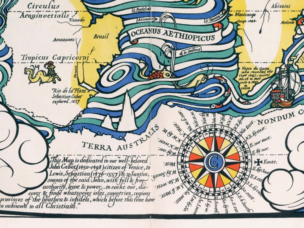
la mappa mondo così come era conosciuto al tempo (1517) dell’esploratore Giovanni Caboto. Disegnata nel 1924 da MacDonald Gill la carta è inserita nell'opera "Pageant of British Empire, Souvenir Volume… An Anthology of British Empire" di E.V. Lucas ⬇️

1
3
249
28 Aug 2024
Giovanni Caboto (Gaeta, 1450 c. – 1498 c.), è stato un esploratore italiano della repubblica di Venezia, al servizio di spagnoli e inglesi, noto per aver continuato l’opera di Colombo e inaugurando la serie di grandi viaggi verso il nord-ovest
1
1
107
28 Aug 2024
in particolare con il viaggio commissionato dal re Enrico VII d’Inghilterra in cui, il 24 giugno 1497, scoprì le coste del Nord America.

111