
678 Photos and videos


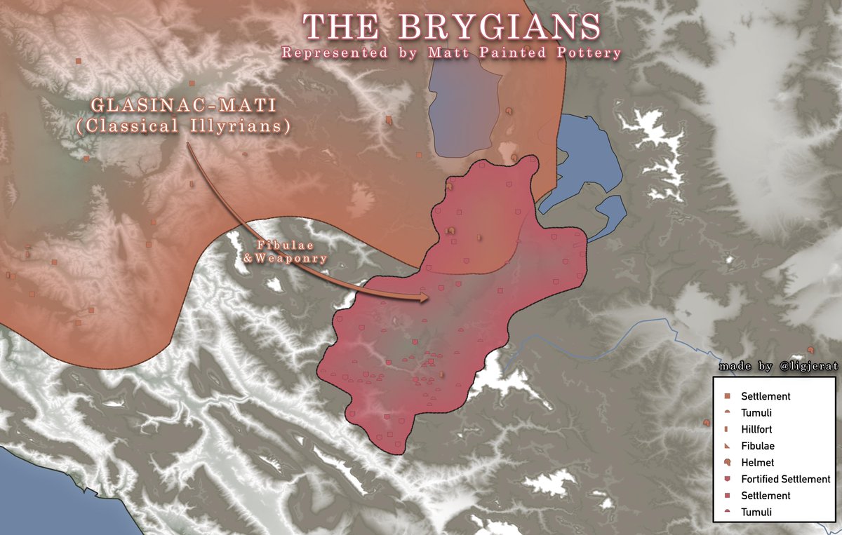

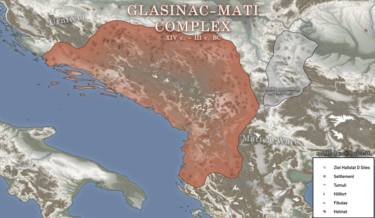
The Glasinac-Mati Complex (1300-200 B.C)
Discovered independetly by Yugoslav and Albanian archeologists, G-M is the coalesced form of the people known as Illyrians by Greeks in classical antiquity.
Zlot group was originally part of LBA Gava and later showed G-M similarities.
4
13
112
8,375

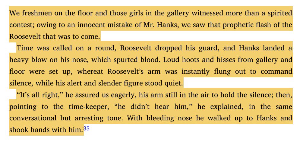
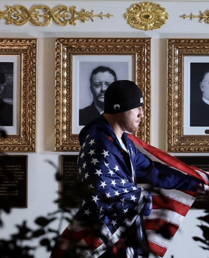
at the Harvard lightweight tournament, after the bell rang and Roosevelt’s opponent Hanks caught him in the nose anyway, the crowd went absolutely apeshit. Roosevelt threw up his arm to quiet them, said Hanks just hadn’t heard the bell, and shook his hand.
Roosevelt was such a brawler that when Hanks asked if they should stop, he shook his head “like a terrier,” bared his teeth, and started swinging again.


"I regard boxing, whether professional or amateur, as a first-class sport, and I do not regard it as brutalizing. . . . Powerful, vigorous men of strong animal development must have some way in which their animal spirits can find vent." —Teddy Roosevelt
1
2
9
231

One big problem regarding maps depicting human migrations is the assumed graduality and continuity. Authors depict the movements as slow, gradual, and constant, perhaps imagining people moving only a few kilometers each lifetime, in a gradual expansion that the people of the time likely barely even realised. In such an illustatration (left) it often looks like a blob that grows larger and larger in all directions with Geographic Continuity all the way. This is of course wrong, and not how humans migrated at all.
Investigating settlement archaeology and c14 dating, Its clear that Humans migrated in controlled, conscious bursts, reaching entirely new areas within a single generation. Entire tribes of families set out into consciously chosen basins, valley or plateaus, reaching them within a single lifetime and ignoring the less fertile land on the way. From thereon, they would gradually move out into the less immediatly attractive land, with different tribes breaking off and forming new exclaves as the population grew, repeating the process. These migrations were often massive and happened in the span of a few generations, such as is evident with the Corded Ware migration, which saw its people reach the Baltics, Poland, Denmark, Germany and parts of Russia in just a hundred years, and from thereon, its descendant, the Bell Beakers, reached Brittain, France, Iberia and Italy in a hundred years or even less again in a seperate burst.
(The maps below are illustrative and totally arent based on the Indo European migrations at all)

9
46
408
14,903
stefan retweeted

17h
The diffusion of the 3 core Albanian Y-chr lineages. Map result was created by subtracting the non E-V13, R-M269 and J-L283 subclades.
Credit to @AlbanianDNA for the Y-chr info
2
10
68
2,224
you just wouldn’t understand


Nietzsche railed against pity as weakness and then had a nervous breakdown and wept over seeing a horse be whipped in the street. There's never been a greater example of a man incapable of living by the ideology he preached
2
2
24
903
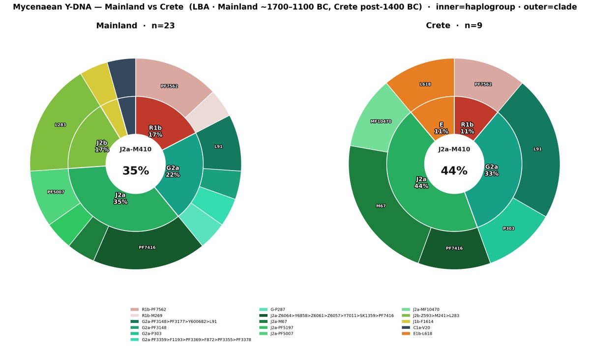
Y-DNA of Mycenaeans, divided into Mainland and Crete.

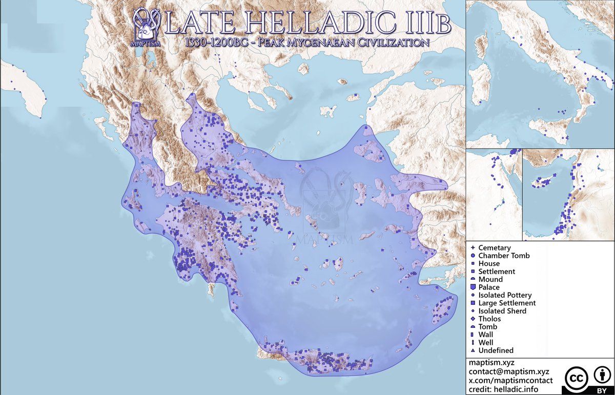
The Peak of Mycenaean Civilization:
The LHIIIb, starting in 1330bc, is when the Mycenaean Civilization reaches its Peak. Sites of this period are the most Numerous compared to the others, and the Territory of Mycenaean Civlization stretches the furthest, encompassing most of Epirus in addition.
This period of unprecedented Wealth and Power for Helladic Civilization precedes the Trojan War in ~1200bc, which would start at the very end of the LHIIIb, or on the Transition from LHIIIb to LHIIIc.
In later phases, Mycenaean Civilization is less prosperous and has less influence overall, as we will see in coming posts.
8
17
122
14,430


stefan retweeted
Jun 12
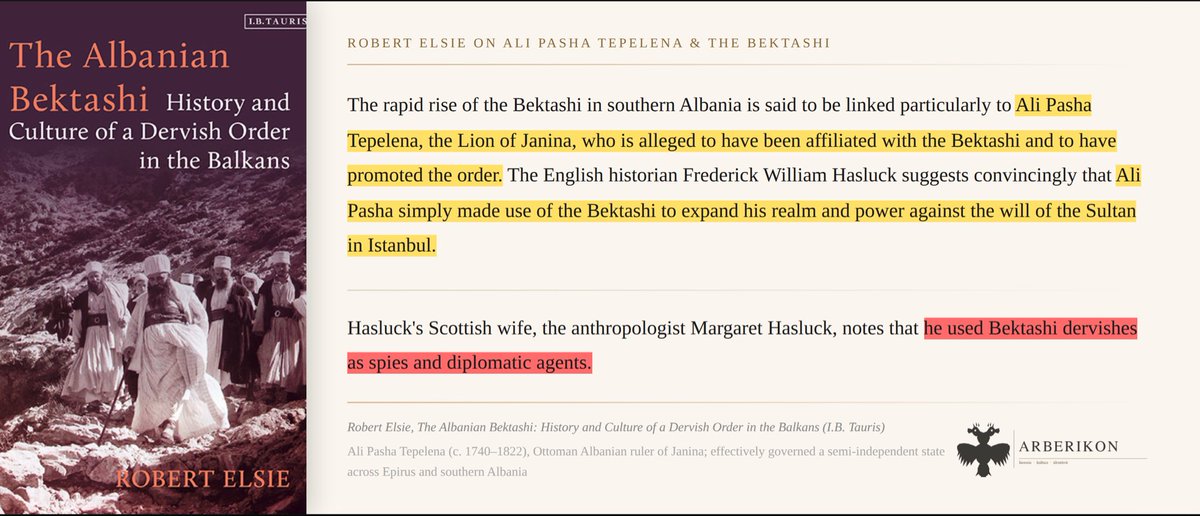
The Bektashi’s largest period of growth in Albania came under Ali Pasha Tepelena, who utilised the mystic order as spies and diplomats against the Porte.
Mar 19

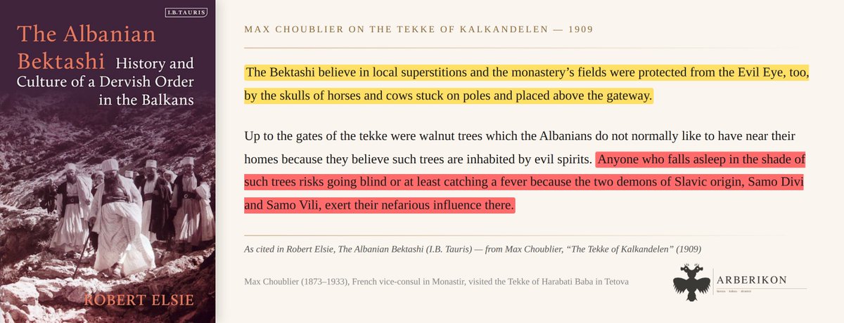
Albanian Bektashis openly believed in superstitions, guarding their tekke fields with horse and cow skulls mounted on poles.
They also believed that anyone who fell asleep beneath the walnut trees risked blindness or fever at the hands of two demons: Samo Divi and Samo Vili.
1
8
63
4,829
stefan retweeted
Jun 10
At the peak of the Summer Offensive in 1998, the KLA had cut major roads across Kosovo and controlled 40 percent of the territory.

11
49
1,883

stefan retweeted

Jun 9
This is also true autosomally. "EHG" from Samara, Karelia, Khvalynsk, etc are all related but have slightly different proportions of ANE, WHG, and CHG ancestry. WHG, on the other hand, are far more homogenous, with WHG in Wales and Germany being nearly the same 1/2

Not many ready that "EHG"s are not a homogenous population with consistent Y-DNA nor any defining material cultures and many carry I2a1 from Ahrensburgian derived mesolithic groups as well as Material culture from them
9
11
97
10,928
stefan retweeted

This app will make you sick of shitposters and ironyfags really fast, and give you a respect for excessively blunt autists who, if nothing else, are very earnest
1
1
3
301
stefan retweeted
Jun 8
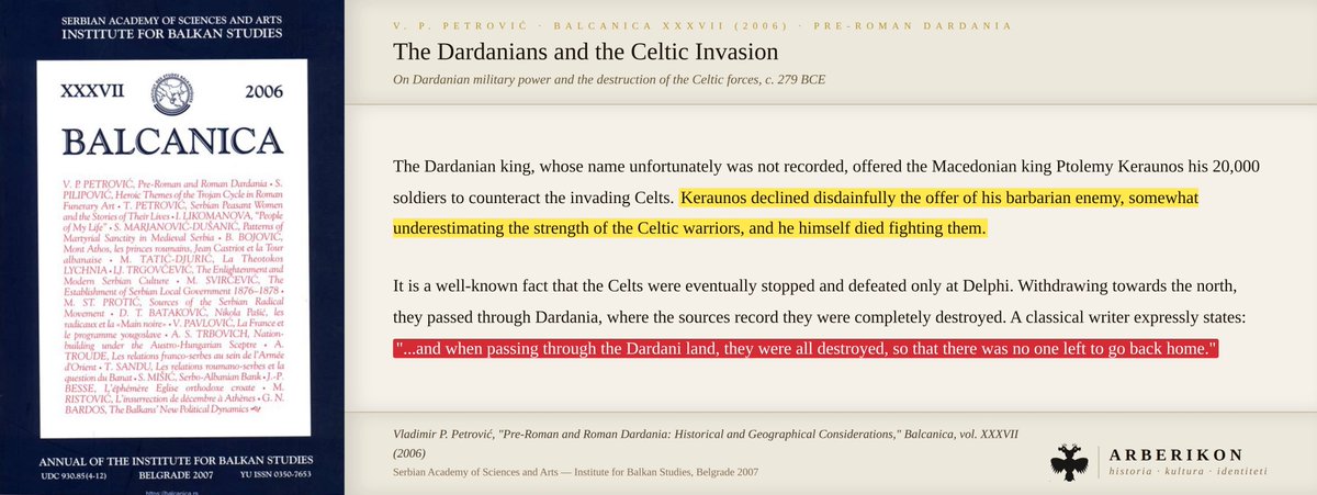
In 279 B.C. the Dardanian king offered Keraunos 20,000 soldiers before the Gauls clashed with the Macedonians. His naive rejection cost him his life and allowed the Gauls to plunder Greece before returning northward. They were all destroyed by the Dardanians and not one returned.
2
9
56
2,008

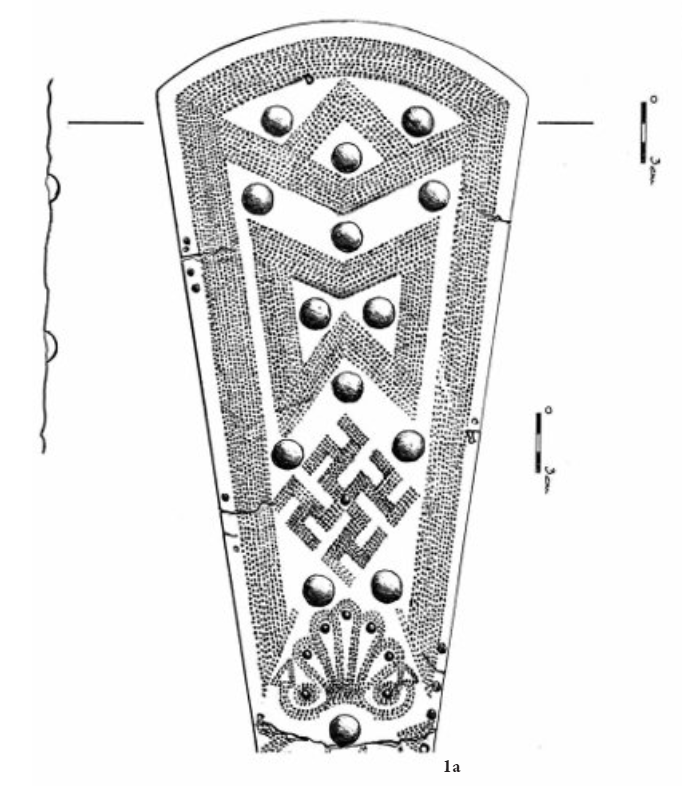
The spread of Mramorac belts and their origins.
Whilst originally thought to be a possibly Triballian invention, later older finds amongst Glasinac and North Albania which developed belt types independently from each other it became clear its origins are within Glasinac-Mat- 1/n
3
9
67
6,278
is roughly between the 7th and 4th centuries B.C, with later variants found as late as 50 B.C. Most archeologists argue the belt design would've developed amongst the Autariatae, and later become popularized amongst other Illyrians, as well as Triballi, Scordisci and Dacians. 3/n
1
1
23
896

stefan retweeted

Jun 5
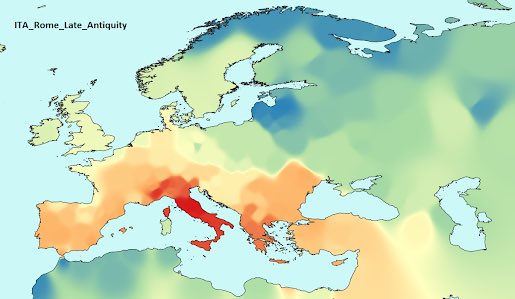
Genetics circles are kind of funny because you often find people blaming the Fall of Rome and the state of Modern Italy on Italians becoming less like Spaniards
Which is ironic given the typical opinion these people have on Spaniards


9
8
116
41,619
stefan retweeted
Jun 5
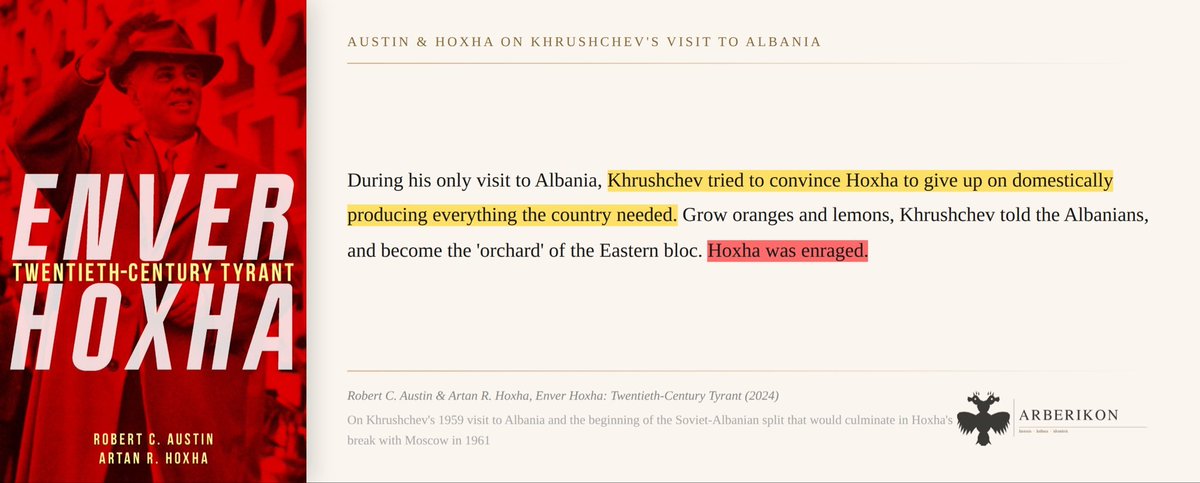
One of the biggest reasons for Hoxha’s break with the USSR was Khrushchev’s insistence that Albania abandon its programme of industrialisation and instead focus primarily on agriculture, supplying food to the rest of the Eastern Bloc.
1
9
60
2,140
stefan retweeted
Jun 3
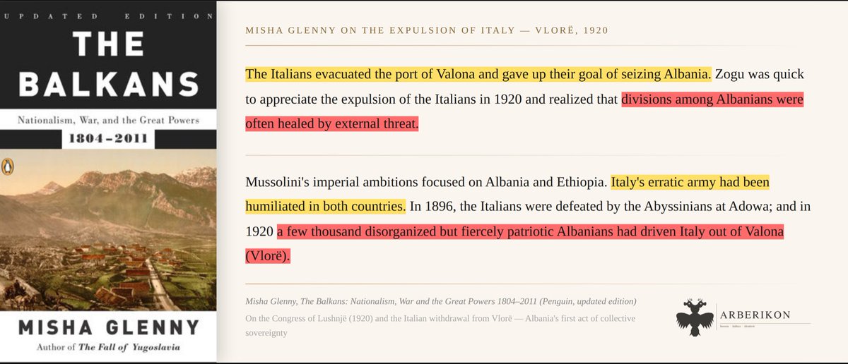
Misha Glenny notes that Mussolini’s imperial ambitions were partly driven by humiliation. Italy’s army had been beaten in Ethiopia in 1896 and driven out of Vlorë in 1920 by, in his words, “a few thousand disorganized but fiercely patriotic Albanians.”
1
10
34
1,330