
Beautiful, accurate, and easy to use camping maps for Algonquin, Killarney, French River, Kawartha Highlands & Massasauga.
Joined December 2016
- Tweets 43
- Following 0
- Followers 198
- Likes 61
8 Photos and videos

7 Dec 2023
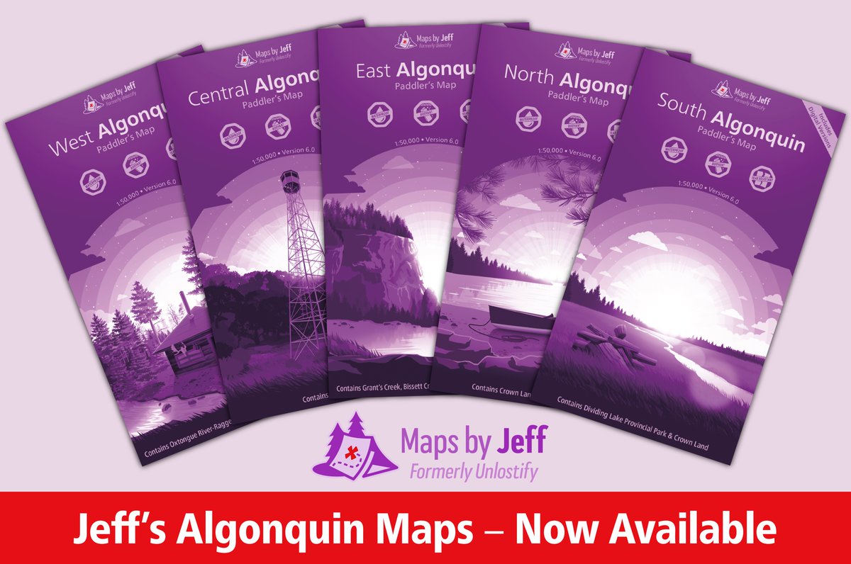
My new Algonquin maps are finally here!!! 😀😬😁
→ mapsbyjeff.com ←
It’s been 5 years in the making and is, by far, the biggest update I’ve ever done.
You can check them out to your hearts content, for free, on my website!
2
2
13
510
29 Nov 2023
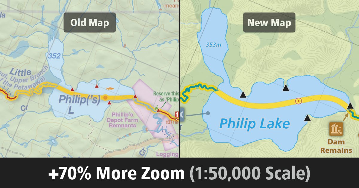
When you see my new Algonquin maps, the first thing you’ll notice is that everything is *way* bigger than on the old ones. 70% bigger in fact. 🔎
What’s my trick?
Simple. Before, I had 4 single sided map sections. Now, I have 5 double sided ones.
I can’t wait to show you!
1
1
7
292
28 Nov 2023
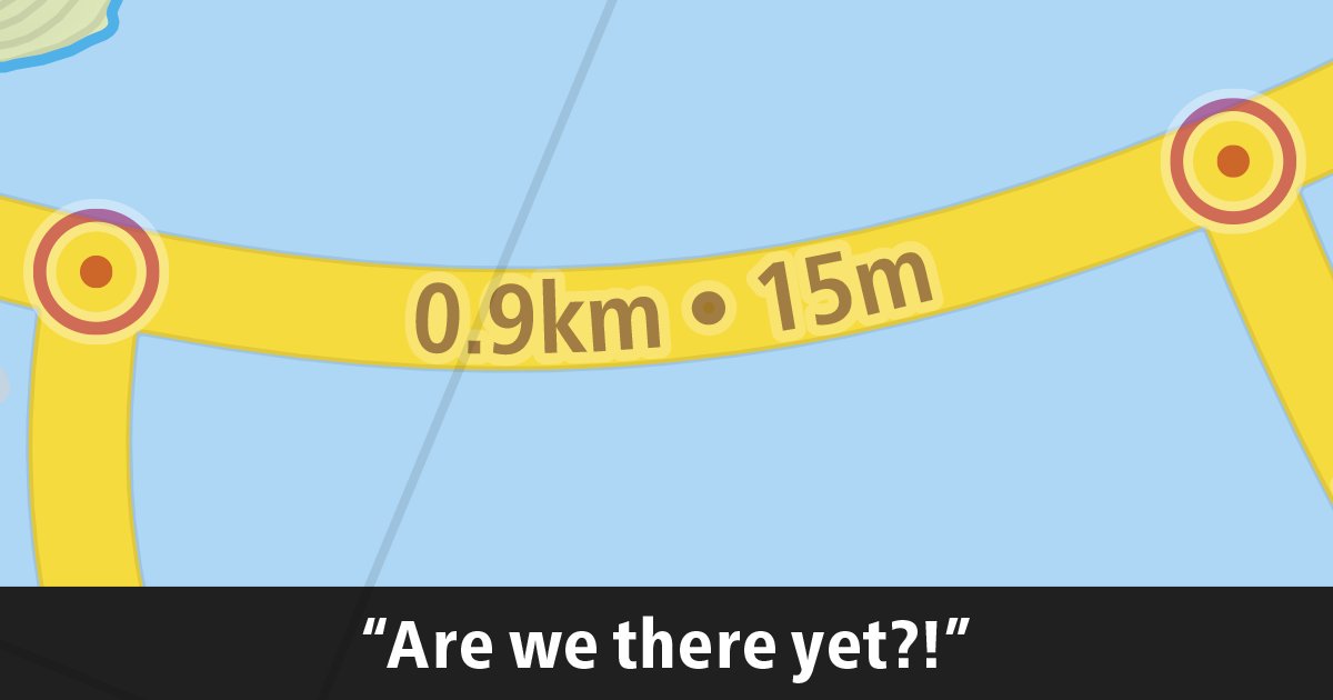
Estimated Travel Times.
If you've used one of my maps before, you're probably familiar with them.
But even though the work *exactly* like the did on the previous version of my map, under the hood they've gotten major improvements!
Intrigued? Check out: mbyj.ca/fb/DistanceTimeGuide…
5
253
27 Nov 2023
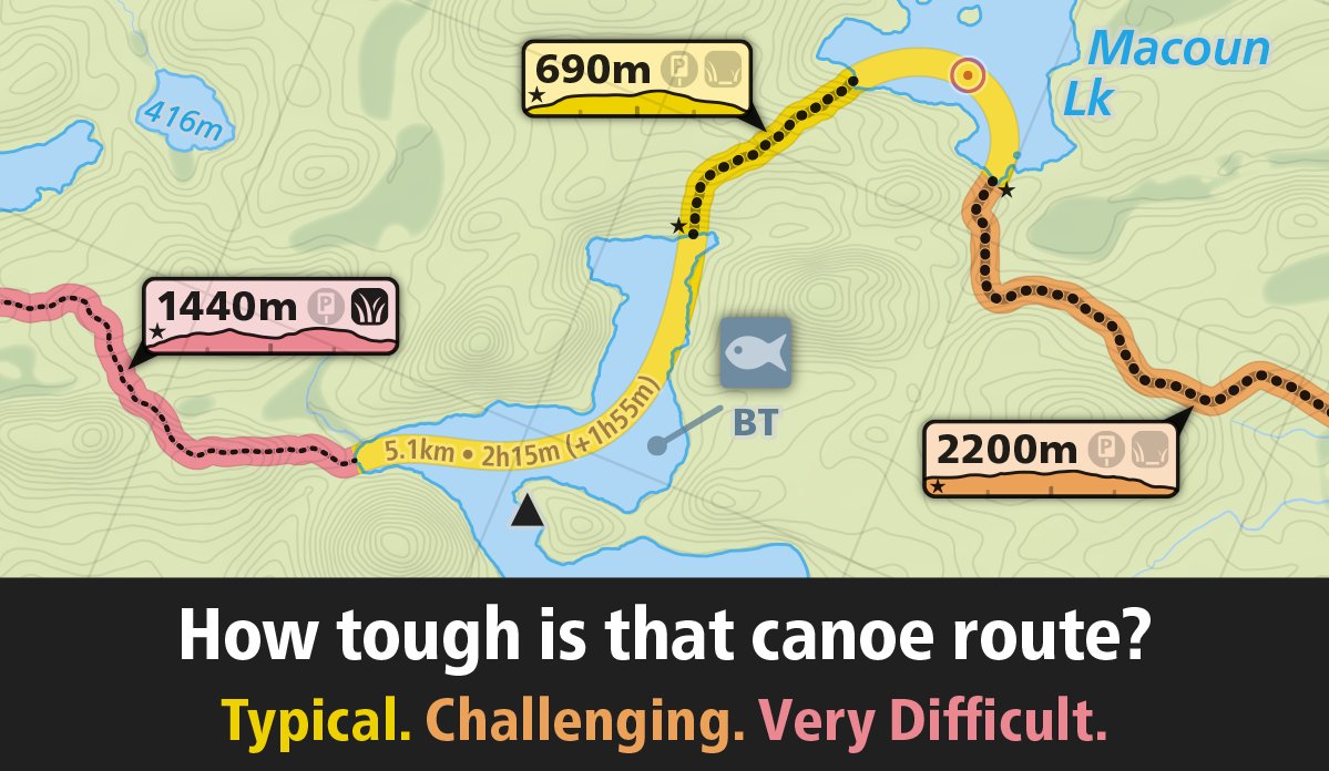
💛 Yellow → Typical Route 😃
🔥Orange → Challenging Route😳
🚨 Red → Very Difficult Route 👹
My new Algonquin map will feature colour-coded route difficulties, making it a breeze to find the easier/harder spots at a glance.
Intrigued? Learn more at: mbyj.ca/fb/DifficultyGuide.p…
1
6
254
24 Nov 2023
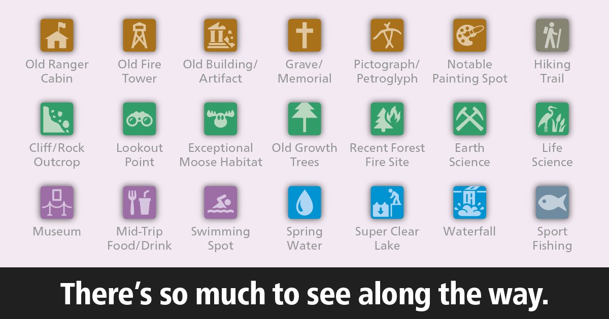
My favourite part of a canoe trip is all the little adventures along the way
It's so fun exploring old ruins – and nothing beats ice cold spring water on a hot August day!🚰
With more than 1800 points of interest, my new Algonquin map is a *huge* upgrade from the previous version
1
5
227
23 Nov 2023
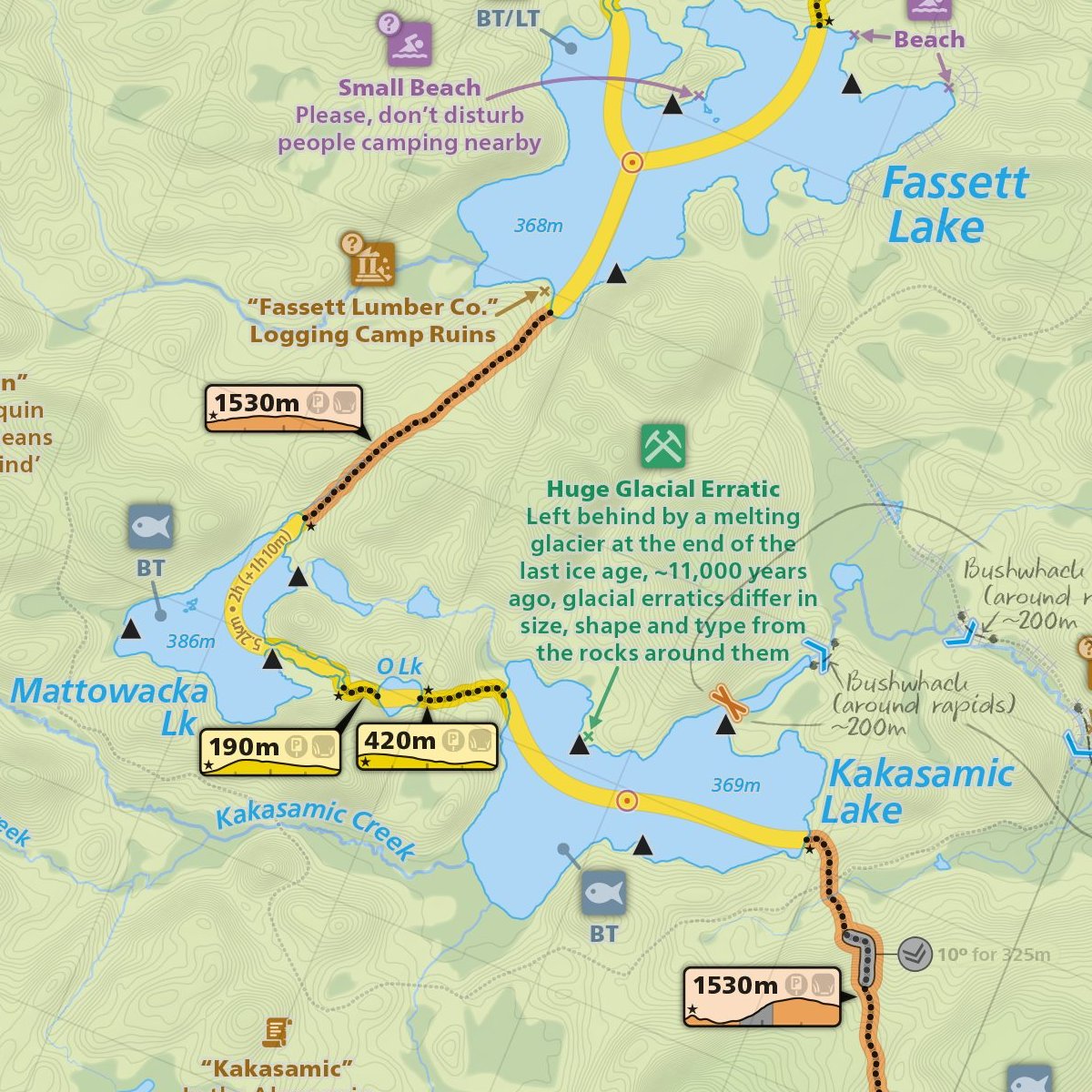
I think it's time to share a small snippet from the upcoming Algonquin map 📷
See how many features you can pick out!
But stay tuned – there's still a ton of cool stuff that you haven't seen yet😀
2
1
8
365
22 Nov 2023
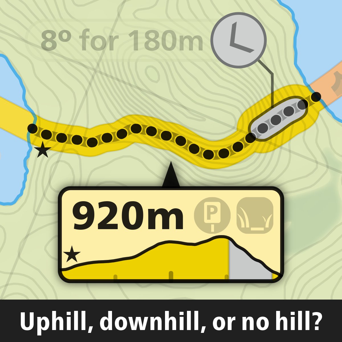
🚣♂️ Let’s talk Algonquin map features! 🗺️
The new map is fully loaded – with both your old favourites and a ton new ones too!
My personal favourite new feature? Portage Elevation Profiles
Intrigued? Check out this sneak peak of the Portage Hills Guide: mbyj.ca/fb/PortageHillsGuide…
1
1
15
697
21 Nov 2023
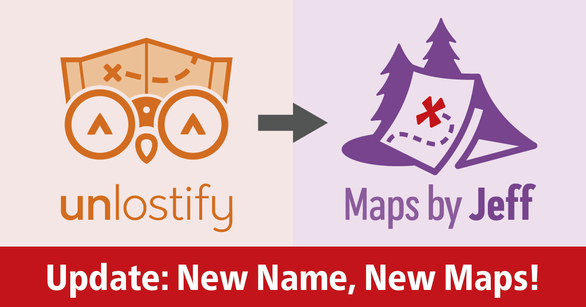
Jeff here 👋. I’ve got news!
1) First, the sad news – Deki has moved on from Unlostify. I hope you’ll join me in wishing him well.
2) Now that I’m returning to my roots and making maps on my own again, I think it’s time for a name change! Unlostify is becoming ‘Maps by Jeff’ 😃
2
2
22
692
Maps by Jeff retweeted

2 May 2018
Unlostify is a new mapping project that strives for user-friendly features and 'relentlessly accurate' guides to Canoe Country. canoekayak.com/canoe/lost-an…
1
7
Maps by Jeff retweeted

8 Apr 2018
Looking forward to trying @Unlostify's maps this canoe camping season, from Jeff and David's new company - they've got some really cool new features!: unlostify.com
3
2
9
Maps by Jeff retweeted

14 Mar 2018
A6. I spend at least as much time looking at maps as I do other reading materials. My favourite map is anything @cloudj is working on. HIs maps are incredible. (Check out @unlostify to see what he’s up to now) #WeGetOutside
1
2
6
9 Nov 2017
I’ve been working on a set of four, new camping maps for Killarney, French River, Kawartha Highlands, and Massasauga.
Check them out for free at Unlostify.com!
2
7