Severe/fire weather enthusiast. Meteorology student at SCSU.
- Tweets 6,792
- Following 295
- Followers 1,151
- Likes 16,955


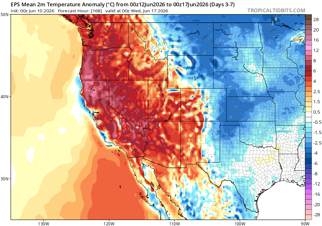
ALT Surface temperature anomaly map showing predicted pattern in about 1 week from present (using data from the ECMWF ensemble). It shows a broad region of much above average temperatures across most of the U.S. West coast and points inland.
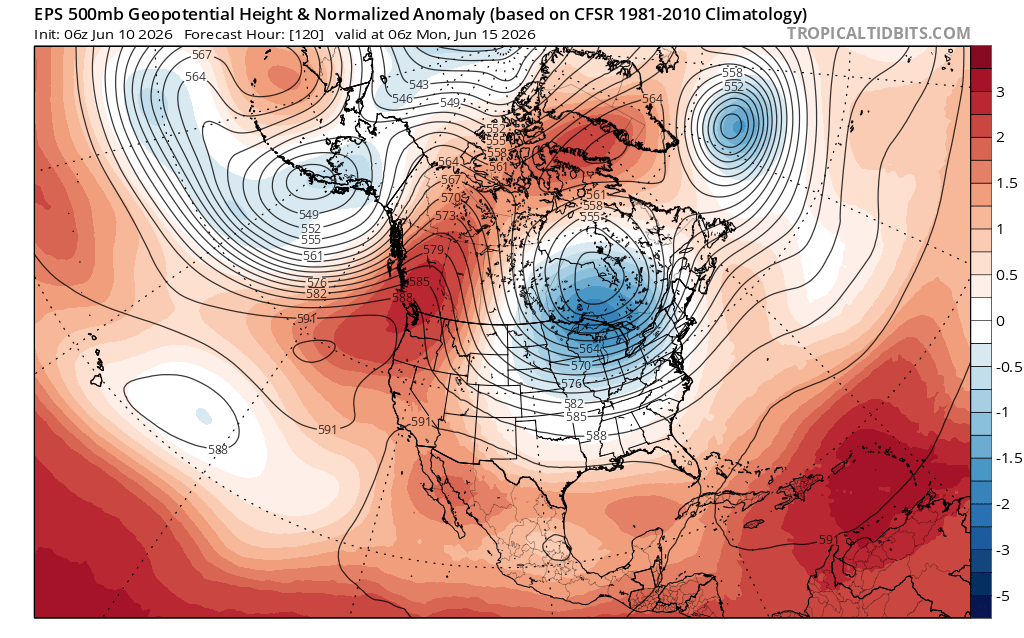
ALT 500mb GPH anomaly map showing predicted pattern in about 1 week from present (using data from the ECMWF ensemble). It shows a large, broad, and persistent ridge centered in the Pacific Northwest.

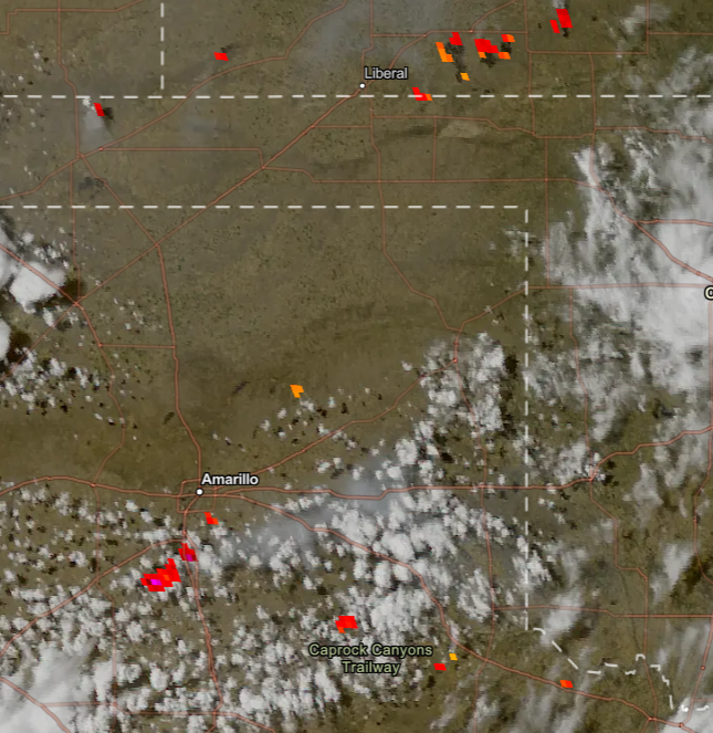
ALT Multi-panel map snapshot from NWS Storm Prediction Center highlighting widespread regions of elevated or critical fire weather conditions across the interior West (but NOT the West Coast) each day for at least the next 6 days.


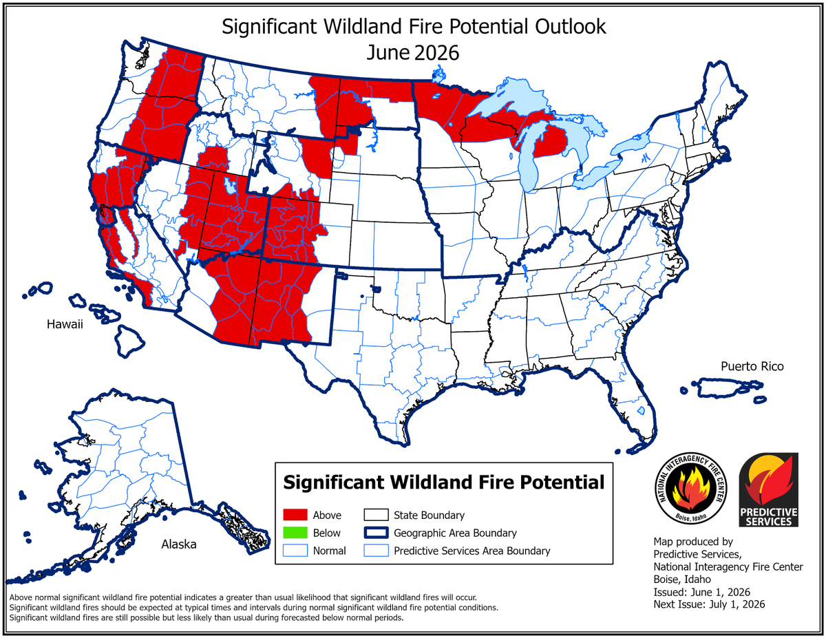
ALT Map of the United States showing areas in red depicting those areas as above normal for significant wildland fire potential. This map is for June 2026.
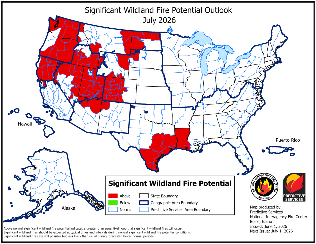
ALT Map of the United States showing areas in red depicting those areas as above normal for significant wildland fire potential. This map is for July 2026.
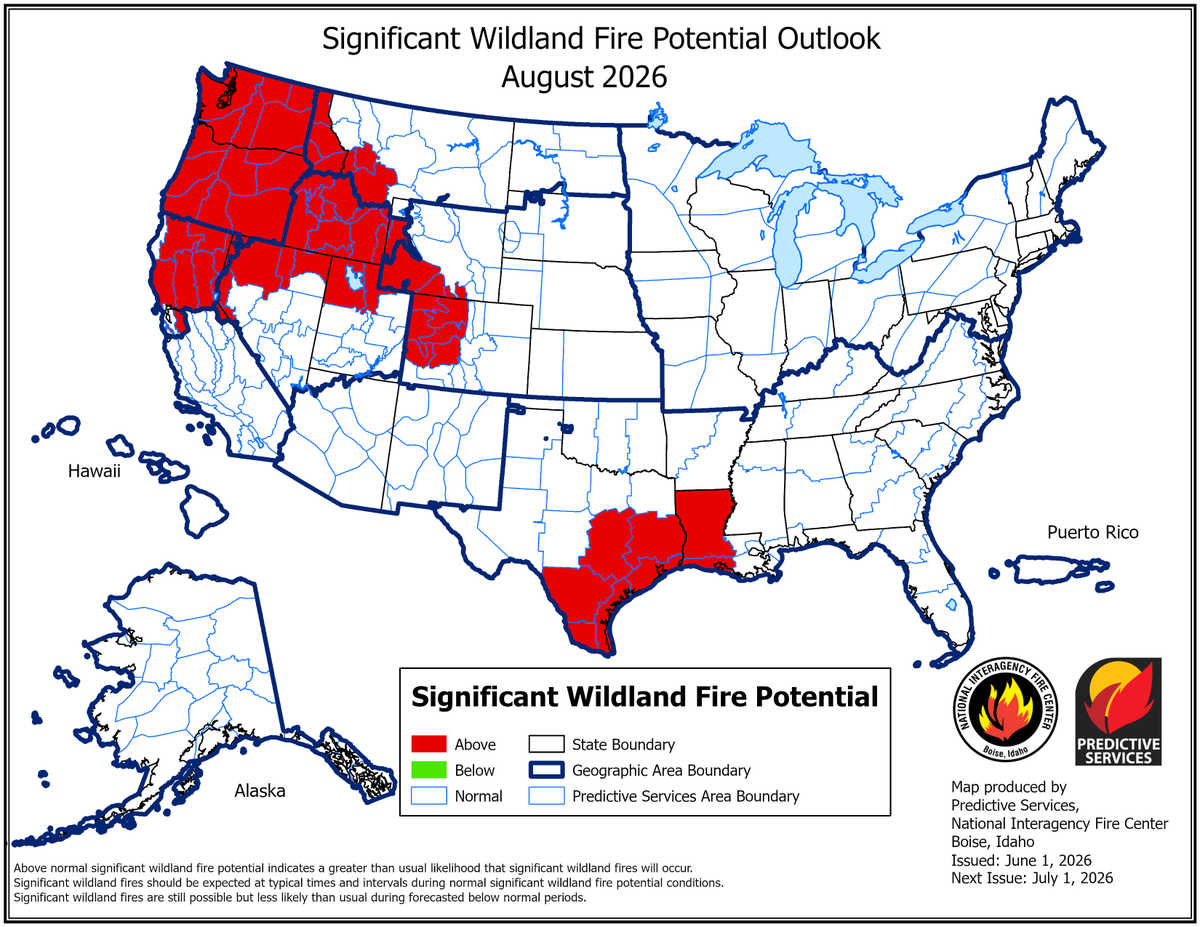
ALT Map of the United States showing areas in red depicting those areas as above normal for significant wildland fire potential. This map is for August 2026.
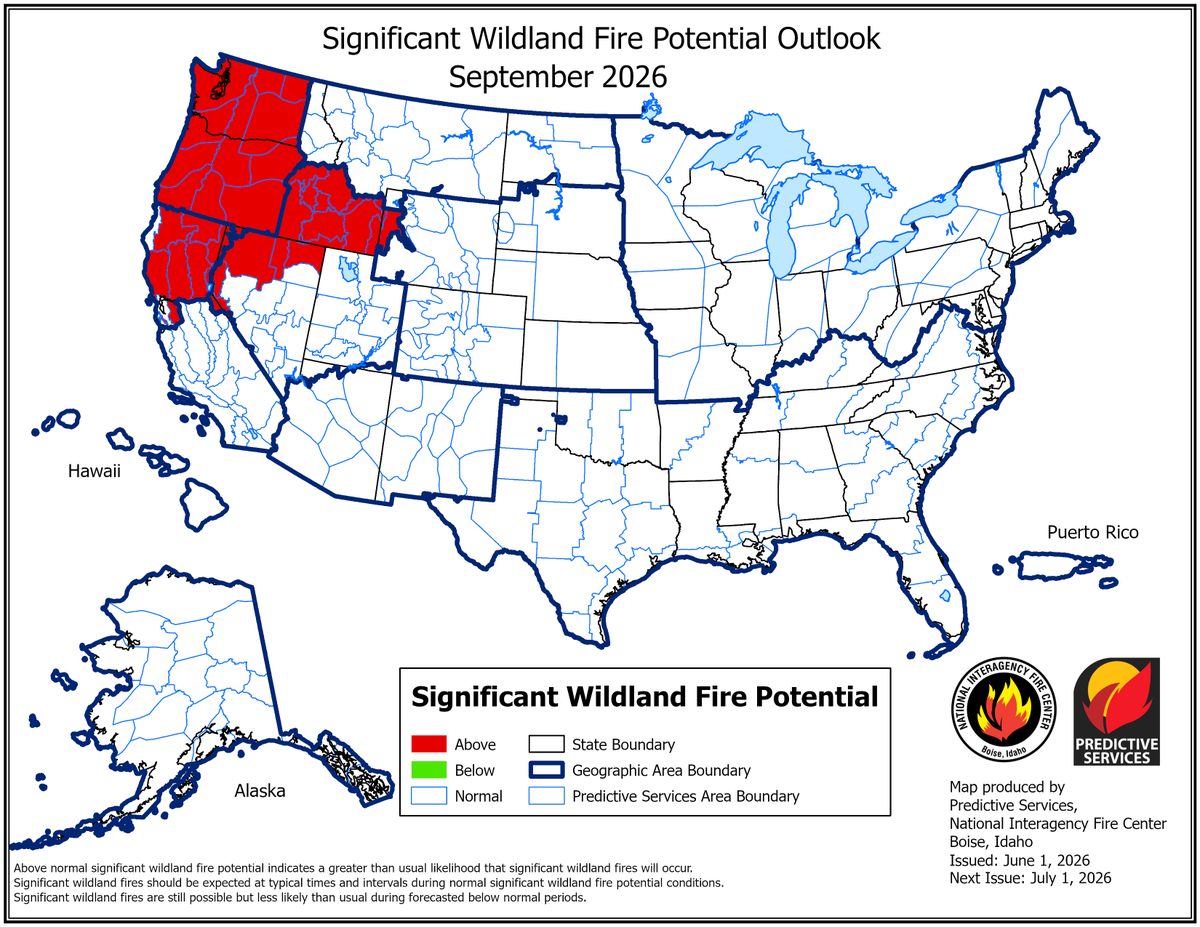
ALT Map of the United States showing areas in red depicting those areas as above normal for significant wildland fire potential. This map is for September 2026.