Have you customized your DriveNC.gov experience yet? Personalize routes, set up alerts, favorite cameras and more.
Also on #NCDOTNow:
- Safety messages target 100 Deadliest Days
- Multi-state collaboration promotes safe travels coast-to-coast
youtu.be/RZmd2GbdAPc
James Flowers from NCDOT dropped a fun fact: Division 6 maintains almost 19,000 signs in Cumberland County. Across the Division? We’re talking 64,000 signs—stack them up, and you’d build a tower 3X taller than the Cape Hatteras Lighthouse!
Then & Now: Take a look at how NC's Scenic Byways have changed over time, all while continuing to connect travelers to our state's unique landscapes.
#America250@America250NC
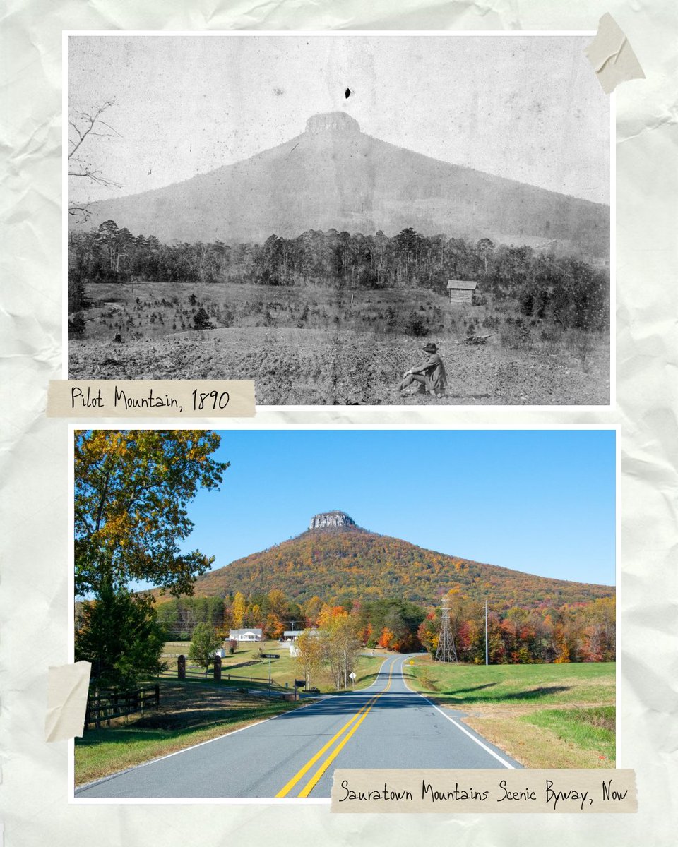
ALT Two images of Pilot Mountain. The top image is a black and white photo labeled 'Pilot Mountain, 1890,' showing the mountain from a distance with trees and open land, a farmer sits in a field. The bottom image is a modern color photo labeled 'Sauratown Mountains Scenic Byway, Now,' depicting a road leading towards a colorful, tree-covered Pilot Mountain in autumn.
ALT Image showing two photographs of Lake Mattamuskeet Lodge.
Top photo: A black-and-white image from 1940 depicts Lake Mattamuskeet Lodge and its distinctive vertical structure, set against a clear sky.
Bottom photo: A recent color image shows the same Lake Mattamuskeet Lodge surrounded by trees, with a reflection in the water below.
Bairds Creek Road bridge over Upper Laurel Fork Creek in Watauga Co. is one of 261 bridges Hurricane Helene damaged over 8 counties in northwest NC.
Temporary repairs reopened the road, but crews are now replacing the bridge to be more structurally flood resilient.
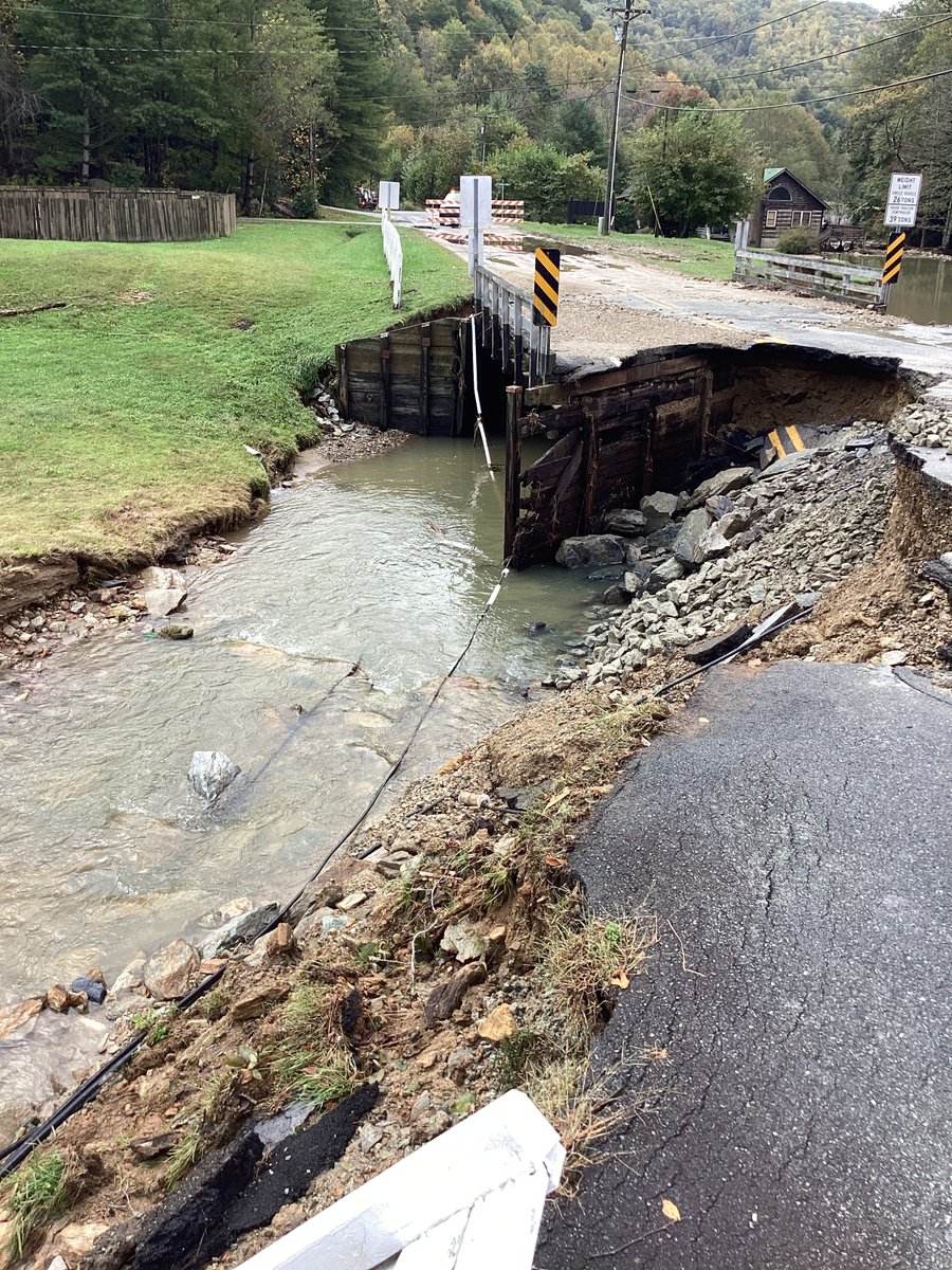
ALT A damaged road with a section collapsed into a flowing stream below. Traffic signs and barriers are placed around the damaged area for safety. Trees and a small building are visible in the background.
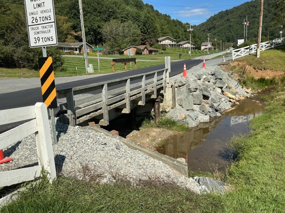
ALT A small bridge with a load limit sign crosses a narrow creek alongside a rural road. Traffic cones and large rocks are near the bridge. In the background, there's a grassy area with houses and a forested hillside.
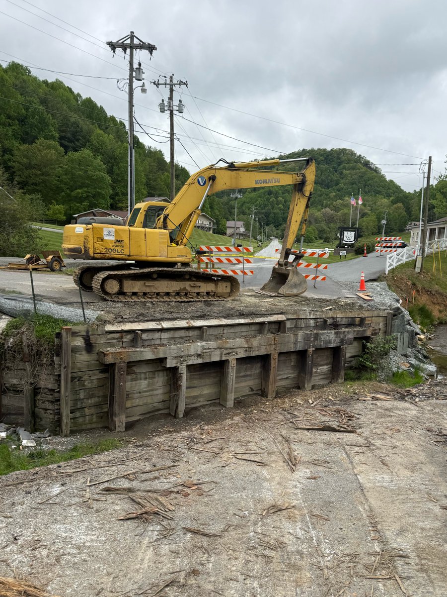
ALT A yellow excavator is parked on a partially collapsed bridge, surrounded by orange and white road barriers. There are orange traffic cones nearby. In the background, utility poles and green, tree-covered hills are visible under a cloudy sky.
Speeding. Driving distracted.
The unthinkable can happen instantly.
Summer months are statistically the most dangerous on the roads - particularly for younger drivers.
#100DeadliestDays
Hurricane season is here and we will not be caught off guard.
The NCDOT Division of Aviation hosted 2 days of hurricane response training in Sanford. Training events play a vital role in ensuring our teams are ready to safely and efficiently support communities across the state.
What you carry affects everyone on the road. The NCDOT Safety Patrol, sponsored by @GEICO, works every day to clear debris that can cause crashes.
#SecureYourLoad
ALT A roadside scene shows a vehicle displaying an electronic sign that reads "MOVE OVER." This vehicle is parked on the shoulder of a highway near Exit 3 for Highway 19. A person stands near the vehicle, which is a Ford truck. Traffic flows on the highway, with trees and distant hills in the background.
The period between Memorial Day and Labor Day represent the 100 Deadliest Days on North Carolina roads.
Make the right call, don't drink and drive. #100deadliestdays
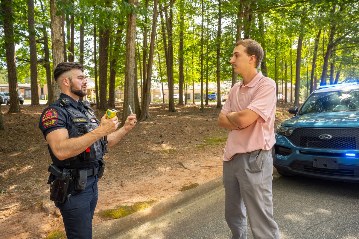
ALT A police officer is standing and talking to an individual near a Ford police vehicle with emergency lights on, in a wooded area. The officer is holding a breathalyzer and speaking to the person, who is standing with arms crossed.
NCDMV launches a new in-office document upload tool that allows customers to send proof of insurance, teen driver logs and more.
Also on #NCDOTNow:
- Traffic Safety Conference in Winston-Salem
- Original builder of I-40 in WNC reflects on construction
youtu.be/54B-BATJ470
For generations, the I-40 corridor through the Pigeon River Gorge has brought people together and opened the doors to western NC.
Rebuilding after Hurricane Helene, crews are carrying on the work started by people like David Noland in the 1960s
📸 NCDOT recently gave journalists a behind-the-scenes look at the historic I-40 reconstruction effort in the Pigeon River Gorge.
👷 Crews have completed the first section of a massive roller-compacted concrete (RCC) retaining wall system that will support the future roadway.
History is hanging high at NCDOT!
Today we are celebrating a fresh new look for #America250 with banners outside our downtown Raleigh office to commemorate the event.
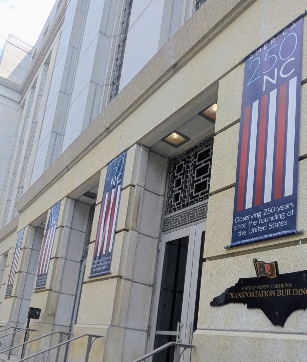
ALT Exterior of the State of North Carolina Transportation Building with banners reading "America 250 NC," noting 250 years since the founding of the United States. The building is constructed from stone and features a decorative entrance.
DYK: Our wildflowers bloom thanks to personalized license plates!
Personalized license plate sales are the primary source of funding for the Wildflower Program.
Explore all 200 designs on the NCDMV website.
#wildflowerwednesday
Traffic around @LenovoCenter will see Hurricanes-type conditions tonight for the @Canes in their @StanleyCup opener against Vegas.
🏒 DriveNC.gov can help you with route planning.
🏒 Sober drivers automatically win
Heavy equipment. Light work.
At this year's State Roadeo, the best of the best at NCDOT showed off their skills and reinforced the importance of safety awareness.
Three-time backhoe champion Dustin Johnson has perspective on the event.
New DriveNC website and app are now live! Download, customize and use to your traveling advantage.
Plus:
- Asheville Intercity Bus crosses 10K riders since relaunch post-Helene
- State ROADEO competition pits the best equipment operators
#NCDOTNowyoutu.be/Q5_lSVNTkaQ
Have you downloaded the *new* DriveNC app yet?
Know your commute conditions before you leave the house.
Download 👇
📱 Apple Store: apple.co/4nVVMsU
📱 Google Play: bit.ly/4nVUAWt