
Jeff Lutz's weather X account for the blog Ministry & Meteorology? I'm a retired NWS meteorologist. I worked at NWS Jackson, KY; Gaylord, MI; Corpus Christi.
Joined June 2013
- Tweets 39,094
- Following 386
- Followers 159
- Likes 551
16,387 Photos and videos


CORPUS CHRISTI Jun 16 Climate: High: 83 Low: 75 Precip: 0.82" Snow: 0.0" Snow Depth: 0" mesonet.agron.iastate.edu/p.…
1
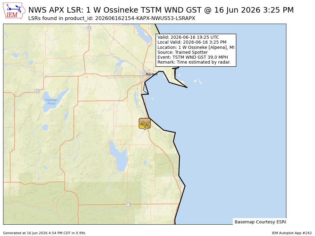
At 8:28 PM EDT, Alba [Antrim Co, MI] Public reports Hail of mothball size (M0.50 Inch). Hail completely covers the ground. #miwx mesonet.agron.iastate.edu/ls…
12
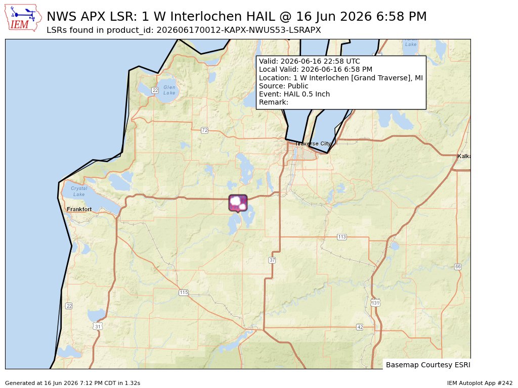
At 6:58 PM EDT, 1 W Interlochen [Grand Traverse Co, MI] Public reports Hail of mothball size (M0.50 Inch) #miwx mesonet.agron.iastate.edu/ls…
25
#APX issues Area Forecast Discussion (AFD) at Jun 16, 8:07 PM EDT mesonet.agron.iastate.edu/p.…
5
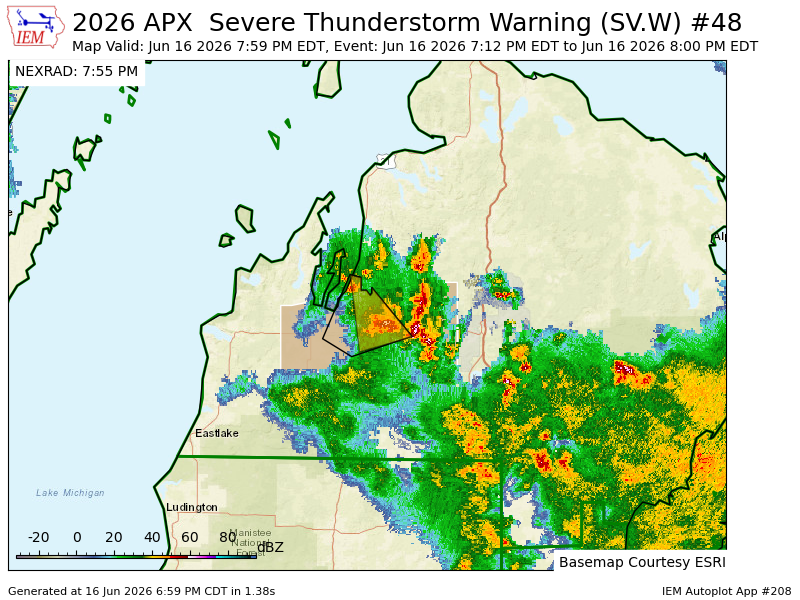
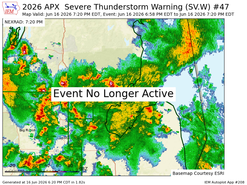
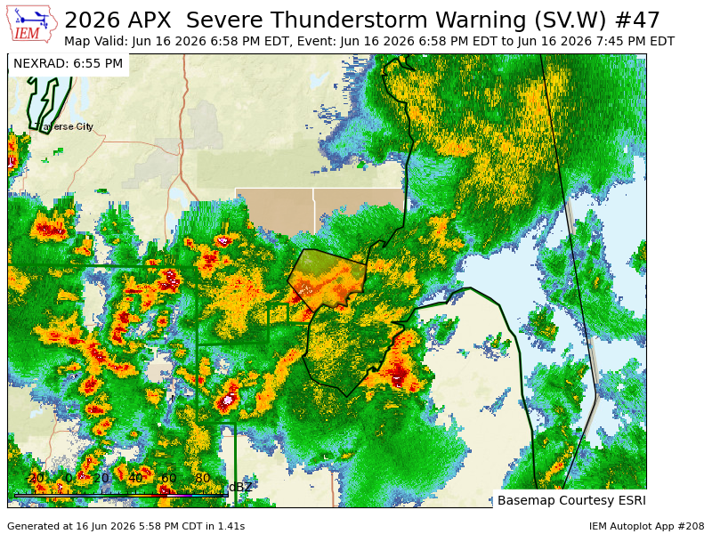
APX expires Severe Thunderstorm Warning for Grand Traverse, Kalkaska [MI] mesonet.agron.iastate.edu/vt…
6
At 7:03 PM EDT, 3 SW Traverse City [Grand Traverse Co, MI] Public reports Hail of pea size (E0.25 Inch). Multiple reports of pea sized near US-31 and S Airport Rd/Hartman Rd/Franke Rd area. #miwx mesonet.agron.iastate.edu/ls…
34
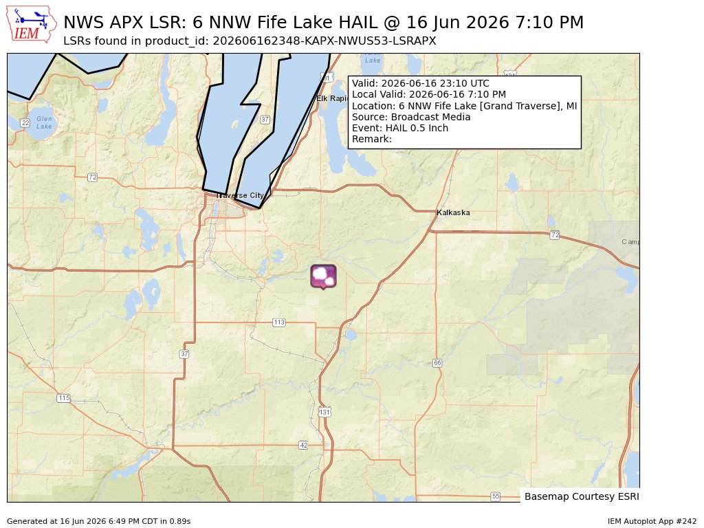
At 7:10 PM EDT, 6 NNW Fife Lake [Grand Traverse Co, MI] Broadcast Media reports Hail of mothball size (M0.50 Inch) #miwx mesonet.agron.iastate.edu/ls…
30
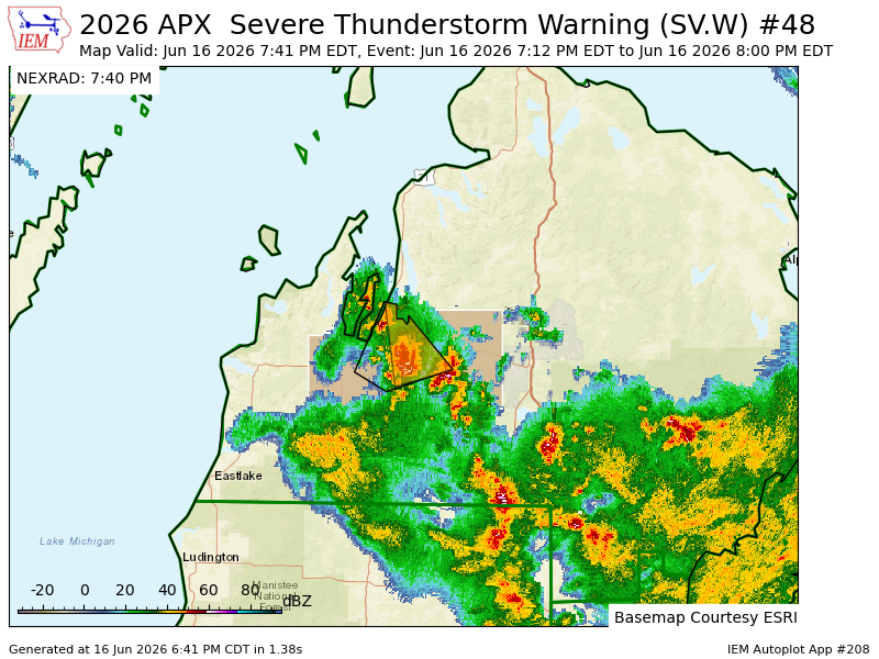
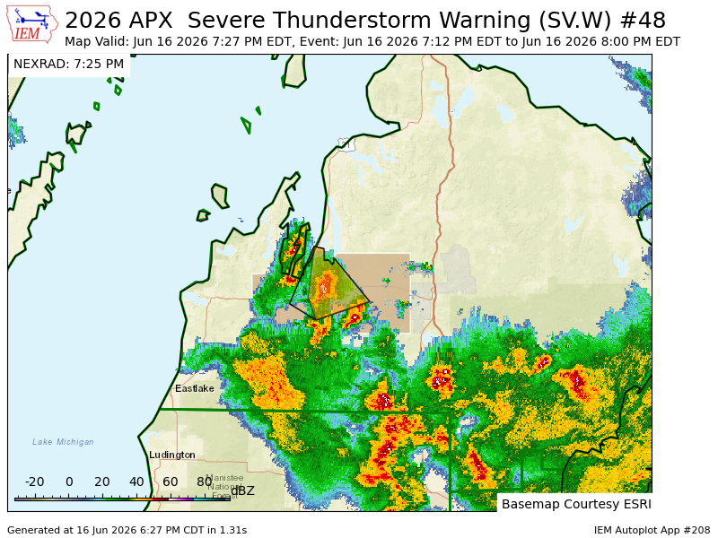
APX continues Severe Thunderstorm Warning [wind: 60 MPH (RADAR INDICATED), hail: 1.00 IN (RADAR INDICATED)] for Grand Traverse, Kalkaska [MI] till 8:00 PM EDT mesonet.agron.iastate.edu/vt…
1
#ILM issues Area Forecast Discussion (AFD) at Jun 16, 7:38 PM EDT mesonet.agron.iastate.edu/p.…
5
#NHC issues Tropical Weather Outlook (TWO) at Jun 16, 8:00 PM EDT mesonet.agron.iastate.edu/p.…
8
Potential Tropical Cyclone #One Intermediate ADVISORY 2A issued. Life-threatening flooding likely over portions of texas and louisiana from potential tropical cyclone one.. nhc.noaa.gov/#One Intermediate
15
APX continues Severe Thunderstorm Warning [wind: 60 MPH (RADAR INDICATED), hail: 1.00 IN (RADAR INDICATED)] for Grand Traverse, Kalkaska [MI] till 8:00 PM EDT mesonet.agron.iastate.edu/vt…
3
APX cancels Severe Thunderstorm Warning for Arenac, Iosco, Ogemaw [MI] mesonet.agron.iastate.edu/vt…
1
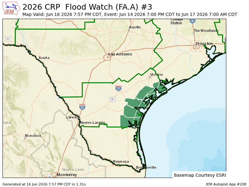
#CRP issues Area Forecast Discussion (AFD) at Jun 16, 6:17 PM CDT ...New AVIATION... mesonet.agron.iastate.edu/p.…
2
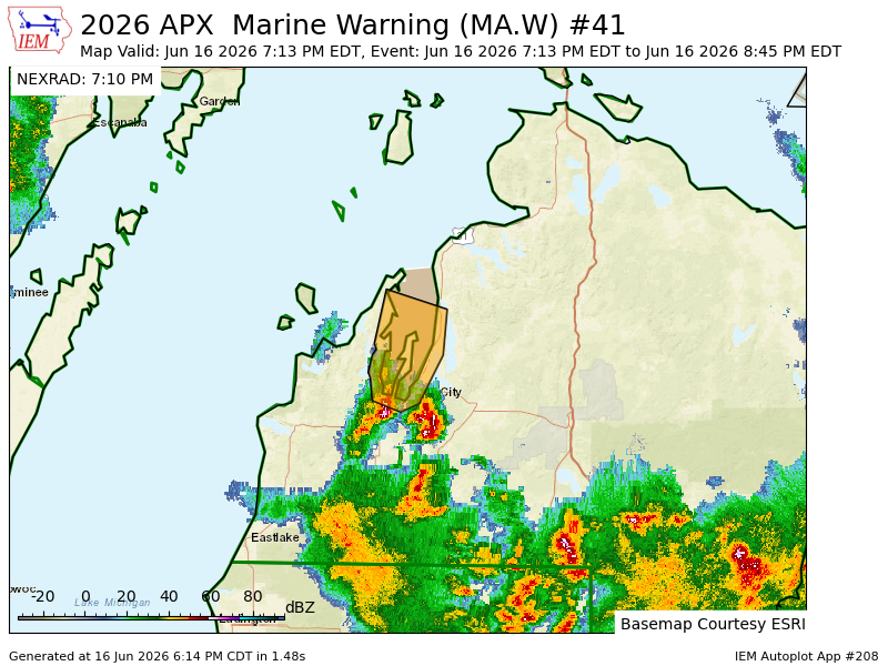
APX issues Marine Warning [wind: >34 KTS, hail: <.75 IN] for Grand Traverse Bay south of a line Grand Traverse Light to Norwood MI [LM] till Jun 16, 8:45 PM EDT mesonet.agron.iastate.edu/vt…
2
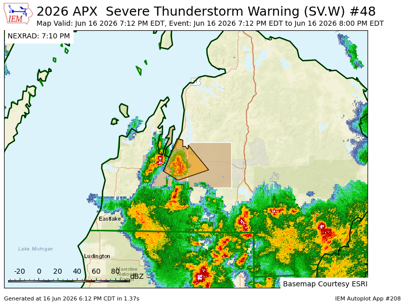
APX issues Severe Thunderstorm Warning [wind: 60 MPH (RADAR INDICATED), hail: 1.00 IN (RADAR INDICATED)] for Grand Traverse, Kalkaska [MI] till 8:00 PM EDT mesonet.agron.iastate.edu/vt…
2
S TX/N Mi Rec Wx retweeted

With recent SST updates, we're now in the top left corner of the MDR vs. ENSO space (near warmest El Niño and near coolest MDR after detrending). All similar years were well below average in the Atlantic.

2
6
34
1,819
APX issues Severe Thunderstorm Warning [wind: 60 MPH (RADAR INDICATED), hail: 1.00 IN (RADAR INDICATED)] for Arenac, Iosco, Ogemaw [MI] till 7:45 PM EDT mesonet.agron.iastate.edu/vt…
2