
Joined January 2014
- Tweets 35,045
- Following 6,332
- Followers 2,345
- Likes 129,308
94 Photos and videos


Avery retweeted

Jun 14
America will not survive another 2 years of with clown in charge!

270
628
2,112
21,395


Avery retweeted

Jun 13
Proud of her for speaking up against Trump and the hate he spreads. 💙
Would you still support Taylor Swift even though she is against Trump?

1,378
1,618
6,816
130,361
Avery retweeted

Trump loves the poorly educated.

18
135
254
2,877
Avery retweeted

Jun 11
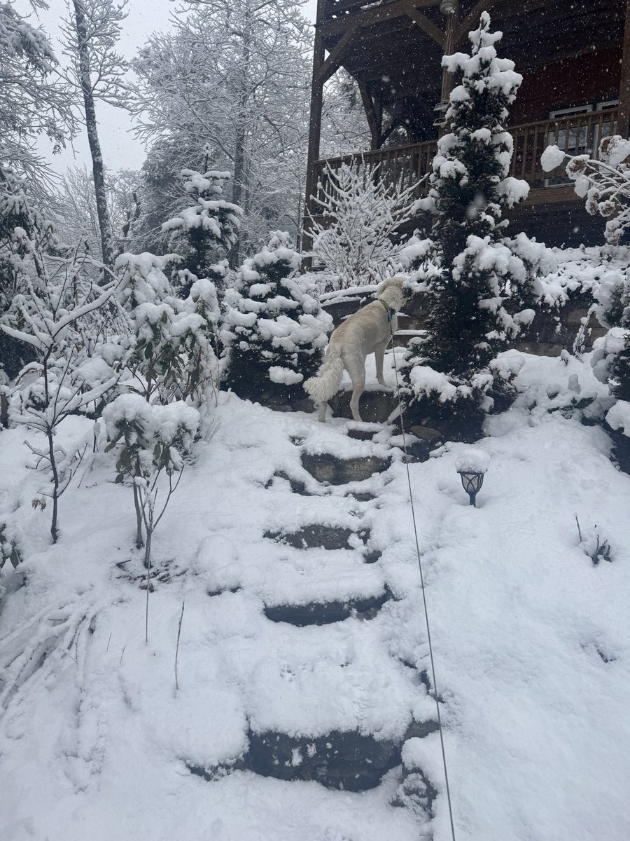
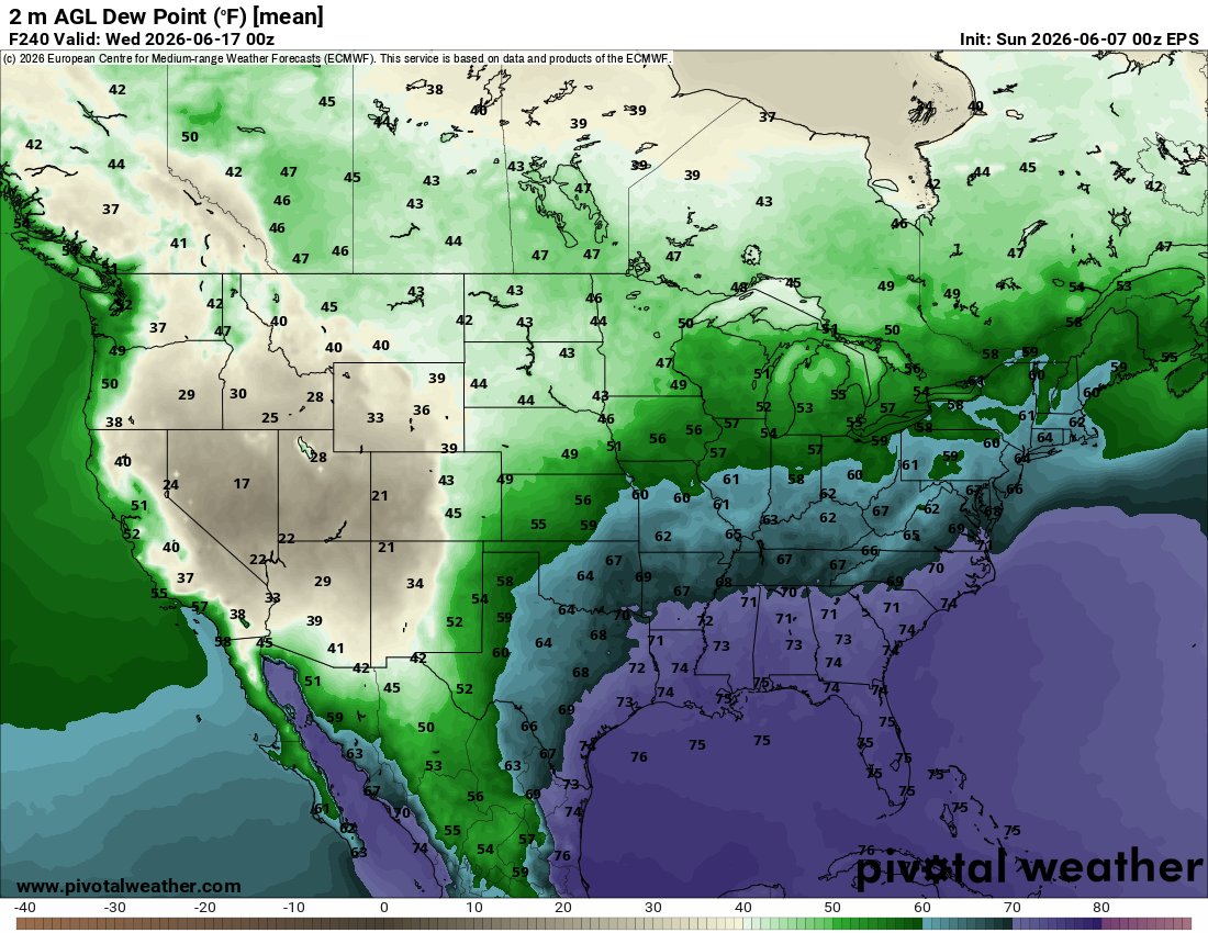
It just continues to struggle to rain East of the Southern Apps this year. Getting ridiculous.

22
12
166
13,508
Avery retweeted
Jun 11
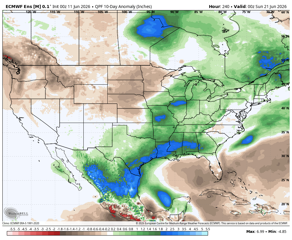
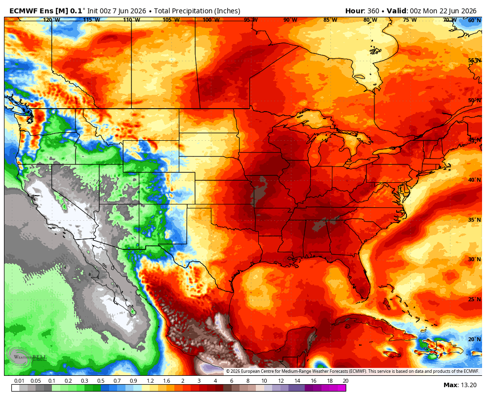
After an active stretch of severe weather through the weekend stretching from the plains into the Northeast, unsettled weather will set up across the South to start next work week. This will be driven off active flow shifting South as the trough digs along with flow rounding a ridge to the South. This MIGHT push moisture from our area of interest in the Gulf back East & bring enhanced moisture across the South. AI guidance is starting to signal something with actual development out of this. Something to watch.
As the trough is positioning back North later next week, a stronger storm system could develop & swing across a section of the country. This could bring very active weather across the Central to Eastern US mid to late next week. Just things to watch for now.

4
13
78
4,910
Avery retweeted

He needed to inconvenience hundreds of thousands, if not millions of people, & ruin the experience for lifelong fans so he could fall asleep in the luxury box.
It's the perfect image for the sloth & the corruption, the decadence & the rot that has descended over America.

417
2,715
7,054
71,639
Avery retweeted

Don’t.
Lose.
Focus.

893
4,285
7,934
73,020


Avery retweeted

Jun 8
Trump completely lost it on Kristen Welker.
He said she was crooked, stupid and walked out of the interview!
I stand with Kristen Welker and all of the journalists Trump has attacked over the years.
Who is with me? ✋

2,948
393
1,932
65,403
Avery retweeted

Jun 7
This is what INSANITY looks like: Bullying buffoon Trump loses his fucking mind and walks out of a softball interview with Meet the Press host Kristen Welker. Because he's so insecure and psychologically fragile, the sick fuck thinks every election he loses must be "rigged."
866
3,223
14,676
320,724
Avery retweeted

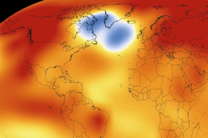
This isn’t a joke, we are all going to die. And it won’t be in a cinematic action movie way. it will be systemic and bureaucratic and driven by the scarcity They manufacture to keep us enslaved and flee from culpability.

Mysterious ‘cold blob’ in the Atlantic suggests the AMOC is weakening
A patch of ocean south-east of Greenland is the only place on Earth that is cooling, and it could be a sign that the warm water “conveyor belt” in the Atlantic is slowing down
newscientist.com/article/252…
docs.google.com/document/d/1…
40
293
2,573
89,793
Avery retweeted
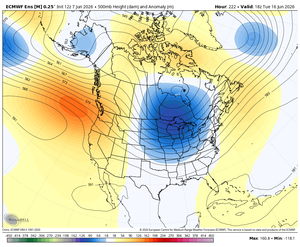
Jun 7
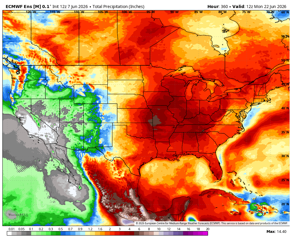
Phase 8 flex with this trough upcoming mid month. This will drive a very active pattern for heavy rain & storms with severe potential. A cool down will follow. This comes next week after what will already be an active stretch of severe weather this week.
7
11
79
11,063
Avery retweeted
Jun 7
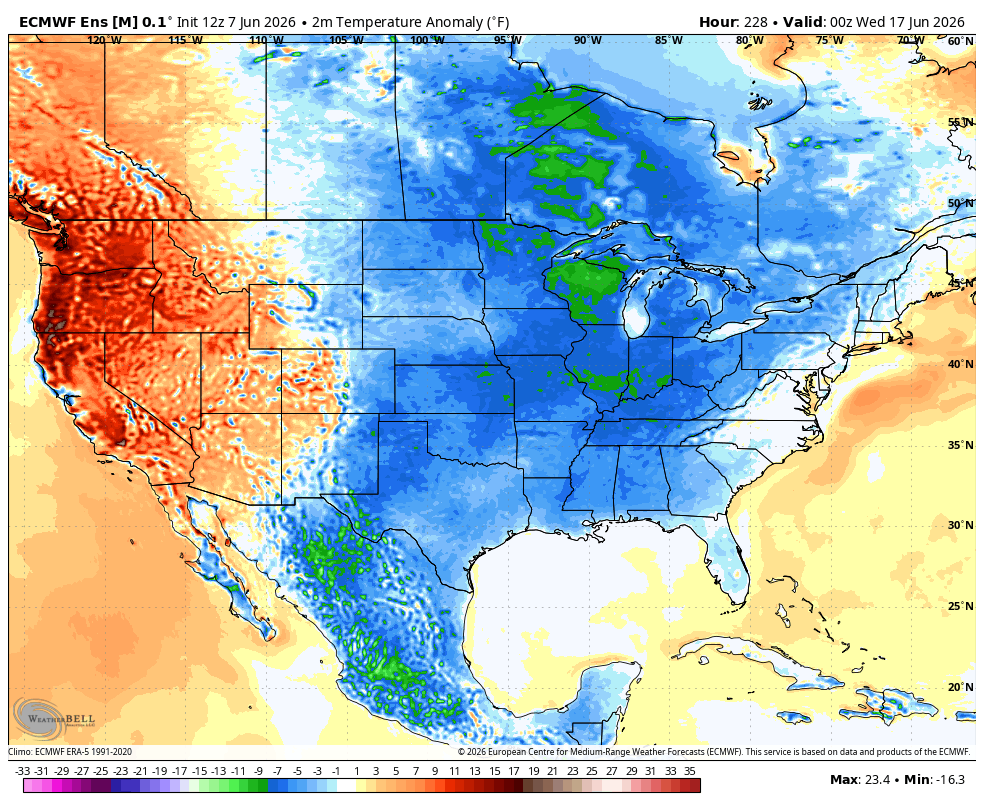
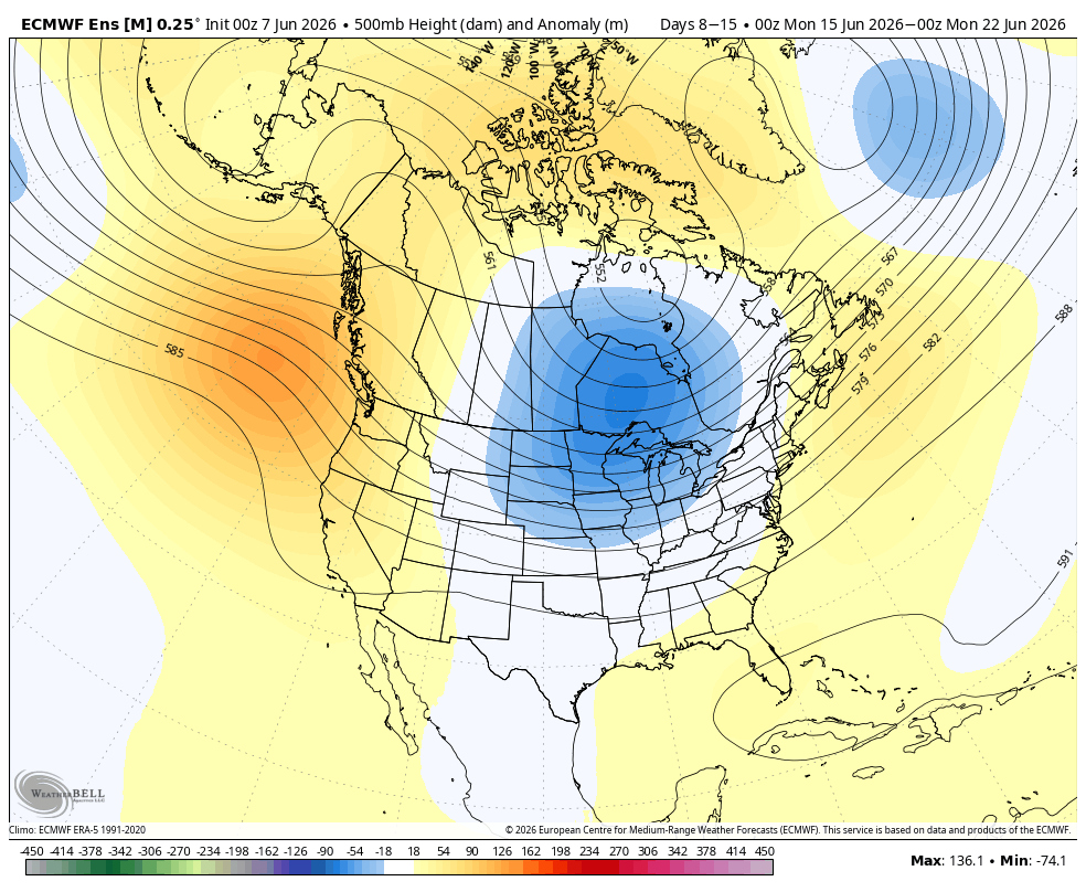
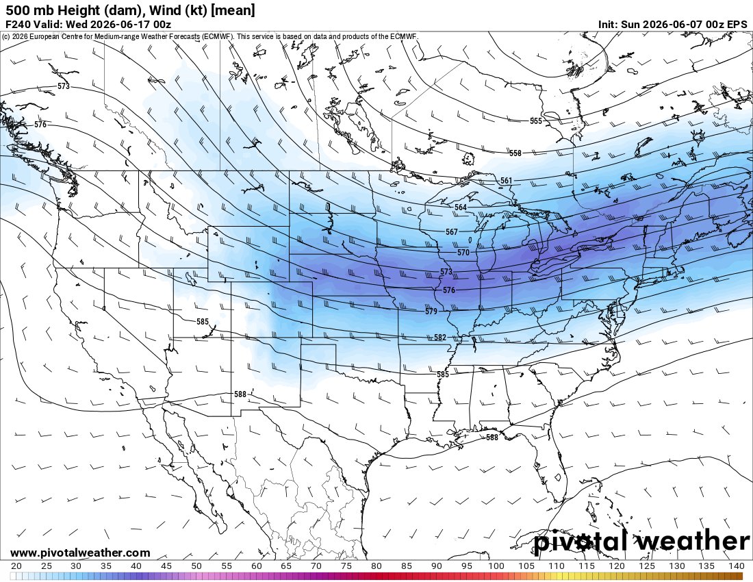
We have a very active stretch of severe weather setting up this week across the Northern sections of the country. The difference this week compared to last is that our belt of favorable flow will position itself further East. This will drive better severe risk into the Midwest & surrounding areas.
Beyond this, I think as we enter the mid month timeframe, things get more active further to the South & East. I am not talking some sort of March or April type severe pattern, but I could see higher severe weather chances shifting further South compared to what we see this time of the year. Maybe areas like the Southern to Central plains, Mid Mississippi valley, Mid South, Ohio Valley into areas of the Mid Atlantic & Northeast. (which is totally unusual for this area in Mid June) We could have severe risk further South than that also.
You can see how a trough digs mid month pushing down better kinematic flow with it (Better winds aloft for severe weather). This will overlap a seasonal moist airmass to the South. This will push a cooldown into the middle of the country also. A ridge will spike ahead of this trough dig in the East driving a bit warm up in the coming days. Phase 8 is likely the driver to this.
Chatter in the tropics remain, but honestly there is a lot more to talk about across the lower 48. The signal decreased overnight for tropical activity.
4
12
101
15,956
Avery retweeted

Totally on brand for a pedophile to think that 10 years old is fully mature

39
152
1,123
12,884
Avery retweeted

Cuts to US ocean program will hinder monitoring of El Niño and AMOC
Scientists warn that the Trump administration’s push to dismantle a vital network of ocean-sensing instruments will stymie crucial weather and climate monitoring in the Pacific and Atlantic
newscientist.com/article/252…
docs.google.com/document/d/1…

2
25
64
115,080

Jun 7
RT @mdbuckley: @b_judah @NickCohen4 Too much of the press too many politicians continue to treat climate impacts as science fiction when…
2
Jun 7
RT @b_judah: The growing risk of a collapse of the Atlantic Meridional Overturning Circulation system, of which the Gulf Stream is part, is…
222