
The easy to use high-resolution map editor. Made with ❤️ by @maptoolkit.
Joined May 2017
- Tweets 44
- Following 821
- Followers 90
- Likes 31
Photos and videos
Printmaps.net retweeted

23 Jun 2025
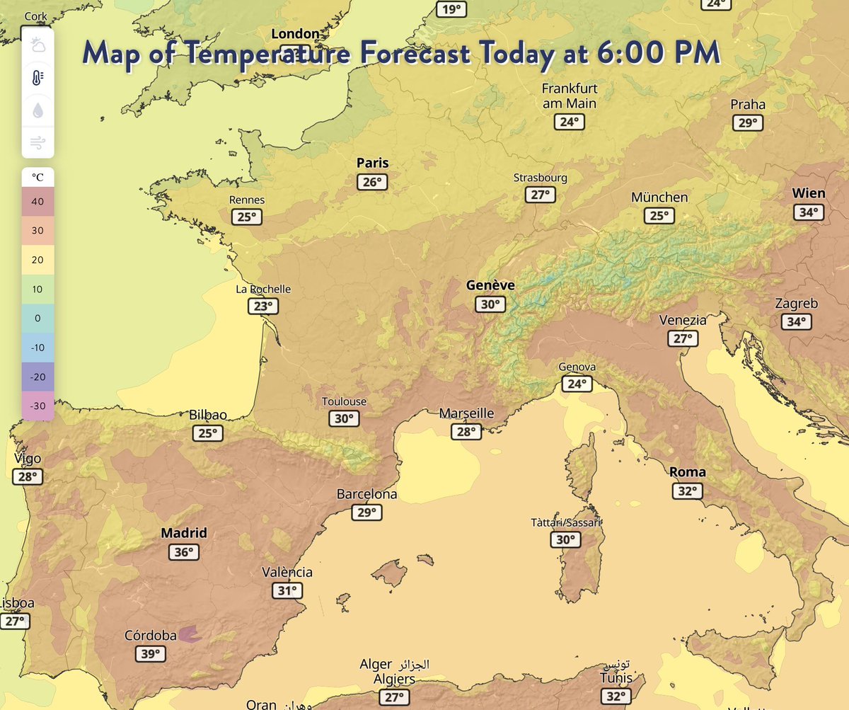
It's going to be a hot day today in most of Europe. Hope you have A/C in the office!
(Picture from our Weather API: maptoolkit.com/api/weather/)
1
2
64

24 Apr 2025
As per popular request:
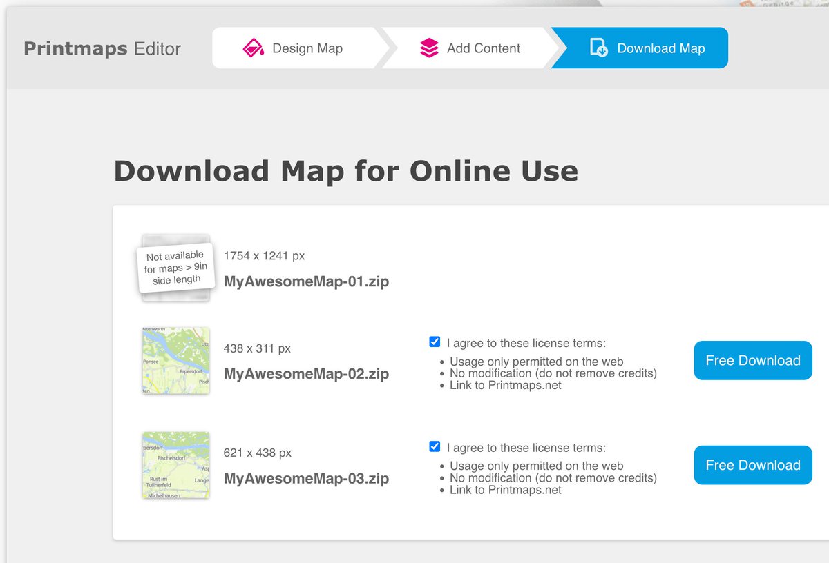
All free map and elevation profile downloads can now be made directly and immediately - no email address needed any more!
1
29
13 Sep 2024
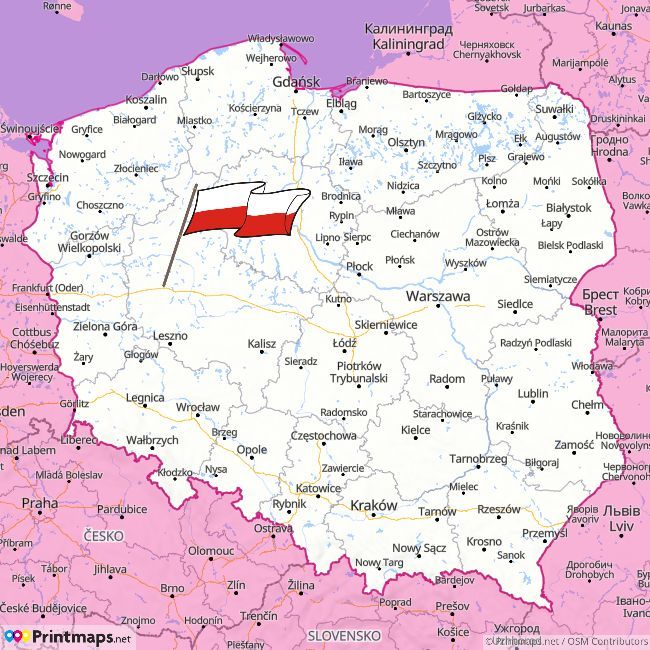
Welcome Poland! You can now use Printmaps in Polish and pay in Zloty. Witamy w Polsce! Możesz teraz korzystać z Printmaps w języku polskim i płacić w złotówkach. printmaps.net/pl/
1
3
127
6 Jun 2024
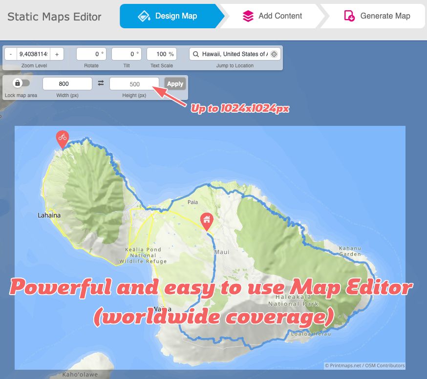
Breaking: Check out the FREE Wordpress Static Maps Editor plugin, powered by Printmaps.
There are dozens of interactive maps plugins for WordPress – Static Maps Editor is the FIRST plugin for creating non-interactive map images.
buff.ly/3yN6v3t
2
1,992
14 May 2024
Hej hej! Printmaps is now available in 🇸🇪 Swedish - plus you can pay in Swedish Krona 🇸🇪
buff.ly/3wq5EF5
1
1
78
13 Mar 2024
Salut Francophonie ! Ciao Italia!
Printmaps is now available in French and Italian, see printmaps.net/fr and printmaps.net/it

1
2
105
Printmaps.net retweeted
28 Feb 2024
See you at ITB in Berlin? Peter @Hoeflehner and @Helge Fahrnberger will be there. Drop us a line, let's meet!

1
1
117
Printmaps.net retweeted
10 Aug 2023
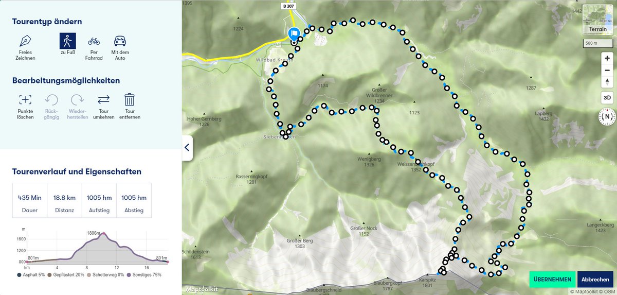
Our Route Editor JavaScript application is the perfect addition to any CMS and editorial backend. It enables editors to quickly draw, upload or edit tours and routes.
See this article @infomax_it (in German) for how this works in the field: buff.ly/45k7anQ
1
1
341
22 Mar 2023
At popular request: We have added the possibility to add POIs from our wordwide database of POIs, for any place in the world. Especially useful for real estate exposés. (Ideally in combination with a travel time radius.)
1
1
248
7 Feb 2023
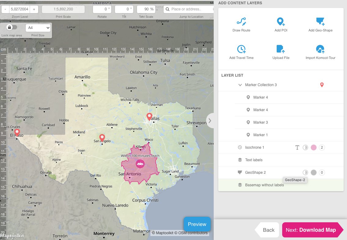
We have added a range of new features and improvements to Printmaps.net 🧵
1/4 TRAVEL TIMES (a.k.a. isochrones)
You can now create travel time perimeters from 1 to 180 minutes by car, bike or foot for any point on the planet. (And print them on a map, of course.)
1
2
2
913
7 Feb 2023
3/4 IMPROVED LAYER LIST
The layer list is now easier to use and understand, plus you can edit all layers after you've added them.
ALT Screenshot
1
1
108
7 Feb 2023
4/4 EXAMPLE DATA FOR YOUR SPREADSHEET
We've compiled a Google Sheet with example data for your POI list and automatic geocoding (for up to 300 POIs). Also includes detailed instructions. (No need to bookmark it, it's linked from the POI tool.) docs.google.com/spreadsheets…
1
87
7 Oct 2022
You can now pay by bank transfer from most European countries. (In addition to PayPal and all major credit and debit cards, worldwide.)

1
1
1 Oct 2022
Thank you!
29 Sep 2022

I just discovered @printmaps ! printmaps.net/creating-maps-… I had a similar idea in mind for a long time, but this seems really well executed 👏
It gave me motivation to layout some ideas about a potential side project :) github.com/leplatrem/mapstat…
2
10 Dec 2021
Bemvindo Portugal, bemvindo Brasil!
Printmaps is now available in Portuguese (and you can pay in Brazilian Reais - BRL)! printmaps.net/pt-br/
1
30 Jul 2021
A long time since the last update here - a lot has happened:
- Max. sizes for SVG doubled to 133x133mm (without price increase)
- New languages versions: Spanish, Portuguese and Netherlands
- Imperial measurements added (inches and miles)
- New currencies: USD, GBP, AUD, BRL

1
29 Nov 2018
Frequently requested: Printmaps now supports payments via PayPal. (And this way also bank transfers.) 🚀

2
2