
Joined July 2009
- Tweets 5,539
- Following 1,434
- Followers 2,986
- Likes 3,278
1,802 Photos and videos


Pinned Tweet

11 Feb 2025
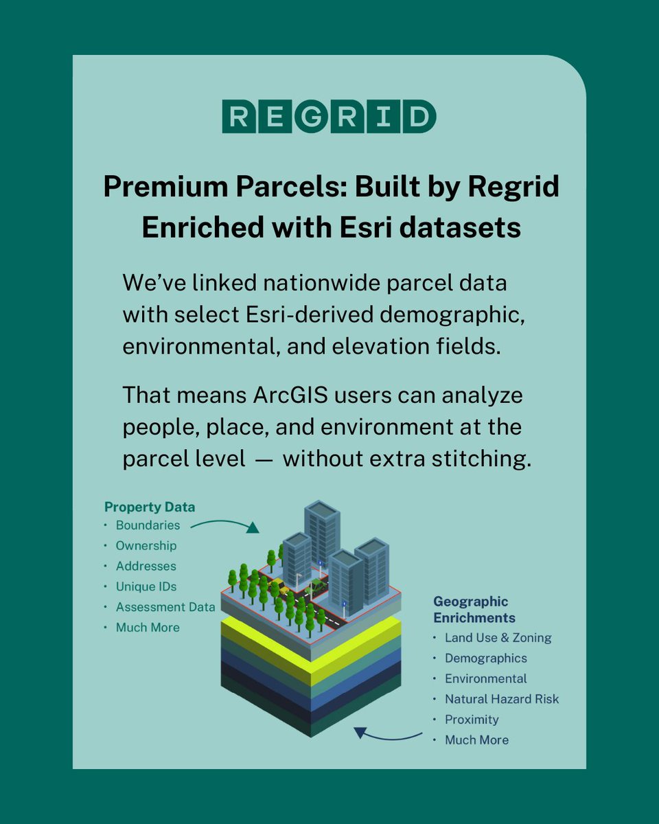
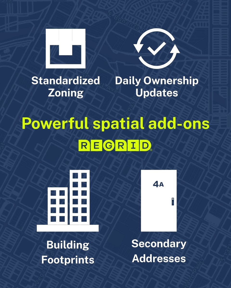
The parcel data you know and trust—now with even more insights.
We’ve enhanced our Premium Parcel Data with new fields, created in partnership with Esri, to help you make even more informed location decisions.
Get the full details here: hubs.li/Q0369G7S0
1
1
3
685
Feb 20
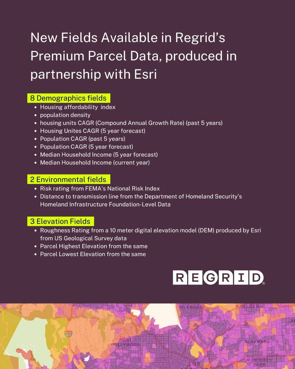
Different industries. One dataset.
Regrid Premium Parcels combine nationwide property boundaries with Esri enrichments like demographics, elevation, and environmental context.
One dataset. No stitching. Decision-ready.
#Regrid #ParcelData #ArcGIS #LocationIntelligence
1
1
84
Feb 20
That means:
➡️ Real estate teams can see where growth is happening.
➡️ Utilities can weigh demand against terrain and infrastructure.
➡️ Emergency planners can spot vulnerable communities at parcel scale.
And more!
1
66
Feb 12
Most carbon data stops at regional maps. @tpl_org used Regrid parcel data to connect carbon values to real properties.
Now land trusts, governments, and ESG teams can target high-impact tracts by parcel.
#CarbonData #ParcelData #Regrid
35
Feb 5
When we partnered with Esri in 2024, our goal was simple: bring property and geography together with less friction.
Today, Regrid Premium Parcels combine boundaries with demographic, elevation, and environmental context. All in one place, ready for analysis.
#Regrid #ParcelData
1
58
Jan 22
Every location decision starts with a question.
For commercial real estate, it’s often: "Where should we open next?"
With Regrid’s crosswalk to GERS IDs, parcels and POIs connect in seconds, making trade area analysis and competitor evaluation faster and cleaner from day one.
1
56
Jan 22
For commercial real estate, that means:
➡️ Less time cleaning and matching datasets
➡️ More time evaluating trade areas and competitors
➡️ Clearer, data-driven decisions from the start
Because good decisions shouldn’t start with bad data.
44
Jan 16
ArcGIS users already trust Regrid for parcel boundaries, ownership, and land use.
Now each parcel carries more context, with Esri demographic, environmental, and elevation data built in.
Premium Parcels bring it together in one convenient dataset.
#Regrid #EsriPartner
55
Jan 14
Parcel data is always changing. And so is our dataset.
Throughout December, Regrid refreshed 11.4M parcels across 259 counties, reflecting changes tied to 27.2M people, or just over 8% of the U.S. population
Updates aren’t an extra at Regrid. They’re part of the product.
1
41
Jan 13
Tired of just knowing the boundary? Now you know the activity too.
Crosswalk: Regrid Parcel IDs & @OvertureMaps GERS IDs.
✈️ Example: A "transport" parcel can now be linked to a specific "major airport" or "seaplane base."
Richer decisions for planning & analysis.
47
Jan 1
Every year, our mission stays the same: bring the actionable unit of geography to everyone.
Thank you for being part of this work, and happy new year from all of us at Regrid.
Wishing you a bright and grounded start to 2026.
48
15 Dec 2025
The full story of 2025 is here.
👇👇👇
Our End of Year Report highlights the numbers, the client stories, and product evolution that shaped the past 12 months at Regrid.
Check it out for a behind-the-scenes glimpse into Regrid world.
➡️ hubs.li/Q03X_RhW0
1
38
12 Dec 2025
Regrid is shifting into Low Power Mode.
If something is time-sensitive, please mark it as urgent to parcels@regrid.com and we’ll make sure it’s seen. We’ll pick things up at full speed when we return on January 5, 2026.
Wishing you a restful end of year.
51
20 Nov 2025
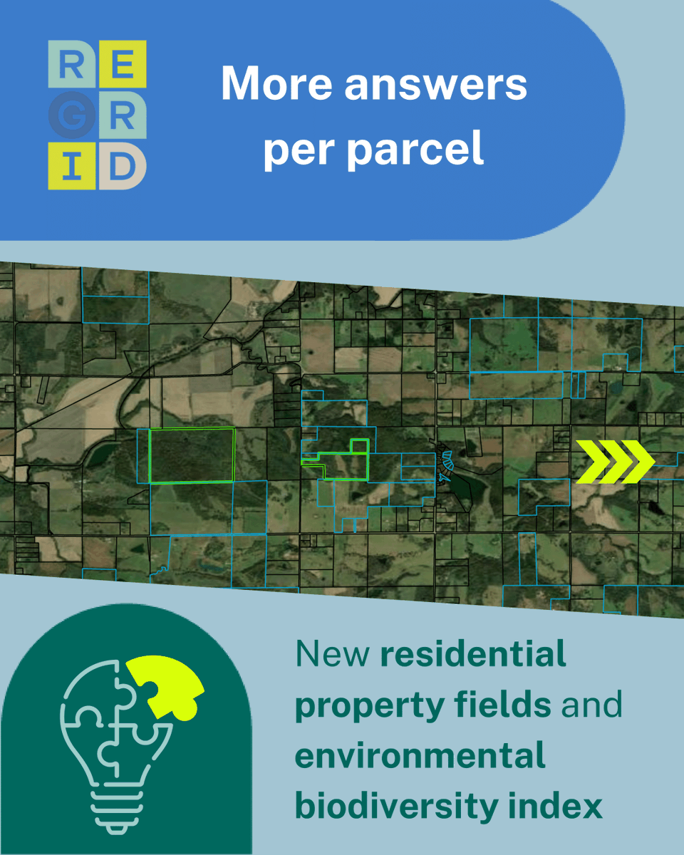
Our data just got even richer!
New residential details and a biodiversity score have been added to every parcel, giving you even deeper insights into every property.
We are continually raising the bar for parcel data, delivering new features and more context with every update.


35
13 Nov 2025
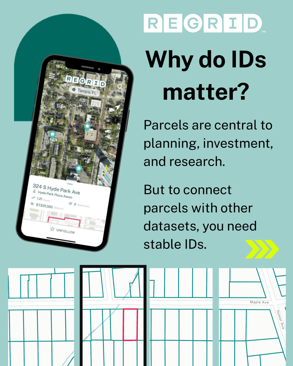
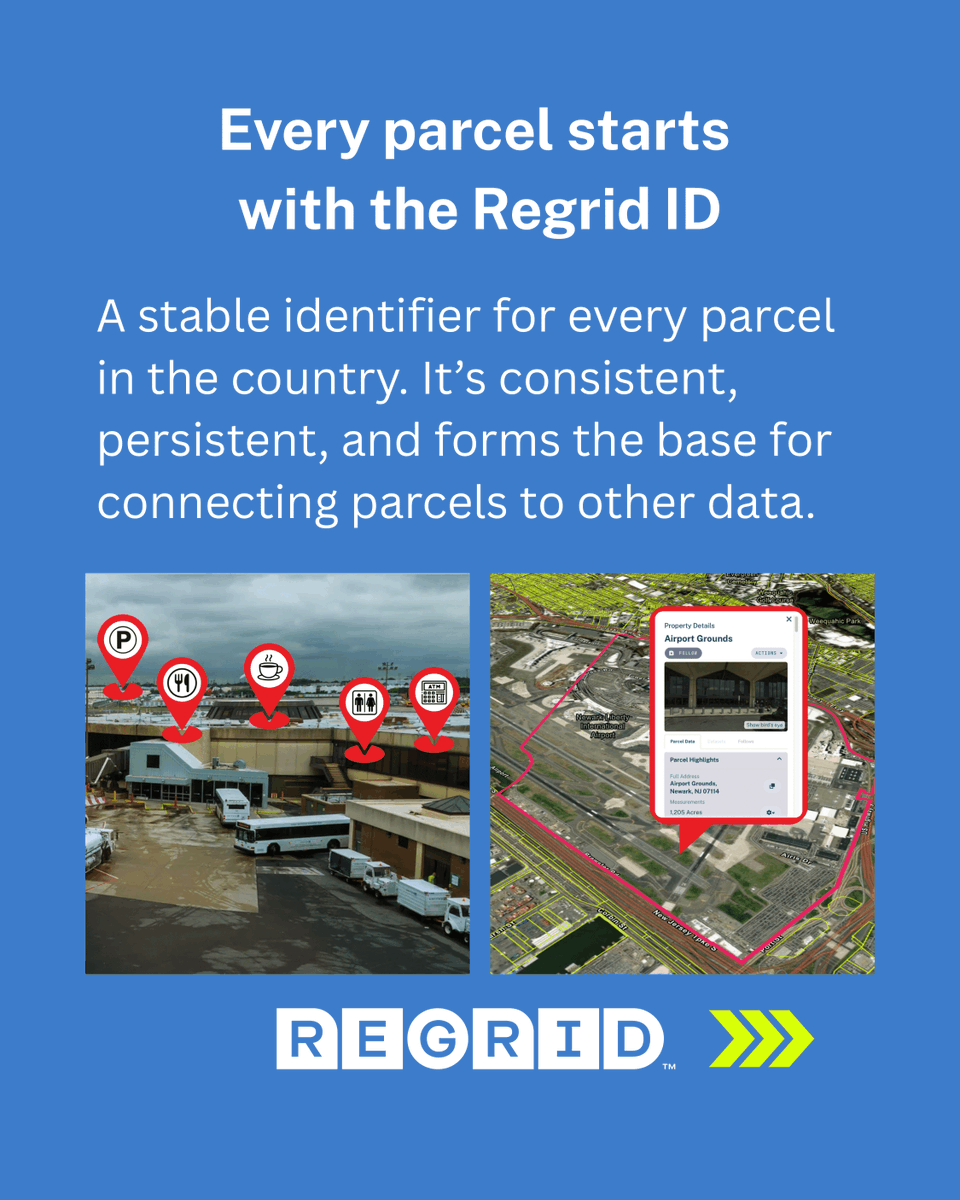
Without a unique ID system, connecting information takes too much time and manual effort. That’s why Regrid parcels come with more than boundaries:
Regrid ID provides a stable reference for every parcel.
Precisely ID and GERS ID connect parcels to other trusted datasets.


1
46
13 Nov 2025
The result?
Fewer stitching headaches 🪡
More ready-to-use insights.
Because every new ID makes parcels more useful in your workflow.
32
31 Oct 2025
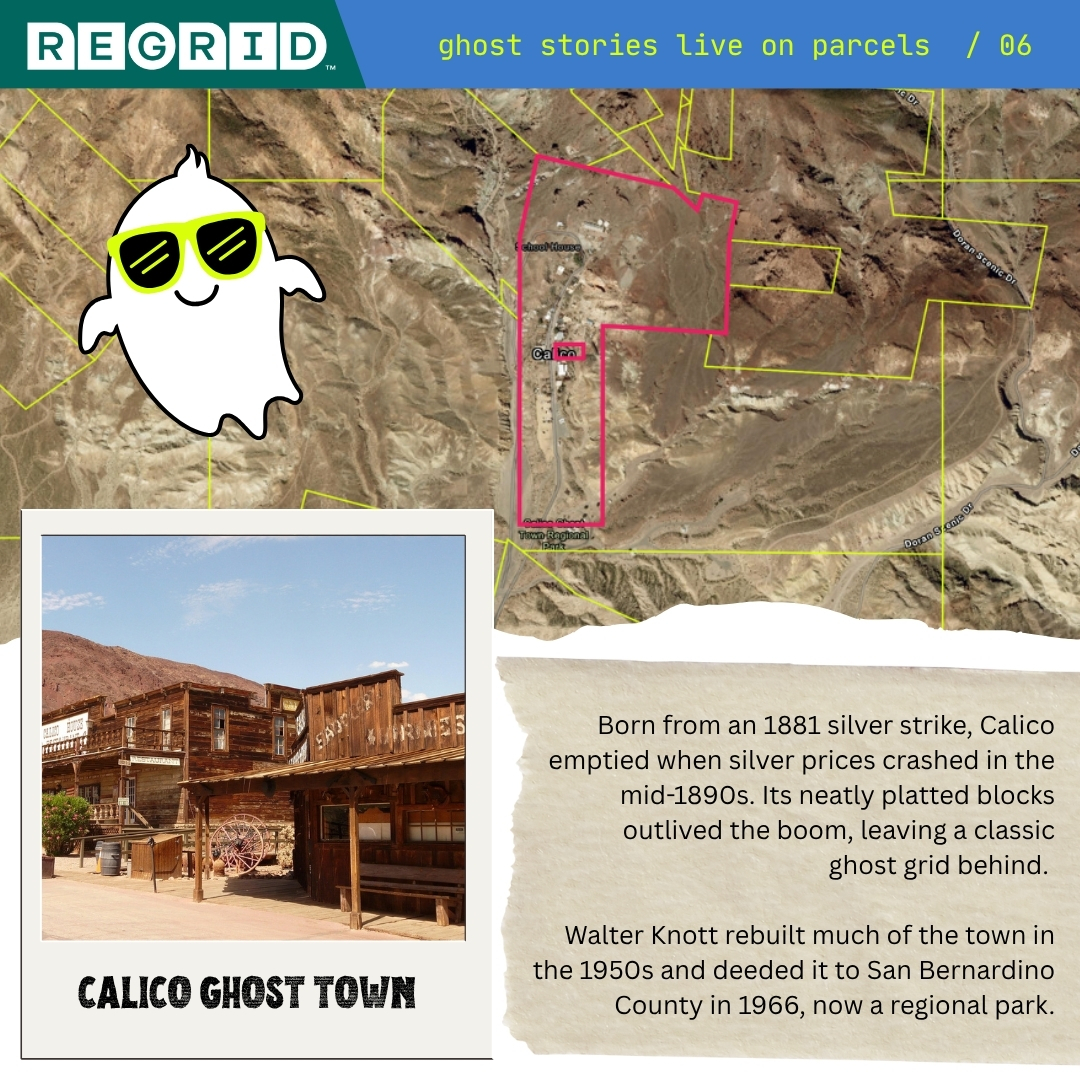
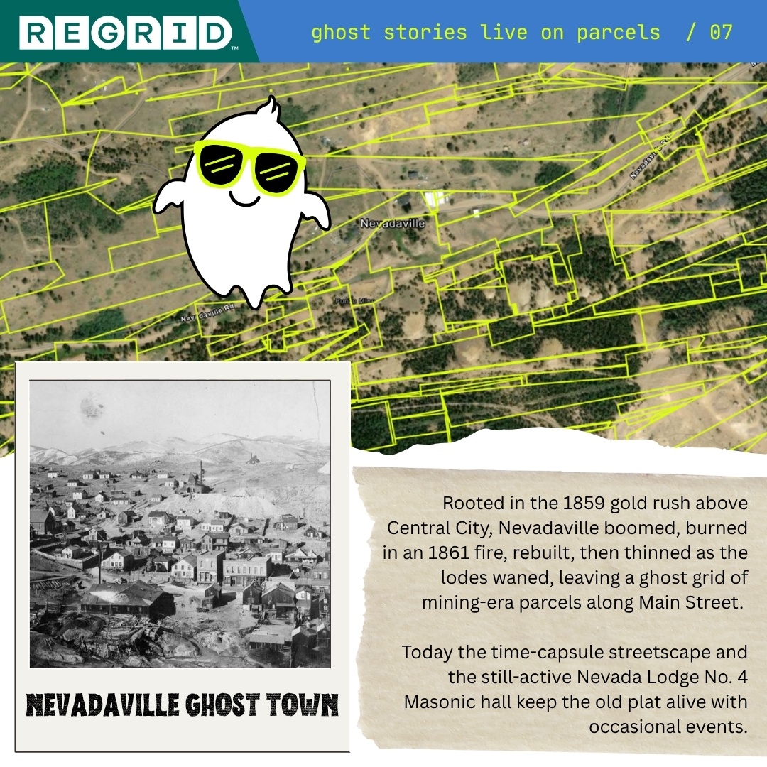
Happy Halloween from the original quiet neighborhoods.
👻 Garnet: 5/5 for mood lighting, 0/5 for cell service.
👻 Calico: great for ghosting your plans, or a train ride.
👻 Nevadaville: population ‘it’s complicated’
#GhostTowns #Halloween
80
23 Oct 2025
Regrid is headed to #esriimgis2025 next week - come and see us at Booth 150 to watch live demos, explore data and integration strategies, and think geospatial!
Headed there? We’d love to hear how you’re working and where we can help.
#Regrid #IMGIS2025 #GIS #Esri
42