
Chief Meteorologist KATC Lafayette, LA - Weather for Acadiana/S LA. Forecasting for Gulf Coast since 1985. 2020 Tropical Weather Conference Broadcaster of Year.
Joined March 2009
- Tweets 37,067
- Following 2,173
- Followers 15,145
- Likes 26,247
21,822 Photos and videos
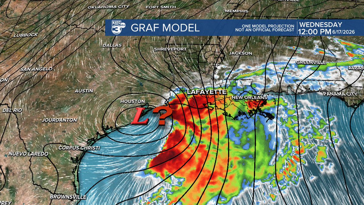


Just a head's up...in addition to the flash flood threats (see my earlier post) that may develop over the next few days, it's not out of the realm of possibility of a tropical-like storm nearing the Louisiana Coast Wednesday or Thursday. The GRAF has been stellar in the past with modelling the tropics (but is usually a little fast), so we'll see if it's on to something or not after a few more model runs into Monday. Squally storms may be in the forecast. Stay tuned. #lawx
2
37
2,092
.A Flash Flood WARNING has been issued for portions of Acadiana, be aware of rising waters in this area. Look out for flooded roadways and avoid low lying areas, bayous and rivers. Doppler & Predictive Radar: katc.com/radars-and-futureca… #LAwx
1
6
547
6
711
2
352
1
554
342
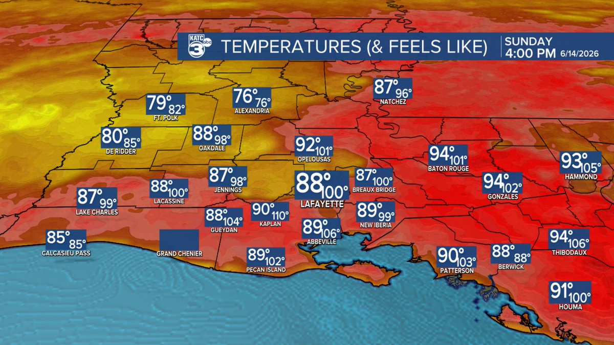
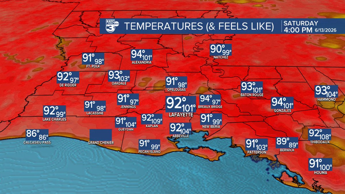
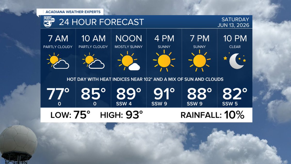
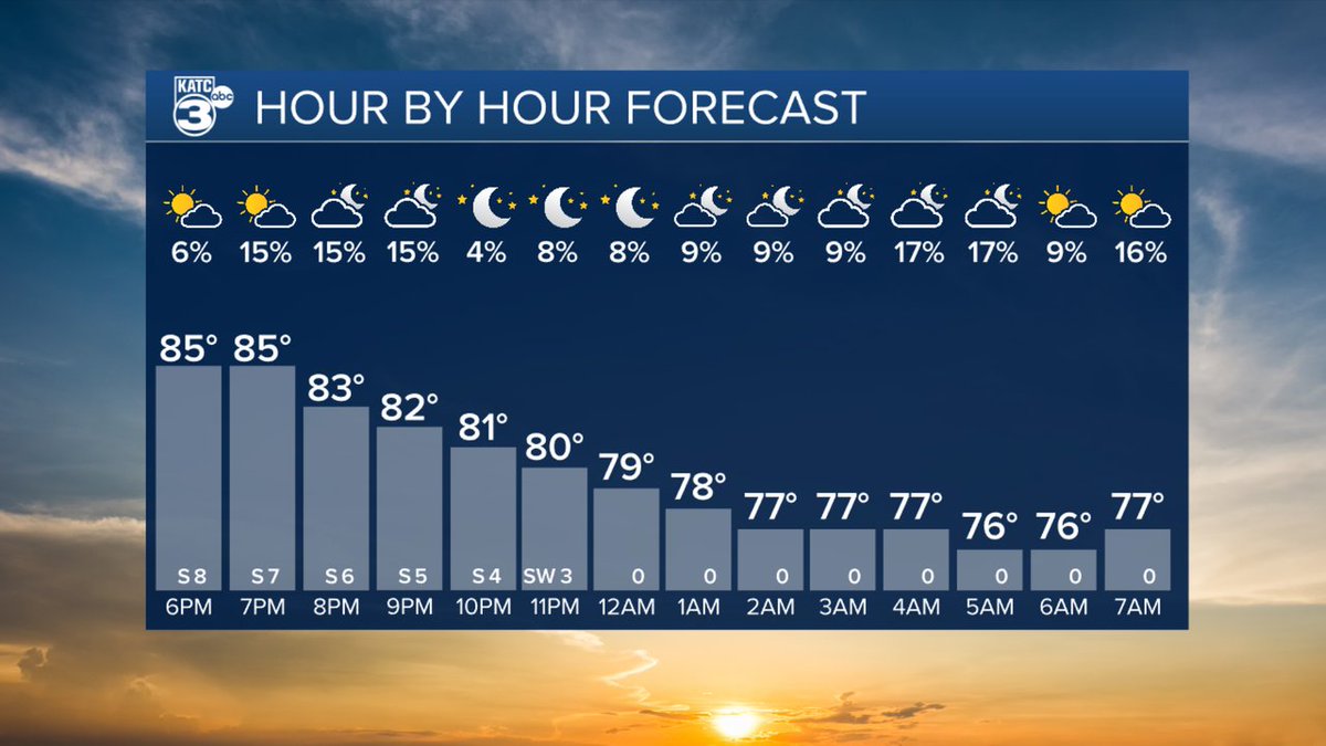
Temperature forecast or Acadiana and South Louisiana for the next 48 hours. #lawx #acadianawx
547
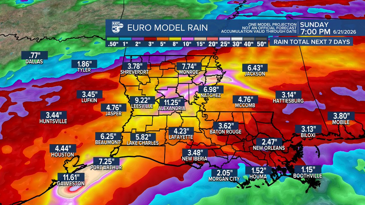
Amazing last summer Acadiana/Louisiana couldn't get a whiff of tropical airmass, but this year a different story with a disturbance likely to bring the threat of flooding rains from Texas through the Gulf Coast states this week. See my previous post for the details. How the Euro sees this playing out. #lawx
2
13
107
15,622
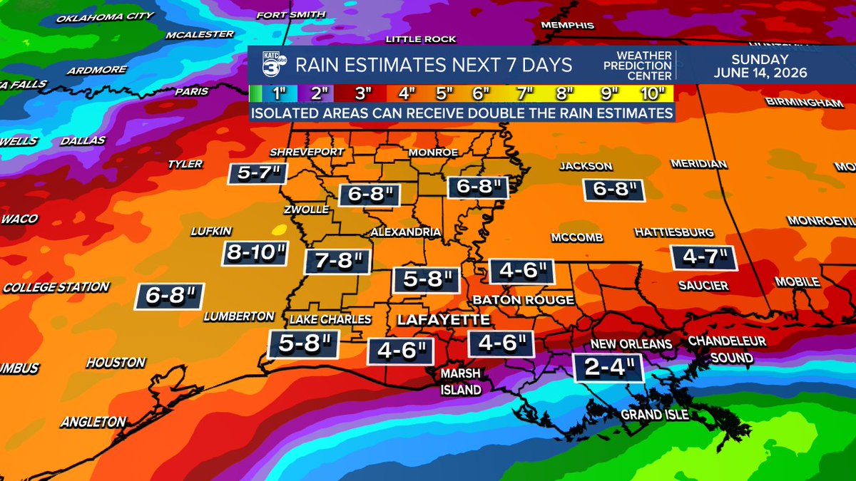
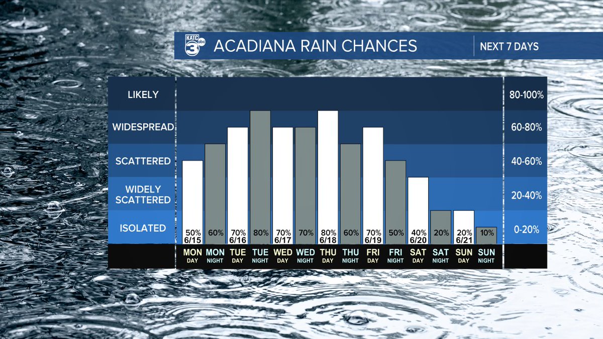
Tropical hybrid low may double down on the risk of flooding rains in Louisiana & portions of Acadiana this week.
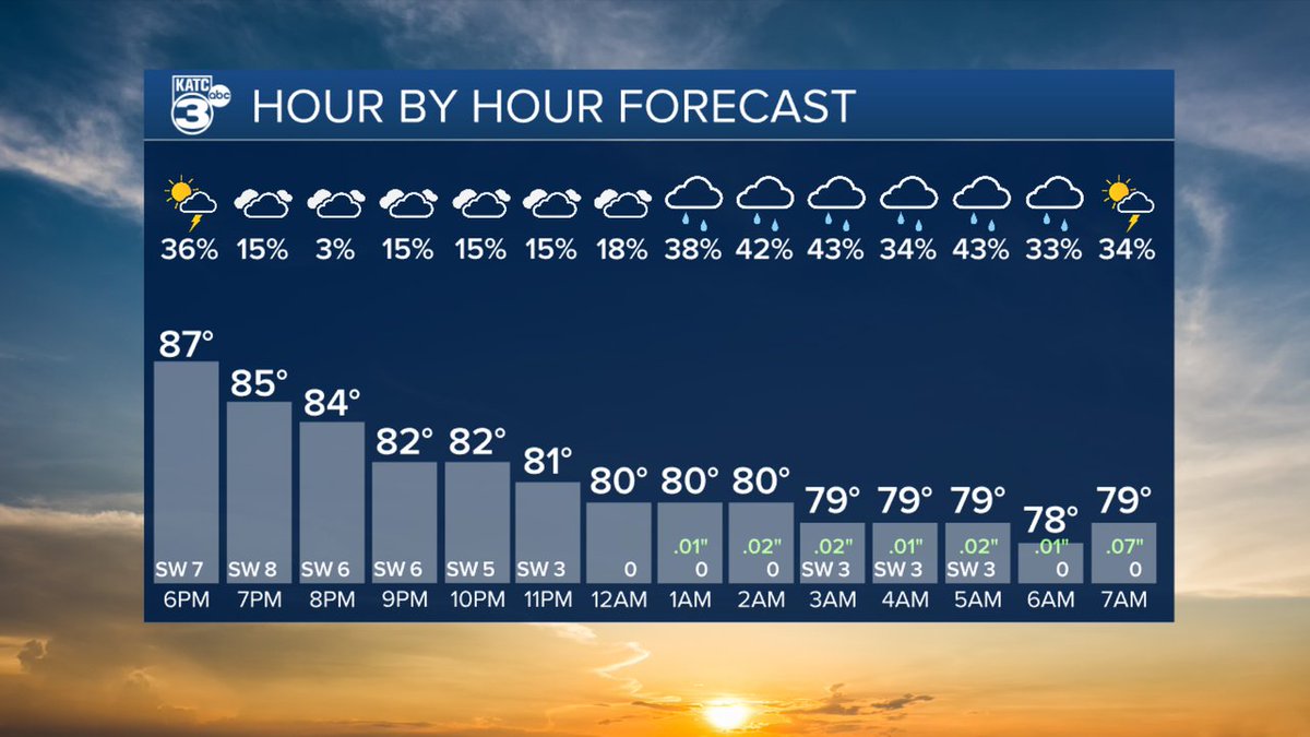
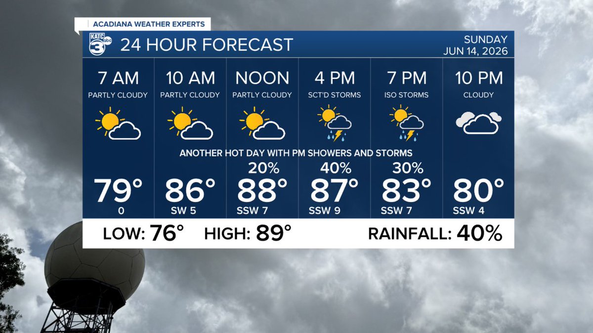
Latest guidance is pouring it on for the threat of excessive rainfall throughout the week with the first round of soaking, widespread rains courtesy of an approaching frontal trough from the north arriving in Acadiana Tuesday.
The tropical disturbance off of the east coast of Mexico will get slowly drawn northward toward South Texas Tuesday and then perhaps to the northeast toward Louisiana Thursday.
A weak tropical hybrid low (as the Euro & GRAF models are more than hinting at) could bring very heavy rains and potentially a higher risk of flooding to the state later this week based on antecedent rains that fall earlier in the week.
The Weather Prediction Center (WPC) has upped their numbers on rainfall totals for the week based on this data with Acadiana likely to receive 4-8" across the board, with isolated hot spots of 10-15" possible somewhere in the state, and perhaps in our area.
It is concerning that the Euro has been throwing out some isolated 15-20" stripes and a few bullseyes over successive model runs, but where they may manifest is unpredictable and changes with every forecast...and the wild card remains how well organized will the low become, and where will it focus its flooding rain threat? Best case scenario, offshore.
Bottom line: it's going to be a busy weather week for our area, and details, and heaviest rain threat windows and areas will change, so see this page for the latest and do not anchor to one forecast...it will be a fluid one, literally. #lawx
5
52
5,413
368

Jun 13
379
Jun 13
1
292
Jun 13
Temperature forecast or Acadiana and South Louisiana for the next 48 hours. #lawx #acadianawx
1
449
Jun 13
1
306
Jun 12
448
Jun 12
1
280

Jun 12
1
251