
Joined June 2010
- Tweets 78,691
- Following 1,474
- Followers 13,032
- Likes 28,437
36,021 Photos and videos


Jun 13
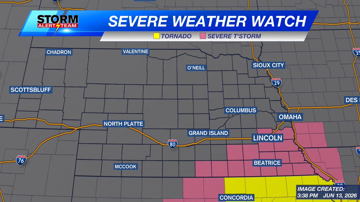
A Severe Thunderstorm Watch is in place for SE Nebraska through 11pm Saturday evening.
Storms will have the potential for hail and damaging wind. An isolated quick spin up tornado is possible, but more likely into Kansas where there's a Tornado Watch.
1
8
1,346

Jun 13
Another batch of storms is expected this Saturday afternoon and early evening. We may have to dodge some storms between 4pm and 9pm.

1
9
3,200
Jun 13
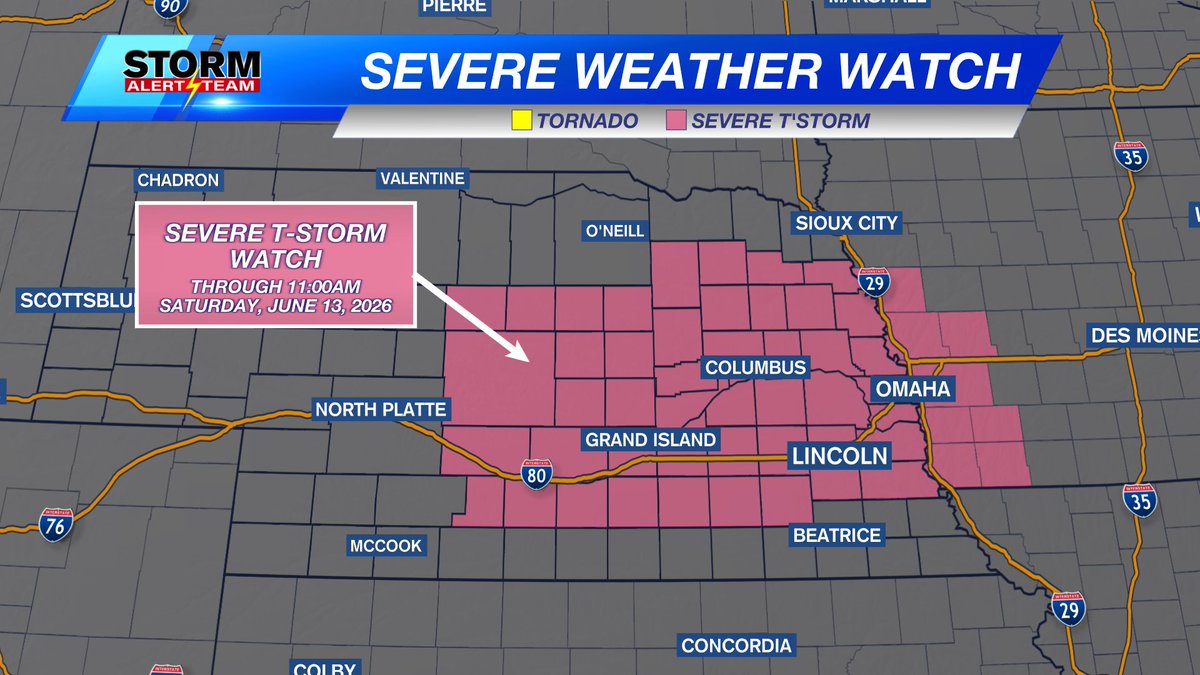
A SEVERE THUNDERSTORM WATCH is in place for most of central and eastern Nebraska through 11:00am Saturday, June 13, 2026
7
1,348
Jun 13
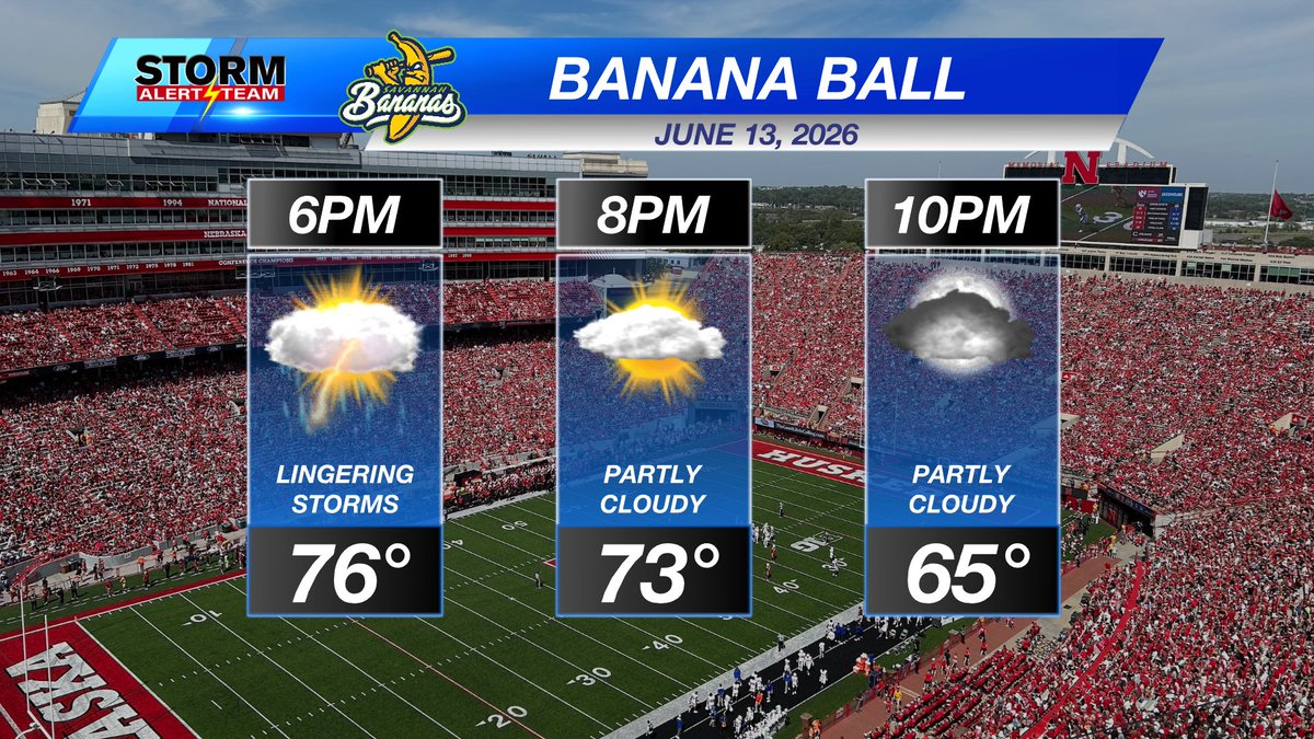
BANANA FORECAST! June 13, 2026
Storms are possible Saturday afternoon and there's a small chance some of that may linger into the 6pm time frame. After that, the sky clears out and temperatures cool off. Hoping for a really fun night of Banana Ball!
1
7
1,320
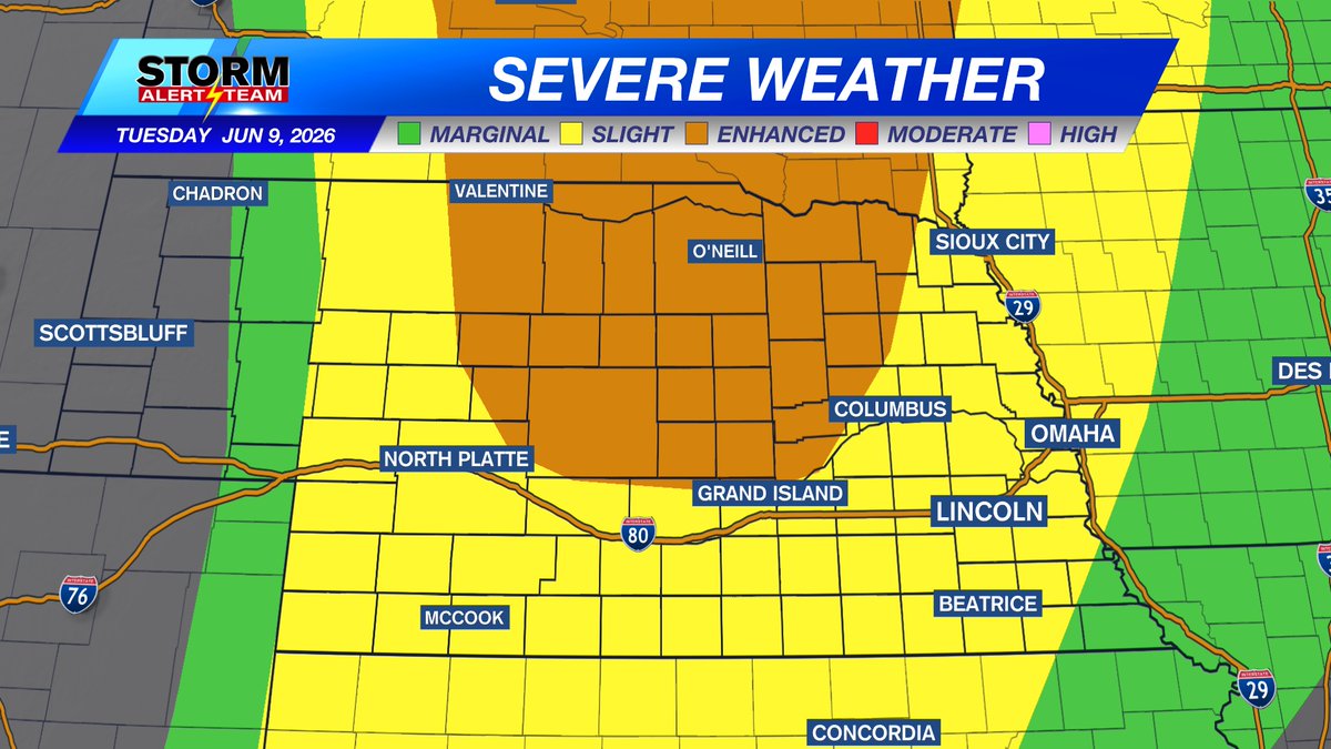
Jun 13
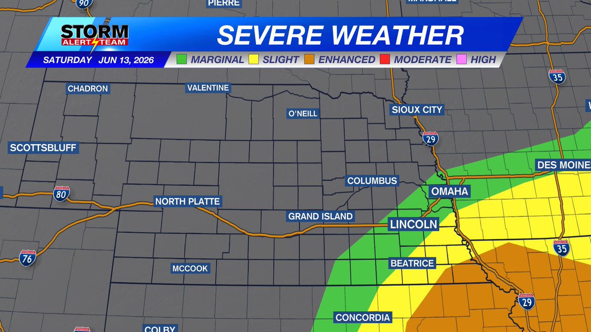
On Saturday, storms will try to form in the green shaded "Marginal Risk" around mid afternoon. Then into the yellow shaded "Slight Risk", becoming stronger, then into the orange shaded "Enhanced Risk", where the greatest threat for severe weather will be.
9
1,344
Jun 12
A level 1 "Marginal Risk" has been added to much of the eastern half of Nebraska for the overnight hours, very early Saturday, June 13, 2026.
RISKS: This is a large hail potential. Not everyone will see hail, but storms that can get severe will have isolated 1-1.5" hail in them.
1
2
941

Jun 12
Low humidity, not a lot of wind, and temps in the 80s. Overall, not too bad!
1
11
1,107
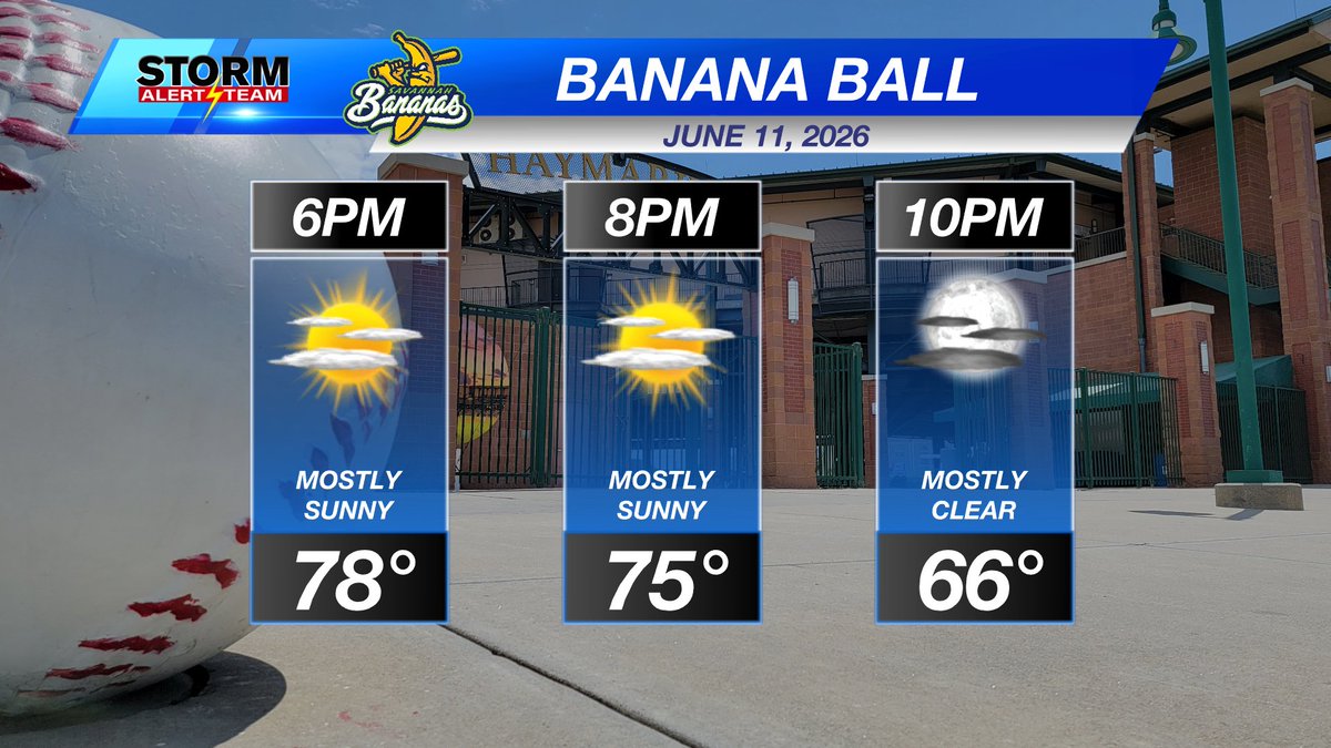
Jun 11
Headed to the @TheSavBananas game at Haymarket Park tonight? It's going to be a FANTASTIC night for some fun "baseball"!
1
8
1,048
There is a level 3 "Enhanced Risk" for severe storms in central and northern Nebraska Tuesday evening, then a level 2 "Slight Risk" surrounding it. Timing will be late afternoon into the evening.
1
11
1,589
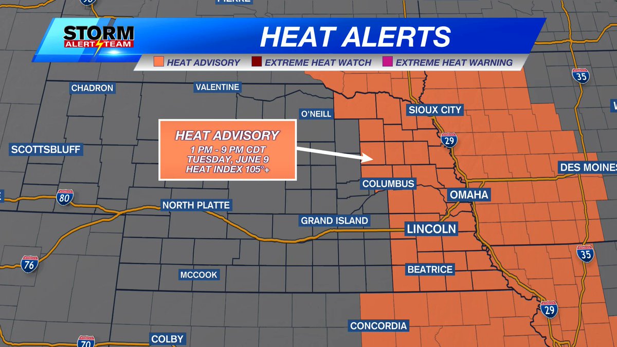
It is going to be HOT today. A HEAT ADVISORY is in place from 1pm through 9pm Tuesday, June 9th for temperatures in the mid 90s this afternoon and a heat index in the 105 to 108 range.
1
4
1,267
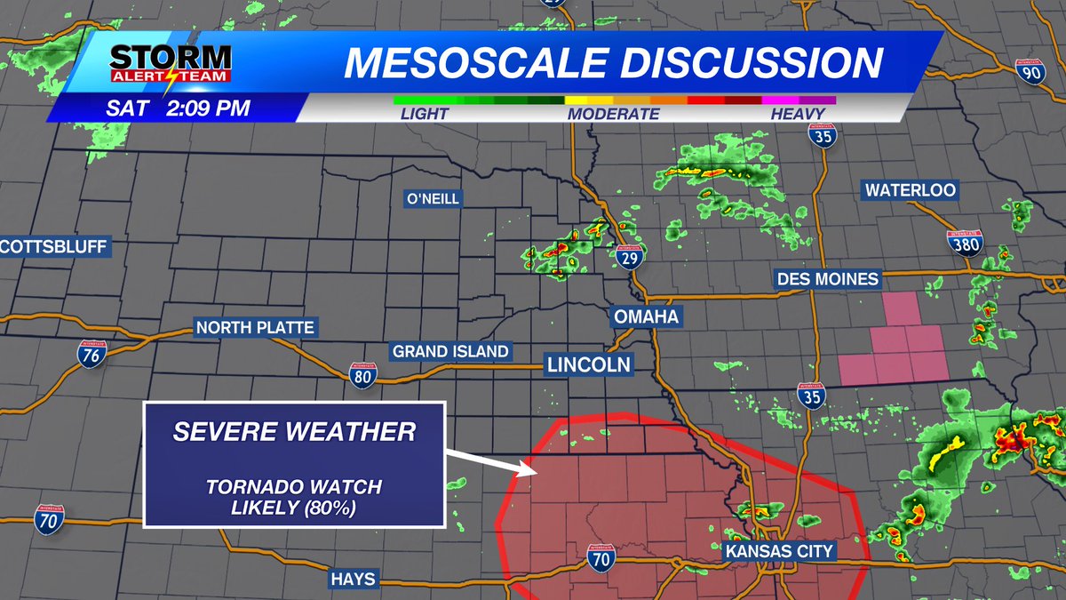
There is a Marginal and Slight risk for severe weather Friday.
Models aren't agreeing with timing/location, but overall it looks like storms form by late afternoon and could linger for most of the night.
Hail, wind, heavy rain, and isolated tornadoes are possible.
1
16
2,384
WATCH BEFORE THE WATCH: June 3, 2026
Parts of northern Nebraska is being monitored for a severe weather watch. There's a chance we may see one later this early evening.
4
1,961
RADAR CHECK: Through 326pm Tuesday, June 3rd
Storms are spreading out, but are also reforming over Harlan and Franklin counties. Might have some flooding issues in that area eventually
6
2,035
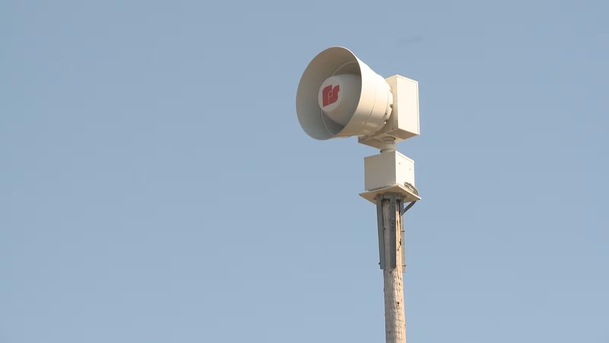
The monthly siren test is happening at 10:15am Wednesday, June 3rd!
Have a plan, practice it, and be ready. And remember, sirens are meant for those outdoors. Have other ways to be alerted should you be inside, in a car, or just can't hear them
1,336
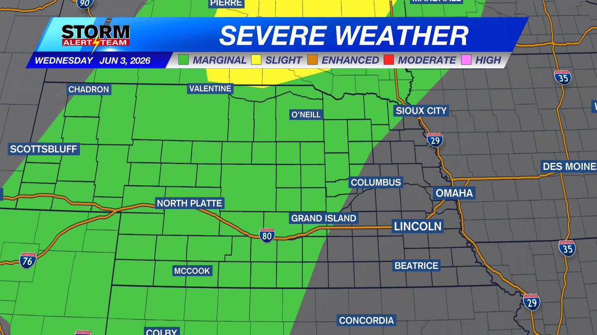
A level 1 Marginal Risk is in place for the potential for severe storms by late Wednesday afternoon and into the evening hours for much of the western half of Nebraska. Large hail and damaging wind are possible.
1
6
1,290
Rusty Dawkins KLKN retweeted

Jun 2
Really impressive light show around 2:15 am Holmes Lake area
1
1
4
1,688
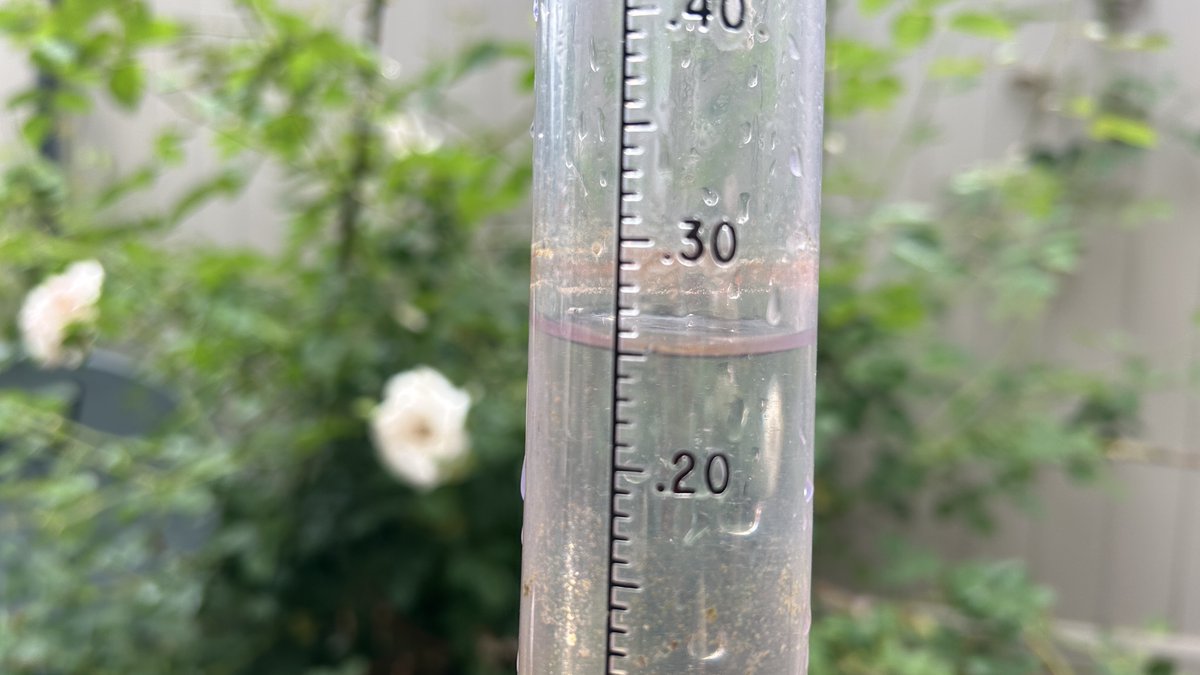
1.01" of rain at the Lincoln airport overnight (early Tuesday morning)! I got about 0.25" in my gauge in SE Lincoln.
1
13
1,669