
This is my personal account where I may occasionally share maps and other items of interest.
Joined June 2011
- Tweets 324
- Following 558
- Followers 303
- Likes 1,941
225 Photos and videos


30 Nov 2025
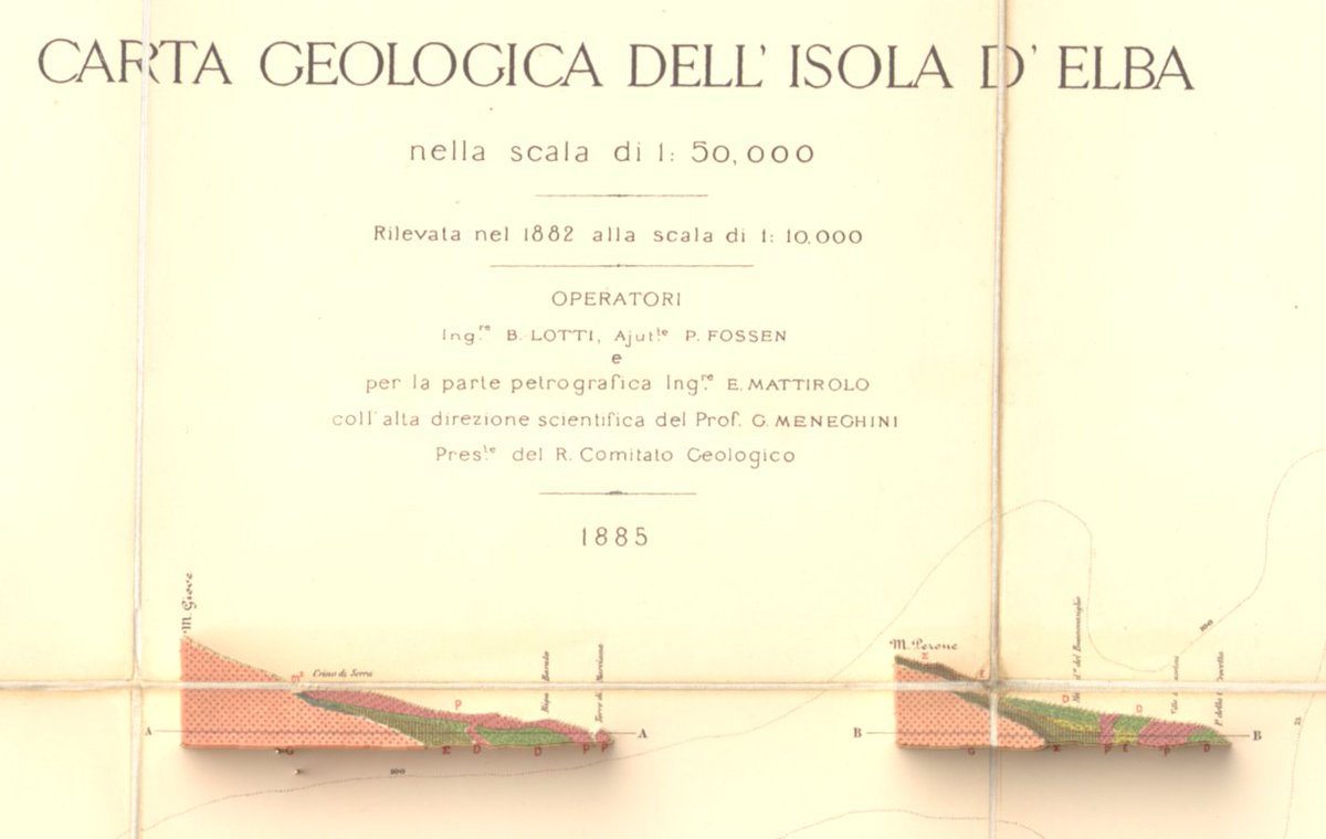
#30DayMapChallenge Day 29: Raster and Day 30: Makeover
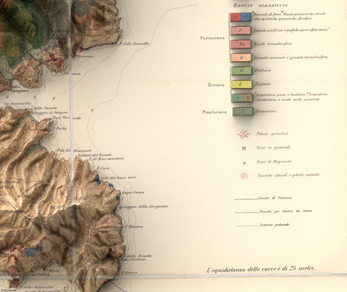
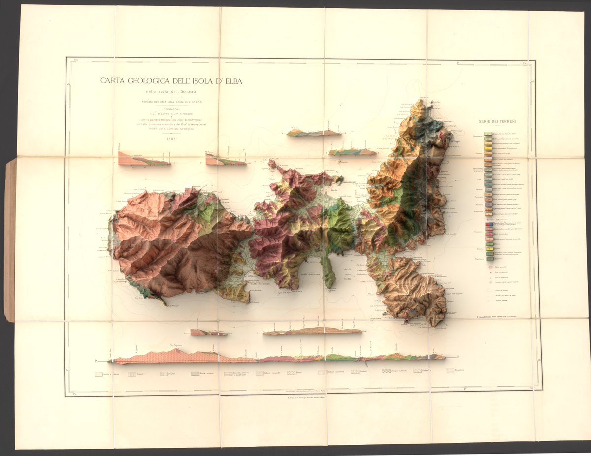
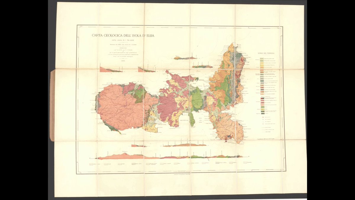
An old map (1882) of the Isle of Elba given an exaggerated elevation makeover using DEM. Made in #qgis and #b3d
(Source of data: Regione Toscana – Modello Digitale del Terreno Orografico,License: CC BY 4.0)
1
5
472
Sam J retweeted

26 Nov 2025
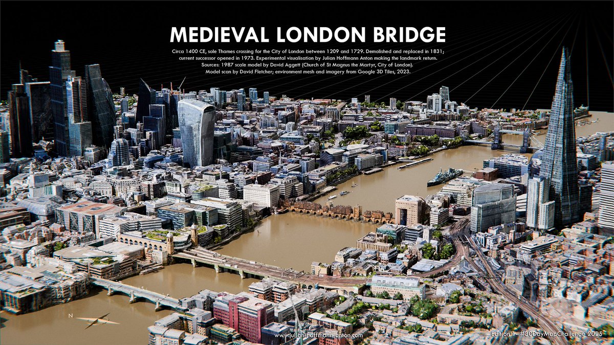
Medieval London Bridge: my Digital Reconstruction (c. 1400 CE) placing the lost structure back into the modern Thames & removing the modern one next to it. First edition for #30DayMapChallenge . Model by David Aggett 1987, scan by @artfletch . Completed in 1209, it remained the City of London’s sole river crossing until 1729. #b3d
1
5
29
3,904
26 Nov 2025
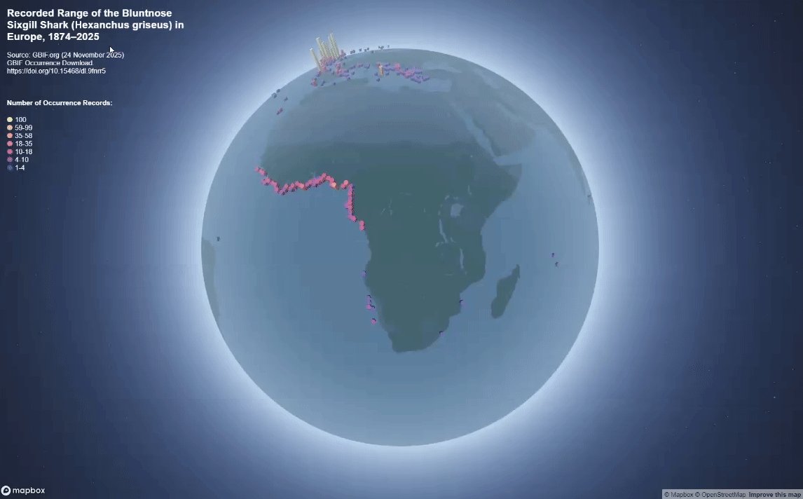
I also meant to post the global version of my #hex shark map for yesterday's (day 25) #30DayMapChallenge. Made with #mapbox
3
12
339
26 Nov 2025
#30DayMapChallenge Day 25: Hexagons
A little 3d hexmap of the bluntnose sixgill shark - aka Hexanchus griseus - and the largest hexanchoid shark.
Made in #qgis and #b3d with data from gbif
2
9
440
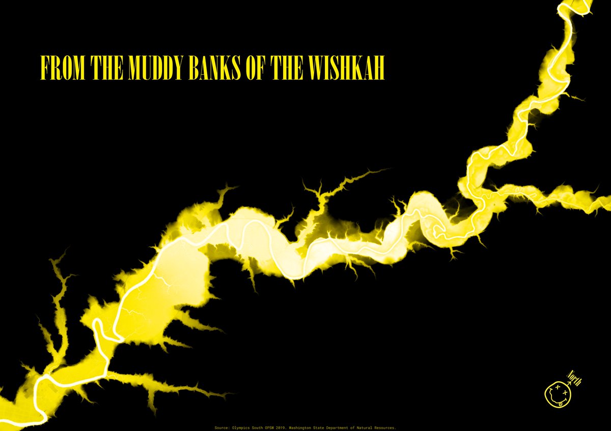
21 Nov 2025
#30DayMapChallenge Day 20: Water
Been meaning to attempt a relative elevation model for a while now, so had a first stab using the tutorial by Dan Coe.
Wishkah River, Washington. Strongly associated with one of my favourite bands of course.
Made in #qgis
1
1
190
21 Nov 2025
Yellow probably wasn't the best colour choice, but well it was part of my theme.
Anyway link to the tutorial that i used:
dancoecarto.com/creating-rem…
1
108
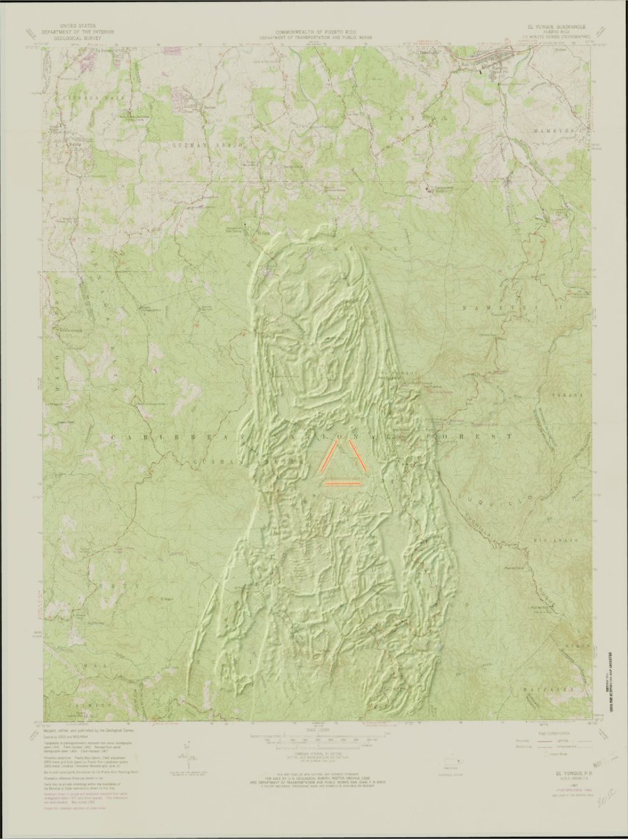
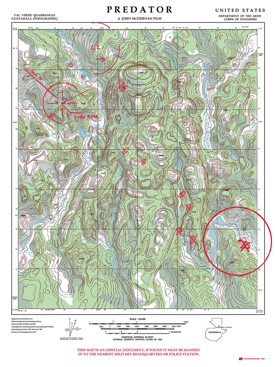
19 Nov 2025
#30DayMapChallenge Day 18: Out of this World
Not quite what I originally set out to achieve, but nonetheless some sort of map celebrating the #Predator movie (1987)
2
167
19 Nov 2025
Inspired by this movie poster which i had initially wanted to recreate but couldnt find the time.
1
73
17 Nov 2025
#30DayMapChallenge Day 16: Cell | Day 17: New tool
Playing around with some of the #mapbox gl js light settings on the BT Tower in Birmingham
1
7
319
17 Nov 2025
(I have used mapbox gl js before, but this month I have been using v3 for the first time - with its new features eg 3d models and dynamic lighting)
98
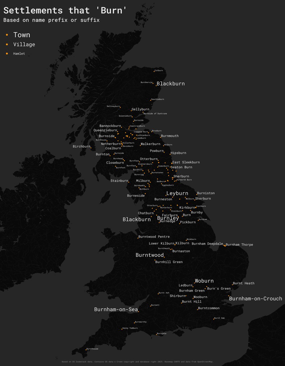
16 Nov 2025
#30DayMapChallenge Day 15 – Fire.
I am still catching up so another simple one here. Place names in GB that begin with or end with 'burn'. Based on @OrdnanceSurvey #zoomstack data, made in #qgis.
1
3
14
1,362
12 Nov 2025
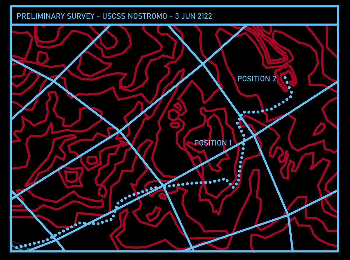
#30DayMapChallenge Day 12 — Map from 2125
Recovered transmission from the USCSS Nostromo - lost in space three years ago - reveals the vessel’s final destination before loss of contact
Made in #QGIS and #Blender, digitised from graphics seen in the #Alien movie (1979)
1
1
21
617
12 Nov 2025
the original graphic I attempted to digitise in order to create a DEM. taken from alientimeline.wordpress.com/…
1
1
173
16 Nov 2025
A clearer clip of the original render before the 80s VHS style effects were added.
1
119
16 Nov 2025
#30DayMapChallenge Day 13: A ten minute map and Day 14: OpenStreetMap
A quick map of Budapest. Actually took a lot less than 10 minutes using
@anvaka's city generator available at anvaka.github.io/city-roads/ which is based on OpenStreetMap data
10
74
3,649
11 Nov 2025
#30DayMapChallenge Day 10: Air and Day 11: Minimal
I fell behind so playing catchup, with a #joyplot map of air particulate matter based on data downloaded from NASA Earthdata. Made in #qgis.
3
21
668
10 Nov 2025
#30DayMapChallenge Day 9: Analogue
An early example of choropleth disease mapping: Joseph-François Malgaigne’s map of hernia incidence in France, 1840

1
6
21
753