Joined August 2020
- Tweets 220
- Following 1,457
- Followers 506
- Likes 229
32 Photos and videos


Jan 4
How to Convert KMZ to Shapefile in QGIS | KMZ vs Shapefile Explained
youtu.be/KK4KbQCcgu0?si=JxoH…
24
Geospatial retweeted

30 Nov 2024
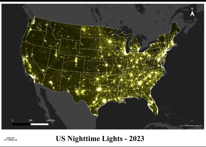
Day 30 of the #30DayMapChallenge: The Final Map
𝗠𝗮𝗽: 𝗨𝗦 𝗡𝗶𝗴𝗵𝘁𝗹𝗶𝗴𝗵𝘁 𝗗𝗮𝘁𝗮 - 2023
For the final challenge, I chose to revisit nightlight data to create a stunning visualization of the United States.
1
3
200
Geospatial retweeted
18 Nov 2024
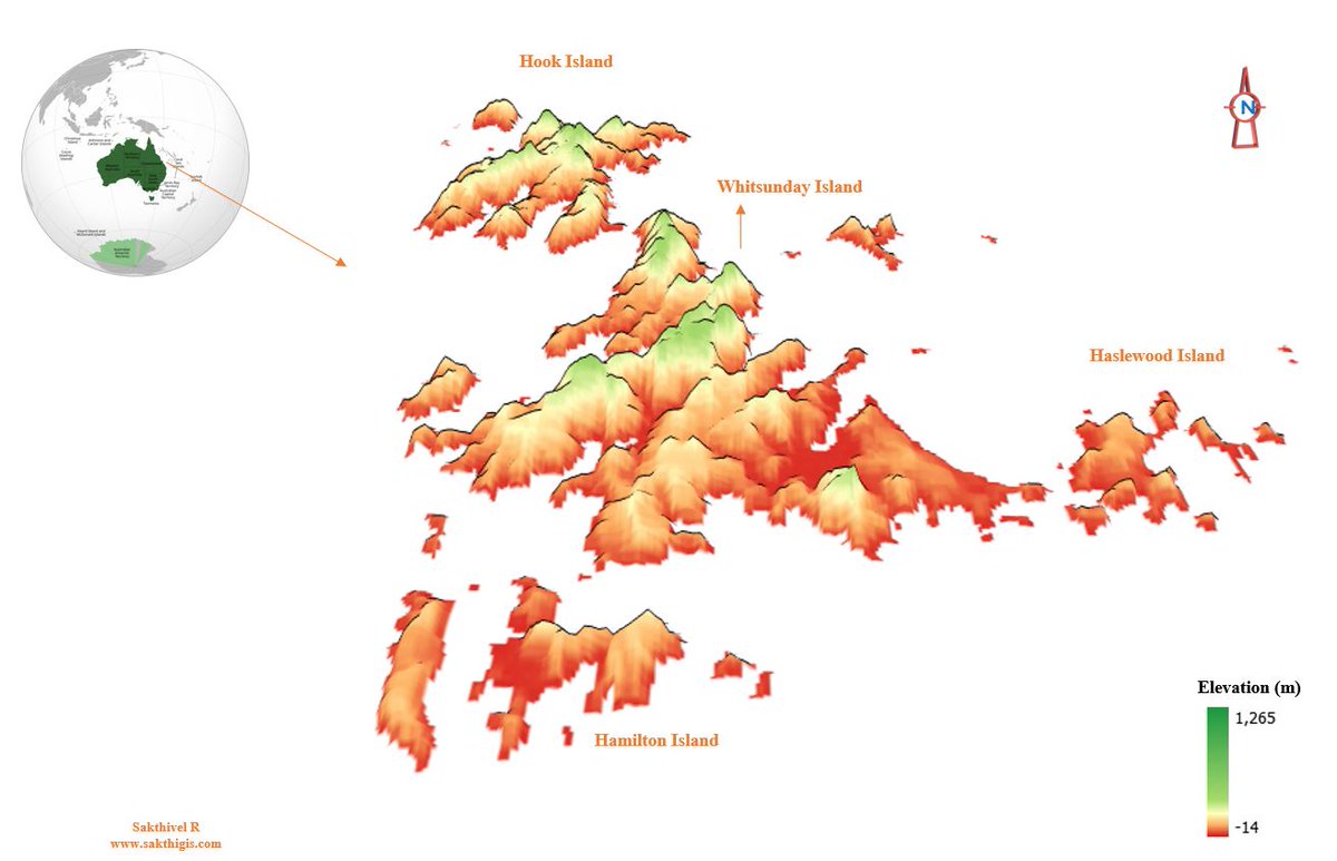
Day 18 of the #30DayMapChallenge: 3D
𝐌𝐚𝐩: 3𝐃 𝐌𝐚𝐩 𝐨𝐟 𝐖𝐡𝐢𝐭𝐬𝐮𝐧𝐝𝐚𝐲 𝐈𝐬𝐥𝐚𝐧𝐝𝐬
This map presents a 3D visualization of the Whitsunday Islands, including Hook Island, Hamilton Island, and Haslewood Island.
2
9
445
Geospatial retweeted
17 Nov 2024
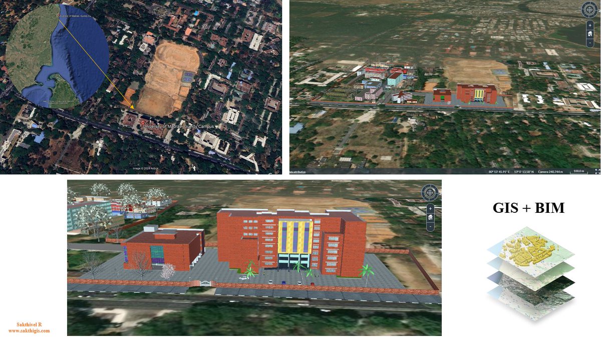
Day 17 of the #30DayMapChallenge: Collaborative Map
𝐌𝐚𝐩: 𝐆𝐈𝐒 𝐁𝐈𝐌 𝐈𝐧𝐭𝐞𝐠𝐫𝐚𝐭𝐢𝐨𝐧
For today’s challenge, I collaborated with my friend Venkatesh Kannayiram, an expert in 3D modeling. Together, we created a 3D map of the UNOM, Guindy buildings.
1
1
129
Geospatial retweeted
9 Nov 2024
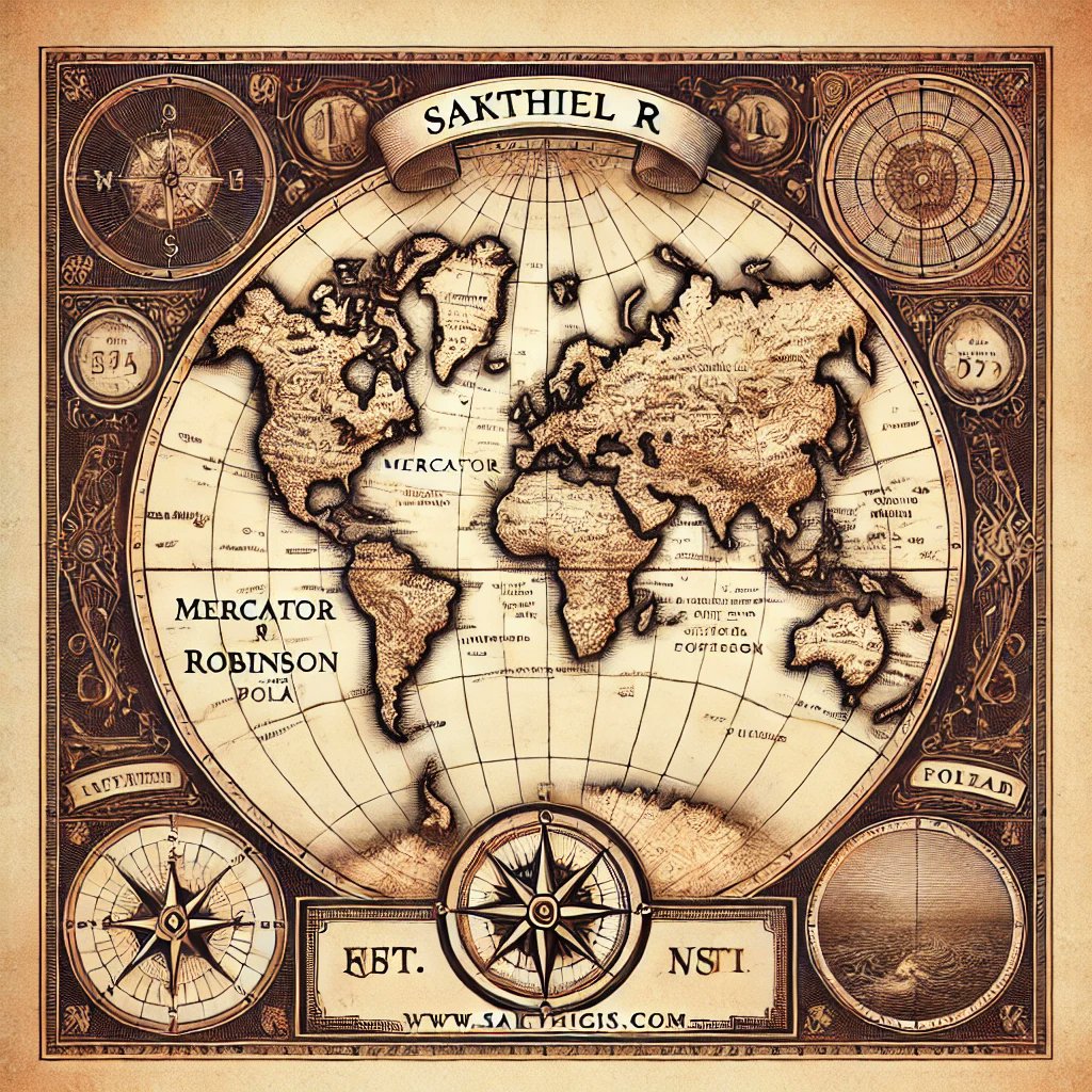
Day 9 of the #30DayMapChallenge: AI Only
𝐌𝐚𝐩: 𝐖𝐨𝐫𝐥𝐝 𝐌𝐚𝐩
Using ChatGPT's image generator, I've created an antique-styled world map. .
2
3
122
Geospatial retweeted
11 Nov 2024
Day 11 of the #30DayMapChallenge: Arctic
𝐌𝐚𝐩: 𝐀𝐫𝐜𝐭𝐢𝐜 𝐑𝐞𝐠𝐢𝐨𝐧 𝐌𝐚𝐫𝐠𝐢𝐧𝐚𝐥 𝐈𝐜𝐞 𝐙𝐨𝐧𝐞
This map illustrates the Marginal Ice Zone in the Arctic region, displaying the extent of sea ice as of November 2, 2024. The data was downloaded from the USIC.

1
1
130
Geospatial retweeted
13 Nov 2024
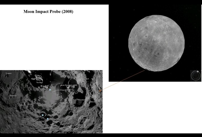
Day 13 of the #30DayMapChallenge: A New Tool
𝐌𝐚𝐩: 𝐌𝐨𝐨𝐧 𝐈𝐦𝐩𝐚𝐜𝐭 𝐏𝐫𝐨𝐛𝐞 (2008) 𝐋𝐨𝐜𝐚𝐭𝐢𝐨𝐧 𝐨𝐧 𝐭𝐡𝐞 𝐌𝐨𝐨𝐧
Tool Used: Google Earth Pro
This map pinpoints the location of the Moon Impact Probe from India's 2008 mission on the lunar surface.
1
1
114
Geospatial retweeted
14 Nov 2024
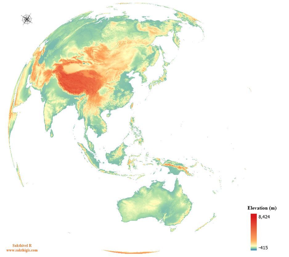
Day 14 of the #30DayMapChallenge: A World Map
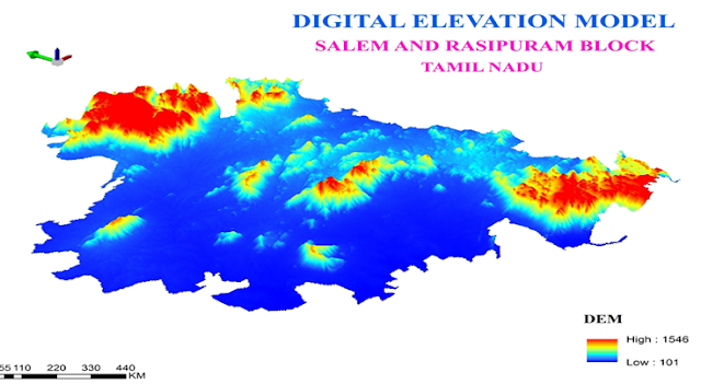
𝗠𝗮𝗽: 𝗘𝗹𝗲𝘃𝗮𝘁𝗶𝗼𝗻 𝗼𝗳 𝘁𝗵𝗲 𝗪𝗼𝗿𝗹𝗱
This map illustrates the elevation of the world, showcasing the diverse topography of our planet.
1
1
94
Geospatial retweeted
15 Nov 2024
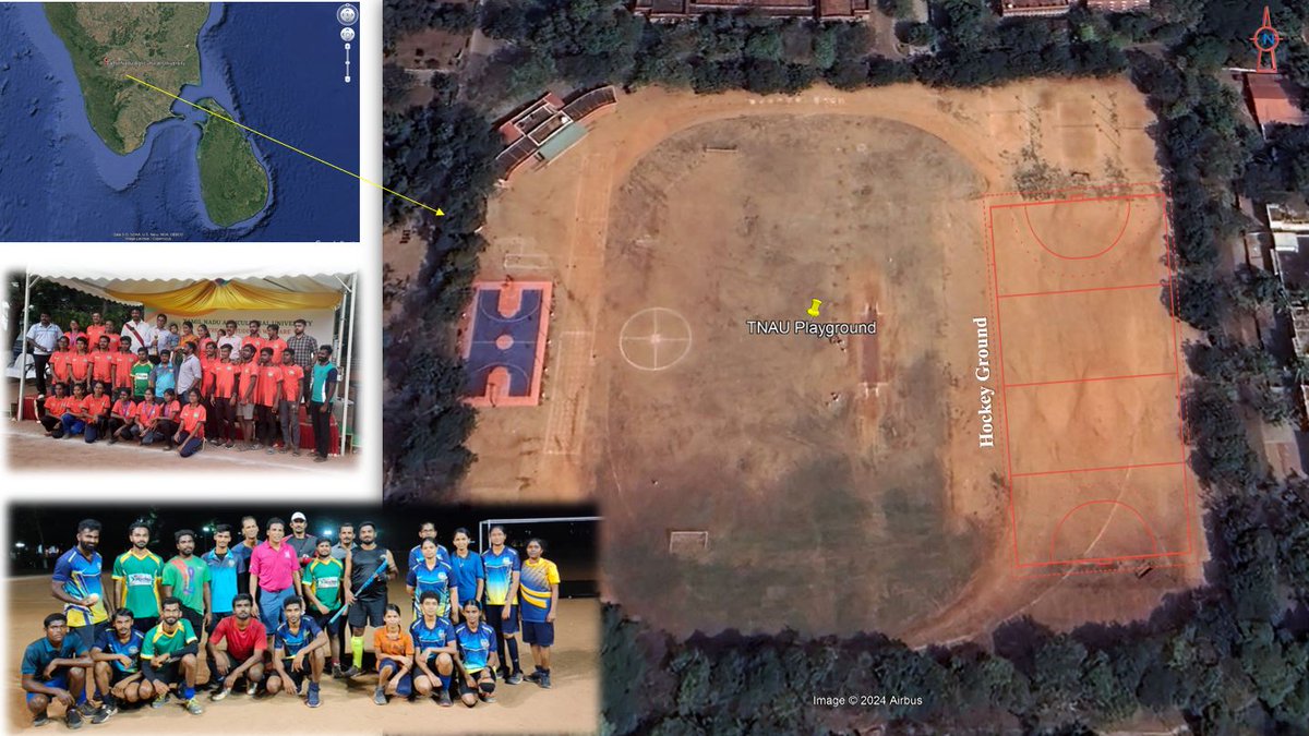
Day 15 of the #30DayMapChallenge: Data: My Data
𝐌𝐚𝐩: 𝐇𝐨𝐜𝐤𝐞𝐲 𝐆𝐫𝐨𝐮𝐧𝐝 𝐨𝐟 𝐓𝐍𝐀𝐔
This map holds a special place in my heart, showcasing the hockey ground of Tamil Nadu Agricultural University (TNAU).
1
1
91
Geospatial retweeted
16 Nov 2024
Day 16 of the #30DayMapChallenge: Choropleth
𝐌𝐚𝐩: 𝐇𝐲𝐝𝐫𝐨𝐥𝐨𝐠𝐢𝐜𝐚𝐥 𝐃𝐢𝐬𝐚𝐬𝐭𝐞𝐫 𝐎𝐜𝐜𝐮𝐫𝐫𝐞𝐧𝐜𝐞 𝐢𝐧 𝐈𝐧𝐝𝐢𝐚 (2014 - 2023)

1
3
117
Geospatial retweeted
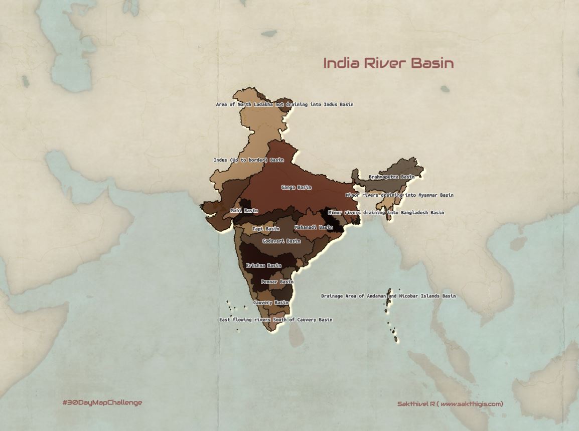
7 Nov 2024
Day 7 of the #30DayMapChallenge: Vintage Style
𝐌𝐚𝐩: 𝐈𝐧𝐝𝐢𝐚 𝐑𝐢𝐯𝐞𝐫 𝐁𝐚𝐬𝐢𝐧𝐬
This map depicts the river basins of India, elegantly rendered in a vintage style. The vintage-styled basemap enhances the historical aesthetic, giving the map a classic appearance.
1
2
75
Geospatial retweeted
6 Nov 2024
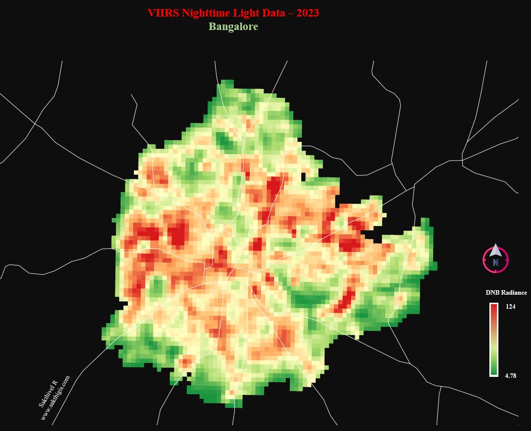
Day 6 of the #30DayMapChallenge: Raster
𝐌𝐚𝐩: 𝐕𝐈𝐈𝐑𝐒 𝐍𝐢𝐠𝐡𝐭𝐭𝐢𝐦𝐞 𝐋𝐢𝐠𝐡𝐭 𝐃𝐚𝐭𝐚 – 2023 (𝐁𝐚𝐧𝐠𝐚𝐥𝐨𝐫𝐞)
This map showcases the VIIRS nighttime light data for Bangalore in 2023 using raster imagery.
1
3
55
Geospatial retweeted
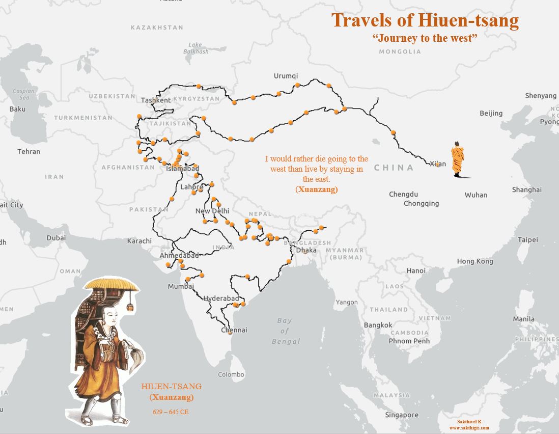
5 Nov 2024
Day 5 of the #30DayMapChallenge: A Journey
𝐌𝐚𝐩 : 𝐓𝐡𝐞 𝐓𝐫𝐚𝐯𝐞𝐥𝐬 𝐨𝐟 𝐇𝐢𝐮𝐞𝐧-𝐓𝐬𝐚𝐧𝐠 (𝐉𝐨𝐮𝐫𝐧𝐞𝐲 𝐭𝐨 𝐭𝐡𝐞 𝐖𝐞𝐬𝐭)
This map traces the remarkable journey of Hiuen-Tsang, the renowned Chinese Buddhist monk & scholar, who traveled to India in 7th cent.
1
1
11
172
Geospatial retweeted
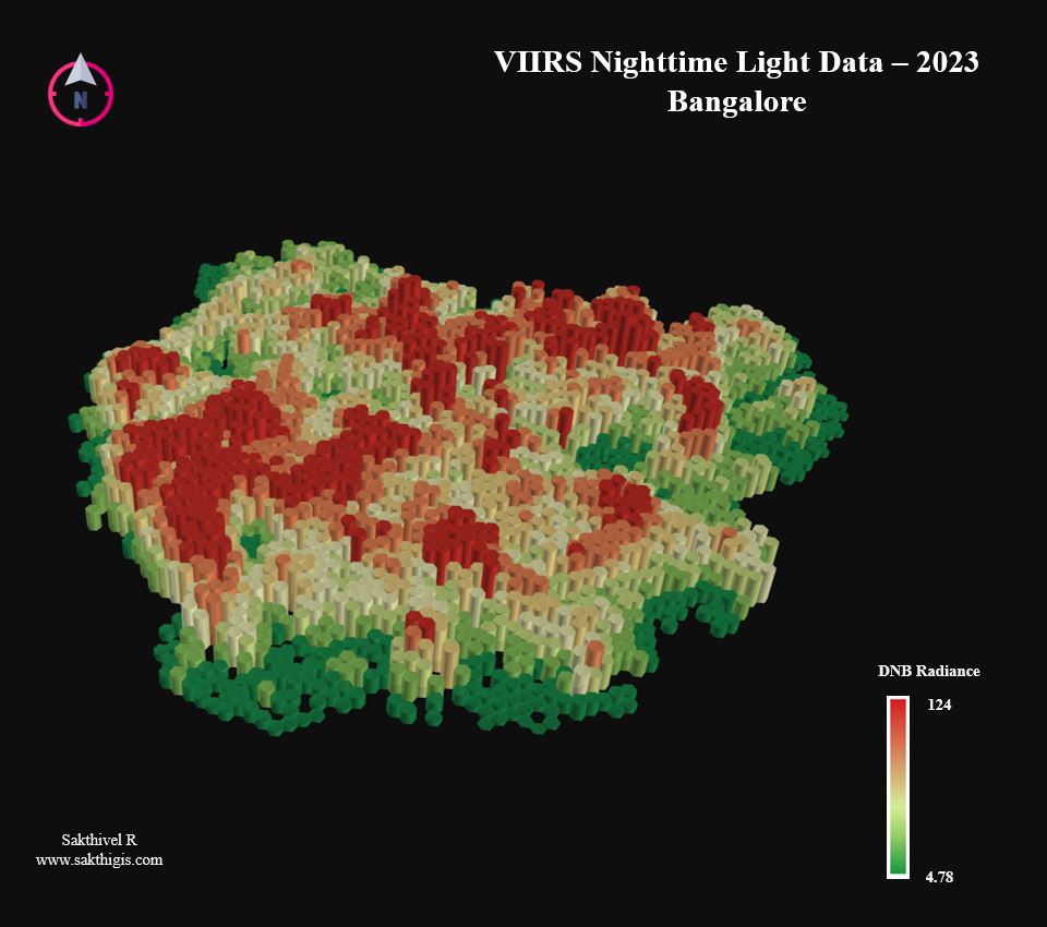
4 Nov 2024
Day 4 of the #30DayMapChallenge: Hexagons
𝐌𝐚𝐩: 𝐕𝐈𝐈𝐑𝐒 𝐍𝐢𝐠𝐡𝐭𝐭𝐢𝐦𝐞 𝐋𝐢𝐠𝐡𝐭 𝐃𝐚𝐭𝐚 – 2023 ( 𝐁𝐚𝐧𝐠𝐚𝐥𝐨𝐫𝐞 )
This map visualizes the VIIRS nighttime light data for Bangalore in 2023 using hexagons.
1
3
66
Geospatial retweeted
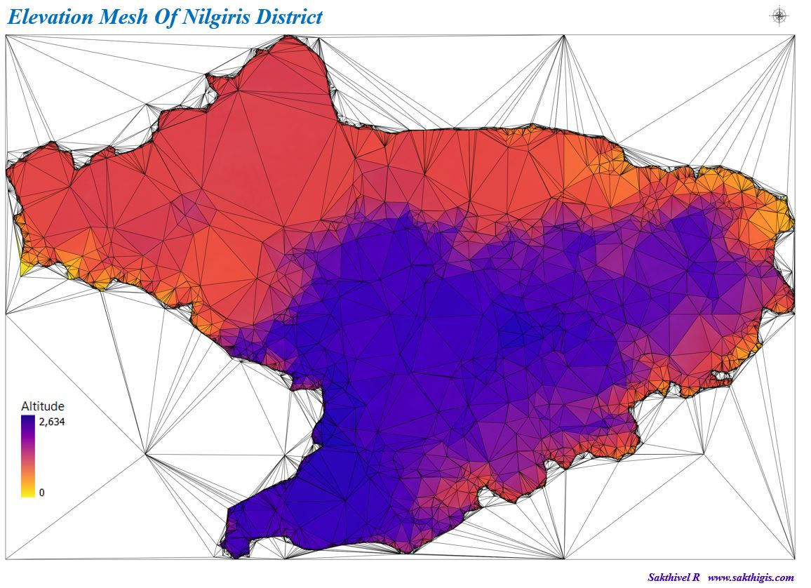
3 Nov 2024
Day 3 of the #30DayMapChallenge: Polygons
𝐌𝐚𝐩: 𝐓𝐡𝐞 𝐄𝐥𝐞𝐯𝐚𝐭𝐢𝐨𝐧 𝐌𝐞𝐬𝐡 𝐨𝐟 𝐍𝐢𝐥𝐠𝐢𝐫𝐢𝐬 𝐃𝐢𝐬𝐭𝐫𝐢𝐜𝐭
The Elevation Mesh of Nilgiris District map showcases the varied topography of this region using polygons to represent different elevation levels.
1
2
75
Geospatial retweeted
2 Nov 2024
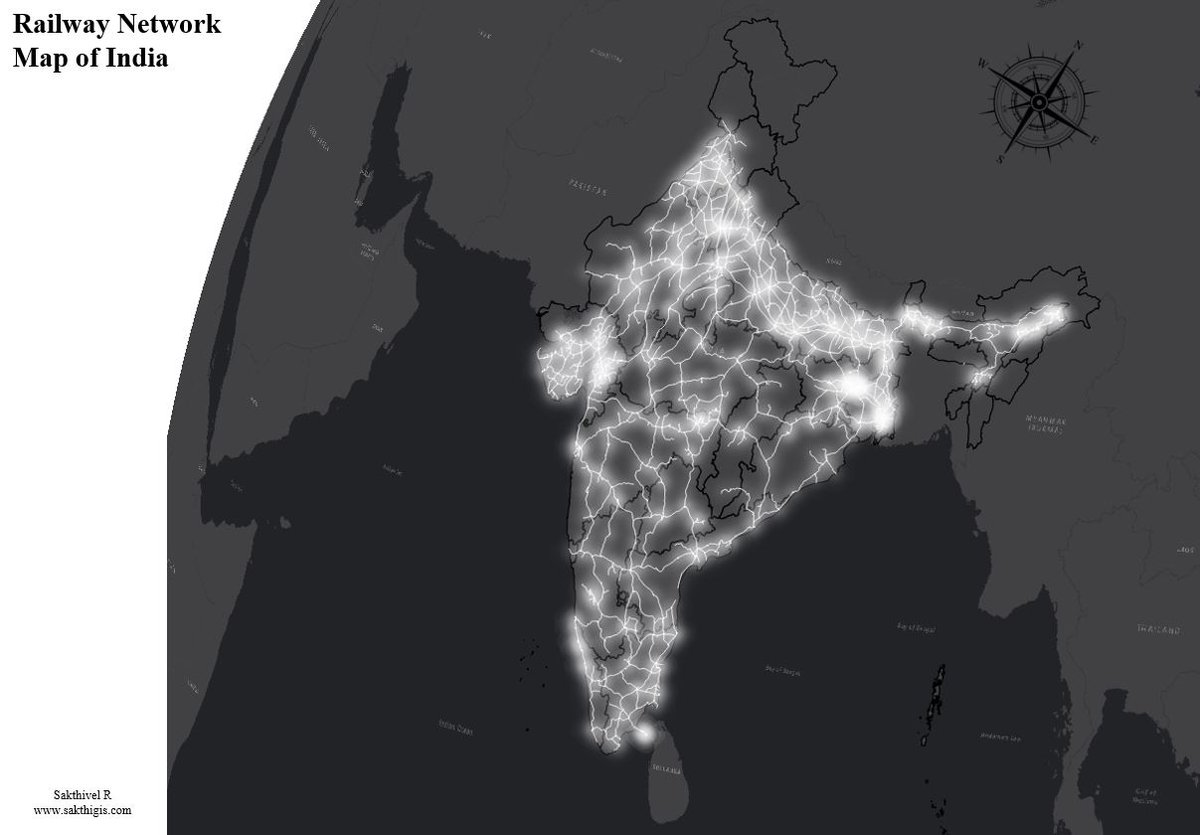
Day 2 of #30DayMapChallenge : Lines
𝐌𝐚𝐩 : 𝐑𝐚𝐢𝐥𝐰𝐚𝐲 𝐍𝐞𝐭𝐰𝐨𝐫𝐤 𝐌𝐚𝐩 𝐨𝐟 𝐈𝐧𝐝𝐢𝐚
The Railway Network Map of India illustrates the extensive and intricate web of railway lines connecting the nation.
1
2
82
Geospatial retweeted
1 Nov 2024
Day 1 of #30DayMapChallenge : Points
𝐌𝐚𝐩 : 𝑷𝒐𝒘𝒆𝒓 𝑷𝒍𝒂𝒏𝒕𝒔 𝒐𝒇 𝑰𝒏𝒅𝒊𝒂
I've created a map showcasing the power plants of India. The colors represent the primary fuels, and the size of the points indicates the capacity of each power plant.

1
4
86

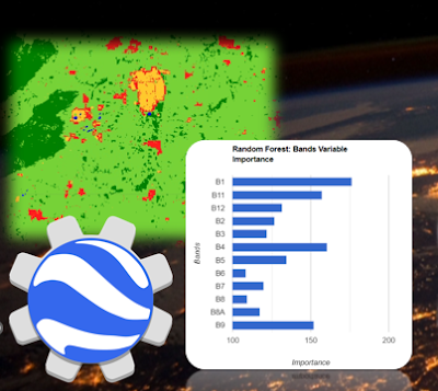
MOLUSCE is back to @QGIS 3! Predict your landcover maps into the future 🌎🌍🌏 youtube.com/watch?v=F4j1fTyC…
1
21
68
4,116