- Tweets 4,794
- Following 886
- Followers 3,896
- Likes 2,179


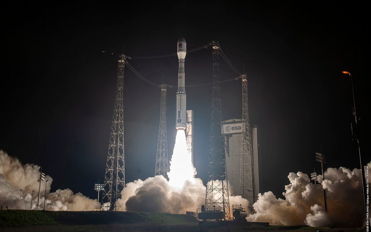


ALT Vega-C liftoff from Europe’s Spaceport in French Guiana at 00:52 local time (04:52 BST/05:52 CEST) on 19 May 2026. Vega-C carried the Smile mission to space on flight VV29. Credit: ESA-S. Corvaja
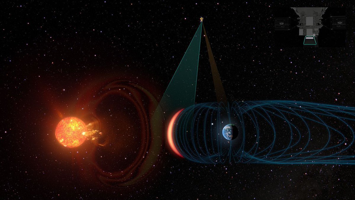
ALT Smile's X-ray camera sees Earth reacting to coronal mass ejection. Artist’s impression. Credit: ESA

ALT Artist’s impression of the Smile spacecraft. Credit: ESA
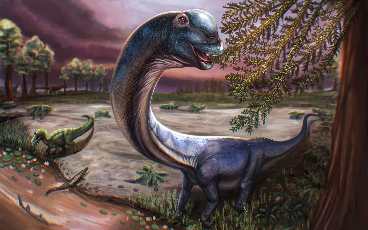
ALT Artistic illustration of a Natagitan. Credit: Patchanop Boonsai.
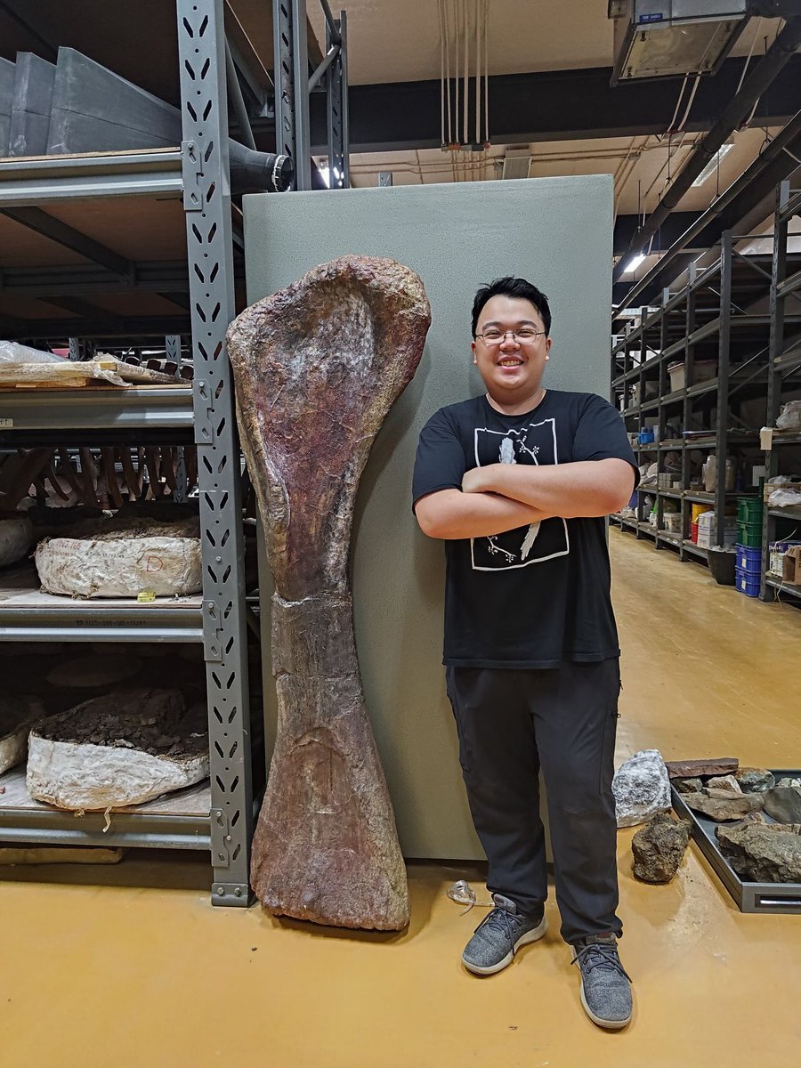
ALT Sethapanichsakul and the front leg bone (humerus). Credit: Thitiwoot (Perth) Sethapanichsakul.
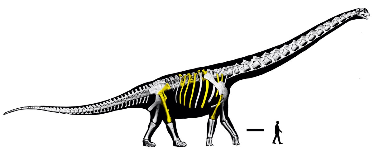
ALT Skeletal reconstruction with specimens highlighted in yellow. Credit: Thitiwoot (Perth) Sethapanichsakul et al

ALT Female student looking out of the window in the Student Centre at Bloomsbury campus overlaid by "UCL Open Days 2026" graphics
ALT Oblique aerial photo of the 10 August 2025 landslide taken from across the fjord during a U.S. Geological Survey field reconnaissance overflight on 13 August, 2025. Note the trimline along the far side of the fjord, caused by the tsunami stripping the walls of vegetations. View direction is approximately north. Photo by Cyrus Read/U.S. Geological Survey.
ALT Oblique aerial photo of the landslide and the highest run-up resulting from the landslide-triggered tsunami in Tracy Arm during a U.S. Geological Survey field reconnaissance overflight. View direction is approximately south. Photo by John Lyons/U.S. Geological Survey.

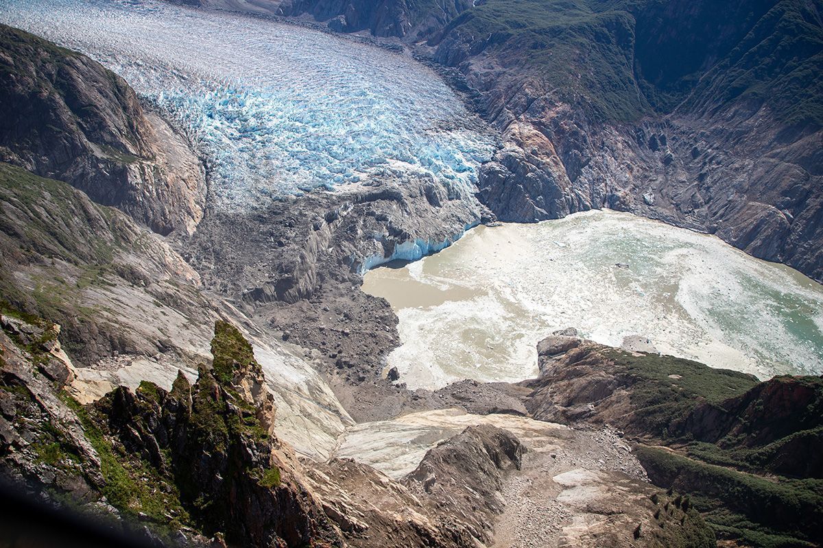
ALT Before and after satellite imagery showing locations and extent of the August 10, 2025 landslide. South Sawyer Glacier terminus positions since 1979 and the locations of three precursory slope failures since 2017 are also shown. In panel B, the white line indicates the main landslide, while the dashed yellow delineates the additional landslide-affected area. The pink line indicates the area of landslide deposition on top of the glacier. Coloured dots (which are close enough together that they look like a line) represent the tsunami runup. Source: Planet Labs.