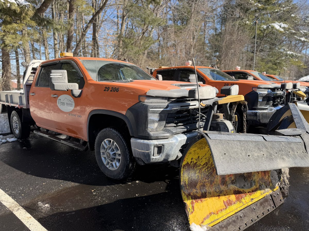
VT Emergency Management is a division of the Department of Public Safety. We assist communities with emergency preparedness, response, and recovery.
- Tweets 3,705
- Following 230
- Followers 10,259
- Likes 169


ALT It'll be a hot and humid day across the region today as temperatures climb into the 80s to near 90 degrees with dewpoints in the mid to upper 60s. This will lead to heat indices in the 90s for many locations and close to 100 degrees in the lower Connecticut River Valley. A heat advisory is in effect for eastern Windham and eastern Windsor Counties in Vermont from noon to 8 PM today.
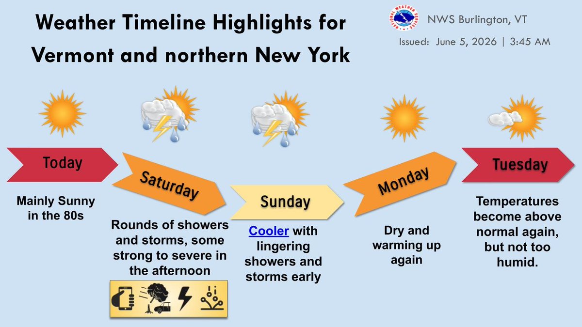
ALT The weather timeline is shown with arrows indicating the direction of temperatures. Text blurbs discuss rain chances Saturday and Sunday, with a bubble of threats for Saturday afternoon (wind, hail, lightning). Today and Tuesday's boxes are red, like the heat.
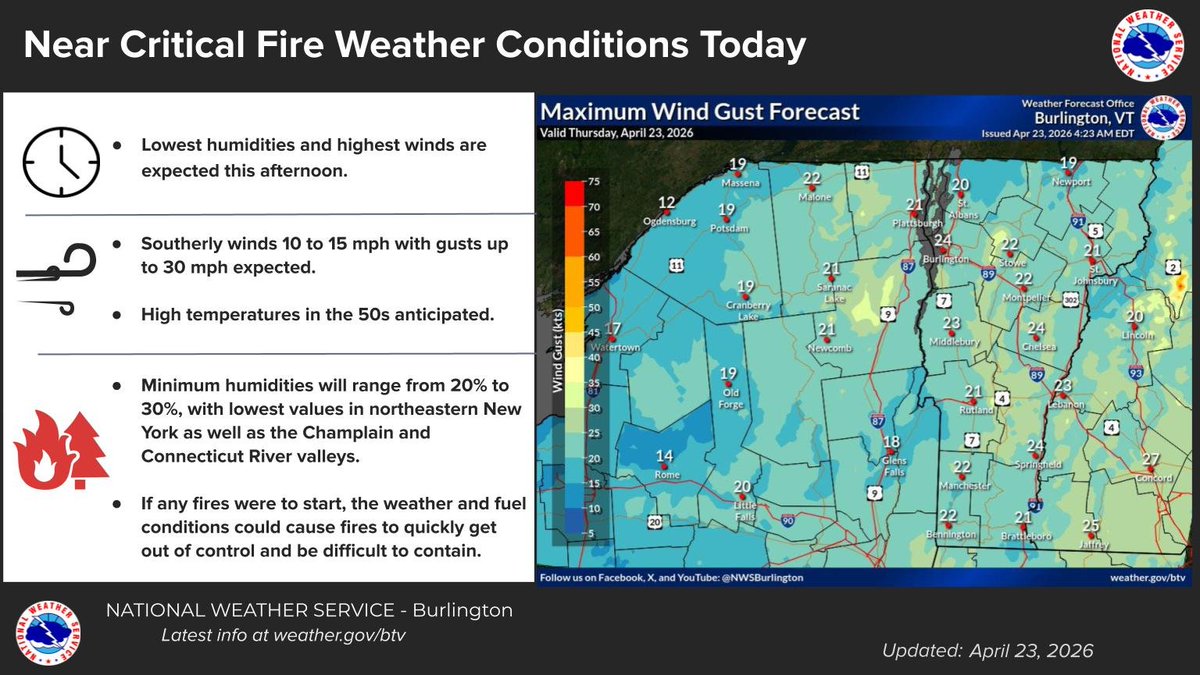
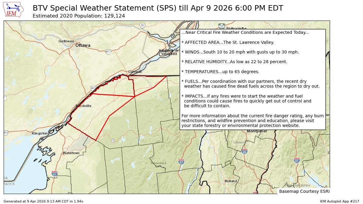
ALT An infographic explaining there will be near critical fire weather conditions today, April 23, 2026, with a map of northern New York and Vermont and overlaid maximum wind gust forecasts overlaid on top.
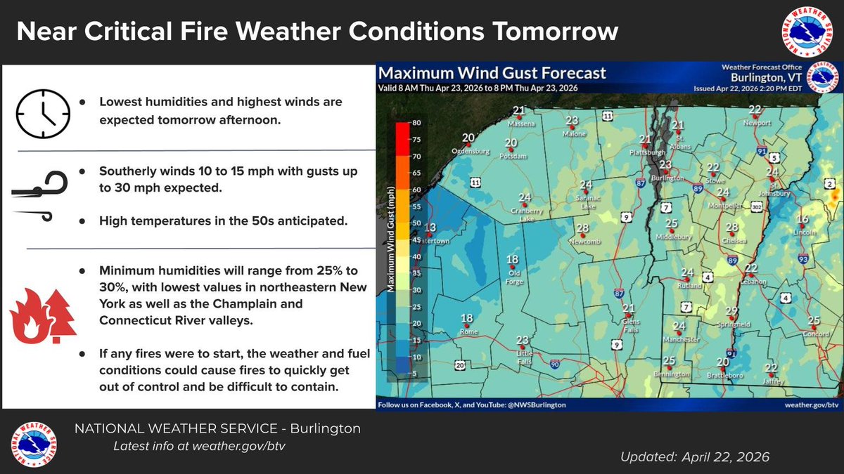
ALT An infographic explaining there will be near critical fire weather conditions tomorrow, April 23, 2026, with a map of northern New York and Vermont and overlaid maximum wind gust forecasts overlaid on top.
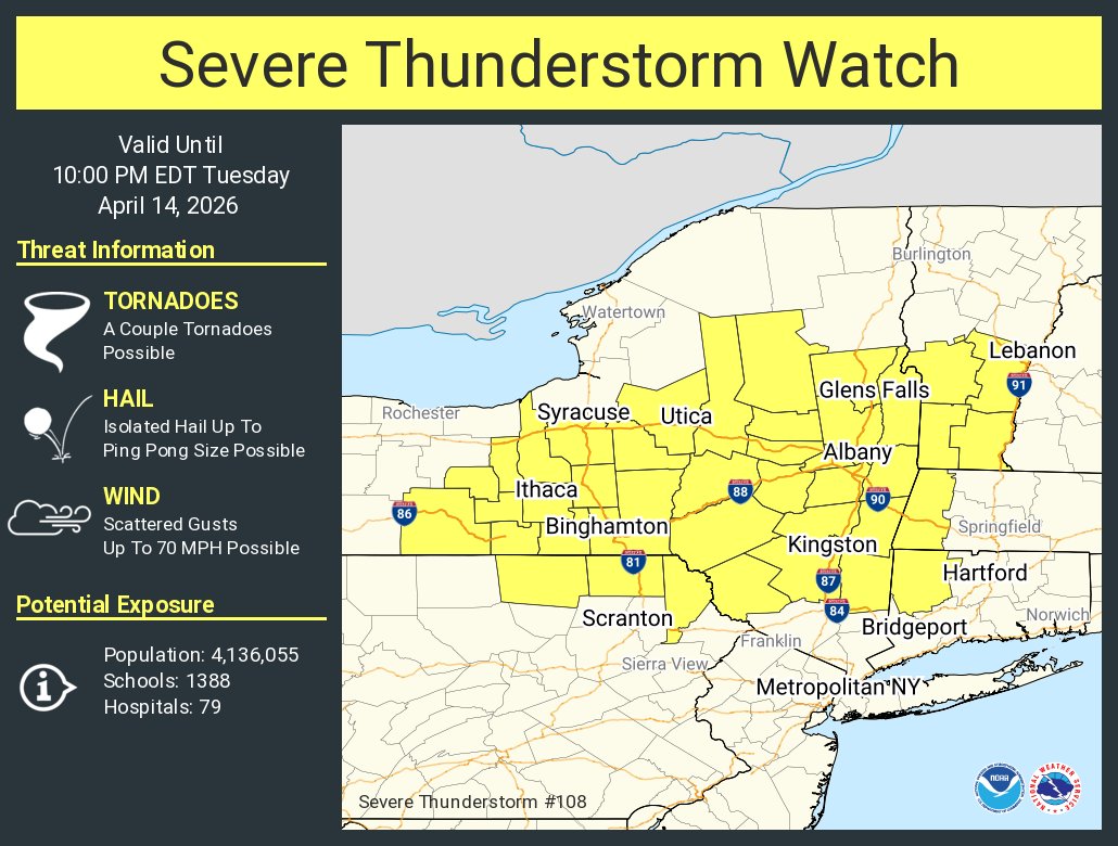
ALT This graphic displays Severe Thunderstorm watch number 108 plotted on a map. The watch is in effect until 10:00 PM EDT. The watch includes parts of Connecticut, Massachusetts, New York, Pennsylvania and Vermont. The threats associated with this watch are a couple tornadoes possible, isolated hail up to ping pong size possible and scattered gusts up to 70 mph possible. There are 4,136,055 people in the watch along with 1388 schools and 79 hospitals.

ALT The risk of severe thunderstorms with a low chance of a tornado continues for later this afternoon in portions of northern New York and Vermont. Greatest risk is between 3 and 7 PM and over southern portions of Vermont.
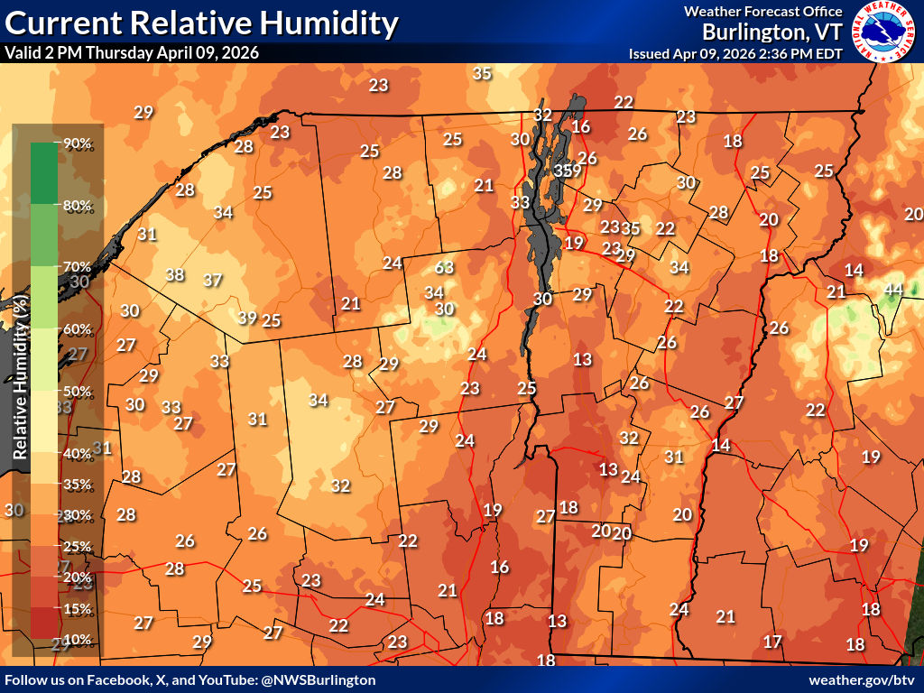
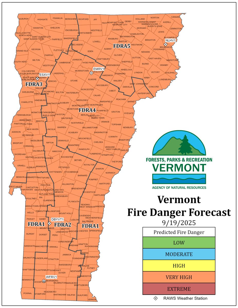
ALT A map that is brown like it is dry. Relative humidity across the area ranges between 13 and 38 percent, driest in Vermont.


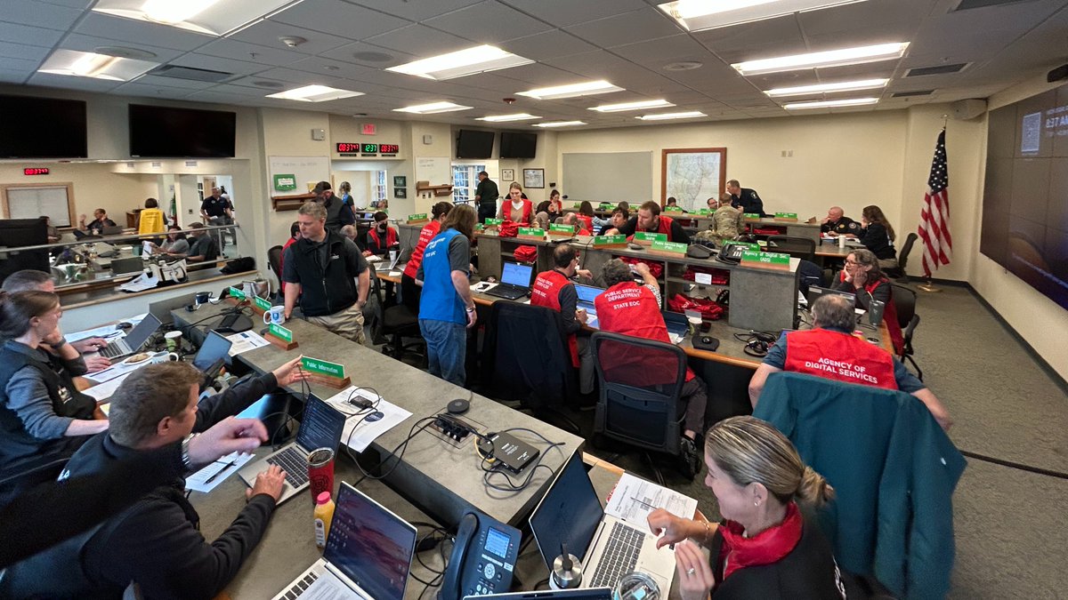
ALT A group of about 30 people in a room sitting around three tables working on computers and talking.
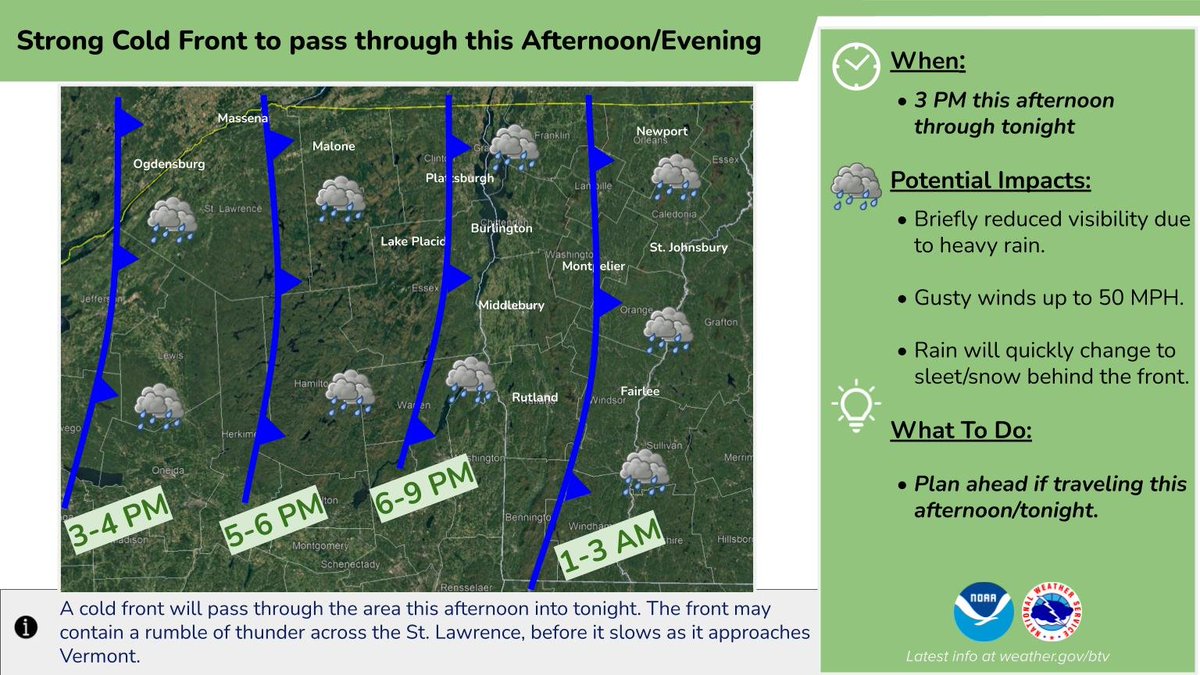
ALT Timeline for the frontal passage this afternoon.
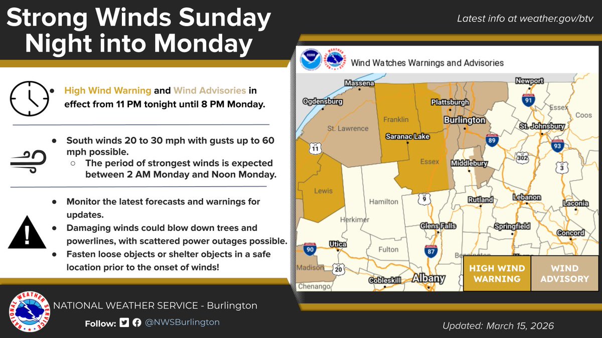
ALT Infographic detailing the wind hazards and timing details for tonight into tomorrow.
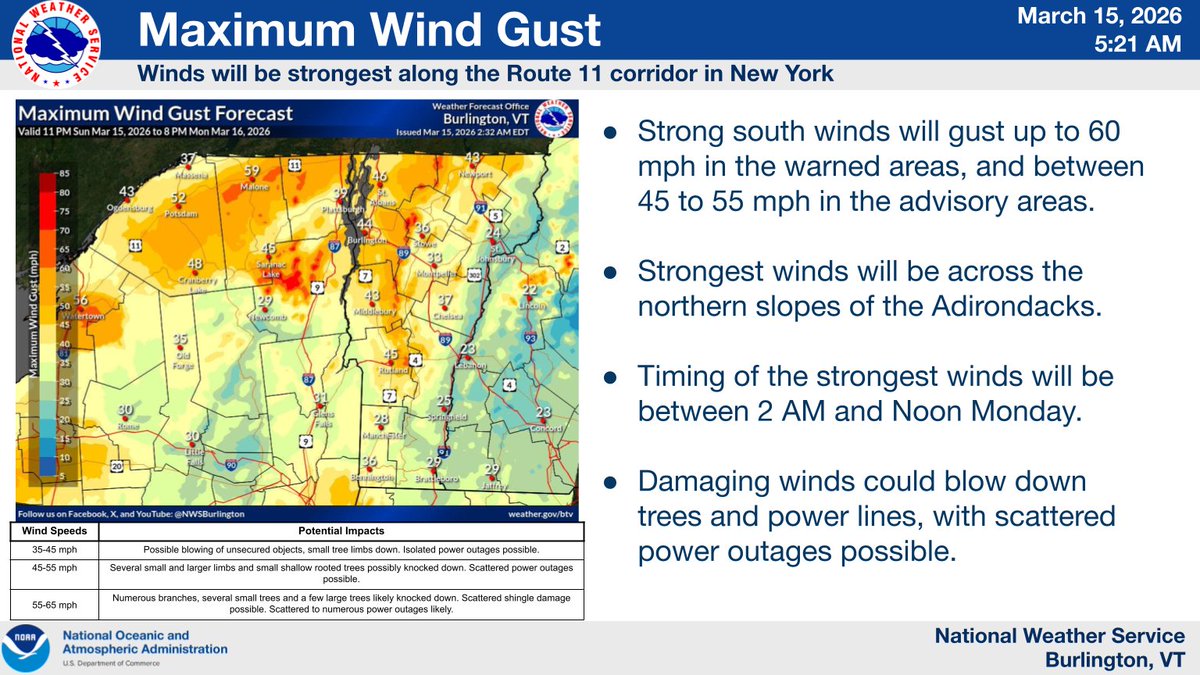
ALT Strongest winds will be across northern New York, as strong gusts up to 60 MPH develop this evening into tomorrow.

ALT Temperatures will fall rapidly across the area Monday night behind the strong front. Patchy black ice and light snow is possible Monday night into Tuesday.
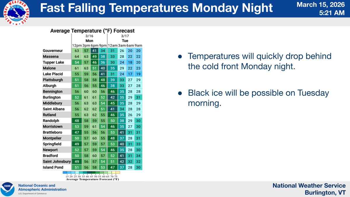
ALT Temperatures will quickly fall behind the front Monday Night. Black ice is possible by Tuesday Night.
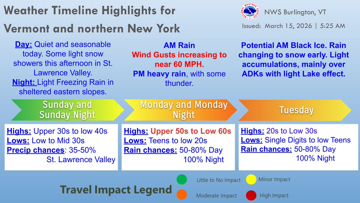
ALT Infographic detailing the future hazards for the region the next few days.
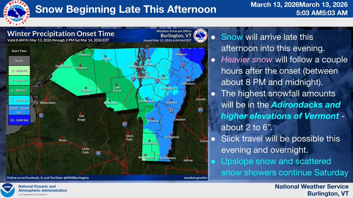
ALT The onset map shows snow reaching northern New York around 4-6 PM, and then expanding northeast by 6-10 PM. Parts of the Northeast Kingdom will be closer to midnight.


ALT Image shows the probability of at least one tenth of an inch of flat ice across eastern New York and western New England through Friday morning.

ALT Image shows the probability of at least one quarter of an inch of flat ice across eastern New York and western New England through Friday morning.

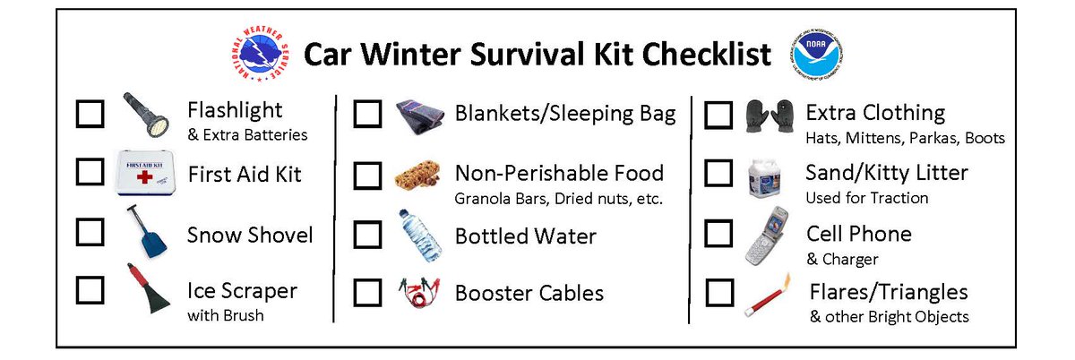
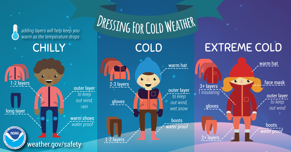
ALT Infographic describing safety information for navigating icy surfaces.
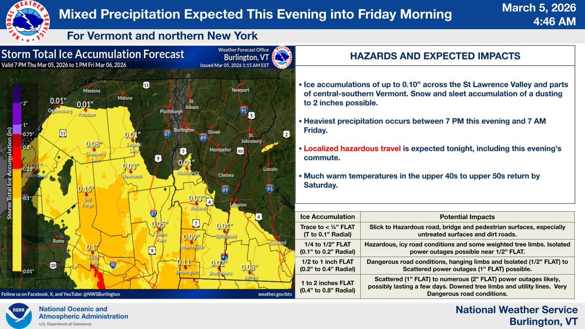
ALT Ice accumulations of up to 0.10” across the St Lawrence Valley and parts of central-southern Vermont. Snow and sleet accumulation of a dusting to 2 inches possible. Heaviest precipitation occurs between 7 PM this evening and 7 AM Friday. Localized hazardous travel is expected tonight, including this evening’s commute. Much warm temperatures in the upper 40s to upper 50s return by Saturday.