
Joined June 2009
- Tweets 10,254
- Following 887
- Followers 9,158
- Likes 9,642
Photos and videos
Pinned Tweet

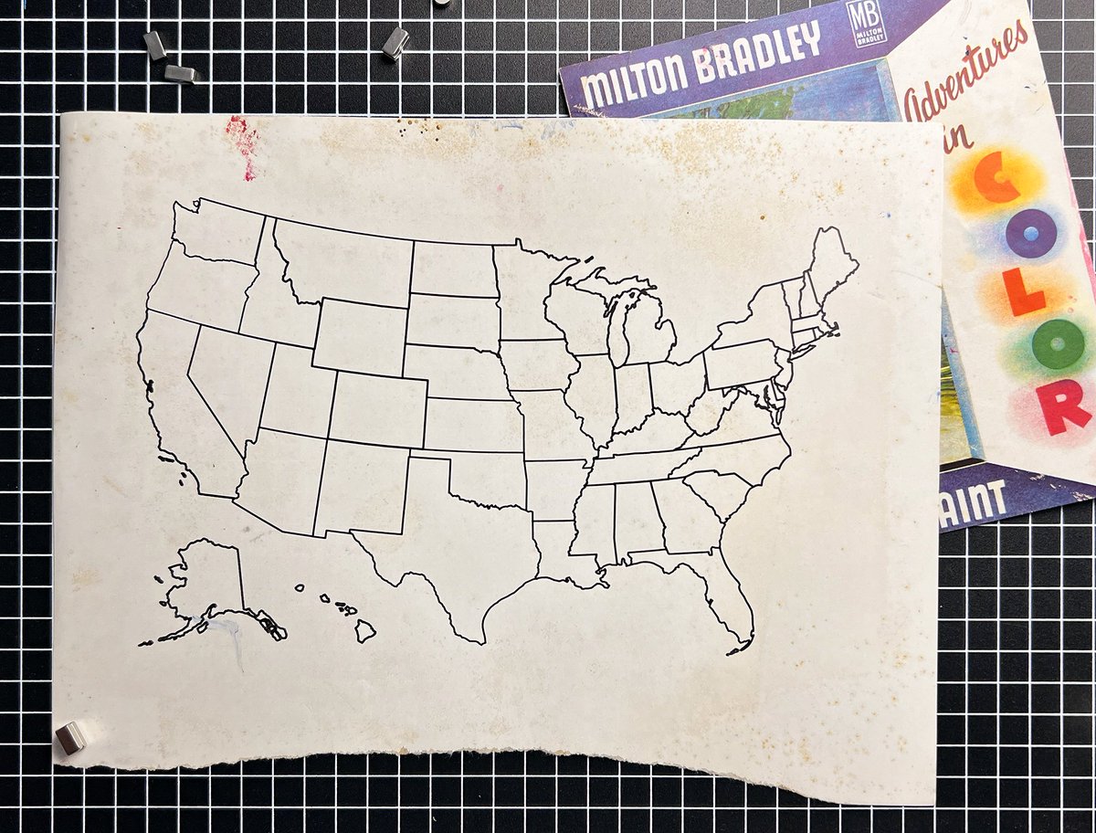
28 Jun 2024
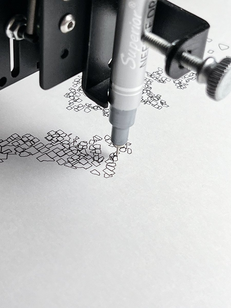
0.38 mm on heavy weight smooth paper

15
35
780
156,089
Jan 16
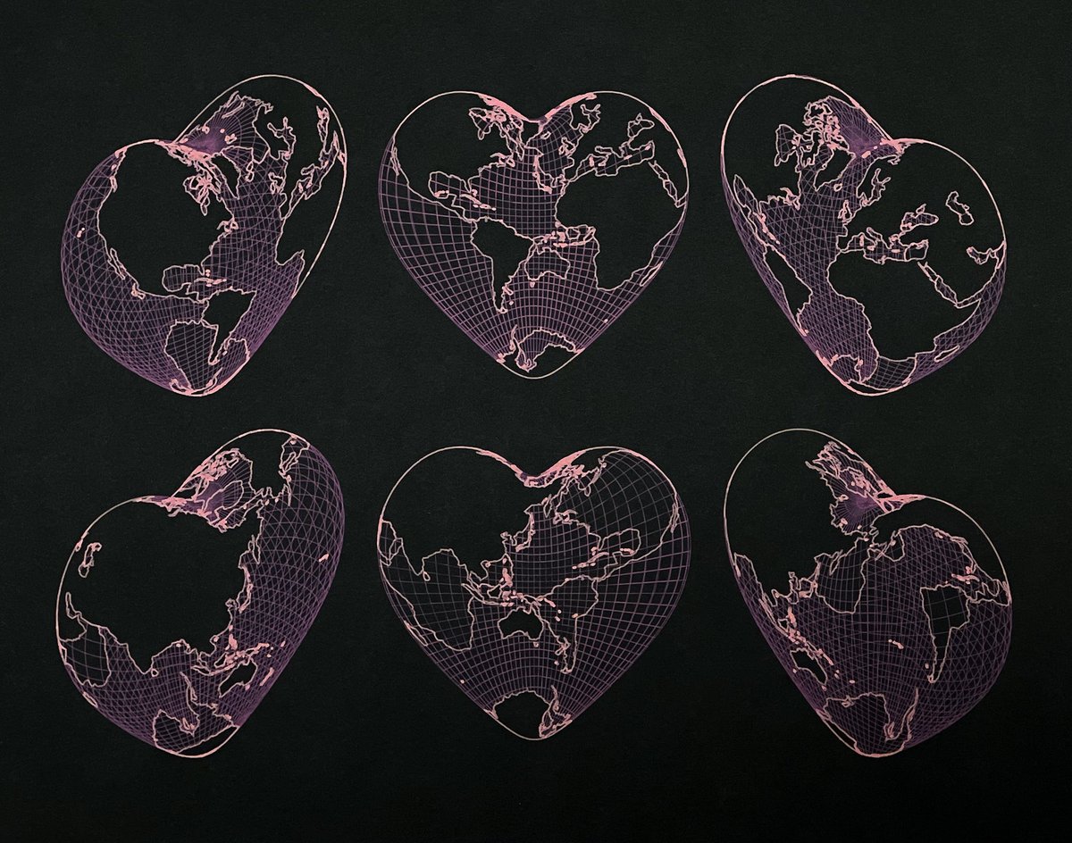
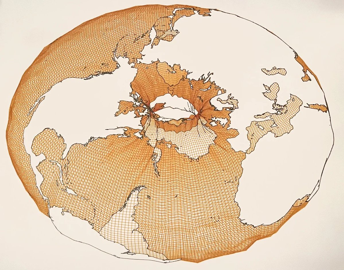
Not on here much nowadays but I'm still offering limited run pen-plotted maps on timwallace.art. Here are some recents, including a fresh batch of Earth Bagels for National Bagel Day.

2
304
8 Dec 2025
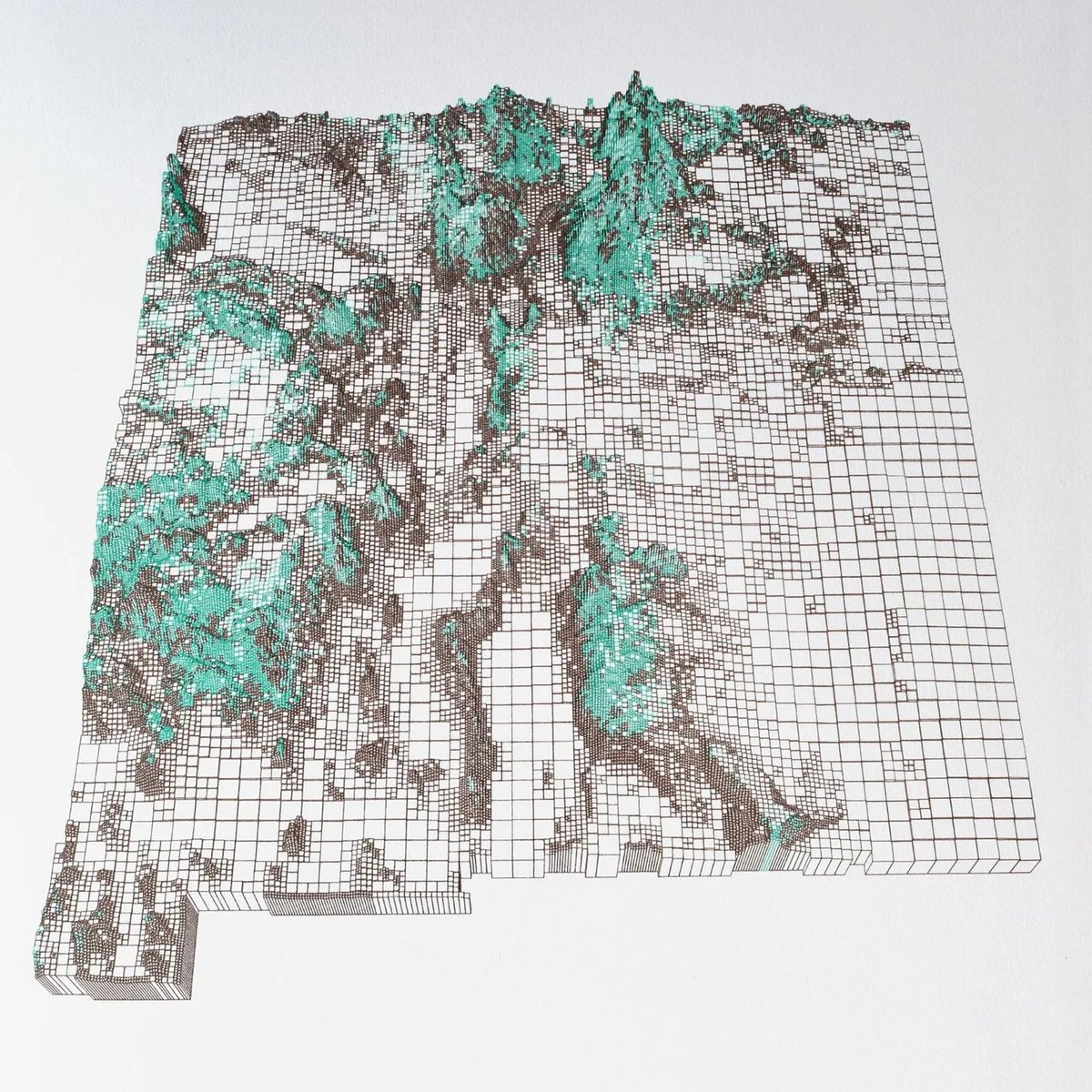
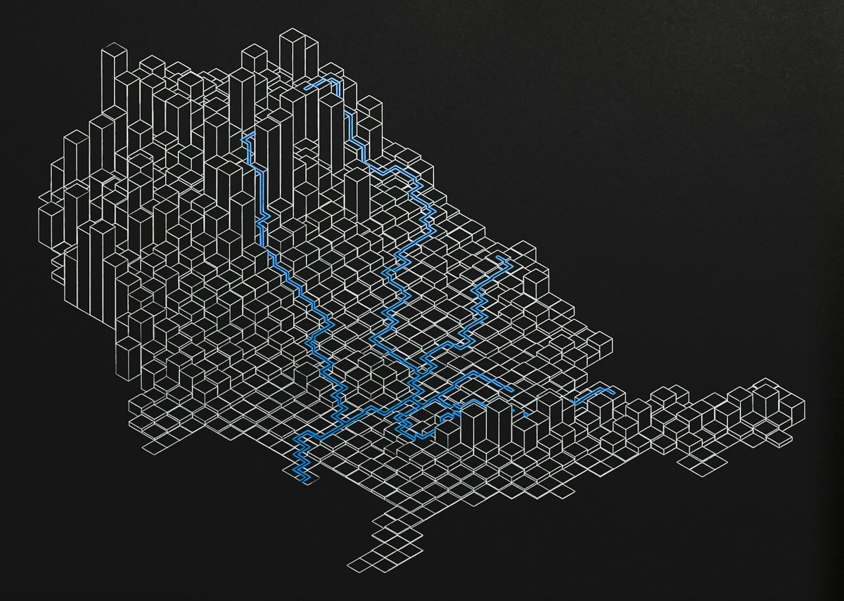
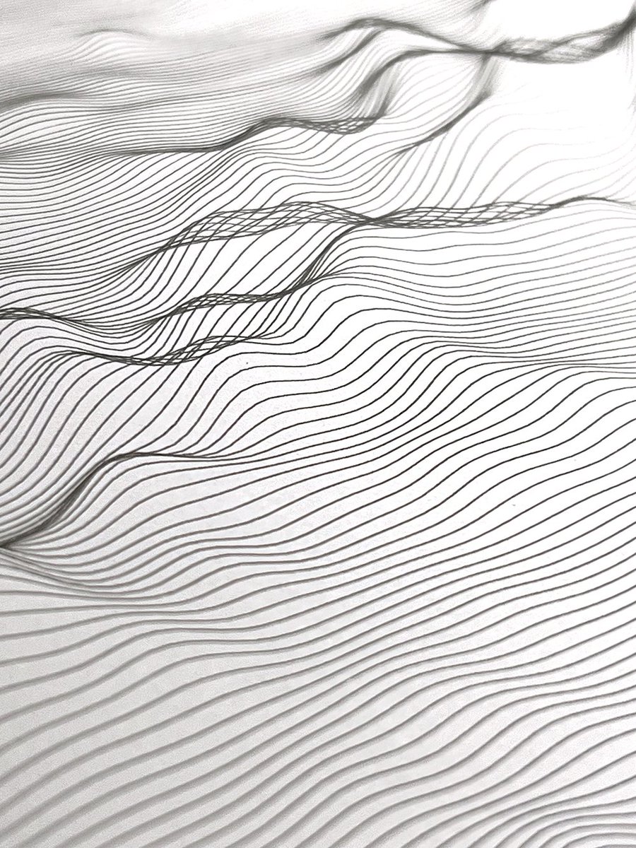
New Mexico terrain as a hierarchical grid.
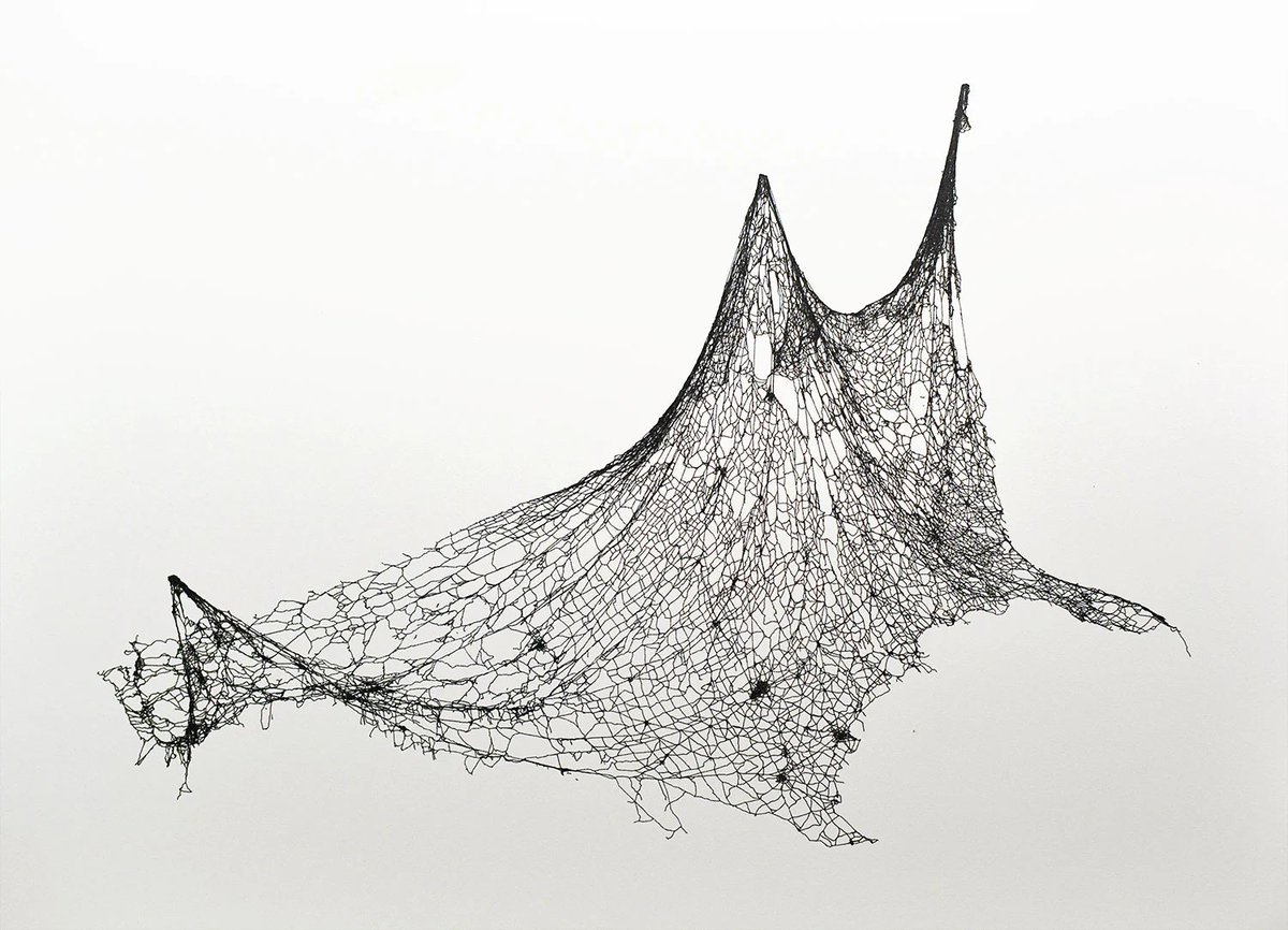
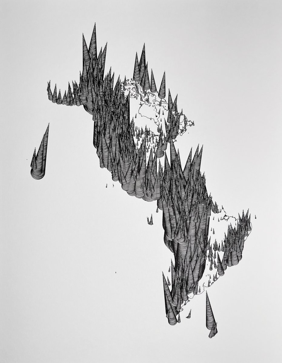
Road network of the U.S. as threads being hoisted up.
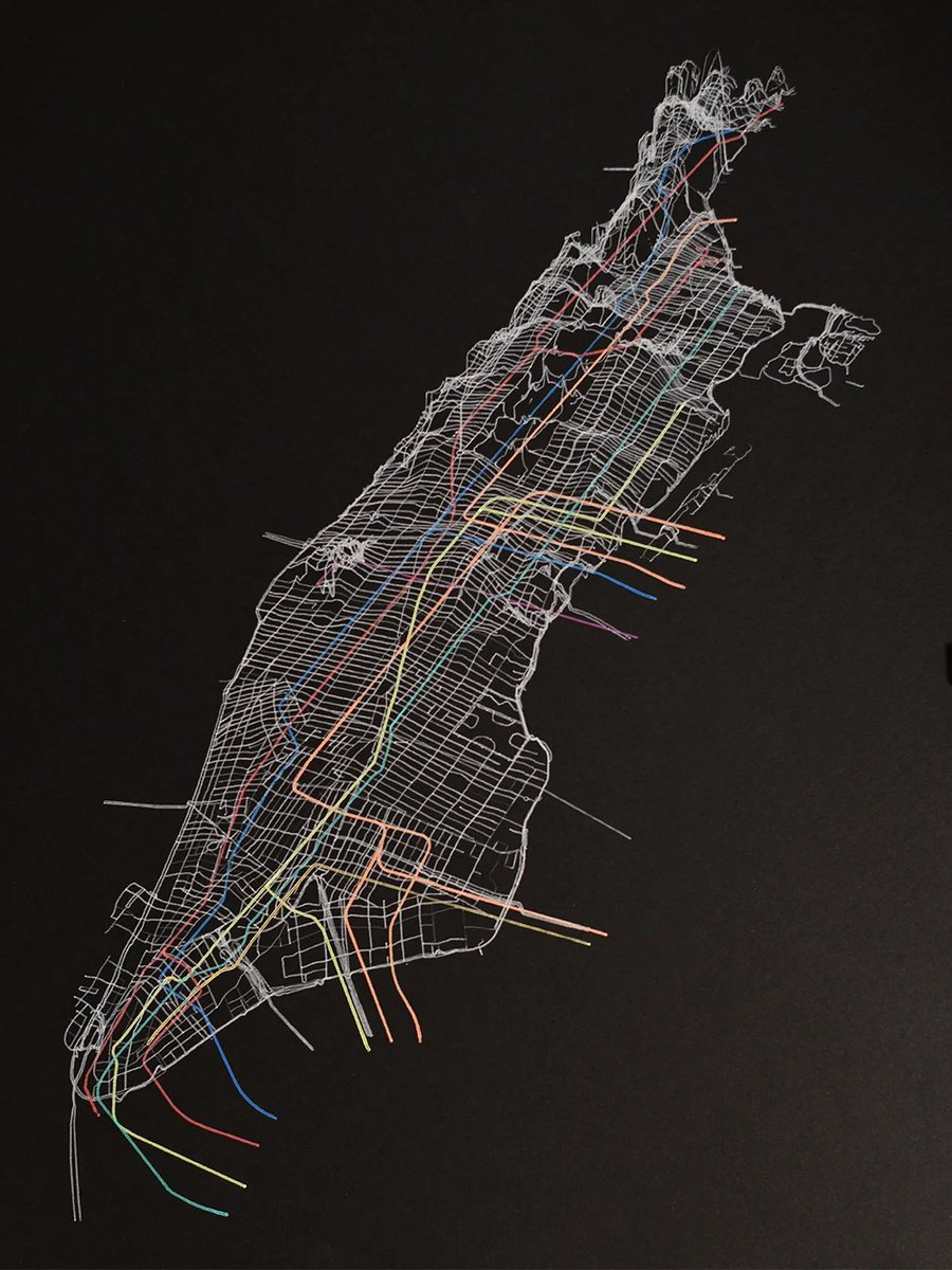
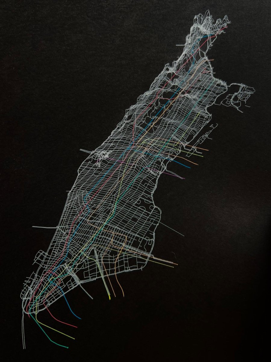
Perspective view of Manhattan roads and subway lines.
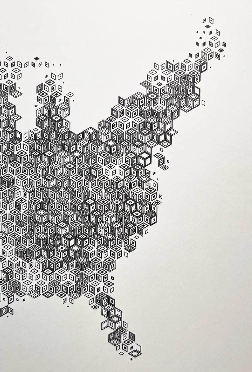
Rhombille population density map of the conterminous U.S.
And others timwallace.art/

12
82
4,568
21 Nov 2025
Transit Study I
Nine gel pens on 24x32cm black paper.
New item in the shop! Adding more this weekend. timwallace.art/product/trans…
2
435
17 Nov 2025
Black pen on heavy weight smooth paper sold last week. Will be adding new plots to the shop in the next week or so.

451
25 Jul 2025
No matter how you map it, tomorrow is the big day for the Peaks to Portland Swim For Kids! A huge thank you to everyone who has already donated. If you haven't had a chance yet, please consider supporting the Y and their amazing kids' programs here: runsignup.com/twp2p

4
474
10 Feb 2020
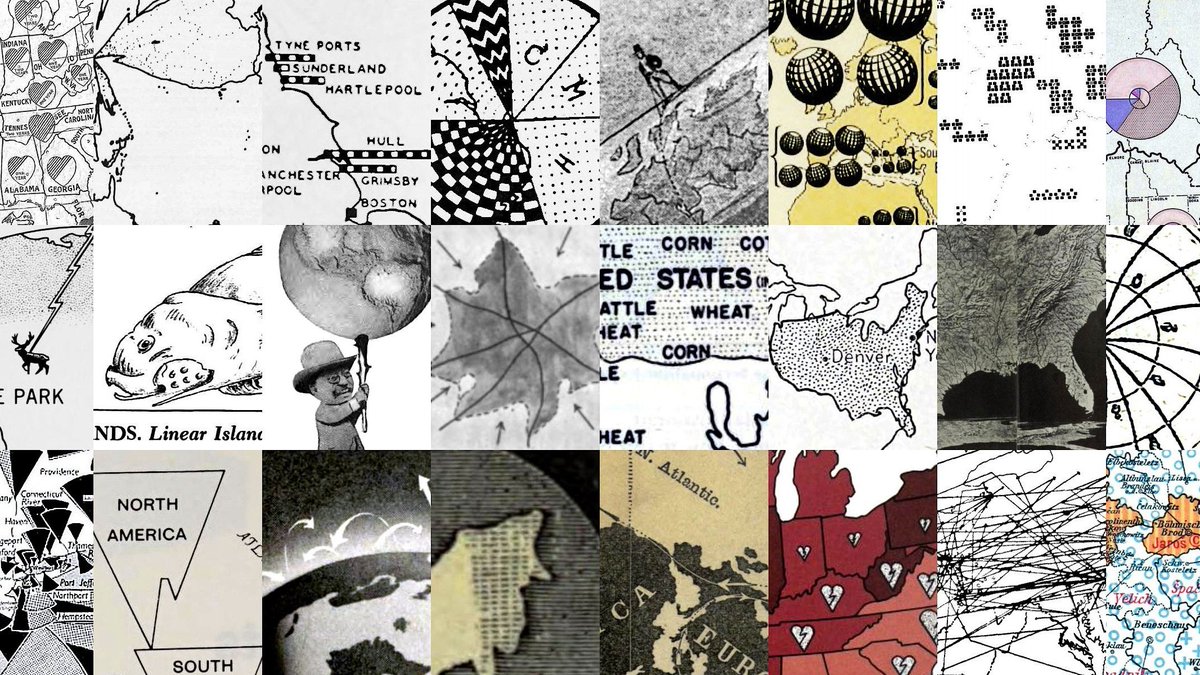
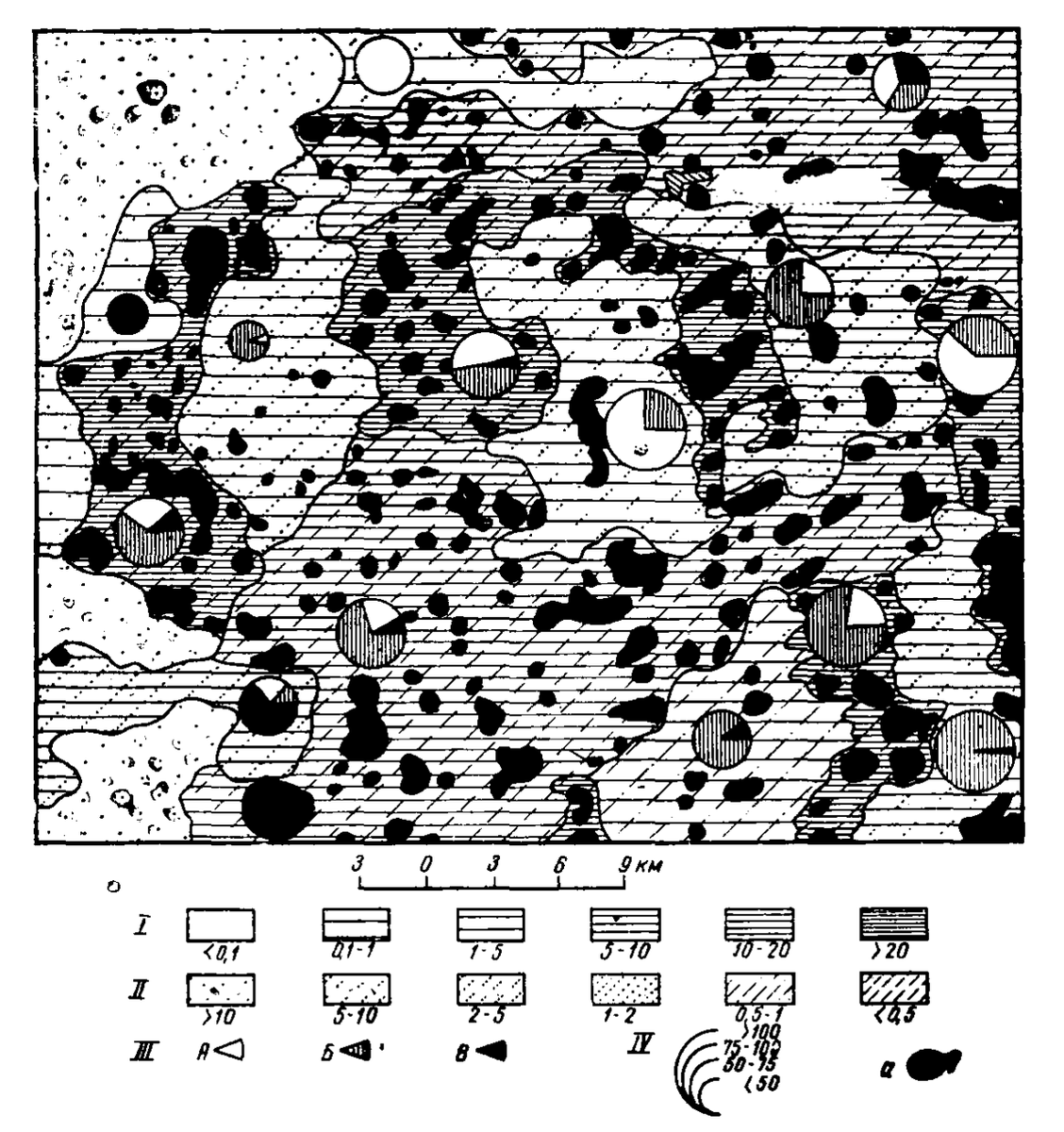
Forgotten Map Types 1-30, with links to sources and a doff of cap to @tophtucker for the nudge.
medium.com/@tim.wallace_9892…
4
17
66

2 Oct 2024
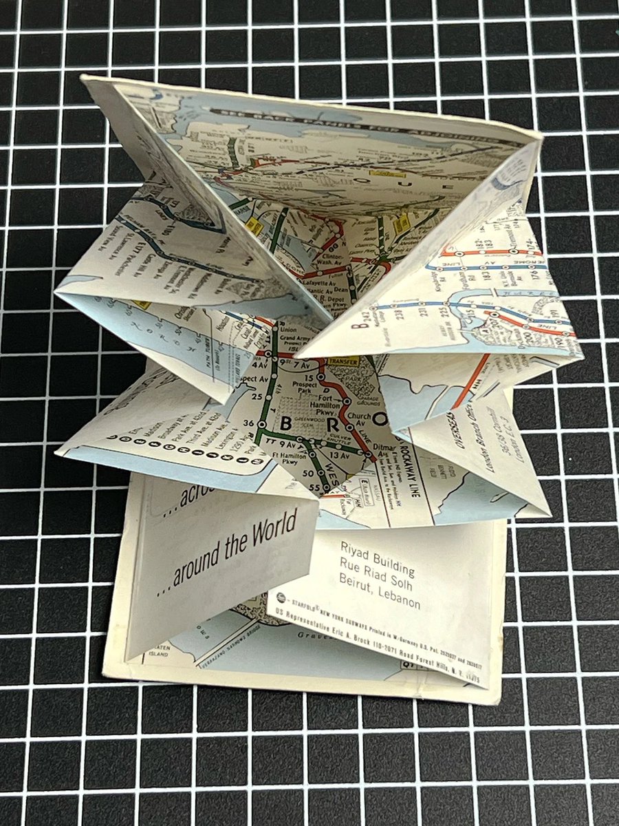
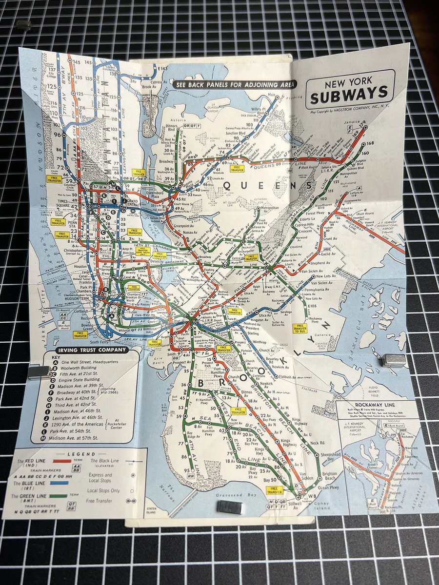
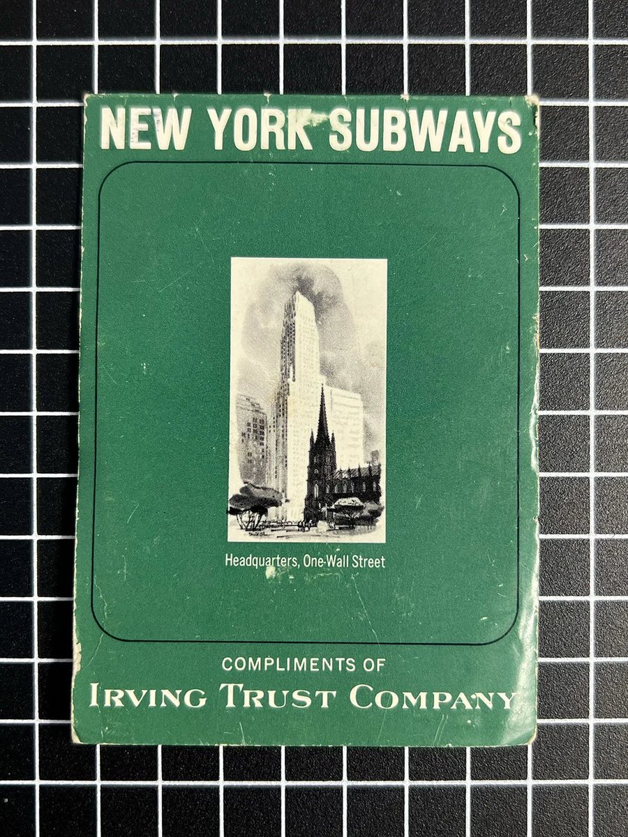
I'll be adding some fun vintage maps to the shop in the coming weeks too. The first is this little mid-century NY subway pocket map with a Turkish map fold. timwallace.art/product/vinta…
12
2,581
2 Oct 2024
Just one of these left. Once it's gone, I'll move on to Mississippi River system elevation study II. timwallace.art/product/missi…
3
12
158
9,400

16 Sep 2024
That sold quickly. I'll cook up something in a similar style soon.
1
494
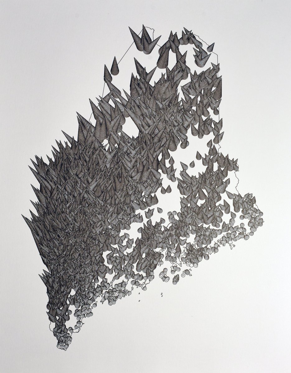
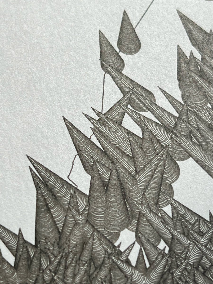
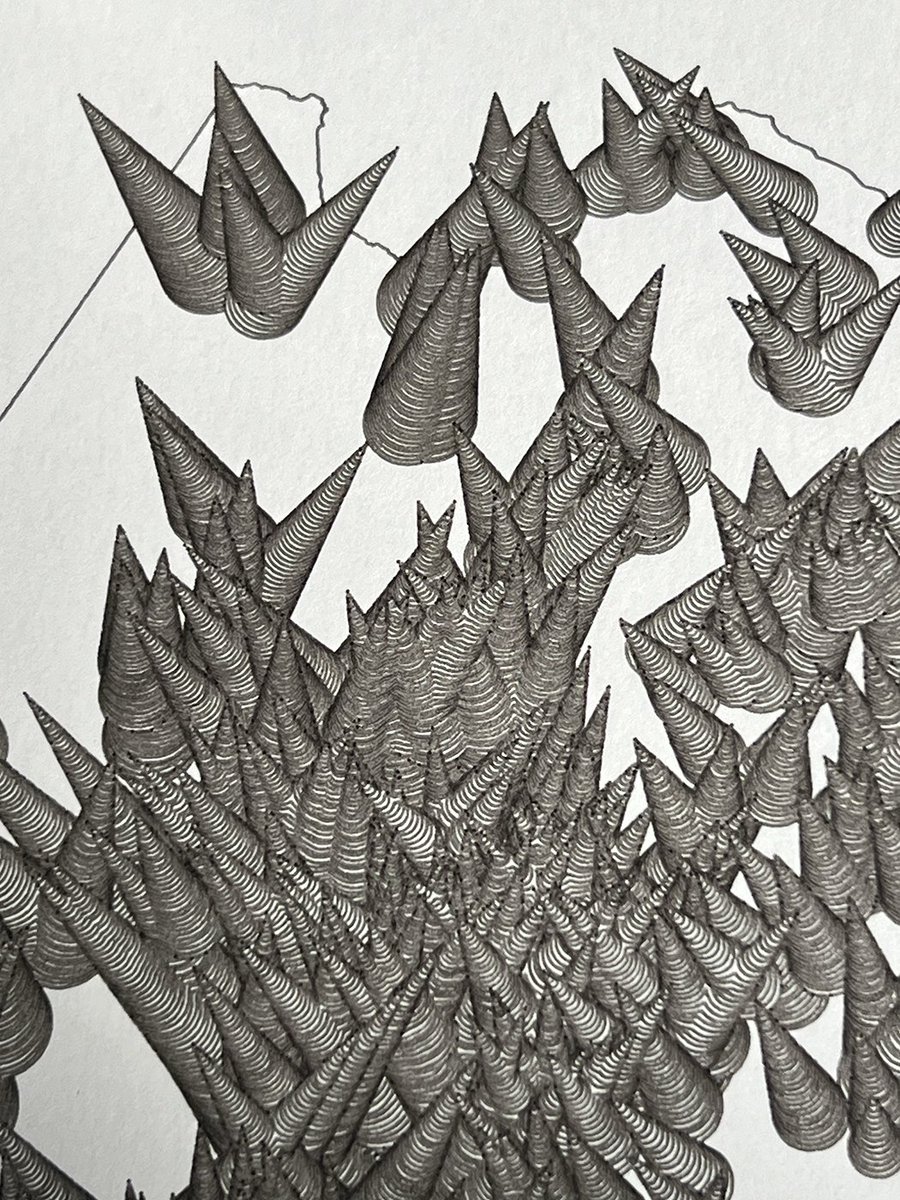
16 Sep 2024
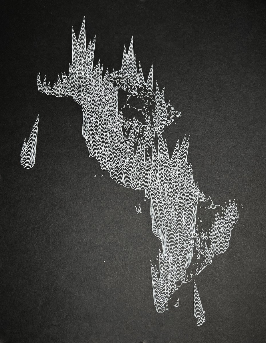
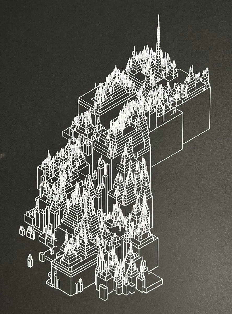
Added this to the shop.
In this plot, 878 of Maine's most prominent peaks are styled as wildly unbalanced prismatic bugles.
I currently only plan on making one of these. The plot takes about 12 hours to complete.
timwallace.art/product/maine…
2
491
29 Jul 2024
The one below has been claimed, but I've just posted another with a clear draw order if that appeals. I like them both equally. timwallace.art/product/count…

3
3
35
4,999
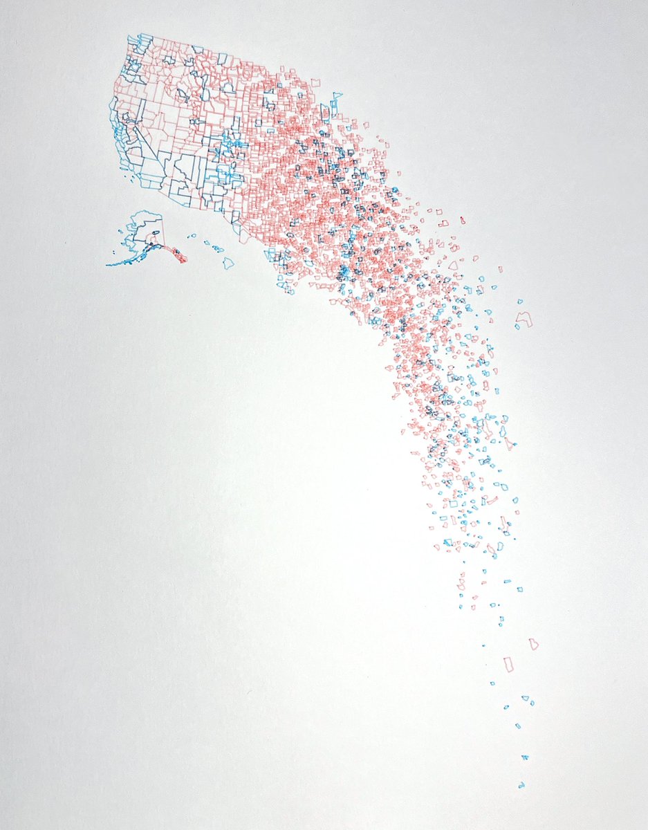
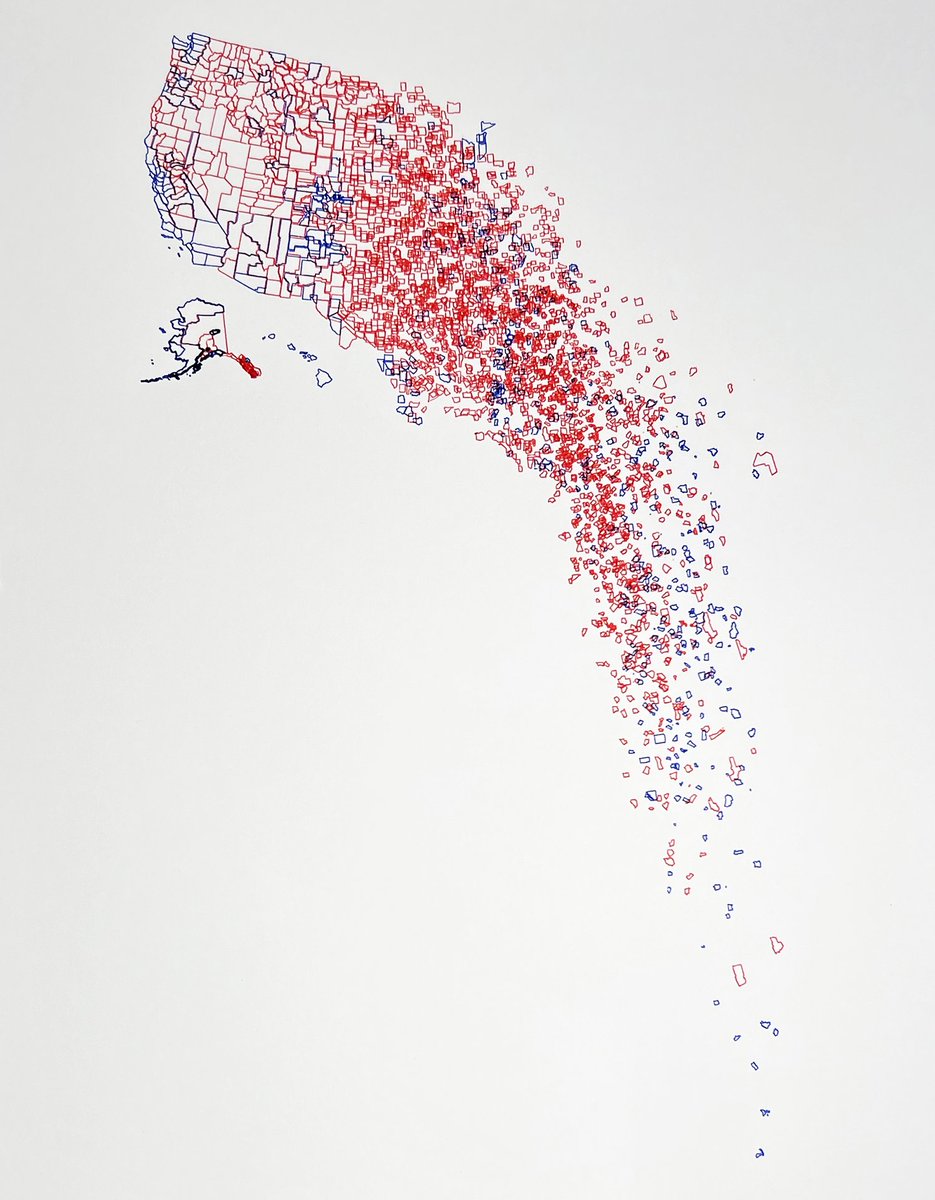
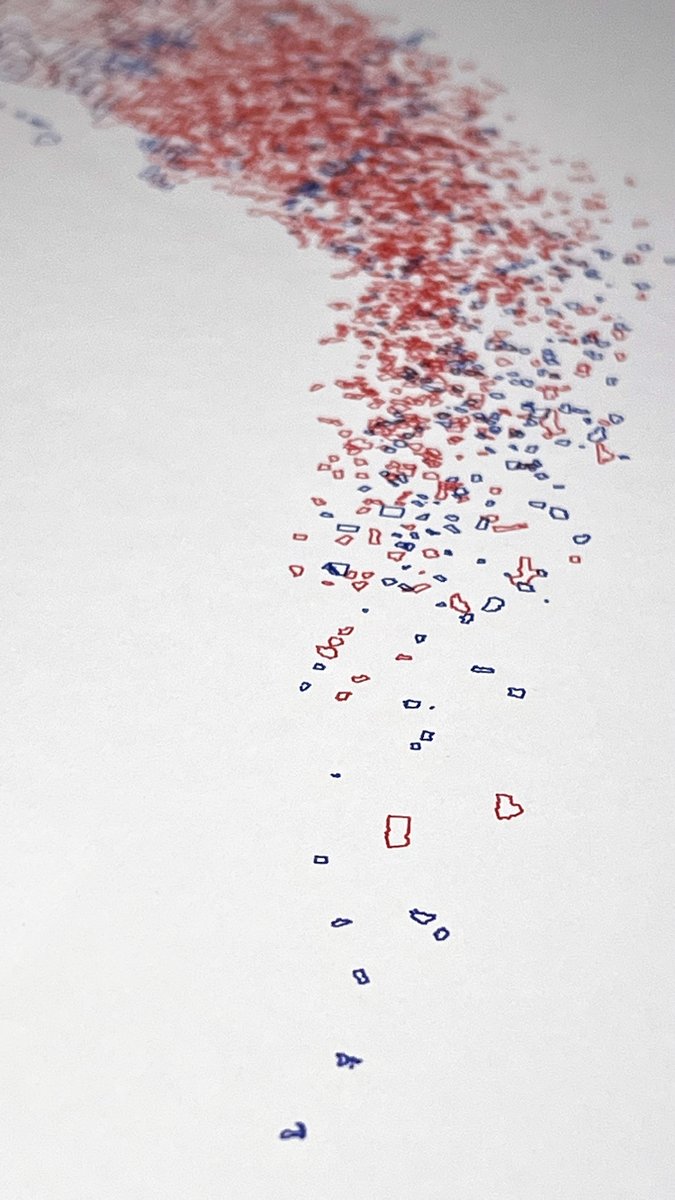
16 Sep 2024
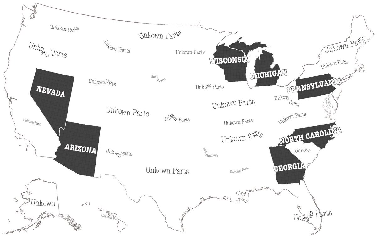
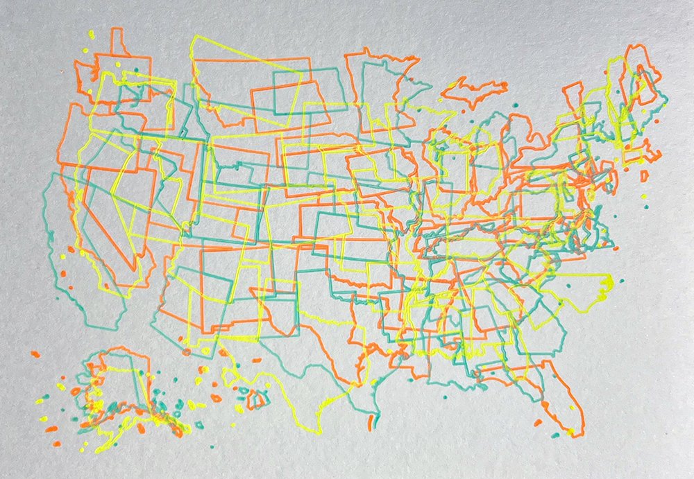
Two left of the original, but I've also made two electoral versions—one bright, one bold. Color means they aren't quite as crisp as the original, but they're potentially more fun? timwallace.art/product/elect…
1
2
798
9 Aug 2024
Shutting down the shop for a few weeks to enjoy the end of summer, but will be posting some fun new things starting in September at timwallace.art.
3
6
69
4,022

8 Aug 2024
Indelible ink on vintage finger paint paper. Potentially fun election night activity?
3
735