
Beautiful weather maps, data, and professional viewing tools for affordable price. Tweets by @es5nhc (TT) support@weathermodels.com
Joined December 2017
- Tweets 4,130
- Following 115
- Followers 10,659
- Likes 762
3,220 Photos and videos


Pinned Tweet

4 Apr 2023
You're working in a team? Then go get a weathermodels.com commercial subscription and add up to 9 subusers to your parent account. Every user has their own dashboard, login and password that can be managed by one parent account. Only the parent account controls billing.
4 Apr 2023

Big upgrade coming for our commercial customers: soon your multi-user subscription will allow you to add up to 9 subusers. So, instead of 2, you get 9 for the SAME price. Perfect for small businesses and TV station weather teams. 😊 #weathermodels #TVweather
4
2
6
29,731
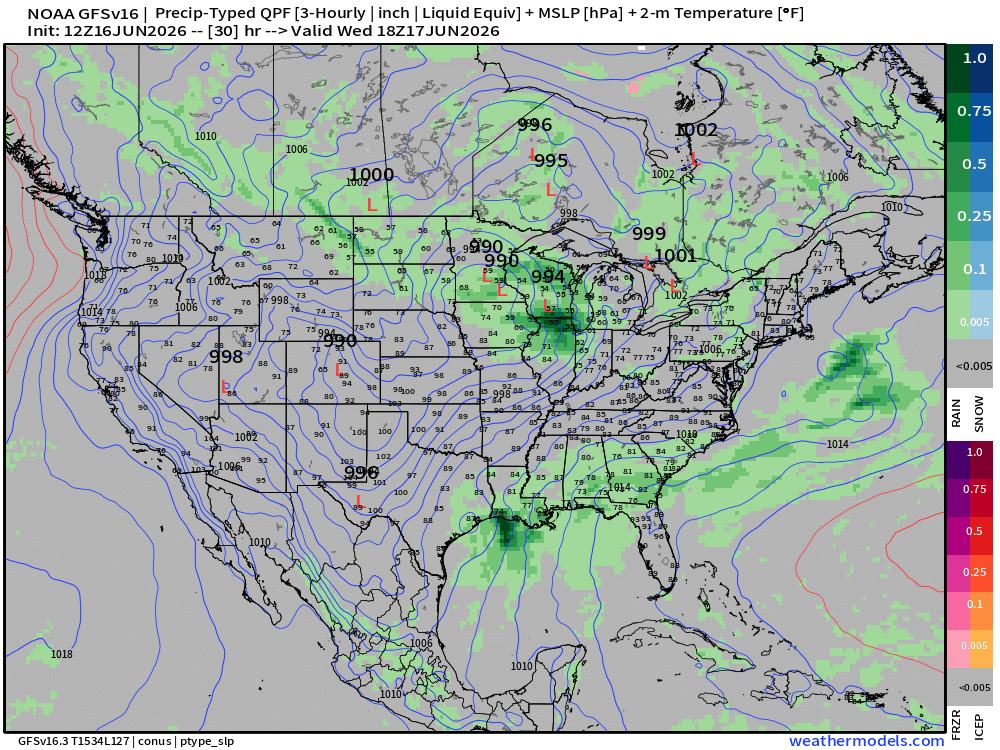
Busy weather day ahead on Wednesday along multiple fronts with a potential tropical storm in the Gulf and a severe weather outbreak in the Midwest. The SPC has highlighted a level 4 out of 5 risk area for Illinois and Indiana in its Day 2 outlook.
TT
310
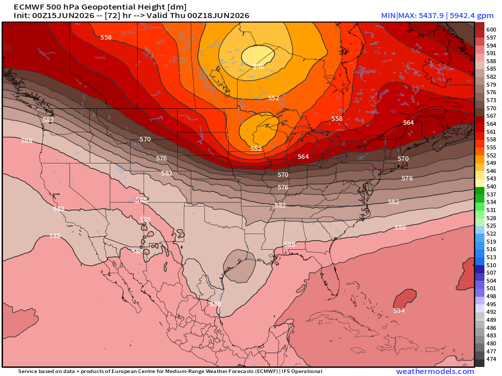
Wednesday could see an episode of severe weather across parts of the Mid-Mississippi Valley into Indiana. All hazards could be on the table in the region and the SPC has already highlighted a level 3 out of 5 risk area for Wednesday.
TT
352
Shown is an NWS NDFD forecast of maximum temperature across the continental USA today.
TT
309
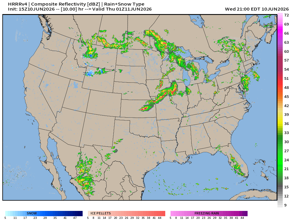
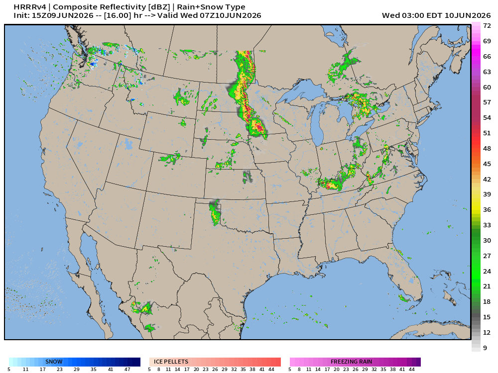
Shown is an MRMS radar composite of the Midwest this morning as another severe weather day unfolds. The SPC has highlighted a level 4 out of 5 risk area for parts of Illinois and Iowa amid a risk of damaging/intense winds, large hail and tornadoes, some could be strong.
TT
296
More severe weather is possible in the US today. Severe thunderstorms capable of causing severe winds, large hail and a few strong tornadoes are possible this afternoon and evening in parts of the Midwest and Upper Mississippi Valley.
TT
298
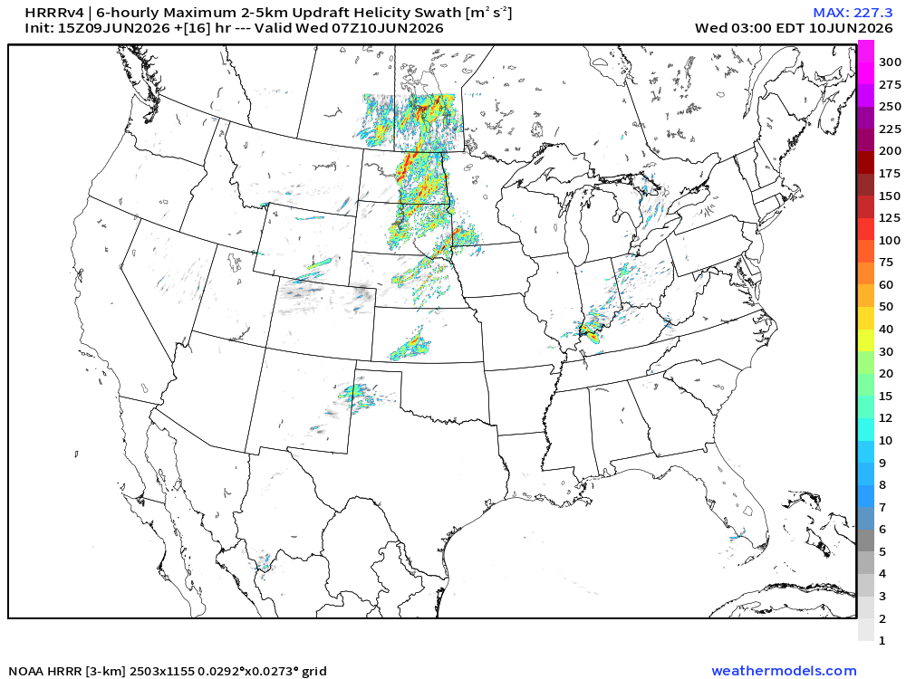
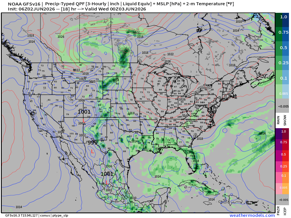
Severe weather is possible today not just in the US but also in Canada. Numerous thunderstorms causing severe winds, large to very large hail and tornadoes are possible this afternoon and tonight(level 3/5 from SPC). On HRRR, storms are simulated up to the model domain limit.
TT
1
348
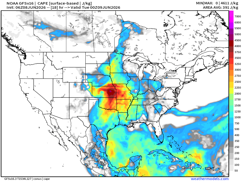
Severe thunderstorms are a concern in the central Plains today with a risk of large hail, severe winds and a few tornadoes. Active weather pattern is expected to continue in the coming days with SPC highlighting level 3 out of 5 risk areas both for Tuesday and Wednesday.
TT
1
321
Shown is a forecast from NWS NDFD of maximum temperature today across the continental USA. Severe thunderstorms and heavy rain continue to be a concern in the northern Plains and in the Midwest.
TT
286
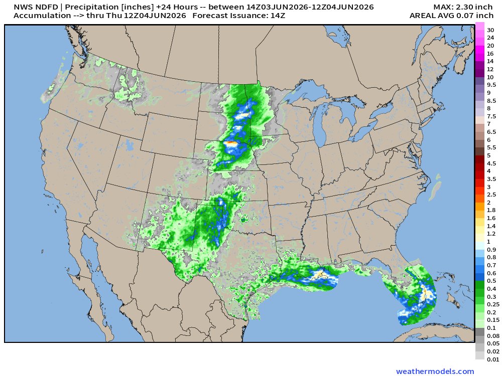
Shown is an NWS NDFD forecast of total precipitation through 7 AM CDT on Thursday as more thunderstorms are expected with the highest severe weather risk (level 2 out of 5) in the northern Plains.
TT
2
284
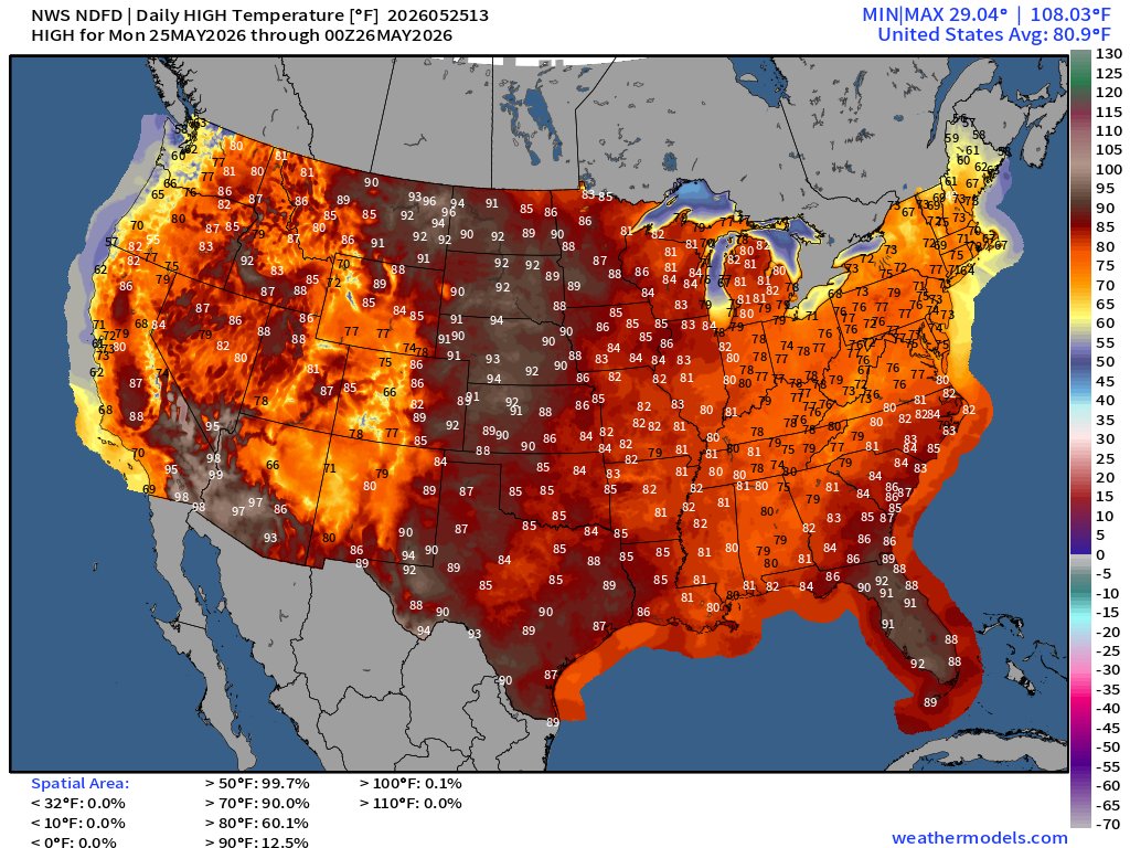
Active weather is expected today as well with the highest severe weather risk (level 2 out of 5) in parts of the northern Plains where thunderstorms this afternoon/evening could cause severe wind gusts, large hail and possibly even a few tornadoes.
TT
2
628
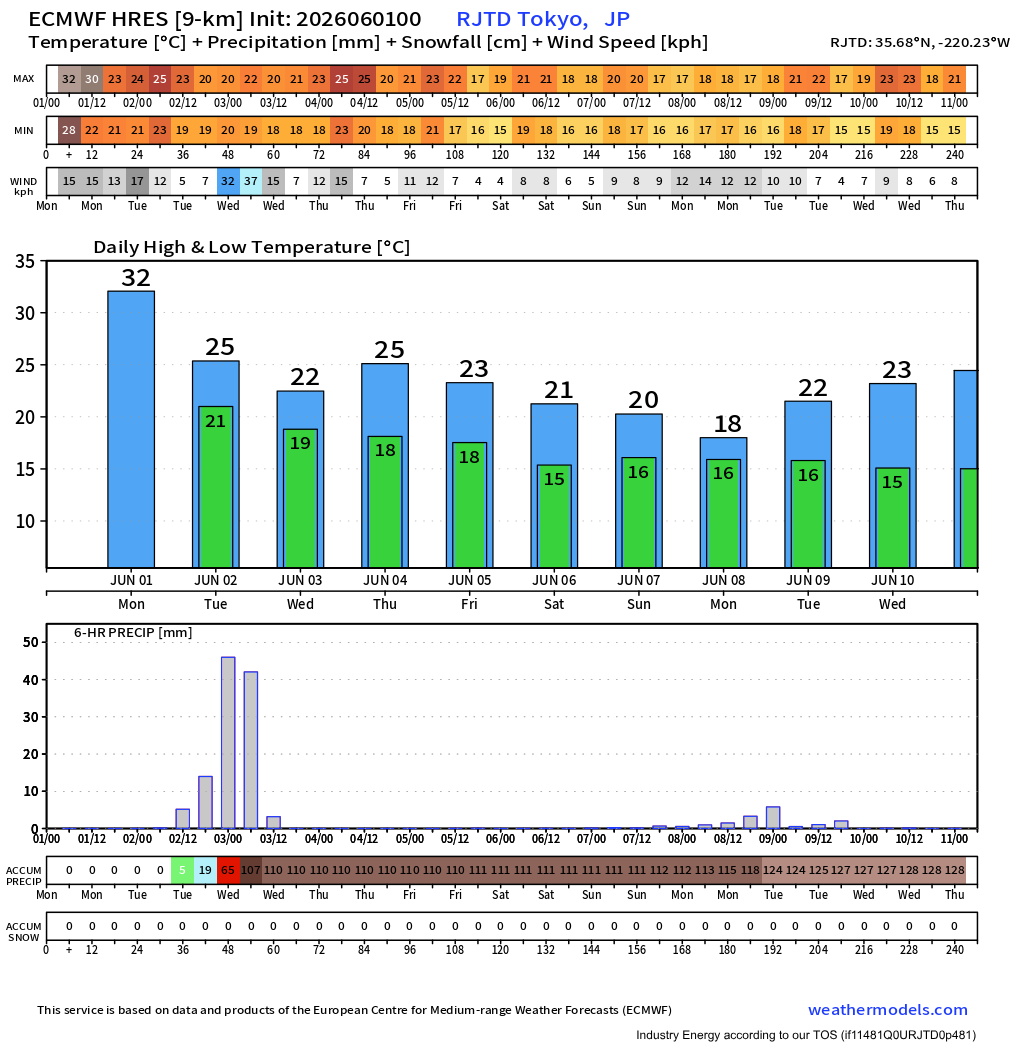
In Japan, the news is weather as Severe Tropical Storm Jangmi is currently impacting the Ryukyu Islands and will parallel Kyushu, Shikoku and Honshu during the next couple of days. Even the capital Tokyo could see impacts as illustrated by this city diagram based on ECMWF.
TT
383
Shown is an HRRR simulation of what infrared satellite imagery could look like today and tonight across the continental USA as there is a risk of severe thunderstorms in West Texas and heavy rain in the Southeast.
TT
1
335
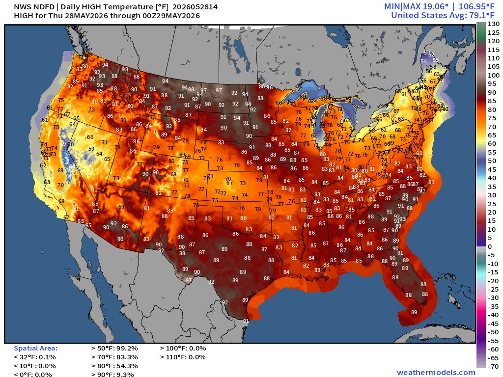
Shown is an NWS NDFD forecast of maximum temperature across the continental USA today. In weather news, the main headlines today are about thunderstorms and showers, expected in the southeastern and northwestern parts of the country.
TT
291
Here's an ECMWF model scenario of 6 hour maximum temperature across Pakistan tomorrow at noon UTC, 5 PM local time. Temperatures in some locations could soar over 50 degrees Celsius (122 degrees Fahrenheit) if this scenario verified.
TT
1
8
1,554
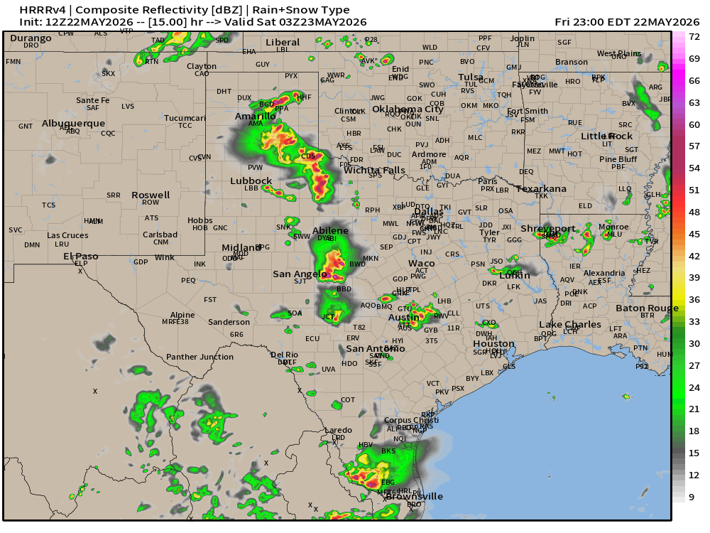
Shown is an MRMS composite of Texas this noontime as the SPC has highlighted a level 2 out of 5 severe weather risk in parts of the state. Risks include large hail, severe wind gusts and a couple of tornadoes.
TT
1
347
Shown is an NWS NDFD forecast of maximum temperature today across the continental USA.
TT
1
465
Severe thunderstorms are possible late this afternoon into the evening in parts of the southern High Plains. Risks include large hail and severe wind gusts. Shown here is a simulated radar reflectivity valid at 10 PM CDT according to the 12 UTC HRRR scenario.
TT
1
341
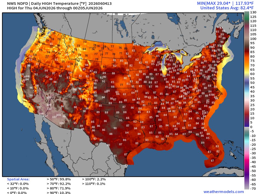
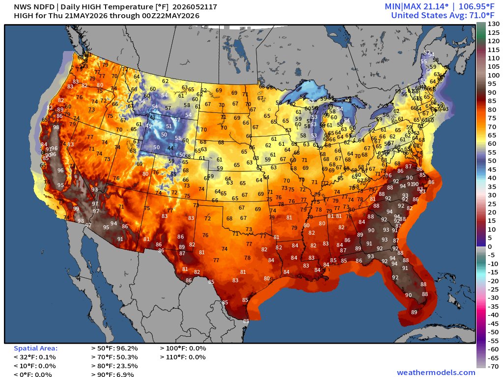
Shown is an NWS NDFD forecast of maximum temperature today across the continental USA. Particularly high temperatures continue today in the southeastern states.
TT
1
1
377
Shown is a forecast from NWS NDFD of maximum air temperature across the continental USA today. Especially standing out is the East Coast.
TT

374
Scattered severe thunderstorms are possible today in an area stretching from border to border, with main concerns being hail and winds. The SPC has highlighted a level 2 out of 5 threat area from southern Plains to lower Great Lakes.
TT
325