
Stories from the worlds of precision measurement and location: the leading geospatial magazine.
Joined February 2013
- Tweets 4,448
- Following 274
- Followers 1,731
- Likes 937
1,487 Photos and videos


At #XPO26, XYHT is bringing together leaders from across the geospatial ecosystem for a practical discussion on what it actually takes to deliver reliable, survey-grade outcomes.
Surveying & Mapping End-User Workshop
📍 XPONENTIAL Detroit
🗓 Tuesday, May 12
🕐 1 PM | Rm 250B/C
3
10
1,198
Construction sites are saturated with radios—creating RF environments that are often hostile to precision positioning. When GNSS performance degrades, many issues originate closer than expected: at the antenna.
Clean signals = better productivity.
xyht.com/constructionbim/cle…
1
57
The National Spatial Reference System is moving beyond NAD 83 and NAVD 88. New reference frames, a new vertical datum and SPCS2022 are emerging as NGS rolls out modernization through 2026.
Read More: xyht.com/cartography-2/brave…
1
1
125
Over the past decade, #geomatics has evolved from a focus on measurement precision to workflow execution. With bigger data, tighter timelines & overlapping survey/GIS/construction tasks, the real differentiator is seamless field-to-office integration.
xyht.com/constructionbim/top…
80
Trust at 165 MPH: What Endurance Racing Teaches Us About Precision, Performance, and Continuous Improvement
See how advanced platforms, dense sensor stacks, and software-driven performance are validated under sustained competitive pressure:
xyht.com/magazine/magazine-m…
33
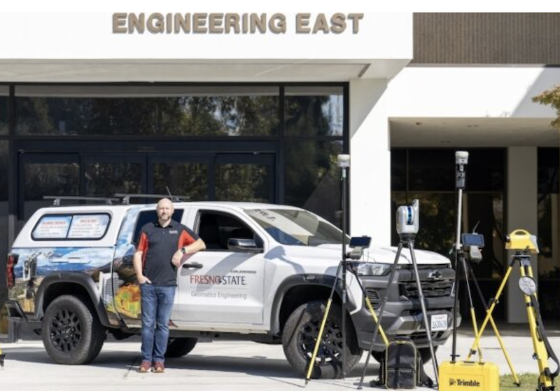
Building the next generation of geomatics professionals is about more than filling roles—it’s about modern skills and workflows. See how Fresno State, Trimble, and CSDS are helping close the gap: xyht.com/education/building-…
1
2
92
Technology That Tracks
A singular railway system provides a linear path from construction to maintenance on the Tren Maya. @motaengil
Read more: xyht.com/civiltransportation…
1
79
Beyond the Science Project: Productizing the Future of Sensor Fusion
@FixpositionAG's xFusion and Vision-RTK 2 keep centimeter-level positioning alive under trees, near buildings, and indoors. Find out more: xyht.com/magazine/magazine-m…
56
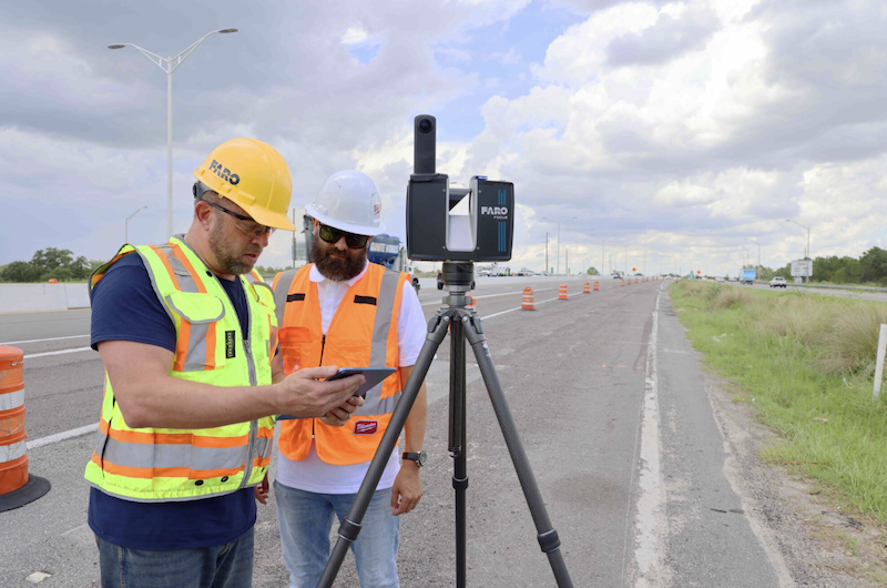
With 20 years of terrestrial laser scanning, @FARO_TechInc is showing how mass data, AI-ready point clouds, and digital twins are shaping the next wave of GIS for managing infrastructure at scale.
Read more: xyht.com/cartography-2/measu…
3
91
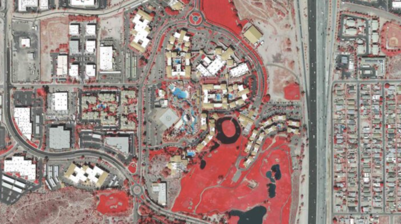
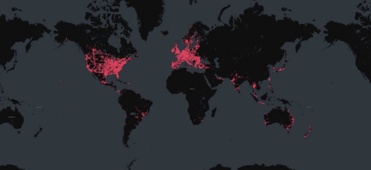
Maps helped win a landmark ecocide case. GIS analysis and satellite imagery exposed the truth—and set a new precedent for environmental justice.
Read more: xyht.com/aerialuas/penguin-c…
2
89
Efficient aerial mapping starts with sensor geometry. In this interview, @vexcel_imaging CEO Alexander Wiechert explains the move from film scanners to large-format digital systems and the photogrammetric principles behind them. Read more: xyht.com/magazine/vexcel-how…
1
2
72
Accuracy isn’t a feature—it’s the foundation.
Inside Trimble’s strategy for subscription-based performance and data confidence.
@TrimbleApplanix
Read more: xyht.com/surveying/the-trimb…
1
2
64
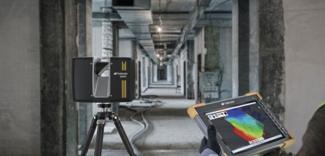
The built world is becoming digital, and digitalization demands truth.
For Topcon, that truth comes from precision—not novelty, not convenience, but accuracy as the foundation for reliable decisions.
Read More: xyht.com/magazine/precision-…
@topcon_today
1
43
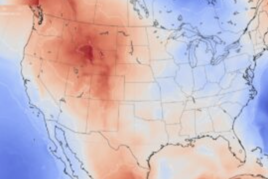
Wildfire response increasingly depends on location intelligence.
In Southern California, sheriff’s departments across Orange, Riverside, and San Bernardino Counties are using GIS-powered mobile apps to accelerate evacuations and improve public safety.
xyht.com/gnsslocation-tech/f…
125
Survey-grade RTK has long been defined by cost and complexity.
GEO-MEASURE changes that by combining professional-grade hardware with built-in RTK corrections in a turnkey solution priced for broader access.
Find out more: xyht.com/surveying/geo-measu…
2
81
Topcon is charting a path that places geomatics at the center of its next phase—positioning it as a driver of innovation, integration, and long-term growth.
Find out more: Inside Topcon 2.0 and The Next Frontier in Geomatics ➡️ xyht.com/magazine/topcon-2-0…
80
If you’re thinking that this is just another total station, you might be pleasantly surprised by the following look under the hood: xyht.com/surveying/the-essen…

48
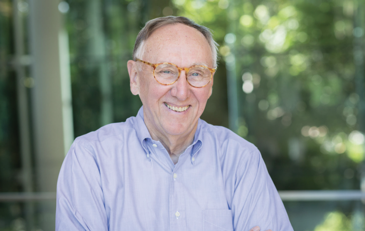
In an extended conversation with xyHt, Jack Dangermond, founder and CEO of Esri, shared not just technical observations but a sweeping vision for the future of GIS. @Esri
Jack Dangermond’s Vision for the Future: xyht.com/cartography-2/jack-…
1
45