
Data-driven visuals and statistics focused on economics, health or human resources. Tools in posts, all visuals are original. 📊🗺️📸
Joined July 2023
- Tweets 2,493
- Following 43
- Followers 7,814
- Likes 1,687
1,518 Photos and videos


Yes Data retweeted

9 Sep 2025
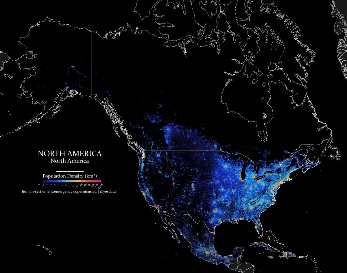
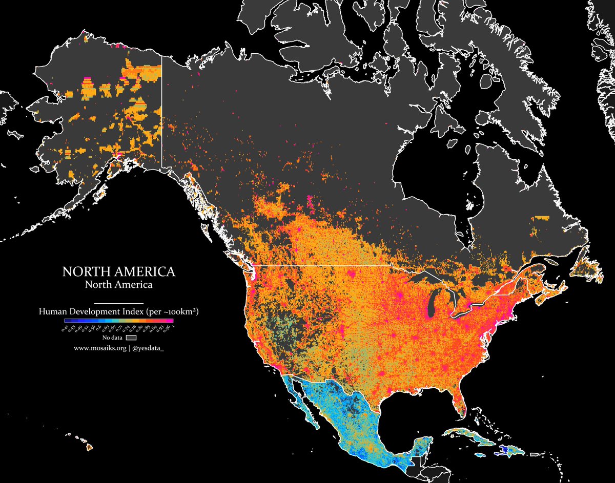
This map by @yesdata_ shows the population density across North America.

17
121
915
73,484
🧯 Series: Fires (No. 4) - Japan
NASA uses its satellites to detect sources of heat on Earth.
This map shows 2023 signals. It only shows 'type 0' heat sources (presumed vegetation fire) with confidence 'h' (high).
🔧 Tools: Python (Geopandas, Shapely, Contextily)
1
3
1,708
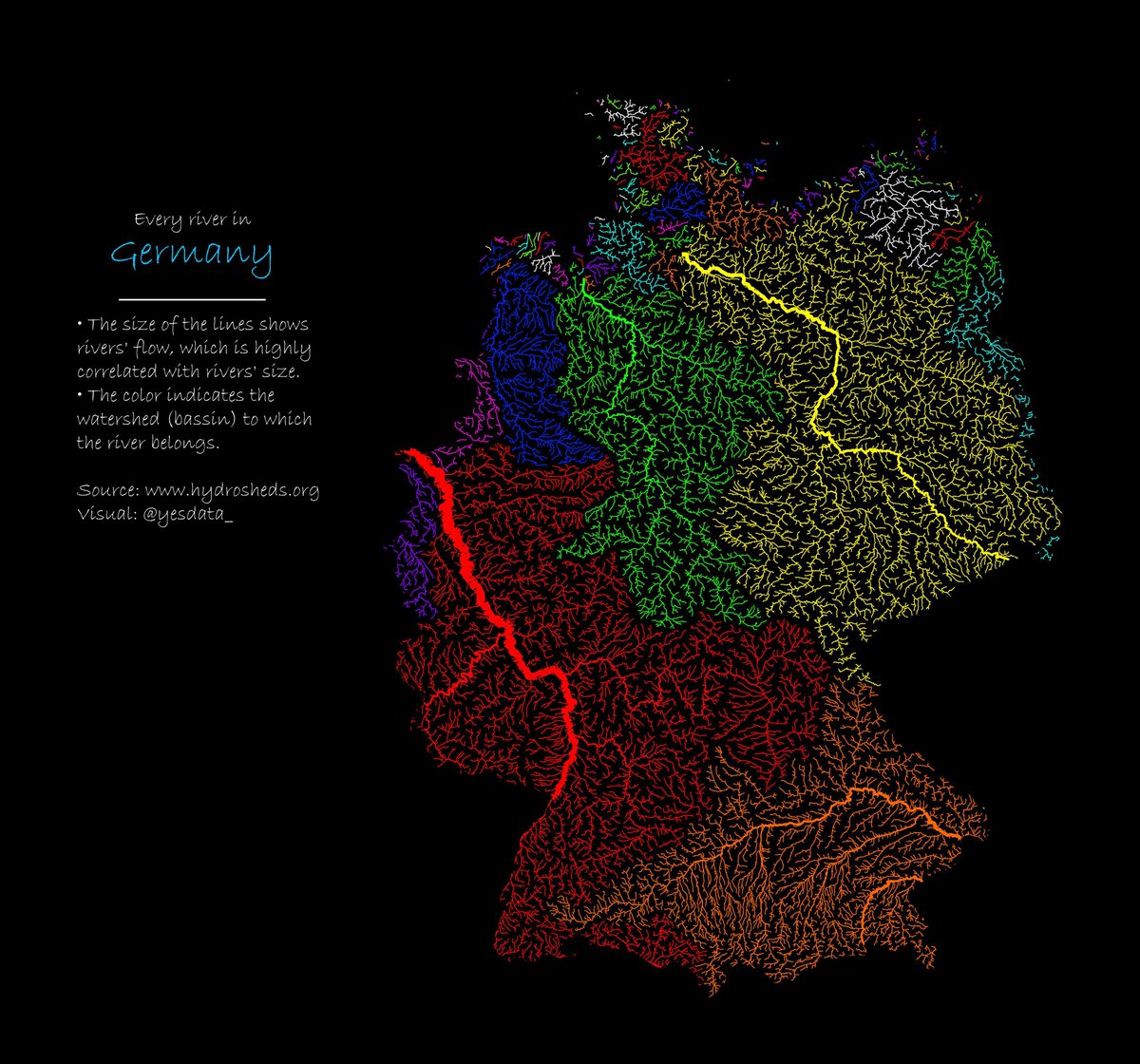
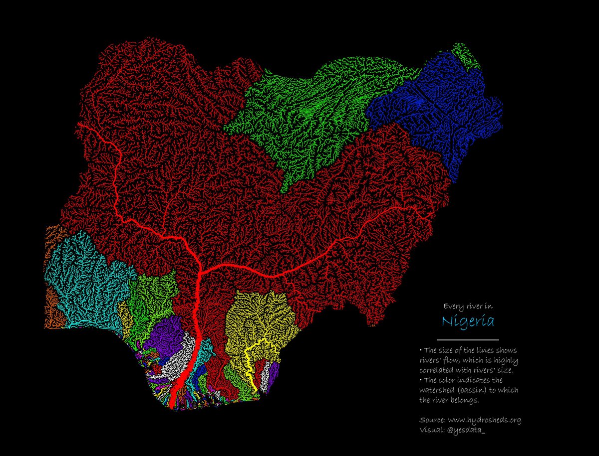
💧 Series: Rivers (No. 5) - Germany
Germany's river system, including major rivers like the Rhine, Danube, and Elbe, plays a vital role in transportation, trade, and supporting diverse ecosystems across the country.
🔧 Tools: Python (Pandas, Geopandas, Shapely)
2
11
3,149
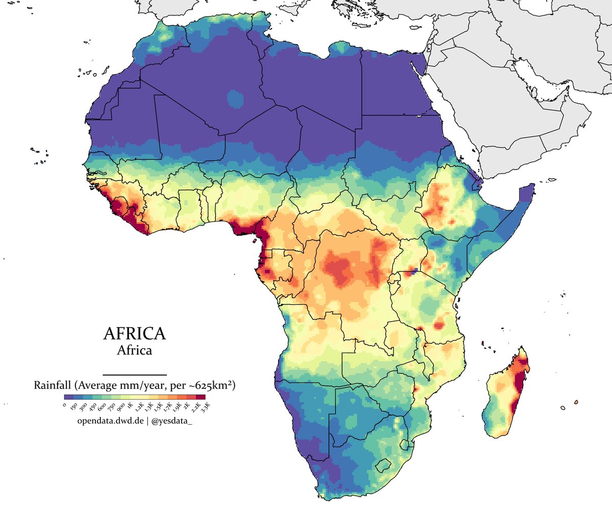
☔️ Series: Rainfall (No. 5) - Africa
Africa's precipitation varies widely, with tropical regions like Central Africa receiving heavy rainfall, while vast deserts like the Sahara experience minimal precipitation.
🔧 Tools: Python (Rasterio, Rioxarray, Geopandas)
1
11
1,419
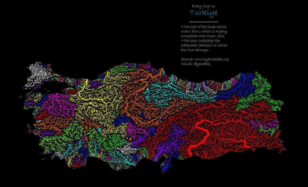
💧 Series: Rivers (No. 4) - Türkiye
Türkiye's river system includes major rivers like the Euphrates, Tigris, and Kızılırmak, which flow through diverse landscapes, supporting agriculture, hydropower, and ecosystems.
🔧 Tools: Python (Pandas, Geopandas, Shapely)
1
1
7
2,638
🗺️ Series: UNESCO World Heritage Sites (No. 3) - D.R. Congo
The D.R. Congo is home to five UNESCO World Heritage Sites, including Virunga National Park, known for its diverse ecosystems and endangered mountain gorillas.
🔧 Tools: Python (Geopandas, Shapely, Contextily)
1
1,783
Yes Data retweeted
3 Jun 2025
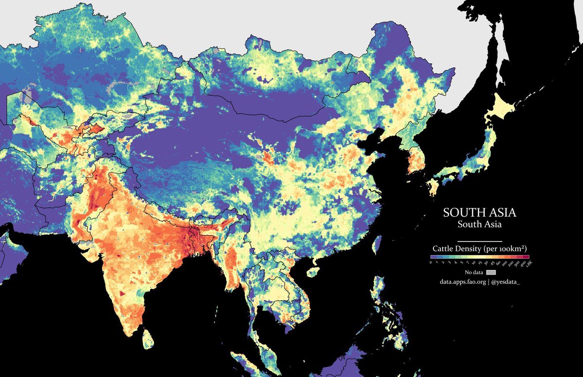
Holy cow! South Asia’s cattle density really is highest in India. HT @yesdata_ (give them a follow)
11
8
55
7,220
Yes Data retweeted
1 Jun 2025
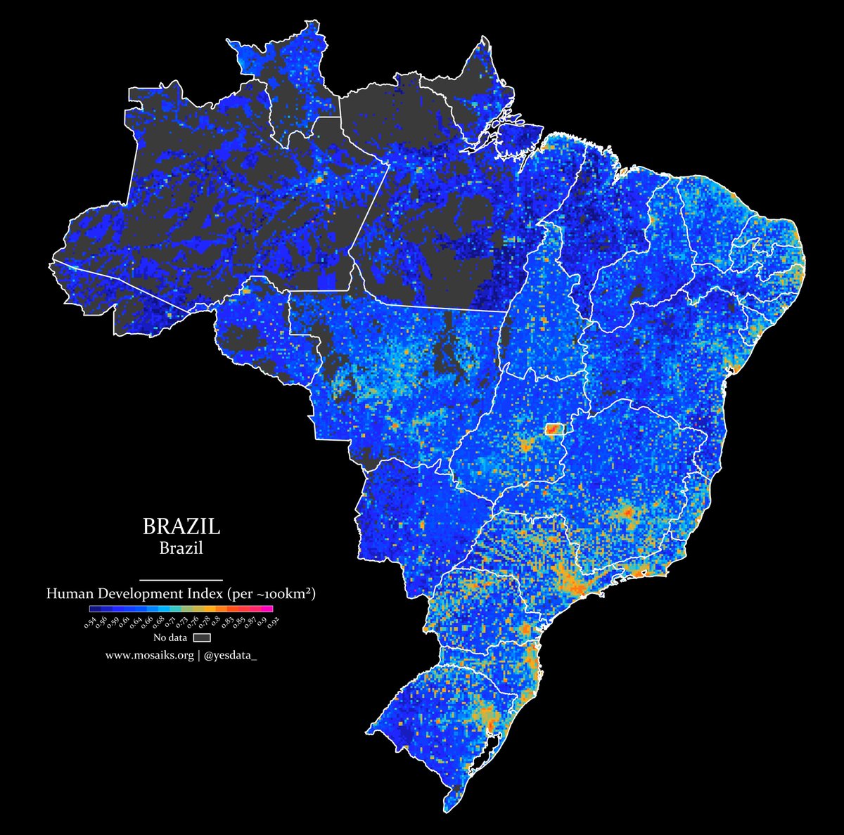
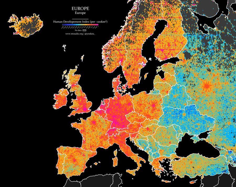
Wonderfully detailed map shows the Human Development Index across Europe. Concentration of development in Central Europe generally and within the big cities within each individual country.
HT @yesdata_
17
90
322
41,918