
Geology professor: Andes | tectonics | basins | geodynamics. @UTAustin, @UTGeophysics, @txgeosciences. #firstgen #NewMexican 🌶🇺🇸⛰
Joined August 2016
- Tweets 262
- Following 433
- Followers 890
- Likes 416
63 Photos and videos


Pinned Tweet

25 Oct 2022
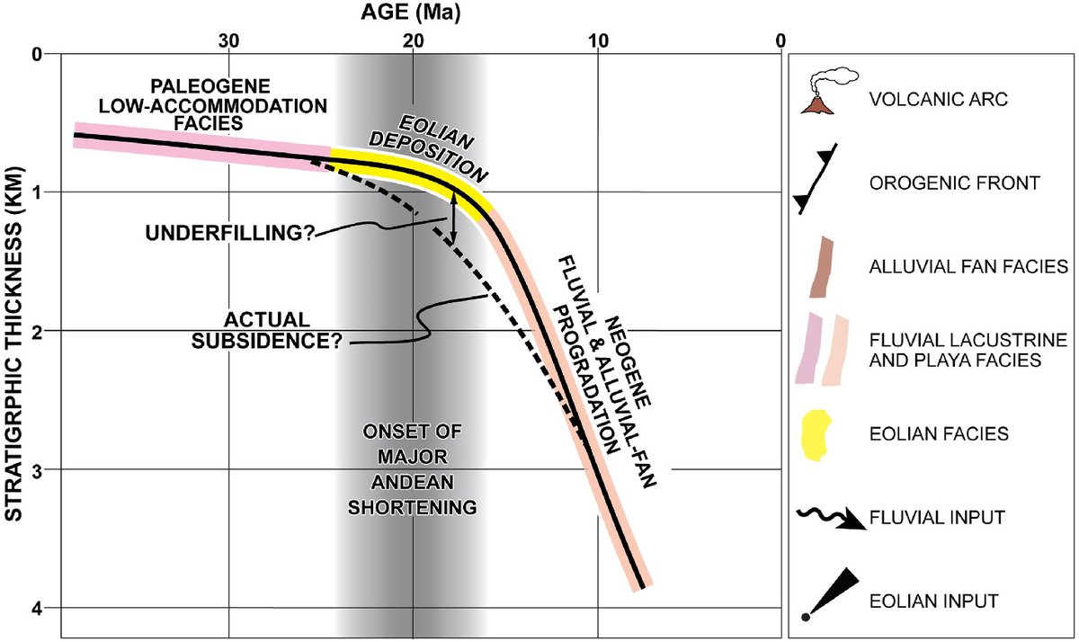
What causes intraplate deformation in South America? Andean topography & geologic structures point to flat slab subduction, ridge subduction, tectonic inheritance. #Andes #foreland #basin #geodynamics #subduction @txgeosciences @UNLVGeoscience @TAMUArtSci pubs.geoscienceworld.org/gsa…
3
81
273
2 Feb 2025
what, not interested in the topic? too dry? not juicy enough?
29 Jan 2025

A description of the desiccated human remains in the California State mining bureau. / Winslow Anderson. California State Mining Bureau Bulletin No. 1. 1888. #mining #sierramadremountains #19thcentury #mininghistory #archaeology

1
112
Brian Horton retweeted

19 Jul 2021
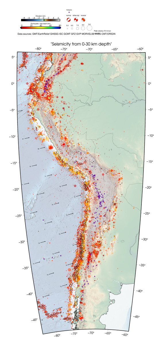
Shallow #earthquakes in the #Andes:
🔸What's going on in #Ecuador?? 😬
🔸Hints at #SlipPartitioning in the north and south. 🥰
🔸Northern #Peru is awfully quiet! And also seem to have been cheated out of its rightful share of #volcanoes. 🤨
#tectoplot
2
7
20
8 Nov 2024
not to be confused with the Bugs Bunny guide to the Ozarks. dailymotion.com/video/x3uq81…
8 Nov 2024
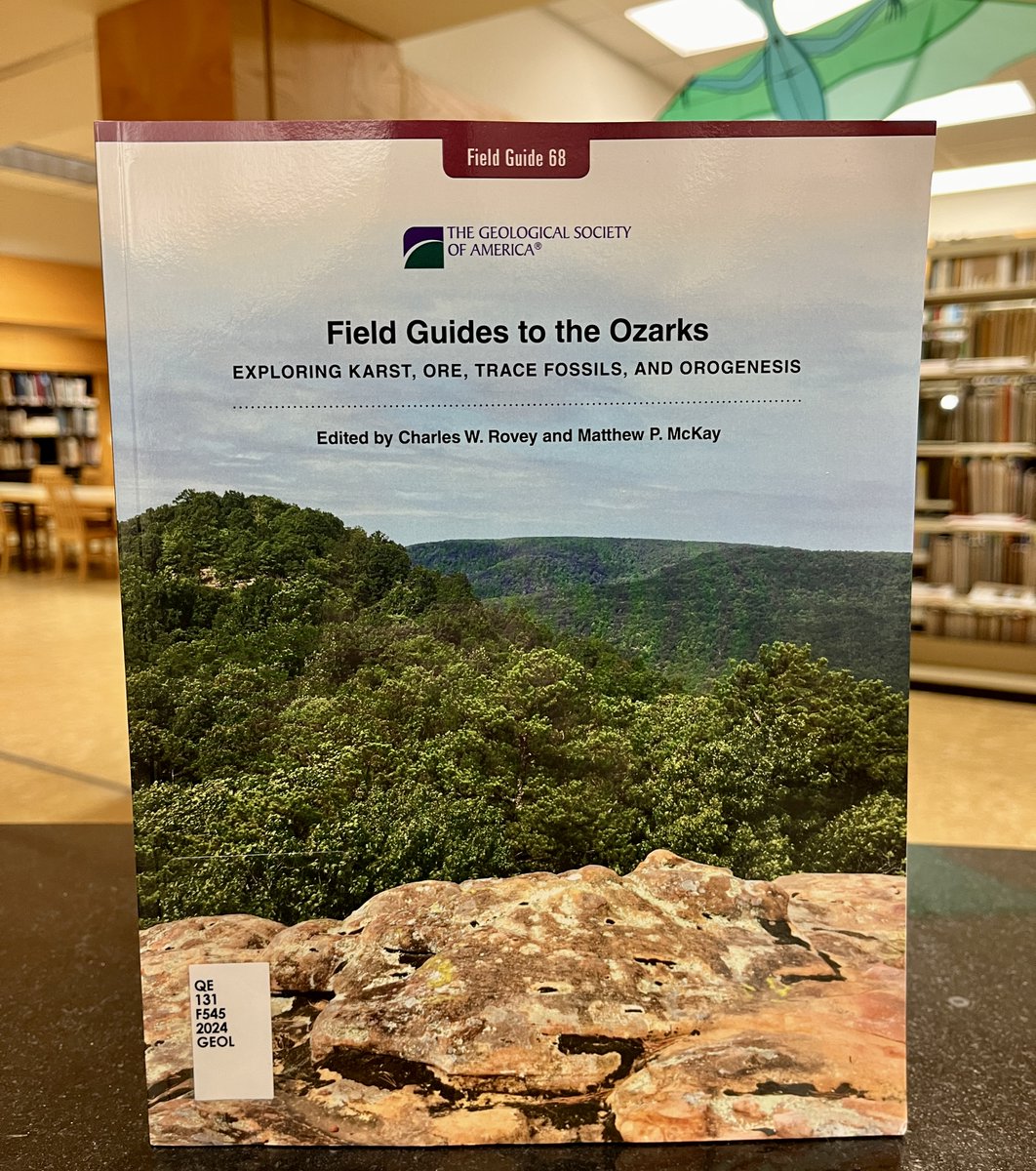
Field guides to the Ozarks : exploring karst, ore, trace fossils, and orogenesis / edited by Charles W. Rovey, Matthew P. McKay. The Geological Society of America, 2024. #geology #Missouri #ozarks #karst #paleontology
1
140
Brian Horton retweeted

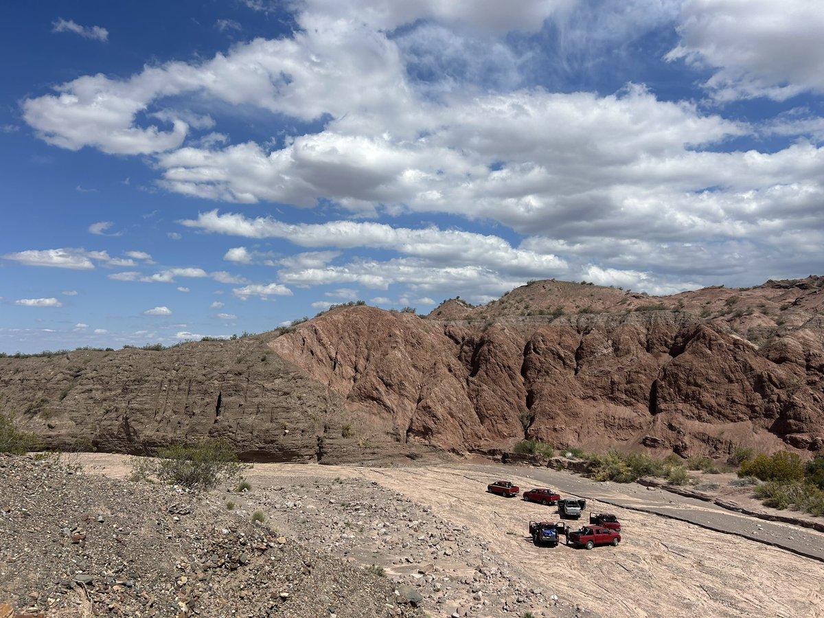
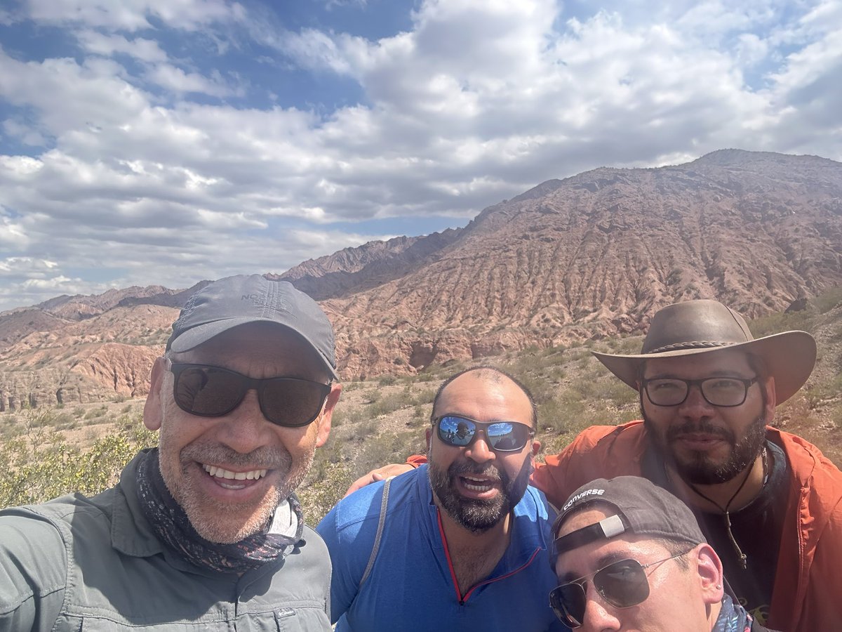
13 Oct 2024
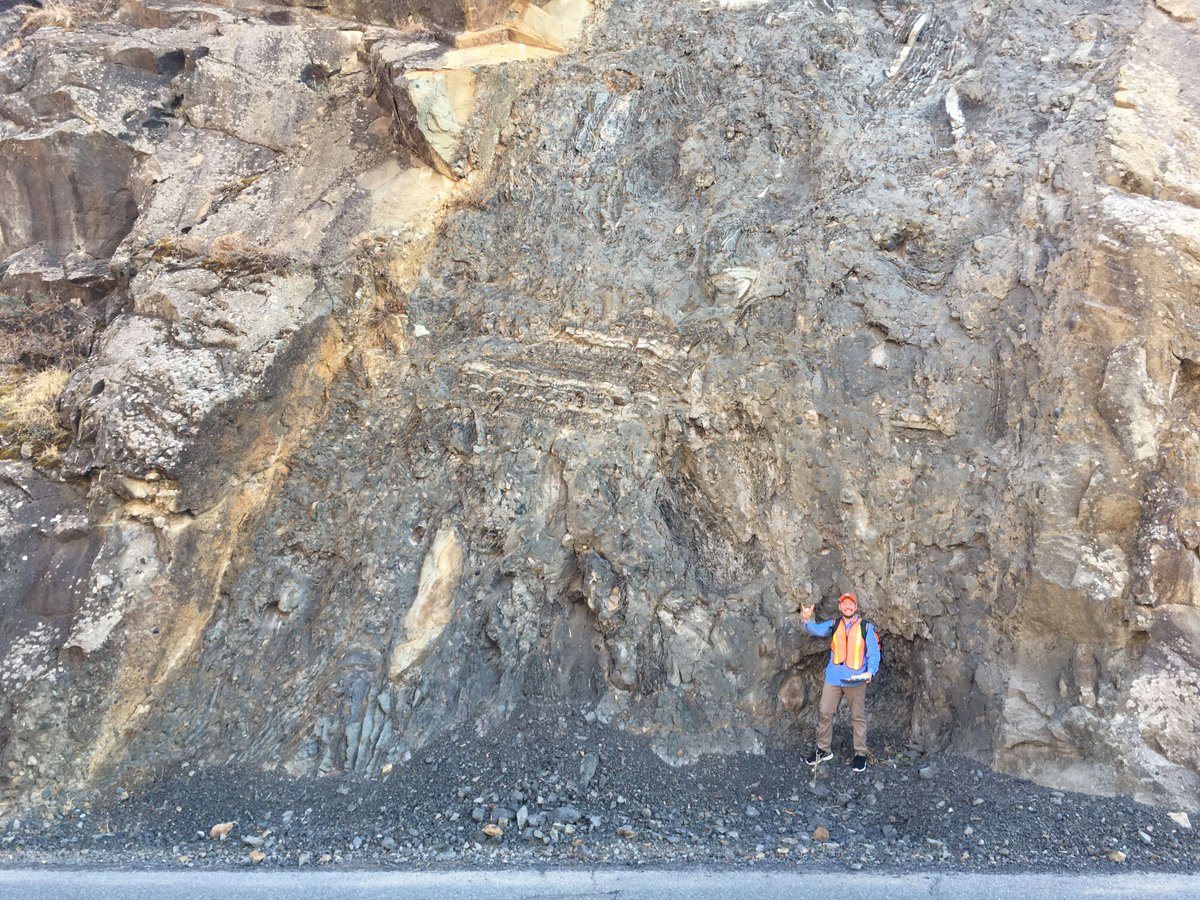
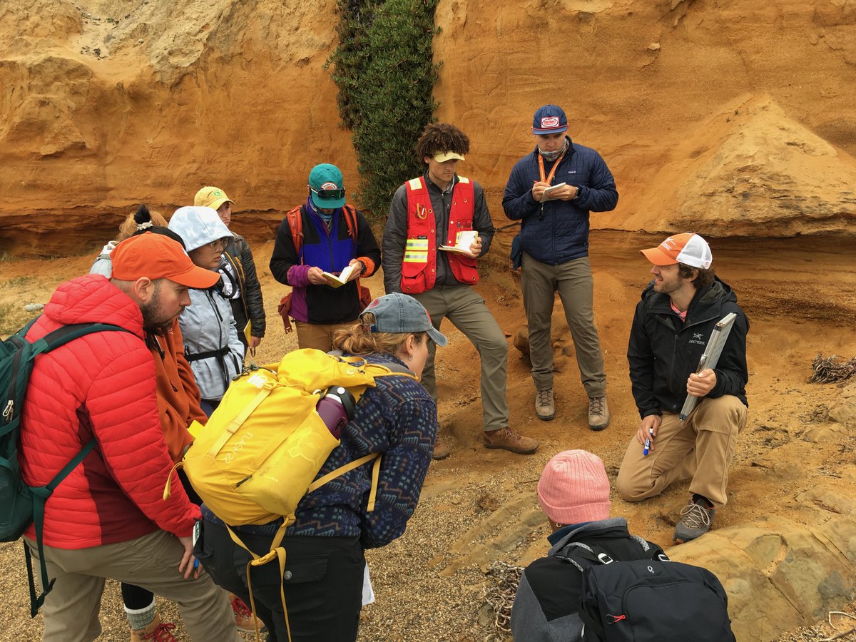
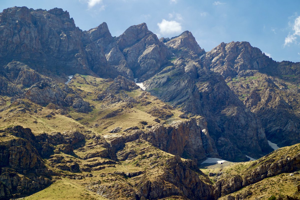
Huge thrust at the eastern slope of the Andes, geologists looking atonish. Post meeting field trip of PATADays 2024

2
11
36
2,075
Brian Horton retweeted

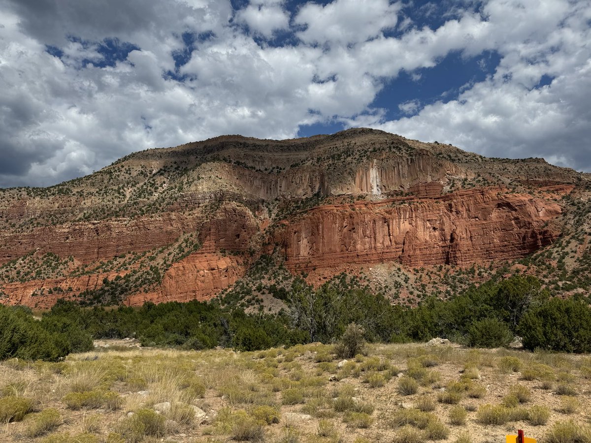
1 Oct 2024
Laramide high angle fault crosscutting Permian and Triassic sediments, and unconformably overlain by the 1.3 My Bandelier tuff that formed Valles Caldera. New Mexico.
6
37
1,593
18 Sep 2024
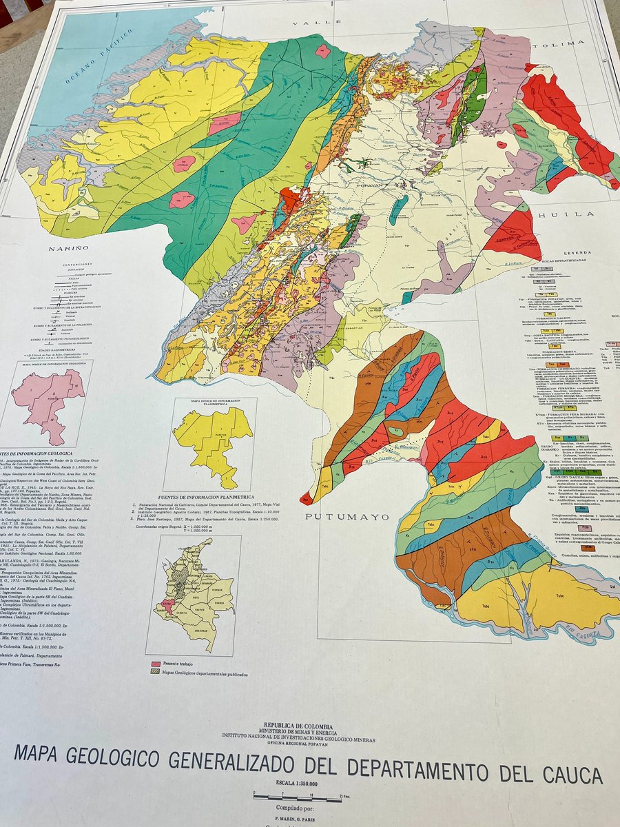
one of many valuable provincial geologic maps from Colombian natl geolog
ical survey. #Andes #Colombia
5 Sep 2024
Mapa geológico generalizado del Departamento del Cauca : escala 1:350.000. República de Colombia, Ministerio de Minas y Energía, Instituto Nacional de Investigaciones Geológico-Mineras, Oficina Regional Popayan, 1979. 93 x 68 cm. #maps #cartography #cauca #colombia
1
2
172
Brian Horton retweeted

11 Sep 2024
In the stacks:
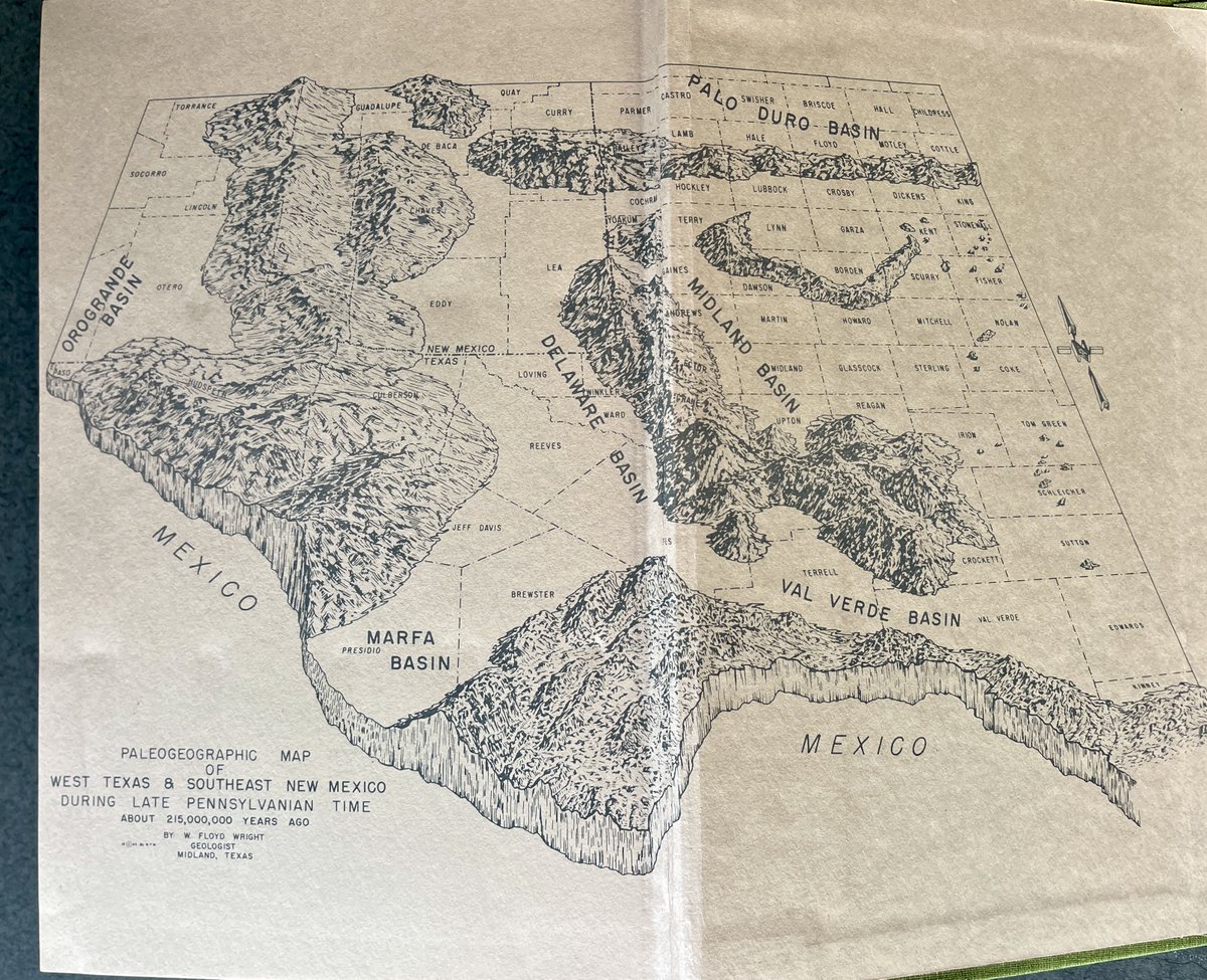
The Permian basin : petroleum empire of the Southwest. By Samuel D. Myres. Permian Press, 1973. #petroleum #petroleumindustry #texas #texashistory #permianbasin
2
4
354
18 Sep 2024
not a ZZTop album cover
13 Sep 2024
In the stacks:
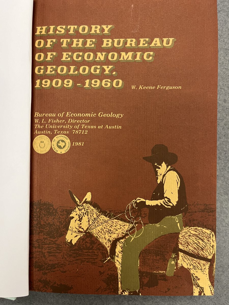
History of the Bureau of Economic Geology / W. Keene Ferguson. Bureau of Economic Geology, the University Texas at Austin, 1981. #geology #bureauofeconomicgeology #history #texashistory #universityoftexasataustin
1
2
295
Brian Horton retweeted

16 Sep 2024
Any geoscience/hydrology scientific illustrators out there? Might have funding to help me build educational content for the citizens of New Mexico all about water resources! DM me if interested!
2
5
4
689
Brian Horton retweeted

27 Aug 2024
Check out the hairpin turns in the Uraricoera and Takutu rivers in the northern Amazonian state of Roraima. These rivers formerly drained north into Guyana and now drain south into the Branco and then Negro rivers.
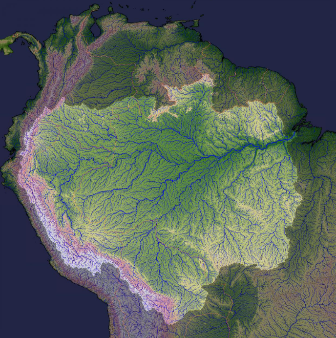
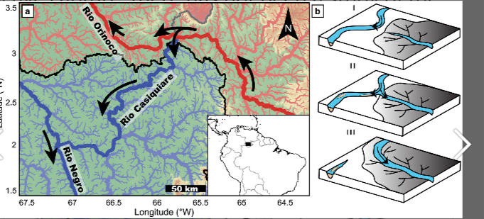
27 Aug 2024

Yes, the Casiquiare canal is a case of ongoing river capture as the upper Negro captures the upper Orinoco.
The Amazon basin is continuing to expand along most of its northern margin.
agupubs.onlinelibrary.wiley.…
2
19
1,212
Brian Horton retweeted

26 Aug 2024
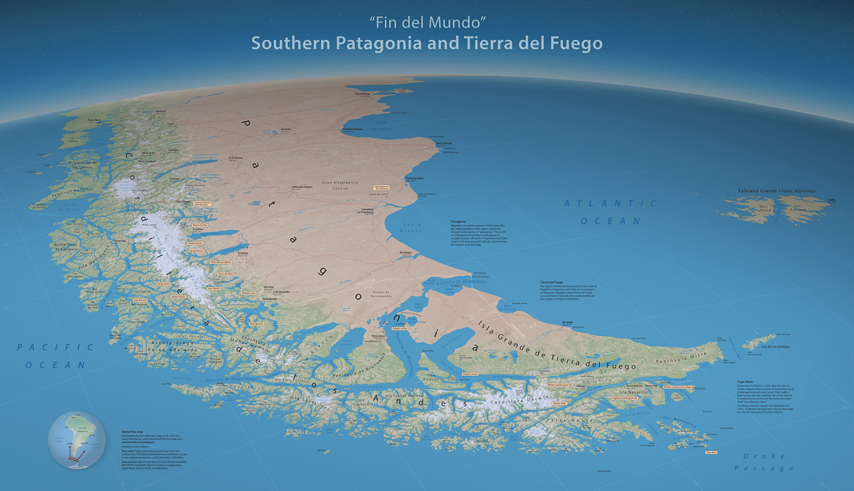
I like making big blue maps of remote places. Here's my latest: shadedrelief.com/patagonia
8
14
136
9,837

Pedro Val (@topoerosion) liked studying geology. But when he learned about how tectonic activity can change the flow of rivers, he “didn’t want to know about anything else.” @theAGU
eos.org/features/pedro-val-r…
Read more in our August career issue: bit.ly/Eos-Aug2024
2
7
1,782
Brian Horton retweeted

8 Aug 2024
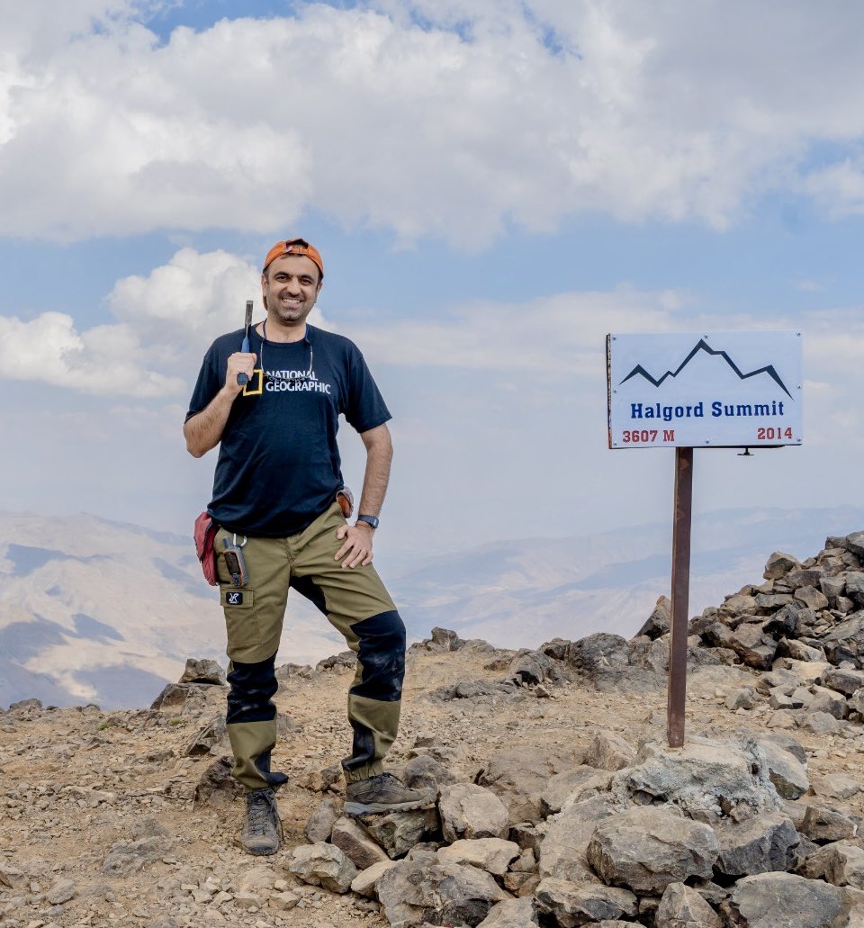
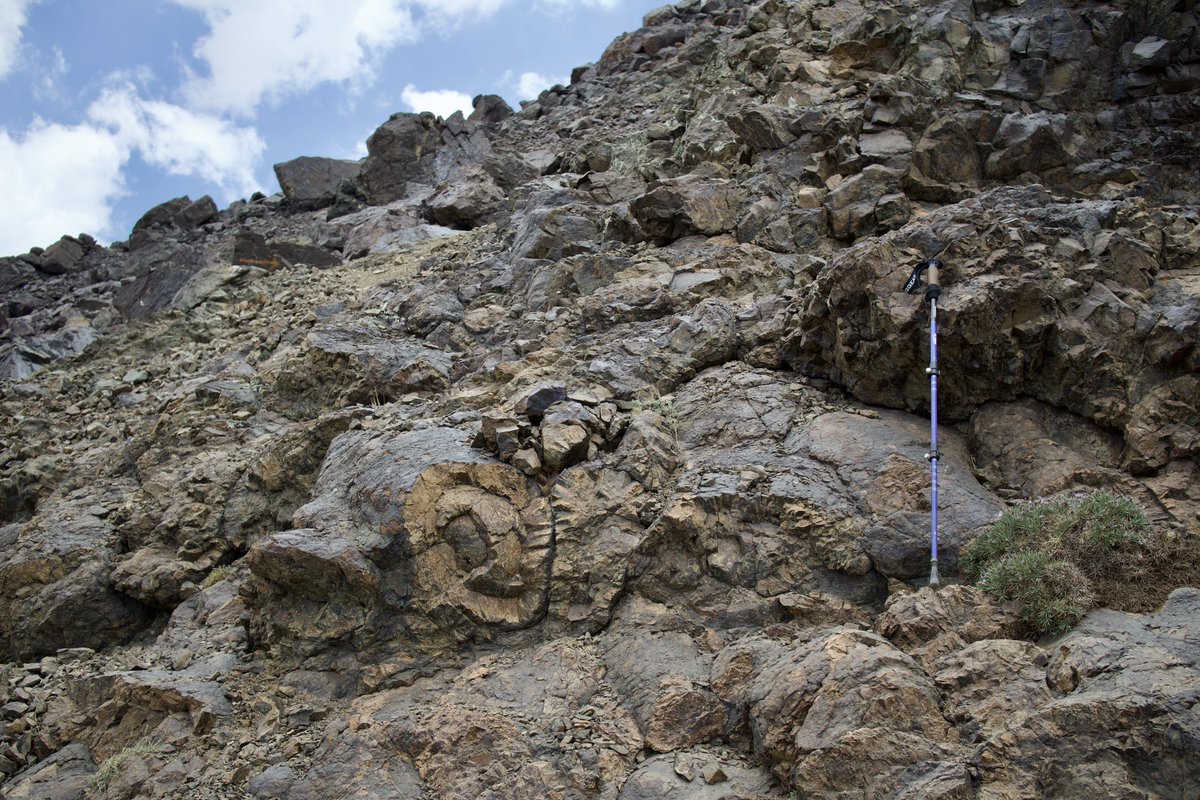
Halgurd mountain (3607 m; 11834 ft) a stacking pile of pillow lava basalts! Once upon a time a newly formed Neotethys oceanic crust between the Eurasian plate and the Arabian plate, now the highest peak of the Zagros mountain range in the Kurdistan region of Iraq! @InsideNatGeo

2
8
537
Brian Horton retweeted
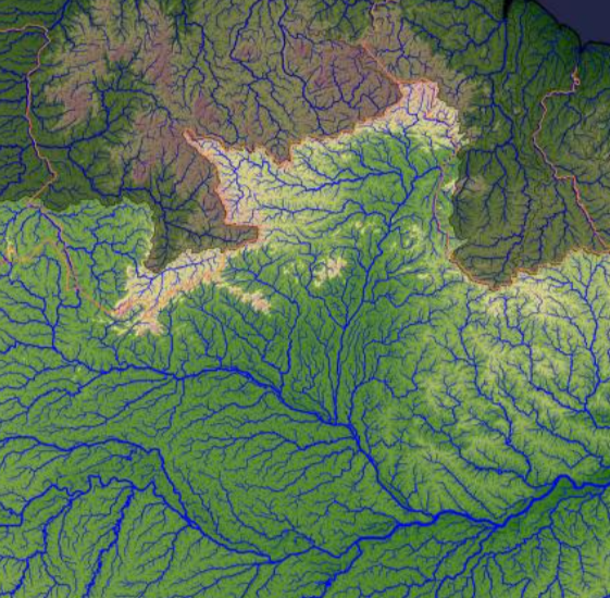
13 Jul 2024
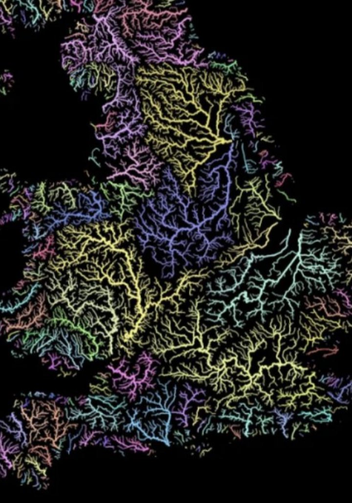
River drainage networks of England show the effects of both tectonics and erosion, with many smaller basins draining to the periphery, but the development of some larger interior basins by river capture, as in the Trent and Severn basins.
1
6
340
Brian Horton retweeted
26 Jun 2024
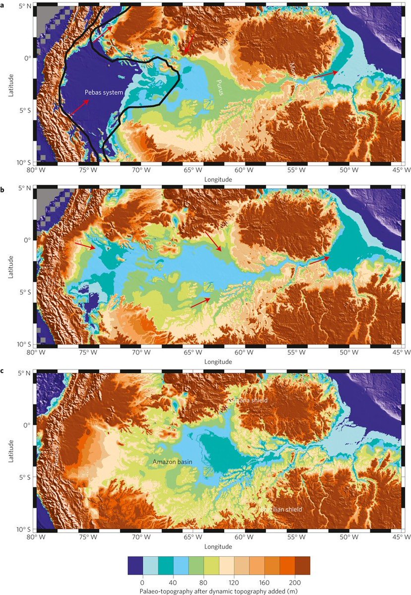
Also environmental conditions in the past. Nothing in the Amazon makes sense except in light of the Pebas megawetlands that covered over 1 million sq km from 22-10 million years ago.
26 Jun 2024

Plate tectonics climate change intermittent stability = massive biodiversity
1
5
19
1,500
Brian Horton retweeted
23 Jun 2024
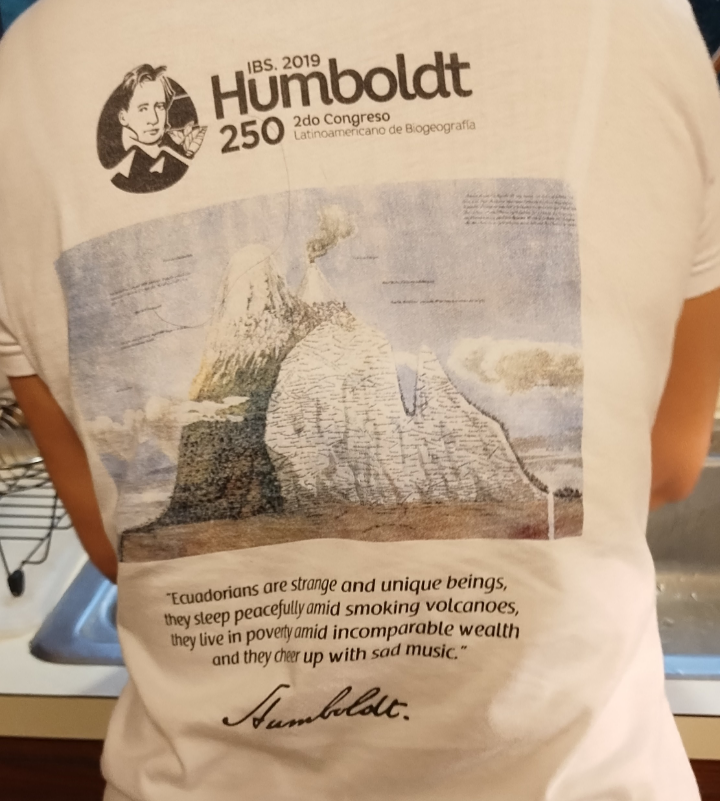
"Ecuadorians are strange and unique beings, they sleep peacefully amid smoking volcanos, they live in poverty amid incomparable wealth, and they cheer up with sad music." A. von Humboldt.
2
18
942
31 May 2024
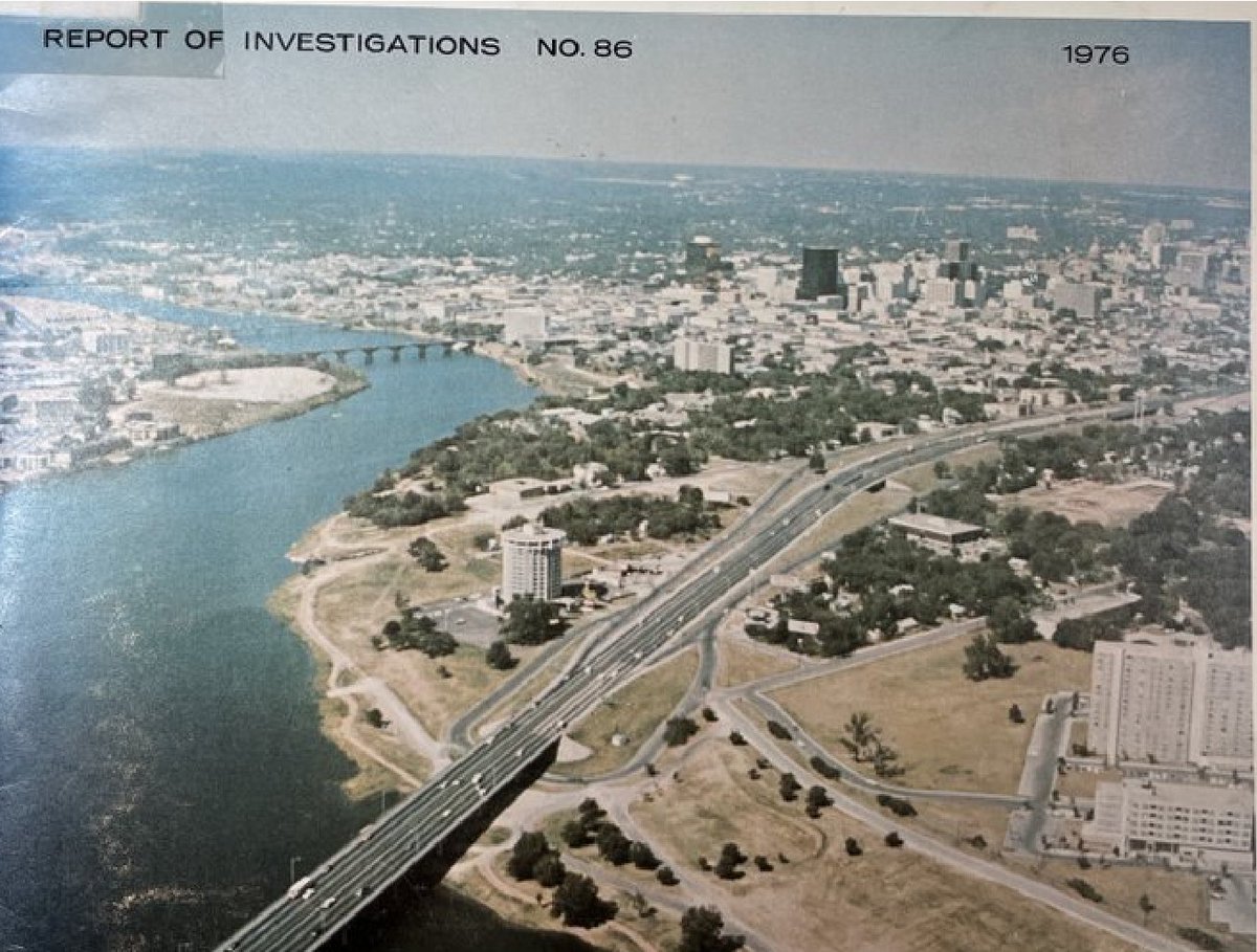
Growth of downtown Austin Texas over ~50 yrs: rough image comparison 1976 vs. 2023 (attempting to match bridges over Lady Bird (Town) Lake = the dammed TX Colorado River). Disclaimer: there is more I-35 traffic than depicted in GoogleEarth #austin #atx
store.beg.utexas.edu/reports…
ALT Aerial view to NNW of Austin TX, from 1976 report by BEG: https://store.beg.utexas.edu/reports-of-investigations/2663-ri0086d.html
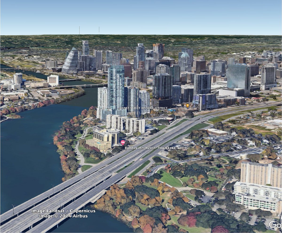
ALT Aerial view to NNW of Austin TX, from ~2023 GoogleEarth imagery.
30 May 2024
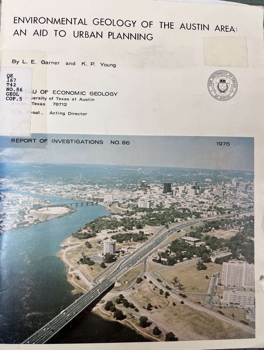
Meanwhile, in 1976... what a view!
Environmental geology of the Austin area : an aid to urban planning. L.E. Garner, K.P. Young. Bureau of Economic Geology University of Texas at Austin. 1976. #austin #urbanplanning #geology #atx #aerialphotography #1970s
5
298
30 May 2024
Nice example of Sub-Cretaceous (K) Unconformity in New Mexico: K Beartooth SS shows variable subcrop relationships, highlighting pre-K regional tilting & erosional beveling. S. Cather 2012 NM Geo Soc Guidebook nmgs.nmt.edu/publications/gu…

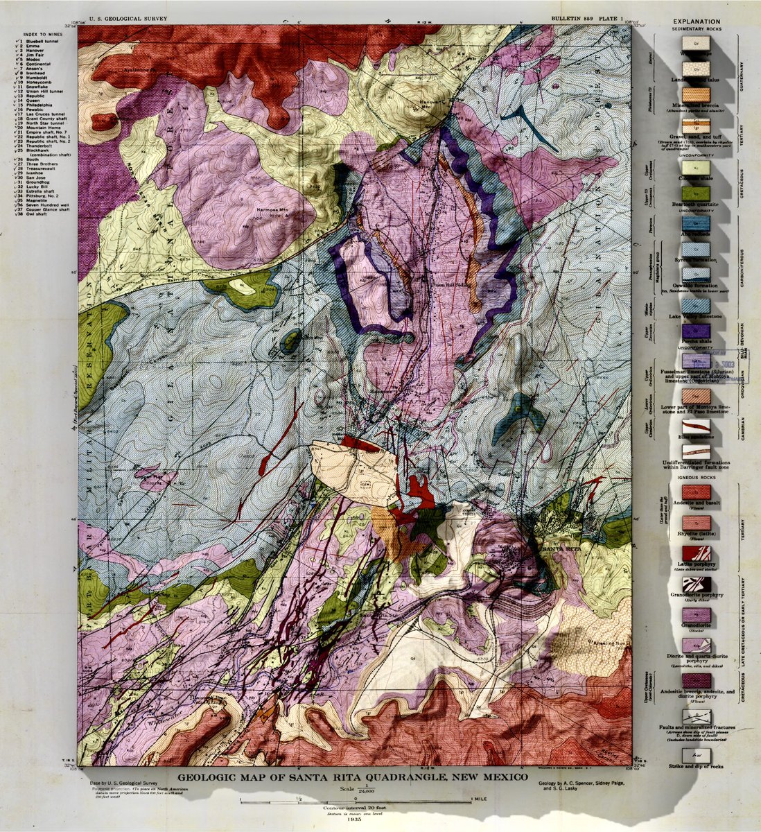
4
240
Brian Horton retweeted

28 May 2024
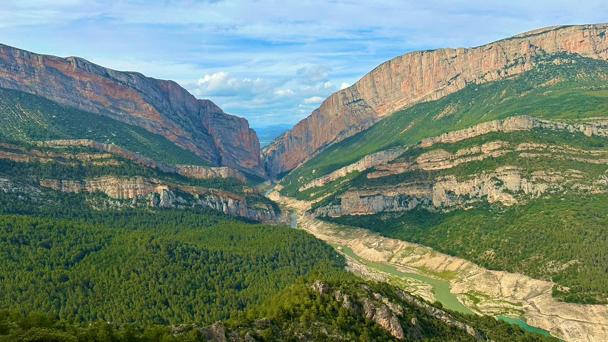
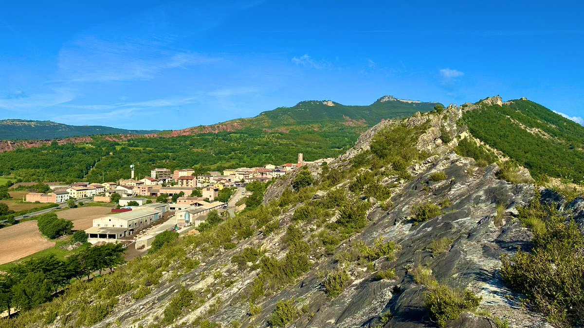
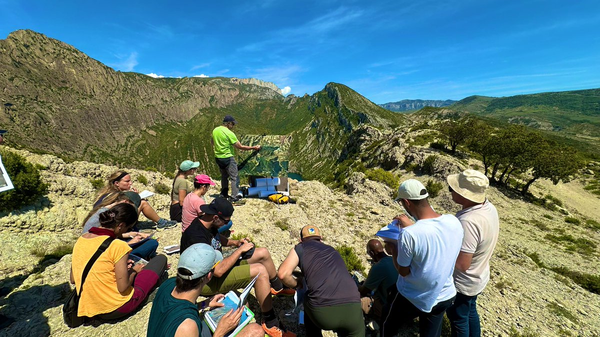
Fieldtrip doing a 2 days transect following the Ribargorçana river #Pyrenees with J.A Muñoz and K. McClay. Interesting discussions about salt-bearing fold-and-thrust belts. #fieldgeology #structuralgeology
@IRGeomodels @DeptDto @geologiaub

3
6
47
1,519