
Severe weather specialist
Joined March 2014
- Tweets 39,991
- Following 487
- Followers 30,315
- Likes 95,717
10,289 Photos and videos


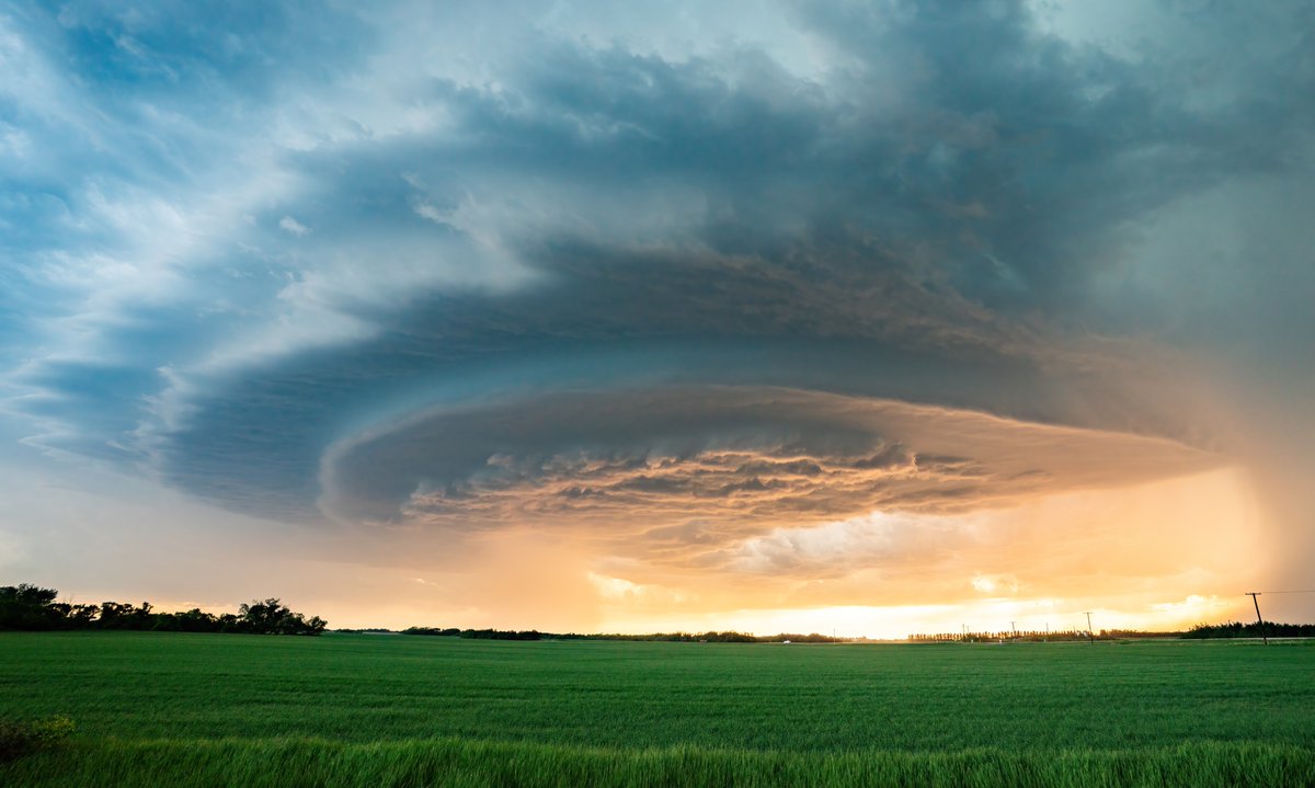

Still tons of snow on the front ranges west of Calgary!
Outlaw Peak at left, Mount Glasgow on the right.
5
12
104
2,405
Kyle Brittain retweeted

Jun 12
Quick edit showing some of the intense moments today while documenting 8 tornadoes in northern Illinois into Indiana. Massive shoutout to @skydrama for nailing the forecast in the warm sector. Hands down the craziest tornado outbreak I've ever documented.
Full video will be released in the near future on the @thestormreel YouTube page.
#ilwx #inwx #tornado #outbreak
96
998
6,881
589,642
Kyle Brittain retweeted

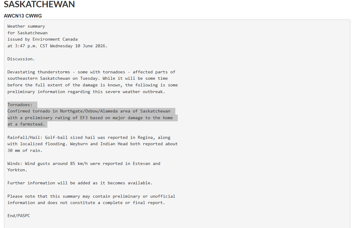
Jun 10
BREAKING: A preliminary report from Environment Canada, likely in conjunction with the NTP, has determined a rating of EF-3 for the tornado that struck near Oxbow/Alameda, Saskatchewan yesterday evening. This is the strongest tornado in Saskatchewan since July 2nd, 2010. #skstorm
1
56
164
9,480

Jun 11
What is a SUPER EL NIÑO and how will it affect Canada's weather in the coming months?
Check it out 👇
4
11
69
7,270
Kyle Brittain retweeted

Jun 10
9
35
201
69,279
Jun 10
Incredible loop of a generational thunderstorm day in Winnipeg.
Had that line that delivered over 250mm of rain to Stonewall set up directly over the city, it could have been catastrophic. #mbstorm

1
4
77
9,261
Kyle Brittain retweeted
Jun 10
Oh man…horrific tornado damage from the tornado earlier near Almeda, Saskatchewan. This farmstead was destroyed and it appears the farmhouse was left with very few interior walls standing. Very significant-intense damage… #skstorm
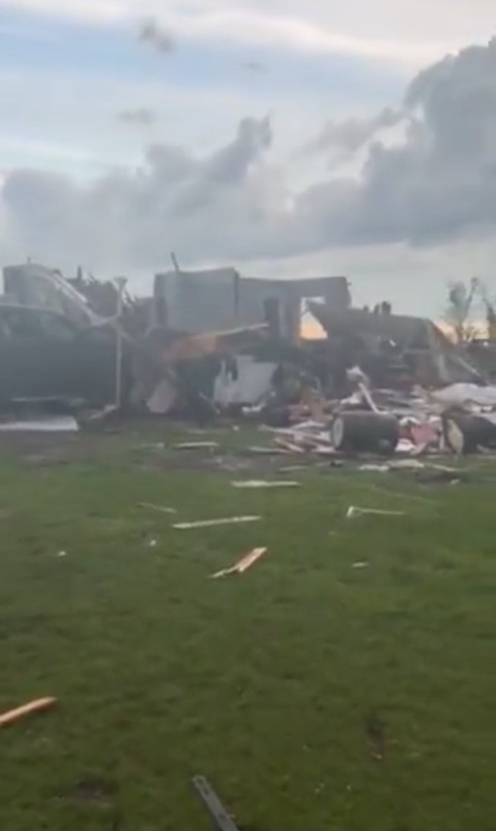
Jun 10

Danny Brock is a Saskatchewan farmer who just got sucked from his bathroom into a tornado and had his farm wiped out near Alameda, Sask.
Everyone is alive, animals uncertain, no buildings left.
More on this, and the aftermath on tomorrow's Rebel Livestream.
4
62
363
46,524
Jun 10
Impactful thunderstorm event continues in Winnipeg.
Just hours of slow-moving thunderstorms with torrential rain and tornado potential #mbstorm
3
11
50
5,592

Jun 10
Biggest tornado watch I have seen in a long time...
From southern Nebraska to Central Manitoba!
2
17
99
5,721
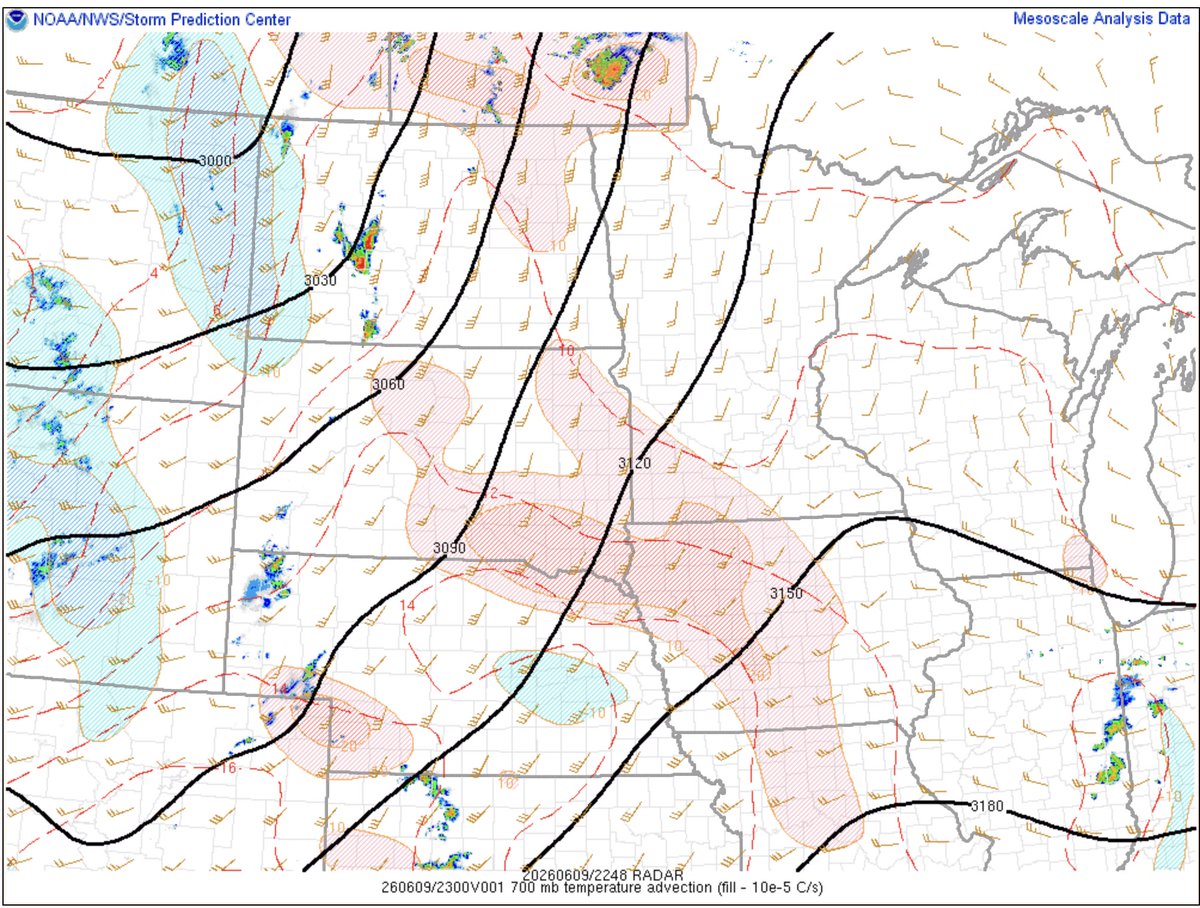
Jun 9
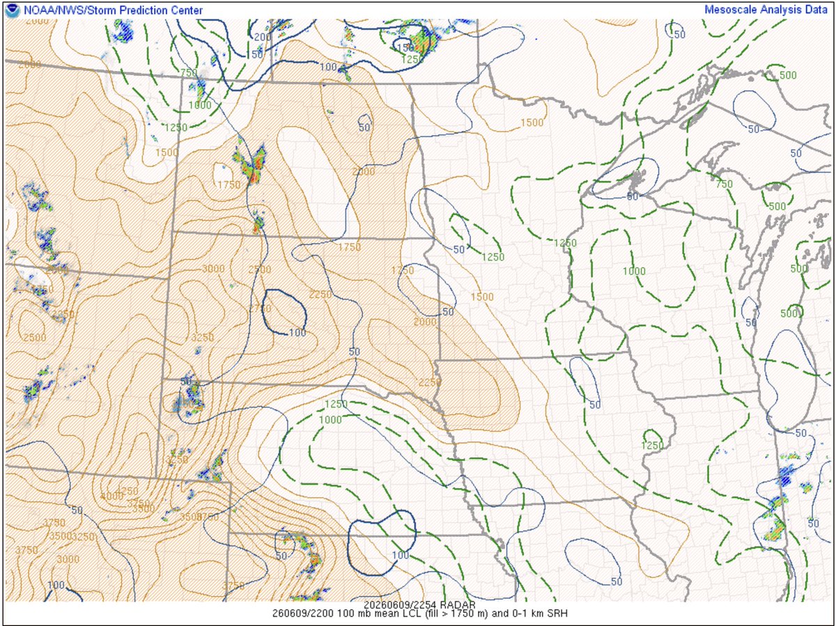
Another reason surface-based convection continues to struggle west of the RRV...
The 700mb thermal ridge axis continues to be firmly entrenched over southwestern Manitoba, while a more breakable cap exists farther east.
LCL heights also peaking with daytime heating #mbstorm
4
31
3,785
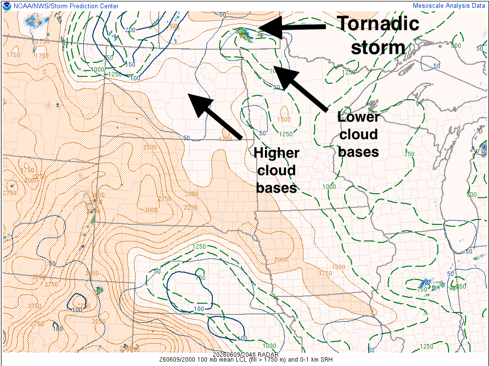
Jun 9
Early tornadic development in the storm south of Winnipeg shows how volatile the local environment is today.
Unlike farther west (at least for the time being), LCL heights are locally lower in the RRV.
Higher LCLs to the west today may again limit tornado potential. #mbstorm

1
6
68
7,231
Jun 9
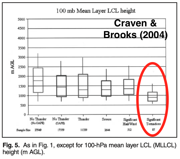
A handy rule of thumb for estimating LCL (lifting condensation level - or the approximate cloud base height):
(Temperature minus dewpoint temperature) times 125 = LCL height in metres
Significant tornadoes are uncommon when LCL height is above 1200m, or when the difference between the temperature and dewpoint is 10°C or greater.
1
1
28
1,553


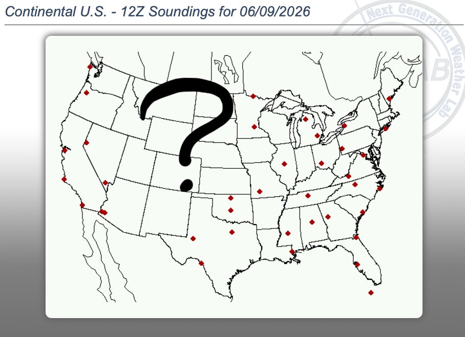
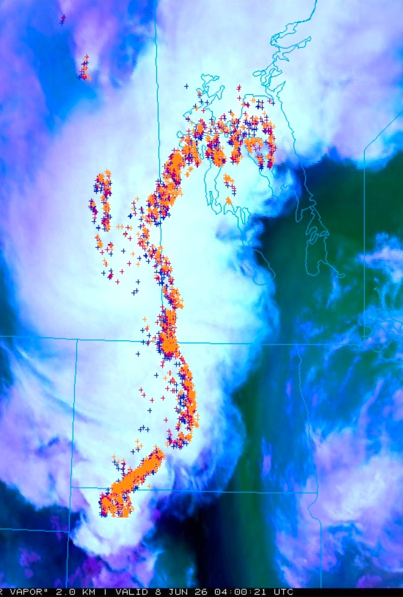
Jun 9
Sure would be nice to be able to sample the real atmosphere ahead of today's severe weather potential in the eastern Prairies.
A lack of upstream weather balloon observations will mean degraded and inconsistent weather model output...
3
12
67
5,610
Kyle Brittain retweeted

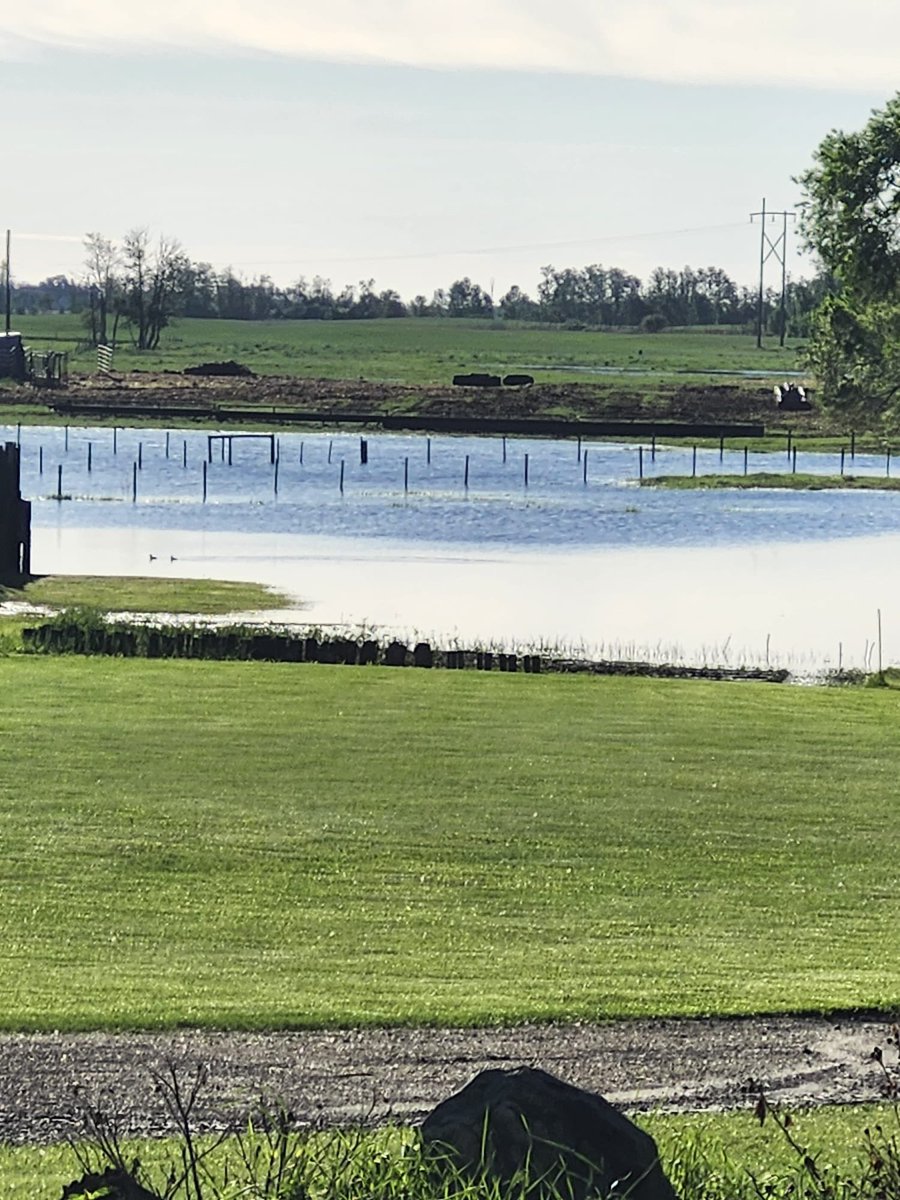
Thunderstorms last night have caused significant flooding in Kipling, Saskatchewan! #skstorm
2
20
102
10,394
Kyle Brittain retweeted

Jun 8
It’s devastating the amount of rain we got near Churchbridge over the past couple of days. Fields are completely gone, there is enormous amounts of sitting water, and roads are washed out. This is one of the craziest years I’ve seen yet.

8
7
109
10,018
Kyle Brittain retweeted
So Saturdays storms feel like a storm of 2 tales the dark side and the bright side what a beautiful storm might be hard to beat this one this year #skstorm


8
25
190
6,303