
Meteorologist/Consultant @weatheragencyus @minnesotawxnet & ft. on @stormfrontfreak 🎙️ (Ep. 153). Tech Sponsor: @nework_us MSP alerts: @BoKnowsWxAlerts.
Joined November 2012
- Tweets 34,111
- Following 3,285
- Followers 6,709
- Likes 15,393
9,959 Photos and videos


Jun 14
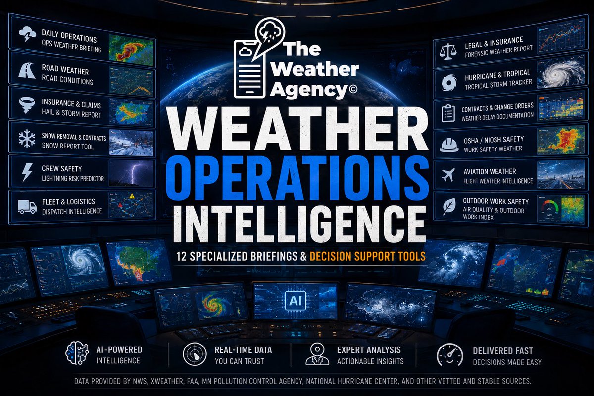
SNOW OPERATORS!!! Calling all Snow Operators. Take a look at 1 of my 12 report generator tools in the product suite. I think you’re going to love this one. DM me with questions or visit the Weather Agency website and hit the contact form. Otherwise if you download my app or visit the web app- which is also linked from the main site- you can read all about the Weather Intelligence Hub. There are a number of other useful tools in the suite that are very usable for all types of businesses.
3
1,004
Jun 13
For those wondering about how the panels fared.
Jun 12

Stunning drone video shows a tornado in Ipava, Illinois, barreling straight into solar panels and sending them flying.
2
5
1,738
Jun 13
This tool will truly be a game changer for a lot of industries. Inside of the new weather agency app. It’s a paid feature but there are free 7 day trials. A lot of development and time went into this one also- which this one I did myself. Available on iOS app and Android app for the weather agency. Or the web app. It is a premium paid feature. app.theweatheragency.com/

ATTENTION! Snow Removal, Contractors, Airports, Pilots, Legal Teams, Logistics/Fleet, Emergency Managers, Property Managers, Insurance/Claims Adjusters- list goes on! I’ve developed an amazing new suite of on-demand briefing generators on my Weather Agency App. You HAVE to see!
5
1,119
Jun 12
Out of my several product launches this past year, this is probably one of the ones I’ve been most excited about… Version 1 is here —with more changes to come, like possible model data integration, and better radar functionality— but for now this is the starting point.
My NEW Graphics/Broadcast Portal v.1, helping you to create weather graphics/ animations faster.
✅ Custom graphics
✅ PNG & MP4 exports
✅ Upload your own images
✅ OBS integration
✅ Built-in tutorials
Create. Animate. Broadcast.
More features soon
graphics.theweatheragency.co…
2
1,014
Bo Cole retweeted

cig system may be new but the 10# curse certainly isn’t 🤩

7
13
206
13,267
Jun 11
How come we aren’t talking about how crazy cool LEGOs are now?? Passed thru the aisle at Target and they have some crazy stuff now. 🤯
2
14
1,543
Jun 10
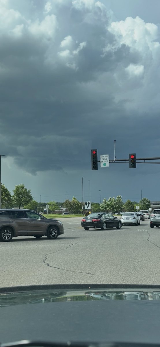
Today massively sucked overall- from an “outbreak” perspective. Disappointed with the performance of the models these days. Makes it brutal for us to take extra hatred from trolls. Anyways. Went for a a baby chase locally after this wannabe storm- as it tried to show a little bit of bite for a brief bit- saw a couple of instances of lowering but of course didn’t get those on camera. Traffic was iffy and was driving alone.

14
1
51
4,699
Jun 10
I feel like a severe watch should also include the twin cities based on some of the convection that the CAMs are showing over the next few hours.
12
66
7,675
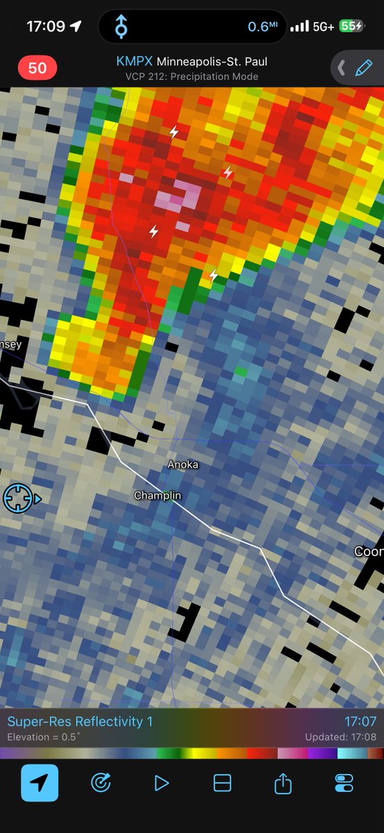
Jun 10
Looking back at radar. You can see where the narrow plume of damaging winds occurred. Starting basically just NE of downtown or so and heading across the N/NE metro or so. Velocity shows the brighter white/red color surging Northeast.
2
1
25
3,217
Jun 10
What a scam!!! Nudging East again. Threat isn’t gone. But this is oh so typical.
21
3
107
25,171
Jun 9
I feel like auto correct was better on phones in 2010. Everything else is advancing- and auto correct gets worse by the year. 😭
3
8
1,810
Bo Cole retweeted

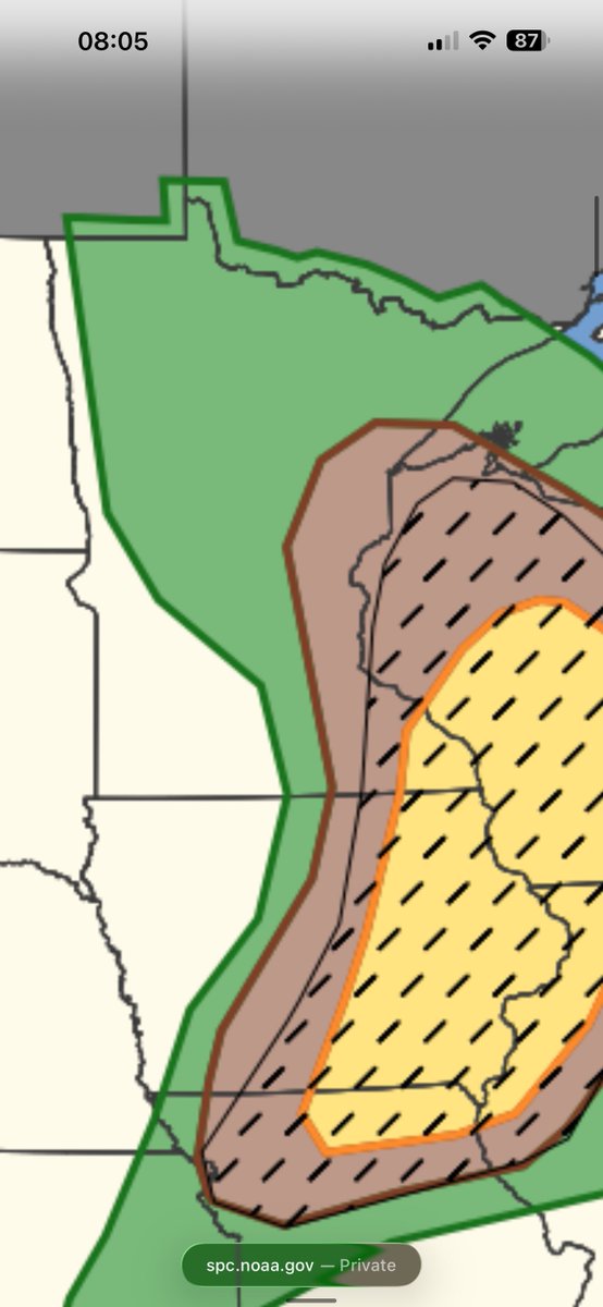
This is either my 1st or 2nd time ever seeing a 100% probability bin of at least 1 severe report within 110 km of a grid point.
Additionally, 53% tornado probs is also in rare analog space - the fact it's maximized around the MSP metro is concerning. #mnwx #iawx #wiwx
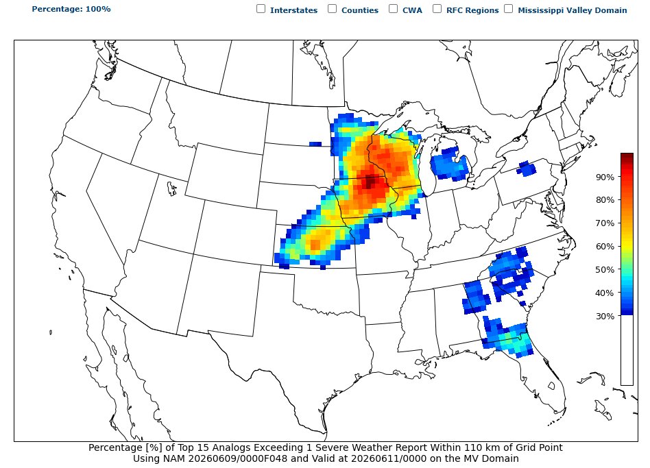


After sifting through CIPS the past few days, I believe the closest analog match is May 1, 2001.
Similar upper-level features lead to similar low-level placement of fronts & air masses.
The 500mb wave is slightly more open than Wednesday's however.
2/6

1
10
91
37,445
Bo Cole retweeted

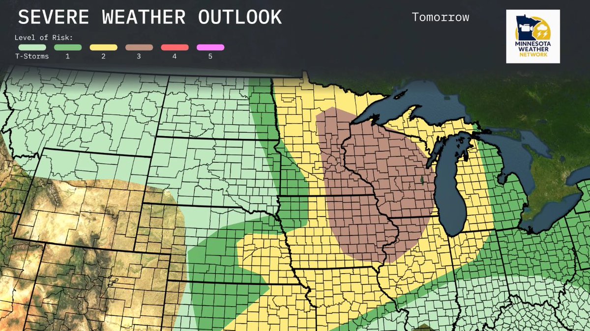
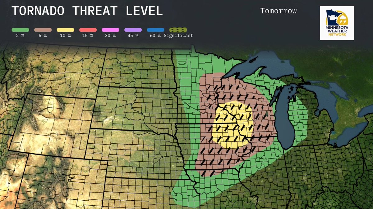
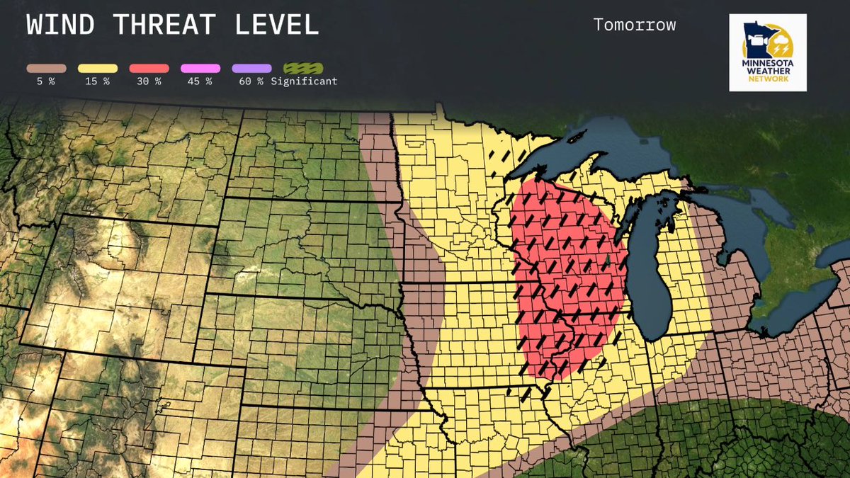
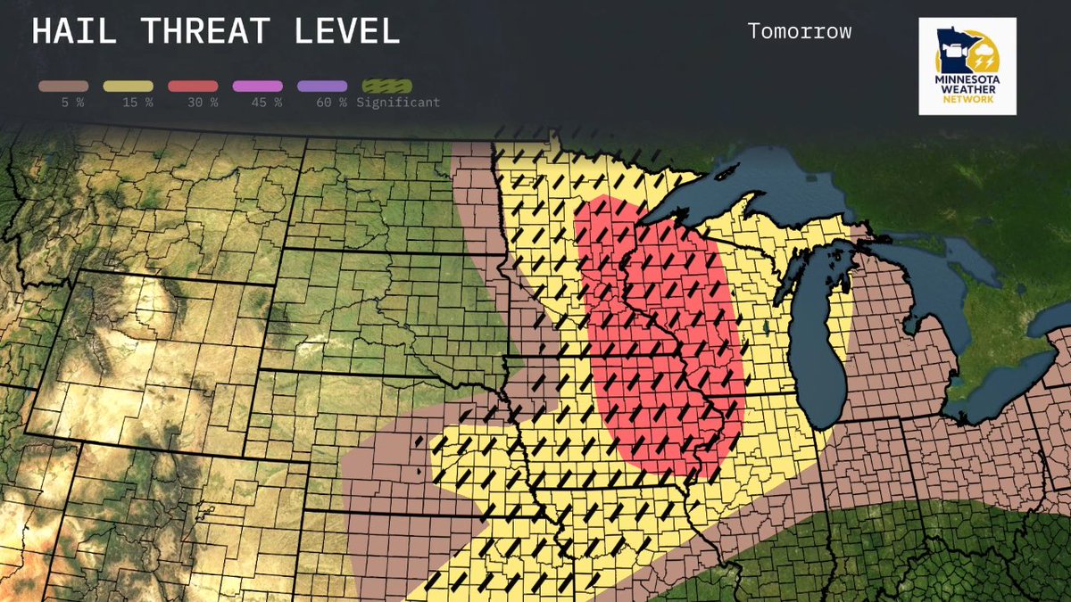
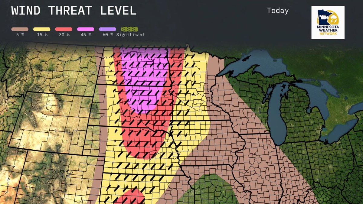
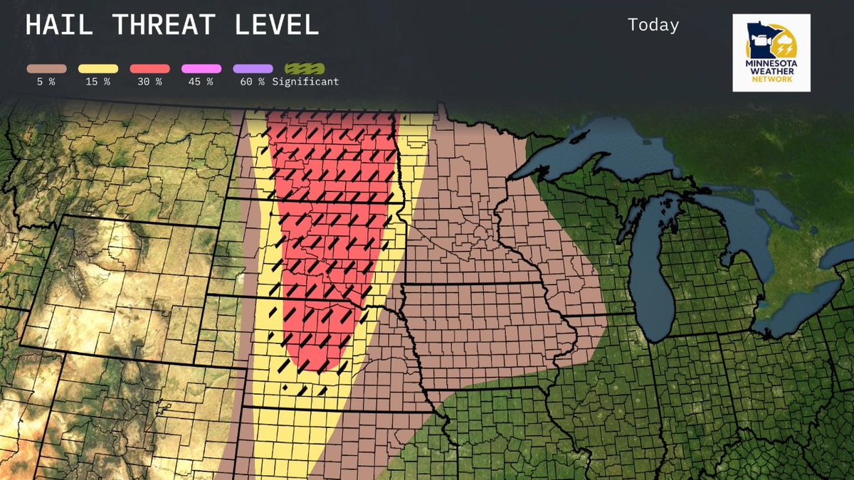
Here is our focus area for Wednesday! The threat comes a lot closer to home. Stay tuned for updates. All modes of severe weather are possible.
1
15
2,042
Bo Cole retweeted
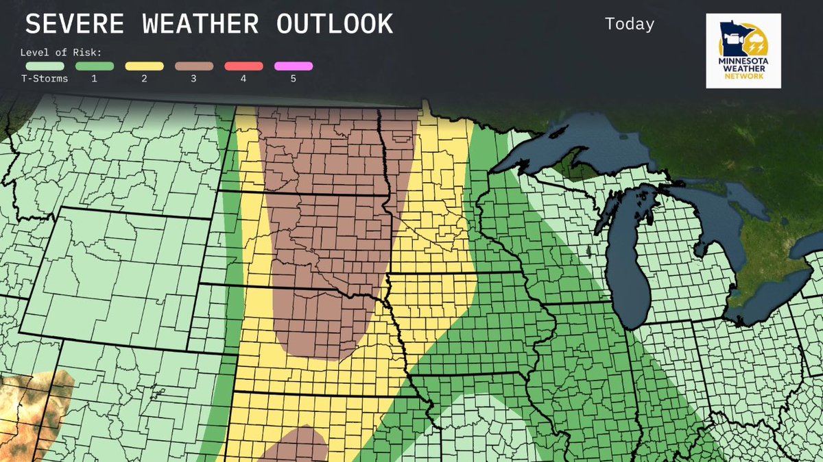
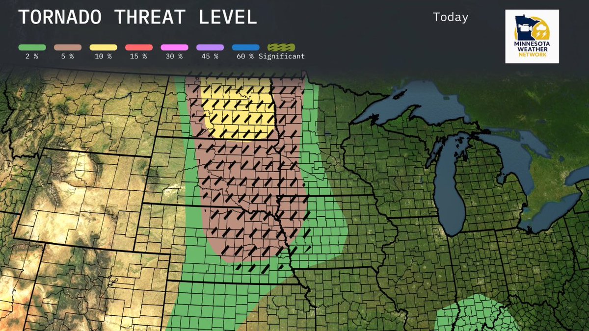
Severe threat for Today looks to be in the Dakotas and then I expect a line of storms to press thru the area between 1am and 7am in the Twin Cities. Then more storms tomorrow for our area are a TBD depending on how the AM clears out. Next post will cover tomorrow’s threat areas.
2
7
1,141
Bo Cole retweeted

Jun 9
Wild radar imagery tonight of a supercell near Salina, Kansas getting absorbed into a powerful thunderstorm complex 👀
A possible 113mph wind gust was measured at Salina Regional Airport! #KSwx
7
63
585
102,128
Jun 9
What is going on with these Dewpoint spreads? 38 to 68 over like 30 miles in SE North Dakota? 👀
3
2
21
4,109
Jun 9
The model (RRFS) that is soon to take over some of the other models we have been used to using- is going nuclear for the Twin Cities on Wednesday. Starting with a heavy round of wind and storms 2-6am? and then 2-8pm “PDS TOR” soundings. Now- other models are more relaxed- somewhat- and it’s important to note that the models have been relatively hot garbage these days. HOWEVER- we are due for our annual banger of a storm. So please stay tuned to the forecast for Wednesday. It looks to be a big day for some of us in the area.

16
16
180
36,003