
Official account of @CBS58 Chief Meteorologist Drew Burgoyne bringing you the latest weather updates. Plenty of Packers, Brewers, and Bucks chatter.
Joined March 2012
- Tweets 26,849
- Following 1,262
- Followers 4,855
- Likes 11,466
12,791 Photos and videos


Jun 11
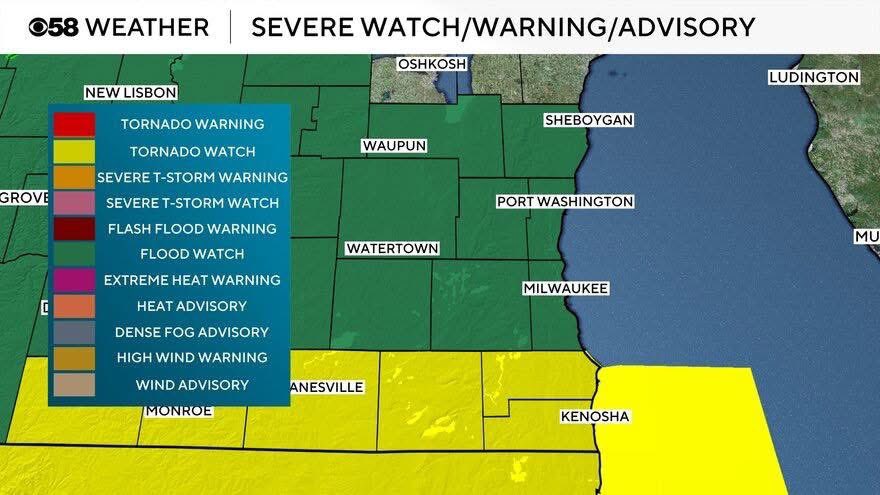
The entire area is under a flood watch. Tornado watch until 9 pm for counties close to the IL border. Greatest instability for strong to severe storms will be near the border
1
1
510
Jun 11
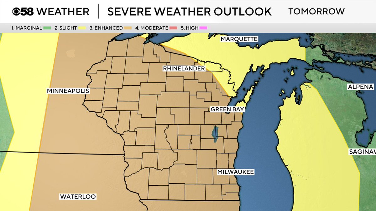
Our border counties have been upgraded to a moderate risk today. That’s level 4 out of 5. This area has the greatest chance for tornadoes this afternoon and early evening. The rest of the area remains in the enhanced. Please make sure you can get warnings.
1
6
441
Jun 11
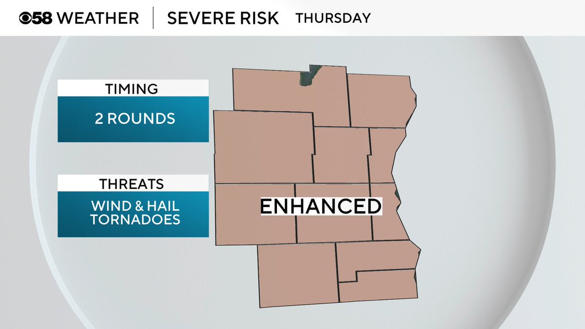
The entire area is again under an enhanced risk for strong to severe storms. All modes of severe weather are possible.
1
4
830
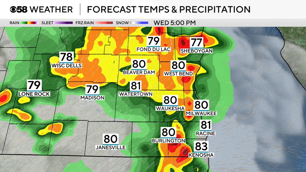
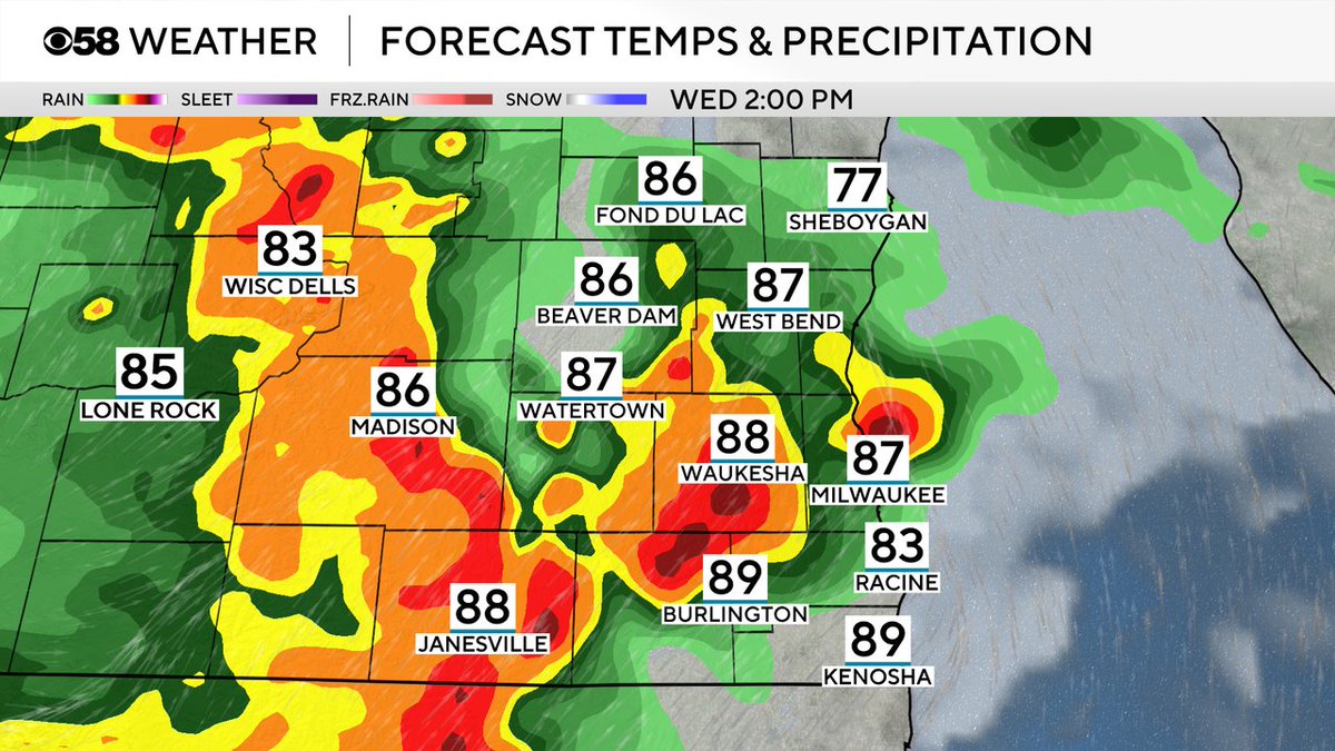
Jun 11
The second round has the potential to be the strongest by the early evening; however, earlier storms could reduce some of the overall punch. It will be wait and see Thursday afternoon.
2
11
1,868
Jun 11
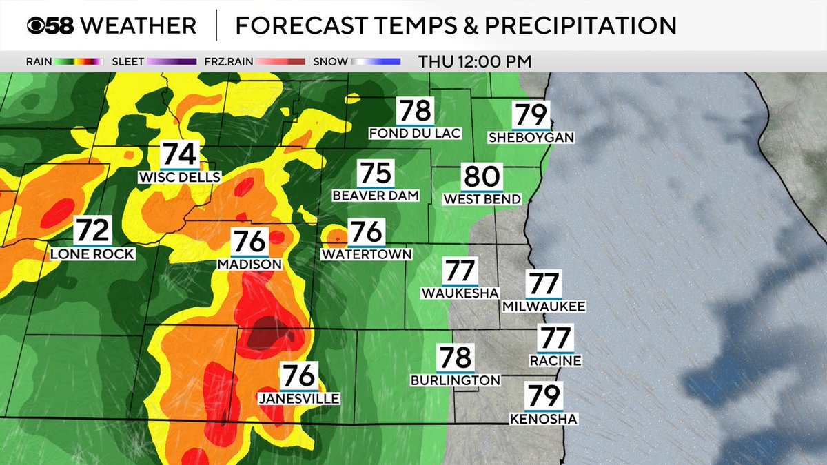
Tomorrow is a very complicated forecast. There could be two rounds of storms. The first would be during the late morning and early afternoon. If this lingers this would limit some of the instability for the second round by the evening.
1
8
999
Jun 10
The back edge is moving through, thankfully, the severe threat is over now.
1
298
Jun 10
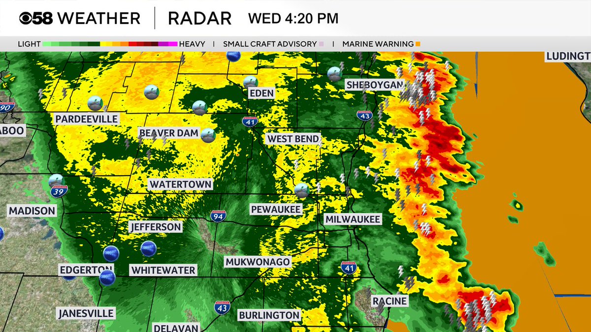
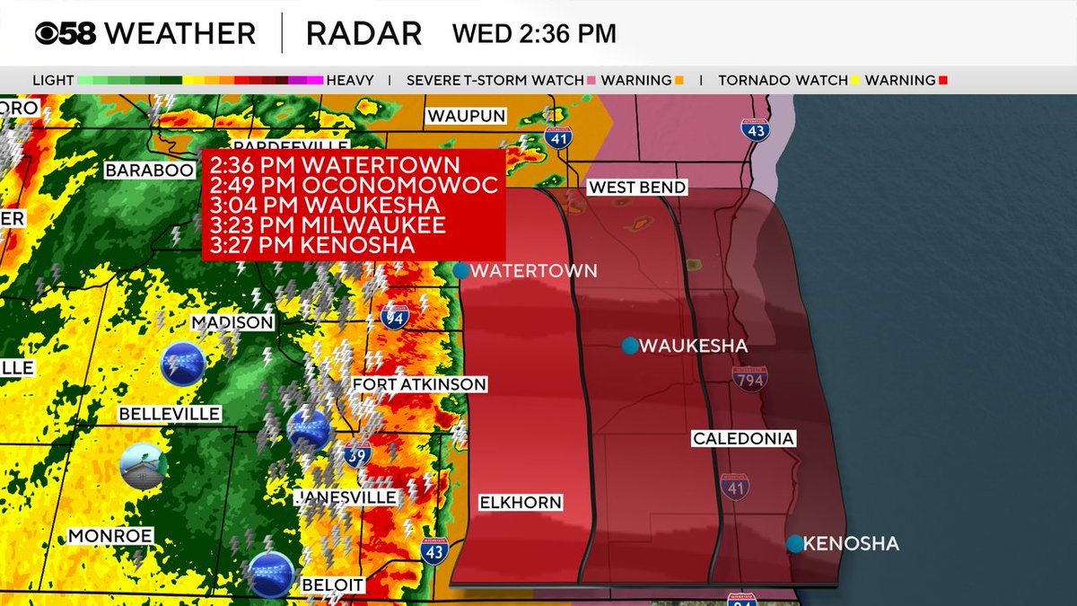
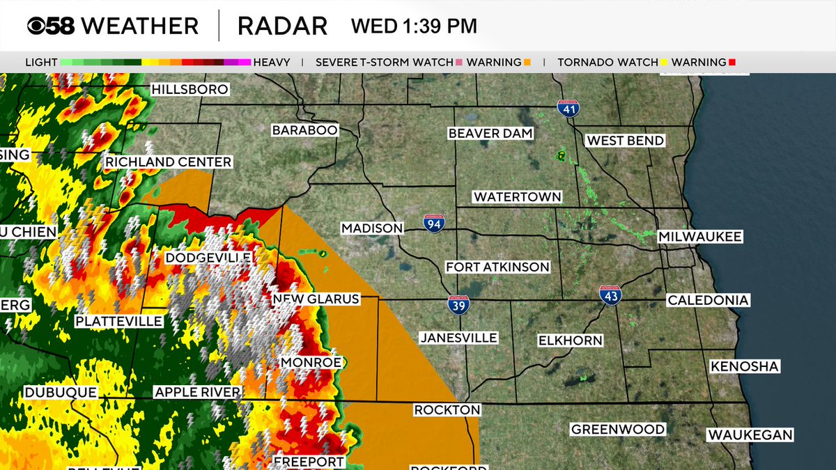
Here's the latest storm track as the storms move east! Pockets of 60 to 70 mph wind gusts are possible.
2
5
1,272
Jun 10
Winds to 70 mph possible in western Jefferson county! Stay away from windows.
2
419
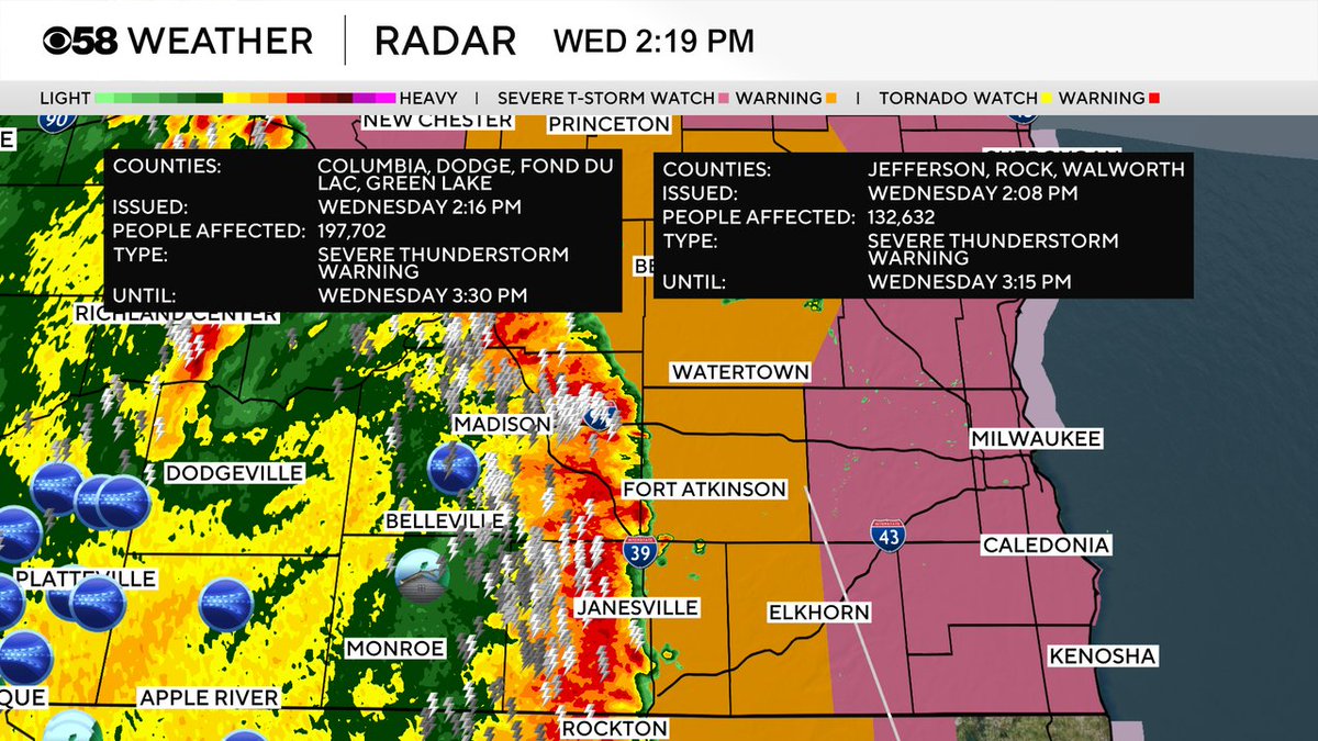
Jun 10
The warning has been expanded north to include Dodge and Fond du Lac counties until 3:30 pm.
1
1
289
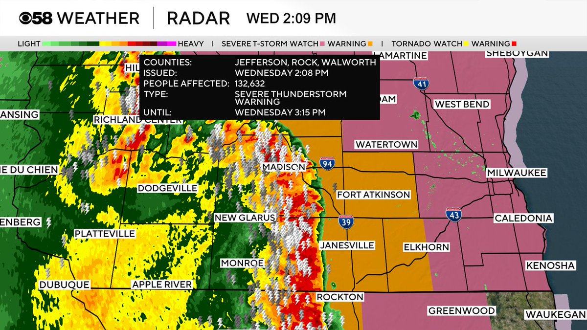
Jun 10
New severe thunderstorm warning for Walworth and Jefferson counties. Damaging winds to 60 mph are possible. Stay away from windows.
4
818
Jun 10
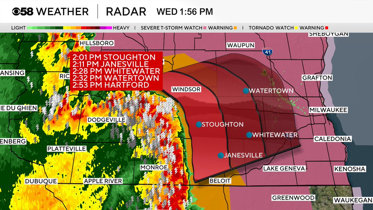
This line is moving very fast over 50 mph. Here is a current storm track.
1
2
12
3,534
Jun 10
Just a heads up, these warnings for damaging winds from the NWS are including the chance for 80 mph gusts.
1
1
5
872
Jun 10
The heart of the storms this afternoon will move through between 2 pm and 6 pm. Main threat will be damaging winds; however, rotation on the eastern side of the line could produce a brief spin up type of tornado.
246
Jun 10
Severe thunderstorm watch for the entire area until 7 pm. This intense line of storms could have pockets of 60 mph wind gusts. More warnings are expected in our area within the next hour.
2
5
894
Jun 10
There is a good chance for strong to severe storms during the heart of the afternoon. All modes will be possible. If those stoms steal the juice from the atmosphere, any late evening storms could be weaker. It all depends on the timing. Bottom line, be ready for warnings!
1
18
1,492
Jun 9
Severe weather is also possible on Thursday, but there remains uncertainty on the timing and placement of the storms.
8
648
Jun 9
All modes of severe weather are possible on Wednesday. Ingredients will be there for strong to severe storms to produce damaging winds, hail, and isolated tornadoes by the late afternoon and through the evening.
2
258
Jun 9
The final Tornado Ready school visit of the year at Ronald Reagan Elementary in New Berlin! That puts us over 6,000 kids for the year.
2
9
693
Jun 9
Wonderful Tornado Ready visit to St. Adalbert’s in Milwaukee today. Love that energy.
176