
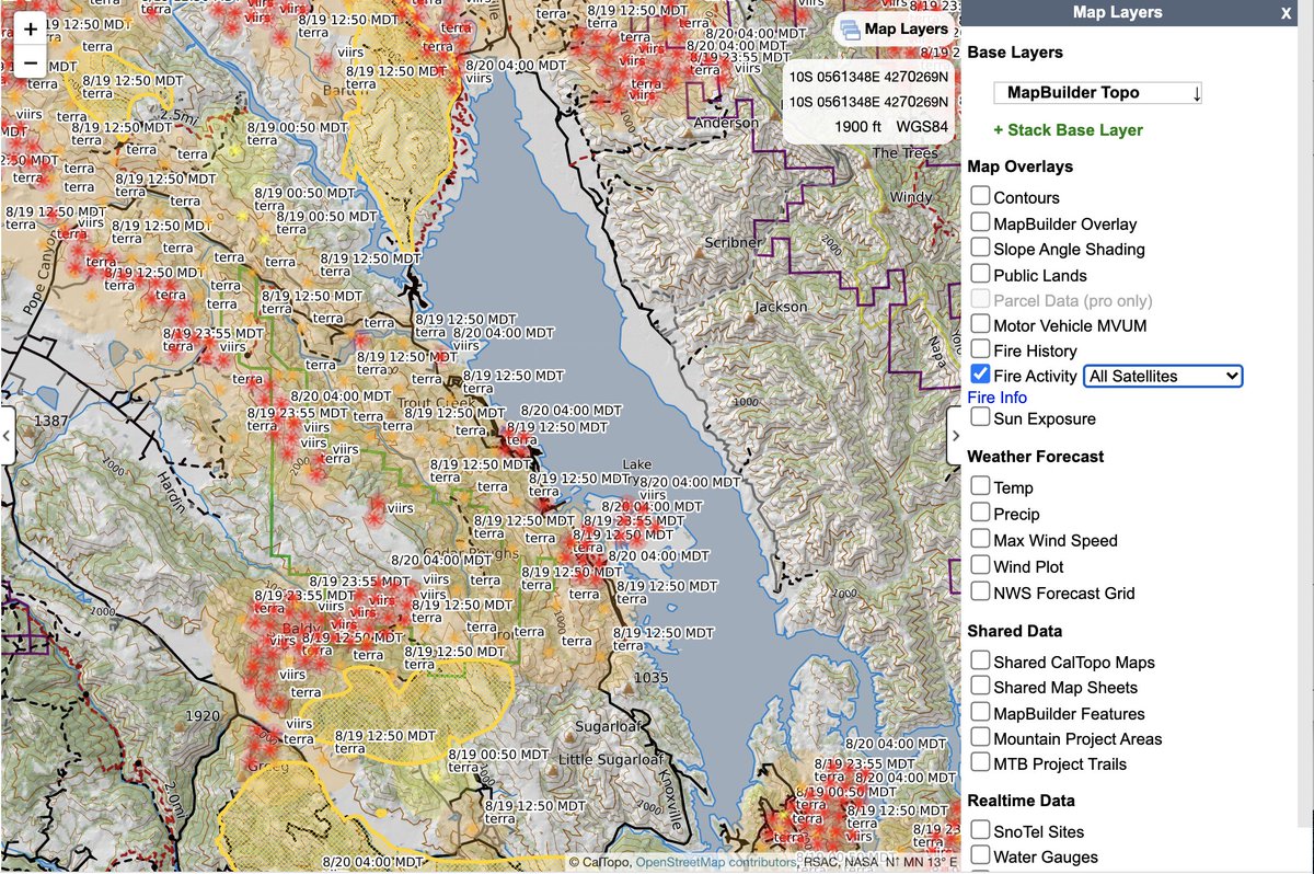
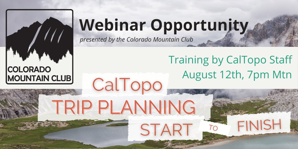
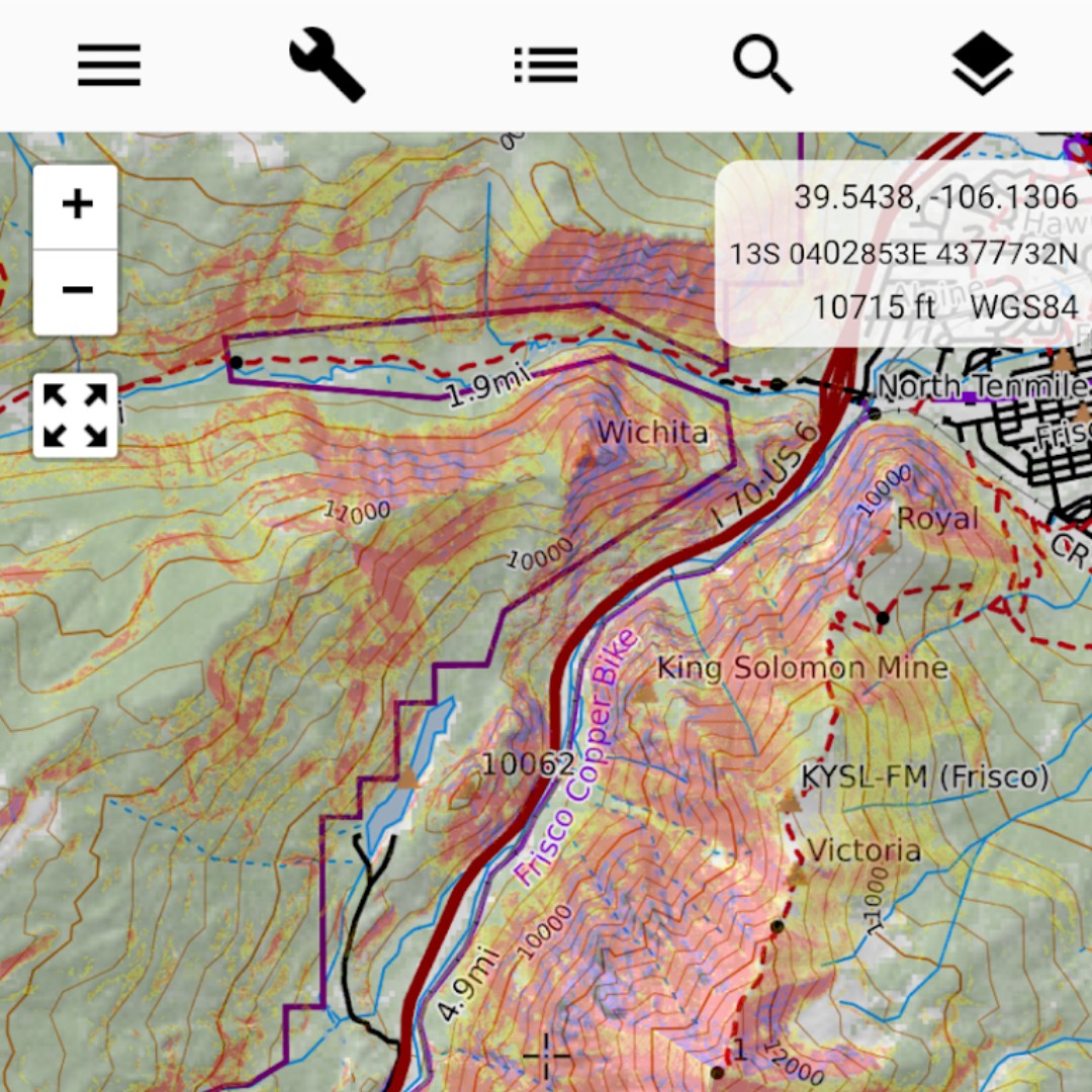
CalTopo provides next generation topographic maps with a number of helpful and unique layers. Used by search and rescue and emergency management orgs.
Joined July 2019
- Tweets 156
- Following 33
- Followers 984
- Likes 64
24 Photos and videos

Pinned Tweet

13 Jul 2021
With so many people accessing fire layers and because we are starting to see CalTopo maps in lots of fire briefings and news, we wrote a new training page explaining how all these layers work and what you can, and can't, learn from them.
Check it out at: training.caltopo.com/all_use…
3
6
40
CalTopo retweeted

3 Aug 2022
Today's 8/3/22 Morning #McKinneyFire and #YetiComplex virtual tour situation and analysis includes:
How to read a wildfire operations map.
Firing tactics.
Incident Command concepts.
Web resources for wildfire intelligence.
youtu.be/J-Ve8JOz9zU
5
37
4 Sep 2021
Here's a brief overview of some fire features available in CalTopo. vimeo.com/597874743 #CaldorFire
1
6
13
3 Sep 2021
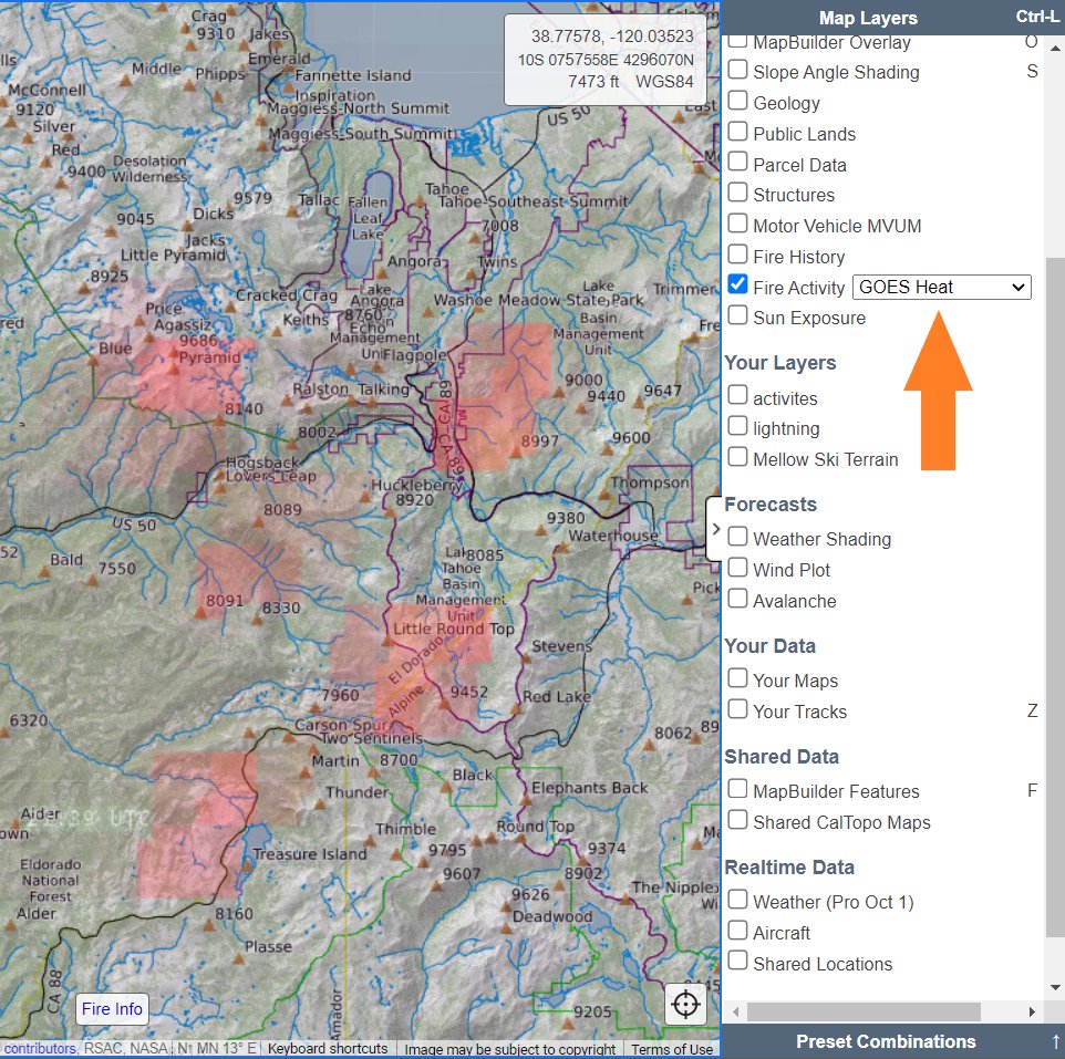
We added a new fire activity overlay option, GOES Heat. This is a different way to visualize where the fire is most active. See training.caltopo.com/all_use… for more about using our fire layers. #CaldorFire #DixieFire
1
5
29
1 Aug 2021
All CalTopo and SARTopo servers are back up and fully operational at this point in time. Services were restored around 4:45 Pacific time. We apologize for those impacted by the downtime.
7
31 Jul 2021
CalTopo and SARTopo have been experiencing an outage since about 11:00 Pacific on Saturday, July 31. Our team is working to resolve the issue and bring the site back to full functionality. At this time we do not have an ETA for restoration of all functions.
3
26 Jul 2021
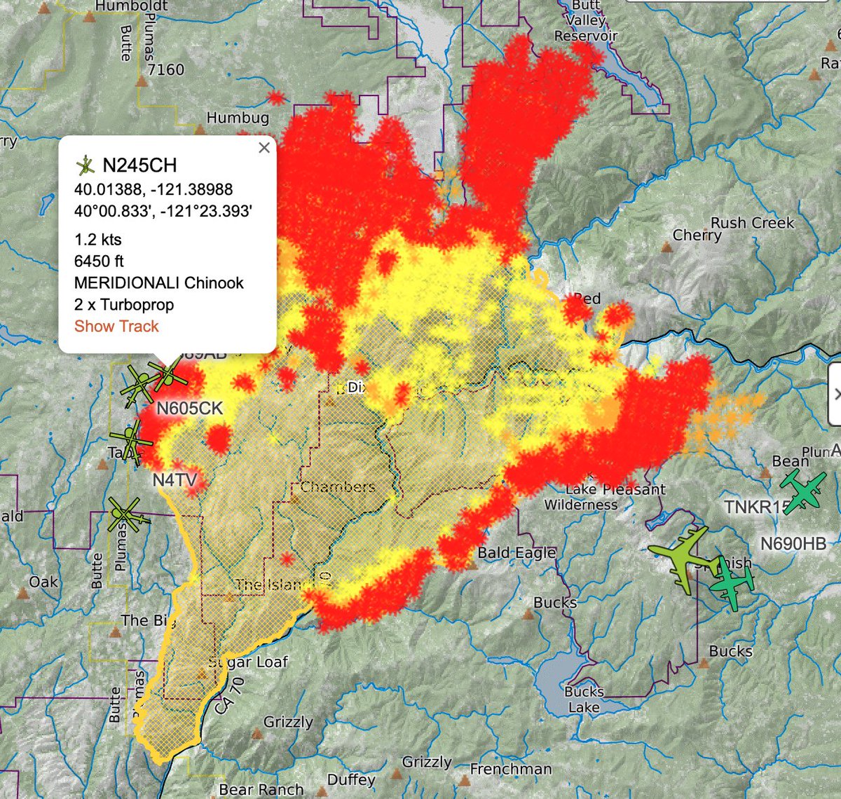
New ADS-B based live aircraft location overlay and improved realtime weather overlay are both now live on CalTopo. Additional improvements to shared data layers. All the details can be found in the blog post: blog.caltopo.com/2021/07/26/…
1
12
13 Jul 2021
With so many people accessing fire layers and because we are starting to see CalTopo maps in lots of fire briefings and news, we wrote a new training page explaining how all these layers work and what you can, and can't, learn from them.
Check it out at: training.caltopo.com/all_use…
3
6
40
5 May 2021
We pushed a big update to subscription management. You can do that via caltopo.com/subscription
8 Feb 2021
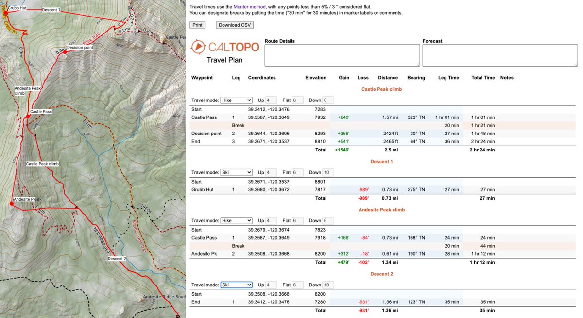
We've rolled out a new travel planning tool based on the Munter method. Take a look: training.caltopo.com/all_use…
4
16
CalTopo retweeted
20 Jan 2021
This week is 3rd Thursday: "Best Practices for Data Management & Search Mapping in SAR Topo"
Download the @CalTopoMaps app in advance!
1/21/2021, 6:00 pm PST
us02web.zoom.us/j/8315211203…
Meeting ID: 831 5211 2031
@Garmin

1
2
28 Dec 2020
CalTopo includes many different tools. Incorporating complex tools and an easy to use interface is very challenging. To help users both new and old orient and learn CalTopo we've launched a new training platform found at training.caltopo.com. Take a look!
2
7
13 Nov 2020
Thanks to @A3Avy and @avalancheca we have added US and Canada Avalanche forecasts to CalTopo web and mobile apps. Make sure to get the forecast and education before heading out to the backcountry!
1
6
2 Nov 2020
CalTopo is hiring! We're looking for a UI/UX Developer and a full stack developer. All the details are found here: caltopo.com/about/2020/11/02…
3
3
28 Oct 2020
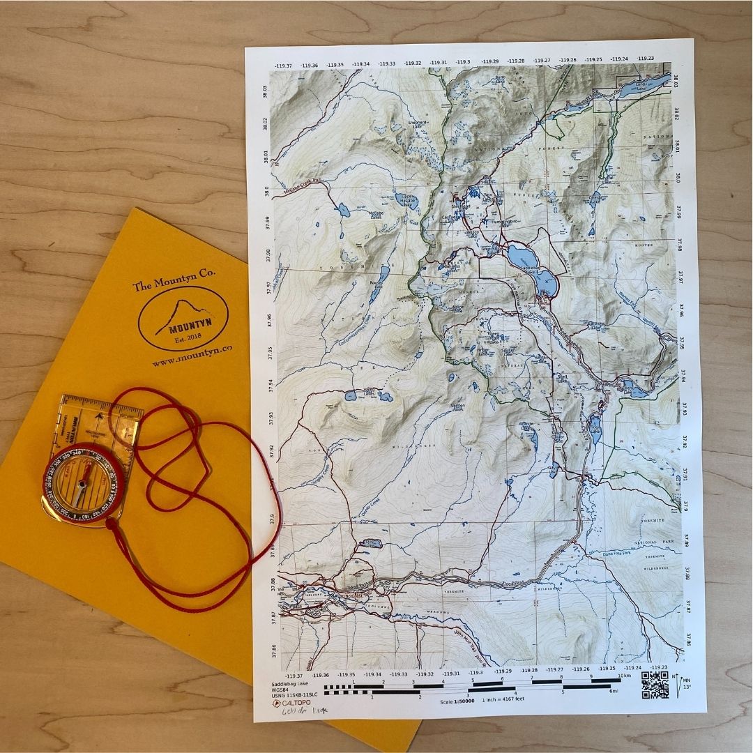
We're excited to announce a partnership with @MountynCo to offer high quality, waterproof, printed maps! A perfect field companion to our mobile app! Available now on our site. More info at: help.caltopo.com/kb/printing…
13
9 Oct 2020
We're frequently asked about the accuracy of maps, tracks, distances, etc. The idea of distance and accuracy is all relative and can be really tricky. Part 1 of a 2 part blog series about these topics can be found here:
caltopo.com/about/2020/10/08…
2
30 Sep 2020
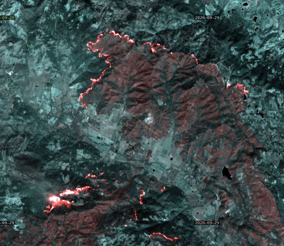
Sobering images from the most recent sentinel-2 satellite pass over the #glassfire #california #wildfire Image on left: false color burn, right false color green. More details on source and images found on our facebook: facebook.com/CalTopo/posts/2…
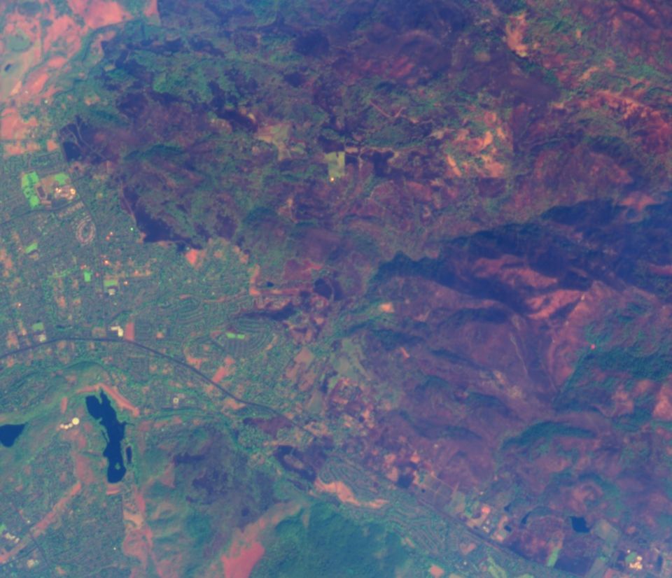
1
3
23 Sep 2020
On Monday we rolled out two new features.
1. High resolution PDF files (up to 400dpi, our standard is 200dpi). This is available to all Pro and Desktop users (as well as teams)
2. Larger PDF sizes up to 4'x8' (increased from 4'x4'). This is available to Desktop and team accounts
1
1
6
16 Sep 2020
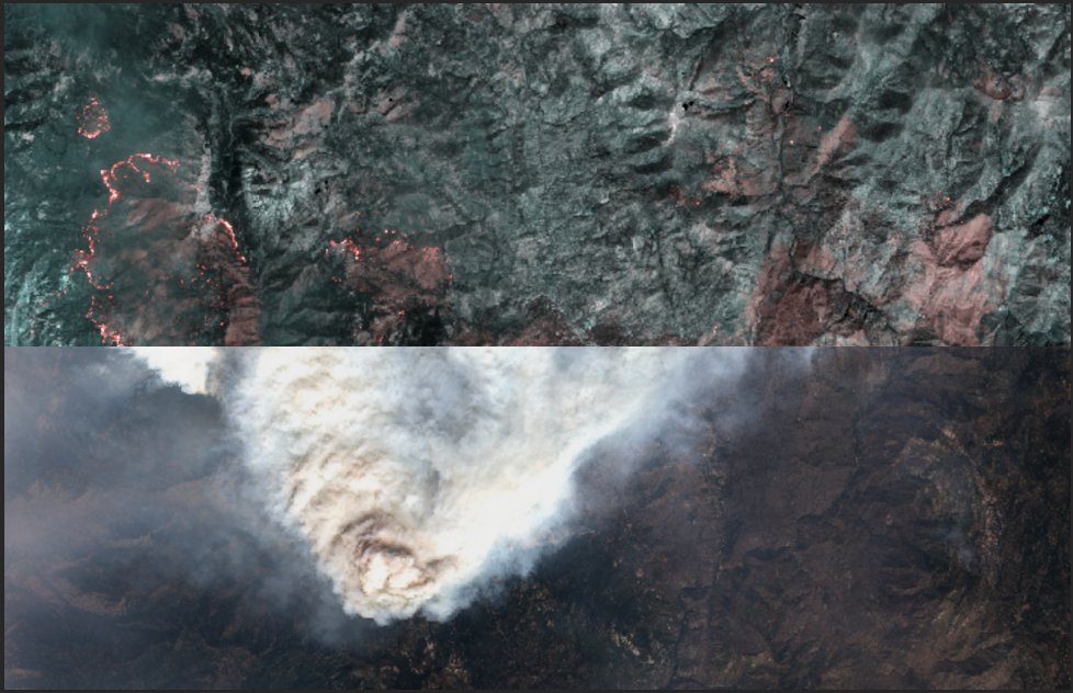
We've launched an additional two fire focused layers. Read all about them here: caltopo.com/about/2020/09/16… (Image: side by side of true color image below false-color burn filter)
2
7
11 Sep 2020
We've updated our Summer Wildfire post from August to include information about GOES Live Fire Detections and GOES Live Satellite Imagery and to try to answer questions that keep coming up. Find it here:
caltopo.com/about/2020/08/20…
Stay safe.
2
3