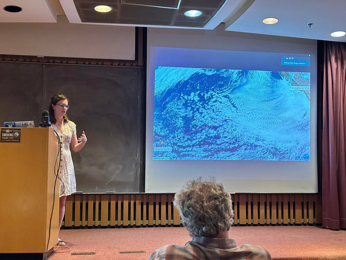
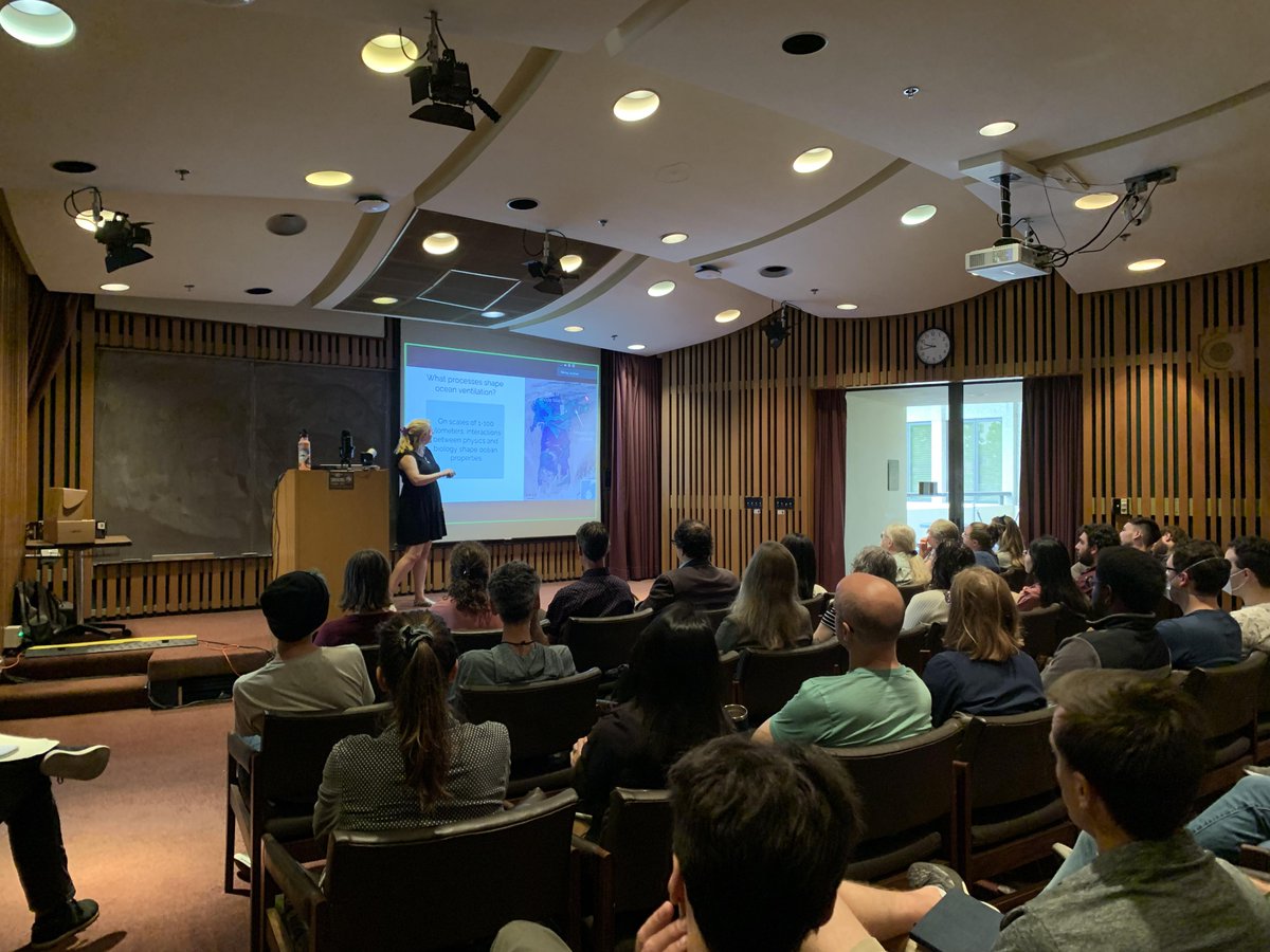
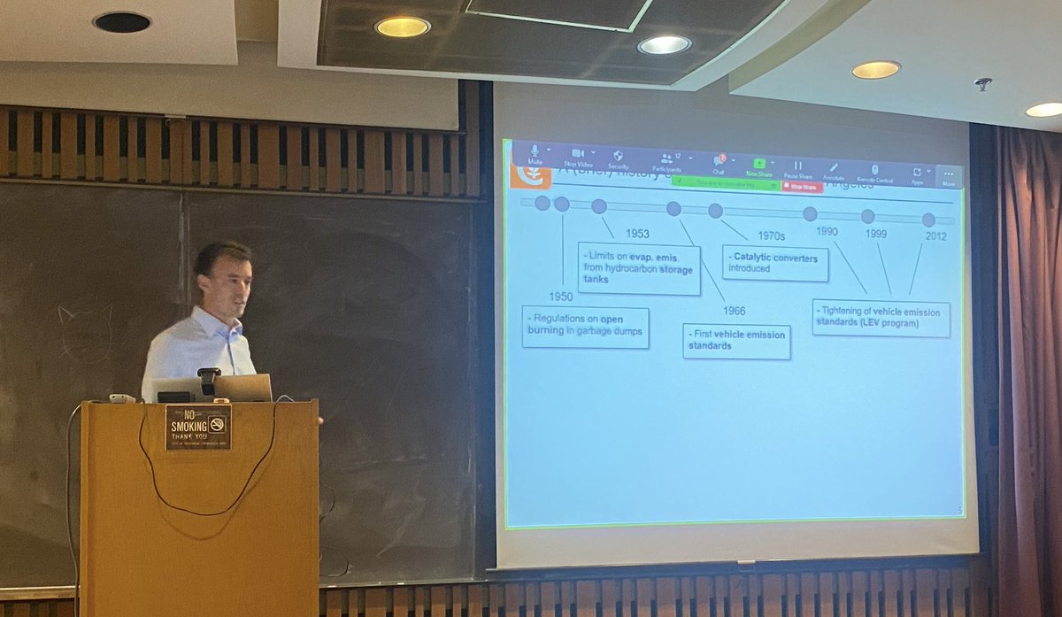
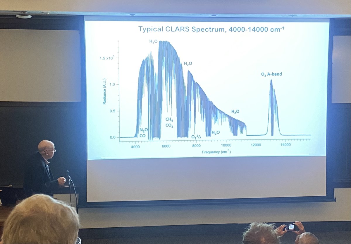
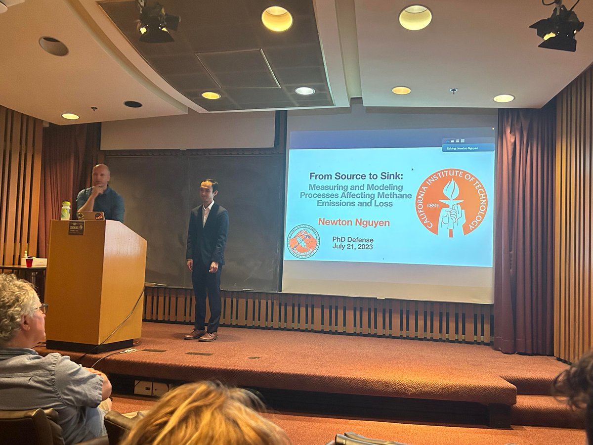
The Environmental Science and Engineering (ESE) program at the California Institute of Technology (@Caltech). Follow us for updates on the latest research!
🥳What a fantastic few months for @CaltechESE filled with lots of celebrations! Today we are celebrating @notThatNewton! Congratulations Dr. Newton Nguyen on successfully defending today!
My final hurrah at @Caltech is my Science Journey presentation, in which I describe how and why scientists explore our blue planet. Combining my loves of outreach and oceanography never gets old and now it's on YouTube for the rest of time!
youtube.com/watch?v=C3Xp25-u…
officially a #PhD! Proudly announce 📢 I will be an Assistant Professor @UMNBBE starting this Fall. I appreciate all my mentors&peers @LehighU@Caltech@MIT family&friends for helping me achieve this milestone. Looking forward to continuing exciting research in the new chapter🥳
🥳🌊 Congratulations on successfully defending today Dr. Lily Dove (@SoLilyquizing)!! What a great talk and what a turnout! @CaltechESE thanks you for everything you have done for the department!
Two ESE PhD student have been selected as NOAA Climate & Global Change postdoctoral fellows! Congratulations Lily Dove (@SoLilyquizing) and Clare Singer (@ClareESinger).
Hey everyone, I’m really happy to say that I've been awarded the Stanford Science Fellowship. I'm excited to learn about methane and CO2 emissions from ecosystems and agriculture and do field-work in cool places. Don’t worry, I’ll always be a Cal Bear! humsci.stanford.edu/feature/…
Are you an early career womxn in civil and environmental engineering research domains? We invite you to apply to the CEE Rising Stars Workshop. CEE research is tackling the worlds grand challenges for a more sustainable future. Apply by June 5.
cee.mit.edu/rising-stars-wor…
A whole new view 🤩 🌊
First taste from the SWOT mission shows Earth’s water in higher definition than ever before. The spatial resolution of SWOT ocean measurements is 10 times greater than sea surface height data gathered over the same area by seven other satellites combined.
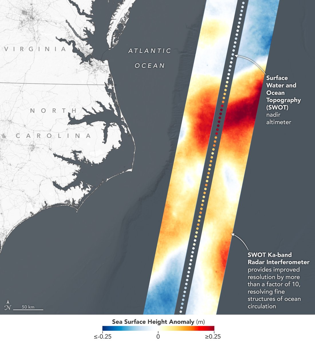
ALT Sea level data gathered Jan. 21 in the Gulf Stream by SWOT’s KaRIn instrument. The ocean is grey and the land is white. A data overlay, generated from SWOT’s measurements, shows up as a colorful stripe on the right side of the image. A color code at the bottom of the image shows that color in the data stripe corresponds to sea surface height anomaly in meters, where dark blue is less than or equal to 0.25, white is 0, and dark red is greater than or equal to 0.25.
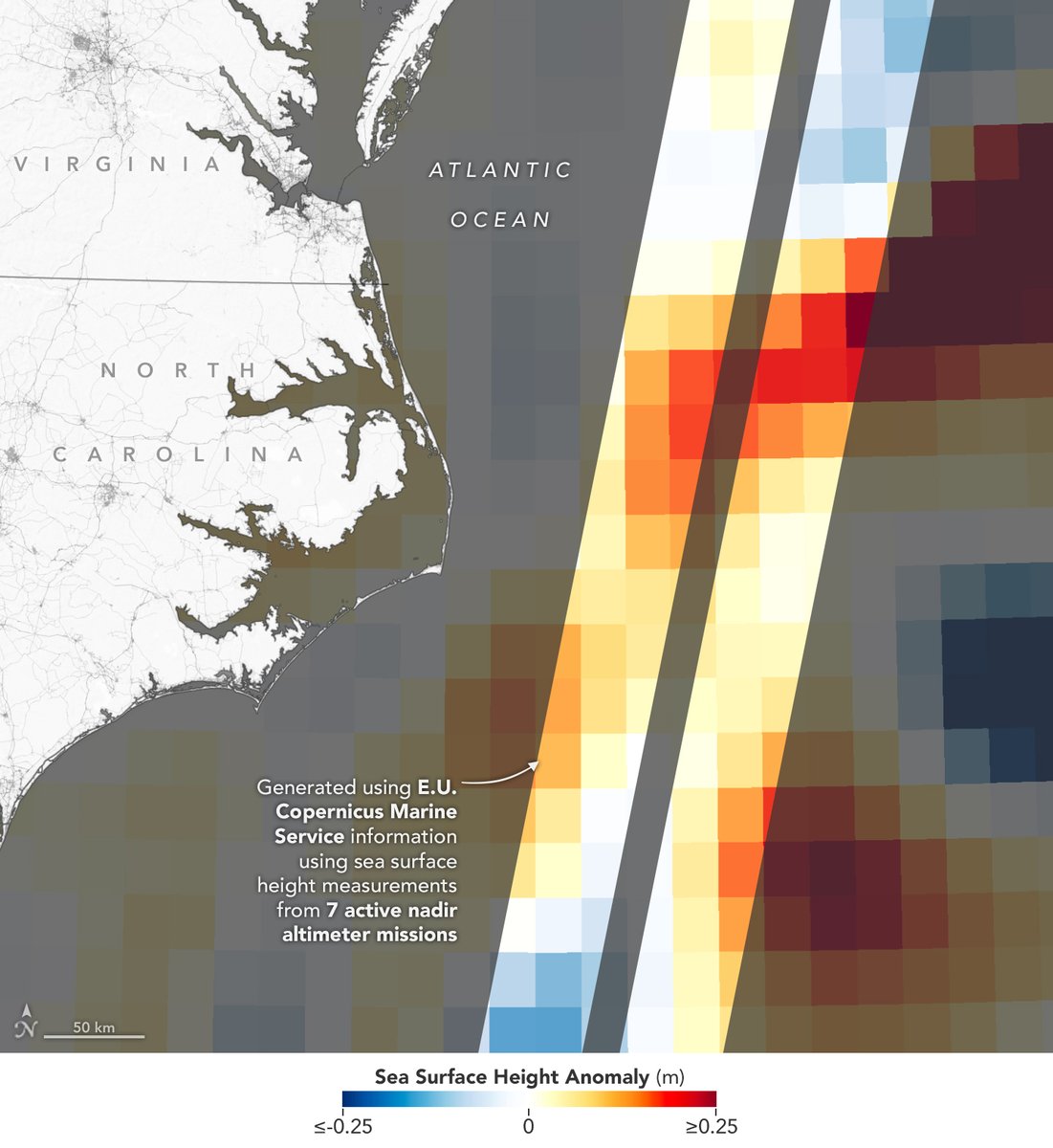
ALT Sea level data generated from 7 active nadir altimeter missions shows up as a colorful stripe that is fuzzier than the first image. A color code at the bottom of the image shows that color in the data stripe corresponds to sea surface height anomaly in meters, where dark blue is less than or equal to 0.25, white is 0, and dark red is greater than or equal to 0.25.
📣 New paper alert by graduate student @saramurphy267 in collaboration with @PaulOWennberg, @brianstoltz70's lab and Henrik Kjaergaard's lab in Copenhagen. Check it out ⬇️
Our paper on ROOR formation in the self-reaction of ethene-derived peroxy radicals was published in RSC Environmental Sciences - Atmospheres. Read on for a summary of the main results. TLDR: There’s a lot of ROOR , and it’s likely a C4 peroxide!