
Jasper, TN native. MCHS 2020. Vol State 2025. Soon-to-be Mississippi State meteorology student. Forecaster for the Tri-State Area Weather (TN/AL/GA) group.
Joined February 2019
- Tweets 4,534
- Following 1,675
- Followers 462
- Likes 17,184
251 Photos and videos


Chase Bryant retweeted
25
59
13,005
Chase Bryant retweeted
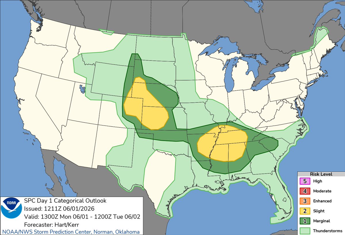
7:13am CDT #SPC Day1 Outlook Slight Risk: over parts of the central High Plains, and parts of the lower MS and TN Valleys spc.noaa.gov/products/outloo…
6
38
146
14,756
Chase Bryant retweeted
7:50am CDT #SPC Day1 Outlook Slight Risk: for the Texas Panhandle and northwest Texas into southwest Oklahoma spc.noaa.gov/products/outloo…

2
36
85
9,719
Chase Bryant retweeted
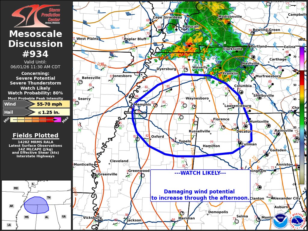
12:46pm CDT #SPC Day2 Outlook Enhanced Risk: from northern Louisiana arcross parts of Mississippi and Alabama spc.noaa.gov/products/outloo…

13
91
367
29,274
Chase Bryant retweeted

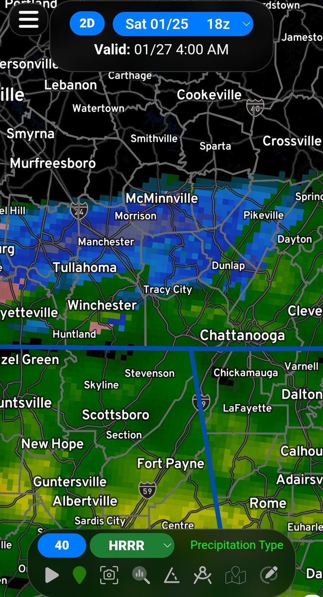
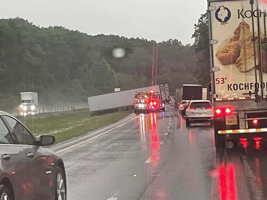
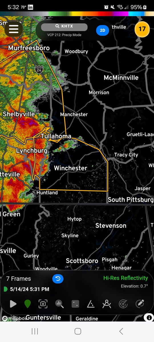
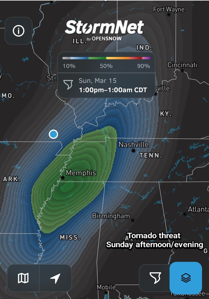
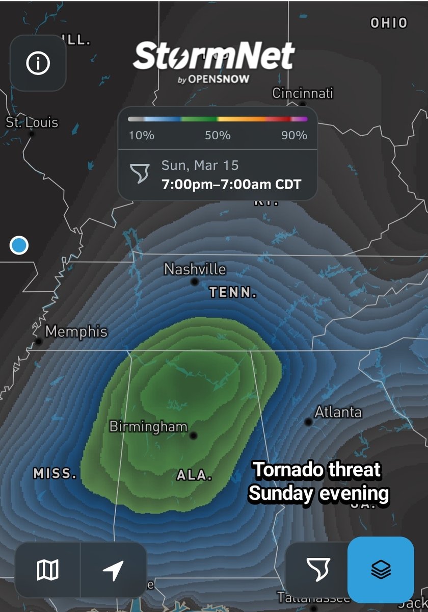
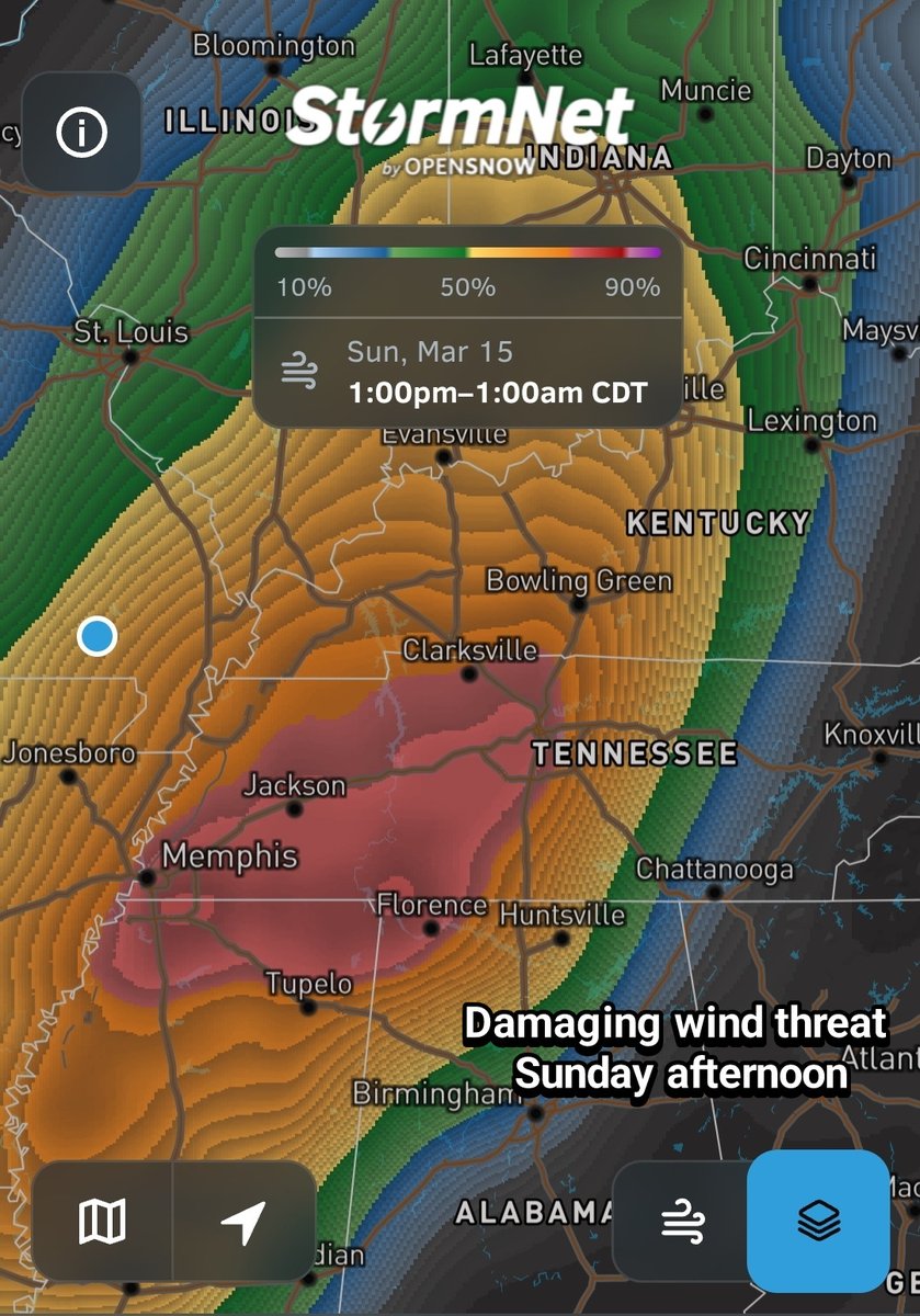
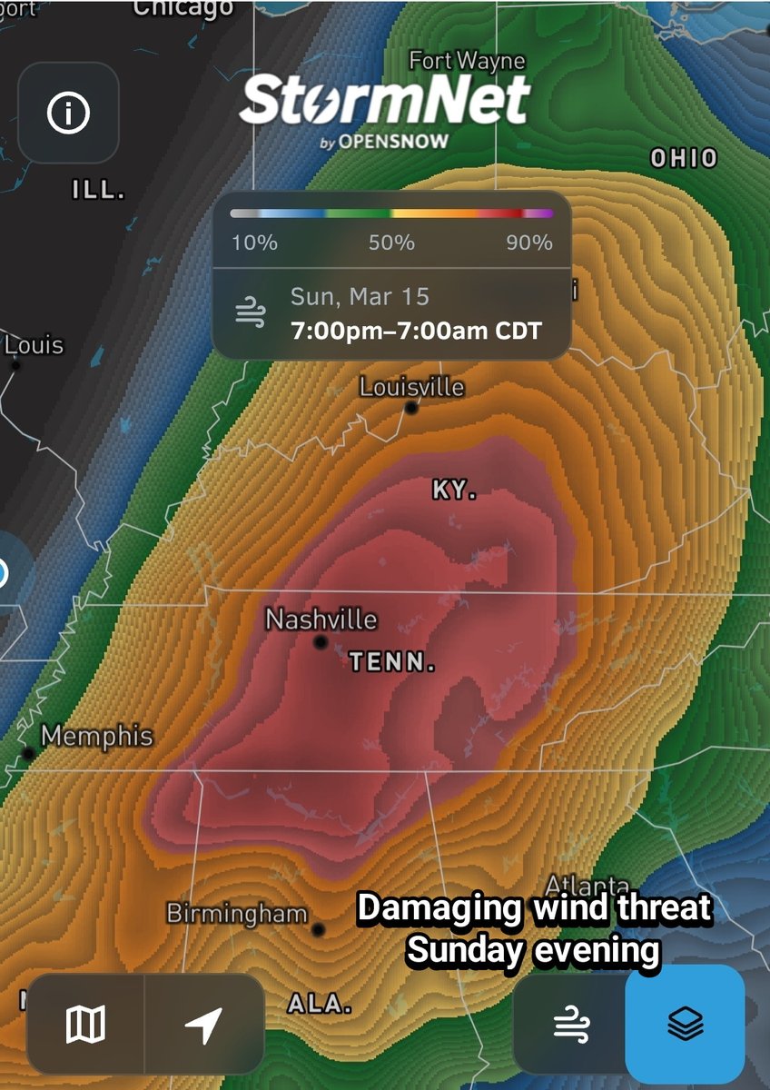
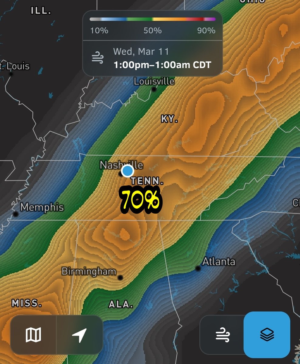
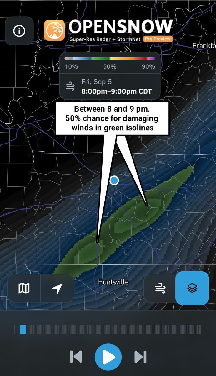
Latest Stormnet-AI continues the trend of wide swath of damaging winds with embedded spin ups. This looks to be more of a QLCS type event for Middle Tennessee and southern Kentucky. Wind damage could be widespread. My Tempest has start time for the stronger storms in Nashville around 9 pm with storms overnight by 1 or 2 am followed shortly by FROPA.
5
45
4,175

Chase Bryant retweeted

11 Nov 2025
#MRX issues Record Event Report (RER) at Nov 11, 3:44 AM EST ...RECORD DAILY LOW MAXIMUM TEMPERATURE TIED AT LOVELL FIELD AIRPORT... mesonet.agron.iastate.edu/p.…
1
1
68
Chase Bryant retweeted

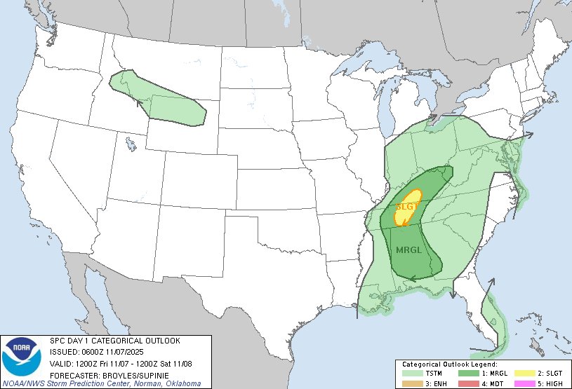
7 Nov 2025
12:02am CST #SPC Day1 Outlook Slight Risk: across parts of the Ohio and Tennessee Valleys spc.noaa.gov/products/outloo…
2
22
100
15,170
Chase Bryant retweeted
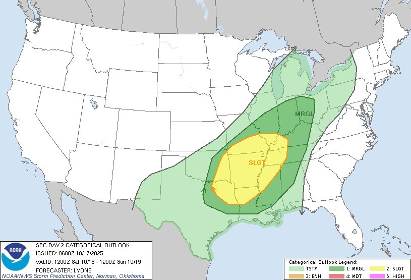
17 Oct 2025
1:01am CDT #SPC Day2 Outlook Slight Risk: from the ArkLaTex to the central Mississippi and Lower Ohio Valleys spc.noaa.gov/products/outloo…
3
78
328
24,260

Chase Bryant retweeted

21 Jun 2025
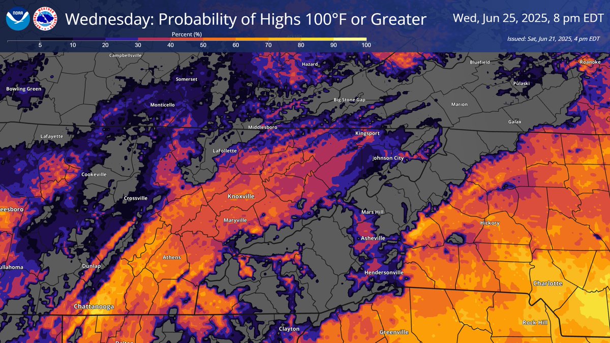
Temperatures will continue to increase into early next week with Wednesday possibly being the hottest day of this heat wave. For much of the Valley, there is generally a 40% to 70% chance of actual temperatures reaching 100°F with heat index values approaching 105°F for some.
1
8
35
2,333
Chase Bryant retweeted
7 Jun 2025
1
26
42
17,669
Chase Bryant retweeted
20 May 2025
7:41am CDT #SPC Day1 Outlook Enhanced Risk: MID/DEEP SOUTH TO TN VALLEY AND CUMBERLAND PLATEAU spc.noaa.gov/products/outloo…
4
130
404
45,517
Chase Bryant retweeted
19 May 2025
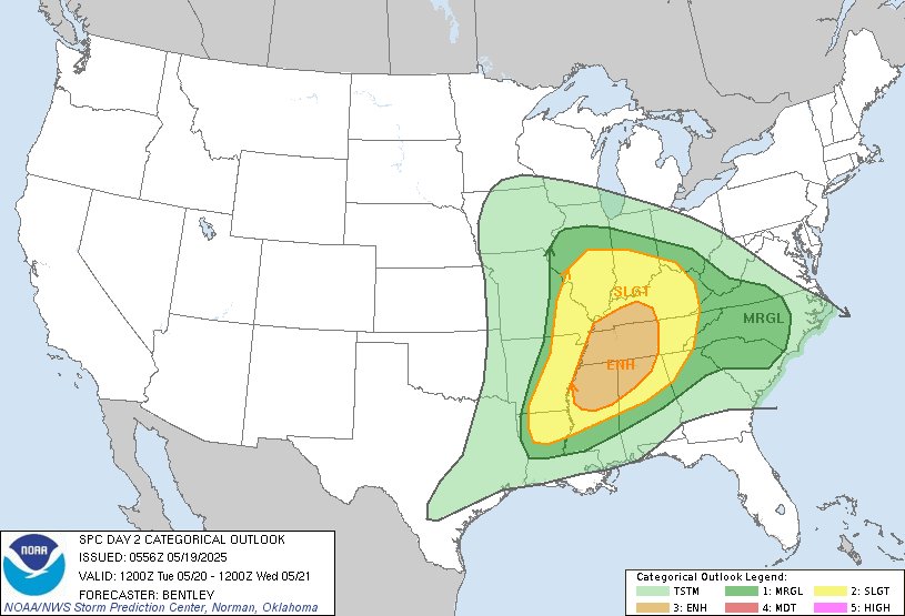
1:01am CDT #SPC Day2 Outlook Enhanced Risk: for portions of the Mid-Mississippi Valley, Ohio Valley, and Tennessee Valley spc.noaa.gov/products/outloo…
4
89
298
30,770
Chase Bryant retweeted
19 May 2025
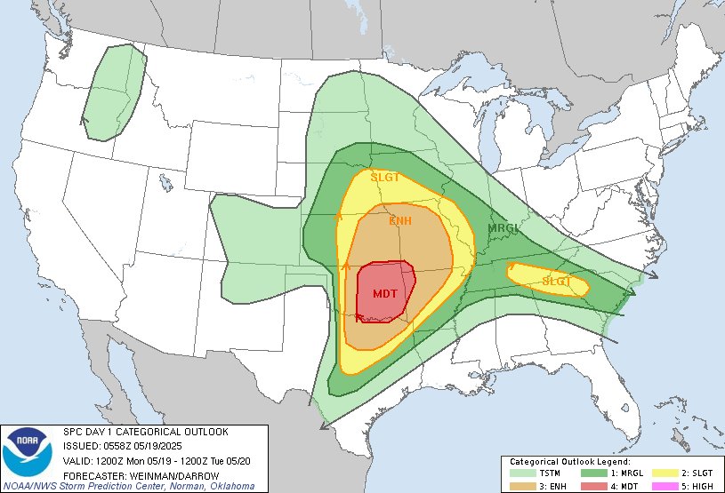
1:01am CDT #SPC Day1 Outlook Moderate Risk: across much of central and eastern Oklahoma into the western Ozarks spc.noaa.gov/products/outloo…
47
345
1,505
138,762
Chase Bryant retweeted

8 May 2025
A severe thunderstorm watch has been issued for parts of Alabama and Tennessee until 10 PM CDT

ALT This graphic displays Severe Thunderstorm watch number 239 plotted on a map. The watch is in effect until 10:00 PM CDT. The watch includes parts of Alabama and Tennessee. The threats associated with this watch are no tornadoes expected, scattered hail up to two inch size likely and scattered gusts up to 70 mph possible. There are 2,314,031 people in the watch along with 758 schools and 55 hospitals.
36
48
3,735
Chase Bryant retweeted
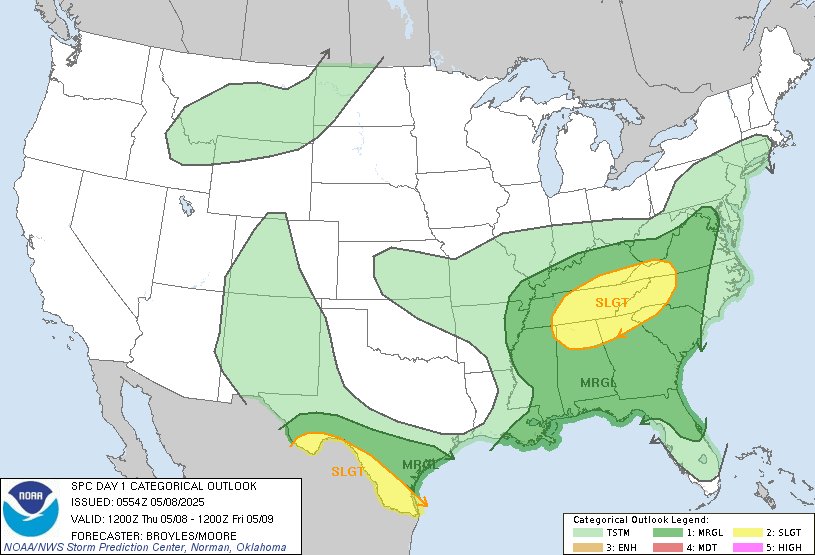
8 May 2025
12:56am CDT #SPC Day1 Outlook Slight Risk: across parts the southern Appalachians, Tennessee Valley, Southeast and Rio Grande Valley spc.noaa.gov/products/outloo…
2
54
168
17,805
Chase Bryant retweeted
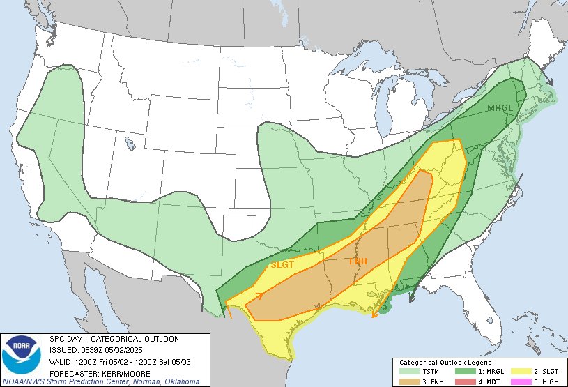
2 May 2025
7:59am CDT #SPC Day1 Outlook Enhanced Risk: from central/east Texas to the Lower Mississippi Valley and Tennessee Valley spc.noaa.gov/products/outloo…
5
95
310
30,605
Chase Bryant retweeted
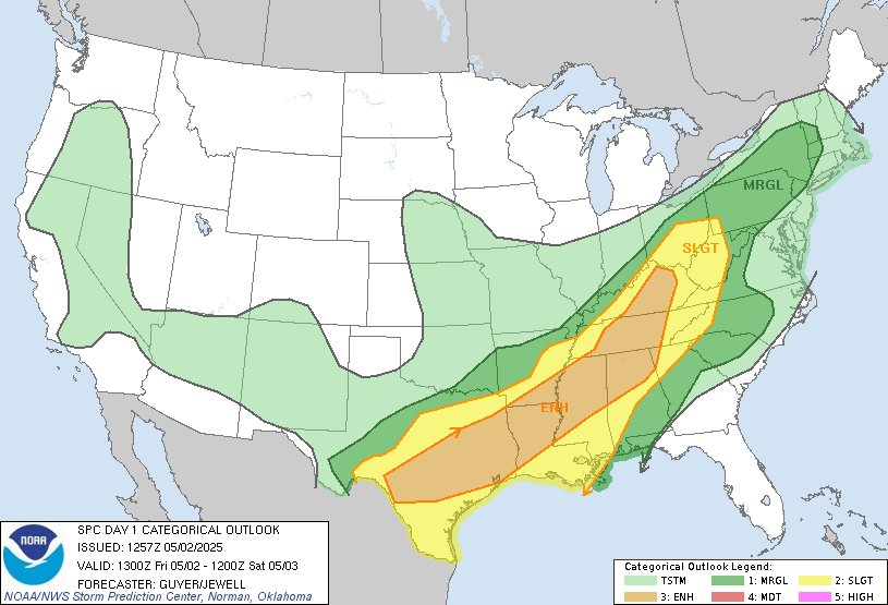
2 May 2025
12:41am CDT #SPC Day1 Outlook Enhanced Risk: today into this evening across parts of cntrl/ern KY middle and ern TN nwrn GA nrn AL nrn and cntrl MS sern AR nrn and cntrl LA cntrl and ern TX spc.noaa.gov/products/outloo…
26
177
775
63,624