
@LiveStormsMedia & @KAKEnews Stringer I Live Stream: @livewxtv I @ksmesonet
Joined April 2014
- Tweets 20,999
- Following 461
- Followers 4,253
- Likes 35,936
6,781 Photos and videos


Pinned Tweet

24 Jun 2023
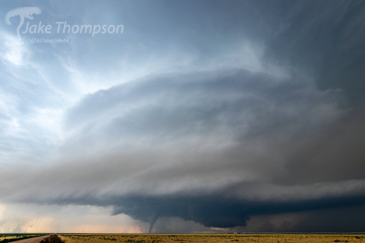
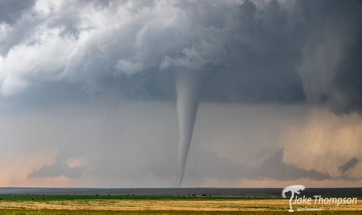
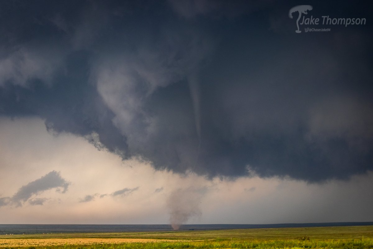
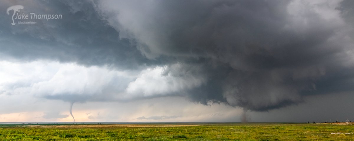
Tornadoes south of Granada/Holly, Colorado yesterday evening, including two that were on the ground at the same time. #cowx
11
48
324
30,892
Jun 16
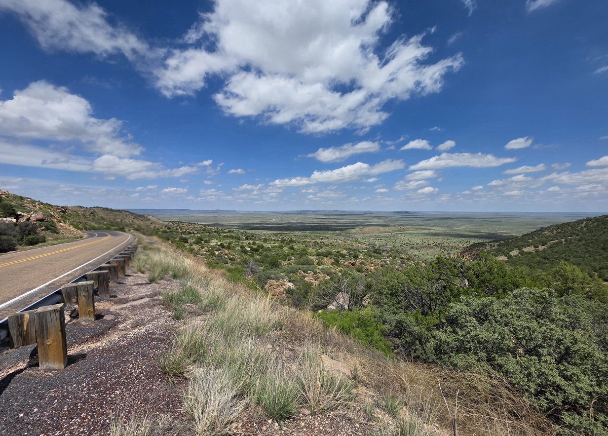
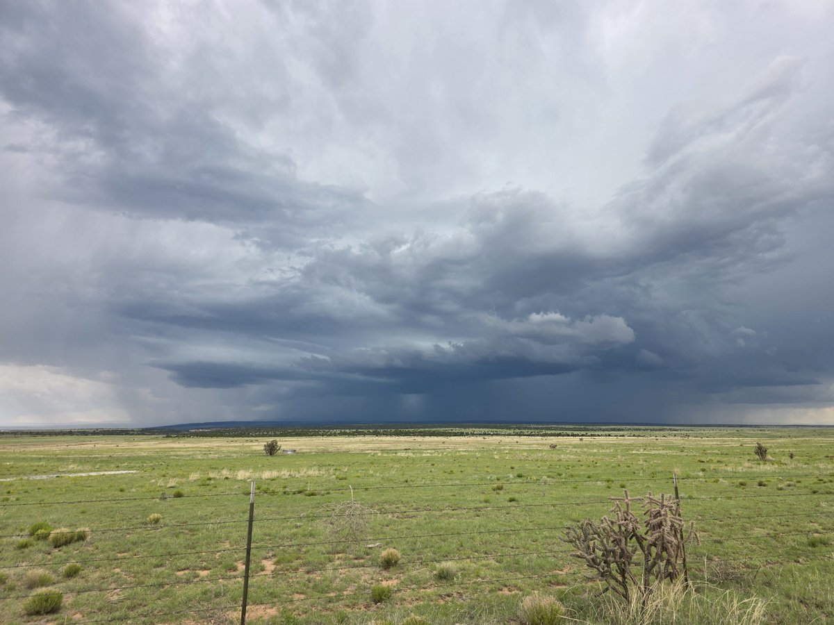
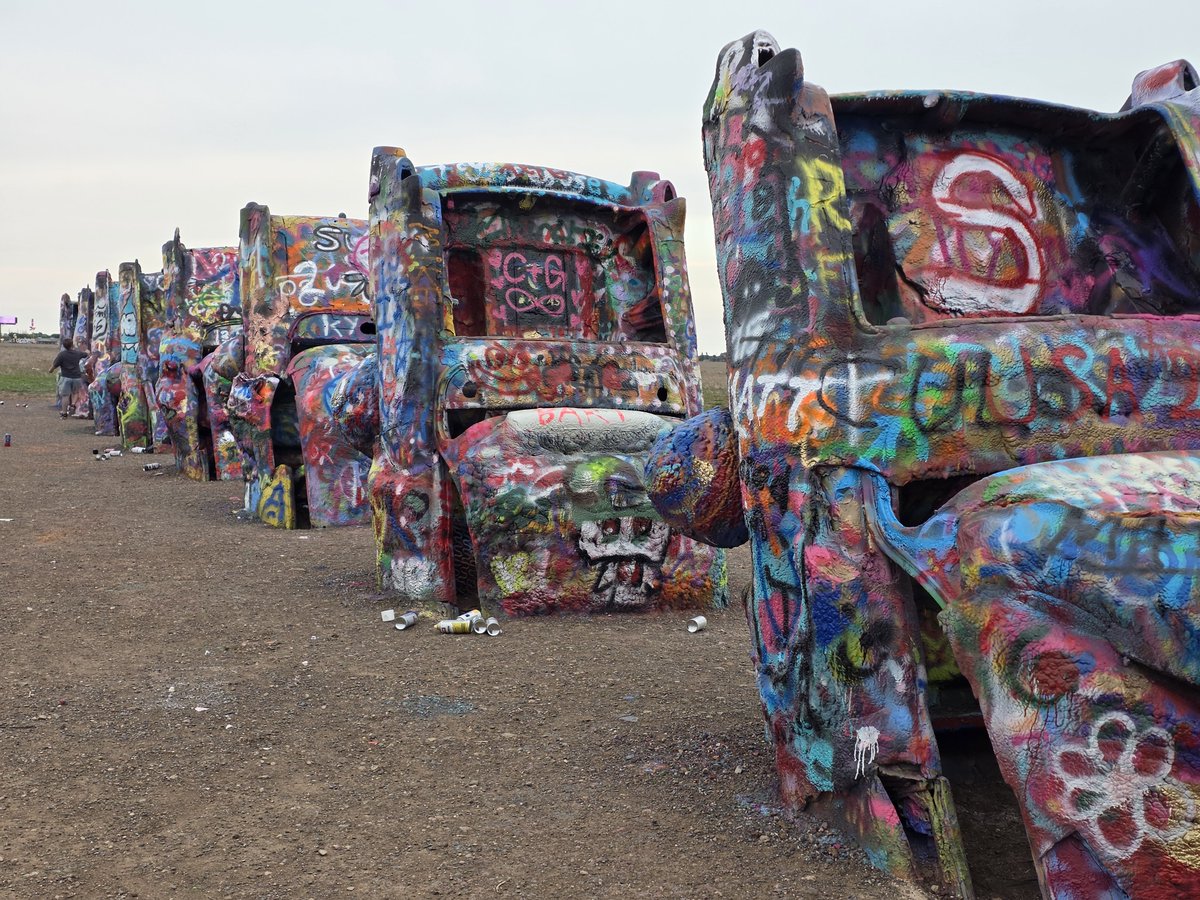
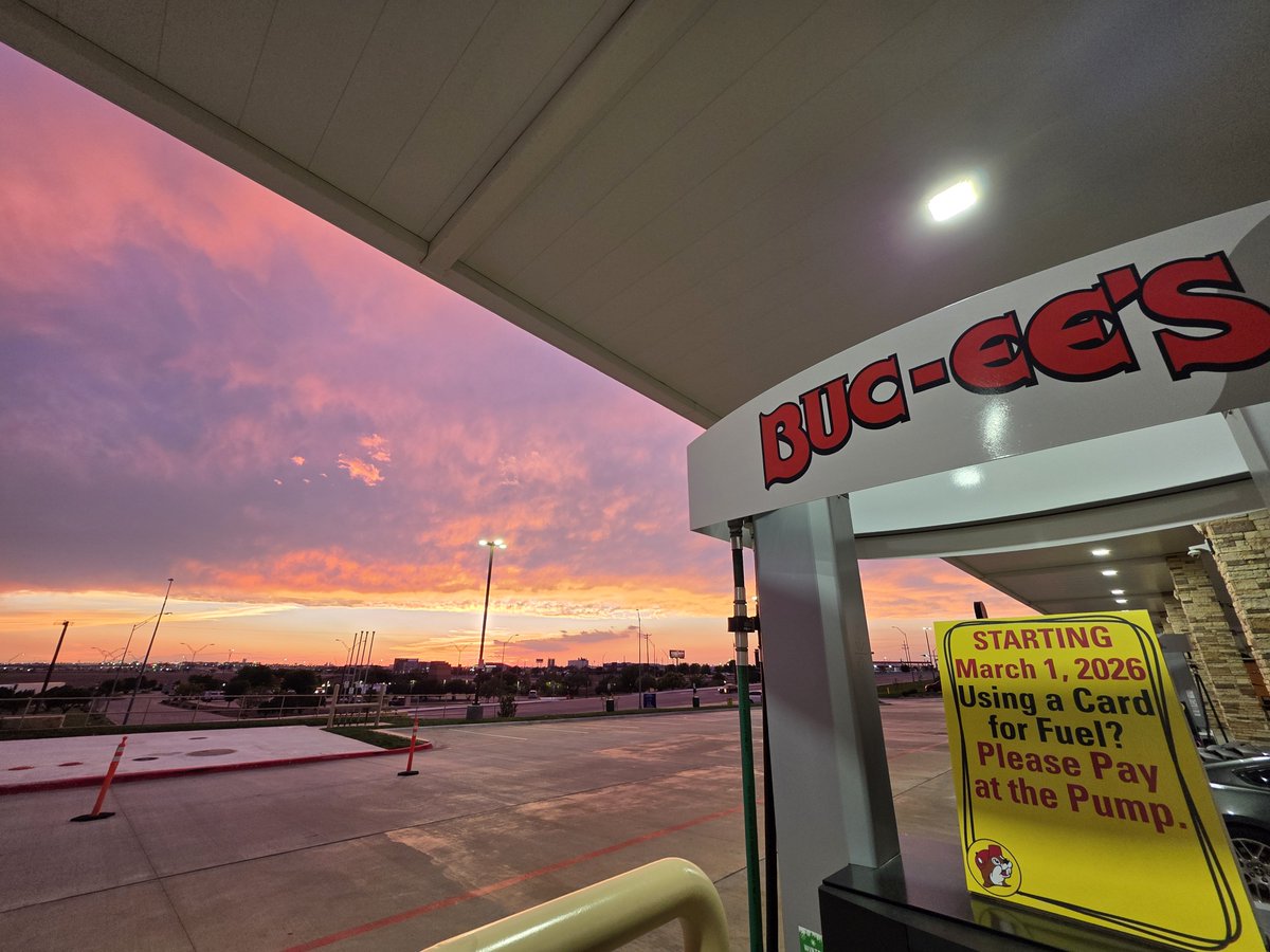
Northeast New Mexico has some incredibly gorgeous views. Chased some storms around the Roy area, then checked out Cadillac Ranch, and of course ending the day at Buc-ee's.
13
367
Jun 15
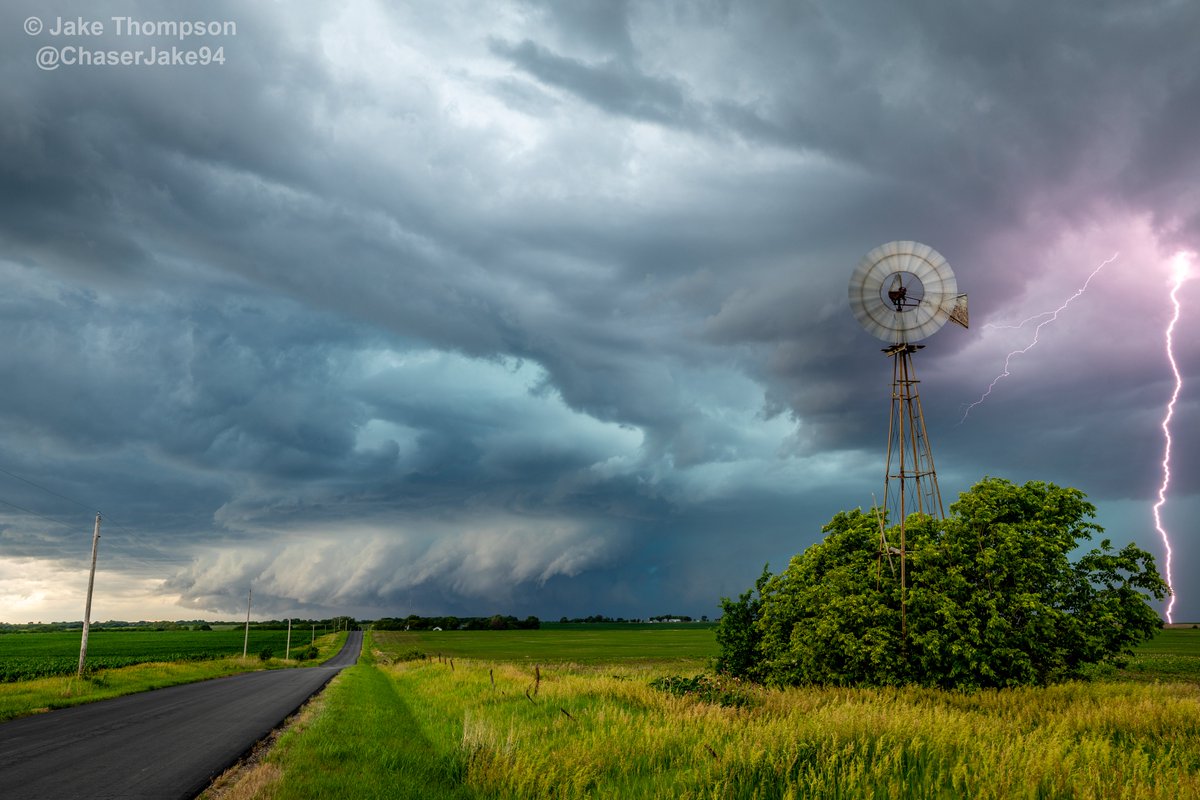
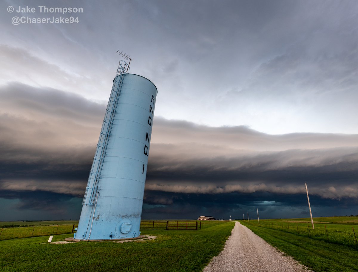
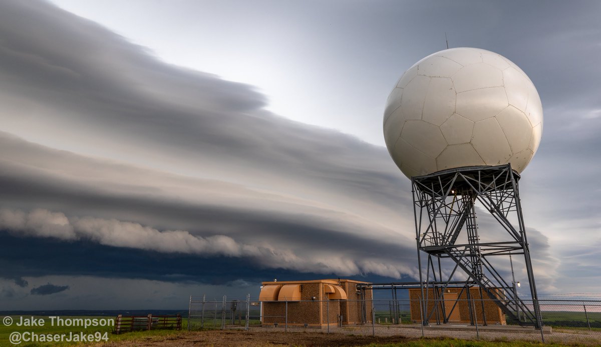
Some photos from the storms in northeast Kansas Saturday evening.
Got onto the supercell that went tornado warned over Marysville, where it had some beautiful blue hue in the clouds from the hail.
As the storms merged into a line later on, there was a nice shelf cloud that approached the Manhattan area and then the Topeka radar near Alma. #kswx

1
2
27
574
Jun 13
Day 1 of the 2026 chasecation with @NStewWX kicks off today, and it's looking and feeling like a tornado day if we can get a storm to take advantage of the outflow boundary.


4
467
Jun 12
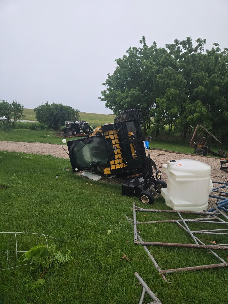
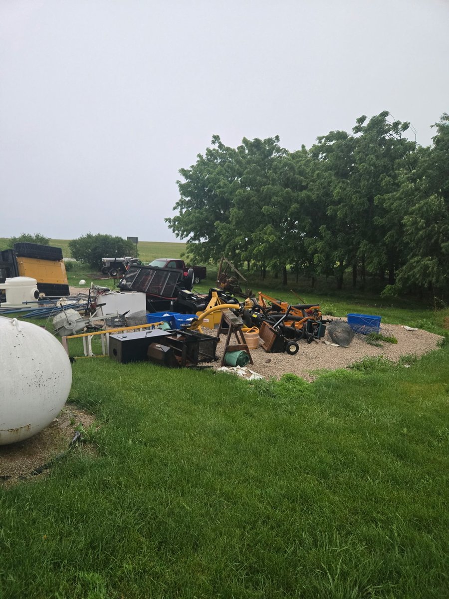
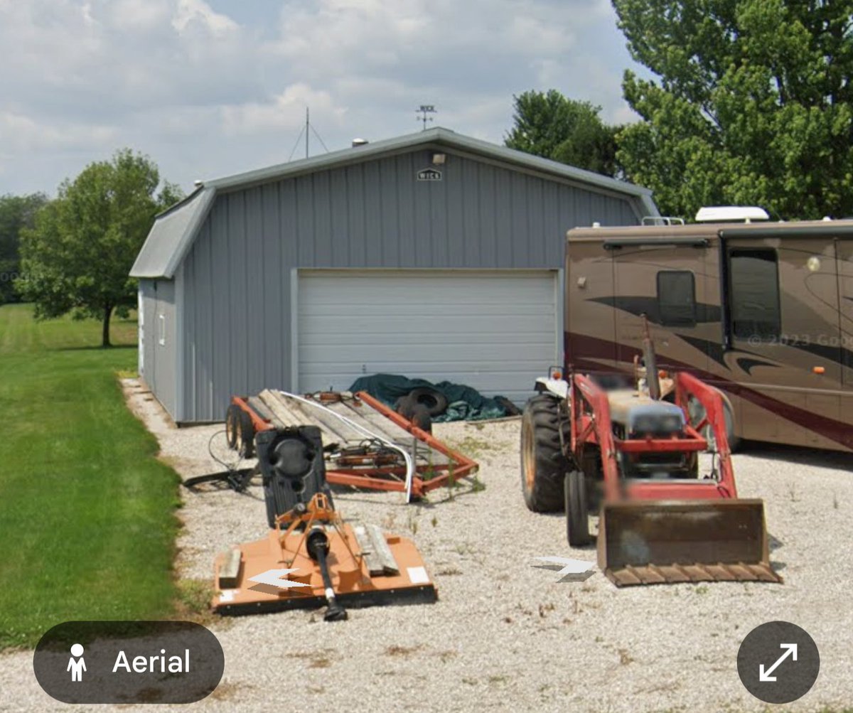
Hey @NWSLincolnIL , got these damage photos from some family that live 3 miles southeast of downtown Eureka. The shed at their house has been blown away along with tree damage and damage to equipment they had.

1
14
1,821
Jun 12
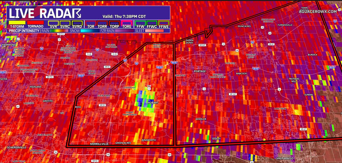
Looks like a significant tornado moving through a highly populated area in far northern Indiana.
4
480
Jake Thompson retweeted

Jun 10
He's our QB1 and you can't have him. @PatrickMahomes

283
1,776
13,770
992,133
Jun 9
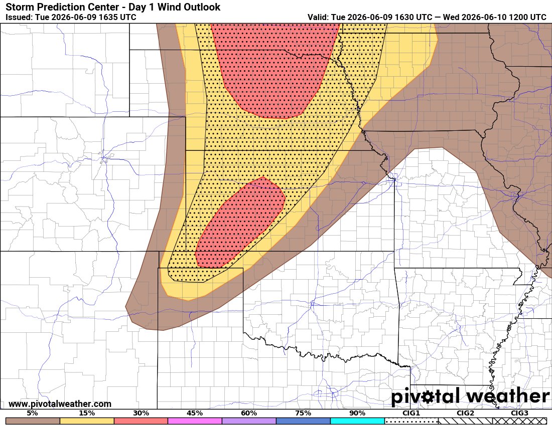
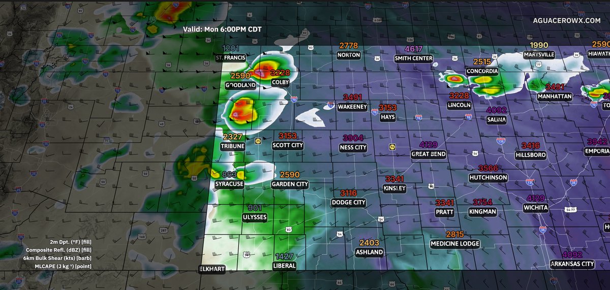
Starting to see quite a bit of CU building across southwest Kansas where storms are forecast to develop over the next few hours with significant damaging wind gusts being a concern. The SPC has an Enhanced Risk in place for the damaging wind risk. #kswx


4
261
Jun 9
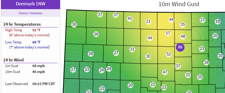
The Denmark1NW @ksmesonet station gusted to 86mph at 10m with these storms. Here are images from the station before the storm hit, in the middle of the storm during the strong winds, and now there is a nice mammatus cloud display. #kswx


Jun 9

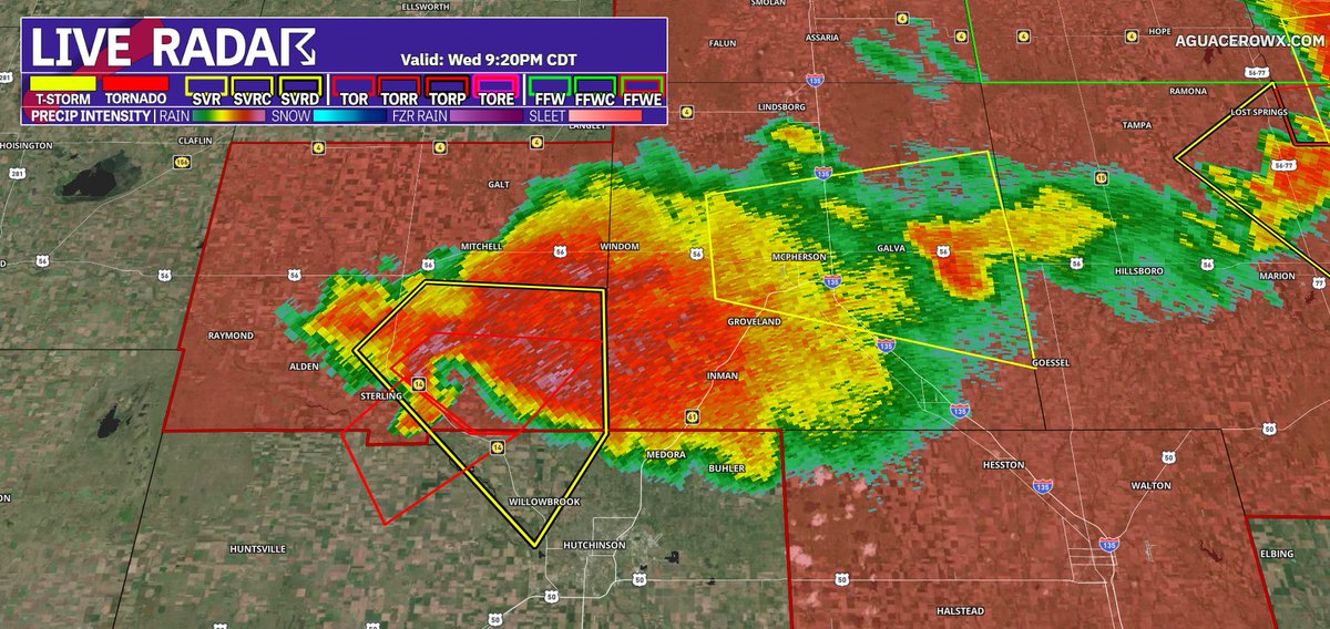
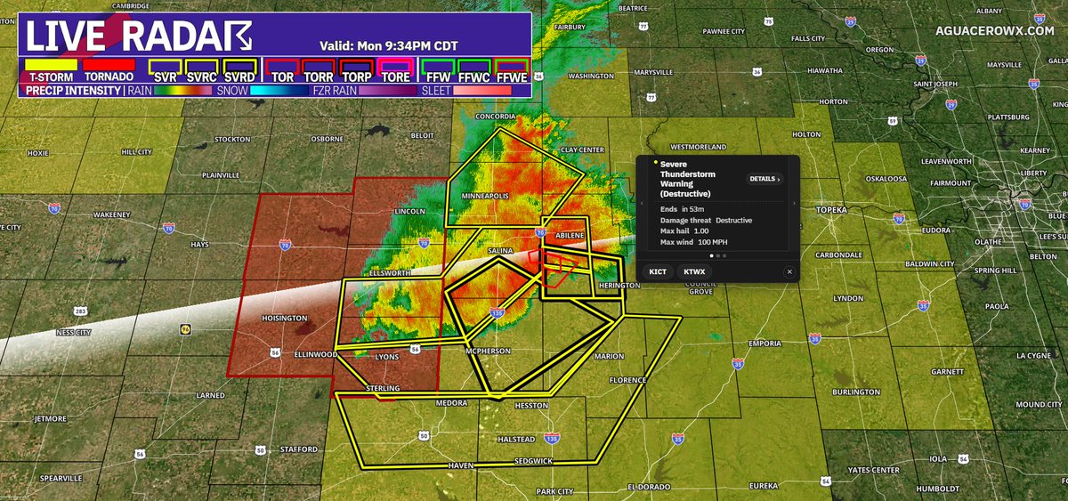
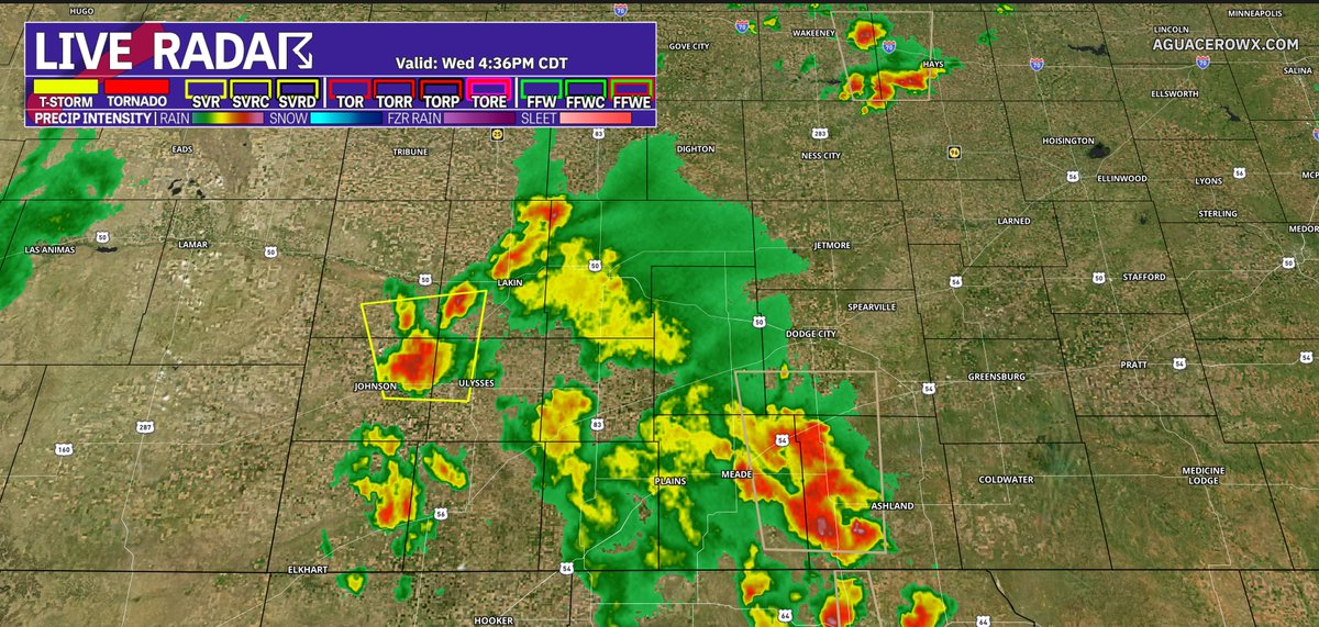
Impressive MCS in north central Kansas this evening. These storms are warned for 100mph winds!
1
1
1
772
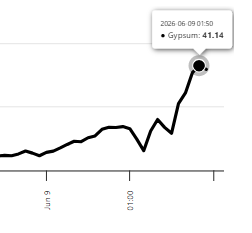
Jun 9
Wow! The Gypsum site in southeast Saline County gusted to 92mph at 10m.
2
158
Jun 9
Impressive MCS in north central Kansas this evening. These storms are warned for 100mph winds!
2
931
Jun 8
Missing out on a Kansas/Colorado chase because my car decided to have power issues at the worst time and the mechanic is still trying to find the cause
1
166
Jun 4
Really nice rainfall totals from southwest to north central Kansas.

1
183