
Joined May 2011
- Tweets 13,554
- Following 2,033
- Followers 1,281
- Likes 3,136
274 Photos and videos


A la librería de mi barrio ya ha llegado, (solo me falta que
@hsocasnavarro venga a firmarlo)
¡Poñame dous!
Lectura @pcoffeebreak
1
2
2
422
MarlénFernándezSilva retweeted

Déixovos o meu último artigo para Mundiario.
mundiario.com/articulo/en-ga…
4
5
182
MarlénFernándezSilva retweeted

May 29
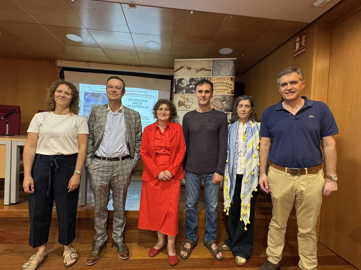
🧠 A alcaldesa de Santiago, @GorettiSRei , participou hoxe no acto de entrega do diploma como socio de Honra do Círculo Escéptico @cescept ao profesor @JorgeMiraUSC , que se comprometeu a facer valer este título a través do pensamento.
💬 Sanmartín Rei defendeu a ciencia e o coñecemento como unha ventá para o espíritu crítico e un antídoto contra a involución.
🎥No marco do evento, tamén se proxectou o documental "A message to the stars" da realizadora galega Ruth Chao.


5
7
1,014
MarlénFernándezSilva retweeted

May 27
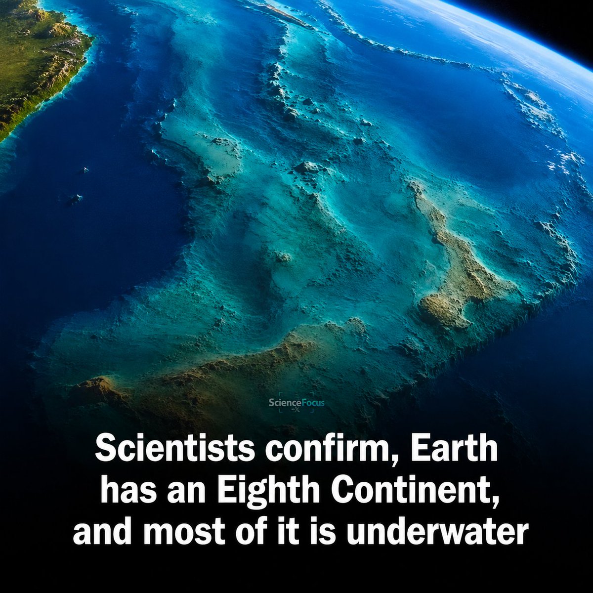
Earth has been hiding a continent from us. And 94% of it is drowning.
Meet Zealandia.
A landmass bigger than India. Almost two-thirds the size of Australia. Sitting quietly under the South Pacific while the rest of the world argued about seven continents in geography class.
Scientists just made it official. Earth has eight.
Here's the wild part. Zealandia spans nearly 1.9 million square miles. But only about 5% of it pokes above the waves. New Zealand? That's a peak. New Caledonia? Another peak. The "islands" you've seen on maps your whole life are actually the tallest mountains of a sunken giant.
The crust gave it away.
Ocean floor is thin, dark, and volcanic, usually around 7 kilometers thick. Zealandia's crust averages 20 kilometers, packed with granite, schist, and sedimentary basins. That's continental DNA. Not seabed.
It ticks every box geologists use to define a continent. Elevation. Distinct geology. A coherent area. Thick crust.
About 100 million years ago, Zealandia was part of the supercontinent Gondwana, alongside Australia, Antarctica, South America, and Africa. Then it broke off. Then its crust stretched, thinned, and cooled. Then it sank.
Scientists drilled more than 4,100 feet into its seafloor and pulled up fossils, pollen grains, and microscopic shells from shallow seas. Translation: this place once had beaches. Plants. Maybe creatures walking around on dry land before the ocean swallowed it whole.
Recent dredging missions across the northern sections mapped sandstone, basaltic lavas, and volcanic pebbles dating from the Early Cretaceous to the Eocene. Magnetic anomaly data finally locked in the boundaries.
It was always there. We just couldn't see it.
The next time someone says there are seven continents, you'll know better.
Source: GNS Science / GSA Today (2017 study) and recent Zealandia tectonic research
42
254
1,040
64,850
MarlénFernándezSilva retweeted

Existe un libro para colorear con el que se pueden aprender las bases de la microbiología y conocer a los científicos relevantes en este área del conocimiento
Lo puedes descargar gratis en varios idiomas en este enlace
kohlerfellows.illuminatingdi…

24
606
1,650
51,934
MarlénFernándezSilva retweeted

Ya disponible el episodio 559 de Coffee Break:
Cara A:
-Actos
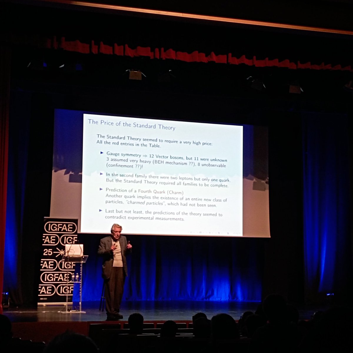
-CMS publica en Nature su medida la masa del bosón W (c.f. Ep. 478)
-Impacto de tormentas solares sobre la aviación
xn--sealyruido-u9a.com

2
20
32
2,437
MarlénFernándezSilva retweeted

Jeje... Un poco de paciencia. Sale el 3 de Junio, poco más de una semanita 🙃. Aunque ya se puede comprar y te lo envían o traen a tienda ese día 🙂

@hsocasnavarro ¡Queremos libro libro! ¡Queremos libro libro! Queremos... ¡LIBRO!
13
29
81
4,844
MarlénFernándezSilva retweeted

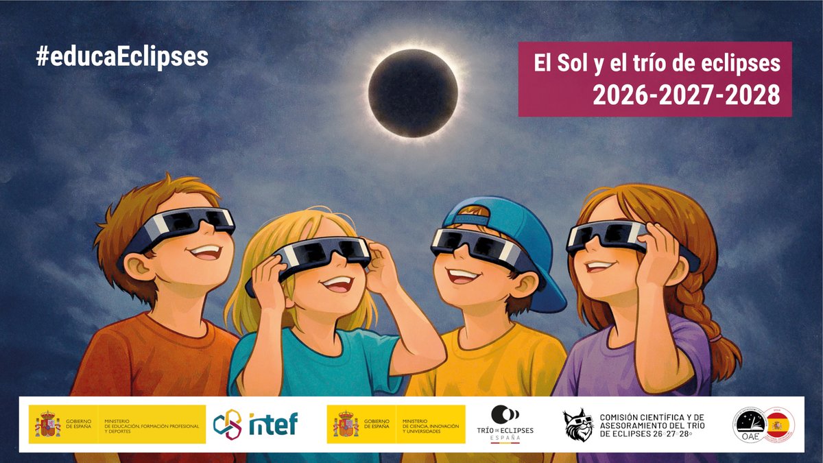
🌞🌑 España vivirá un trío de eclipses único (2026-2028)… ¡y ya puedes prepararte!
📚 Abierta la inscripción al curso online gratuito sobre el Sol y los eclipses
👩🏫 Para docentes y público general
🔭 Con contenidos prácticos y científicos
👉 Más info: iac.es/es/divulgacion/notici…
3
47
123
8,644
MarlénFernándezSilva retweeted
El @IAC_Astrofisica participa en la creación de este curso online gratuito sobre el trío de eclipses 2026-28. En este vídeo está mi modesta contribución, "El ciclo del Sol y su impacto en la Tierra":
youtube.com/watch?v=kxdUmkpO…
Más información sobre el curso👇👇
1
26
46
4,934
MarlénFernándezSilva retweeted
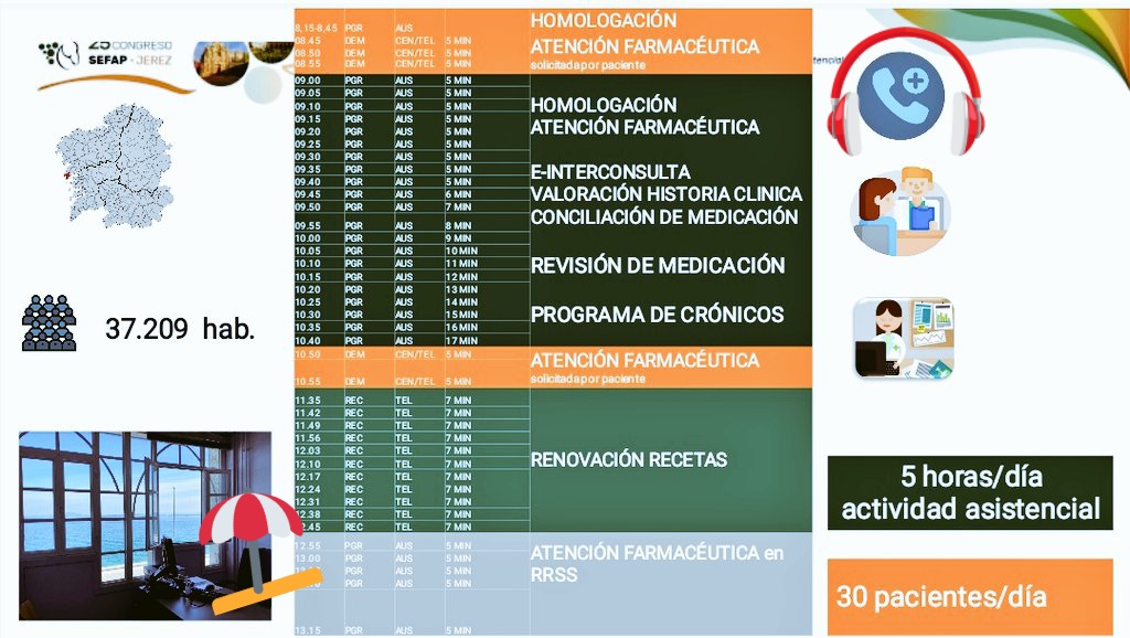
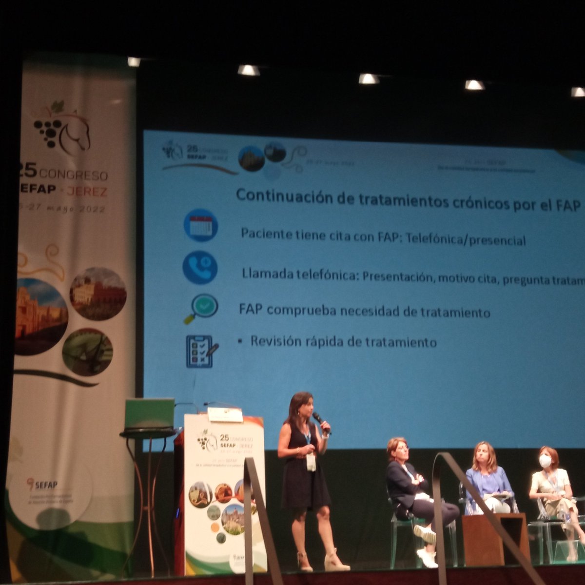
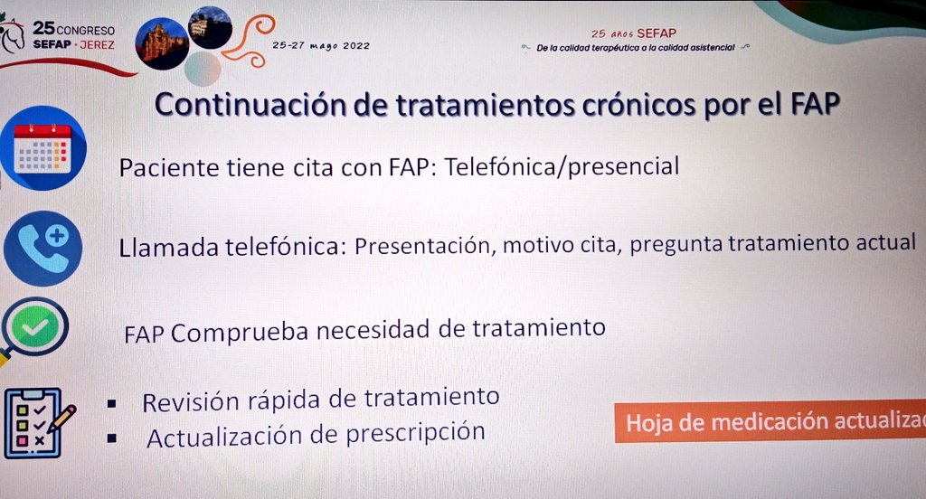
Caso representativo, presentado por @CasteloRosana
paciente que se vería muy beneficiado de realizar su pastillero en la farmacia #SPD @FAPsGal
@COFCoruna
youtu.be/1nYbq-izVjA?is=nJfQ…

2
5
556
MarlénFernándezSilva retweeted

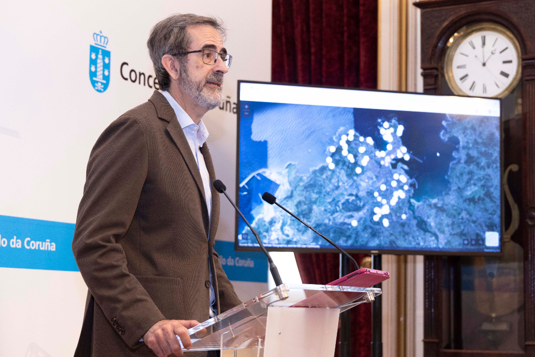
☀️ O Concello presenta dous visores interactivos para facilitar lle á cidadanía a observación da eclipse total
👉 O 30 de abril o Sol situarase na mesma posición que terá durante a eclipse, o que permitirá facer probas reais de visibilidade
ℹ️ i.gal/6HtgA
9
17
2,921
MarlénFernándezSilva retweeted

Apr 29
1
4
196
MarlénFernándezSilva retweeted

(SEIMC) Documento de Consenso sobre diagnóstico y tratamiento de las infecciones de transmisión sexual en adultos, niños y adolescentes. seimc.org/wp-content/uploads…
13
15
870
MarlénFernándezSilva retweeted

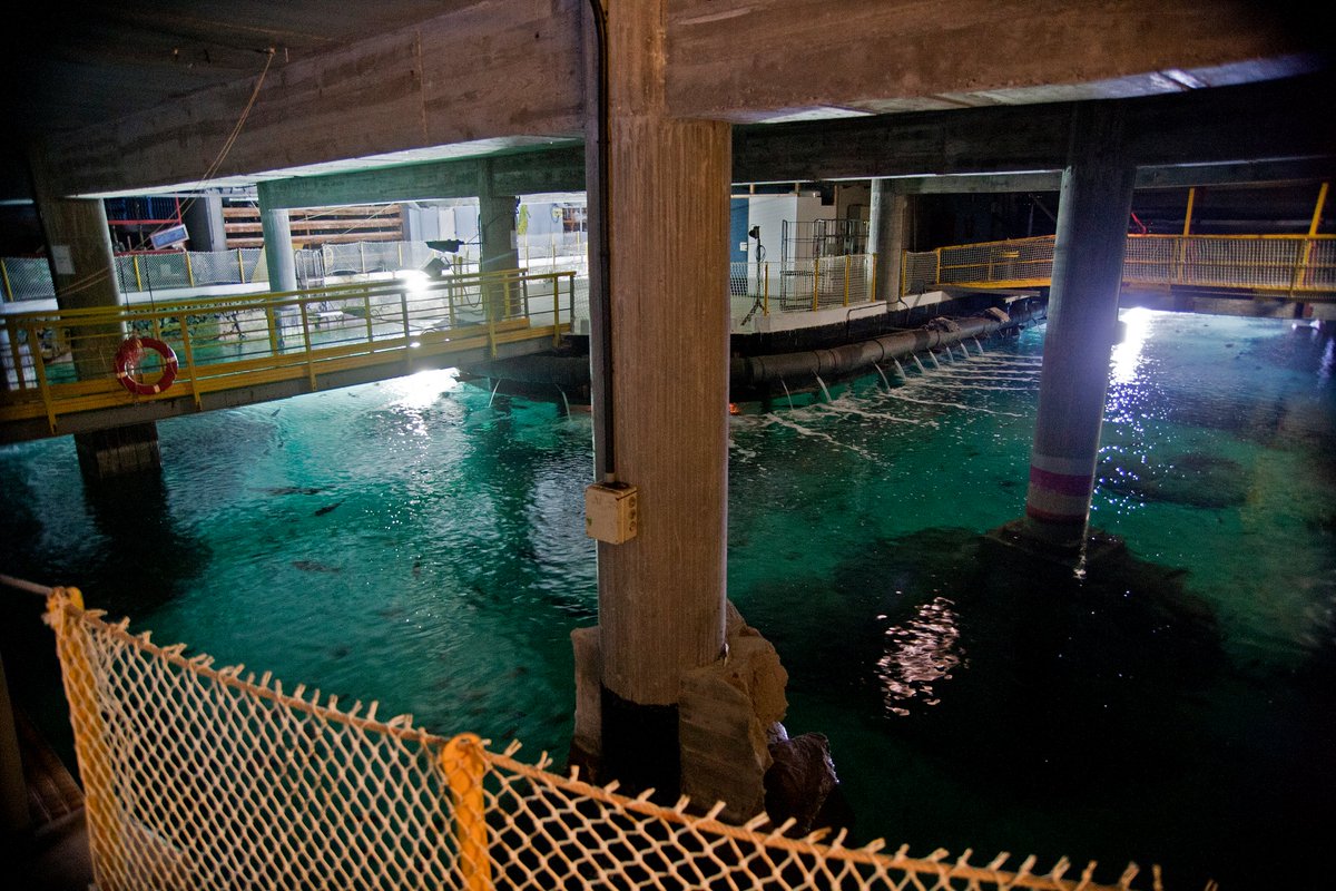
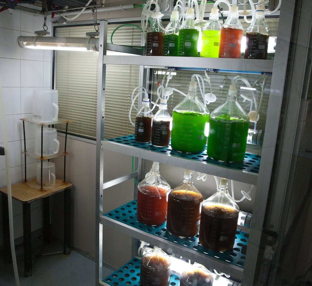
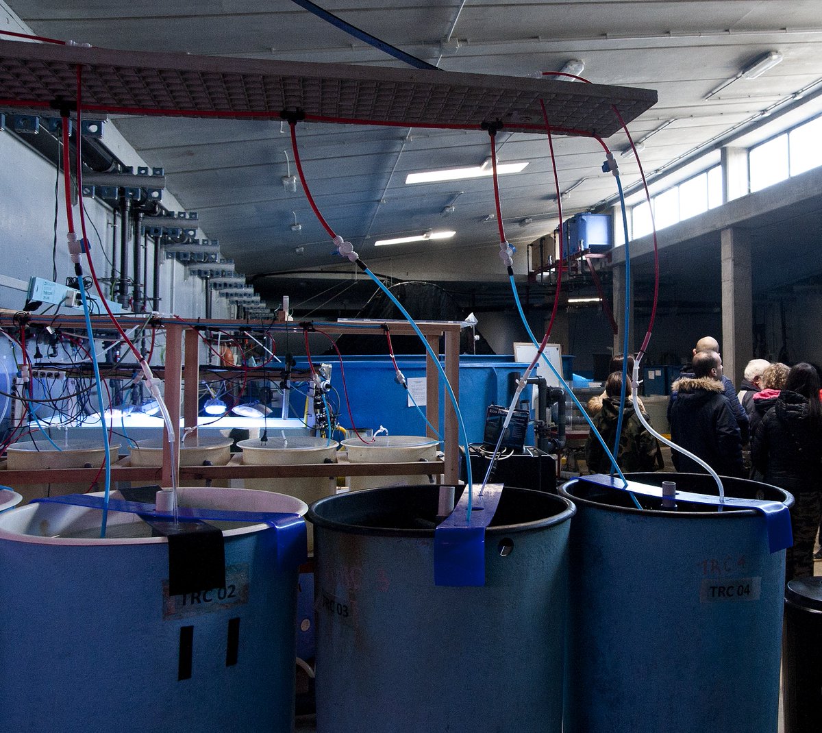
🌊 Queres descubrir como é o Aquarium Finisterrae detrás dos tanques de exposición? Apúntate á actividade «Viaxe ao centro do Aquarium», dirixida a maiores de 16 anos ➡️acortar.link/fLaM0f
📆 Sábado 11 de abril
🎟 Adquisición de entradas, desde as 9 h do mércores 8 de abril
5
9
1,251
MarlénFernándezSilva retweeted
Disfruté mucho la entrevista esta mañana en RTVE sobre el programa Artemisa. Aquí está el vídeo:
rtve.es/play/videos/programa…
6
30
104
6,706
MarlénFernándezSilva retweeted
(Cardioteca) Antidiabéticos antes de la cirugía: qué suspender y cuándo según las guías clínicas en 2026 cardioteca.com/blog-diabetes…
18
31
2,204
MarlénFernándezSilva retweeted

Mar 30
👇
Mar 5

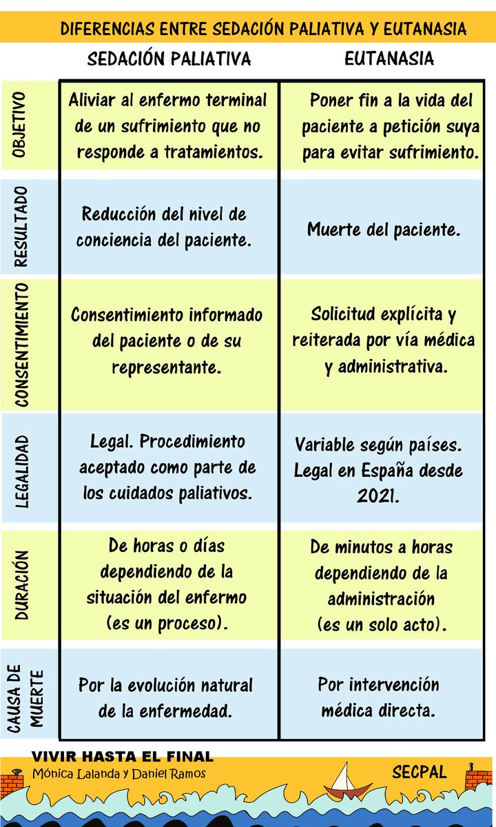
Entiendes que la sedación terminal y la eutanasia son diferentes?
Estos dos conceptos (que parecen similares, pero no lo son) siguen causando confusión y sufrimiento a familiares y profesionales
Te lo explicamos en esta página de Vivir hasta el final
cc @PaliativosTeam @secpal_
18
39
1,748
MarlénFernándezSilva retweeted

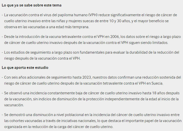
(BMJ) Seguimiento extendido del riesgo de cáncer cervical invasivo después de la vacunación tetravalente contra el VPH bmj.com/content/392/bmj-2025… Est Observ
1
2
197
MarlénFernándezSilva retweeted
(NERDS) Mañana, puntual, en el buzón de los suscriptores. ¿Te lo vas a perder?
1
2
482