
We're a modern 3D design solution for creating and iterating on urban environments and scenarios. Start a free trial: esri.social/1e0O50TgLVj
Joined February 2009
- Tweets 2,543
- Following 2,660
- Followers 14,402
- Likes 832
518 Photos and videos


Pinned Tweet

3 Sep 2024
We’re excited to share that CityEngine is now included in the new Professional Plus User Type, and available to add-on to the Creator and Professional User Types.
New to ArcGIS User Types? Learn more here to see what’s included in each option: esri.social/Jvma50SyUP5

5
6
820
Feb 25
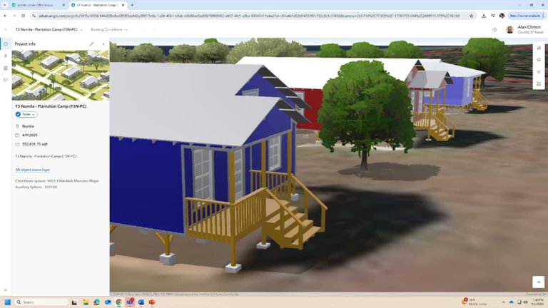
Kauai County is using #ArcGISUrban and #CityEngine to redesign safer communities—modeling form‑based code updates in 3D to strengthen wildfire resilience and protect historic plantation camps. ow.ly/6CFJ50Y3Pmh
1
143
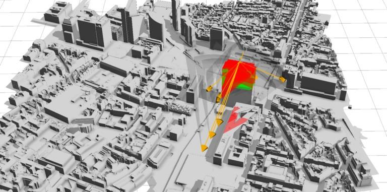
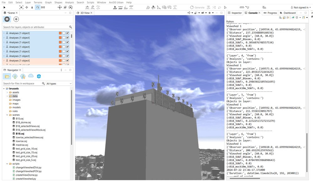
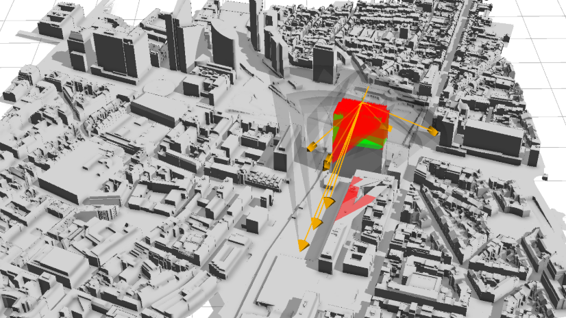
🌆 UC Louvain used #ArcGISCityEngine Python to run automated viewshed analysis and evaluate optimal spots for small urban wind turbines in downtown Brussels. A great example of #GIS powering sustainable urban planning!
Read more ➡️ ow.ly/HL8w30sSQt3
1
116
Did you know that you can use CityEngine’s Get Map Data function to quickly bring real-world 3D context into your workflow, including a terrain surface for your site? See how in this blog: ow.ly/RToB50XU4th
100
18 Nov 2025
For the second year, the Esri Planning Directors Summit delivered an informative and inspiring message to planning leaders. Communities thrive when planners understand community needs and create policies to fulfill them. Read the meeting summary. ow.ly/UwGP50XtwiH
117
5 Nov 2025
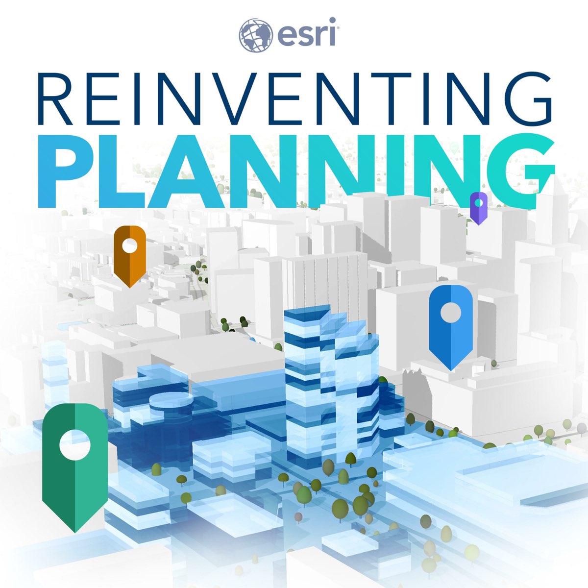
Have you heard the Reinventing Planning podcast? 🎧 Sit down with planners using ArcGIS Urban and CityEngine to see how they’re reinventing planning in their communities with the latest tech and data-driven tools. 🏙️ ow.ly/G20R50XlOo5
112
3 Nov 2025
Curious about #ArcGISCityEngine? Whether you’re just starting out or looking for a specific detail, the official FAQ has all the answers you need in one place 👉 ow.ly/ItgS50XlNvv
107
15 Oct 2025
🏙️ Unlock collaborative urban design in 3D! Explore how #CityEngine enables integrated master planning with GIS-powered modeling and cross‑team workflows.ow.ly/TeBH50X9fOm
122
9 Oct 2025
🚀 Take your 3D workflows further. Did you know #ArcGISCityEngine integrates with Unreal Engine, Rhino/Grasshopper, Maya, Houdini, APIs for Python & C ? Learn how to do more with your procedural city models to drive design and simulation. ow.ly/2rpX50X777o
1
118
6 Oct 2025
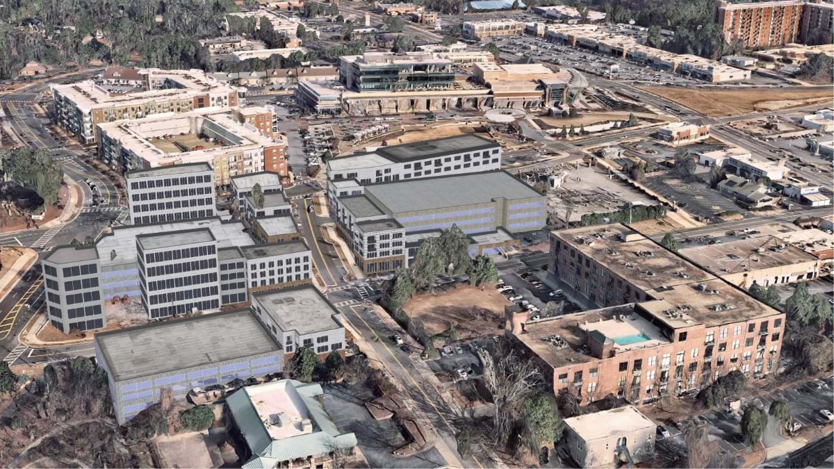
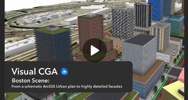
🏙️ Sandy Springs, GA is shaping its future in 3D using #ArcGISCityEngine to bring realistic building facades, trees, streetlights, and viewpoints into public‑facing models. It’s not just planning, it’s visual communication. ow.ly/yP5T50X76ot
1
116
26 Sep 2025
CityEngine’s procedural modeling supports semi-automated urban design using point & polygon features. Skip complex CGA by using point shapes or custom footprints, ideal for small to mid-scale projects. 🏙️ See the tutorial: ow.ly/3XqN50WWTVT
2
144
24 Sep 2025
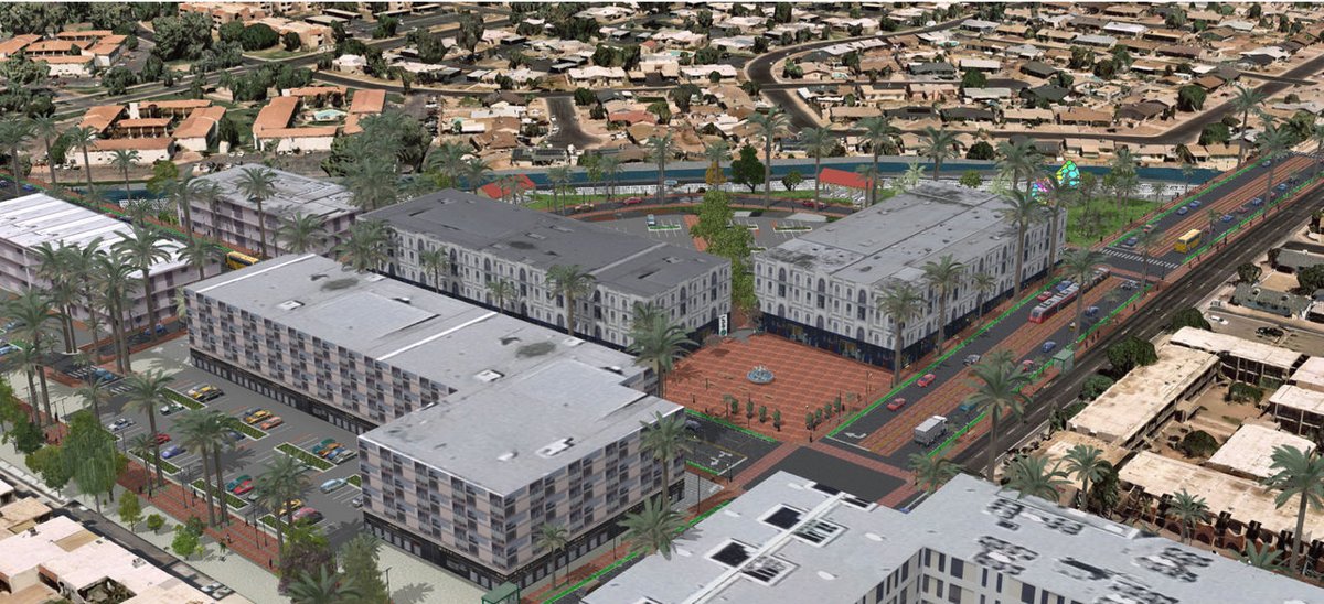
"ArcGIS Urban and CityEngine allow us to transform abstract design ideas into a format that resonates with our community." — Rachel Nettles, City of Mesa
See how these tools help the city bring their plans to life: ow.ly/quSL50WWUc0
79
17 Sep 2025
🚧 Designing future streets is now easier! With the new Street Designer in #CityEngine, planners and designers can sculpt road configs, sidewalks, medians & more. Check out the introduction to get started: ow.ly/6ufN50WWTM7
3
1
190
15 Sep 2025
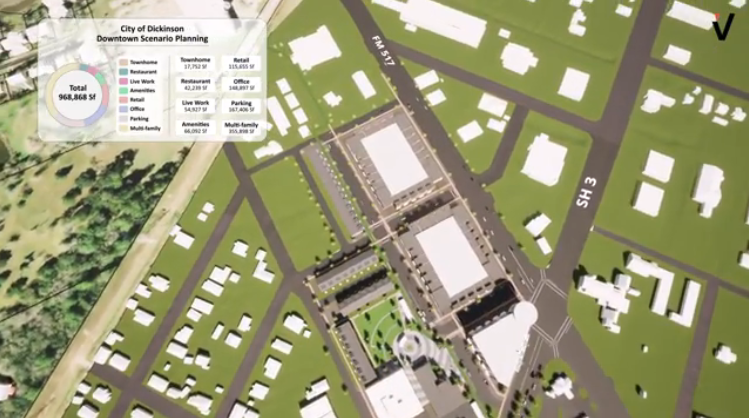
The City of Dickinson, Texas, used a 3D GIS to innovate urban planning. A geospatial-powered immersive experience helped city leaders communicate the value of vertical growth and mixed-use development. ow.ly/Pa0j50WOf9L
102
12 Sep 2025
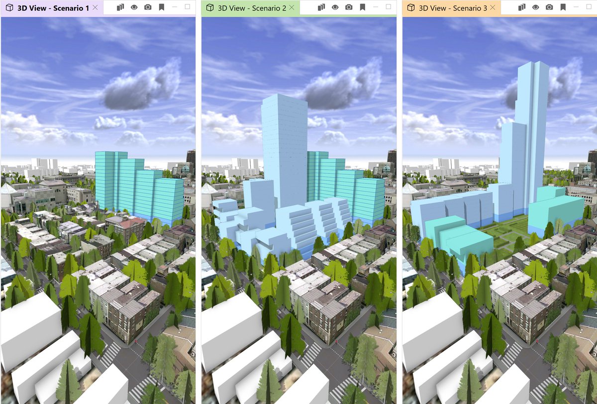
💡#CityEngine Tip: Scenarios let you create & compare multiple designs in a single scene, side by side in split views. Dashboards are scenario-aware too, showing metrics for each design to compare performance at a glance. ow.ly/Trgf50WPyH0
1
121
10 Sep 2025
🌆 UC Louvain used ArcGIS CityEngine Python to run automated viewshed analysis and evaluate optimal spots for small urban wind turbines in downtown Brussels. A great example of GIS powering sustainable urban planning! Read more: ow.ly/eNS850WPyyc
97
3 Sep 2025
The 2025 Planning Directors Summit is now open for registration! Join your peers in West Palm Beach, Florida, to talk housing, economic mobility, comprehensive planning, and more. Request to attend here: ow.ly/9i6730sPe75
67
2 Sep 2025
If you haven’t heard: #ArcGISUrban, #CityEngine, and all the tools planning departments need are now bundled into one user type, Professional Plus. See what this means for your team: ow.ly/9qm050WPxXk
83
29 Aug 2025
Join host Andy Revkin on #SustainWhat with Alan Clinton (Kauai County, Hawaii) & Taisha Fabricius (Esri Zurich) for a conversation on the future of urban planning & design. ow.ly/f3GE50WOeXe

99
25 Aug 2025
Sketch it in #ArcGISUrban. Design it in #CityEngine. Go from zoning plans to stunning 3D models. Now with Urban and CityEngine included in the Professional Plus user type, early-stage planning flows straight into real-world design. See how: ow.ly/fXaw50WJM4P
1
93
22 Aug 2025
How visible are small urban wind turbines in a dense city? Researchers at UC Louvain used ArcGIS CityEngine and 3D GIS to analyze turbine visibility in Brussels. See how they did it: ow.ly/6wJu50WIRXb
94