
I develop remotely sensed products for Australia. I have a PhD in palaeoclimate and a passion for science and sharing it with everyone.
Joined November 2015
- Tweets 938
- Following 238
- Followers 534
- Likes 5,386
92 Photos and videos


21 Nov 2024
I, like many others, have officially now shifted off this platform. I've moved over to Bluesky. You can find me there as ClaireScience if you'd like to keep in touch.
9
Claire Krause retweeted

12 May 2023
Our #geomorphology report is out! You can use it to consistently #classify and map your #seafloor and #Coastal #landforms. Let us know how it goes and send us your feedback #geohab #oceanmapping #glossary #OpenAccess
11 May 2023

We love to bring consistency and ocean best practice to life! With @BritGeoSurvey @UCC @GeolSurvIE and @NGUgeology we've defined and structured hundreds of geomorphic unit terms into the marine settings and processes that form them
👉 bit.ly/42IfiNF
📷North Flinders Reef
4
21
2,070
Claire Krause retweeted

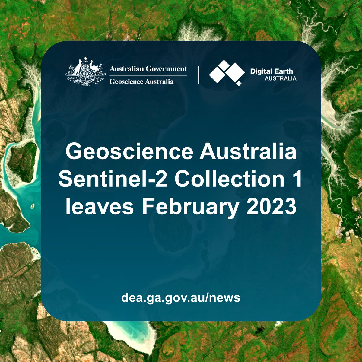
21 Feb 2023
One week left until @GeoscienceAus's #DigitalEarthAU #Sentinel2 Collection 2 data disappears on February 28 2023! 🛰⏳
Please let us know if you're having any issues with updating your code to the new data - we're happy to help out!
More info: communication.ga.gov.au/link…
15 Feb 2023
#Sentinel2 Collection 3 is here! The new collection provides major upgrades and enhancements to the quality of data available to #DigitalEarthAu users. If you’re yet to make the switch, get started before we say goodbye to Collection 1 on Tuesday 28 Feb👉bit.ly/3jyV2Nw.
1
5
976
Claire Krause retweeted
1 Feb 2023
Couldn't be more excited about this major #DigitalEarthAU update: a brand new #Sentinel2 satellite data collection for Australia!
Too many improvements to fit in a single tweet - see the 🧵 below for some of the biggest highlights!
1 Feb 2023
We're always working to improve our data's quality and accessibility, bringing #EO to more people.
#DigitalEarthAU has reached a significant milestone as we migrate to our enhanced #Sentinel2 Collection 3.
Users new & old, come join us 👉bit.ly/3QQgBW4
📹 Windorah, QLD
1
9
40
6,076
Claire Krause retweeted

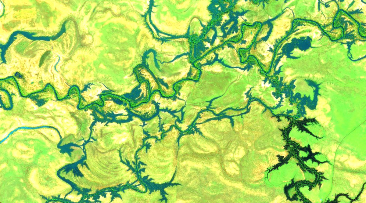
17 Nov 2022
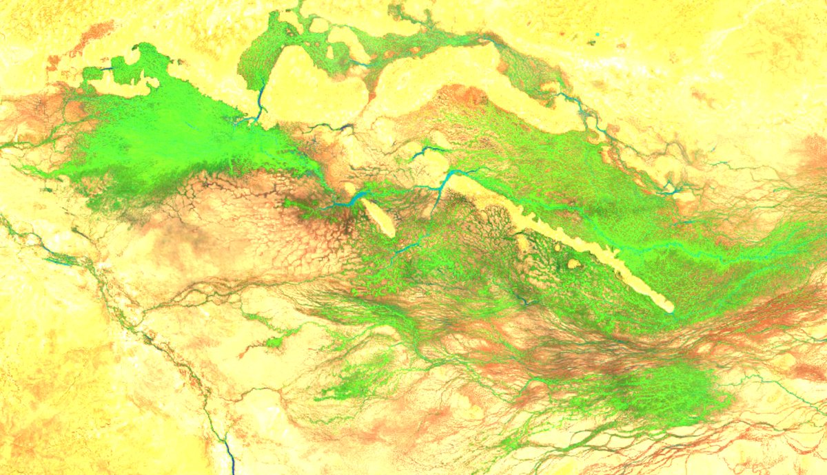
The inland rivers of NSW are not usually broad enough to be visible from geostationary satellites, stationed 36,000 km above the equator.
18
320
923
Claire Krause retweeted

6 Oct 2022
2022 has been a truly exceptional year of rainfall in #Sydney. It only took 279 days to break the city’s annual rainfall record of 2194mm from 1950, with annual data available back to 1859.
13
184
596
4 Jul 2022
Our new paper on solar forcing of SAM is out! Thanks to Nicky Wright for pulling this work together.
It's so nice to see it published!
9
9 Mar 2022
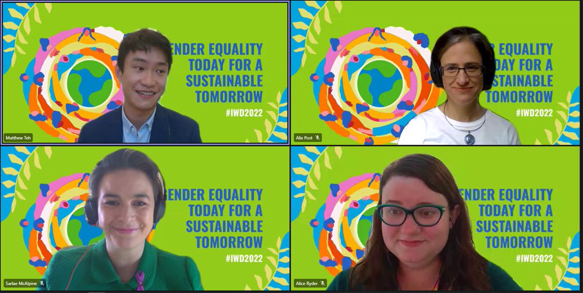
Happy #IWD2022. I'm excited to be watching the @GeoscienceAus panel seminar featuring some stellar GA women.
GA also just announced a new family violence policy and support for employees who can now work safely in the GA building with their kids.
I love our inclusive workplace.
1
6
9 Mar 2022
brilliant point from @sarlaemcalpine - It's important to be able to bring your whole self to work, but it's equally important to be able to bring it back home in tact.
2
3 Mar 2022
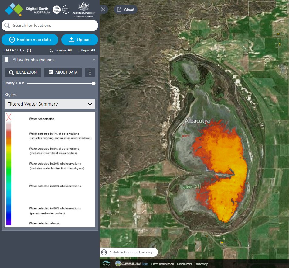
New dataset alert!
#DEALandCover is now live. Check out the interactive map story that showcases 30 years of land cover over all of Australia.
2 Mar 2022
We are very excited to announce the release of #DEALandCover! See Australia as never before with our new annual #LandCover maps from 1988–2020 at 25 m resolution. Based on #OpenData and created using #OpenSource software. Explore it for yourself 👉 bit.ly/35MjQu0!
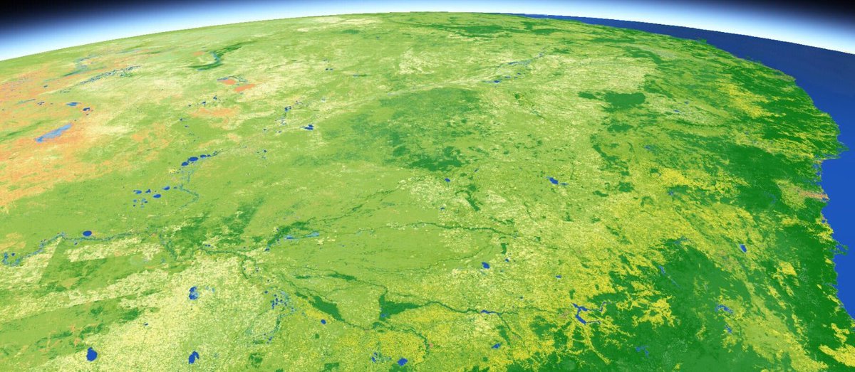
ALT A DEA Land Cover map of Eastern Australia, showing how the physical attributes of the surface change. This image is predominately shades of green, indicating vegetation, with some orange to the west, indicating bare. To the east there is blue to denote the ocean. The image appears to be taken from space, with some atmospheric detail in the background.
2
9
Claire Krause retweeted

13 Jan 2022
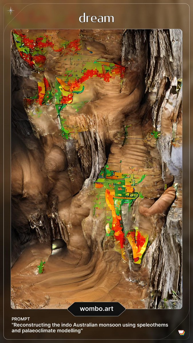
Dream postdoc still available for speleothem peeps out there. Peruvian stalagmites, hydroclimate reconstructions, multi-archive comparisons, 3 year position. There's a lot to like.
10
14
Claire Krause retweeted

13 Jan 2022
Interested in sharing Earth science with students and potentially influencing the next generation to work in Earth Science? @GeoscienceAus has a position open in its education team and you will get to share an office with me 😉 candidate.aurion.cloud/ga/pr… @nonschistyjobs
#scicomm
18
17
Claire Krause retweeted

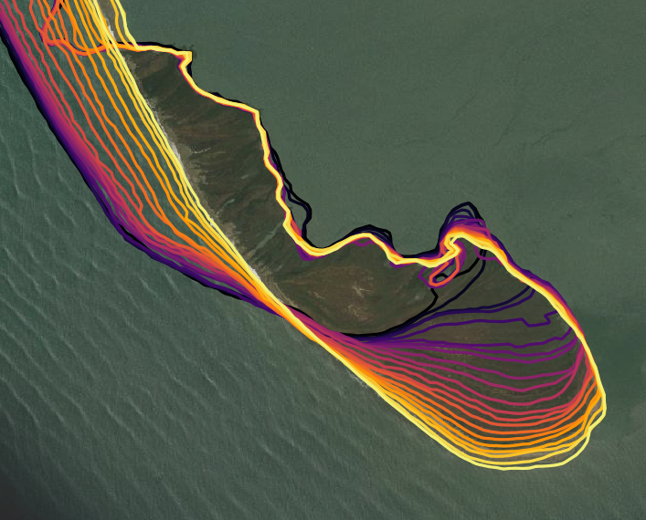
19 Dec 2021
We are excited to announce the first annual #DEACoastlines update! This includes shoreline data for 2020, a new temporal filter that improves mapping performance across small islands & dynamic sand bars, & much more! Follow the link to explore the map 👉 bit.ly/3a9rVZh
10
39
Claire Krause retweeted
17 Dec 2021
Finishing the working year with some hypnotically beautiful coastal change from across western, southern and eastern Africa.
Look forward to sharing many more coastlines from space in the new year... after spending some time with a few real-world beaches instead! 🌊🛰️🏖️


1
13
89
Claire Krause retweeted

New discussion paper: Reconstructions and models suggest that changes in solar irradiance may have driven changes in the Southern Annular Mode over the last millennium, with Nicky Wright, @Claire_Science, Ghyslaine Boschat and @ClimateNerilie. #openscience cp.copernicus.org/preprints/…

3
4
Claire Krause retweeted

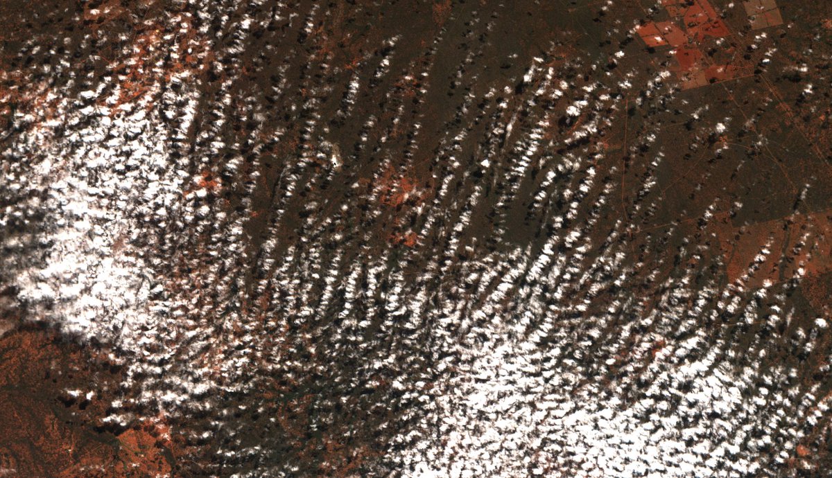
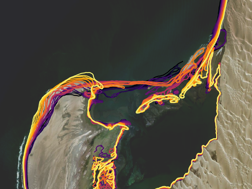
14 Nov 2021
Check this fire burning south of Roebourne (Australia) past few days. An incredible dendritic path, behaviour complexity. Following drainage, flowing with the fuel. A beautiful example of how closely fire and water are connected in the desert. @RangelandsNRM #sentinel2 #Pilbara
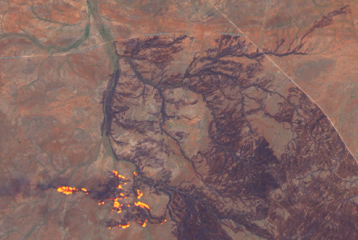
9
126
454
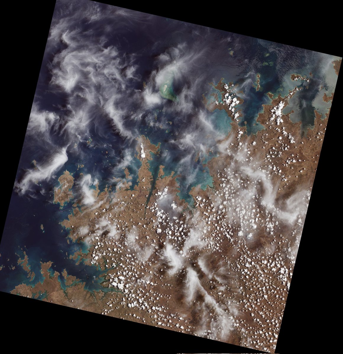
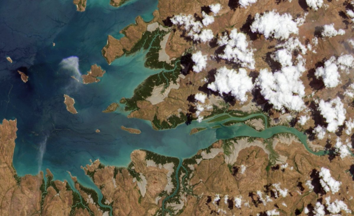
Claire Krause retweeted
5 Nov 2021
This is incredible: the very first image captured by #Landsat9!
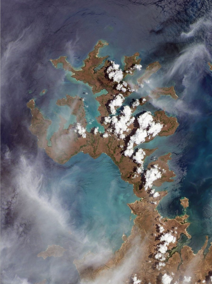
Acquired on October 31st 2021 over Admiralty Gulf in north-western Australia's Kimberley region - one the world's most remote and beautiful coastlines.
@NASA_Landsat @USGSLandsat
3
54
265
Claire Krause retweeted
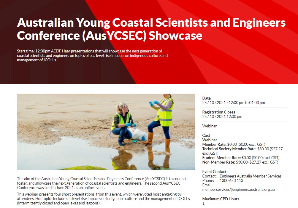
24 Oct 2021
If you're a member of @EngAustralia, there's still time to register for the Australian Young Coastal Scientists and Engineers Conference (@AusYCSEC) Showcase at 12pm today!
Featuring @DrHannahPower, @StephanieDoumt3, @AkuhataBailey, @PdR_NZ and myself!
engineersaustralia.org.au/ev…
2
7
Claire Krause retweeted
13 Oct 2021
Really excited to finally announce our new paper published today in Remote Sensing of Environment!
Mapping Australia's dynamic coastline at mean sea level using three decades of @NASA_Landsat imagery 🛰️🌊🕜
Open access paper here - thread below!👇
sciencedirect.com/science/ar…
9
94
415
19 Oct 2021
The #AussieBirdCount has kicked off and I have submitted my first survey. It's really easy and relaxing (until you spot a bird you can't identify), but there is lots of help in the app to get you started.
So far sparrows, miners, wattle birds and a cockatoo in my yard.
18 Oct 2021

The #AussieBirdCount is on, and it's time to GET COUNTING!
This year we blast off with some of our brilliant bird count ambassadors: @ProfPCDoherty, @julia_zemiro, @MyfWarhurst, Michael Veitch and @stelladonnelly.
Check out our 2021 launch video at: youtube.com/watch?v=HAAH5Hvj…
1
1
3