
Joined November 2011
- Tweets 80
- Following 382
- Followers 312
- Likes 456
17 Photos and videos


Pinned Tweet

10 Jan 2024
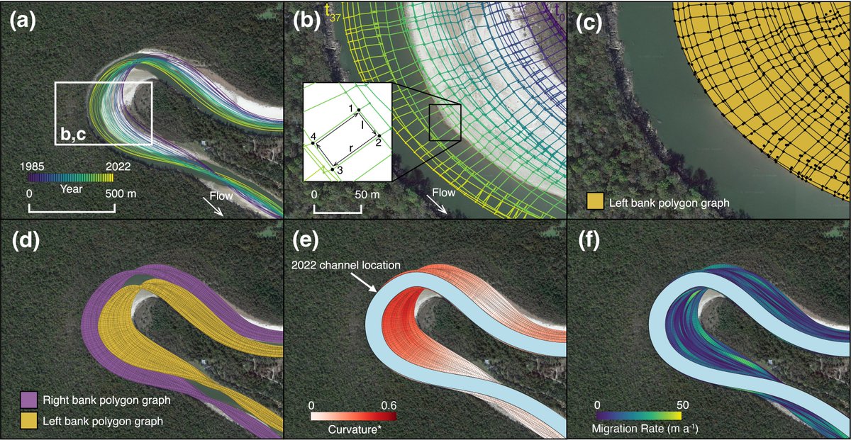
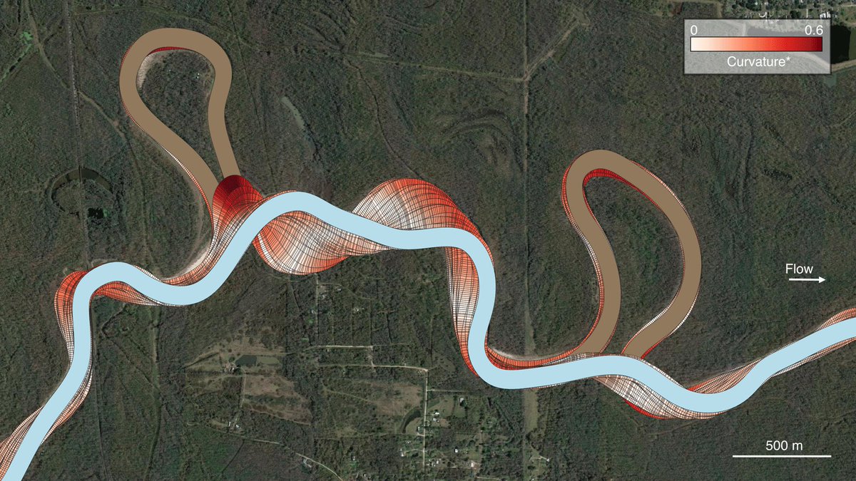
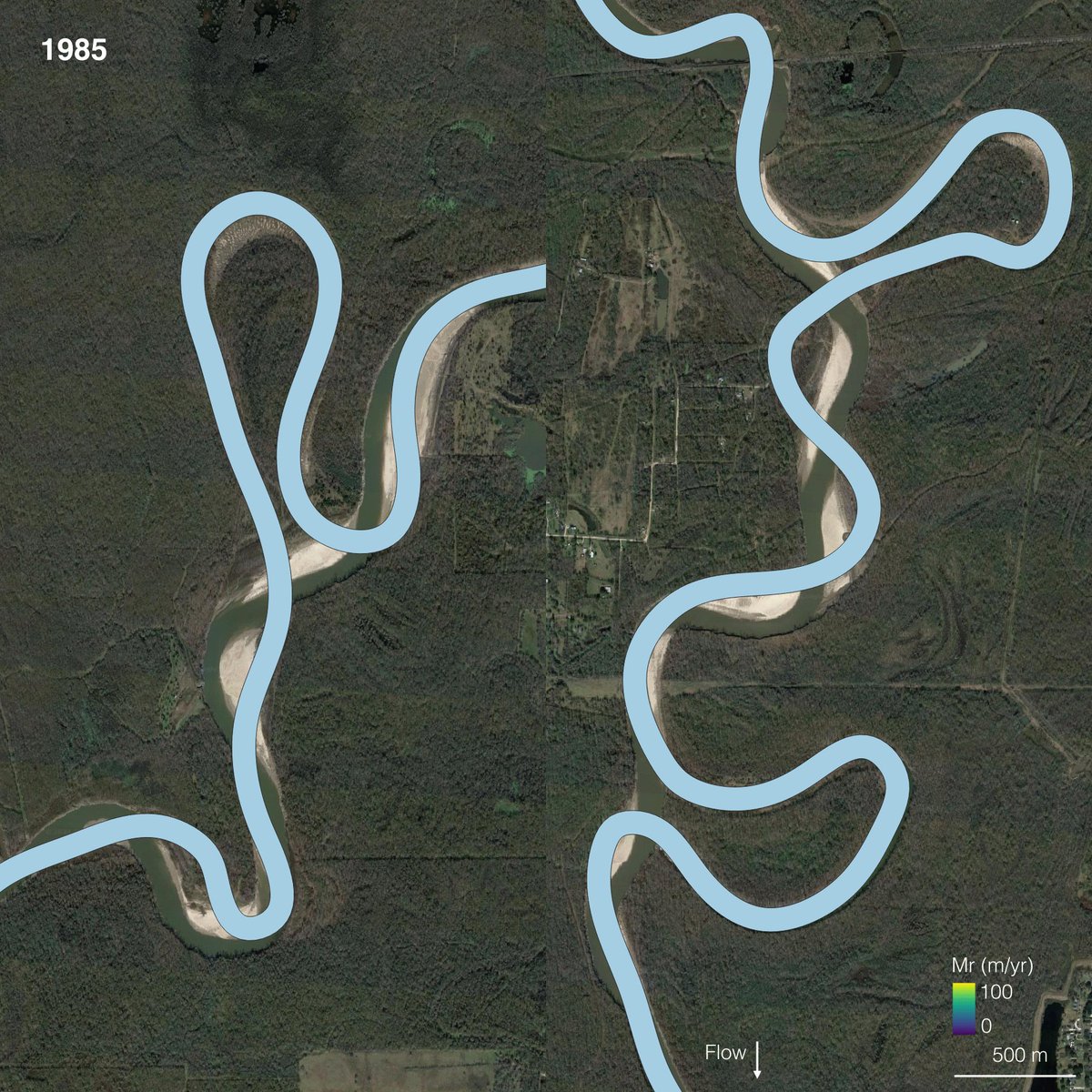
Excited to announce a new paper out of the @ClasticsLab & @txgeosciences (with co-authors @zzsylvester, @PaulMGeo , and D. Mohrig) exploring the kinematics of meander bend cutoffs in timelapse satellite imagery. The full OA paper is available here [1/6]:
lyellcollection.org/doi/abs/…
2
36
152
9,361
25 Sep 2024
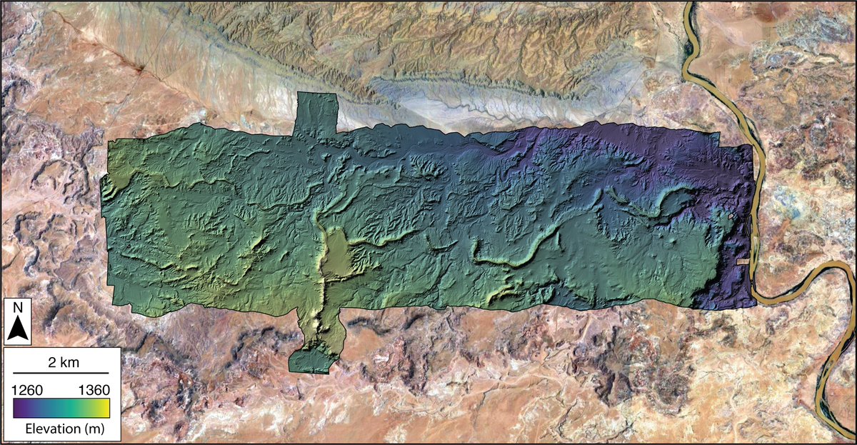
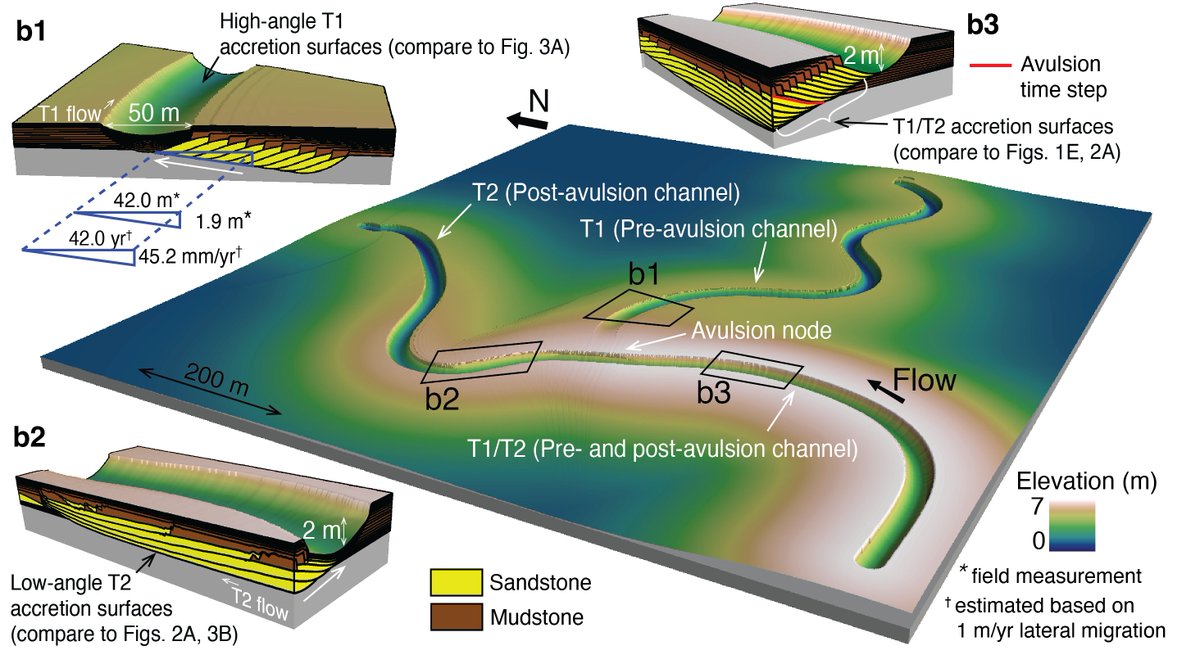
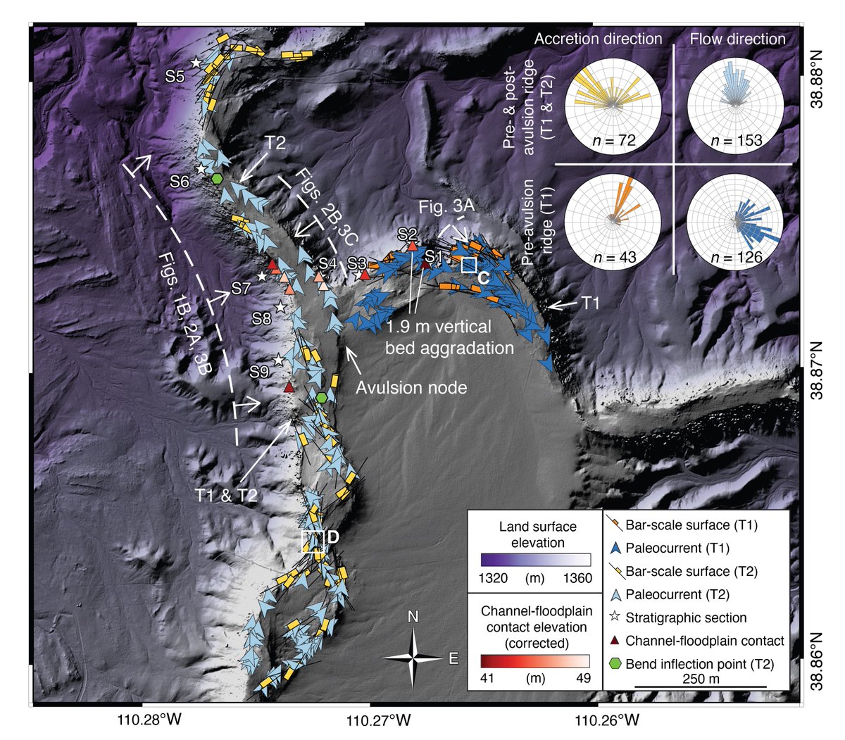
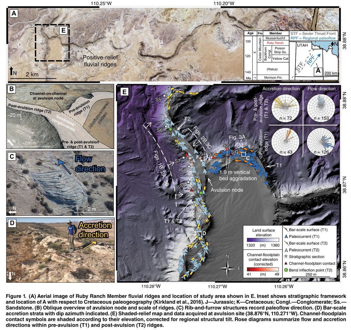
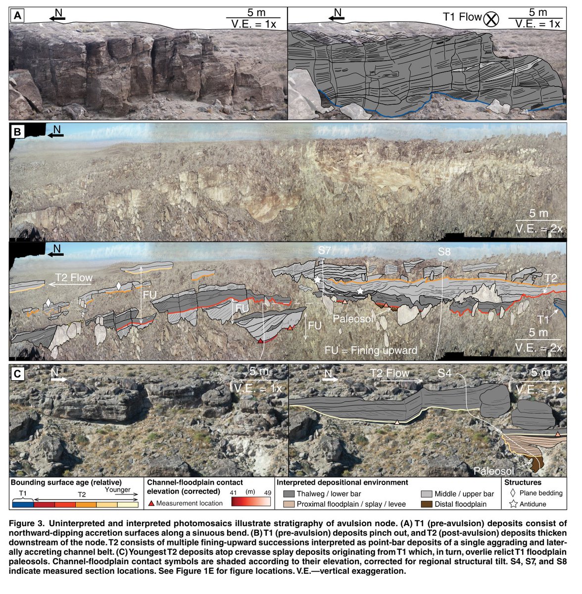
New paper out now in Geology w/ co-authors @zzsylvester, @RiversToRocks, and @peteflaig exploring linkages between river avulsions and their 3-D stratigraphic architecture in the ancient sedimentary record: doi.org/10.1130/G52254.1
1
7
42
2,280
25 Sep 2024
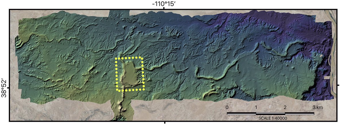
Lidar point cloud data capturing a ~50 sq. km region of the Cedar Mountain Fm. fluvial ridges, including the avulsion site analyzed here, were acquired by @NCALM_UH and are hosted by @OpenTopography:
portal.opentopography.org/da…
1
2
177
25 Sep 2024
Digital outcrop models analyzed in this study are freely available for download on @Sketchfab: sketchfab.com/c.speed/models
Data and code used in analysis and to produce and explore the 3-D stratigraphic avulsion model are available on @github: github.com/cmspeed/avulsion
76
Cole Speed retweeted

19 Jun 2024
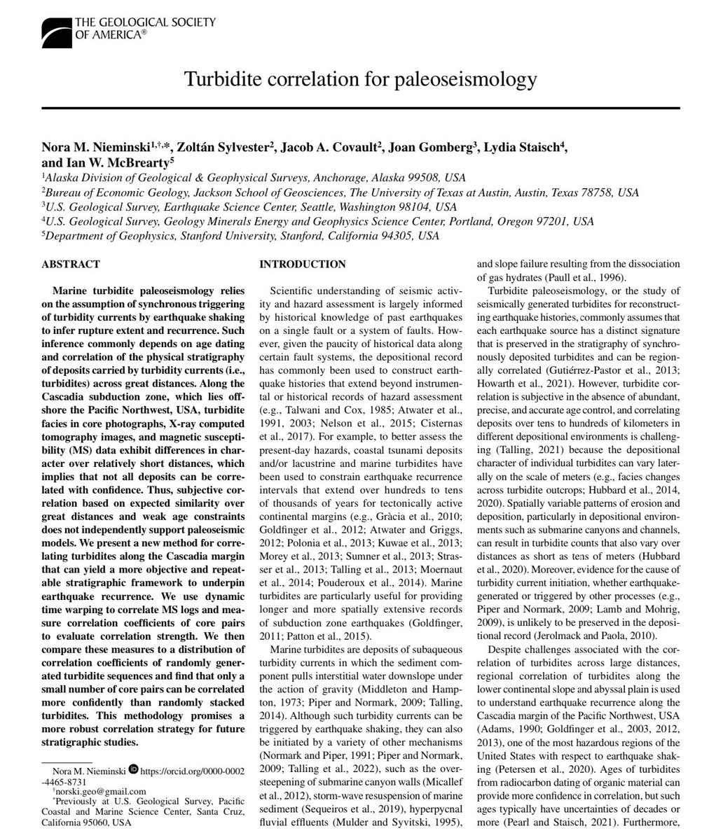
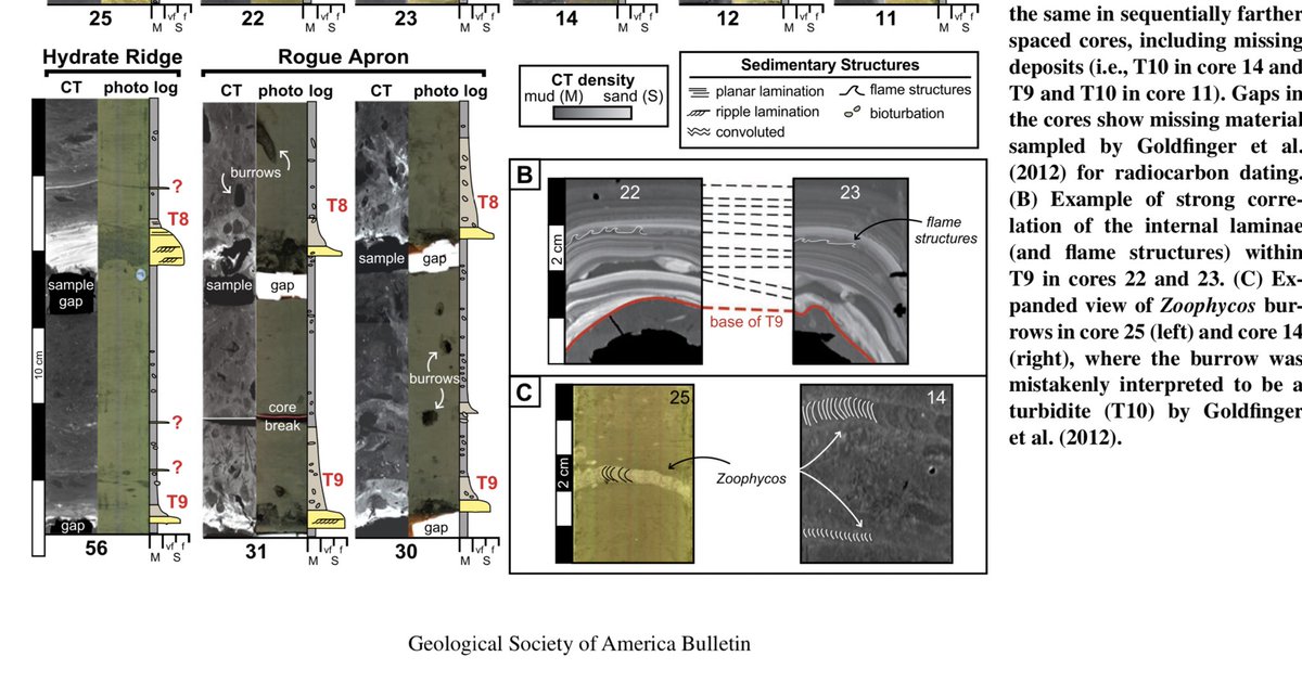
New #OA #GSApubs @GSAPublications @geosociety w/ @NorskiGeo, @zzsylvester, Covault, Gomberg, @faultscarp & McBrearty ‘Turbidite correlation for paleoseismology’: pubs.geoscienceworld.org/gsa…

4
24
2,106
Cole Speed retweeted

11 Apr 2024
Thrilled to announce the release of @GeoscienceAus #DEAIntertidal, a next-generation continental coastal dataset for Australia!
🏝️ 3D coastal elevation models
🦆 Ecological exposure maps
📏Vertical uncertainty
⏱️ Annual data from 2016
🔎 10 m resolution
maps.dea.ga.gov.au/story/DEA…
2
29
138
11,095
Cole Speed retweeted

12 Jan 2024
ICYMI: New JPL Observational Products for End-Users from Remote Sensing Analysis (OPERA) Level 2 products are available at NASA's #ASFDAAC.
➡️Learn more about the new analysis-ready #SAR datasets: go.nasa.gov/3NKOxDp
10
38
4,828
10 Jan 2024
Excited to announce a new paper out of the @ClasticsLab & @txgeosciences (with co-authors @zzsylvester, @PaulMGeo , and D. Mohrig) exploring the kinematics of meander bend cutoffs in timelapse satellite imagery. The full OA paper is available here [1/6]:
lyellcollection.org/doi/abs/…
2
36
152
9,361
10 Jan 2024
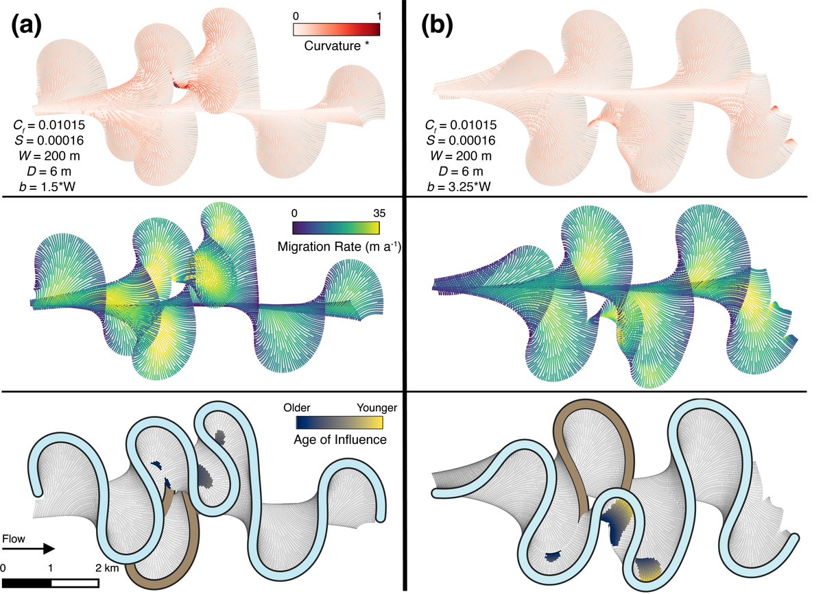
We further explore the predictability of bend migration rates and patterns based on initial planform bend geometry using the simple geometric model of Howard and Knutson (1984) [5/6].
1
3
19
1,378
10 Jan 2024
This paper is published as part of a forthcoming GSL Special Publication on Meandering Streamflows, and I am stoked for our work to be included alongside this awesome group of scientists. Highly recommend checking out the full Spec. Pub. here [6/6]:
lyellcollection.org/toc/sp/5…
7
445
15 Dec 2023
For those still around #AGU23, drop by Moscone South this morning and chat with me about new ways to track and quantify river meandering processes (1666) and/or this afternoon to discuss Jupyter Notebook applications in-development by the OPERA project team at JPL (0207).

1
5
41
5,037
Cole Speed retweeted

21 Nov 2023
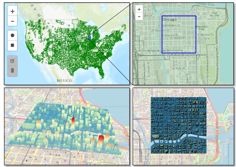
New blog post highlighting a suite of Jupyter Notebooks to enable programmatic access to cloud-hosted USGS 3D Elevation Program (3DEP) #lidar data. Notebooks demonstrate how to use @pointcloudpipe to access & process data hosted by Amazon Open Data. opentopography.org/blog/new-… 1/2

1
46
253
28,104
21 Nov 2023
This suite of programmatic workflows are enabled by–and rely heavily upon–flexible and customizable pipelines provided by the outstanding PDAL (@pointcloudpipe) library developed by the @hobuinc team.
1
1
159
21 Nov 2023
Workflows are designed to run locally and on @GoogleColab. Additional project details and source code may be found here:
Blog: opentopography.org/blog/new-…
Github: github.com/OpenTopography/OT…
140
21 Nov 2023
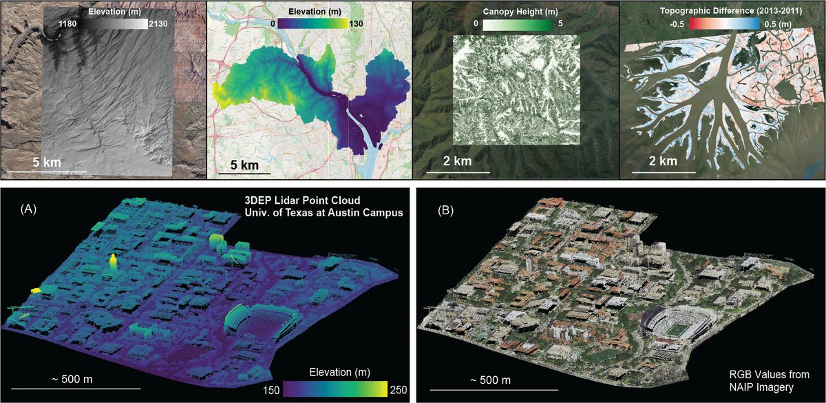
Workflows enable users to generate elevation products for custom AOIs, @USGS quads/HUCs, and corridors. Derivative products include topographic difference maps, canopy height models, and RGB-colorized point clouds from 1m NAIP imagery.
1
10
1,083
21 Nov 2023
Thanks for helping to get the word out @giswqs! Very excited to share the results of this collaborative effort between @OpenTopography and the @USGS_CDI to streamline access to USGS 3DEP #lidar data. Feature suggestions / improvements are welcomed and greatly encouraged.
21 Nov 2023

New collection of Jupyter Notebooks enables programmatic access to cloud-hosted USGS 3D Elevation Program (3DEP) lidar data
Blog: opentopography.org/blog/new-…
GitHub: github.com/OpenTopography/OT…
#lidar #dataviz #3dep
2
2
12
3,111