Open access to high-resolution, Earth science-oriented topography data, and related tools & resources. US NSF supported. #lidar
- Tweets 2,845
- Following 582
- Followers 10,159
- Likes 3,483


ALT OpenTopography "I heart LIDAR" bumper sticker.
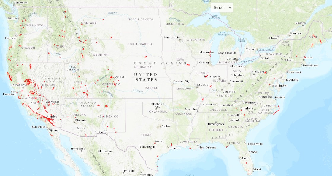
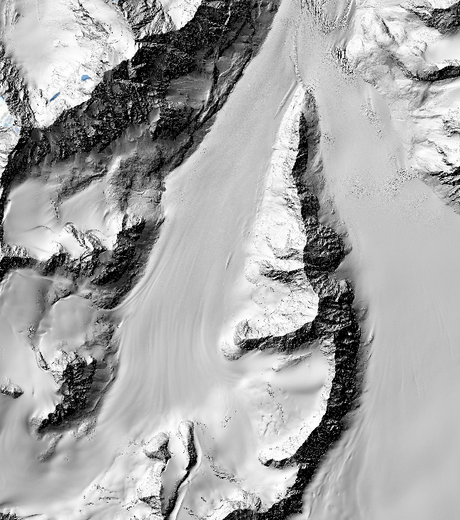
ALT Map of CONUS showing locations of NCALM collected lidar data as red polygons.


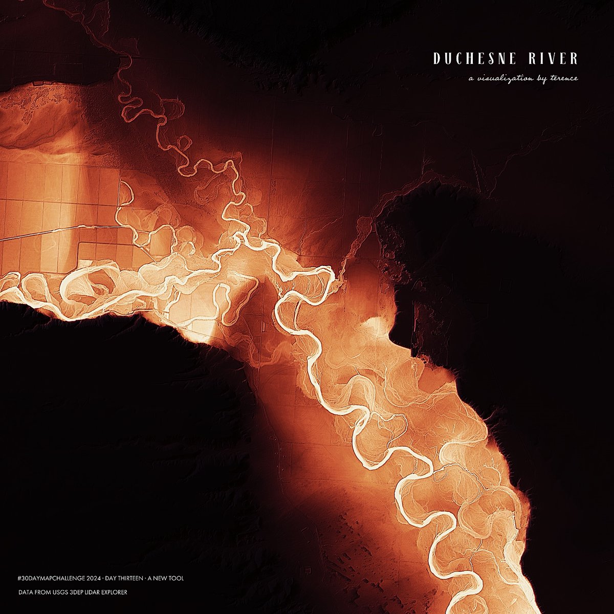
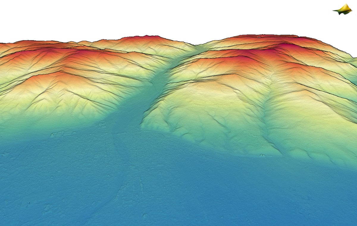
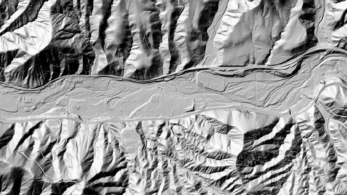
ALT A visualisation of a segment of the Duchesne river

ALT A visualisation of a segment of the Sevier river

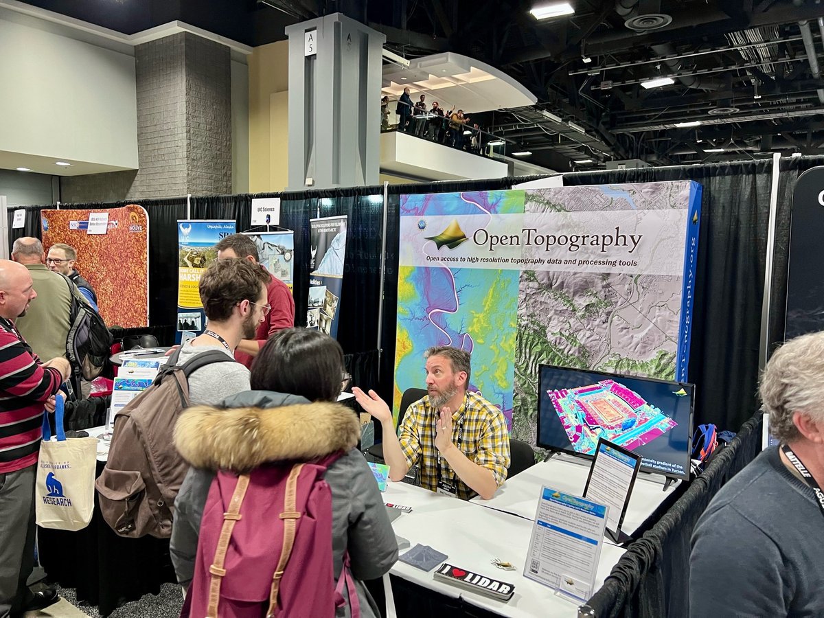
ALT OpenTopography exhibit hall booth at the SACNAS NDiSTEM conference.


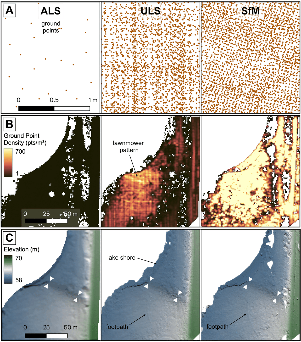
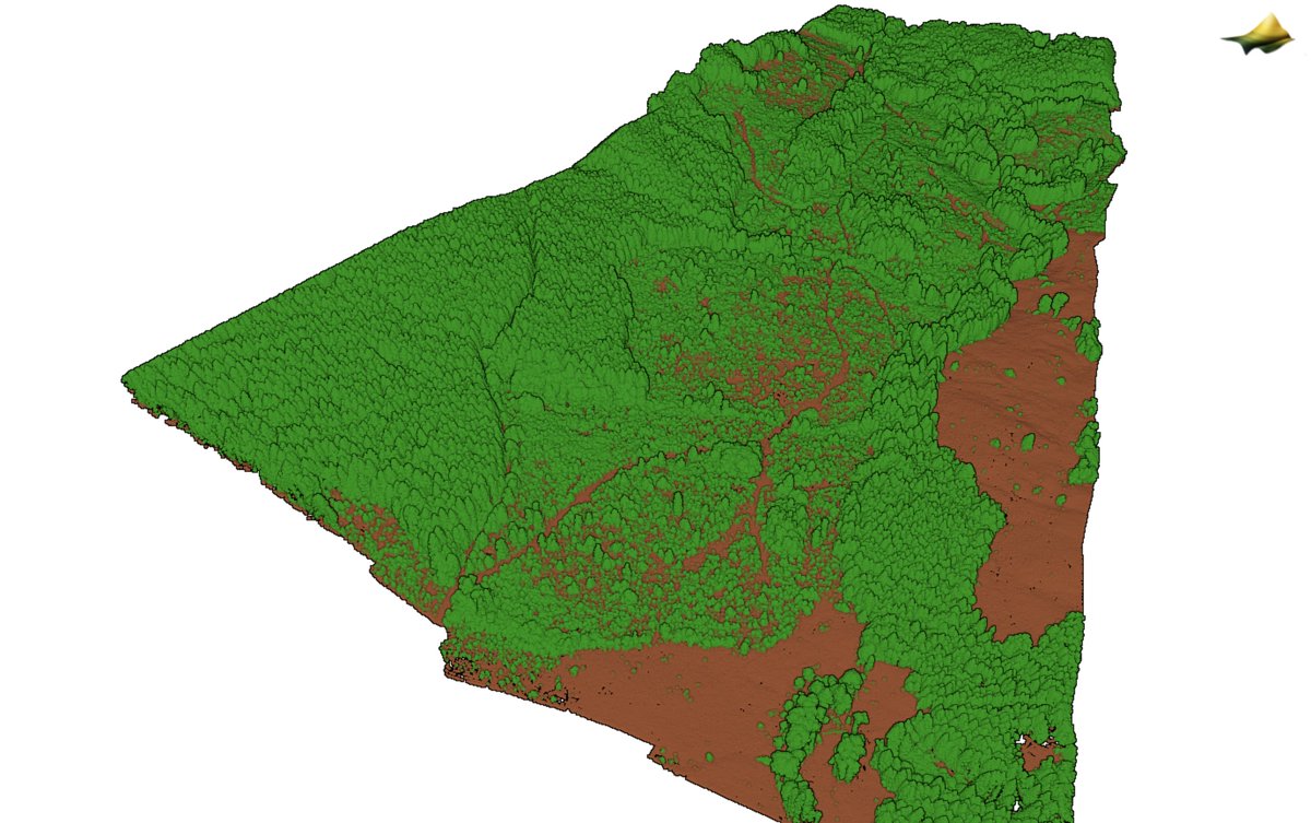
ALT Comparison between airborne laser scanning (ALS), UAV laser scanning (ULS), and Structure from Motion (SfM) surveys from one of the study areas.
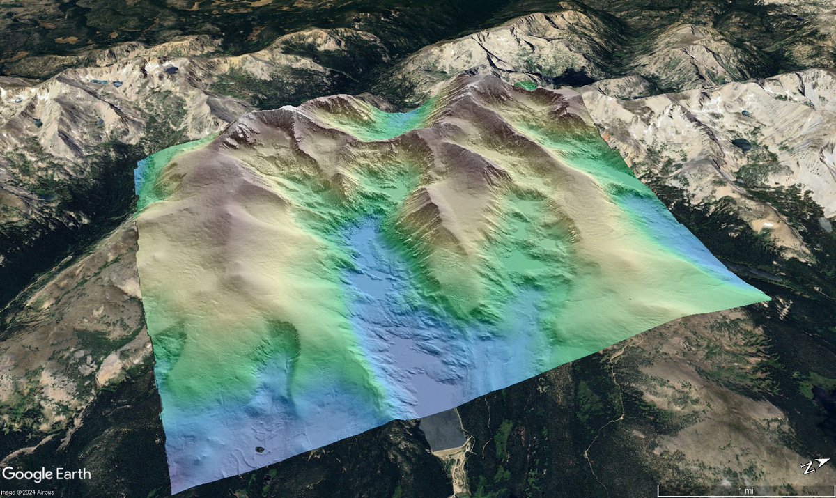
ALT Hillshade colored by elevation of Niwot Ridge overlain on Google Earth imagery.

ALT aerial image comparison of No Name Key, Florida before and after hurricane Irma.


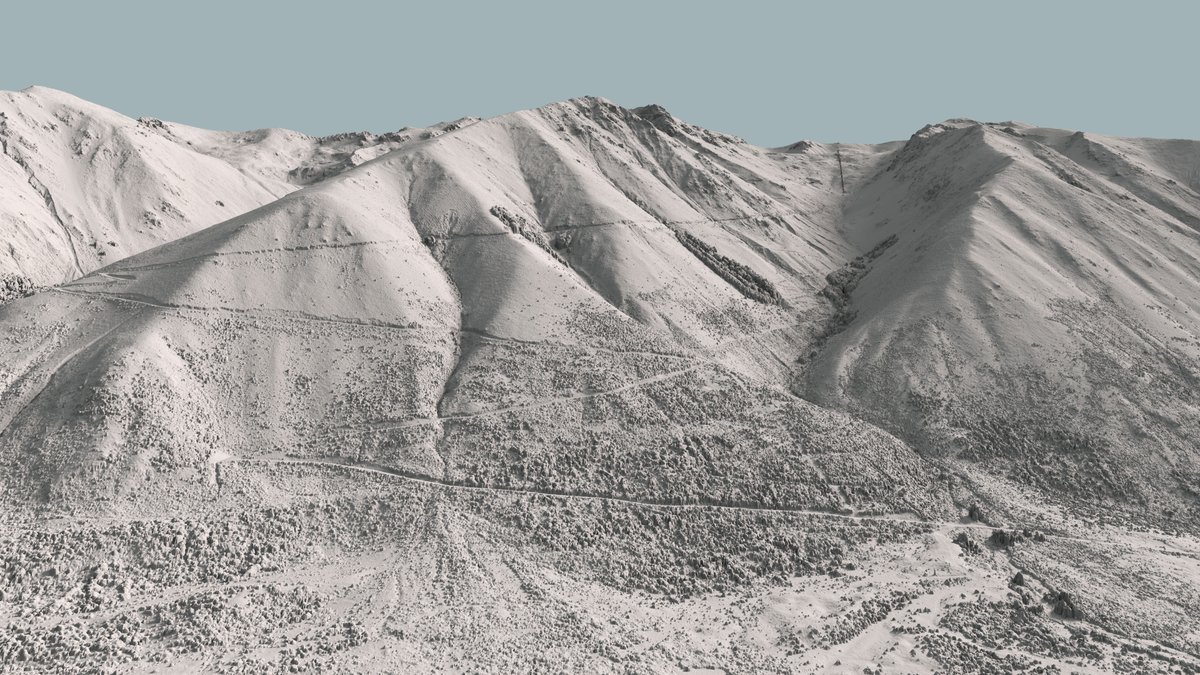
ALT Ohau ski field
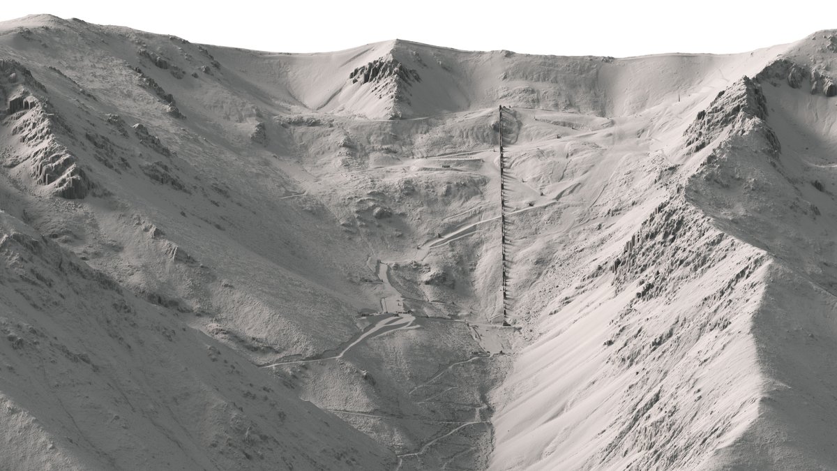
ALT Access road to Ohau
ALT OpenTopography topographic differencing with NOAA lidar shows how the Earth’s surface changed from 2010-2014. The left image shows a lidar hillshade. In the right image, the difference between the 2010 and 2014 datasets is shown. Red indicates where the land surface moved down or was eroded. Blue shows where the land surface moved up or where material was deposited. Topographic analysis of these older lidar datasets indicates that landslide activity has been persistent in this area for decades.

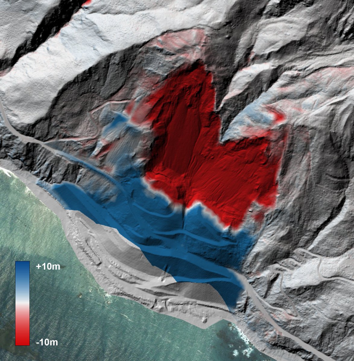
ALT The 2017 Mud Creek landslide occurred along the Big Sur coastline of central California, approximately 140 kilometers south of San Francisco. The red areas indicate zones of erosion or material loss, while blue areas highlight where the displaced material was deposited.