
Retired National Weather Service Meteorologist, NWS Houston. Owner Reilly Weather, LLC. UVA, MIT Alum. Tweets, retweets are my own.
Joined July 2012
- Tweets 3,046
- Following 2,453
- Followers 1,870
- Likes 3,409
820 Photos and videos


Jun 11
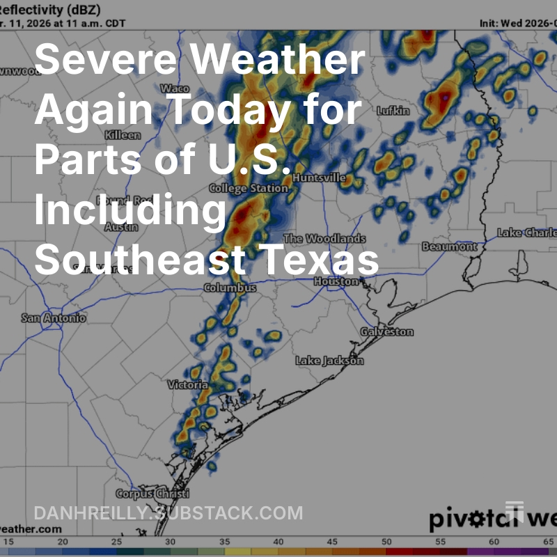
Disturbance with a Low Chance of Developing Over Southwest Gulf. Heavy rain, flood threat from slow moving cold front late this weekend and next week. Check out blog post here. open.substack.com/pub/danhre…
75
Jun 1
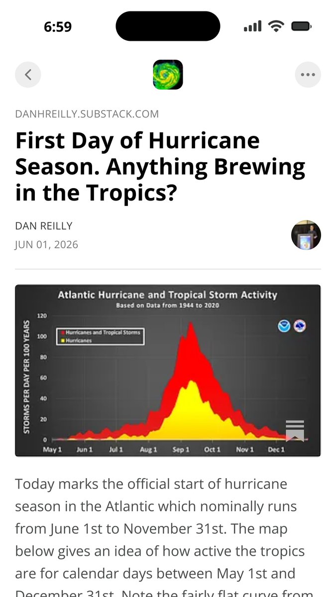
New weather blog post linked here. Early June formation zones and a look at potential for development this week. danhreilly.substack.com/p/fi…
84
May 26
A stormy night on tap for Texas. See latest blog post here. danhreilly.substack.com/p/be… #txwx #houwx
2
211
May 23
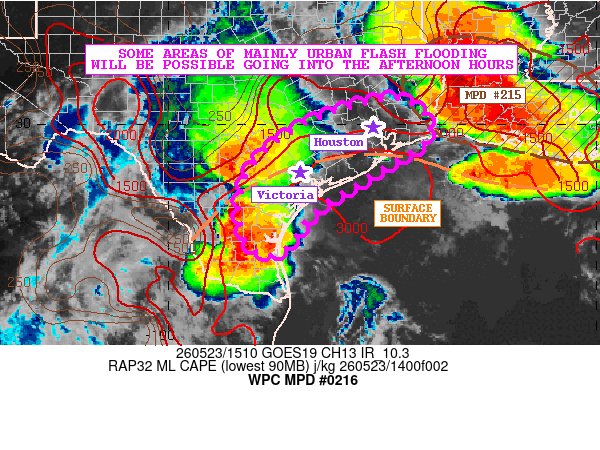
Mesoscale rainfall discussion from WPC. Focus on thunderstorms, high rain rates, for this afternoon and evening including SE Texas and the Houston area. wpc.ncep.noaa.gov/metwatch/m… #houwx
1
1
206
May 20
Rainy period to continue next several days with daily flash flood threat. See latest blog post here. danhreilly.substack.com/p/ra… #houwx #txwx
1
152
May 18
Check out latest weather blog post outlining risk areas for severe weather today and the multiday rain/flood threat for Texas and surrounding areas. #txwx
danhreilly.substack.com/p/se…
83
May 9
Severe weather possible on Mother's Day for portions of Texas. Latest weather blog post here. #txwx danhreilly.substack.com/p/se…
1
96
Apr 10
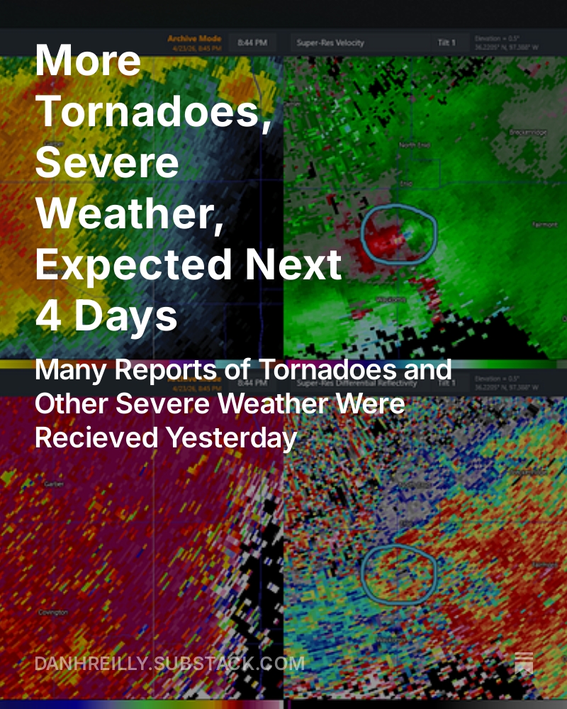
Latest weather blog post: Multiple Days of Severe Weather Possible for Portions of the U.S. Over the Next Several Days open.substack.com/pub/danhre…
65
Dan Reilly retweeted

72-hour loop of FrontFinder-AI predictions for the upcoming severe weather sequence: 1 April 13z - 4 April 12z
9
33
376
36,910
Mar 31
Thunderstorm blowing up out toward the Texas panhandle at this hour. Expecting a much more active and wetter week or two for Texas after a dry period. Nice sunset view of the gravity waves along the thunderstorm anvil. #txwx
10
51
5,345
Mar 15
Extreme weather next few days due to intense cyclone and associated strong cold front. Read blog post here. danhreilly.substack.com/p/lo…
138
Dan Reilly retweeted

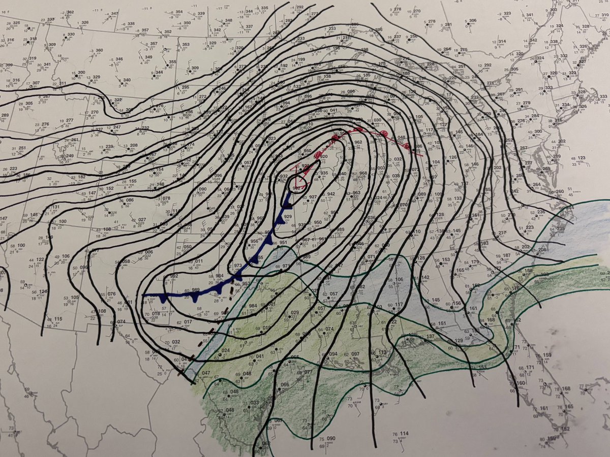
Here at the Storm Prediction Center, we dig deep into the data to do the best possible analysis of the storm threat. Even in 2026, this sometimes involves putting pencil to paper to do hand surface analysis. This is what the morning map looks like today.
38
250
1,879
129,249
Mar 13
Looking Back at March 10/11 severe Weather Outbreak and Ahead to Another One Potentially Sunday and Monday. danhreilly.substack.com/p/lo…
84
Mar 11
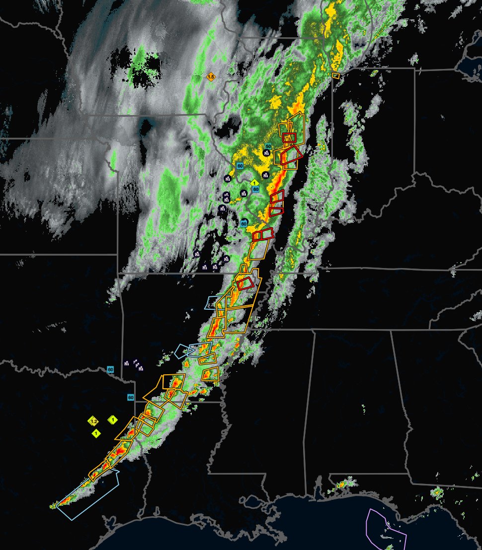
Severe Weather Today for Parts of U.S. Including Southeast Texas Where Tornado Watch in Effect. #houwx #txwx danhreilly.substack.com/p/se…
2
315
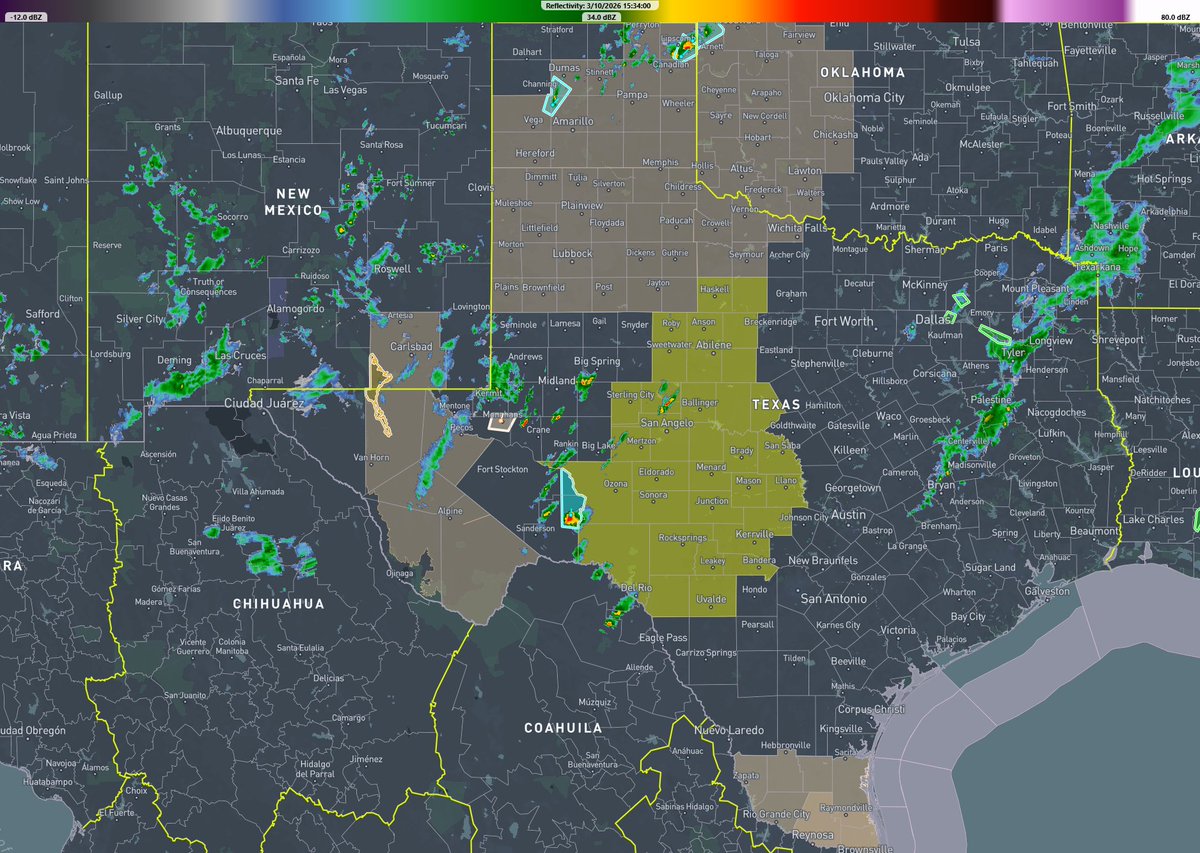
Mar 10
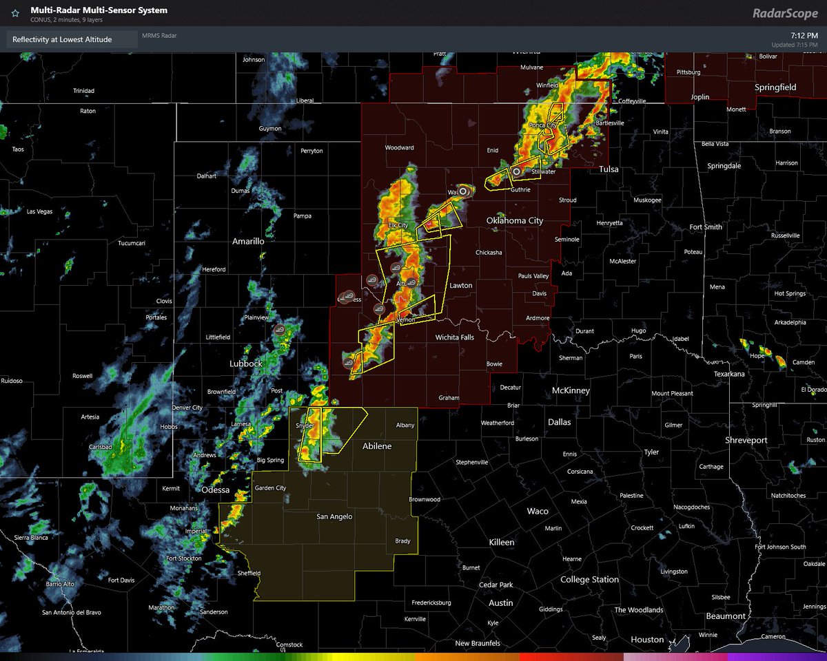
About to get active across Central Texas. Yellow area shows tornado watch and radar as of 330 pm. HRRR model reflectivity loop shown going forward. Day 1 hazard outlooks suggests possibility of intense tornadoes, damaging winds and giant hail. #txwx
228
Mar 5
Severe Thunderstorms/Tornadoes Forecast for Parts of the U.S. Next Several Days. Post showing risk areas and new SPC intensity level hatched areas on their outlooks. open.substack.com/pub/danhre…
106