
Deakin Marine Mapping is a group of researchers from Deakin University led by @Dr_Dan_I focusing on mapping the seafloor and coastal regions of Victoria, Aus.
Joined April 2017
- Tweets 143
- Following 34
- Followers 292
- Likes 115
18 Photos and videos


Deakin Marine Mapping retweeted

29 Jul 2022
Join our team! #2 Research Assistant position at
@DUmarinemapping in Coastal Erosion and Biodiversity Assessments across temperate marine waters with seabed mapping, remote video and much more! careers.deakin.edu.au/cw/en/…
15
21

30 Jul 2022
If you have a PhD degree in marine geo/ biology or a related field and looking for a position focusing on sediment characterisation and integrating with substrate data, apply now @Deakin @deakinresearch @DeakinSEBE @Dr_Dan_I.
marinemapping.org/copy-2-of-…
2
2
30 Jul 2022
We are hiring @Deakin @deakinresearch @DeakinSEBE @Dr_Dan_I . If you have a degree in Marine Science, or equivalent, and are familiar with seafloor mapping and good at geospatial analytics, click the link and submit the application.
marinemapping.org/copy-of-ph…
2
3
Deakin Marine Mapping retweeted

3 Apr 2022
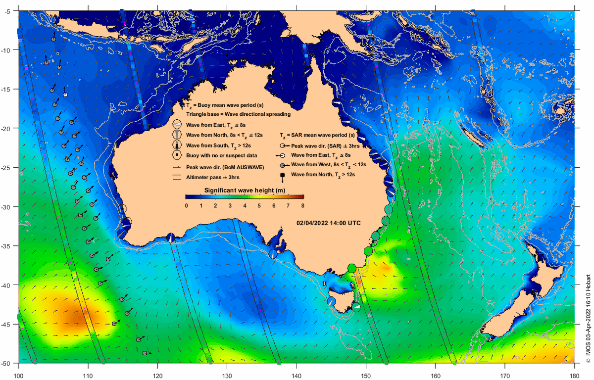
The NSW coast has seen plenty of storm waves this weekend. @IMOS_AUS OceanCurrent new wave product provides a good observational perspective oceancurrent.imos.org.au/wav…
1
10
22
Deakin Marine Mapping retweeted
24 Mar 2022
Check out this great work led by Jin and collaborators closing knowledge gaps on the wave climate of Bass Strait | Home authors.elsevier.com/c/1eoOD…
5
8
31 Mar 2022
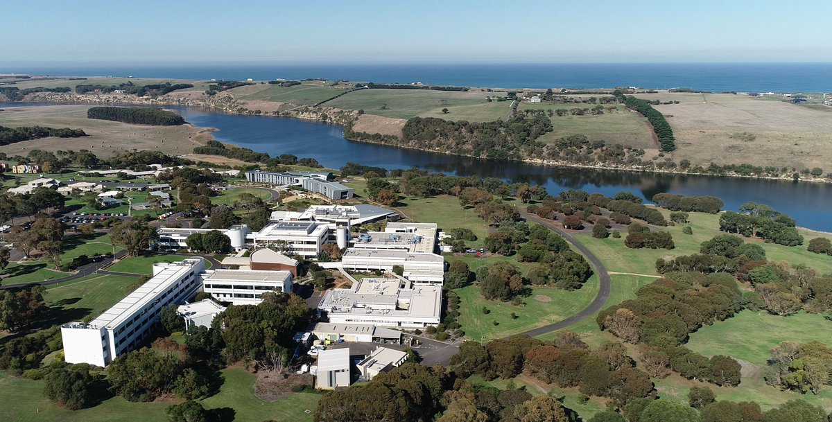
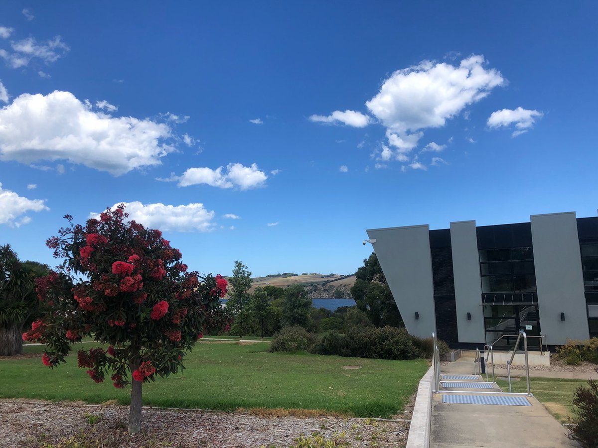
Ou Marine Mapping Group is on this beautiful Warrnambool campus.
27 Mar 2022

Looking for a new opportunity?
Deakin University is recruiting a Technical Officer to support our teaching and research program in Marine Science at our stunning Warrnambool Campus-
Apply now!👇 careers.pageuppeople.com/949…
1
Deakin Marine Mapping retweeted
27 Mar 2022
Looking for a new opportunity?
Deakin University is recruiting a Technical Officer to support our teaching and research program in Marine Science at our stunning Warrnambool Campus-
Apply now!👇 careers.pageuppeople.com/949…
19
21
Deakin Marine Mapping retweeted

11 Mar 2022
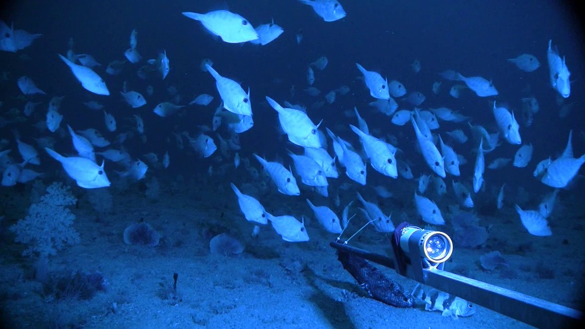
Time for #OctopusFriday. This particular octopus was seen emerging from a burrow while exploring in the Gulf of Mexico in 2017 at a depth of 615 meters (2,018 feet).
2
67
409
Deakin Marine Mapping retweeted

2 Mar 2022
🚨PhD positions available🚨
Interested in studying physical processes along the Perth coastal margins or the fate of kelp detritus from coastal reefs to the deep sea at @uwaoceans. Applications close 30 April 📆
👉 bit.ly/3C6bY2V
👉 bit.ly/3C8szCZ
26
38
Deakin Marine Mapping retweeted

28 Feb 2022
📢📅Abstracts close 4th March
#AusSeabed session: "Multi-disciplinary approaches to monitor change and connections through #seafloor #mapping" @amsa_marine @AMSAconf
We esp. invite talks from #seacountry #traditionalowners
amsa2022.amsa.asn.au/abstrac…
11 Feb 2022

📢Call for Abstracts📢 Closing 4th March!
Please consider submitting an abstract to the @AMSAconf #AusSeabed symposium:
"Multi-disciplinary approaches to monitor change and connections through #seafloor #mapping"
amsa2022.amsa.asn.au/confere…
@amsa_marine 1/5
5
9
Deakin Marine Mapping retweeted
18 Feb 2022
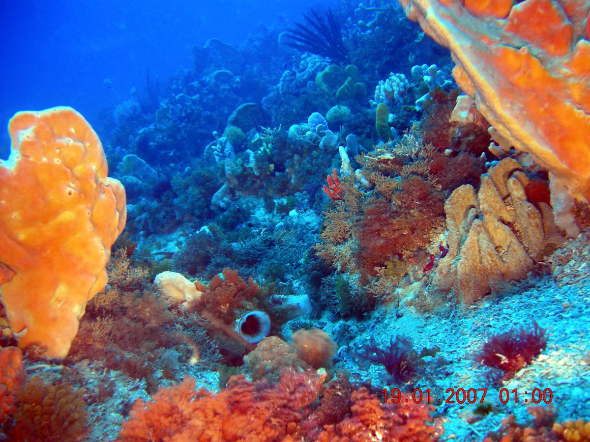
From Feb 24-March 11, researchers will explore waters off Tinian & Saipan in Northern Mariana Islands to locate & document U.S. warplanes lost during #WorldWarII: oceanexplorer.noaa.gov/explo……
[📽️: 2016 exploration of a B-29 that will be surveyed again during upcoming expedition.]
5
26
Deakin Marine Mapping retweeted

10 Feb 2022
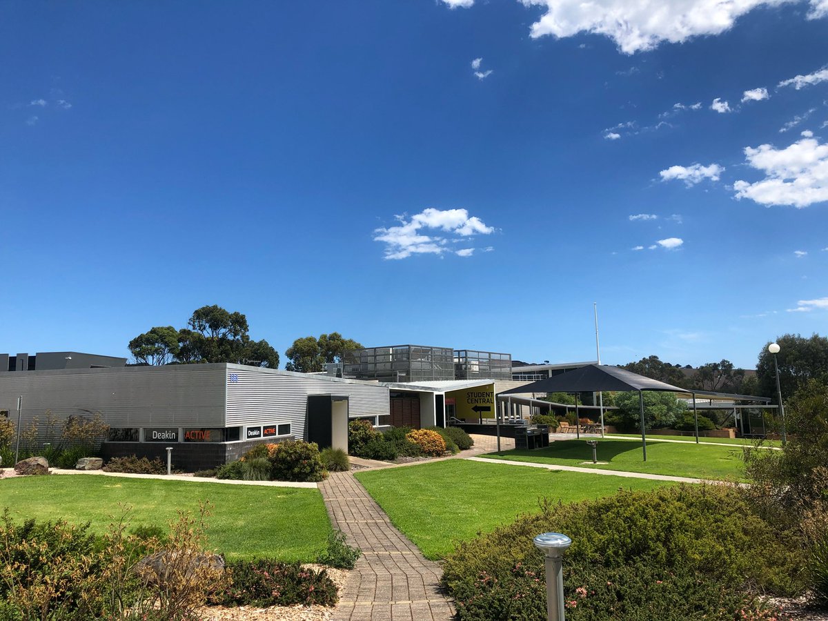
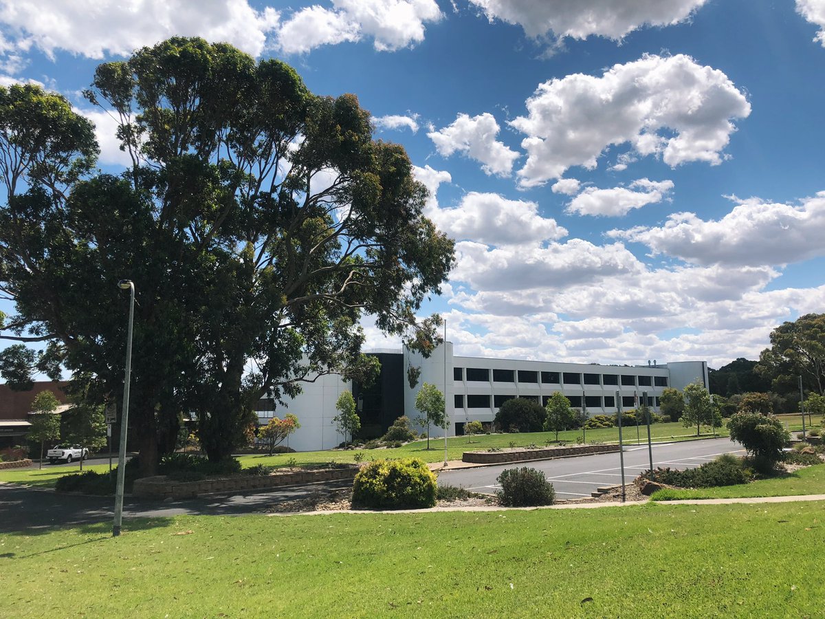
📸 A perfect afternoon at the Warrnambool Campus 💛
3
21
Deakin Marine Mapping retweeted

9 Feb 2022
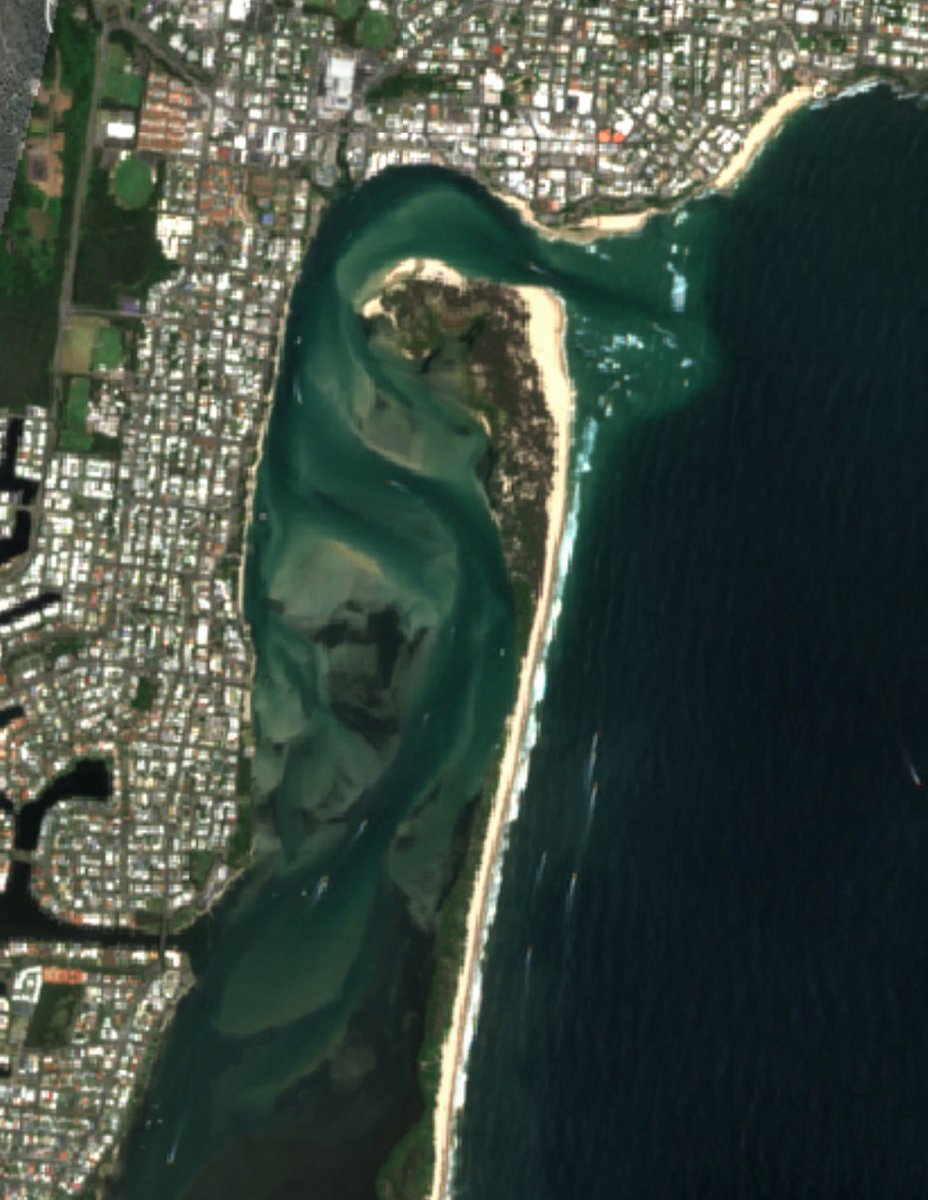
The breach at Queensland's Bribie Island has continued to grow over the last month, with the inlet now over 350 metres wide. At the same time, the original northern channel has shrunk to less than half its previous width.
@CopernicusEU #Sentinel2 imagery from #DigitalEarthAU
9 Jan 2022

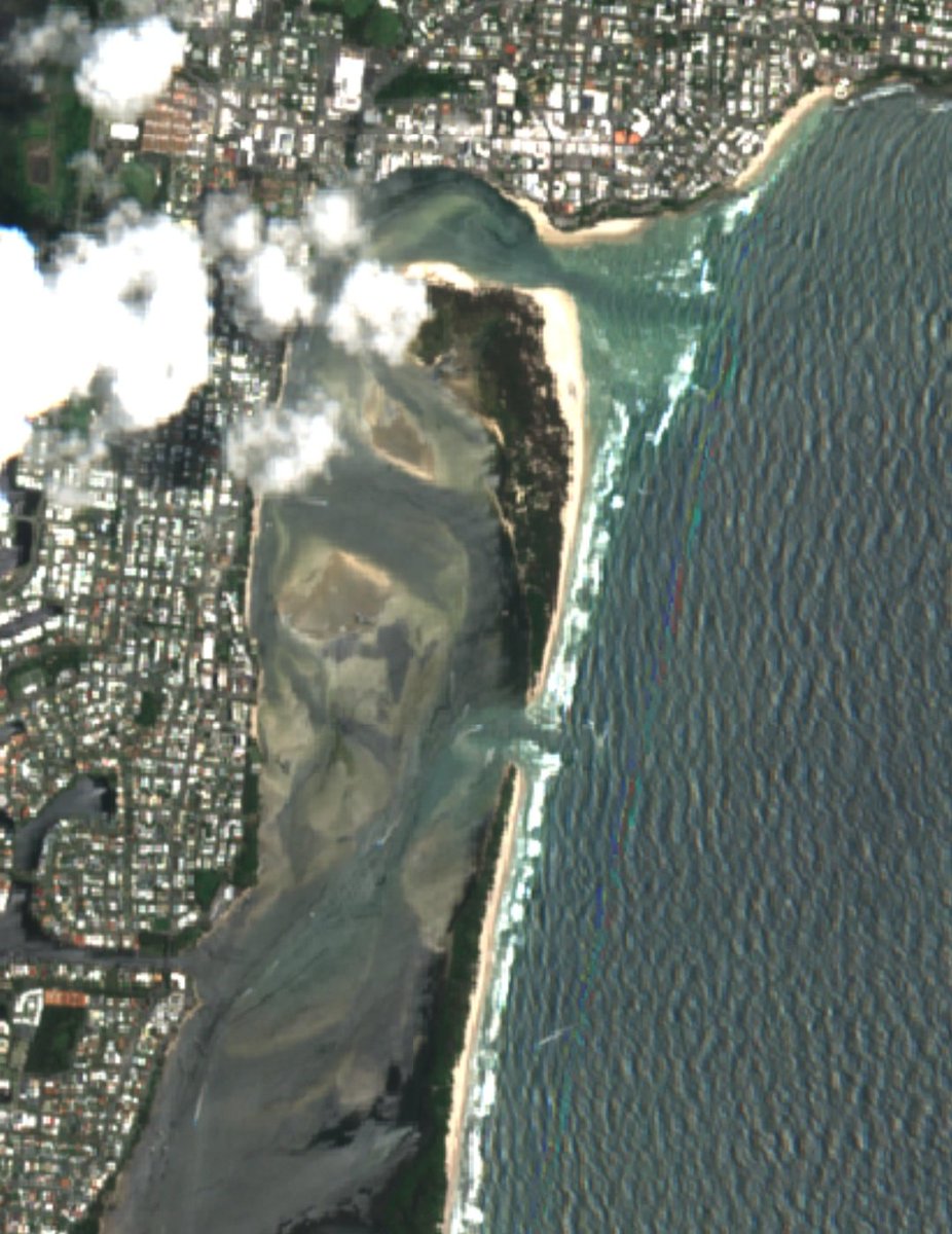
One week ago, the combined impact of #CycloneSeth and king tides broke though the narrow neck of Queensland's Bribie Island.
Yesterday we got the first clear @CopernicusEU #Sentinel2 image of the new channel that breaks Bribie into two:
25 Dec vs 9 Jan: maps.dea.ga.gov.au/#share=s-…
2
6
41
1 Feb 2022
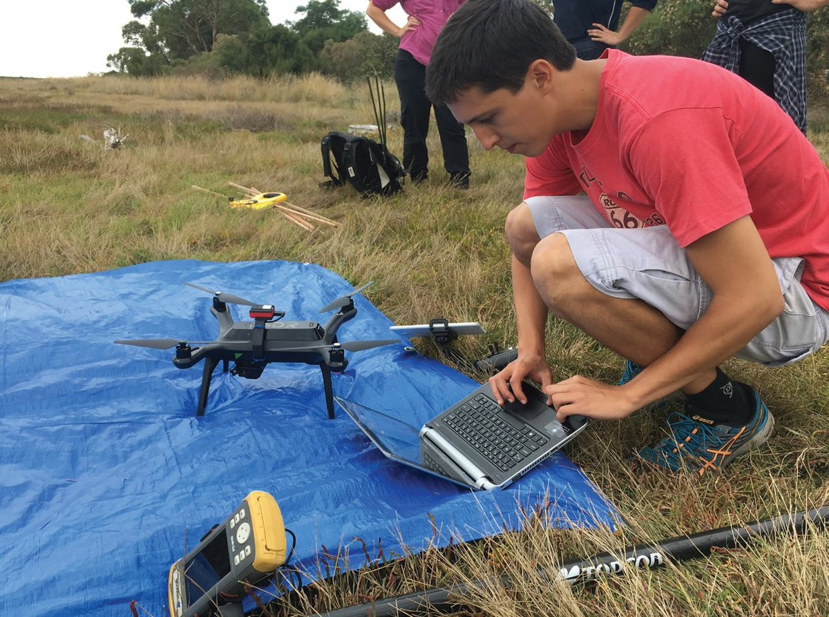
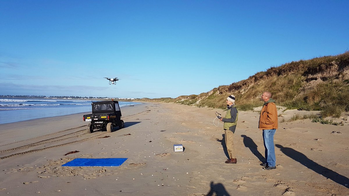
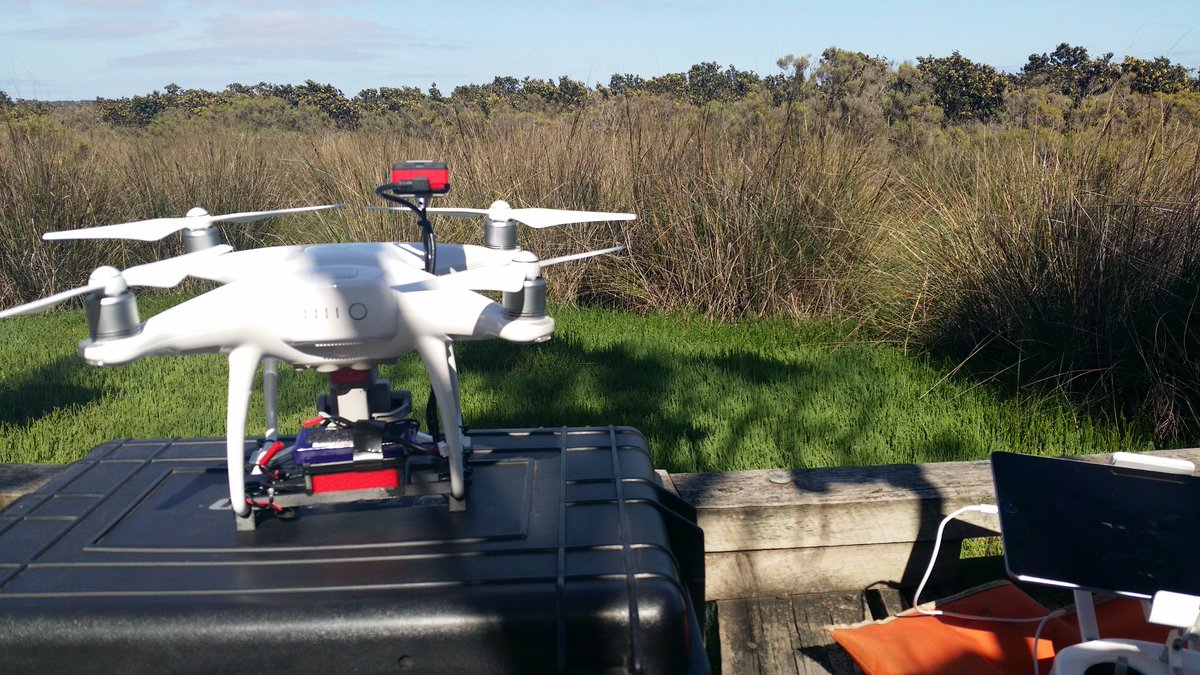
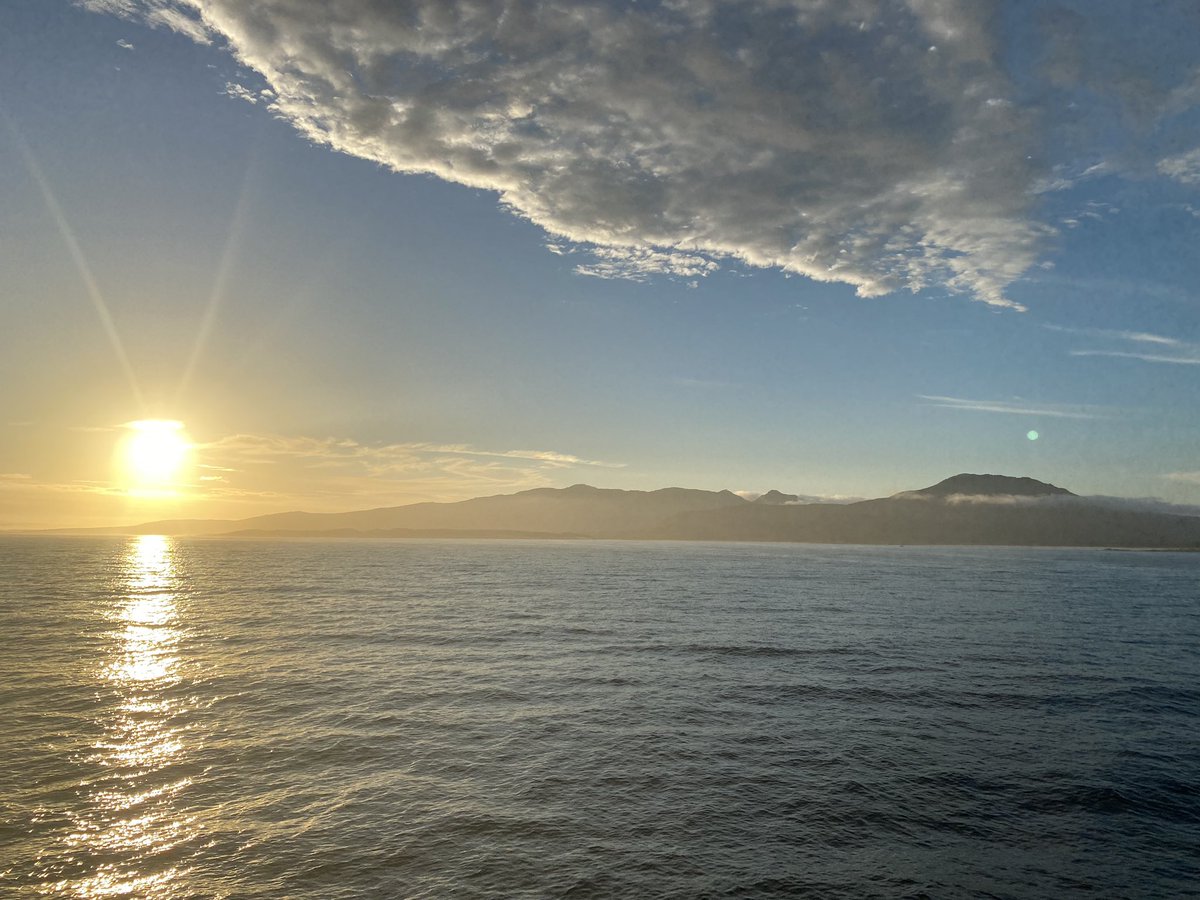
An astonishing sunset marks the end of a fruitful day for the #seafloor #mapping campaign in the #BassStrait.
3
15
22 Jan 2022
1
11
13 Jan 2022
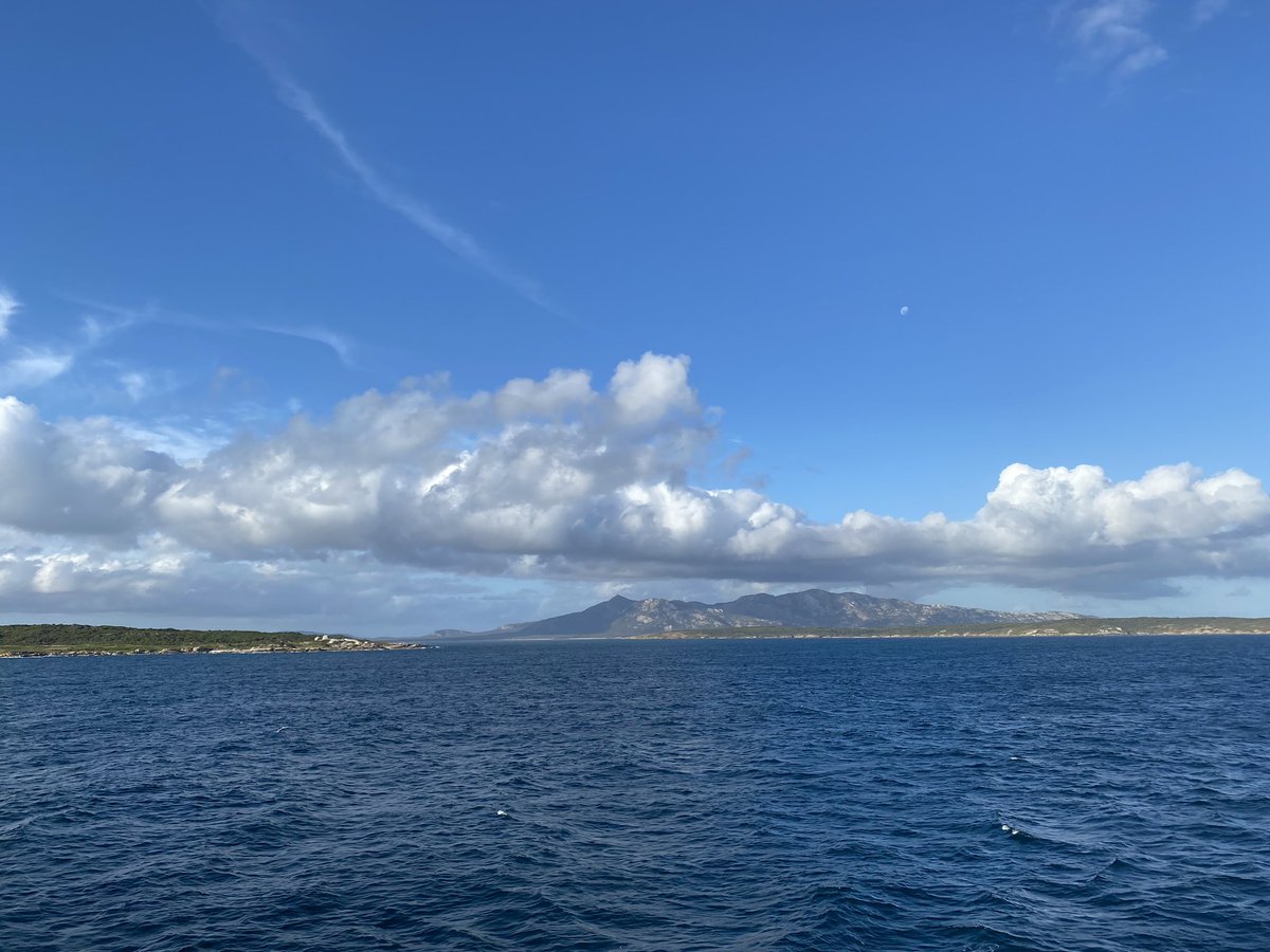
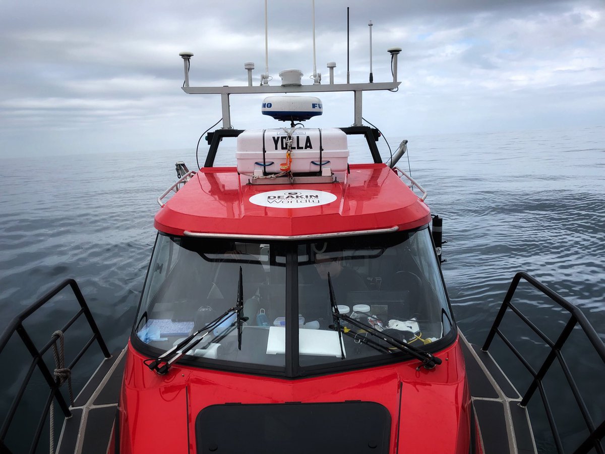
Another beautiful day for the #seafloor #mapping in the #BassStrait (background Cape Barren Island).
2
2
8
Deakin Marine Mapping retweeted

12 Jan 2022
Wildlife trafficking threatens the future of Victoria’s native animals.
This @ausgeo article provides an insight into the work we’re doing to end this cruel and illegal trade. australiangeographic.com.au/…

1
7
12
10 Jan 2022
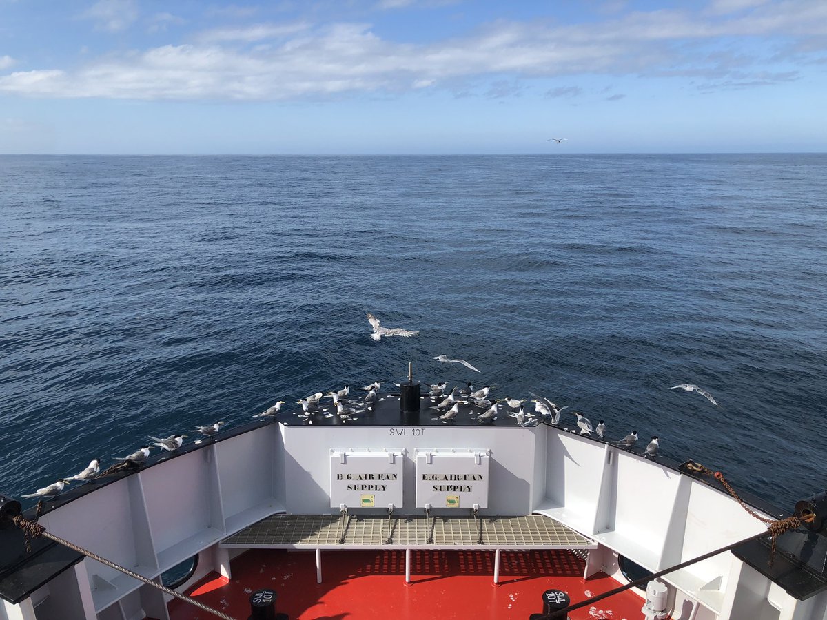
Free riders of the #BassStrait. Not easy to have a fair weather while #Seafloor #mapping in this area.
1
1
9